2026 Vol. 32, No. 5

Cover Page
Cover Page
2026, 32(5)
Abstract (6) PDF (3107KB)(1)
Abstract:
Contents
Contents
2026, 32(5): 1-4.
Abstract (3) HTML (2) PDF (444KB)(1)
Abstract:
2026, 32(5): 999-999. doi: 10.12090/j.issn.1006-6616.202632001
Abstract (3) HTML (1) PDF (230KB)(1)
Abstract:
2026, 32(5): 1000-1003. doi: 10.12090/j.issn.1006-6616.202632002
Abstract (8) HTML (2) PDF (377KB)(1)
Abstract:
Tectonic System & Structural Geology
Long displacement of thrusts and tectonic patterns in the central Tibetan Plateau
WU Zhenhan, ZHAO Zhen, JI Changjun, WU Yan, LIU Zhiwei, LI Yinglie, CHEN Yun
2026, 32(5): 1004-1012. doi: 10.12090/j.issn.1006-6616.2026083
Abstract (69) HTML (19) PDF (17268KB)(11)
Abstract:
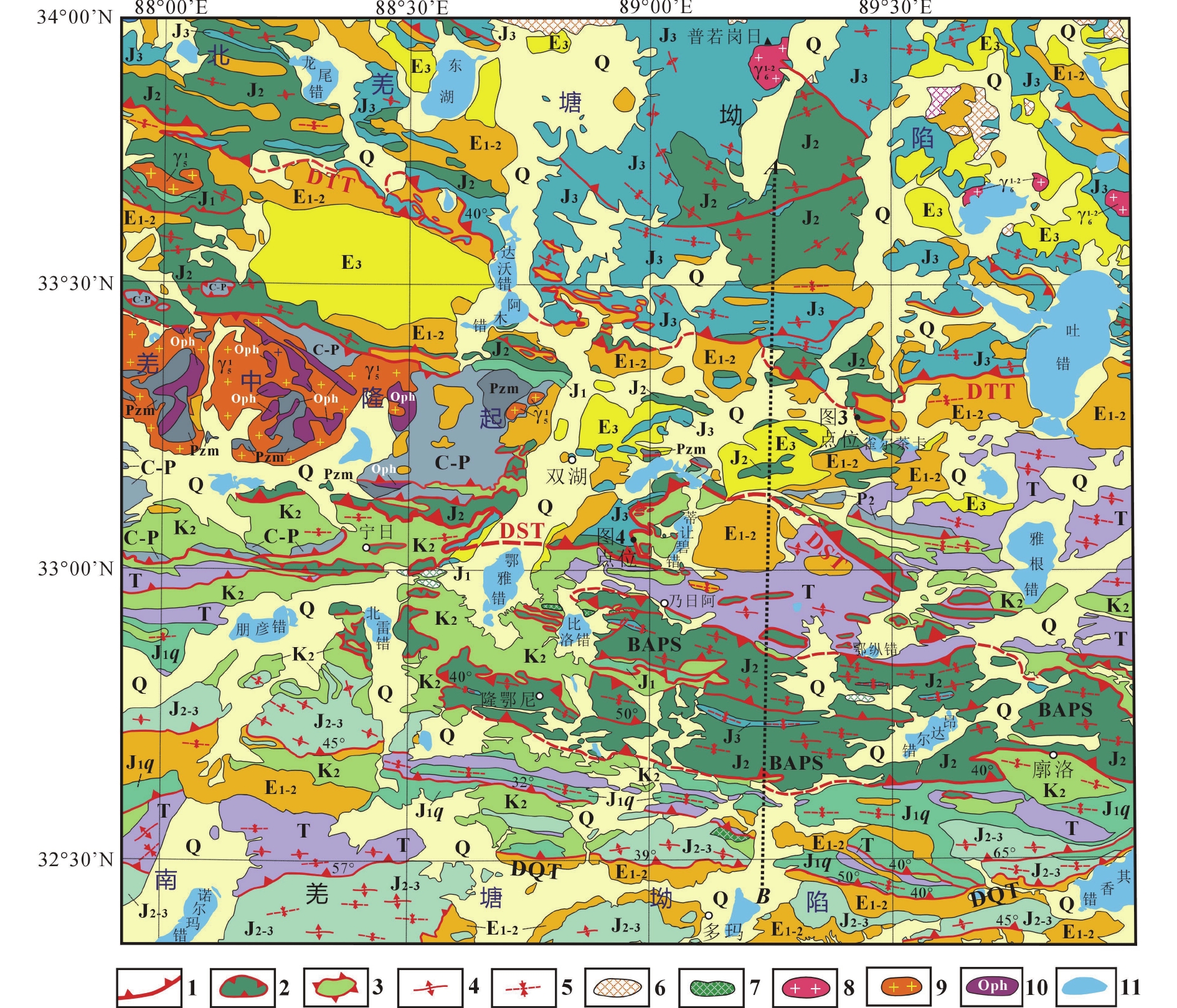
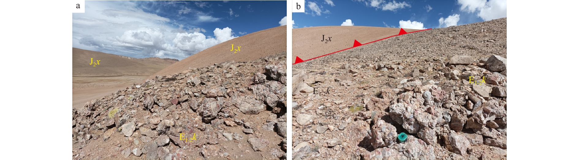
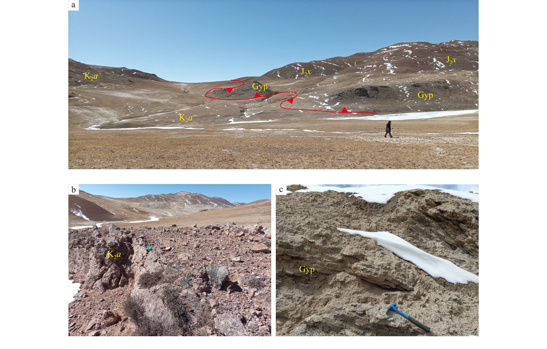
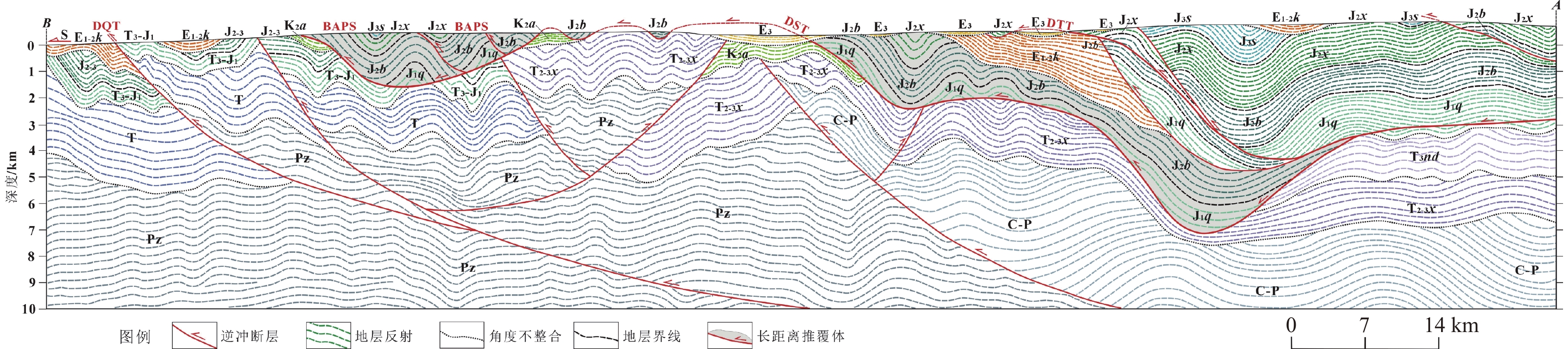
  Objective  Thrust nappe structures are widely developed in the Qiangtang Basin. Clarifying the episodes and structural styles of this tectonic movement is of great significance for oil and gas exploration in the Qiangtang Basin.  Methods  Detailed field observations combined with integrated interpretation of 2D seismic data reveal two episodes of long-distance southward thrusting in the Shuanghu area of the central Tibetan Plateau, one in the Late Cretaceous and the other in the Paleogene.   Results  Late Cretaceous southward thrusting formed a huge nappe of the Bilogco–Andarco Paleo-petroliferous System (BAPS) overlying the Upper Cretaceous Abushan Formation (Fm), and rooted in the Dirangbico–South Yaqu Thrust (DST). The minimal displacement of the BAPS–DST thrust system is 116 km, corresponding to more than 54% crustal shortening in the Late Cretaceous. The Paleogene southward thrusting occurring north of the DST formed the Dawoco–Tuco Thrust (DTT) in the Northern Qiangtang Depression. The minimal displacement of the DTT is 38 km, corresponding to more than 53% crustal shortening.   Conclusions  Both the DST–BAPS and the DTT are thin-skinned thrusts, and thick gypsum layers in the Lower–Middle Jurassic formations act as favorable detachment layers for the long-displacement thrust. The foreland basins and molasse formations of the Abushan and Kangtuo Fms. formed along the BAPS-–DST and DTT thrust fronts in the Late Cretaceous and Paleogene, respectively.  Significance  Long-displacement thrusting in the Shuanghu area is key to the accumulation and preservation of oil and gas in the central Qiangtang Basin.
Study of main faults and deep-seated structural characteristics of Shanghai and adjacent areas based on gravity and magnetic anomalies
HU Xiangyun, XIE Jianlei, ZHANG Henglei
2026, 32(5): 1013-1026. doi: 10.12090/j.issn.1006-6616.2026130
Abstract (75) PDF (10468KB)(6)
Abstract:
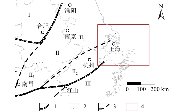
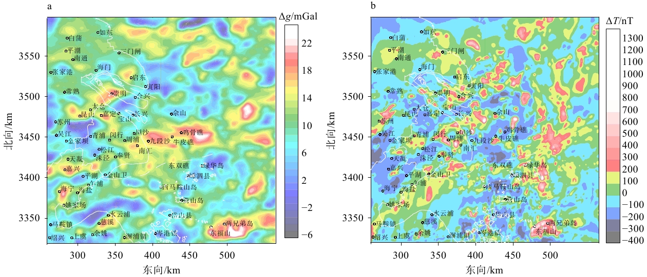
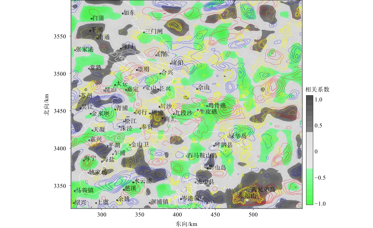
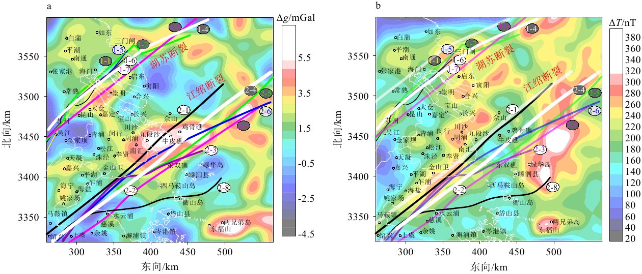
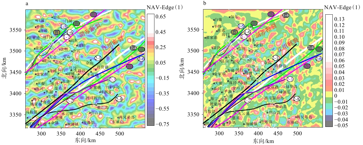
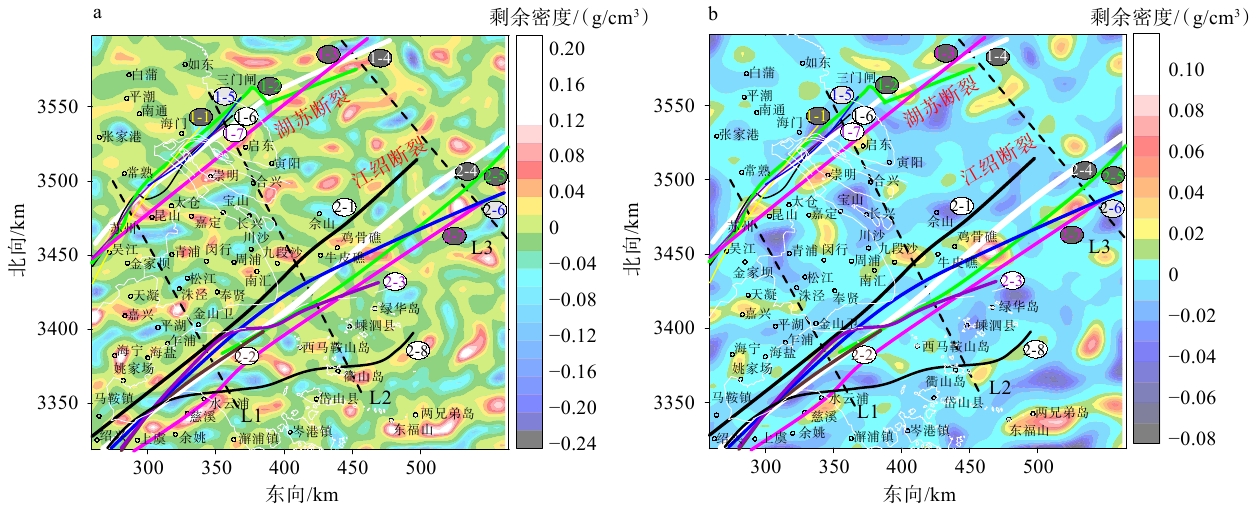
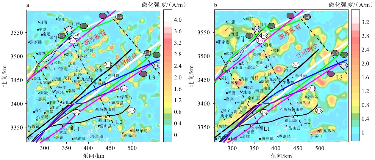
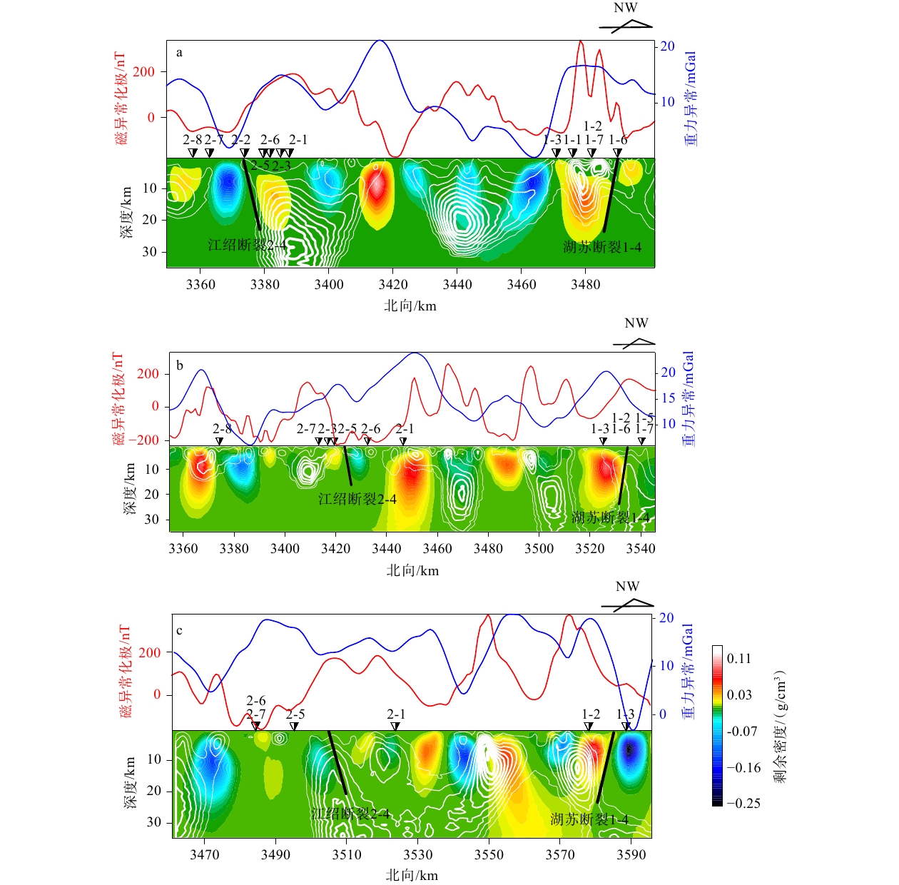
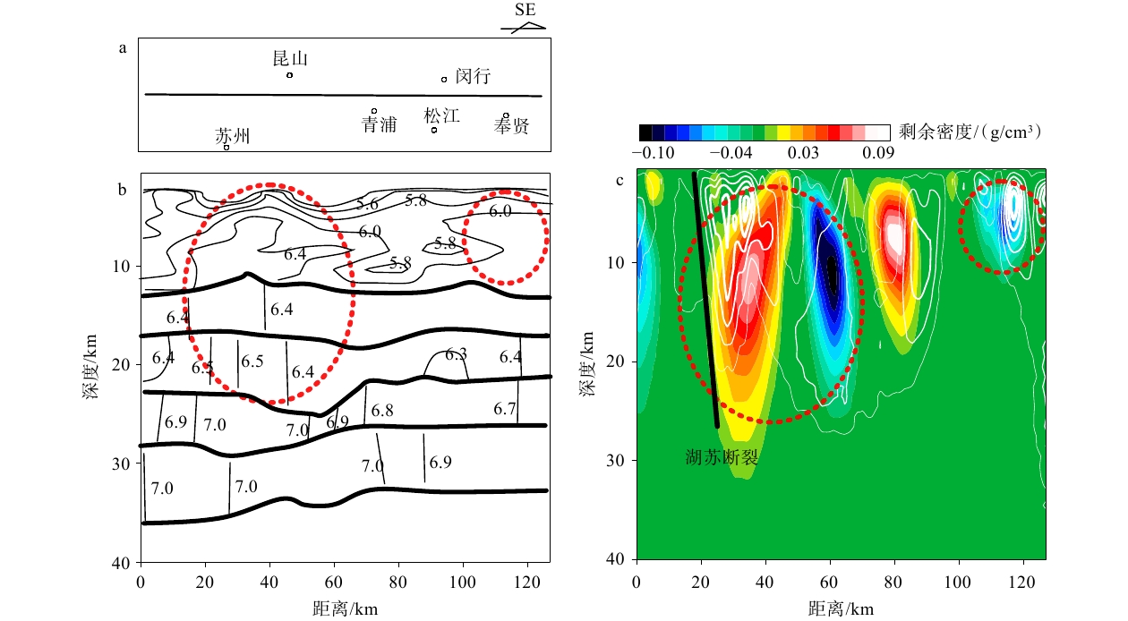
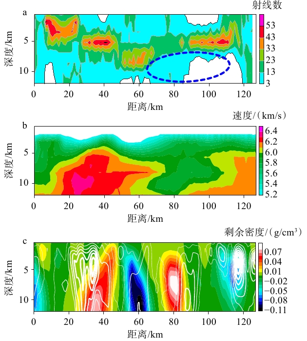
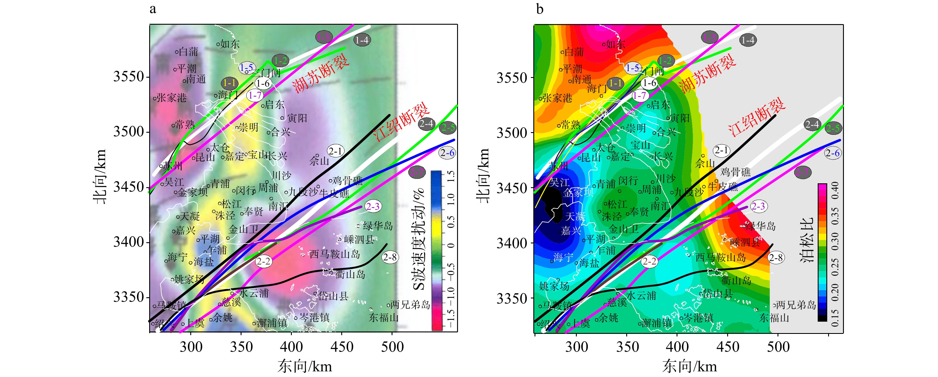
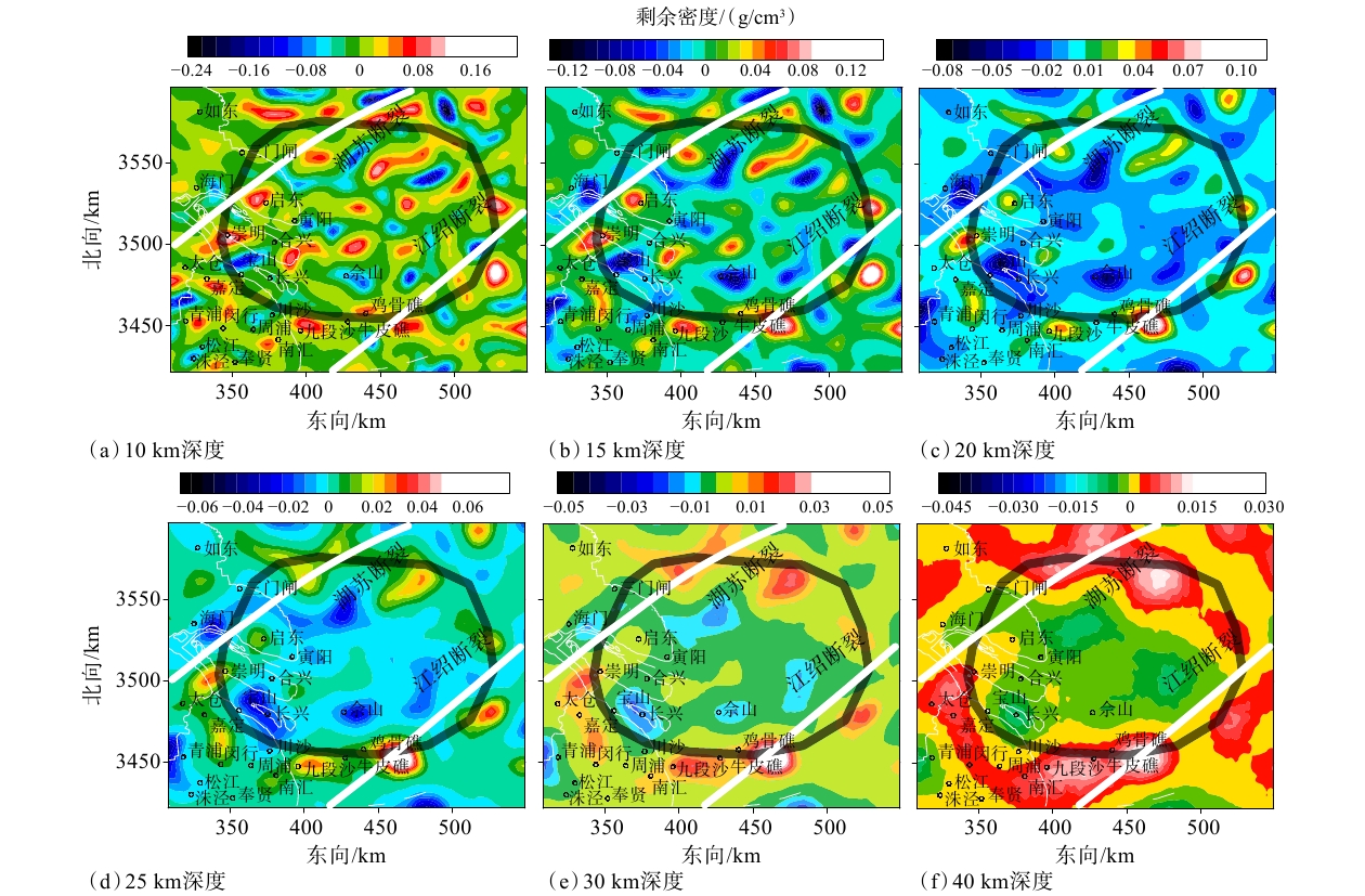
  Objective  Shanghai and its surrounding areas play a vital role in China’s economic development. As the region is also prone to earthquakes that are felt by local residents, its crustal structure has attracted considerable research interest. Despite previous investigations, uncertainties remain regarding the spatial distribution of major deep-seated faults, particularly the Hu-Su and Jiang-Shao faults, and their offshore extensions into the East China Sea.  Methods  Airborne gravity and magnetic data were used to perform three-dimensional physical-property inversion and construct crustal residual-density and magnetization models for the study area.   Results  Correlation analysis of gravity and magnetic anomalies revealed that the sources of these anomalies are distinct but spatially associated, with absolute correlation coefficients below 0.4. Medium-to high-intensity magnetic anomalies are widely distributed along density-anomaly gradient zones, suggesting that intermediate-to-felsic intrusions along the margins of uplifted structures are the main source of the magnetic anomalies.   Conclusions  This study provides critical quantitative constraints on the faults and on a crustal ring structure. Analysis of the gravity and magnetic features of the Hu-Su and Jiang-Shao fault segments that extend into the East China Sea indicates that both faults reach a depth of 20 km and control the tectonic framework of the Shanghai region. In addition, the density model reveals a crustal ring structure in the Yangtze Estuary.  Significance  Our findings highlight the value of 3D inversion models derived from magnetic and gravity data and underscore the need to revise interpretations through 3D inversions of high-quality potential-field data—a step that is vital for understanding the crustal structure in the region.
Crustal Stress & Tectonic Stress Field
Tectonic stress distribution and its control on fracture development in the Jurassic–Cretaceous succession of the Kuqa foreland area, Tarim Basin
CAO Yingchang, HUAN Zhipeng, LIU Yin, SUN Xiaolong, WANG Jian
2026, 32(5): 1027-1048. doi: 10.12090/j.issn.1006-6616.2026119
Abstract (63) HTML (9) PDF (11878KB)(7)
Abstract:
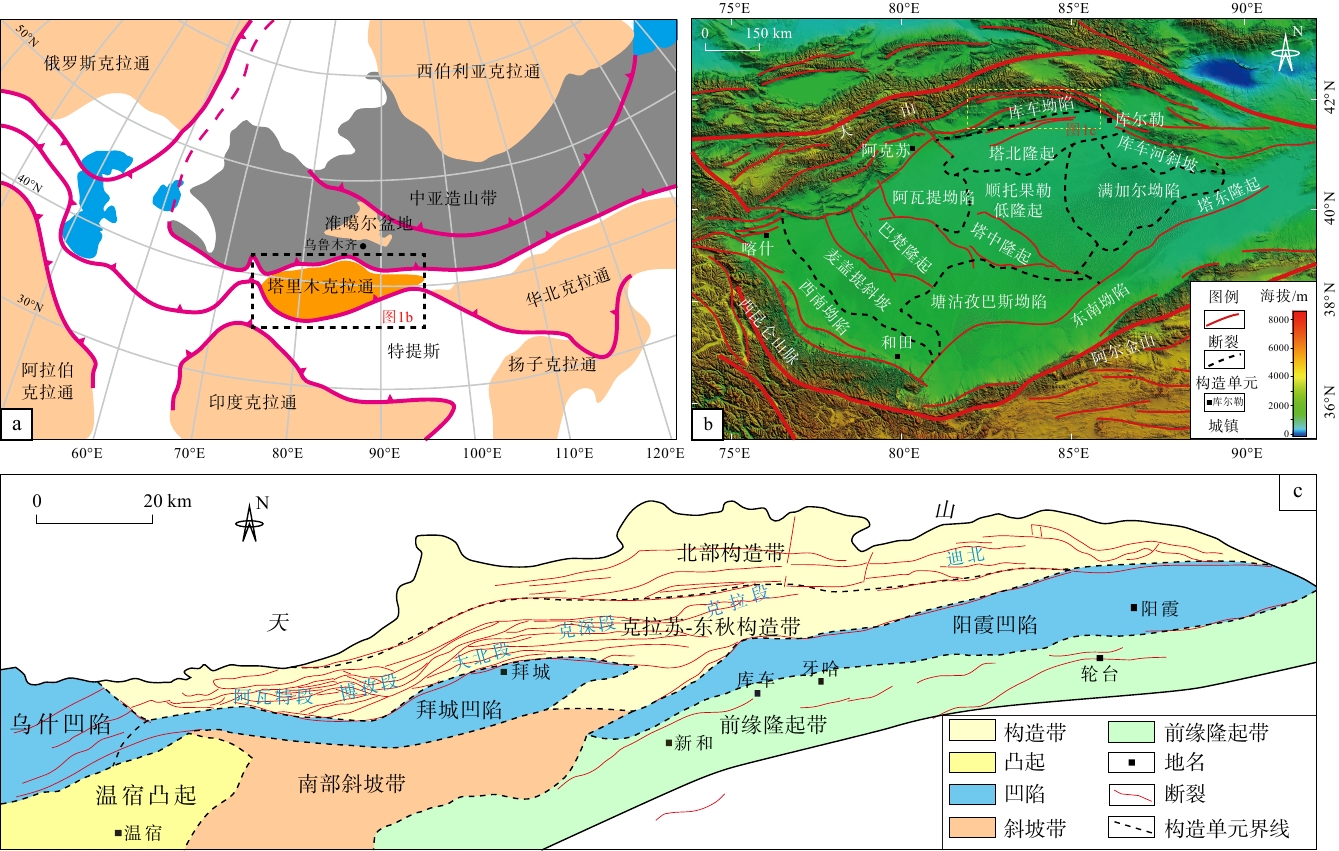
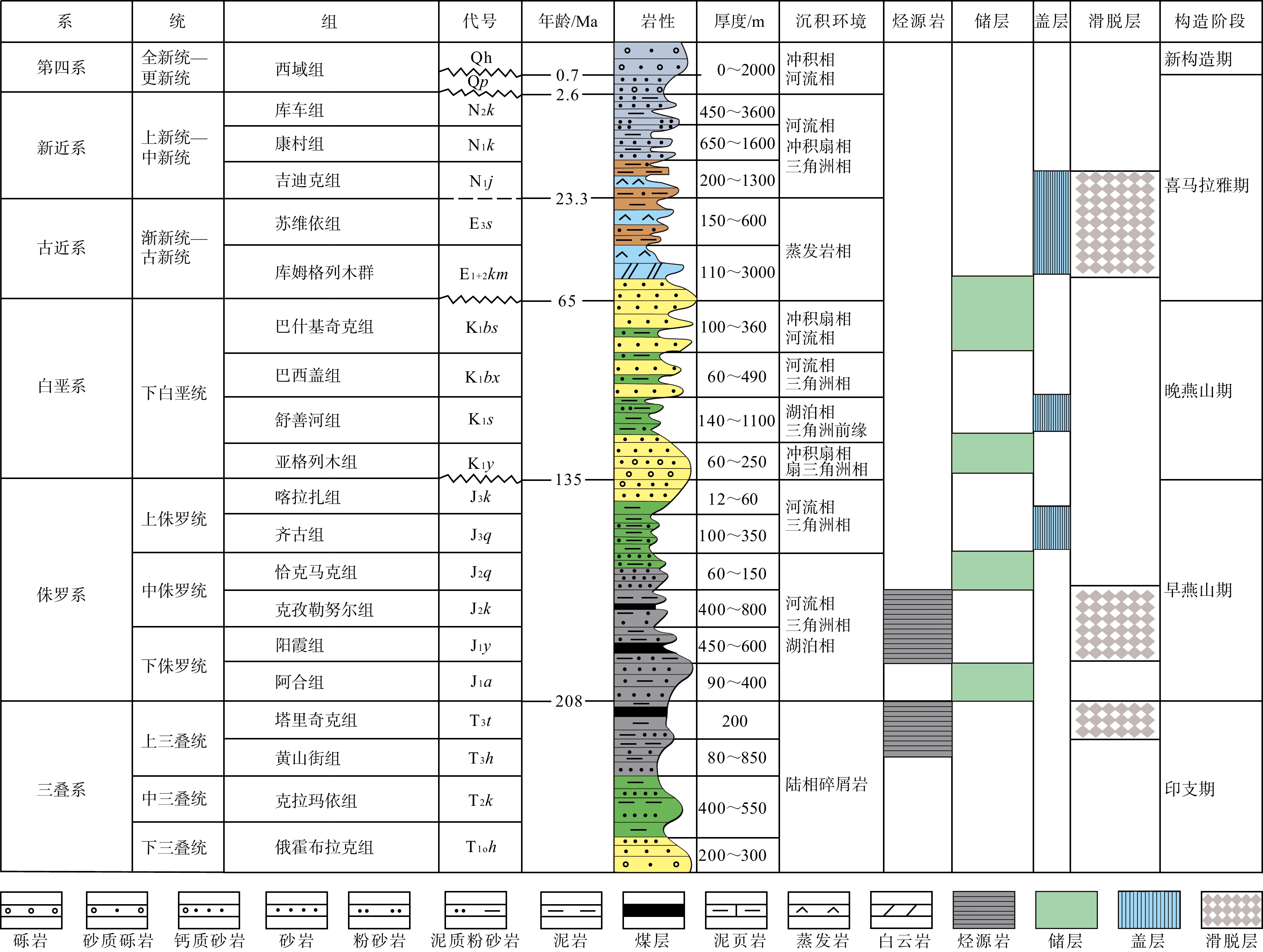
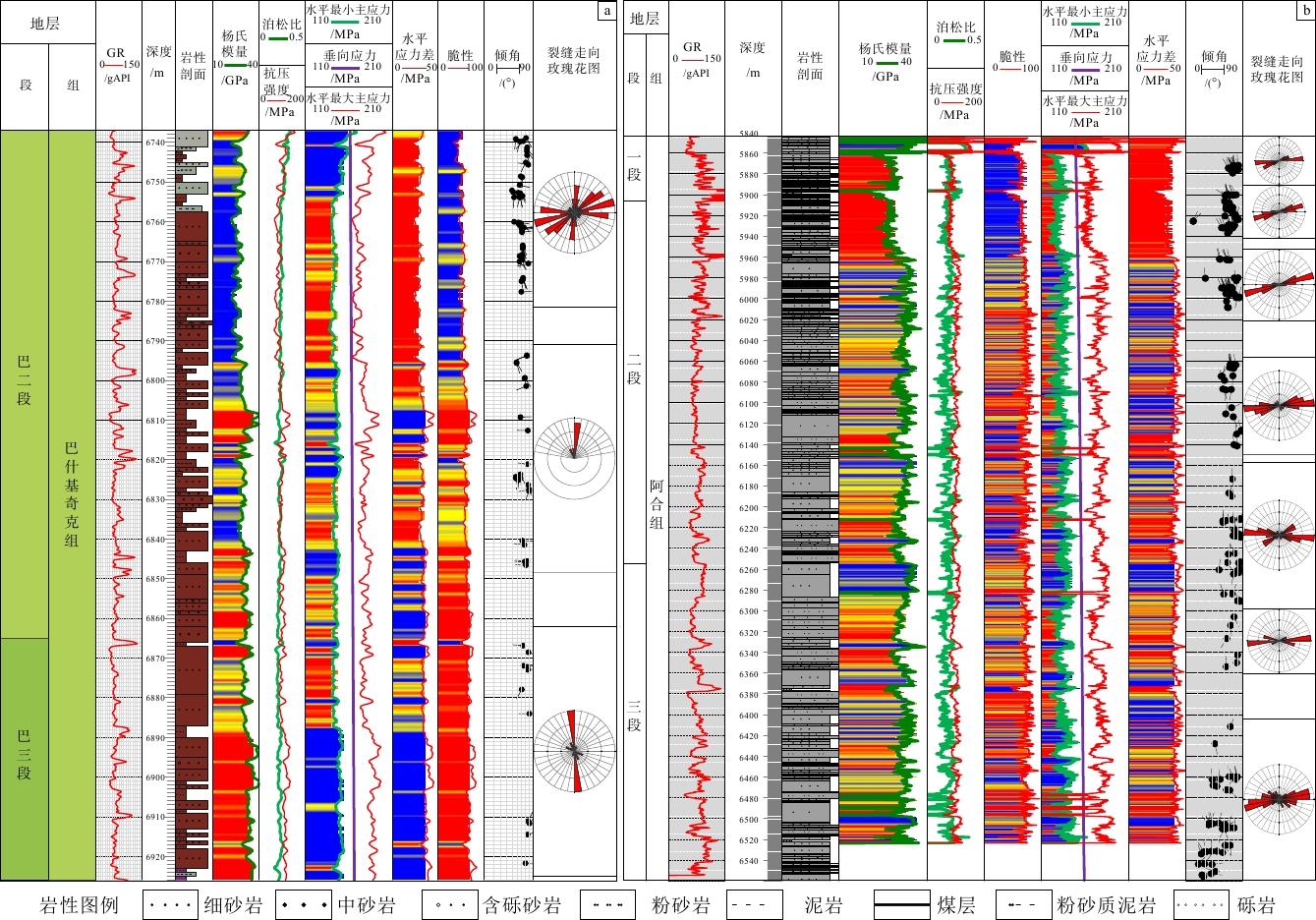
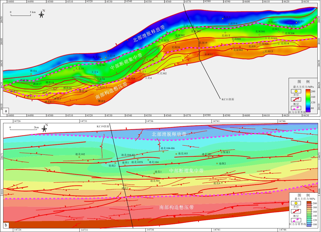
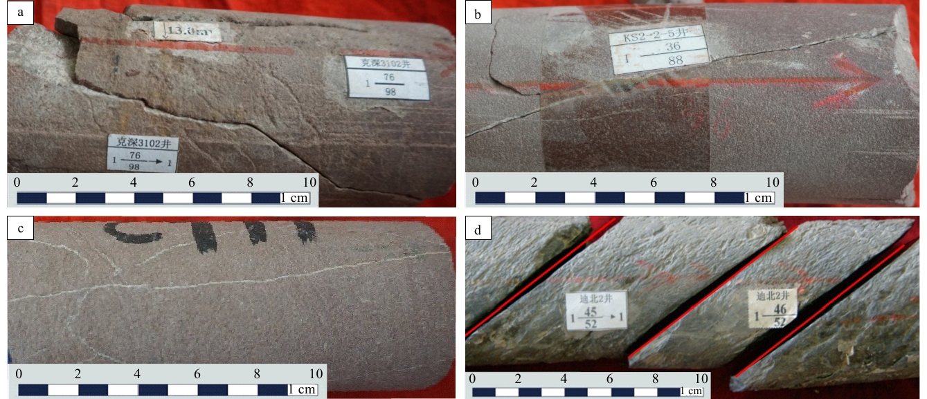
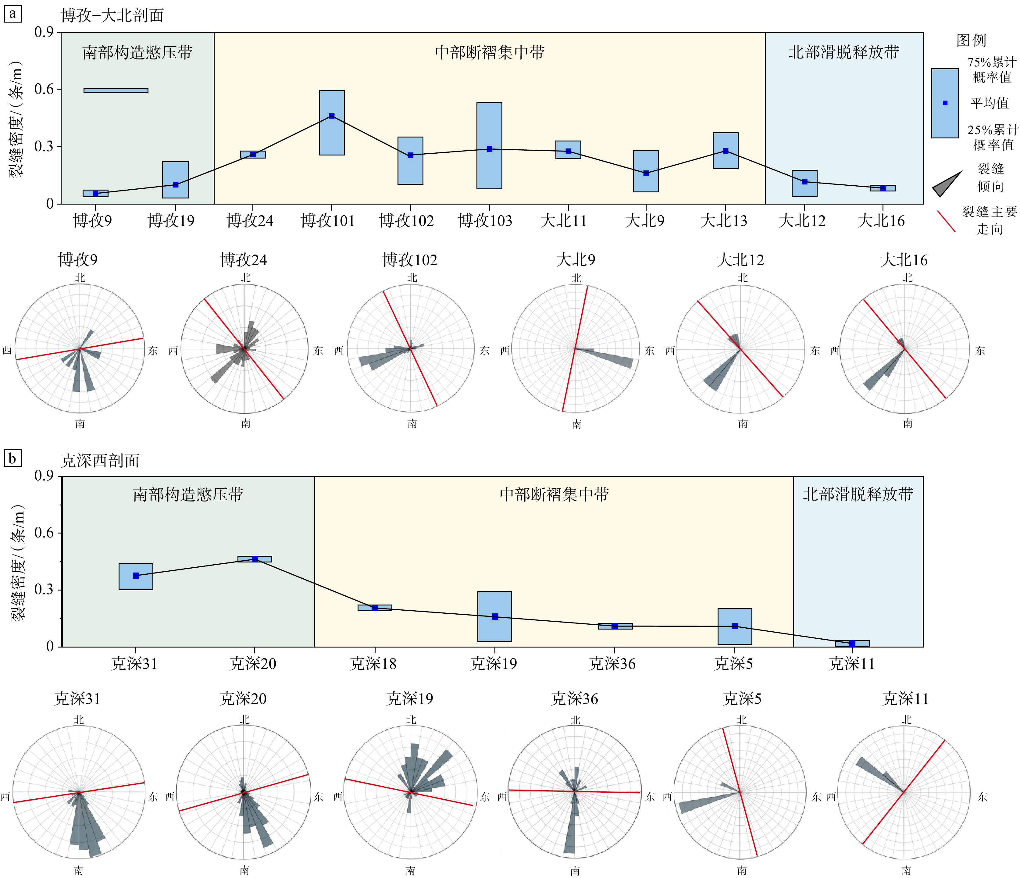
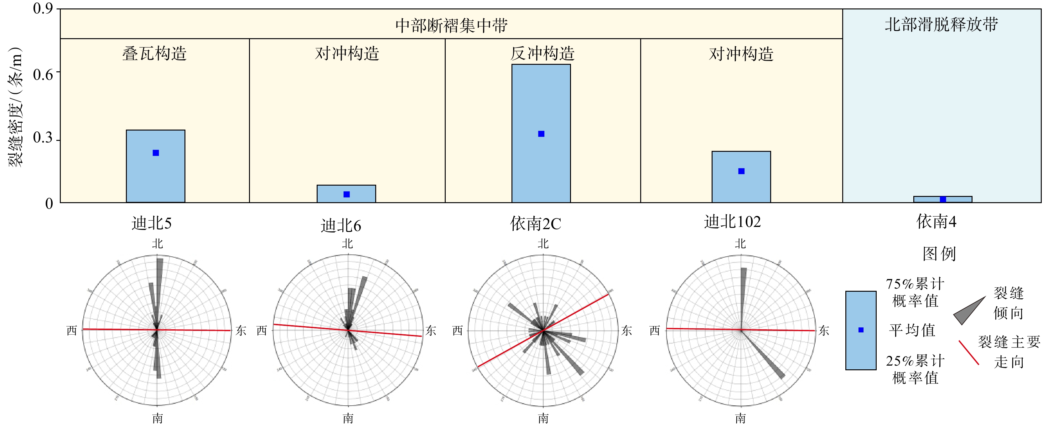
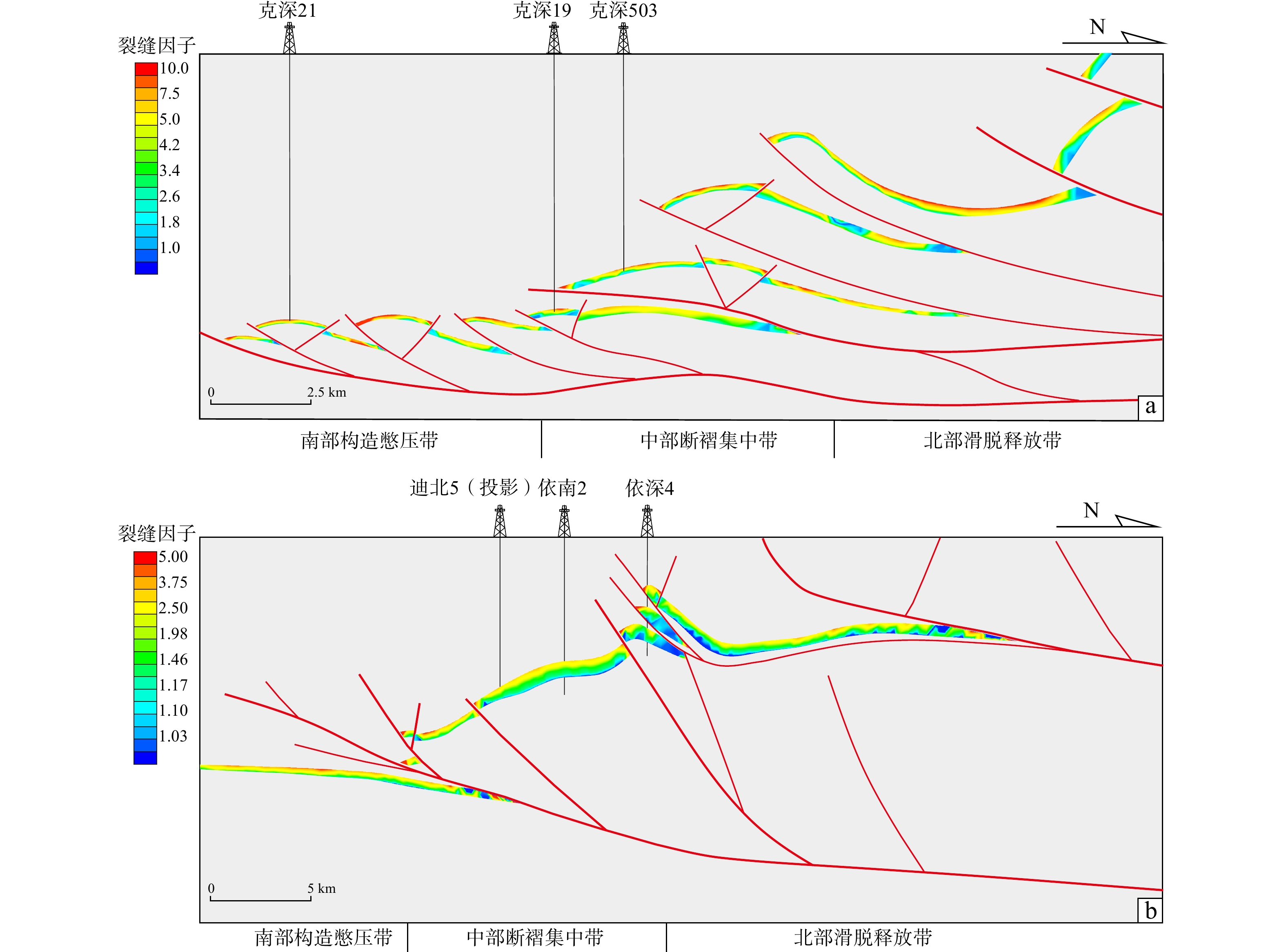
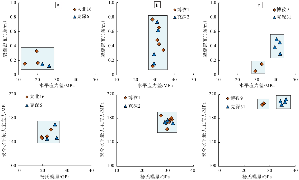
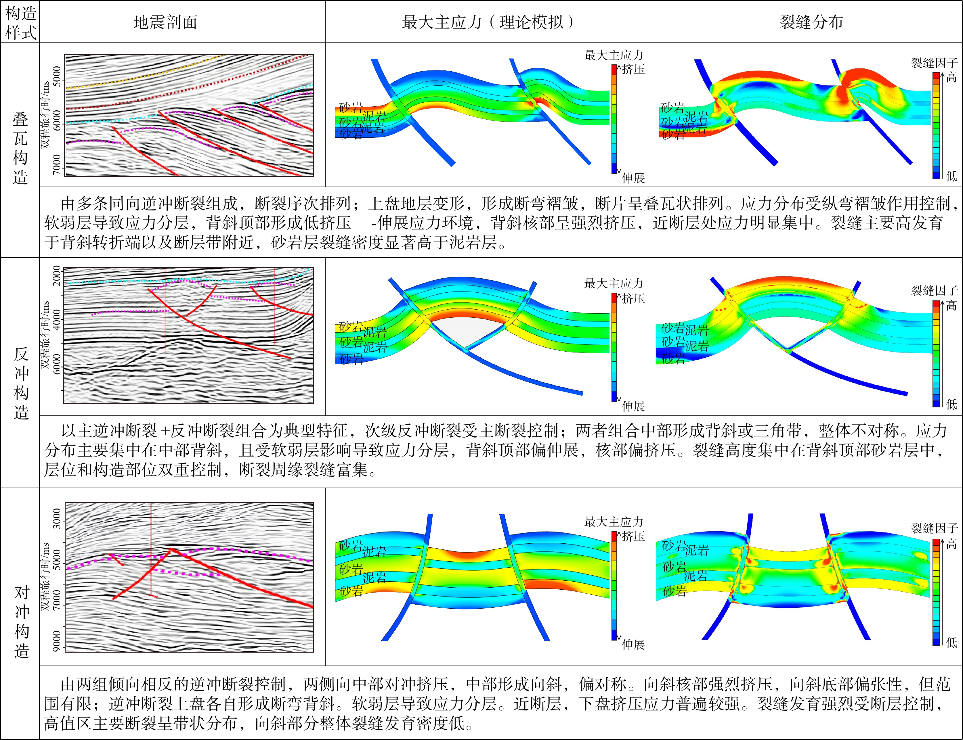
  Objective  The clastic reservoirs in the Kuqa Depression are generally tight, making tectonic fractures crucial for identifying high-quality reservoirs and understanding hydrocarbon enrichment patterns. However, fracture development is highly heterogeneous under the influence of a complex tectonic stress field. This study aims to clarify the distribution patterns of tectonic stress in the Kuqa foreland area and elucidate how stress variations control fracture development and distribution.  Methods  The Cretaceous Bashijiqike Formation in the Kelasu structural belt and the Jurassic Ahe Formation in the Dibei area were selected as the study targets. Structural analysis, numerical simulation of the tectonic stress field, and quantitative fracture characterization were integrated to investigate stress distribution and evaluate the effects of stress variations and structural styles on fracture development.  Results  The macroscopic stress field can be divided into three zones: the northern detachment-release zone, the central fault-fold concentration zone, and the southern tectonically confined compressional zone. Stress heterogeneity within each zone is jointly controlled by fault assemblages, fold deformation, and the detachment along evaporite layers. This stress zonation strongly controls fracture development. The northern detachment-release zone is dominated by low-density, hinge-orthogonal, and oblique fractures; the central fault-fold concentration zone features widely developed fractures with complex attitudes; and the southern tectonically confined compressional zone is characterized by E-W segmented, hinge-parallel fractures. This spatial distribution reflects a genetic transition of fractures from north to south, shifting from strike-slip accommodation and local fault-related origins to fold-deformation-related origins. Furthermore, structural styles within a single stress zone play a critical role in regulating local stress differentiation and fracture development. Fractures are most developed with optimal connectivity in back-thrust structures, followed by imbricate structures, while counter-thrust structures exhibit the least developed fractures with poor effectiveness.   Conclusions  This study reveals the critical role of tectonic stress in controlling fracture development and hydrocarbon enrichment.  Significance  This study can provide theoretical support and practical references for reservoir evaluation and hydrocarbon accumulation in areas of complex stress in foreland basins.
Energy Resources Geology
Artificial intelligence-empowered coal geology: advances, challenges, and prospects
DAI Shifeng, XU Na, ZHU Wei, LI Pengfei, QI Anliangyu, LIU Yu, YAN Ruiwen, ZHAO Zhengfu
2026, 32(5): 1049-1061. doi: 10.12090/j.issn.1006-6616.2026060
Abstract (140) HTML (12) PDF (852KB)(45)
Abstract:
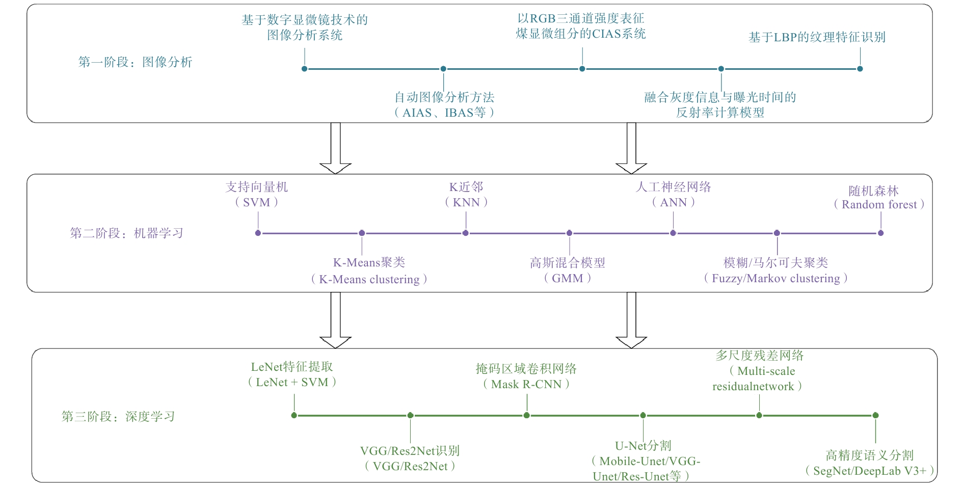
  Objective  The rapid development of artificial intelligence (AI) is reshaping the research paradigm of geosciences. Coal geology focuses on coal, coal seams, coal-bearing strata, coal basins, and the mineral resources that coexist or are associated with coal-bearing strata. These research objects exhibit highly complex material compositions, multiscale characteristics, and pronounced spatiotemporal variability. Consequently, major research directions of coal geology, including coal petrology, coal quality evaluation, critical metals in coal-bearing strata, and coalbed methane exploration and development, are particularly well suited to AI-based approaches.   Methods  AI is driving coal geology beyond traditional, experience-based identification and localized statistical analysis toward a new paradigm integrating multi-source data fusion, intelligent prediction, and mechanistic interpretation. It also provides new opportunities for discovering previously unrecognized geological phenomena.  Results  This paper systematically reviews recent advances in AI applications to the intelligent identification of coal macerals, prediction of coal quality, assessment of the occurrence modes and resource potentials of critical metals in coal-bearing strata, and prediction of coalbed methane. AI technologies have significantly improved the efficiency and accuracy of maceral image recognition, coal quality parameter prediction, identification of critical metal occurrence patterns in coal, and comprehensive resource evaluation. However, several challenges remain, including the scarcity of high-quality datasets, limited cross-regional generalization capability, weak model interpretability, insufficient consistency with geological mechanisms, inadequate knowledge constraints, and limited implementation in engineering scenarios.  Conclusions  Future research should strengthen the development of standardized large-scale databases, promote the deep integration of geological knowledge with data-driven models, develop interpretable and transferable AI models, and establish an intelligent research paradigm oriented toward major scientific questions in coal geology and the green and efficient development of critical mineral resources.  Significance  This review highlights the transformative role of AI in advancing coal geology from experience-driven analysis toward knowledge-guided, intelligent research, providing methodological support for major scientific discoveries and the green and efficient development of coal-related resources.
Genesis and resource potential of high-temperature geothermal systems along the three major fault zones of the western Sichuan Plateau
HOU Mingcai, ZUO Yinhui, HU Yazhao, MU Feisheng, PENG Bo, XU Xiaoqing, ZHANG Junlong
2026, 32(5): 1062-1081. doi: 10.12090/j.issn.1006-6616.2026056
Abstract (124) HTML (29) PDF (3747KB)(0)
Abstract:
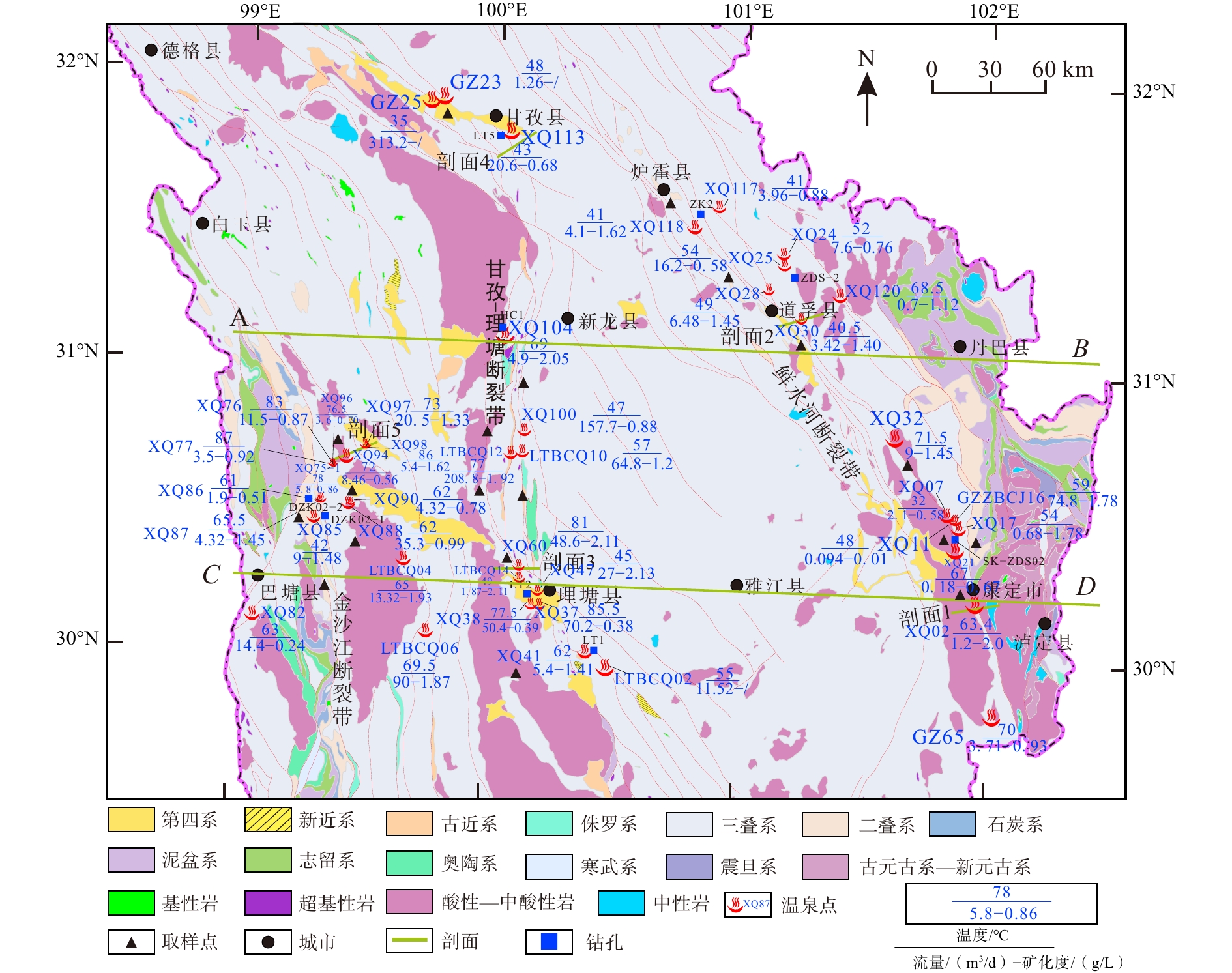
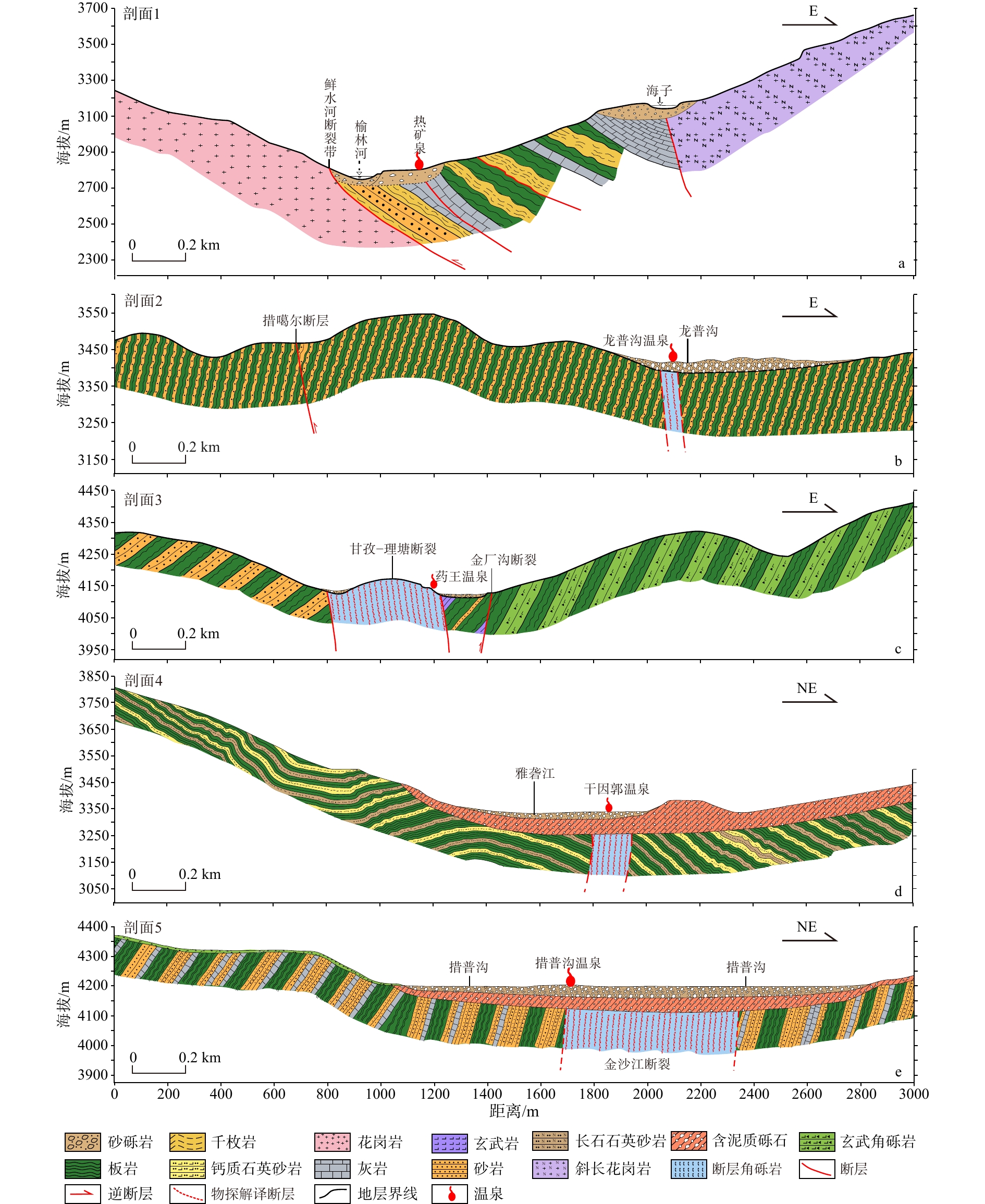
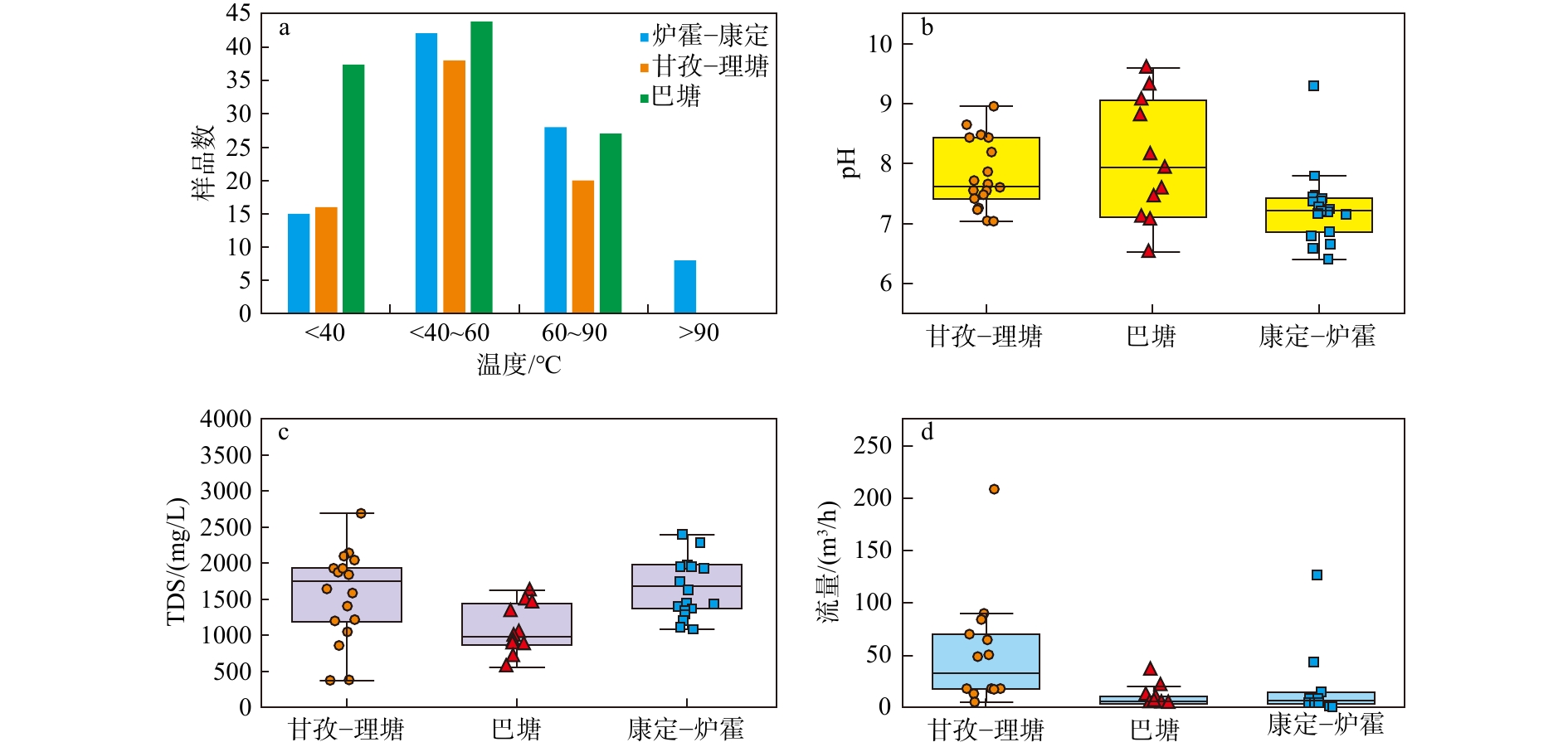
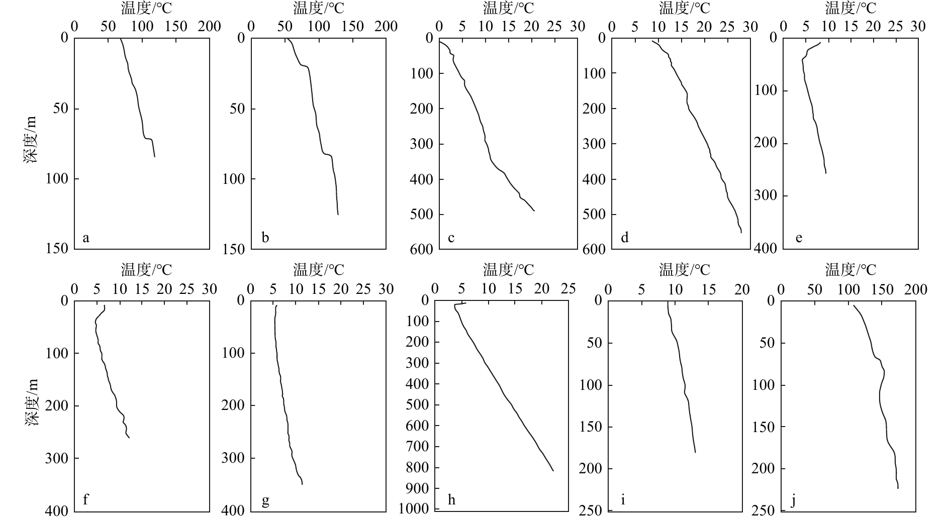
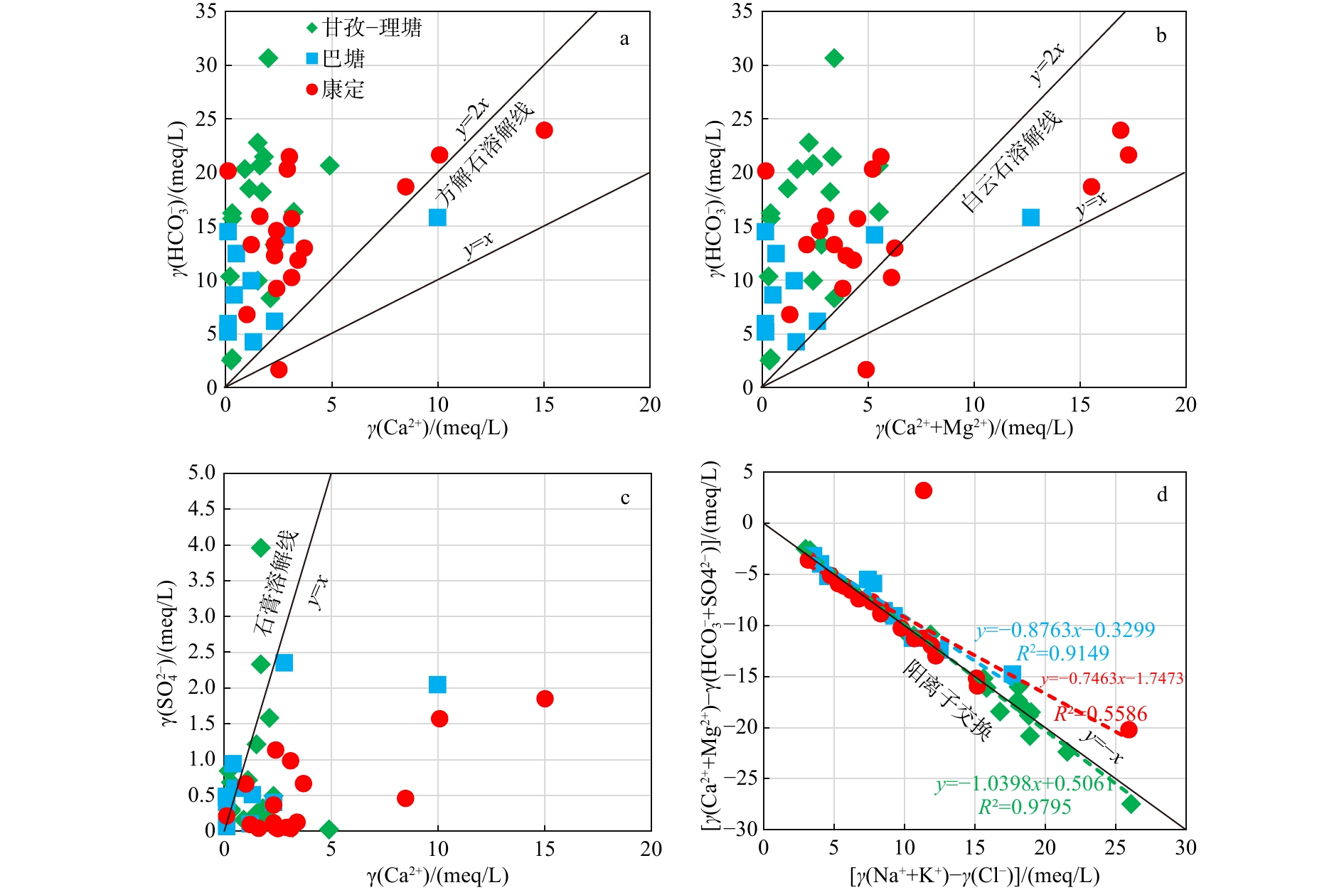
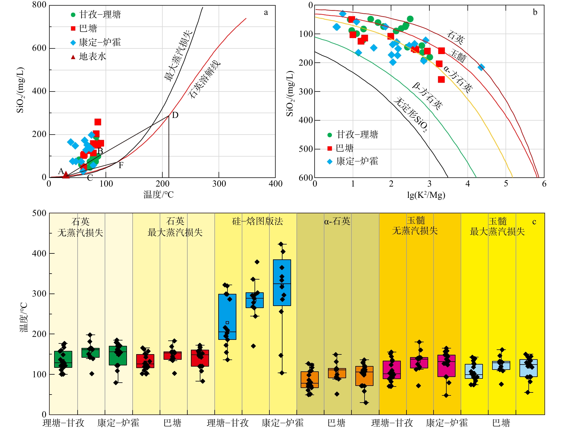
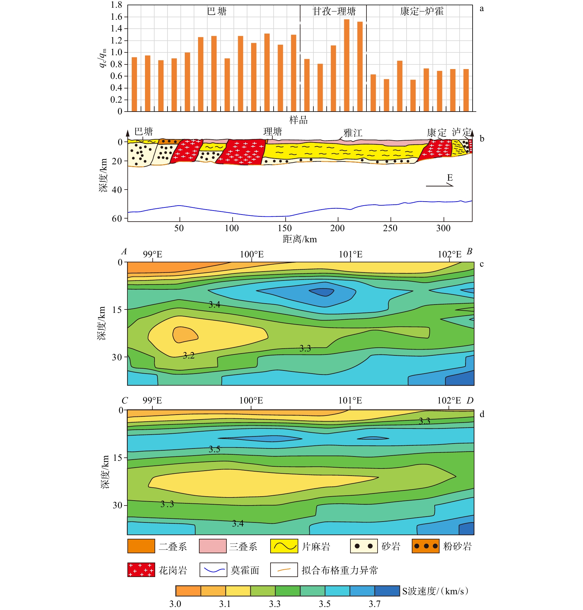
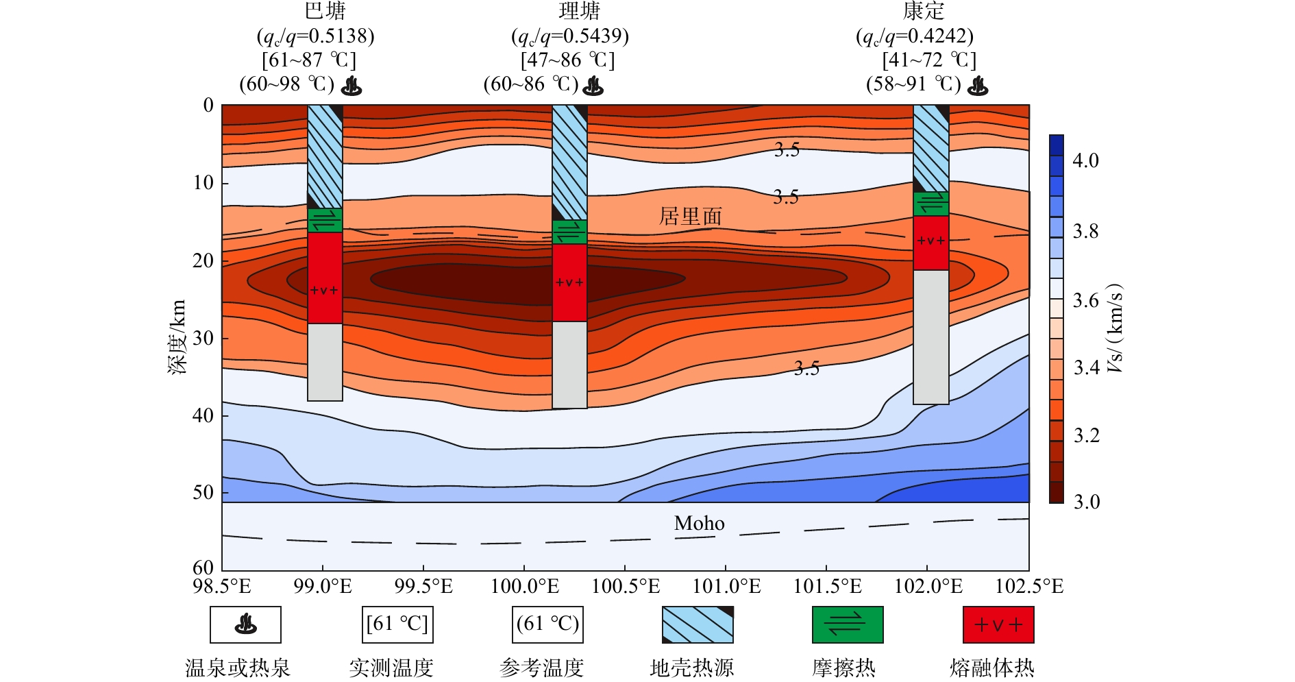
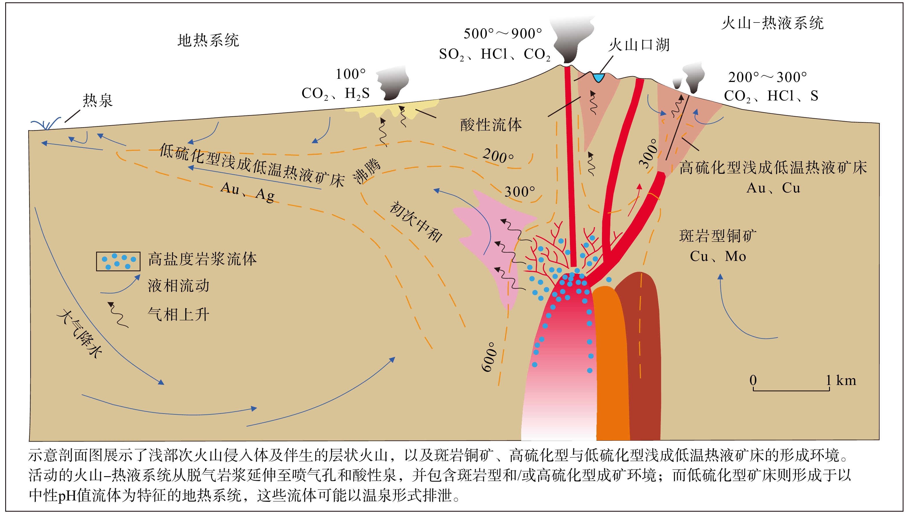
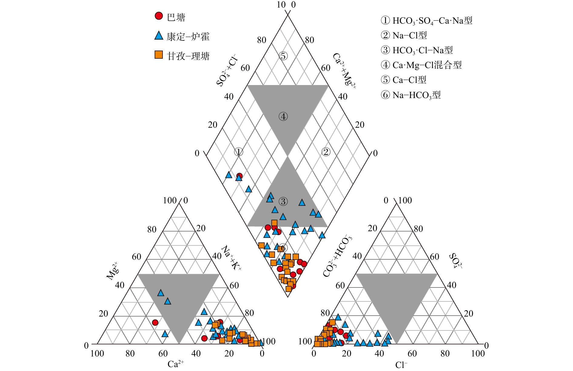
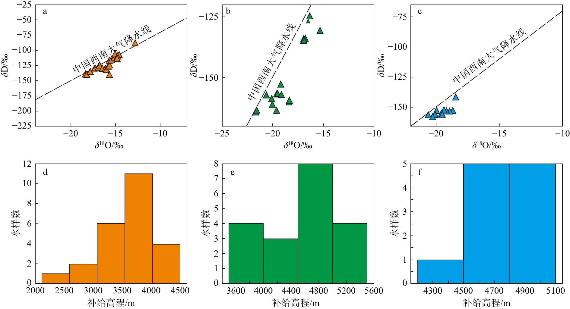
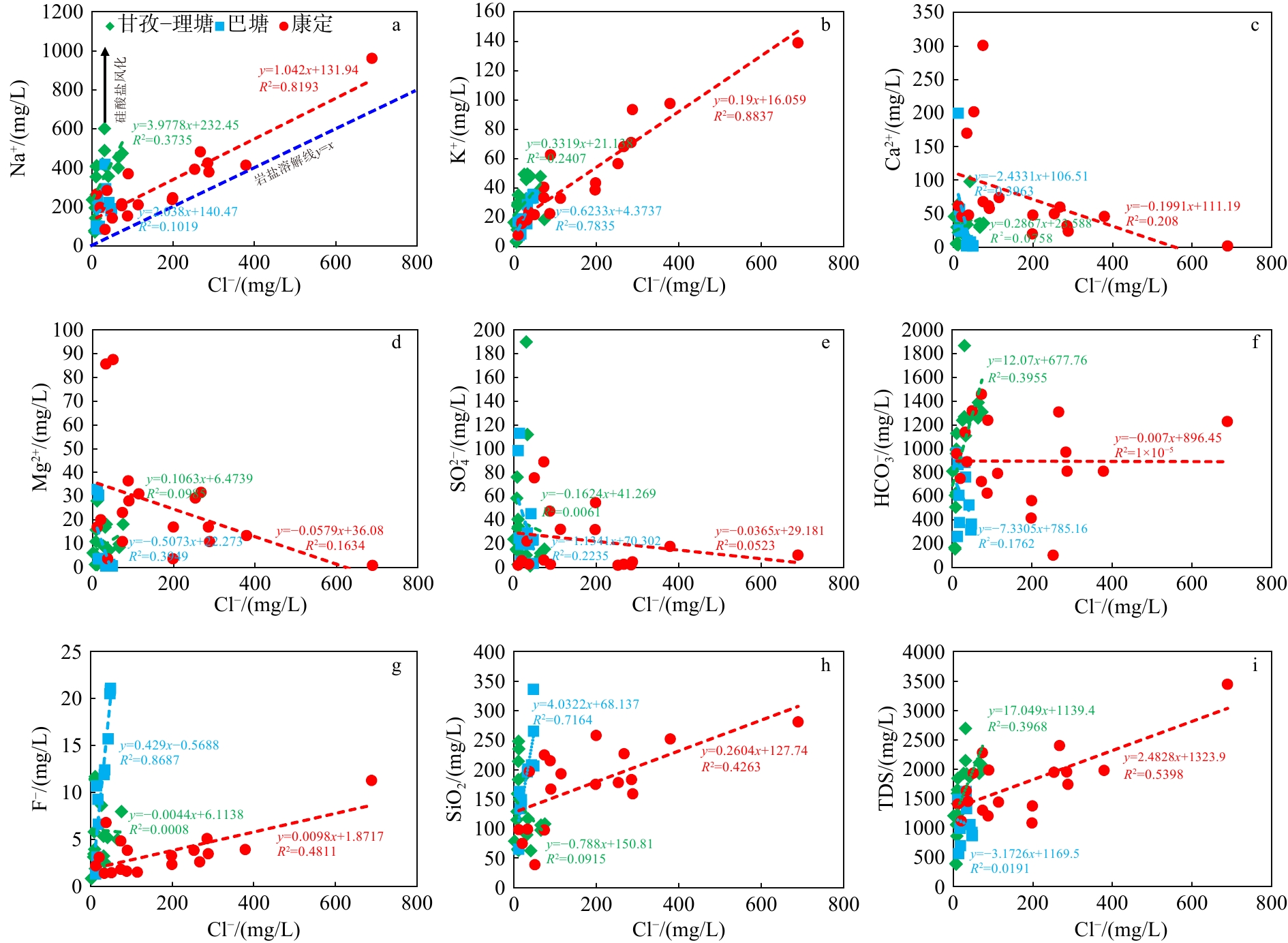
  Objective  This study aims to elucidate the present-day geothermal field, geothermal-fluid evolution, and differential heat-control mechanisms of the Kangding–Luhuo, Ganzi–Litang, and Batang geothermal belts in the western Sichuan Plateau.  Methods  Field investigations and hydrochemical analyses were conducted on 55 hot springs and geothermal wells. Temperature-logging data from 10 boreholes, geothermal-gradient and terrestrial heat-flow data from two wells, and thermophysical measurements of 43 rock samples were integrated with regional fault-distribution and deep seismic-velocity data.   Results  The results show that hot springs in the western Sichuan Plateau are mainly distributed in belts along major deep faults, including the Xianshuihe, Ganzi–Litang, and Jinsha River faults. Geothermal gradients range from 17.5 to 59.7 ℃/km, while terrestrial heat flow ranges from 50.8 to 116.2 mW/m2, with an average of 77.2 mW/m2, showing an overall pattern of higher values in the southwest and lower values in the northeast. The geothermal fluids are predominantly of the HCO3-Na type and are mainly recharged by high-altitude meteoric water, with varying degrees of water–rock interaction and cation exchange during deep circulation. SiO2 geothermometry indicates that reservoir temperatures are mainly concentrated between 100 and 180 ℃, with local values approaching or exceeding 200 ℃. Overall, the high-temperature geothermal systems in western Sichuan are fault-controlled hydrothermal systems jointly governed by the regional thermal background, deep heat input, heat and fluid transport along major deep faults, and deep circulation of meteoric water. Regional comparison indicates that the Ganzi–Litang geothermal belt is characterized by relatively high terrestrial heat flow and a substantial crustal heat-flow contribution, together with relatively stable fault-controlled fluid transport. The Batang geothermal belt exhibits pronounced deep thermal anomalies and is mainly controlled by strong deep heat input and the coupled effects of the Jinsha River Fault and deeply incised valleys. In contrast, the Kangding–Luhuo geothermal belt has a comparatively lower regional thermal background, although activity of the Xianshuihe Fault and local frictional heating promote the localized accumulation of high-temperature geothermal fluids.   Conclusions  Integration of geothermal manifestations and fault distribution suggests that the Ganzi–Litang and Batang geothermal belts have relatively favorable regional exploration potential for high-temperature geothermal resources, whereas the Kangding–Luhuo geothermal belt shows stronger localized potential, particularly at intersections of the main Xianshuihe Fault with subsidiary faults and in areas with concentrated high-temperature geothermal manifestations.   Significance  These results provide a basis for evaluating favorable areas and selecting exploration targets for high-temperature geothermal resources in western Sichuan Plateau.
Current status and prospects of geothermal resource exploration and development in Xiong’an New Area
WANG Guiling, MA Feng, LU Xingchen, LI Jie, ZHU Xi, YU Mingxiao, DONG Xiangyu, GU Haochen
2026, 32(5): 1082-1100. doi: 10.12090/j.issn.1006-6616.2026095
Abstract (112) HTML (20) PDF (4570KB)(5)
Abstract:
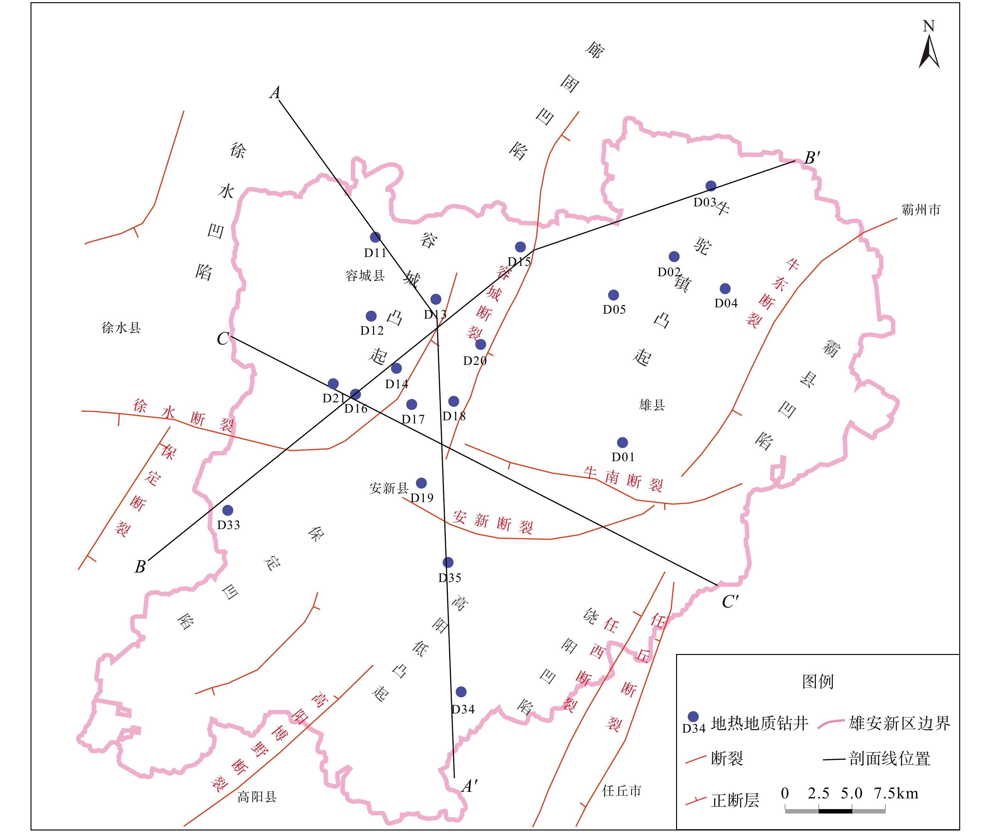
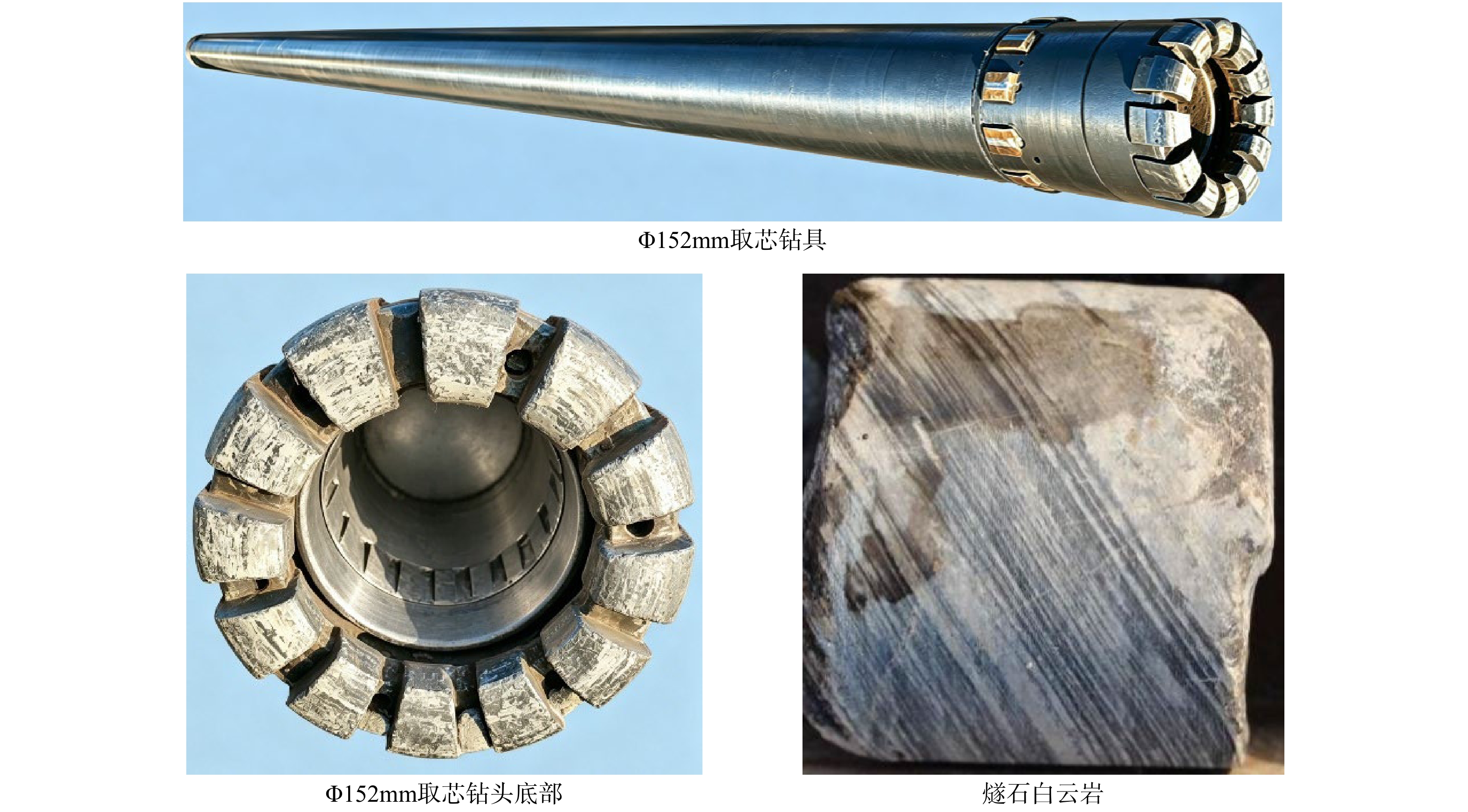
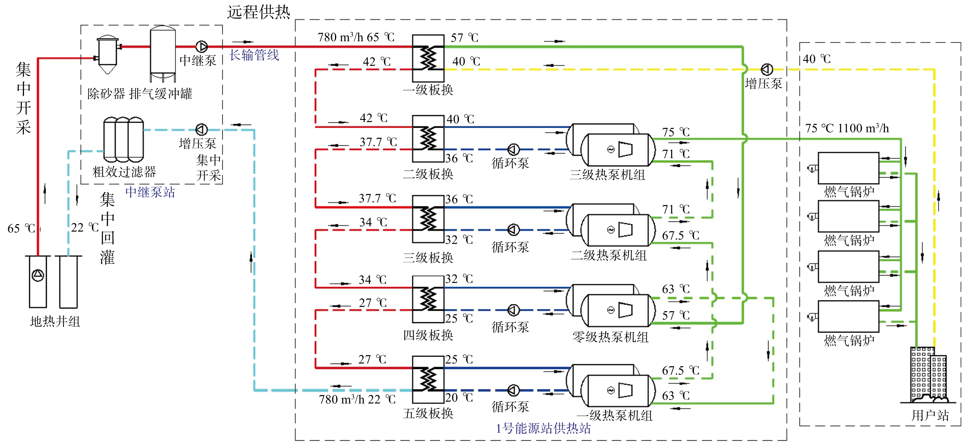
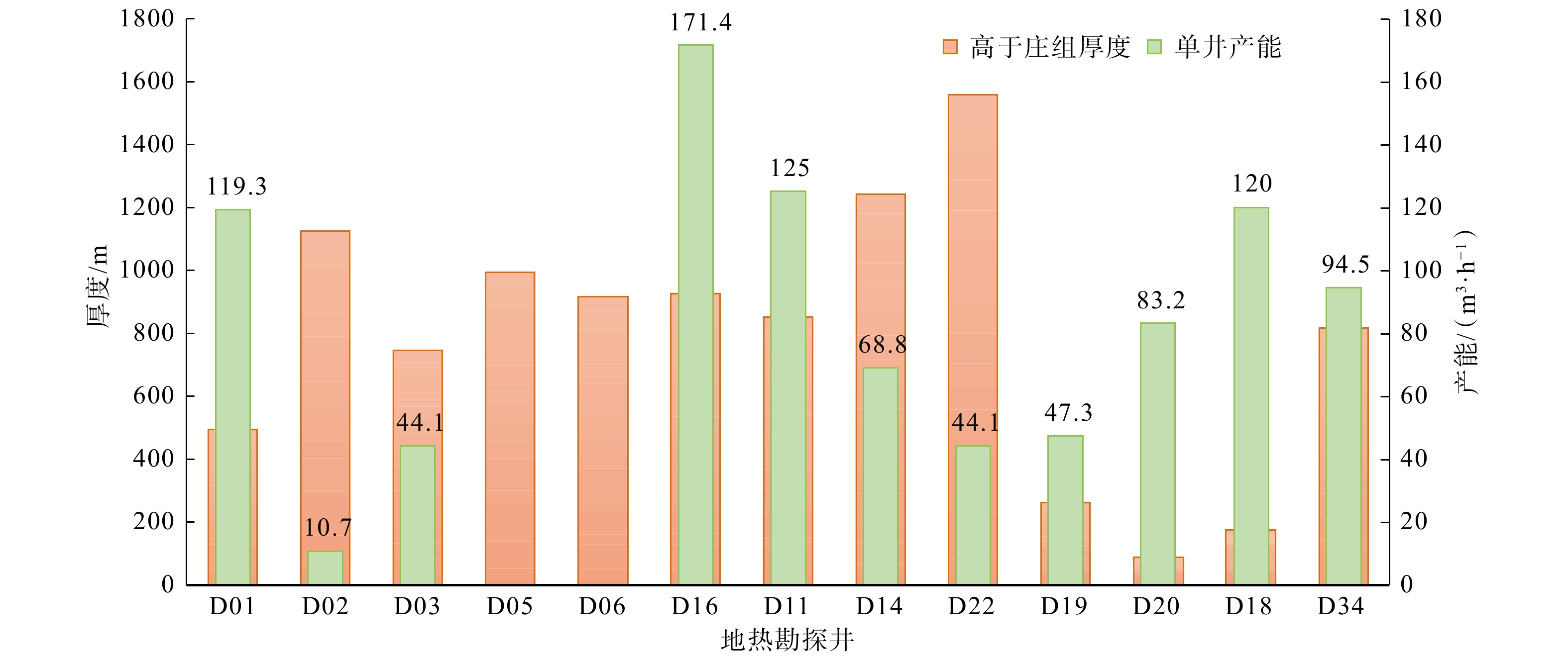
  Objective  This study aims to review the history and current status of geothermal resource exploration and development in Xiong’an New Area, and to assess the advances, challenges, and future directions of geothermal exploration and utilization.   Methods  Based on the results of comprehensive geothermal exploration across the whole area, this study synthesizes the theoretical approaches, exploration and development technologies, and representative applications.   Results  The principal achievements are as follows: (1) The “dominant-flow heat transfer” theory for buried hills is proposed, revealing the nonlinear characteristics of upward deep heat transport and providing a theoretical basis for identifying highest-temperature and largest-capacity geothermal wells in North China. (2) An evaluation method for recoverable geothermal resources under withdrawal–recharge equilibrium is established, comprehensively considering recharge rate, inter-well heat-exchange efficiency, and reservoir temperature attenuation, thereby improving the applicability of resource assessment to geothermal planning and development. (3) For geothermal exploration, the wide-field electromagnetic (WFEM) method is applied for the first time to the Jixianian geothermal reservoirs in Xiong’an New Area; demonstrating high precision and low cost in locating deeply buried geothermal reservoir structures. To address the low core recovery caused by the fractured weathered crust at the top of buried-hill reservoirs, a small-diameter pilot-hole drilling technique is proposed, achieving an overall core recovery of 85.06%. (4) Hydra-jet and acid-fracturing stimulation is implemented for the first time on the deep Gaozhuangzhuang Formation geothermal reservoir, increasing reservoir productivity eightfold and raising the geothermal-fluid temperature from 60.0 ℃ to 66.5 ℃. (5) To address the spatial mismatch between resource-rich areas with low heat demand and heat-demand centers with limited geothermal resources, the concept and associated technologies of long-distance heat transmission are proposed, and a new large-scale exploitation model based on “centralized extraction–centralized transmission–centralized reinjection” is established.   Conclusions  The geothermal exploration and development in Xiong’an New Area has progressed from localized exploration to systematic and scaled utilization, forming an integrated pathway from genetic understanding and resource assessment to exploration and drilling, reservoir stimulation, and cross-regional heat transmission and development. Future efforts should focus on the detection and enhanced development of deep Gaoyuzhuang Formation geothermal reservoirs, digital and intelligent integrated development, and “geothermal+” multi-energy complementarity and geothermal energy storage.  Significance  These theoretical and technological innovations provide guidance for the efficient and scaled development of geothermal resources in Xiong’an, and offer theoretical and technical support for the green and large-scale geothermal development in the Beijing–Tianjin–Hebei region and nationwide.
Seismic technology and its application to ultra-deep oil and gas in the platform area of the Tarim Basin
LI Yalin, CAO Hong, LI Dajun, ZHANG Yintao, DUAN Wensheng, SUN Chong
2026, 32(5): 1101-1128. doi: 10.12090/j.issn.1006-6616.2026093
Abstract (64) HTML (7) PDF (29658KB)(2)
Abstract:
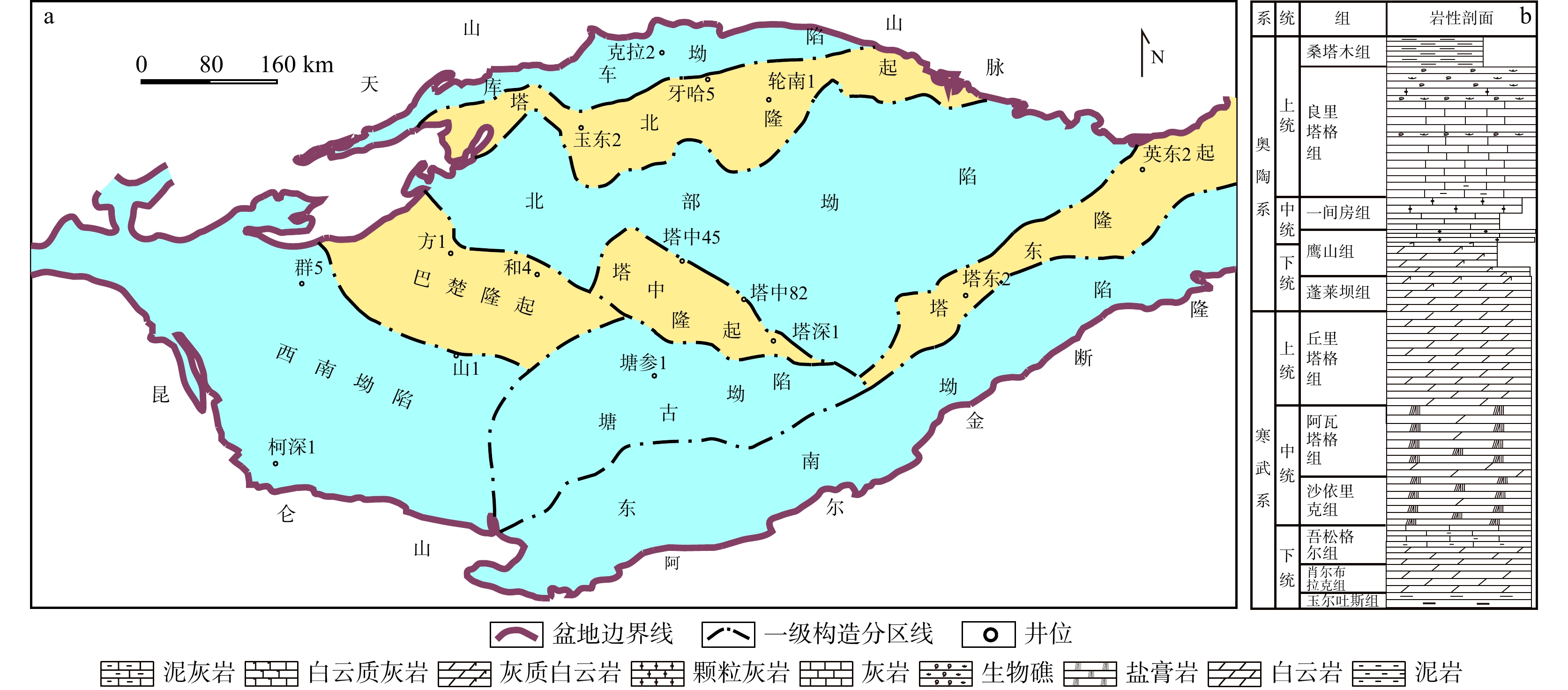
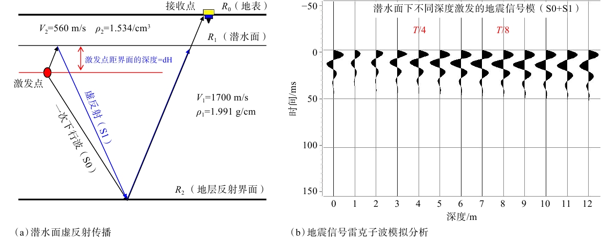
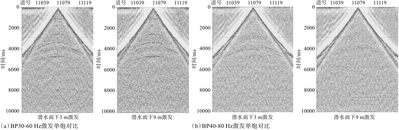
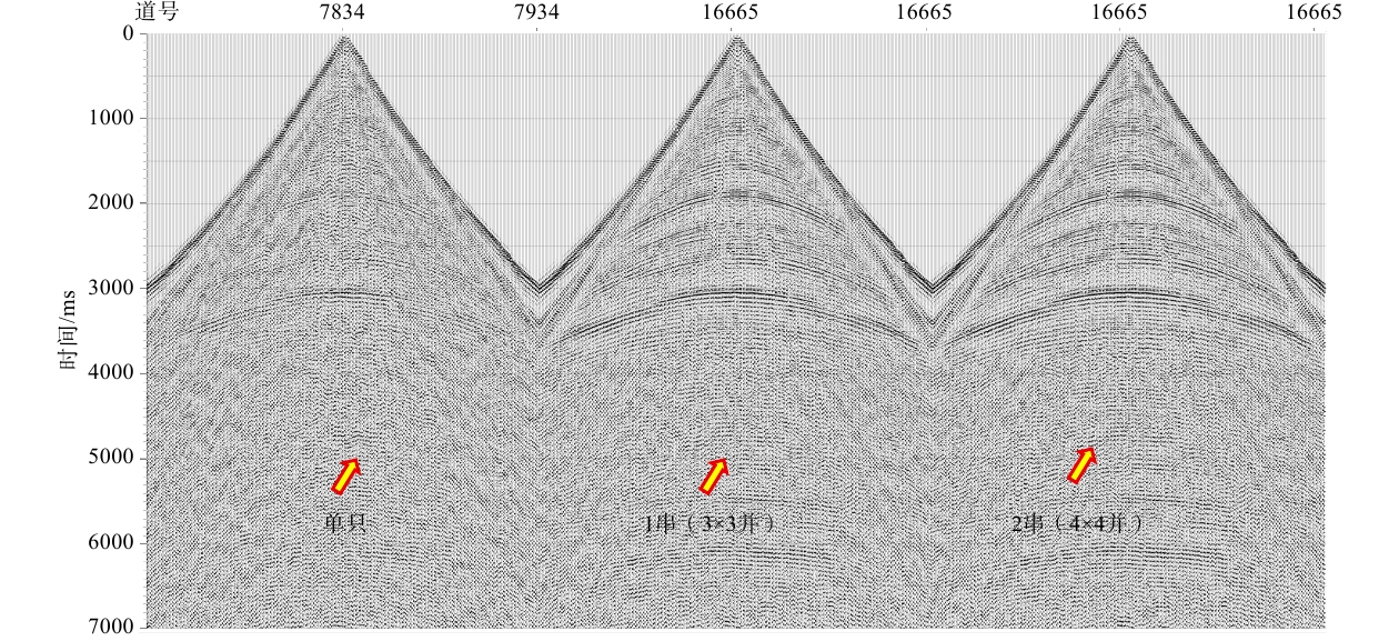
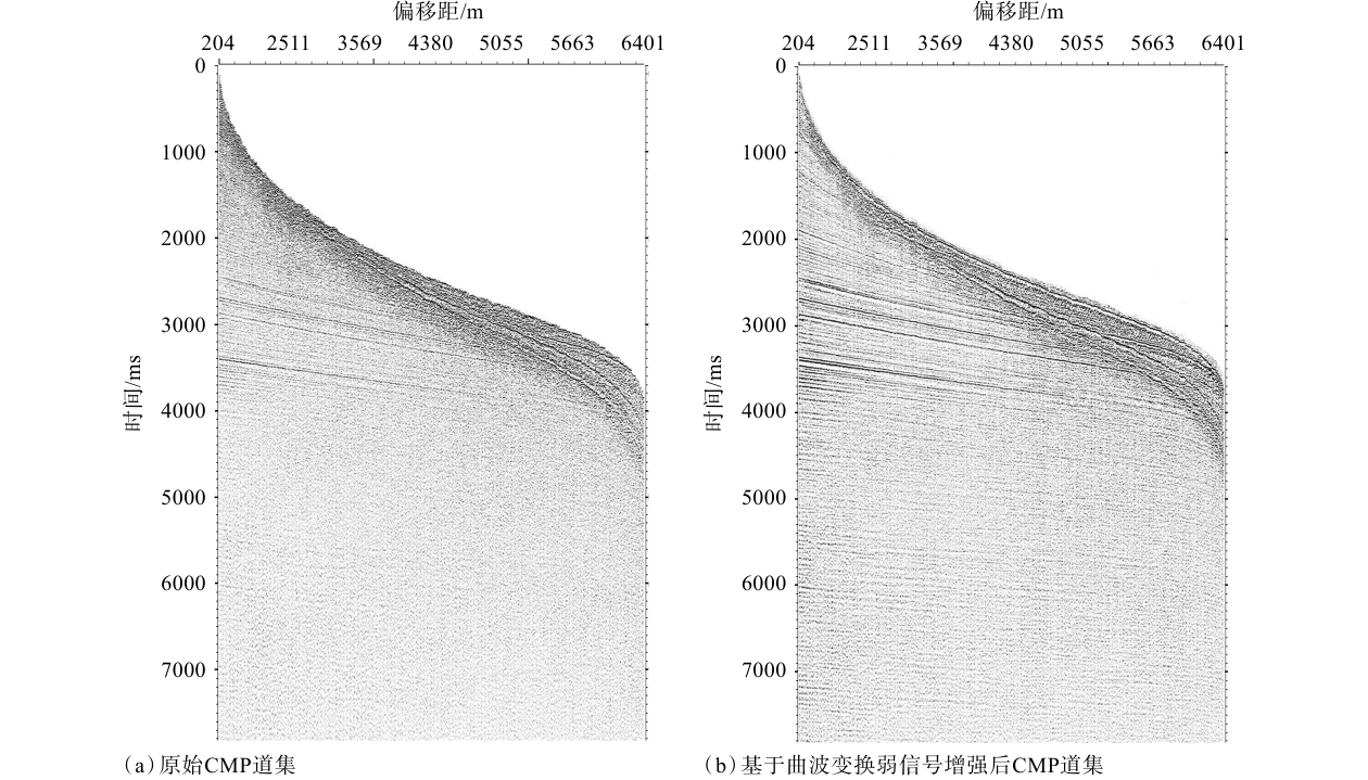
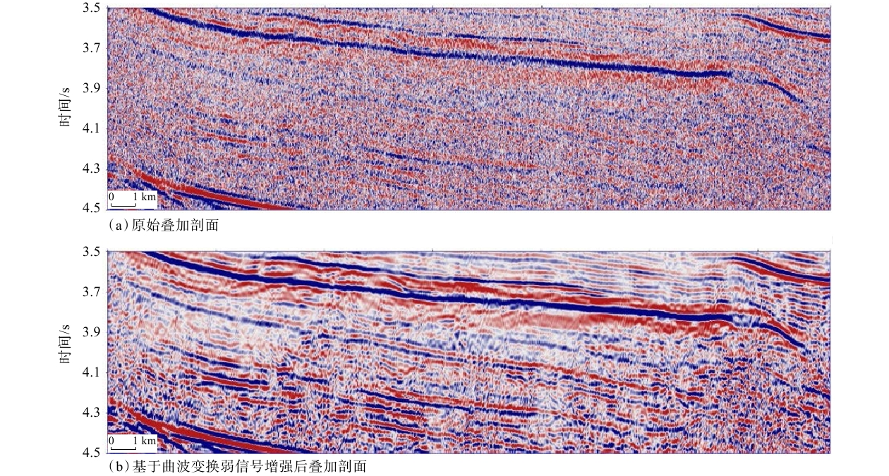
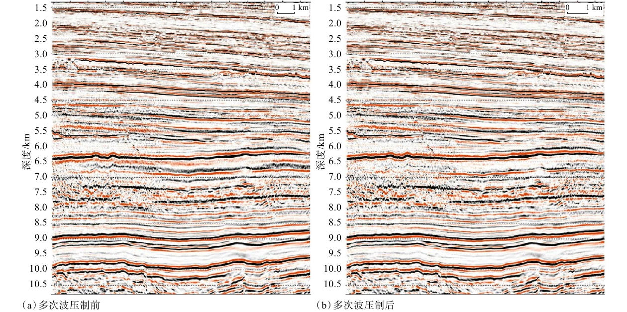
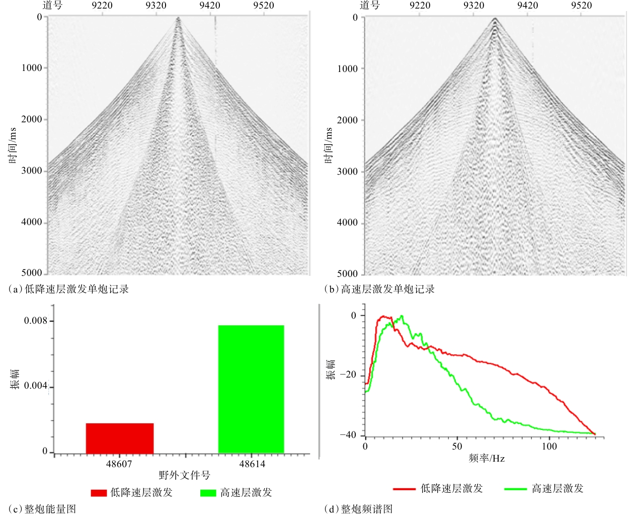
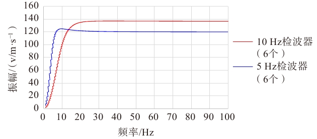
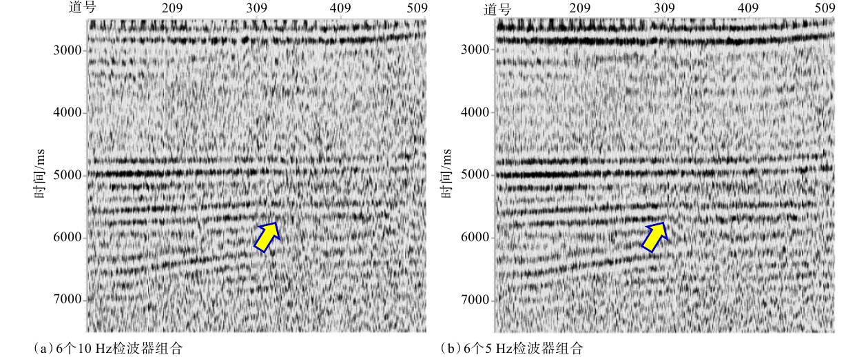
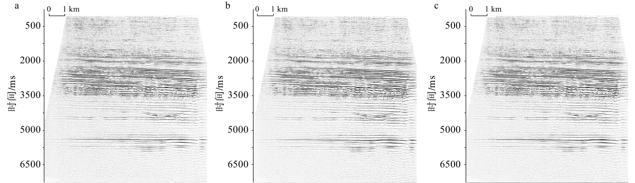
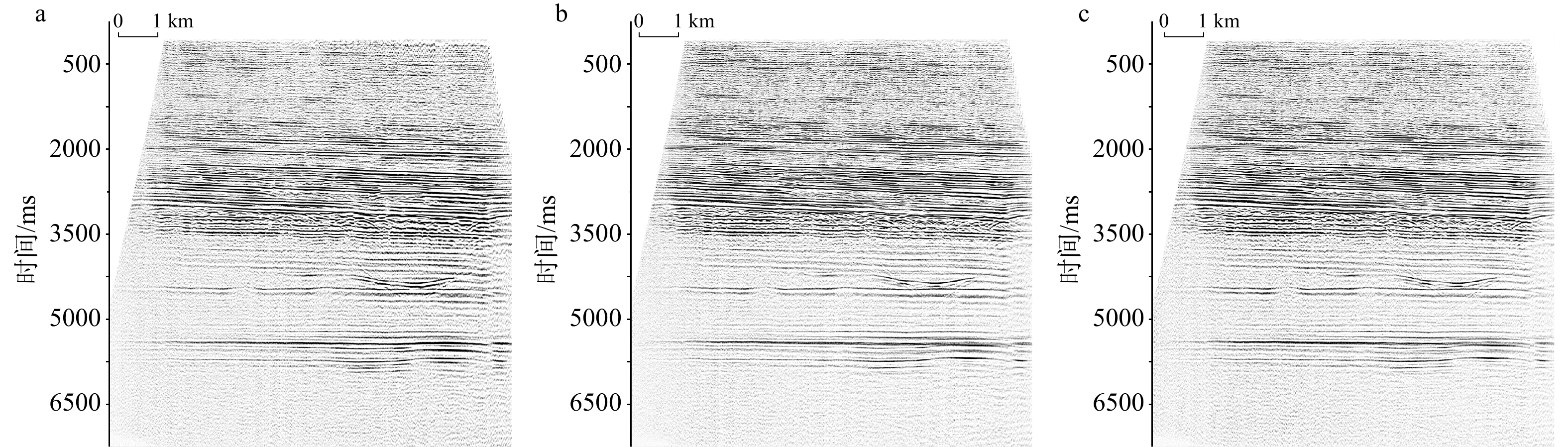
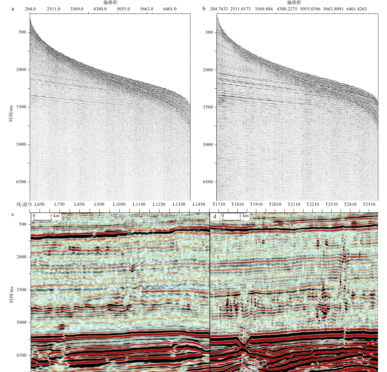
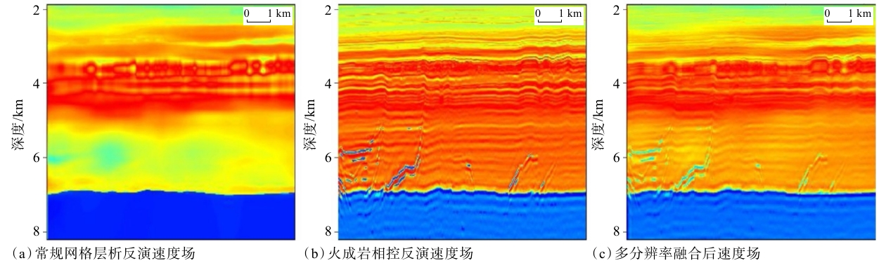
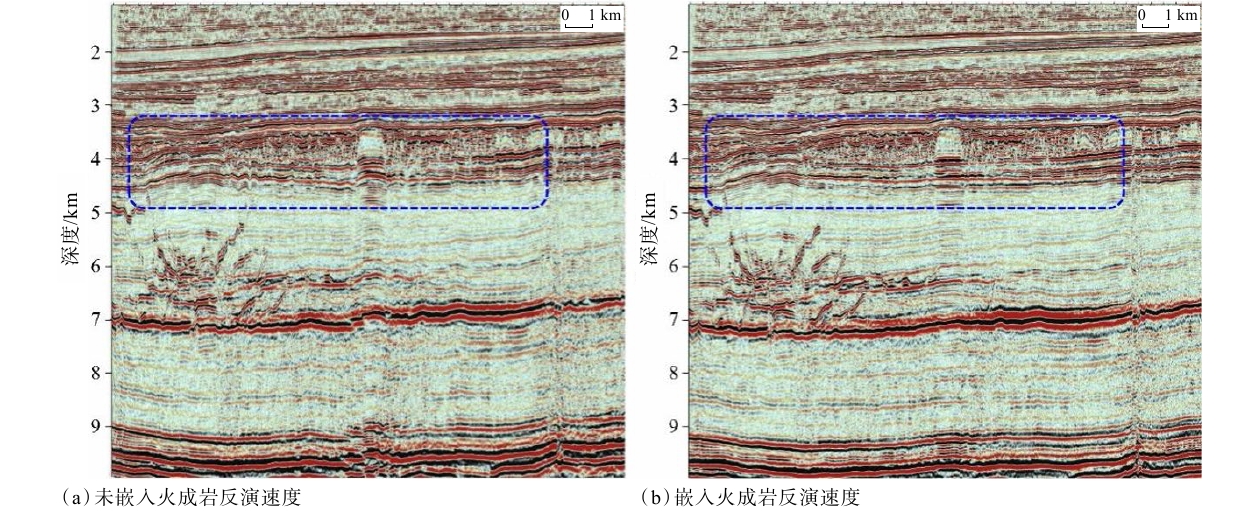
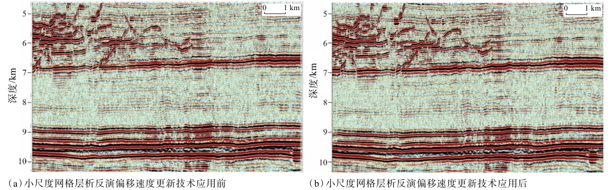
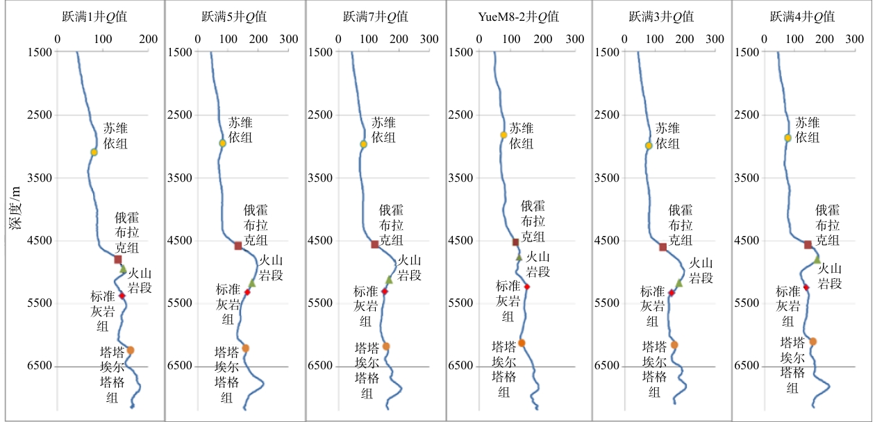
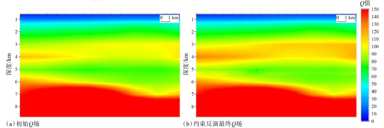
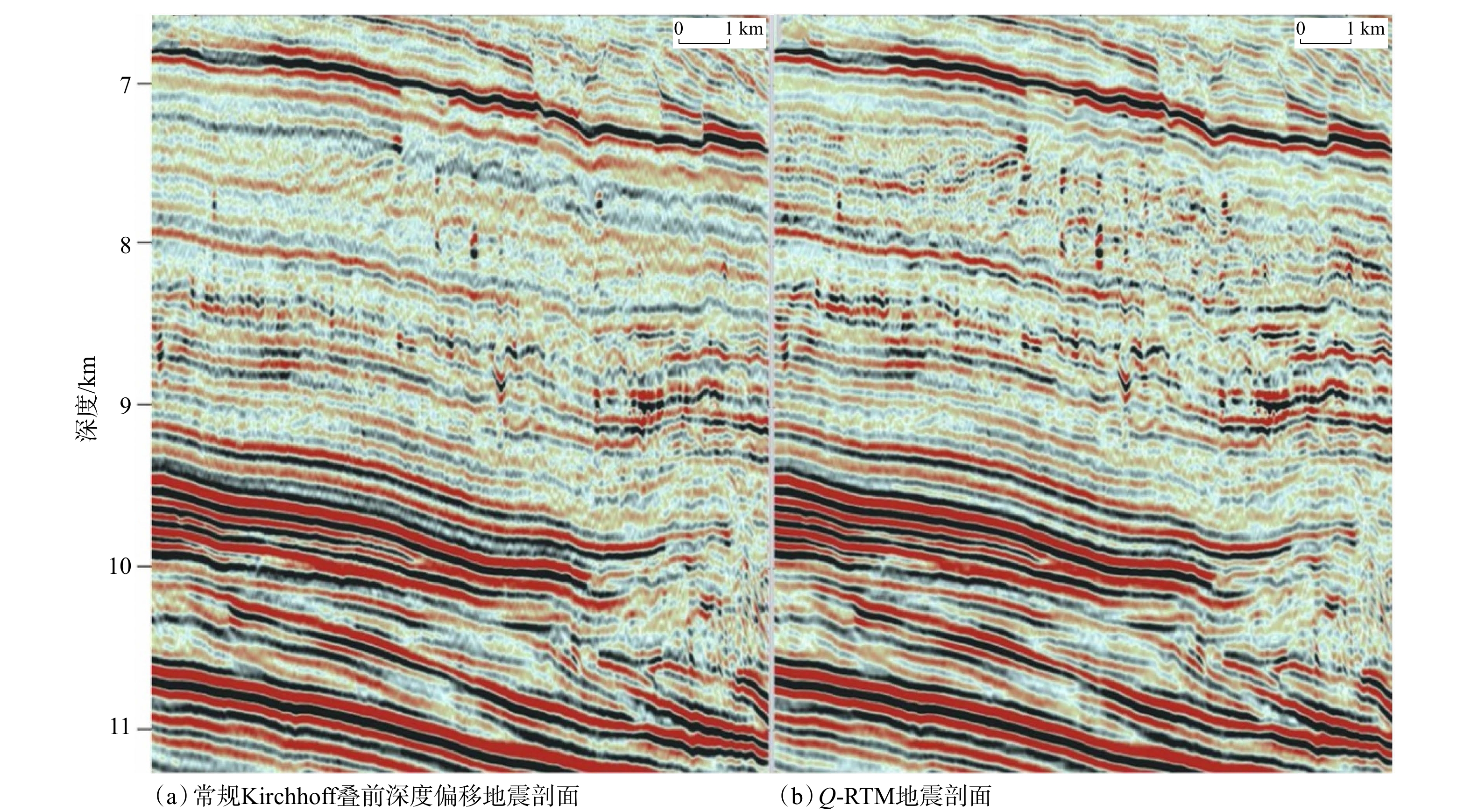
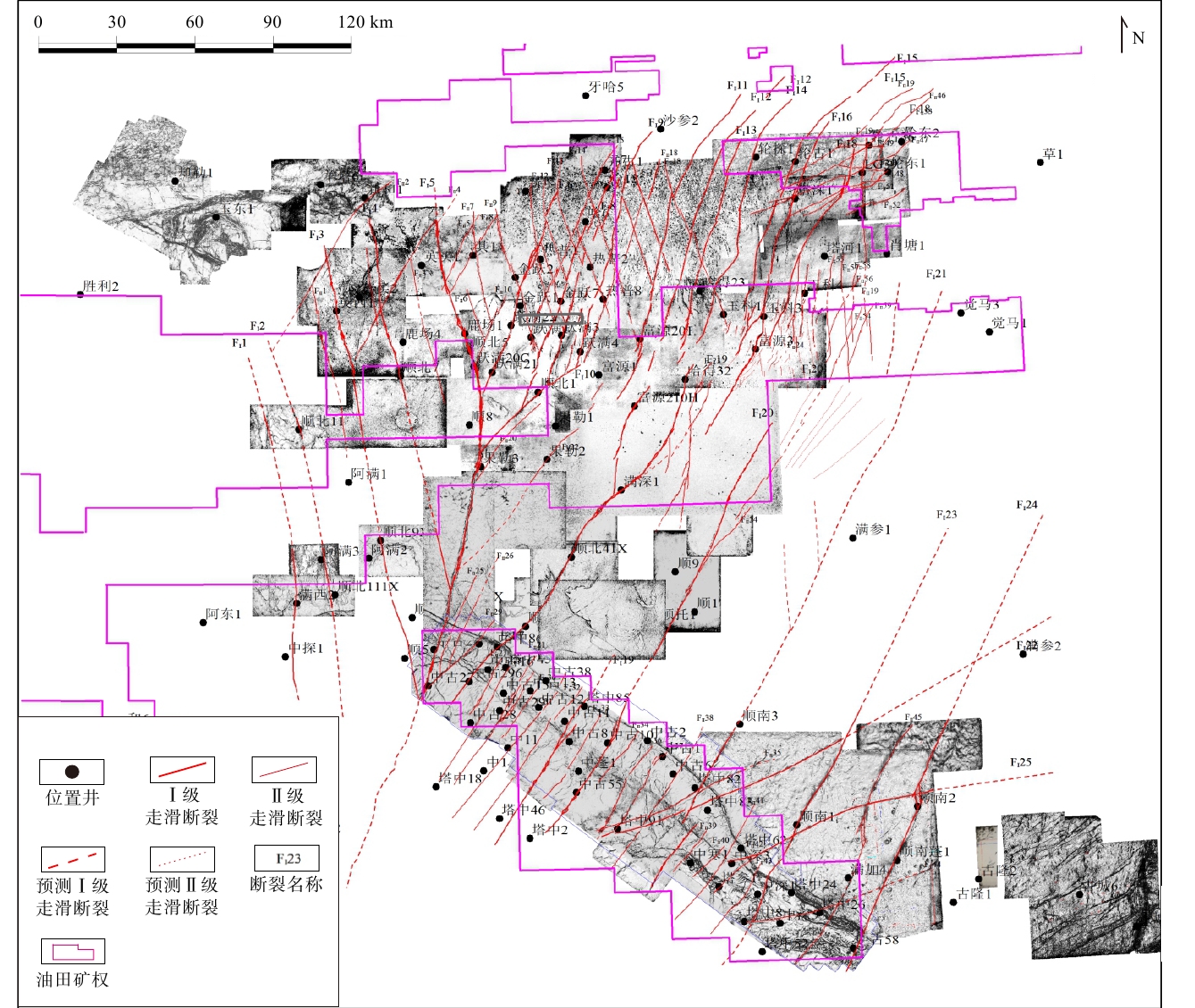
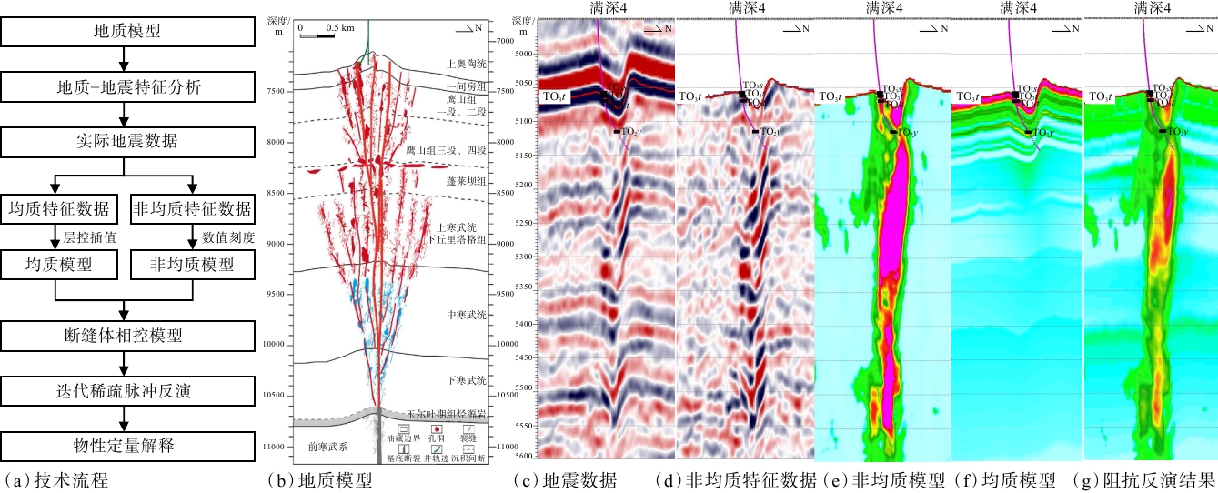
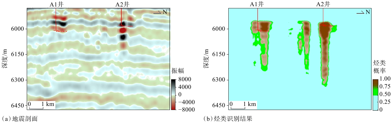
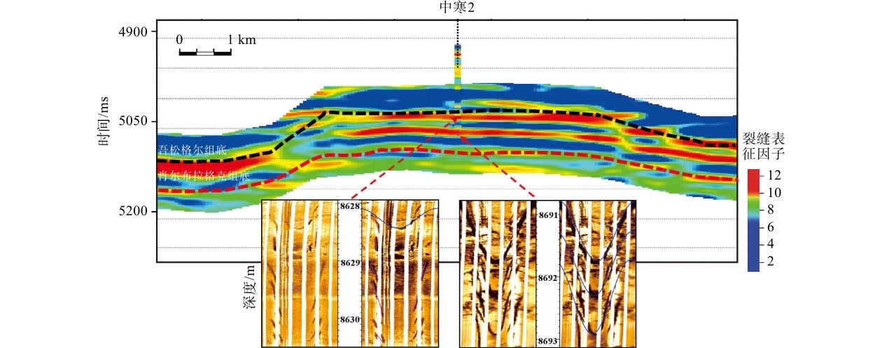
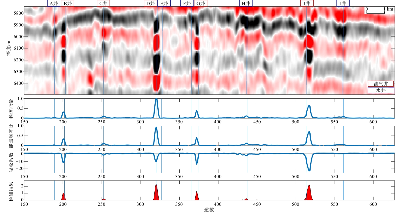
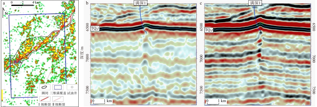
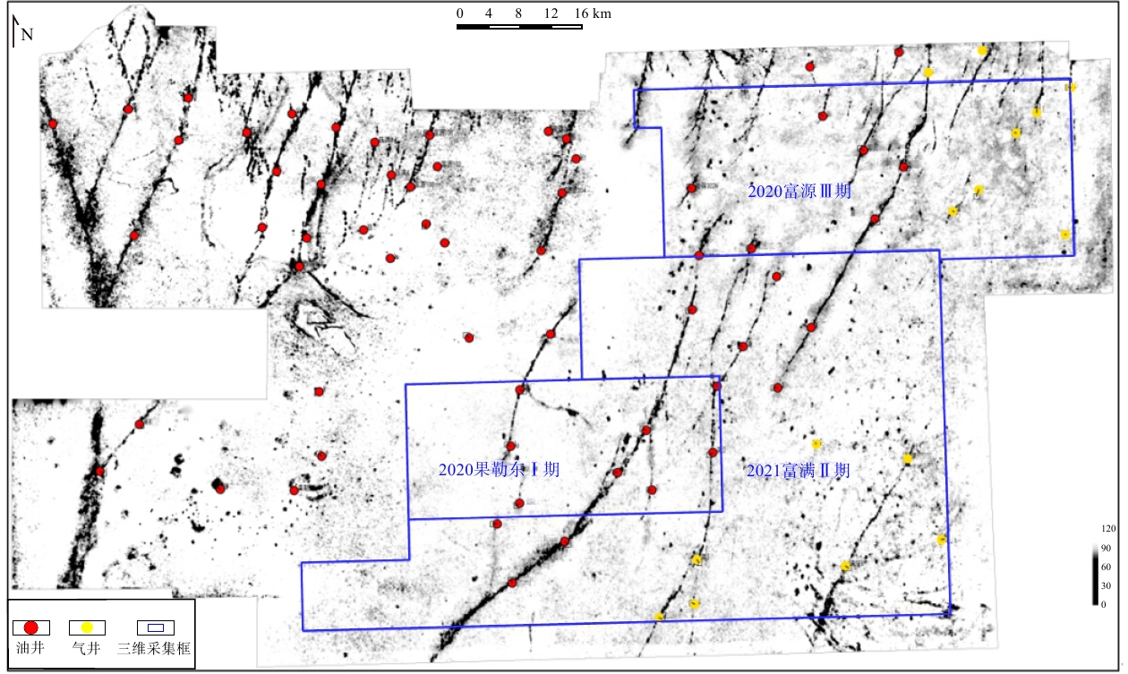
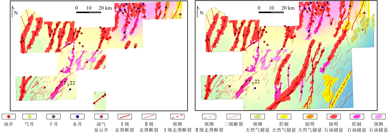
  Objective  The platform area of the Tarim Basin has enormous potential for ultra-deep (>6,000 m) carbonate hydrocarbon resources. Efficient exploration and development of these resources require breakthroughs in four key areas: prediction of the thickness of major source rocks, characterization of the distribution of strike-slip faults, prediction of high-quality ultra-deep reservoirs, and detection of ultra-deep hydrocarbon accumulations. However, the great burial depths and strong heterogeneity of the reservoirs, poor seismic source and receiver conditions in extensive desert terrain, severe seismic attenuation, and complex distributions of subsurface igneous intrusions result in low signal-to-noise ratios, poor resolution, and limited imaging accuracy of ultra-deep seismic data, hindering reliable reservoir prediction. This study aims to establish a systematic seismic technology framework for exploring ultra-deep carbonate hydrocarbons in the platform area and overcoming these key technical challenges.   Methods  Four core seismic technologies were developed to address these challenges. (1) Energy enhancement and noise attenuation technology, comprising source excitation using ghost-reflection focusing, combined reception using small-aperture square arrays, weak-signal enhancement in the curvelet domain, and interbed-multiple suppression using the inverse scattering series method. (2) Fidelity-preserving bandwidth extension technology, comprising high-velocity layer excitation, low-frequency geophone acquisition, and wavelet-based consistency correction using the recorded wavelet; (3) Energy focusing and accurate positioning technology, comprising 3D wide-azimuth, high-density, small-bin, long-offset seismic acquisition, refined migration-velocity modeling incorporating igneous intrusions such as volcanic rocks, detailed Q-field modeling, and Q-compensated reverse-time migration. (4) Seismic decoupling mapping technology, comprising seismic decoupling mapping of strike-slip fault systems, source-rock thickness, ultra-deep reservoir properties, and ultra-deep fluid properties.   Results  Application of this technology framework in the Tabei Depression yielded significant results. The ultra-deep strike-slip faults transformed from weak and indistinct reflections into clearly identifiable seismic features, substantially improving fault interpretation. The prediction error for the thickness of the major source rock, the Lower Cambrian Yu'ertusi Formation, has been constrained to within ±10 m. The coincidence rate of predicted high-quality ultra-deep carbonate reservoirs exceeds 85%; and the accuracy of ultra-deep hydrocarbon detection exceeds 80%.  Conclusions  These advances led to the discovery and efficient delineation of the Fuman ultra-deep giant oil and gas field in the Tabei Depression. Proven reserves reach the billion-ton level, and an ultra-deep oil and gas production base with an annual production capacity of approximately five million tons has been established.
Applications and prospects of geophysical exploration technologies in large-scale oil and gas engineering construction
JING Shaodong, MA Xuedong, YAN Yuefeng, SUN Huaifeng
2026, 32(5): 1129-1149. doi: 10.12090/j.issn.1006-6616.2026054
Abstract (115) HTML (18) PDF (18233KB)(24)
Abstract:
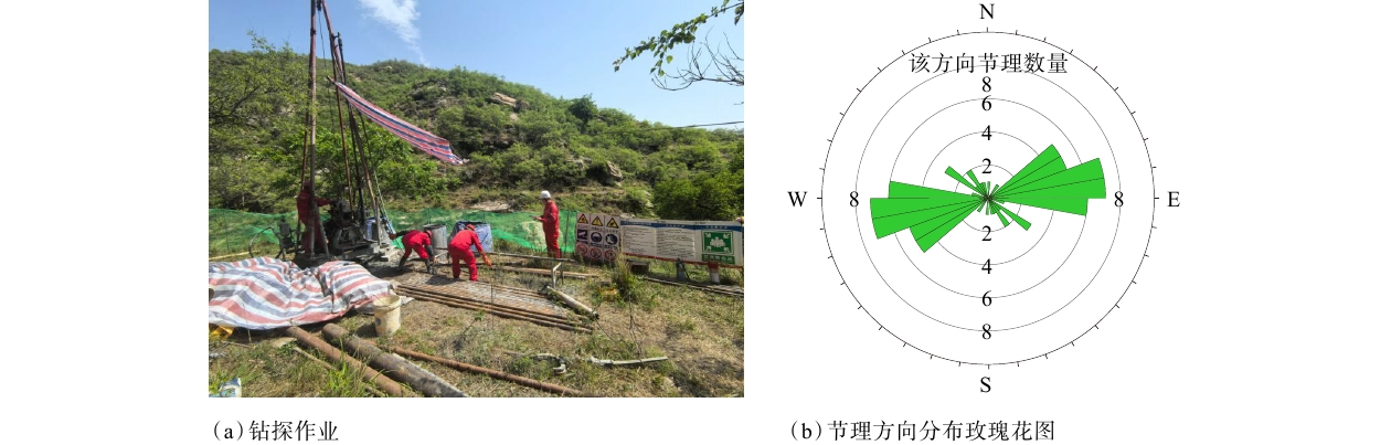
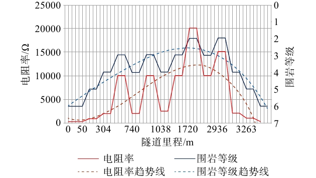
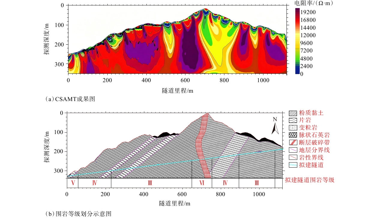
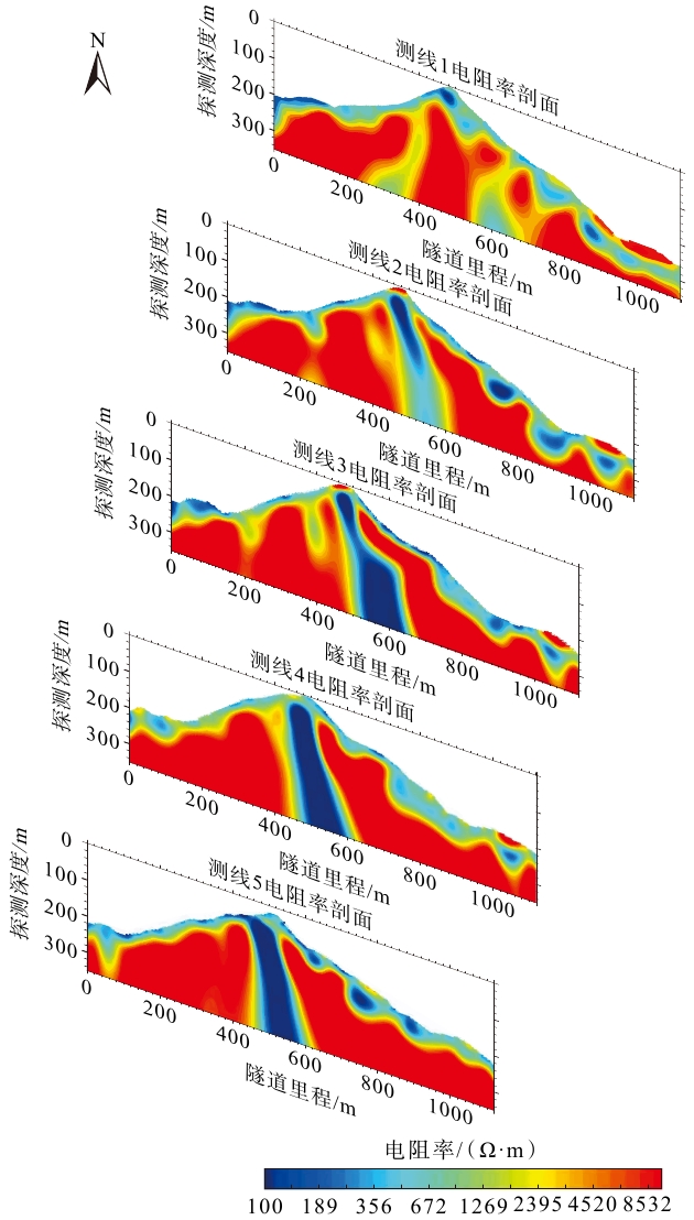
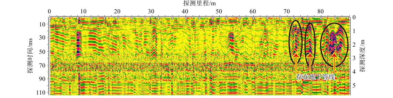
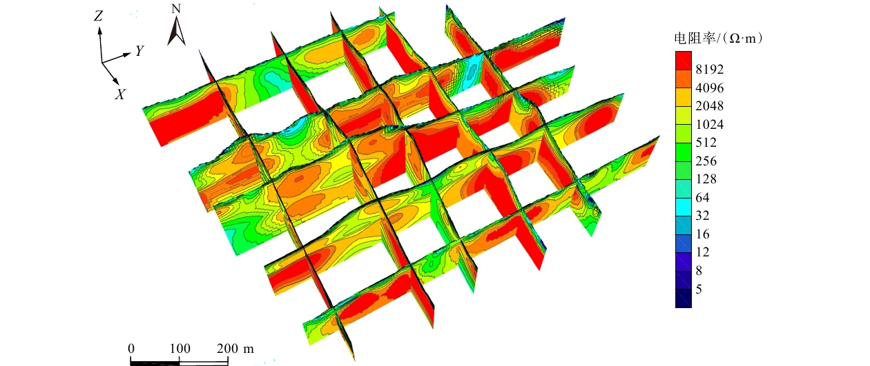
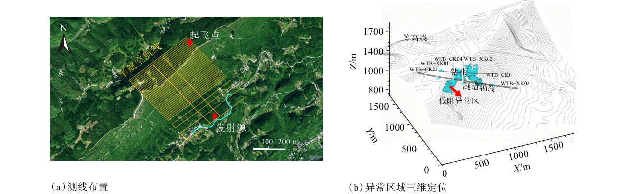
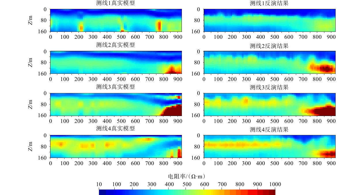
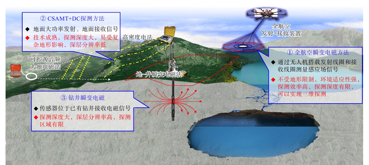
  Objective  The construction of large-scale oil and gas engineering projects serves as a strategic cornerstone for ensuring national energy security. Various types of projects, including long-distance pipelines, refining and petrochemical facilities, and underground storage facilities, work together to support the national economy and people’s livelihoods. An integrated site investigation runs from site selection and design to construction and operation. Its core tasks include identifying geological hazards along pipelines, assessing foundation conditions at refining and chemical facilities, and evaluating rock mass integrity and stability in underground spaces. However, conventional investigation methods, including drilling, have limitations such as poor adaptability to complex terrain, limited exploration coverage, site disturbance, high costs, and long investigation periods.  Methods   Engineering geophysics with its unique advantages of being non-destructive, rapid, and capable of 3D exploration has become the solution to the aforementioned challenges. Methods such as controlled-source audio-frequency magnetotellurics (CSAMT), electrical resistivity tomography (ERT), shallow seismic exploration, ground penetrating radar (GPR), and microtremor surveys have been widely applied in oil and gas projects.   Results  Appropriate combinations of geophysical methods have demonstrated significant effectiveness in pipeline investigation, foundation exploration in karst-developed areas, and underground storage facility investigation.  Conclusions  With advances in unmanned aerial vehicle (UAV) technology, airborne geophysical surveys are expected to improve personnel safety and survey efficiency in areas with complex terrain. Artificial intelligence (AI)-driven geophysical data processing and inversion techniques are expected to achieve a computational acceleration of tens of thousands of times. Joint inversion of Airborne, ground-based, and borehole geophysical data can leverage the complementary strengths of different methods to achieve high-precision 3D imaging. The development of distributed acoustic sensing (DAS) technology provides a new approach to real-time dynamic monitoring of geological structures.  Significance  As engineering geophysics continues to advance in intelligence, multidimensional integration, and real-time monitoring, it will provide stronger technical support for large-scale oil and gas projects.
Ore Field Structure & Mineralization
Mineral systems, evolutionary patterns, and spatial mineral prospecting methods for rare-metal mineralization
WANG Rucheng
2026, 32(5): 1150-1161. doi: 10.12090/j.issn.1006-6616.2026133
Abstract (73) HTML (15) PDF (5786KB)(12)
Abstract:
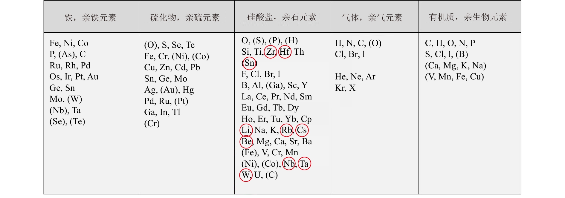
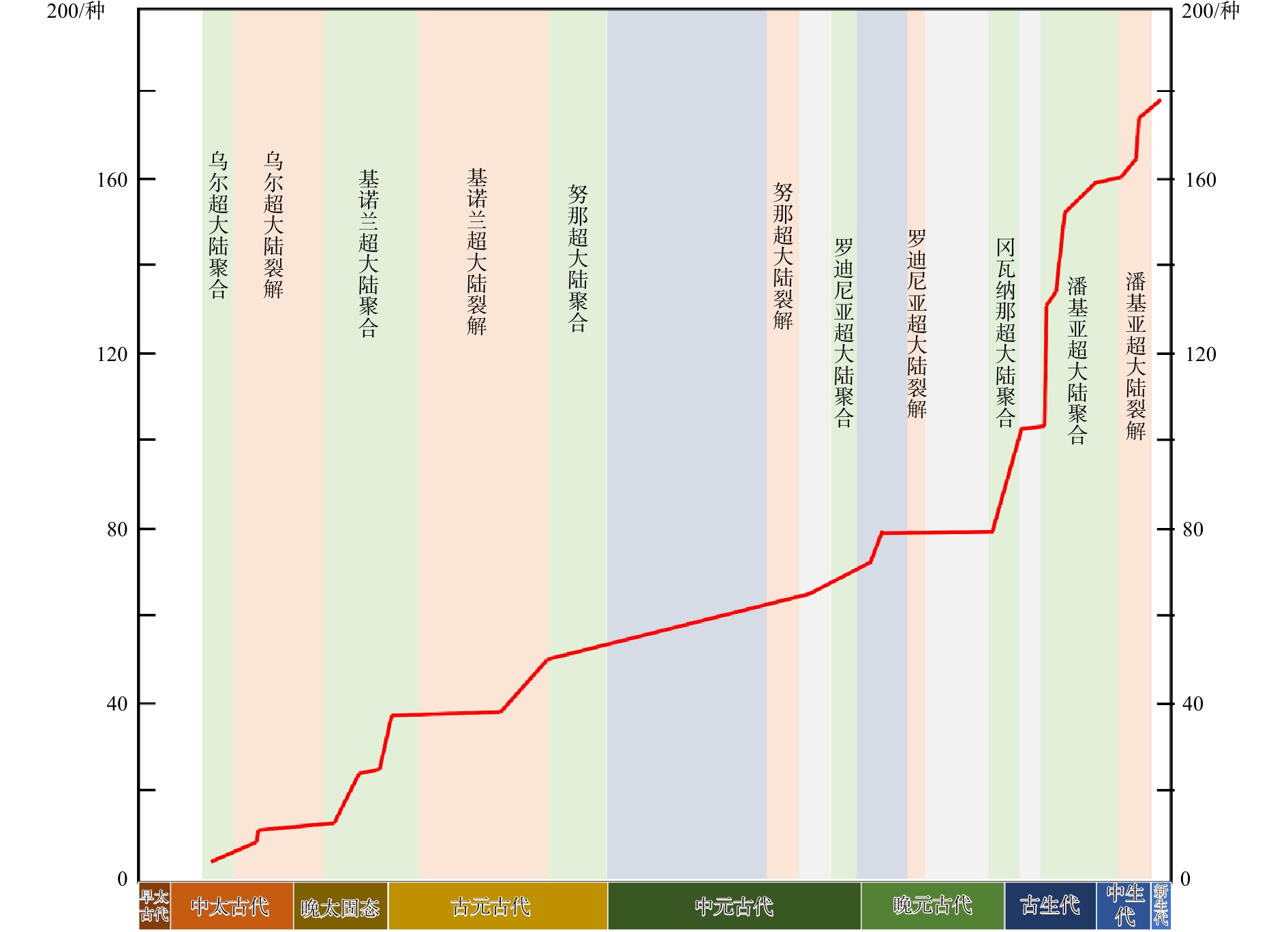
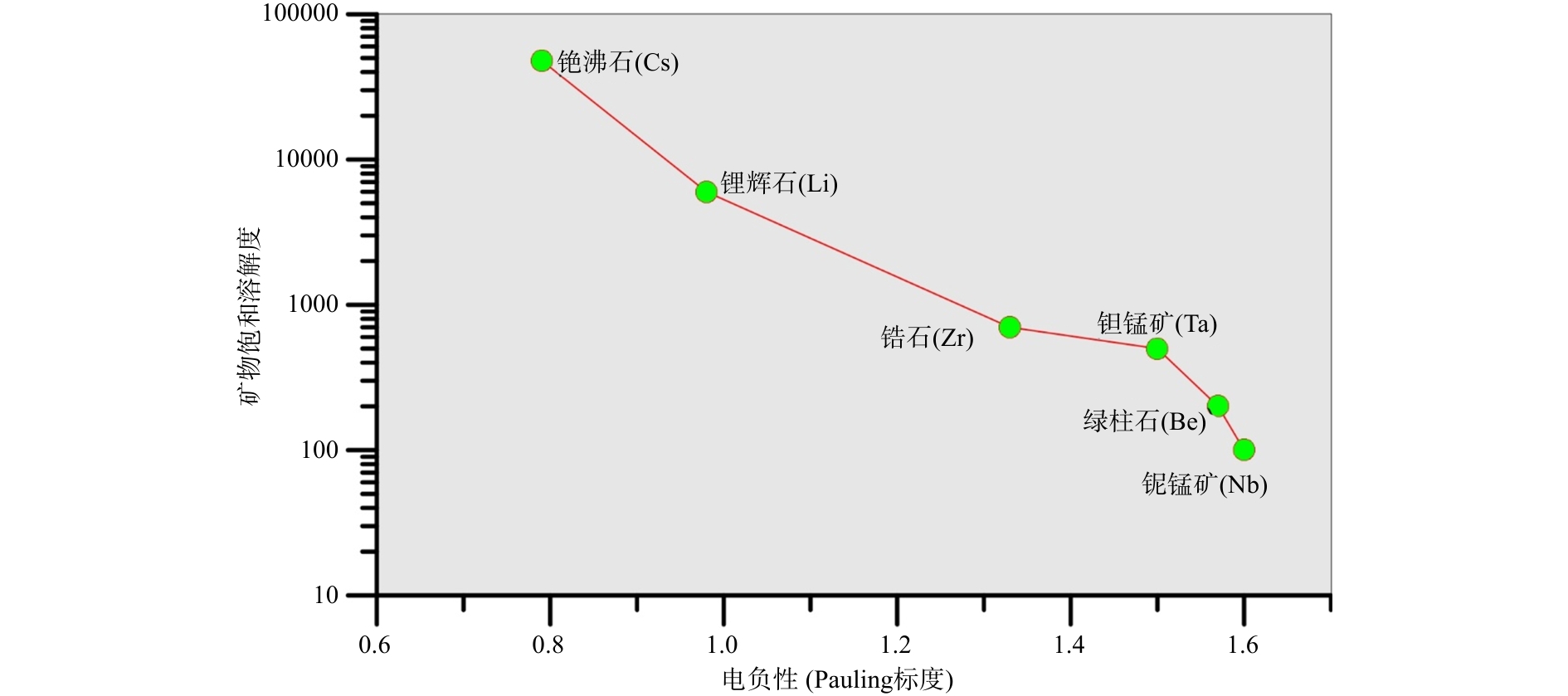
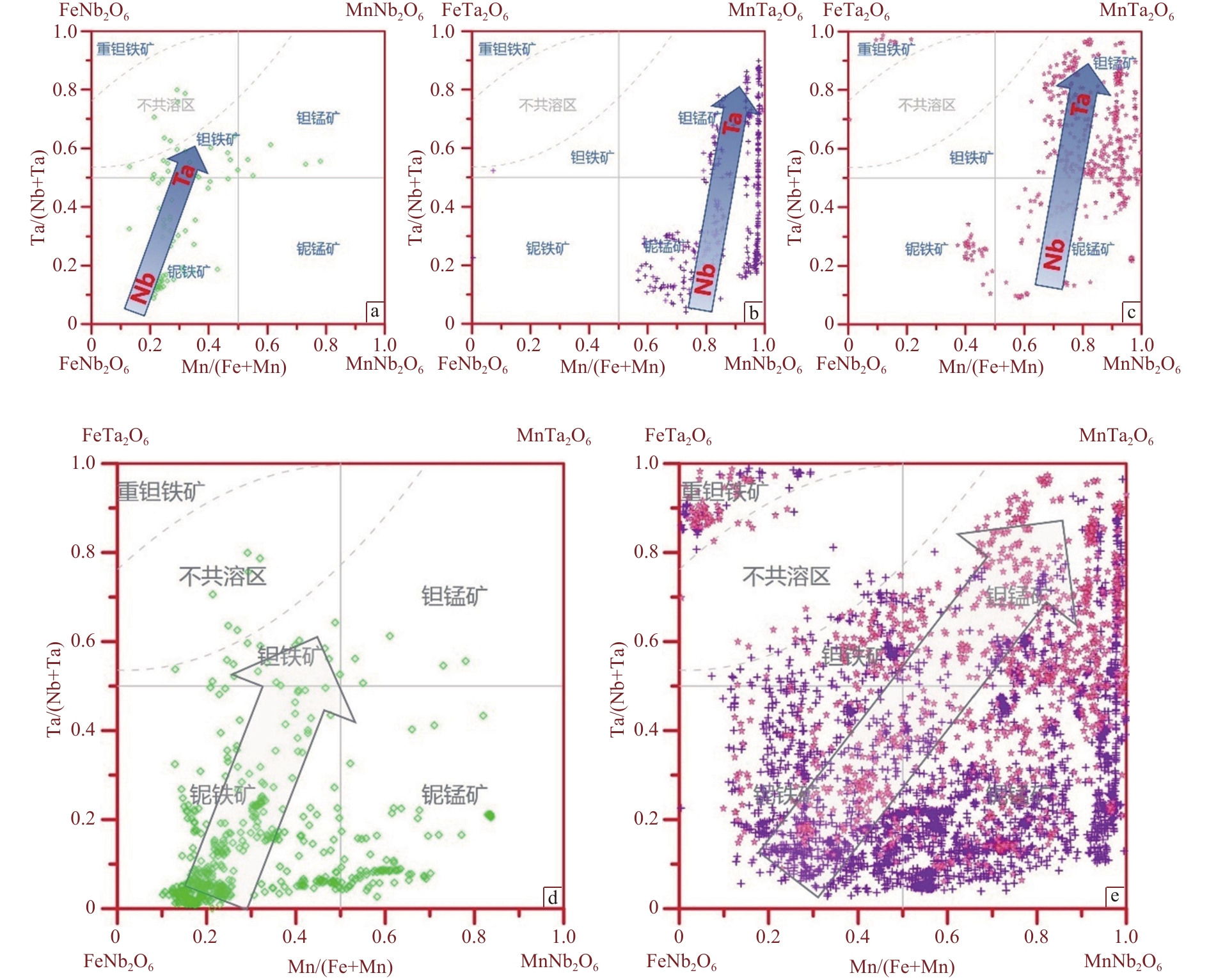
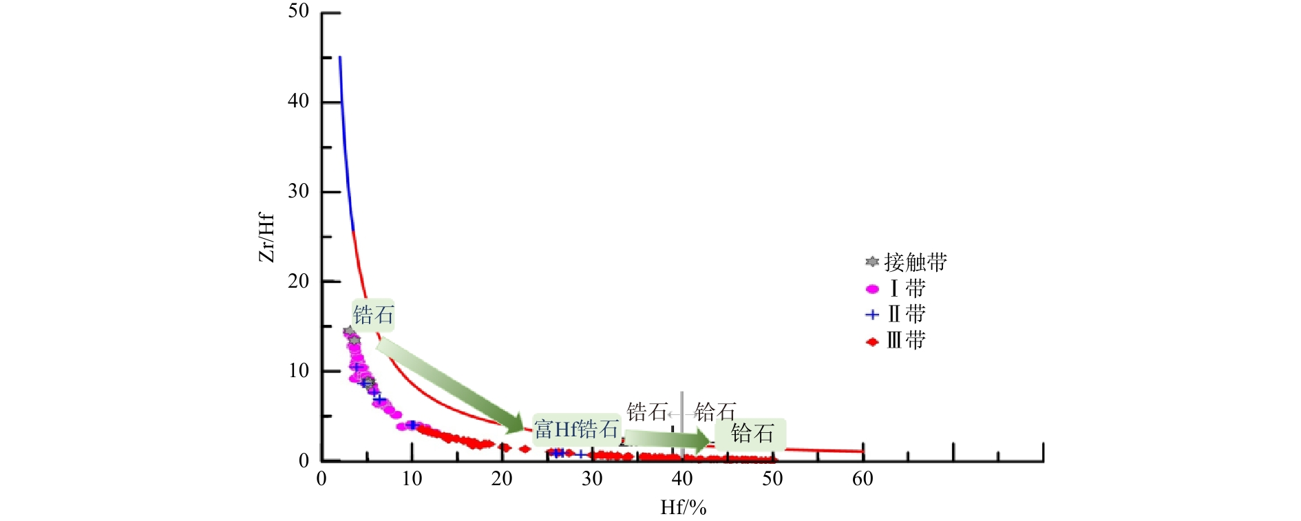
  Objective  Rare metals are an important subset of critical strategic metals, and their mineralization is closely related to the granite–pegmatite system. As direct products of mineralization, the crystallization behavior and evolutionary patterns of rare-metal minerals provide an essential basis for understanding metallogenic mechanisms, assessing resource potential, and predicting ore-forming districts.   Methods  A systematic analysis of rare-metal minerals in different geological and metallogenic settings has been carried out.   Results  This study identifies (hydro)oxides, silicates, and phosphates as the main types of rare-metal ore minerals and systematically analyzes their mineralogical characteristics. At the global scale, it investigates the evolutionary features of these minerals during key geological periods, revealing the relationship between rare-metal mineralization and supercontinent assembly–breakup cycles. Based on differences in element electronegativity, it establishes the relationship between the chemical behavior of rare elements and their mineralization potential, elucidating the fundamental processes of rare-metal enrichment and mineralization. At the orebody scale, it systematically analyzes the crystallization sequence of lithium minerals and develops a generalized evolutionary framework for lithium mineralization in rare-metal pegmatites. Furthermore, from the perspective of compositional evolution in Nb–Ta and Zr–Hf minerals, it develops a multi-dimensional tracing system for rare-metal mineralization.   Conclusions  This study establishes a comprehensive mineral system for rare-metal mineralization and develops a mineral-centered mineralization processes, thereby advancing our understanding of the evolutionary patterns of rare-metal mineralization.  Significance  This work will promote the establishment of a spatial prospecting methodology based on mineralogical responses and offer theoretical support for rare-metal resource exploration.
Tungsten and tin mineralization in the northern Jiangxi–southern Anhui metallogenic belt, eastern Jiangnan Orogen, China
JIANG Shaoyong, XIONG Suofei, ZHANG Wei, SU Huimin, DONG Jiaxiang, CHEN Wei, YIN Jin, HU Dalong, PENG Ningjun
2026, 32(5): 1162-1191. doi: 10.12090/j.issn.1006-6616.2026103
Abstract (114) HTML (15) PDF (2599KB)(31)
Abstract:
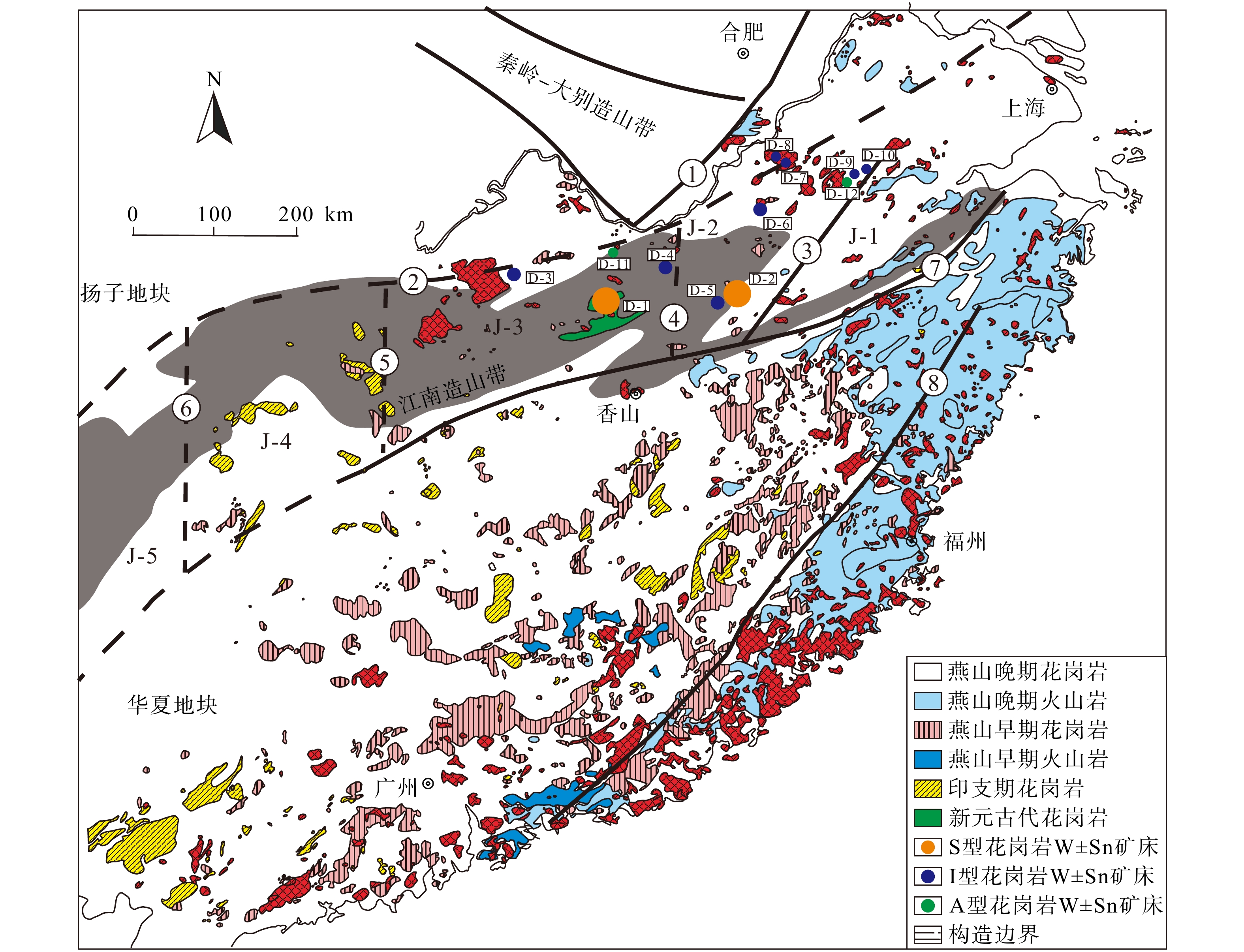
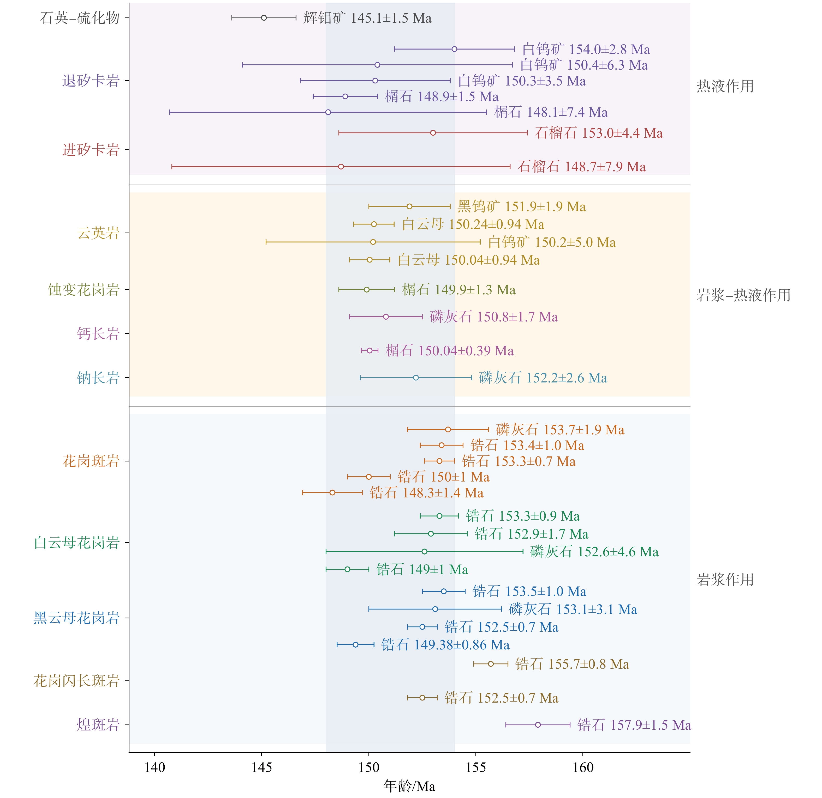
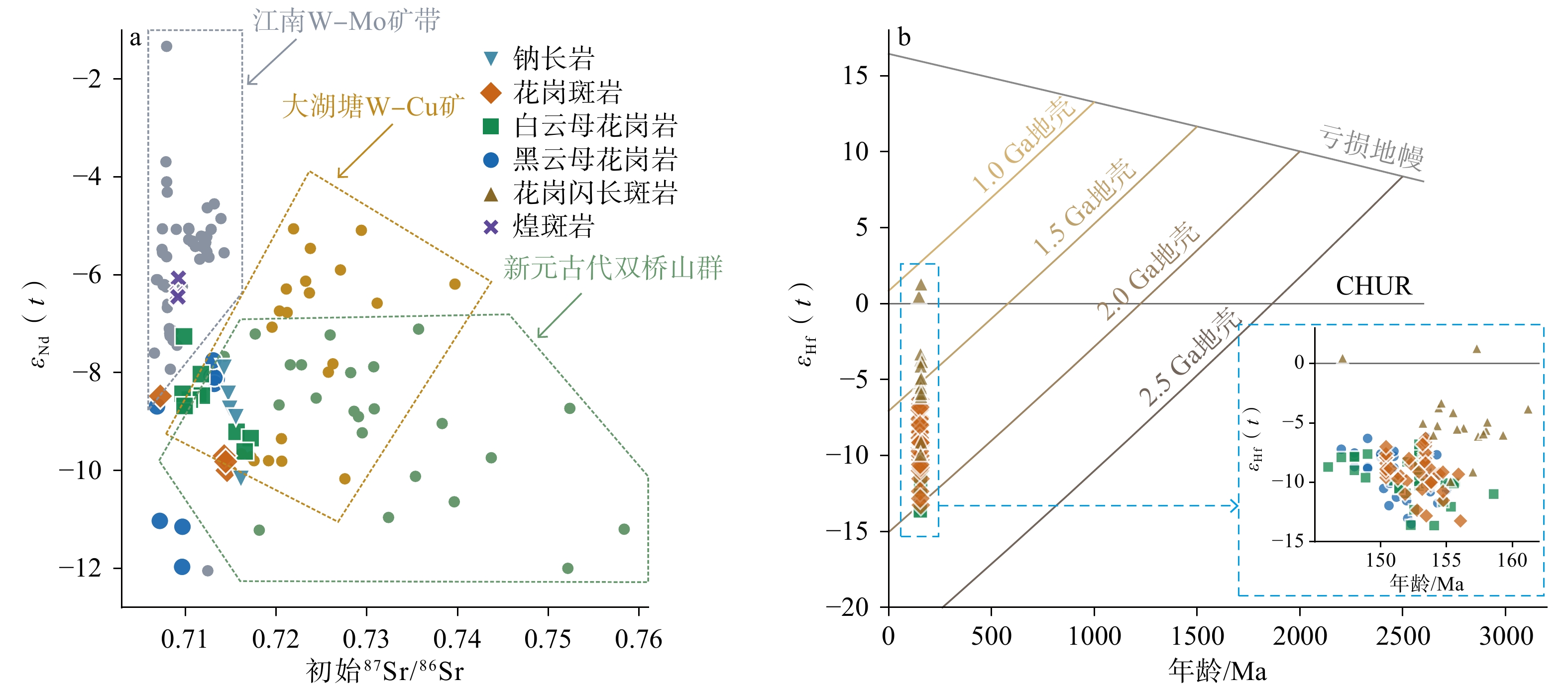
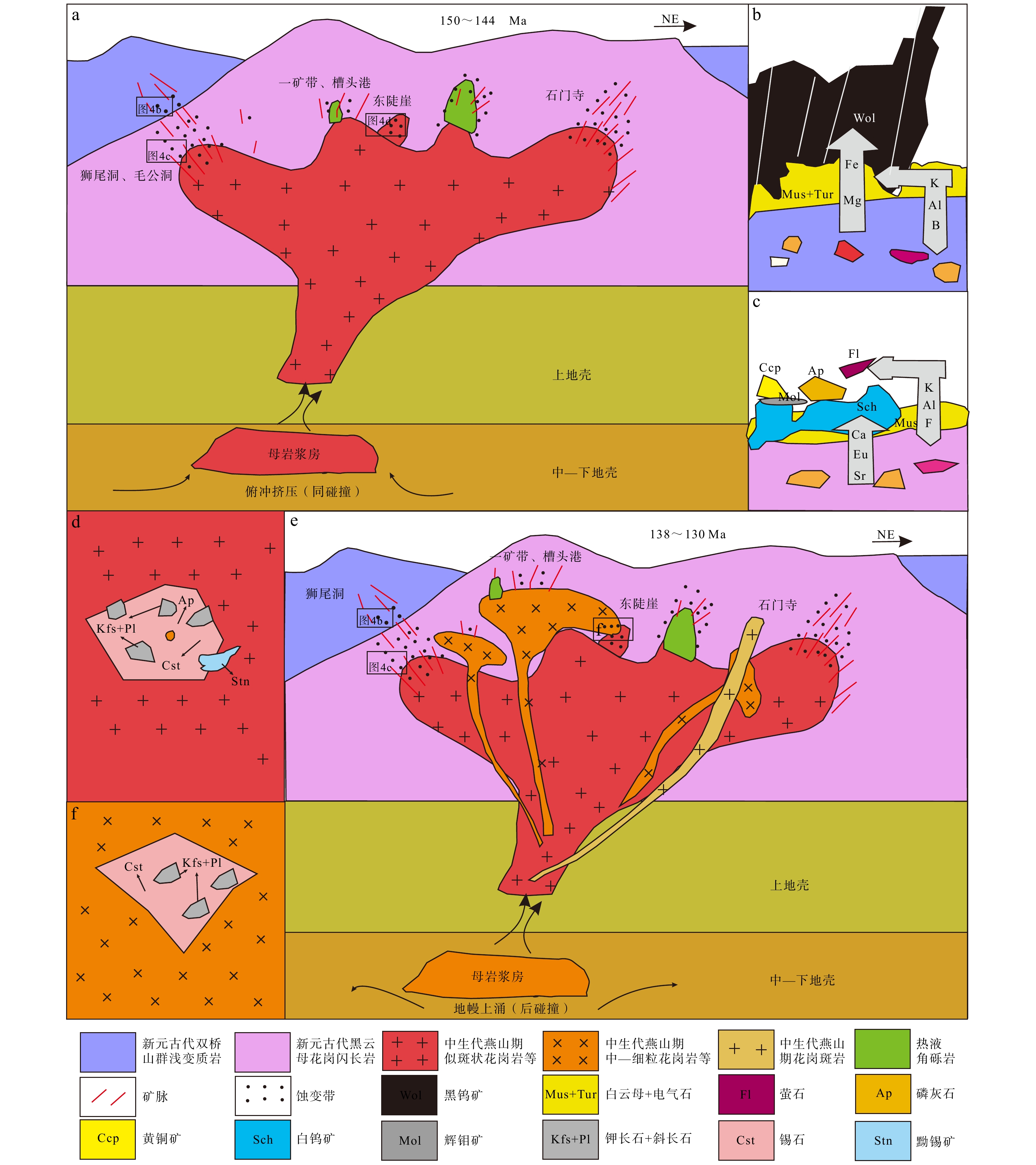
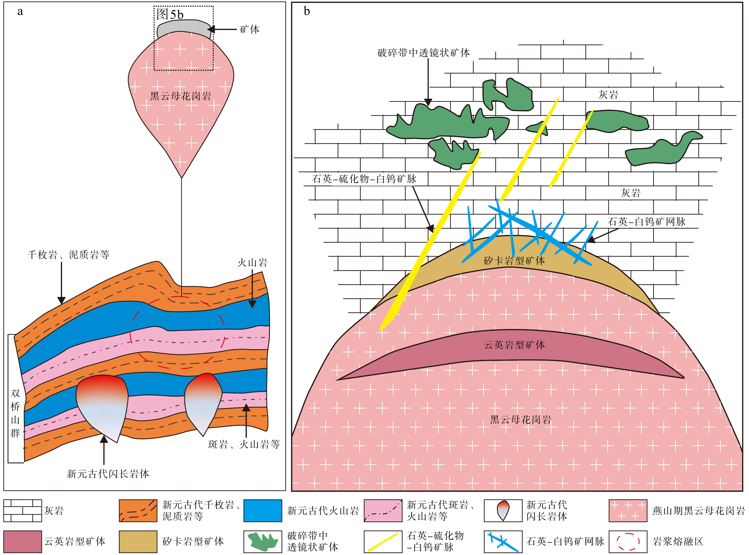
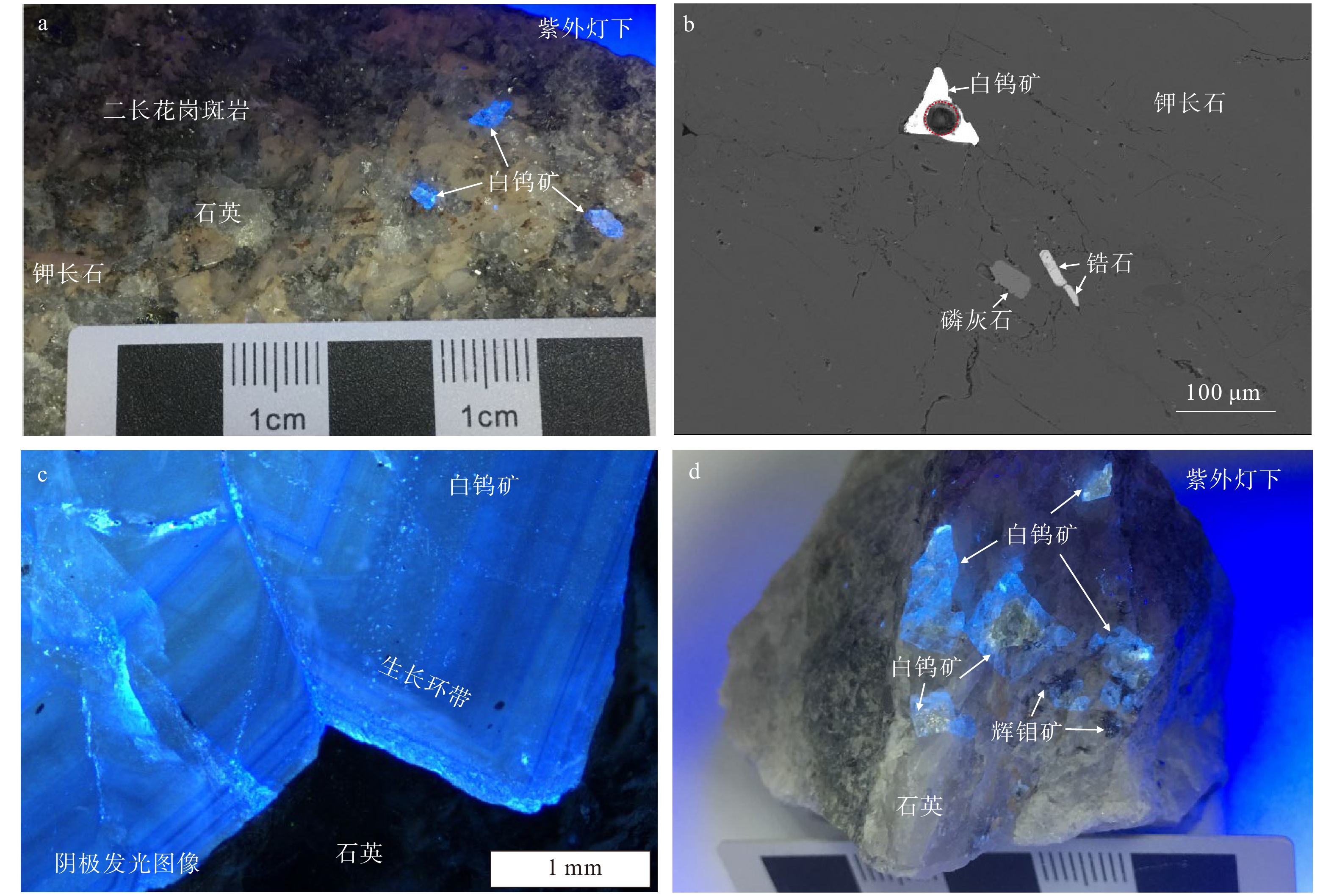
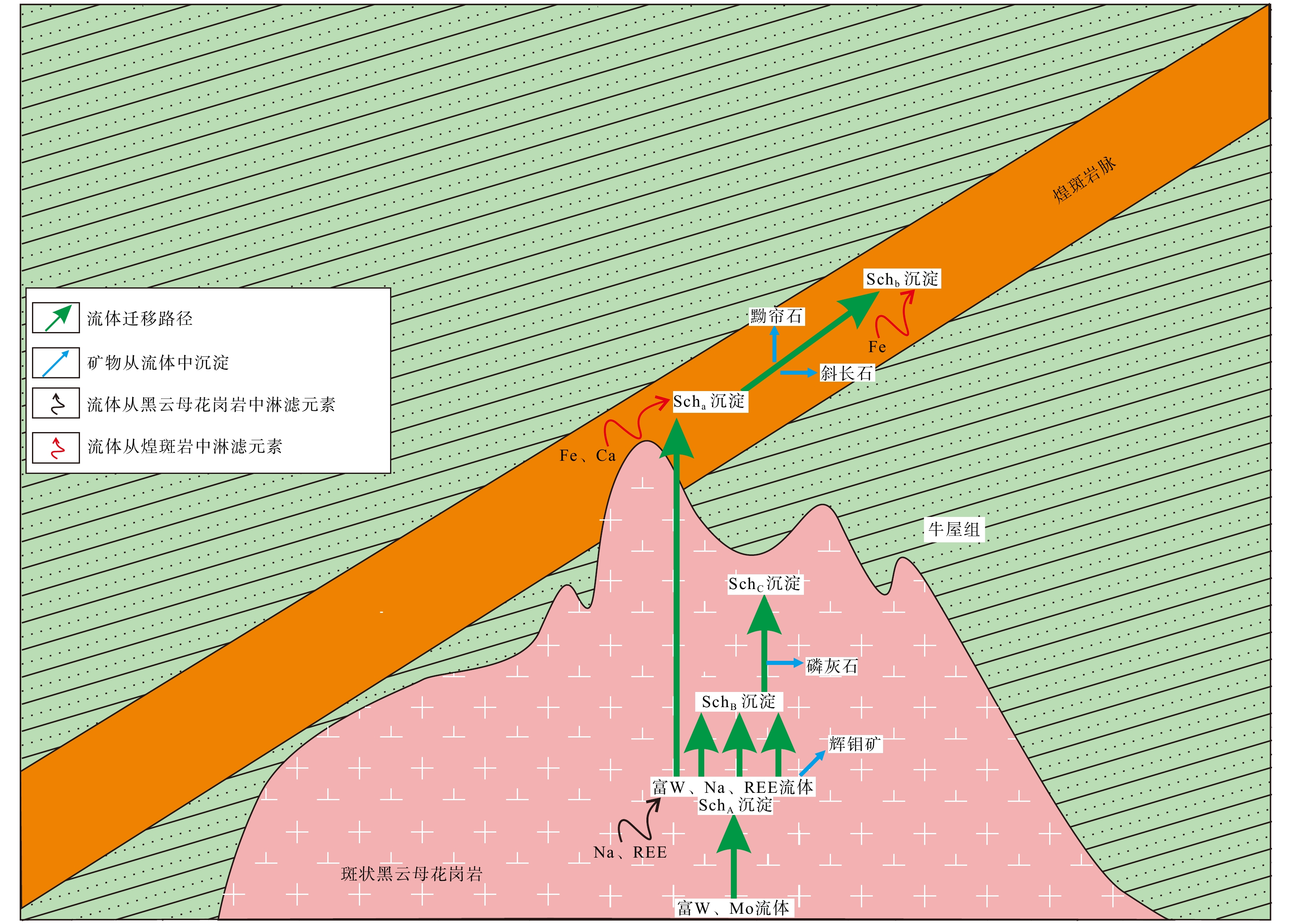
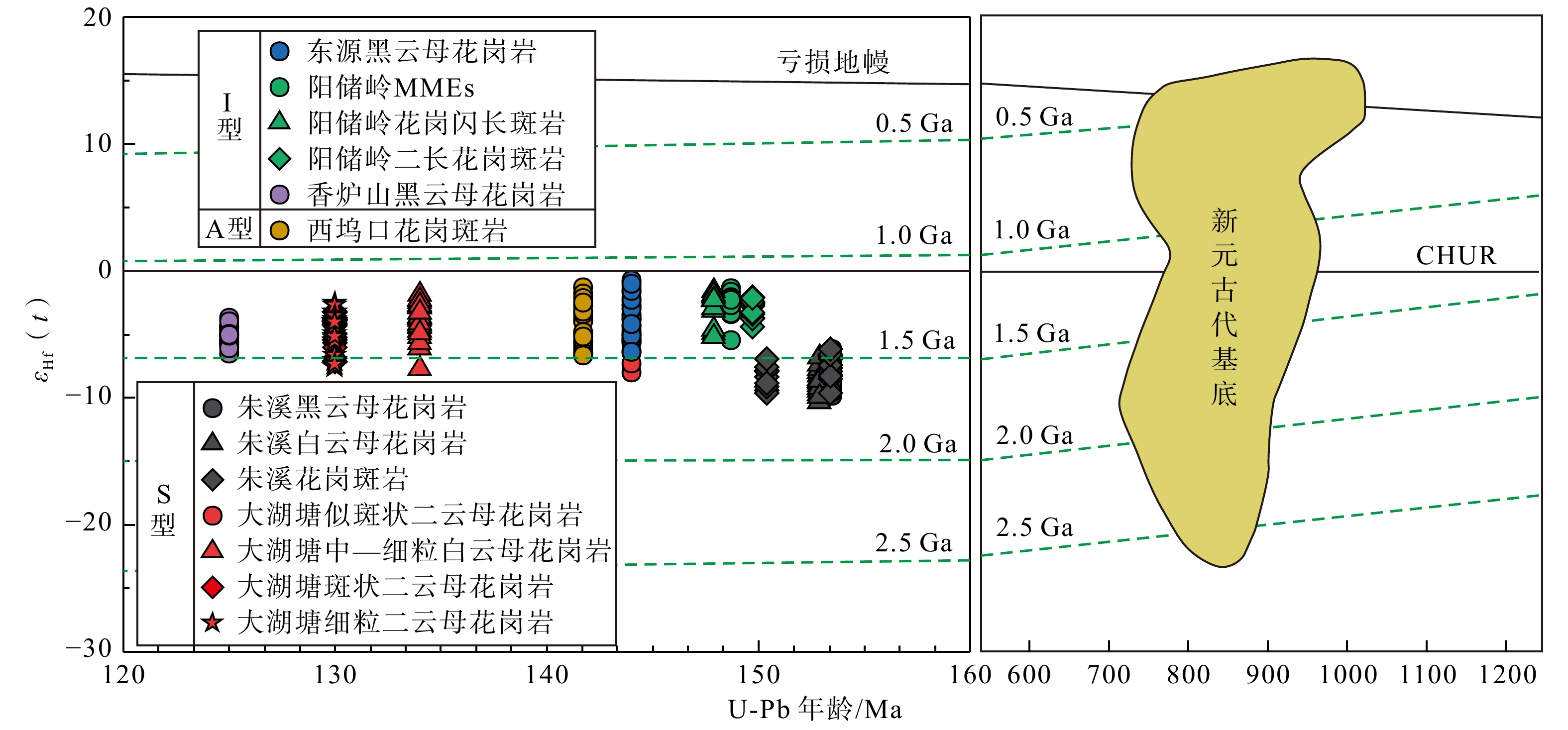
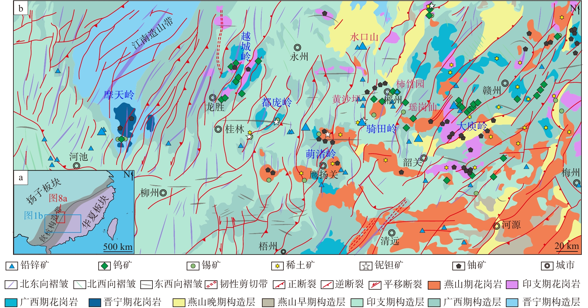
  Objective  Tungsten and tin are strategic critical metals in China. The Northern Jiangxi–Southern Anhui metallogenic belt in the eastern Jiangnan Orogen is a newly recognized world-class tungsten-rich province. This study aims to supplement the traditional understanding that tungsten mineralization is solely controlled by S-type granites, clarify the differences in W-Sn mineralization related to S-, I-, and A-type granites, reveal geodynamic metallogenic mechanisms, establish regional metallogenic models, and support deep mineral exploration.   Methods  Based on field geological investigations, petrographic observations, U–Pb dating of zircon and other hydrothermal minerals, molybdenite Re–Os geochronology, Sr–Nd–Hf isotopes, in-situ trace-element analysis of minerals, and fluid-inclusion data, typical deposits including Zhuxi, Dahutang, Xianglushan, Yangchuling, Dongyuan and Xiwukou were systematically compared. Metallogenic processes were analyzed under the classification of S-, I- and A-type granites, and the migration-enrichment of ore-forming materials was summarized.   Results  (1) The total W resources in this belt exceed those in the Nanling metallogenic belt, with major Yanshanian metallogenic ages of 150–130 Ma. (2) S-type granites host the giant Zhuxi and Dahutang W-Cu polymetal deposits, characterized by strongly peraluminous, reduced magmas and skarn-superimposed mineralization. (3) I-type granites host medium-to-large W-Mo polymetal deposits, such as Xianglushan, Yangchuling, and Dongyuan, which formed under medium-to-high temperature conditions in weakly-peraluminous systems with porphyry-skarn mineralization; calcium for scheelite formation derives either from carbonate wall rocks or silicate-mineral (e.g, plagioclase) alteration within plutons. (4) The A-type-granite-related Xiwukou Sn-W-Rb deposit records highly fractionated, F-rich magmatism with the enrichment of Sn, Rb, and other rare metals. (5) A three-stage enrichment model is established: basement pre-enrichment, Mesozoic crust-mantle interaction, and magmatic fluid exsolution and unloading. Regional mineralization is likely driven by Paleo-Pacific slab rollback and lithospheric extension. (6) Four categories of deep prospecting targets, e.g. fault intersections and concealed pluton domes, are proposed.   Conclusions  The W-Sn mineralization in the Jiangnan Orogen is not restricted to S-type granites; S-, I- and A-type granites constitute differentiated metallogenic systems. The W-Sn-enriched meta-sedimentary rock basement of the Shuangqiaoshan Group provides primary ore-forming materials, while crust-mantle interaction supplies heat and partial components; magma differentiation and fluid evolution dominate metal precipitation.   Significance  This work improves the regional understanding of W-Sn metallogenesis and provides theoretical support for the deep exploration of strategic critical minerals, not only in Northern Jiangxi-Southern Anhui provinces but also in other areas with similar geological conditions.
Geochemical fingerprinting of typical giant deposits in the Central Asian metallogenic domain: case studies of the Muruntau gold deposit and the Almalyk porphyry copper deposit
WANG Xueqiu, XIE Miao, LIU Qingqing, JING Xiuming
2026, 32(5): 1192-1205. doi: 10.12090/j.issn.1006-6616.2026134
Abstract (64) HTML (12) PDF (2394KB)(6)
Abstract:
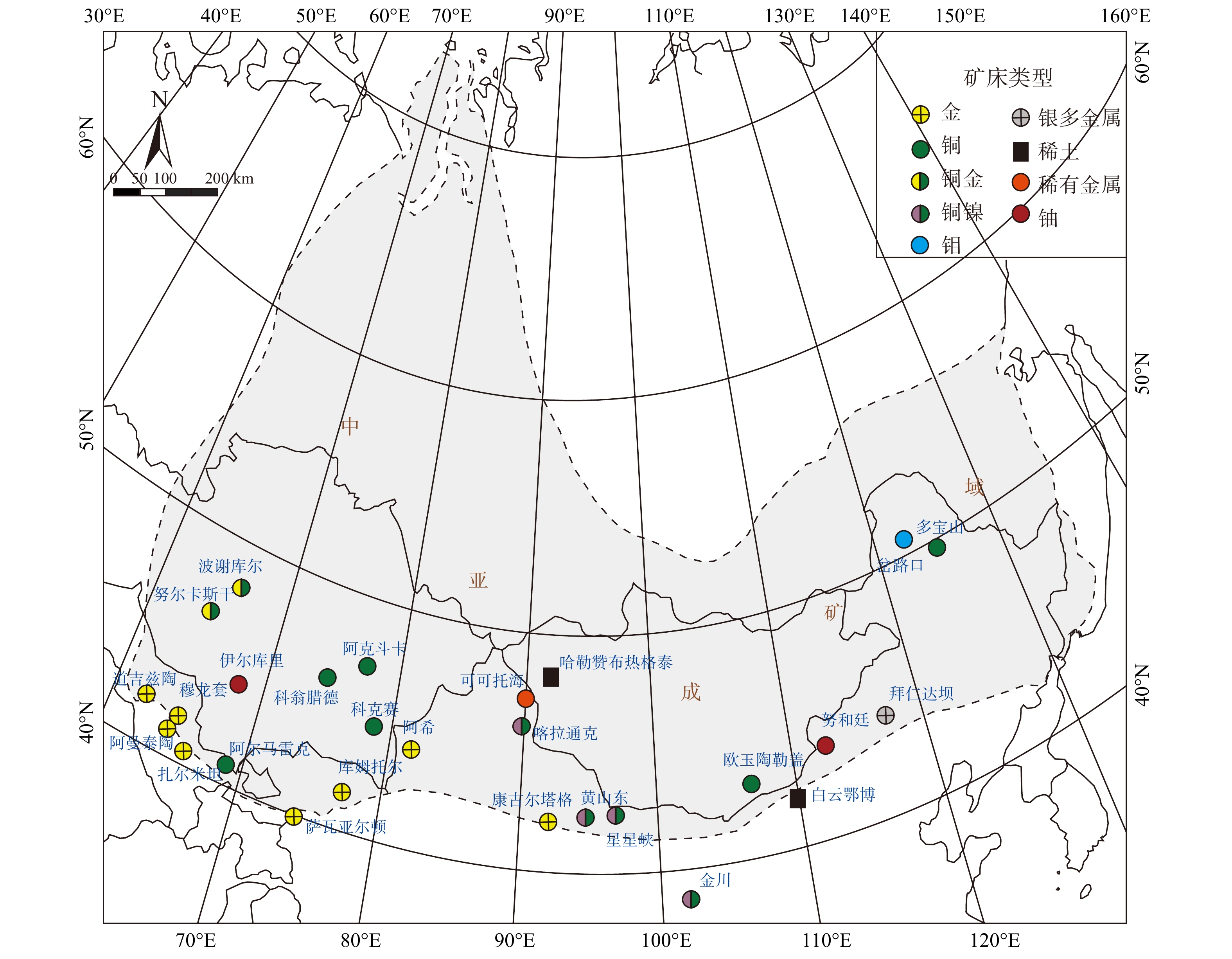
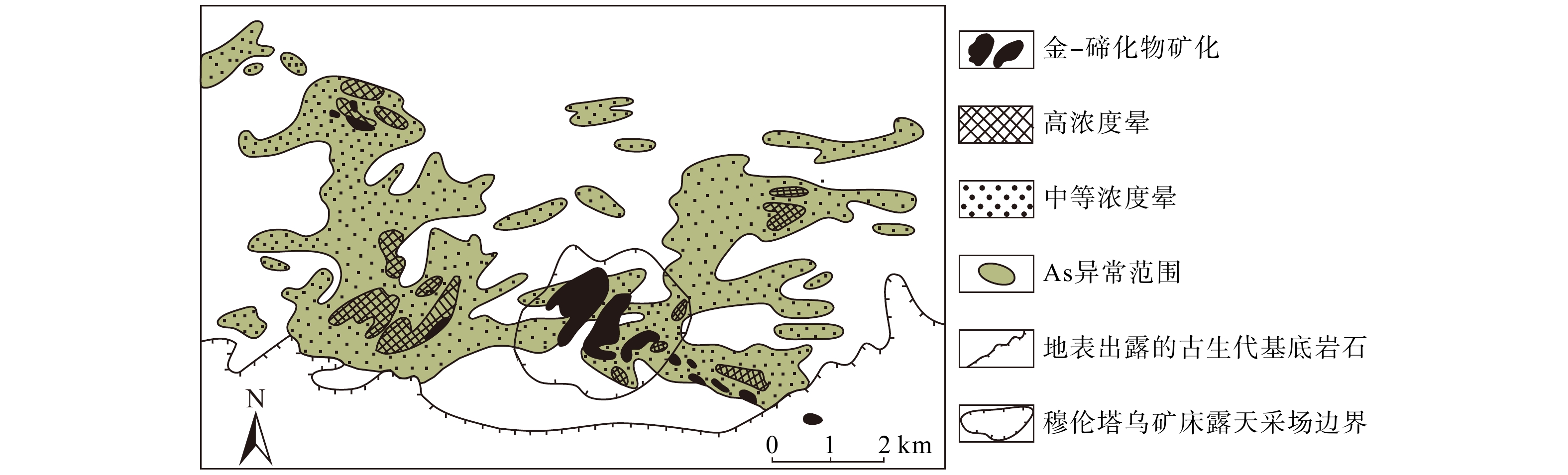
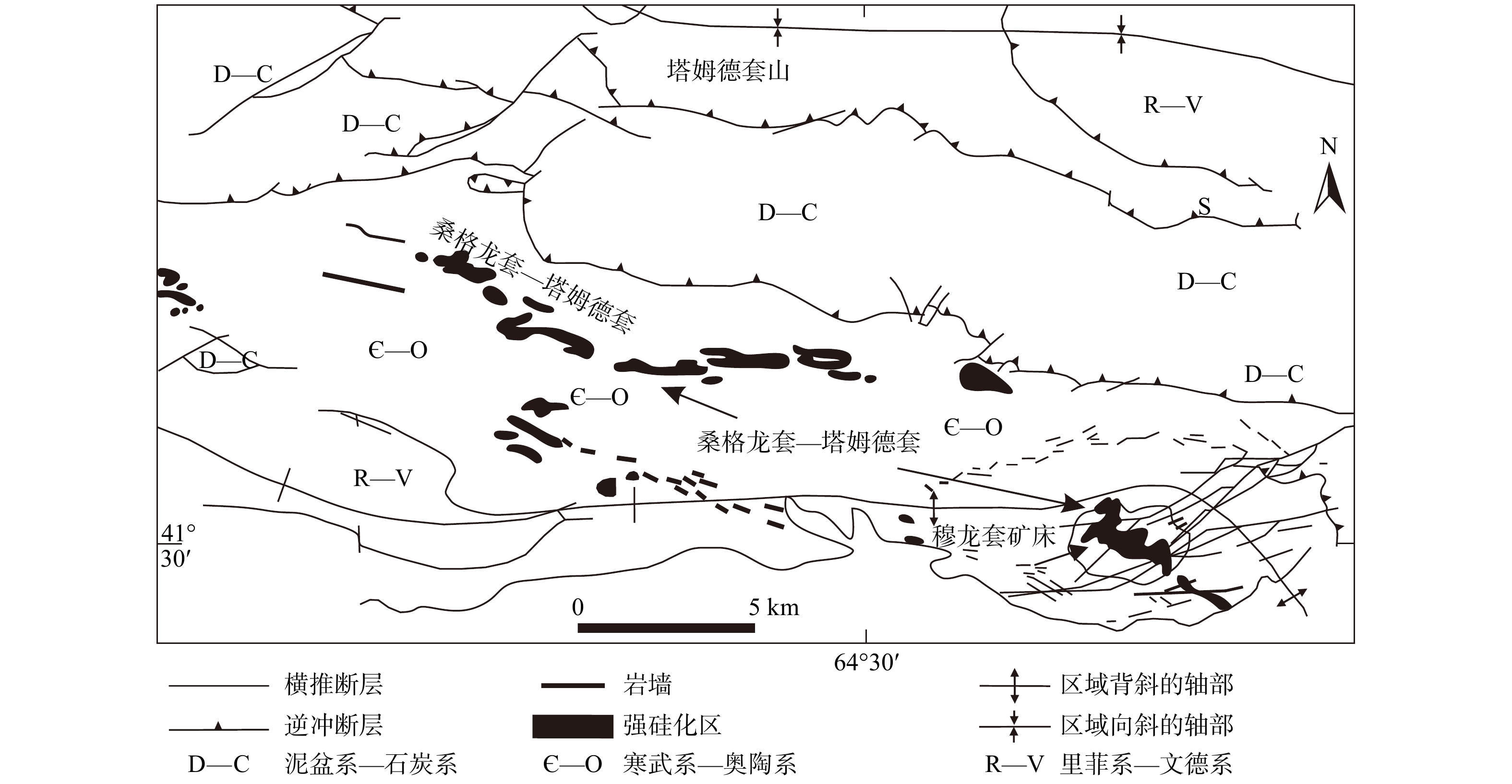
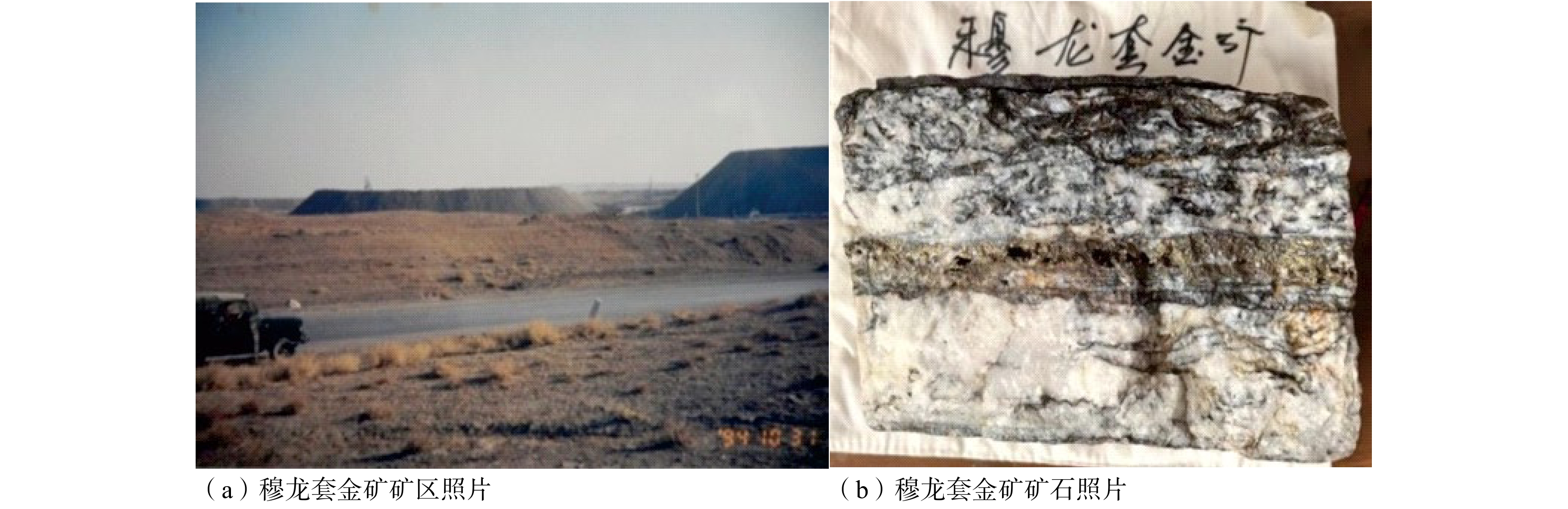
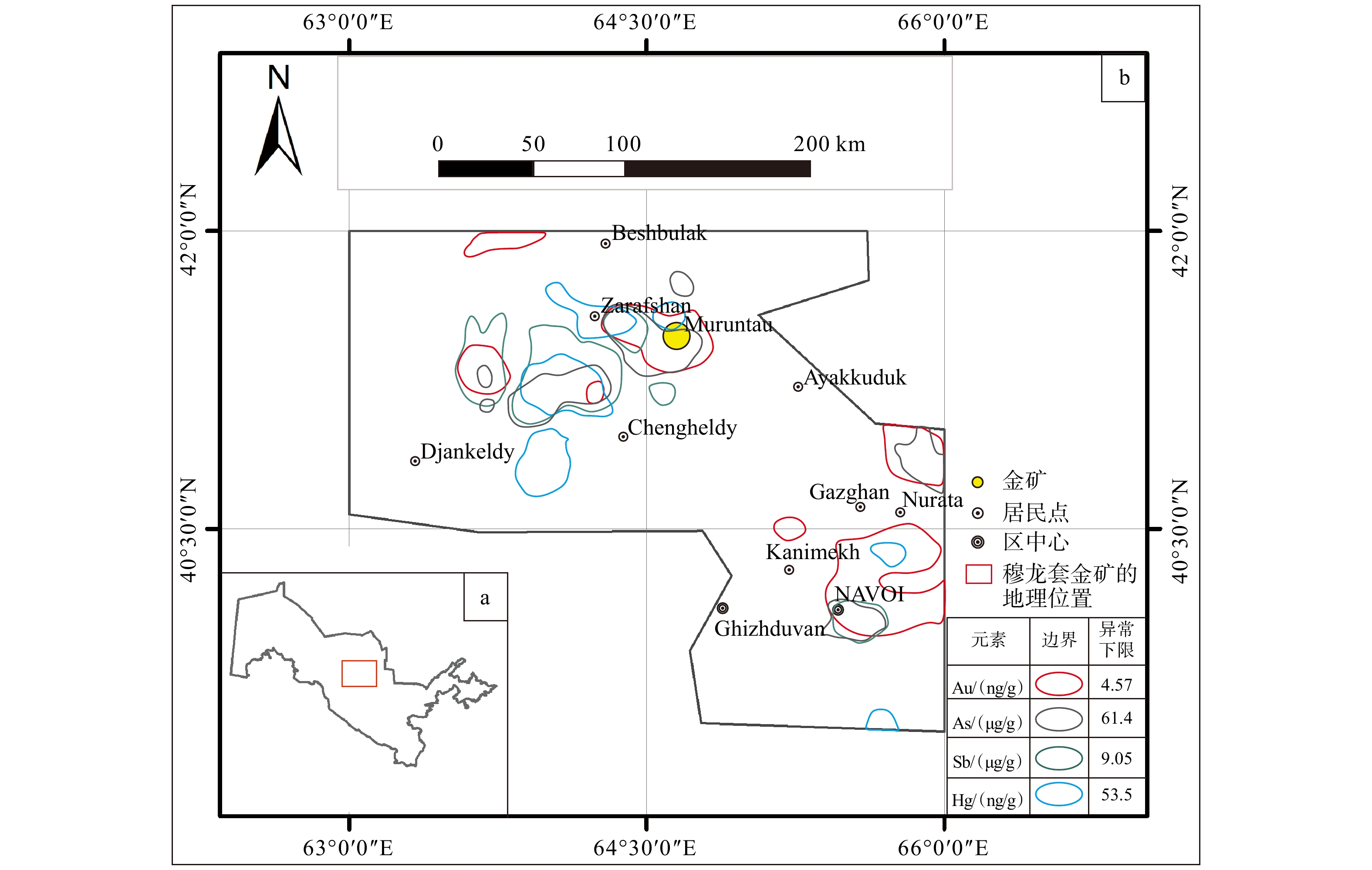
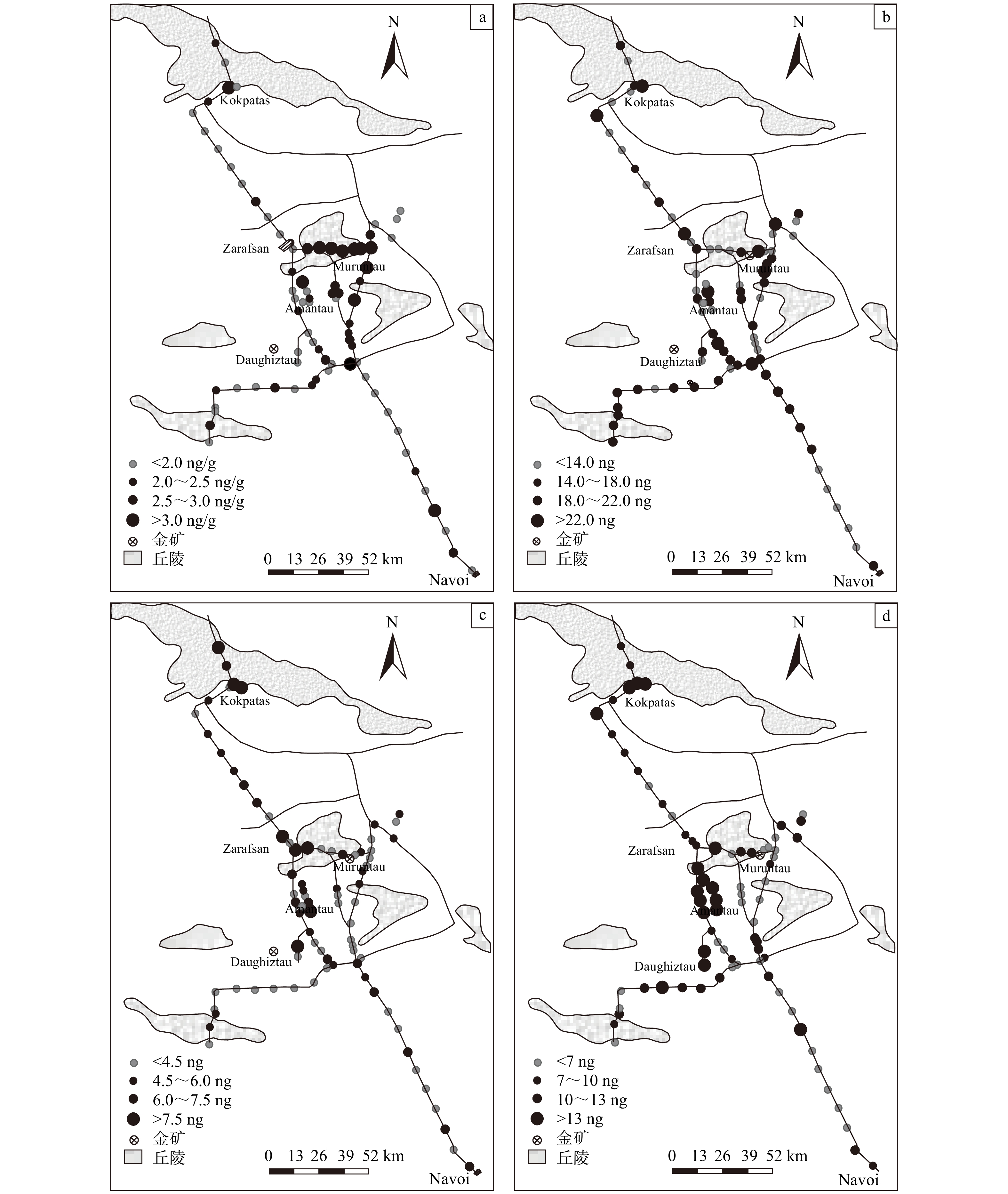
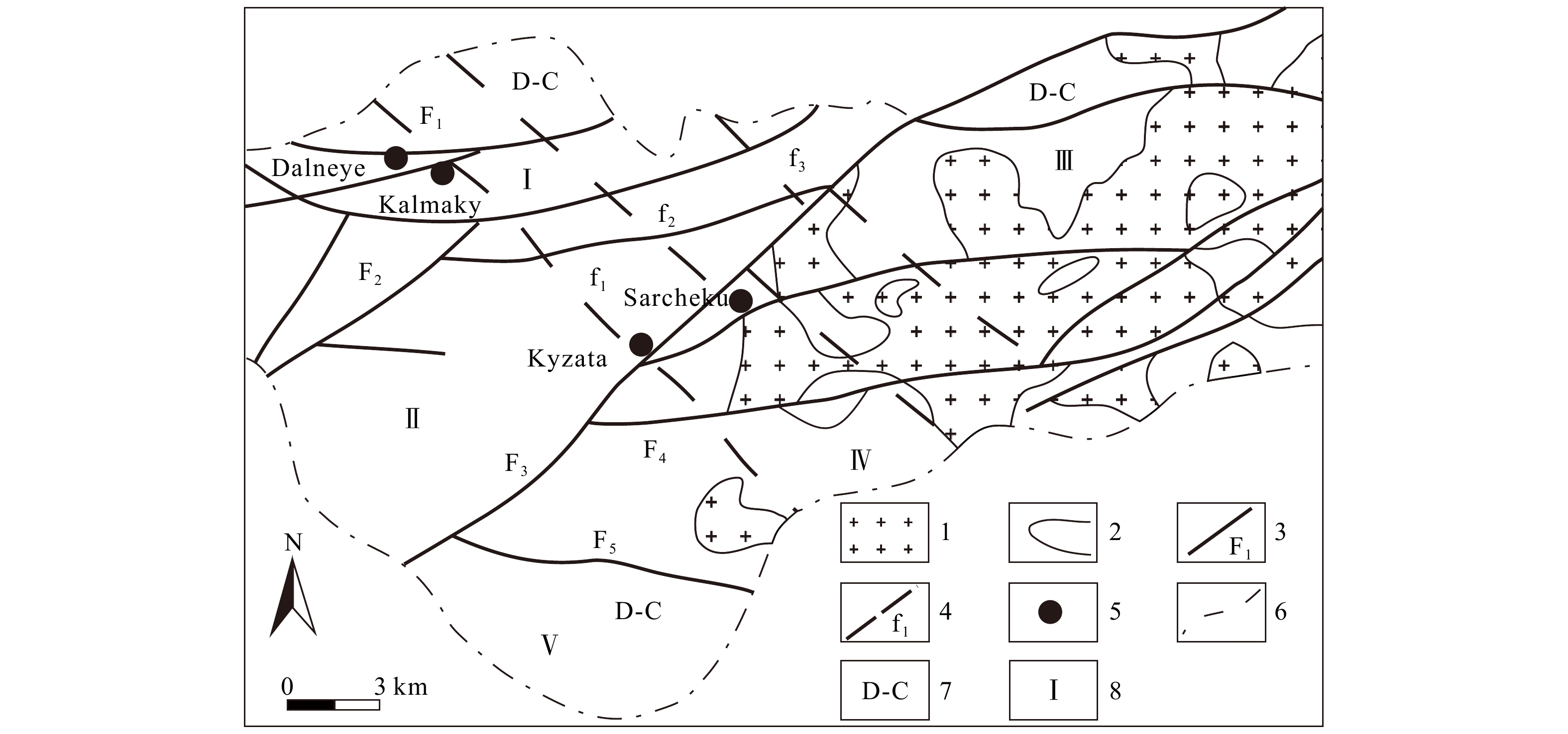
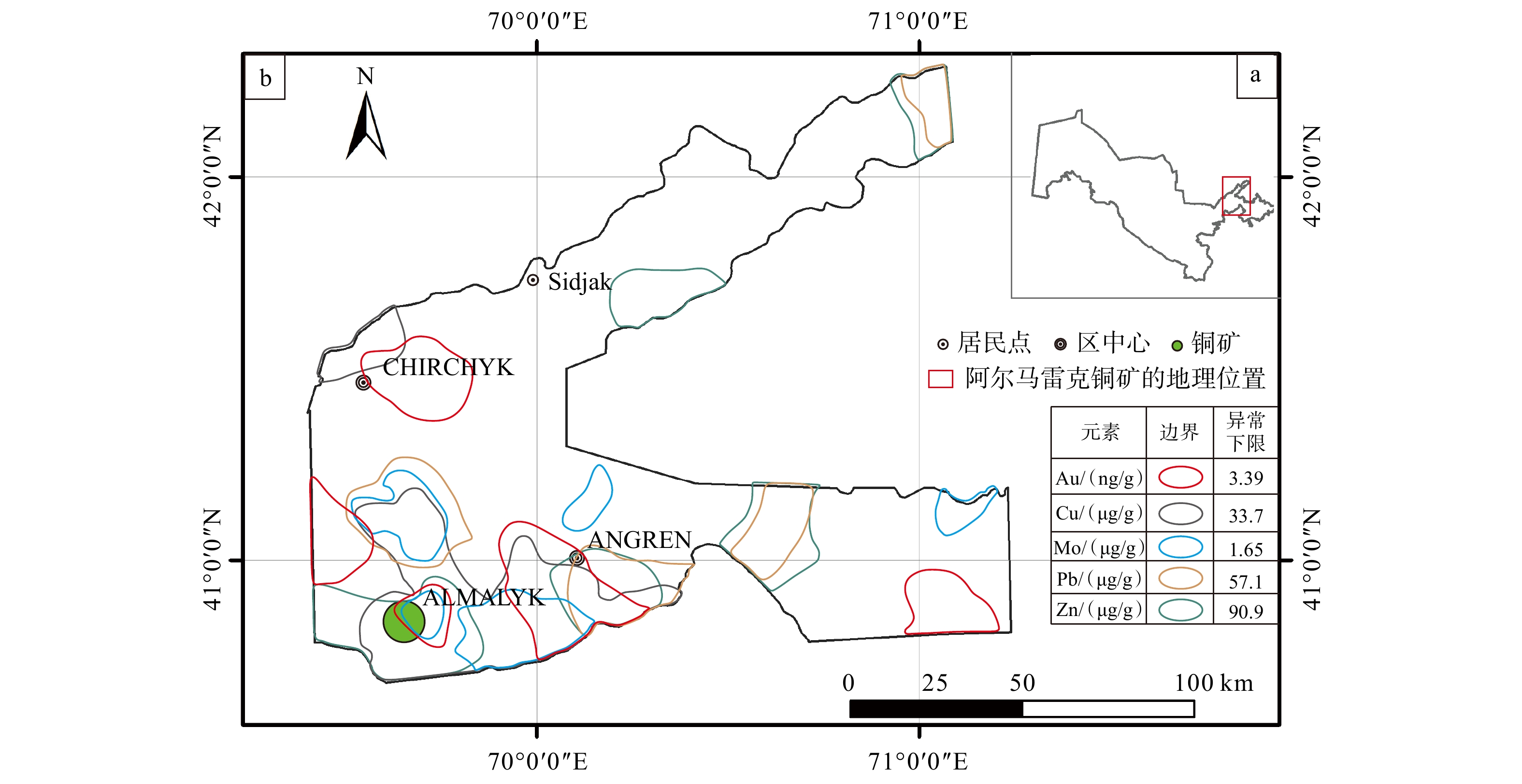
  Objective  The Central Asian Metallogenic Domain is rich in mineral resources. Geochemical metal-content surveys conducted during the Soviet era led to the discovery of the Muruntau gold deposit, the world’s second-largest gold deposit, and the Almalyk porphyry copper deposit, the largest porphyry copper deposit in the Central Asian Metallogenic Domain. Research on their geochemical characteristics is of significance for finding similar deposits in China.   Methods  Geochemical characteristics were investigated at both regional and deposit scales to characterize the distribution and spatial relationships of geochemical anomalies in the two deposits.  Results  In the Muruntau gold deposit, soil and rock-fragment geochemical surveys in areas covered by residual and colluvial materials, as well as penetrating geochemical surveys in peneplained areas covered by aeolian sand, effectively delineated geochemical anomalies. At the regional scale, Au, As, Sb, Hg, Pt, and Pd anomalies showed strong spatial overlap, with exceptionally high concentrations along the ore-controlling anticline and in carbonaceous wall rocks. At the deposit scale, pronounced Au and As anomalies occurred above the main orebodies. The Almalyk porphyry copper deposit exhibited a distinct geochemical anomaly pattern. At the regional scale, Cu–Mo–Au–Pb–Zn multielement anomalies showed substantial spatial overlap. At the deposit scale, the anomalies displayed a distinct concentric zoning pattern, with Mo forming the inner zone, Cu–Au the intermediate zone, and Pb–Zn the outer zone.  Conclusions  The two deposits represent distinct types of giant deposits in the Central Asian Metallogenic Domain, each characterized by specific geochemical signatures and prospecting indicators.  Significance  These findings provide a reference for exploring similar deposits in the Xinjiang region of China, from regional target selection to deposit-scale exploration.
Relationship between reducing media and uranium mineralization in the Telaaobao uranium deposit, Ordos Basin
PENG Yunbiao, JIANG Xiaojie, LU Chao, WANG Longhui, ZHONG Weihui, YANG Yong, LUO Wenta
2026, 32(5): 1206-1222. doi: 10.12090/j.issn.1006-6616.2026074
Abstract (62) HTML (9) PDF (20753KB)(2)
Abstract:
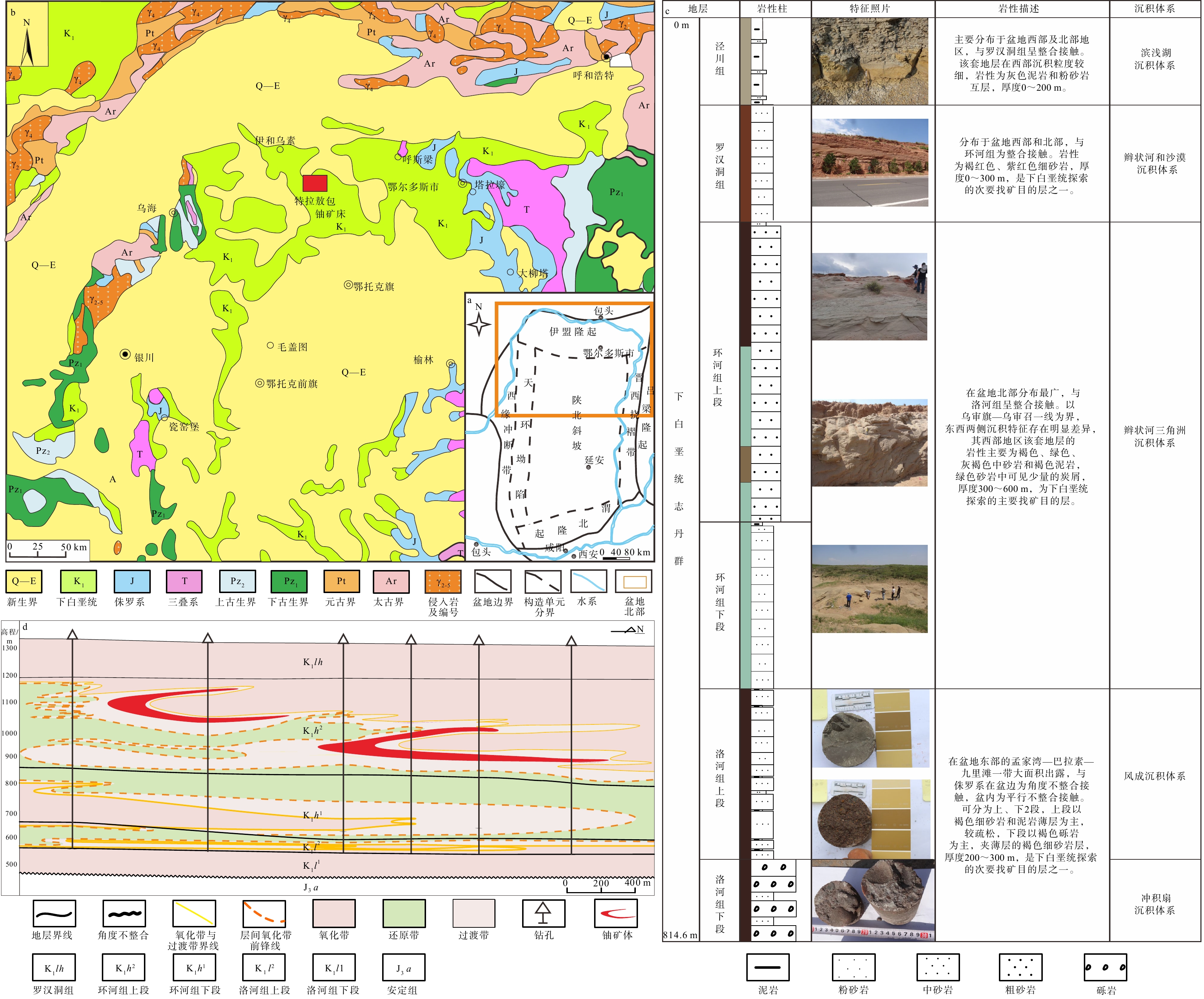
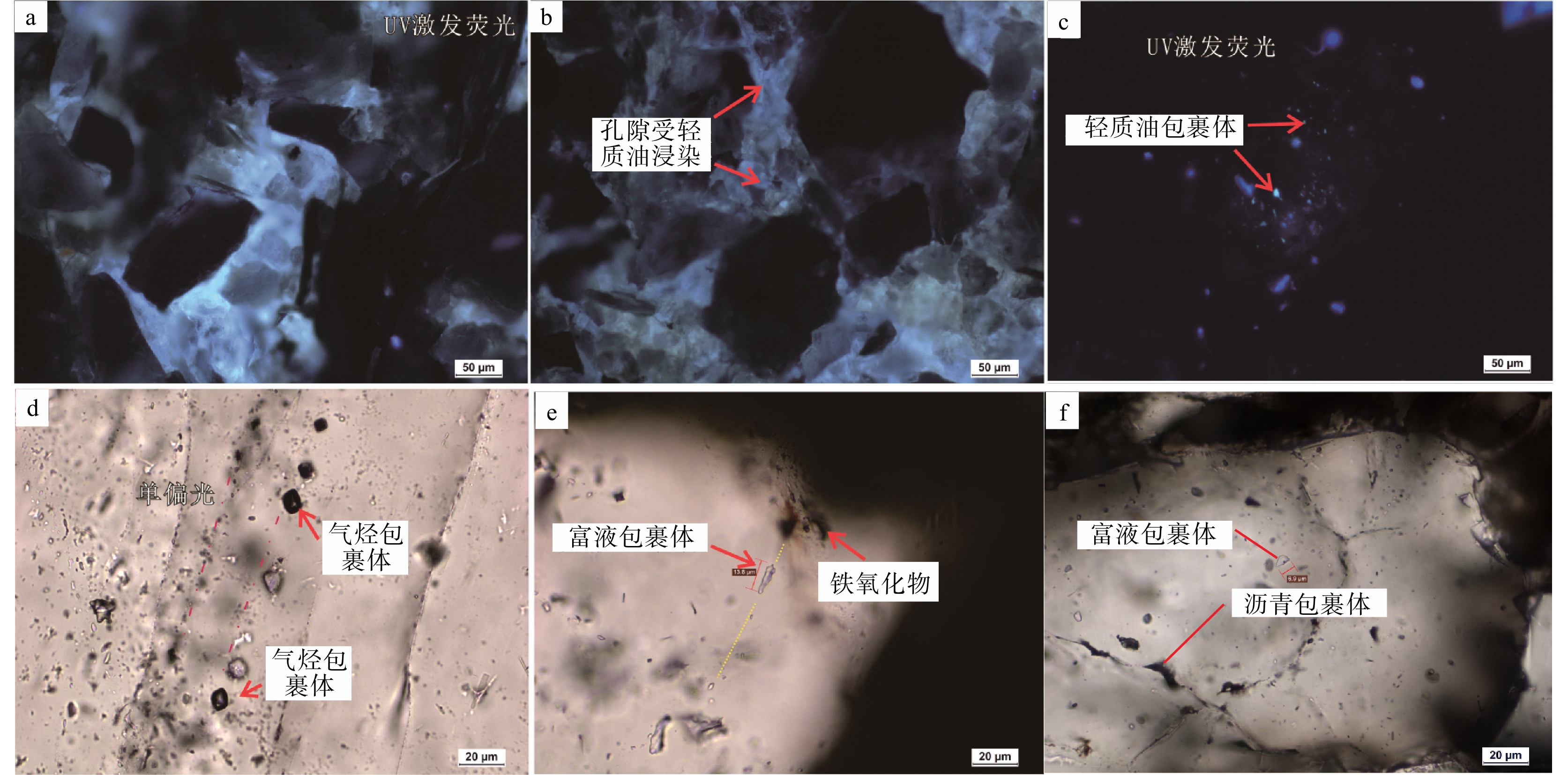
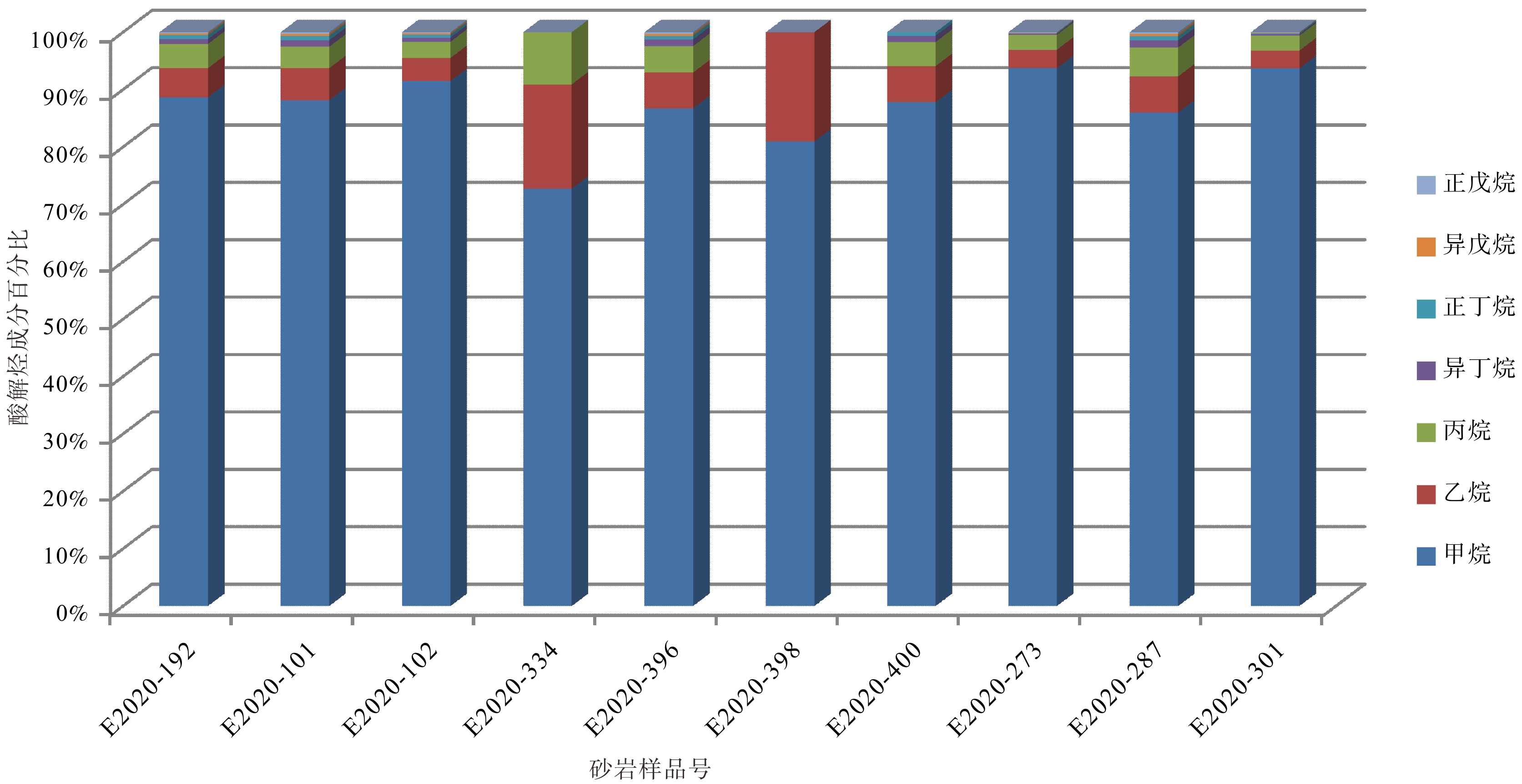
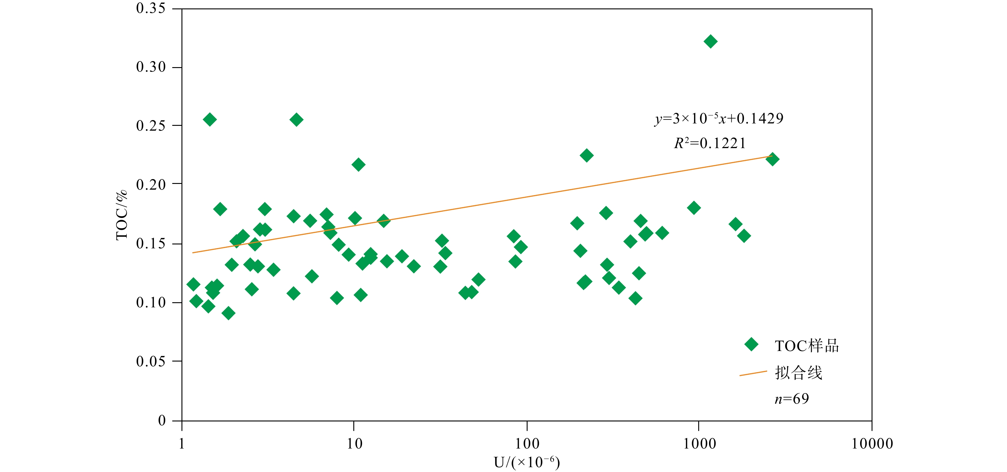
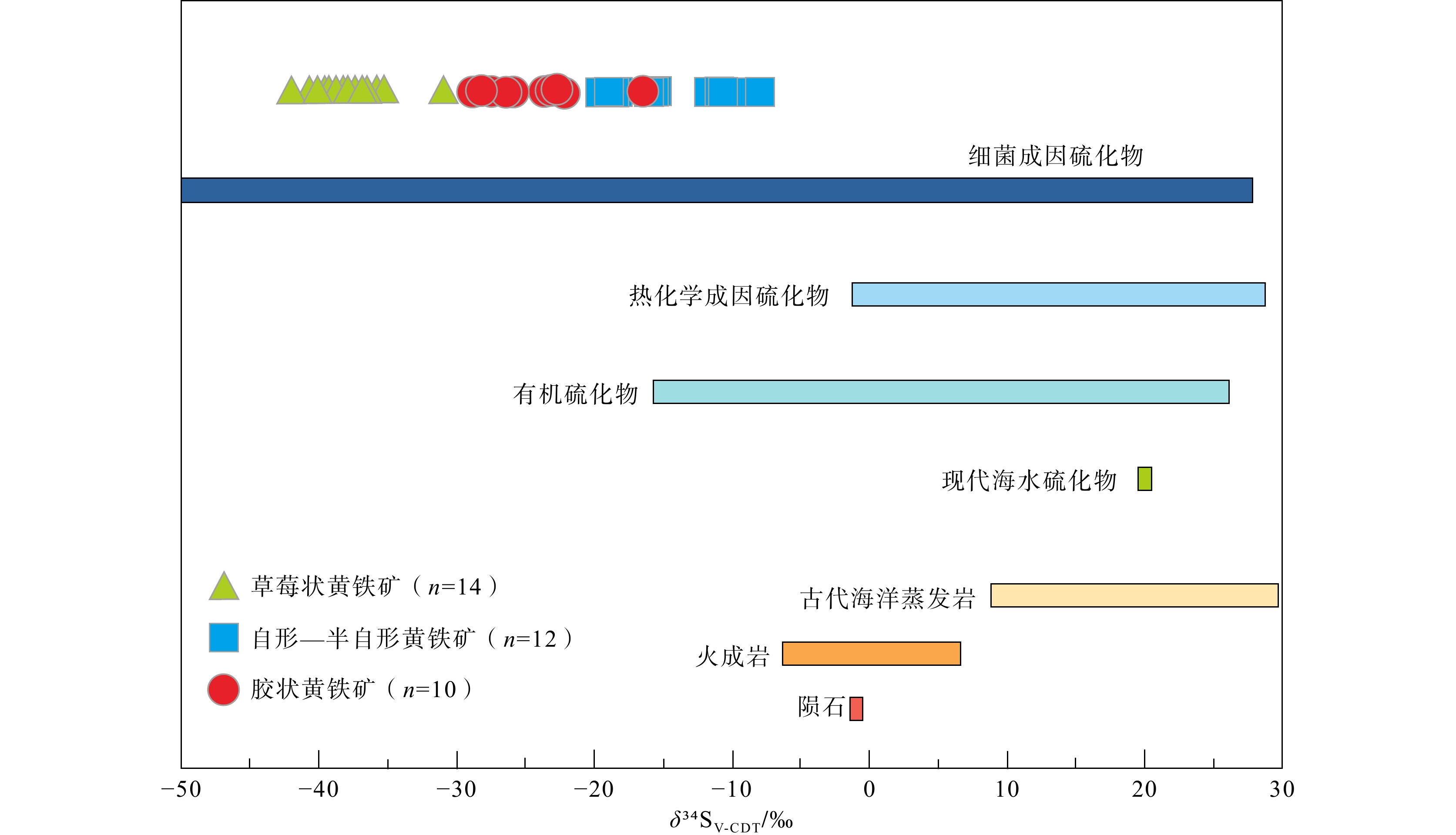
  Objective  The Telaaobao uranium deposit is the first super-large uranium deposit hosted in the Lower Cretaceous strata in the northern Ordos Basin. Its sedimentary setting is markedly different from that of the numerous uranium deposits previously studied in the Middle Jurassic Zhiluo Formation. The uranium-bearing sandstone reservoirs in this deposit are notably deficient in traditional reducing agents, such as carbonaceous debris and pyrite. This limited understanding of reducing media has significantly hindered the refinement of uranium metallogenic models and the advancement of successful exploration. This study aims to identify the types and genetic characteristics of reducing media in the Telaaobao uranium deposit and elucidate their roles in uranium mineralization.   Methods  Optical microscopy, scanning electron microscopy (SEM) coupled with energy-dispersive spectroscopy (EDS), and electron probe microanalysis (EPMA) were employed, together with fluorescence analysis, sulfur isotope analysis, and acidolysis hydrocarbon analysis to characterize the reducing media and investigate their origins and roles in uranium mineralization. The findings were interpreted within the framework of the metallogenic model of the Telaaobao uranium deposit.   Results  Four types of reducing media were identified: carbonaceous debris, pyrite, hydrocarbon-bearing fluids, and chlorite. Hydrocarbon-bearing fluids were identified as the predominant reducing medium. The carbonaceous debris was mainly allochthonous and derived from older strata. Sulfur in pyrite primarily originated from bacteriogenic sulfides and organic sulfides. The hydrocarbon-bearing fluids were sourced from deep coal-, oil-, and gas-bearing strata and migrated into the deposit via faults in its vicinity. Chlorite can be subdivided into alteration products of mica and feldspar and authigenic chlorite.   Conclusions  Based on the Telao Bao metallogenic model, the types and roles of reducing media during different mineralization stages were discussed: (1) During the sedimentary-diagenetic stage in the early Early Cretaceous, the main reducing media were carbonaceous debris and metal sulfides such as pyrite; (2) In the late Early Cretaceous large-scale reduction stage, the principal reducing medium was deep-sourced hydrocarbon-bearing fluids; (3) From the Late Cretaceous to the Oligocene, during the secondary oxidation–mineralization stage, chlorite further enhanced the reducing capacity of the sandstone reservoirs, ultimately leading to termination of redox-driven mineralization.  Significance  These findings clarify the types, origins, and stage-specific roles of reducing media in the Telaaobao uranium deposit, highlighting the importance of deep-sourced hydrocarbon-bearing fluids in uranium mineralization. The results provide a basis for refining the metallogenic model of the deposit and may inform uranium exploration in comparable geological settings.
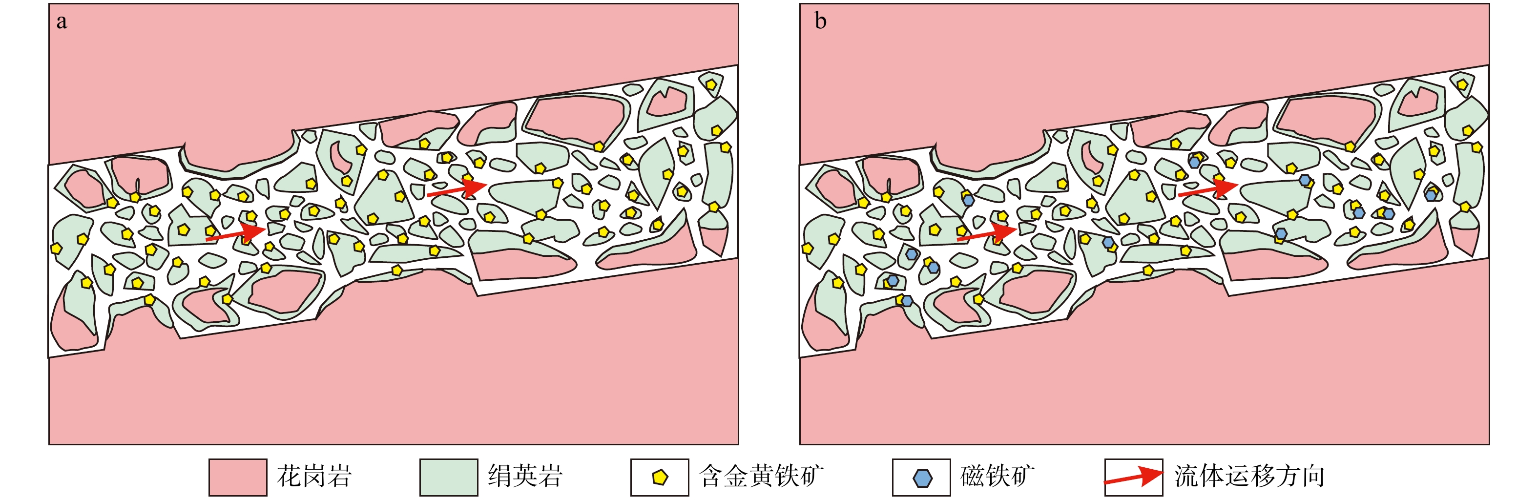
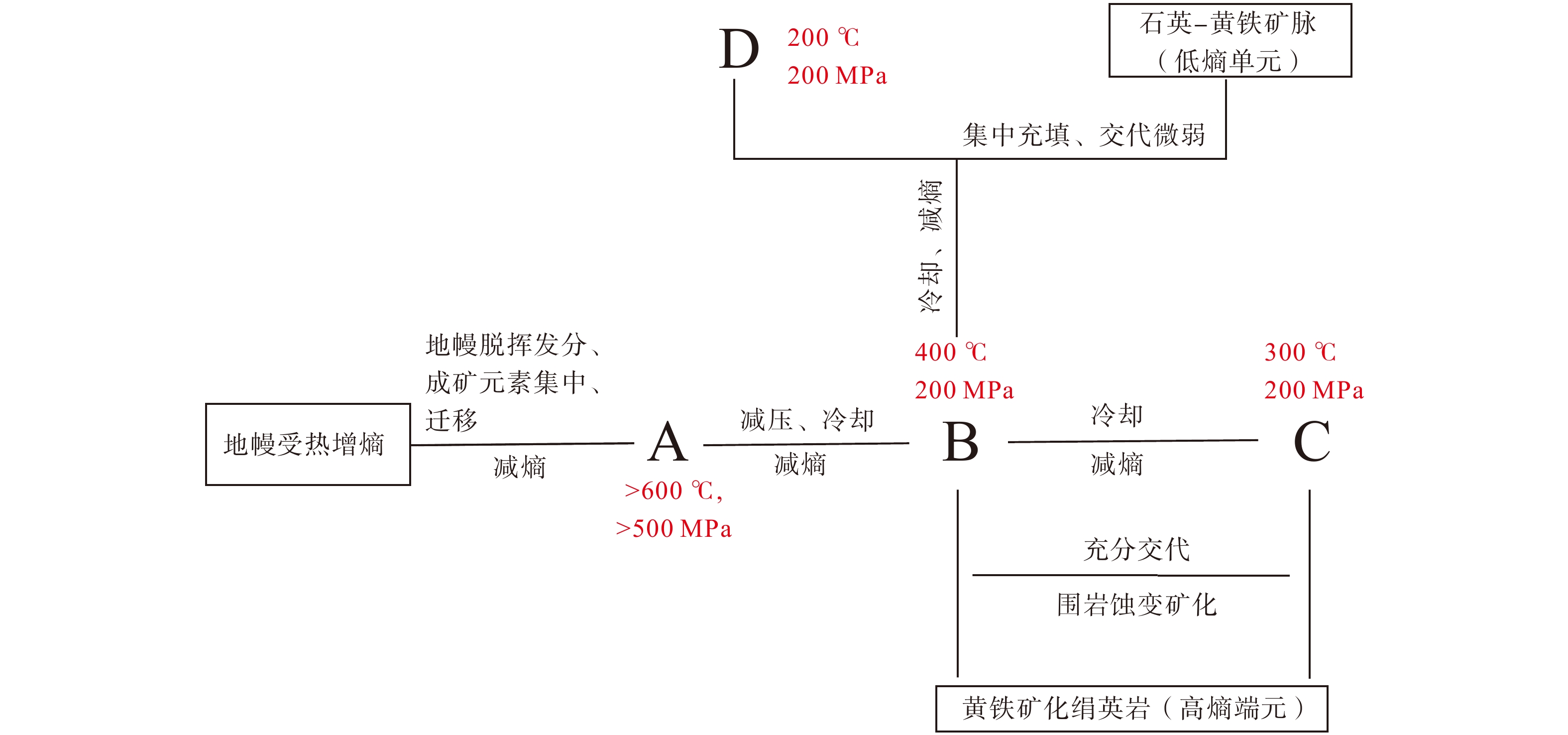
A preliminary exploration of Extremal-Entropy Mineralization Theory for Jiaodong gold deposits: proposal of two metallogenic end members and thermodynamic constraints on their formation mechanisms
DING Zhengjiang, XIN Wei, SUN Fengyue, QIU Kunfeng, BO Junwei, ZHANG Qibin, WANG Bin, ZHANG Jing, DENG Jun
2026, 32(5): 1223-1241. doi: 10.12090/j.issn.1006-6616.2026094
Abstract (38) HTML (10) PDF (9308KB)(4)
Abstract:
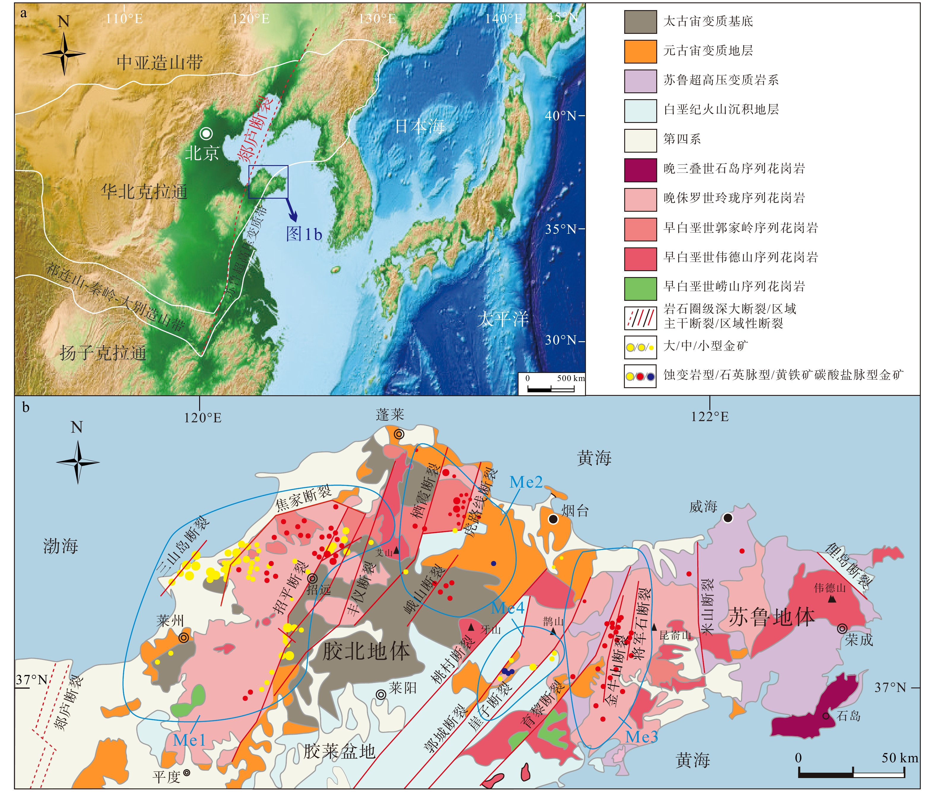
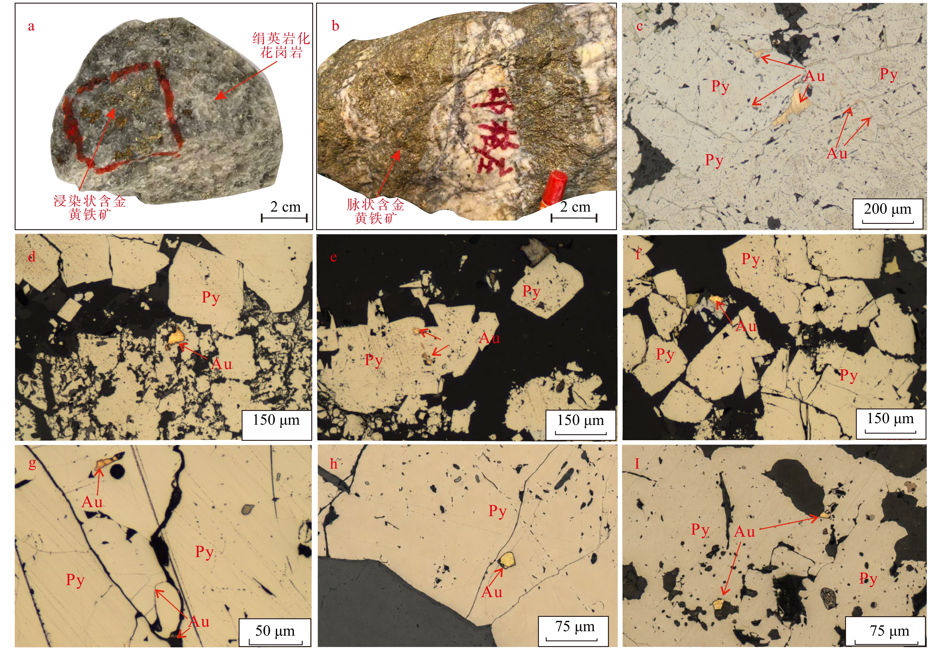
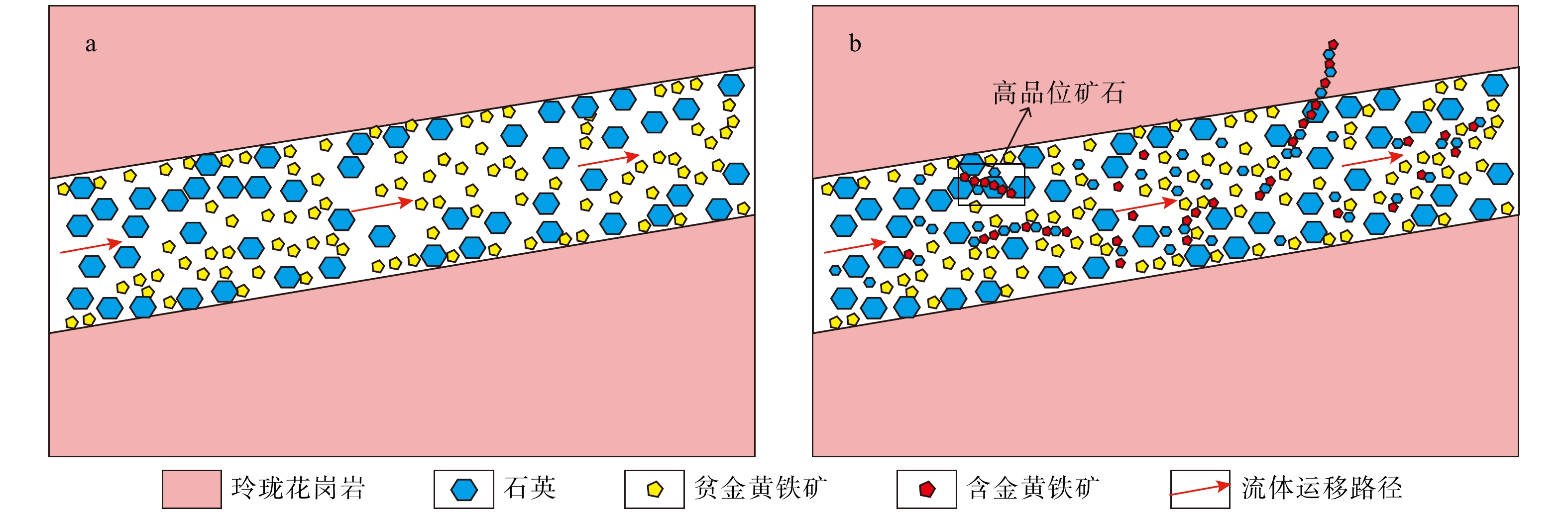
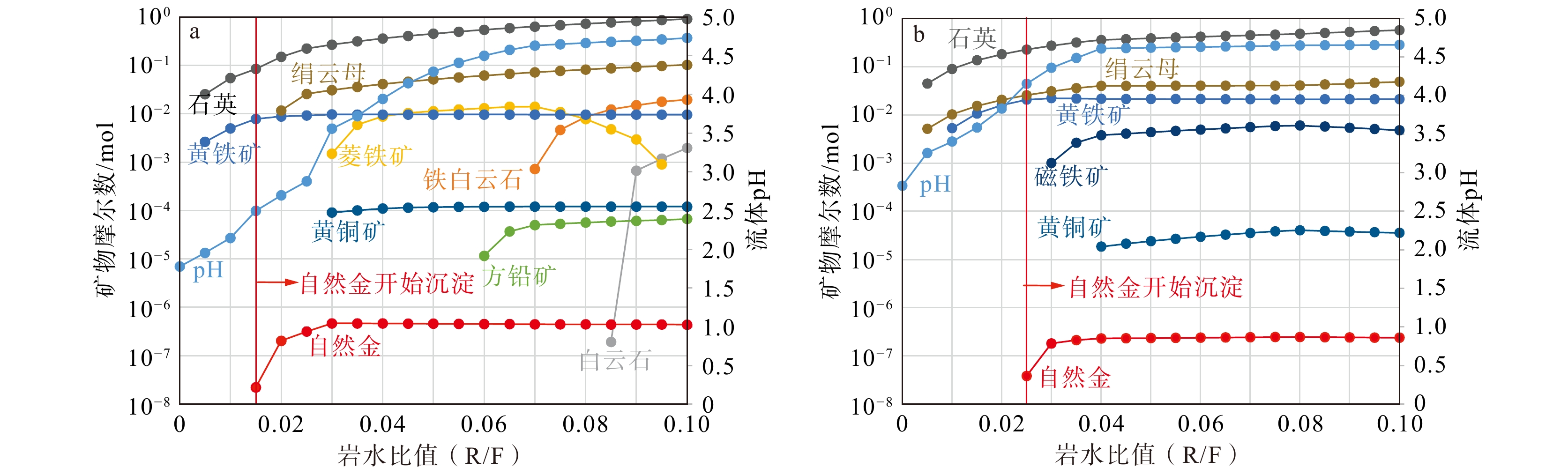
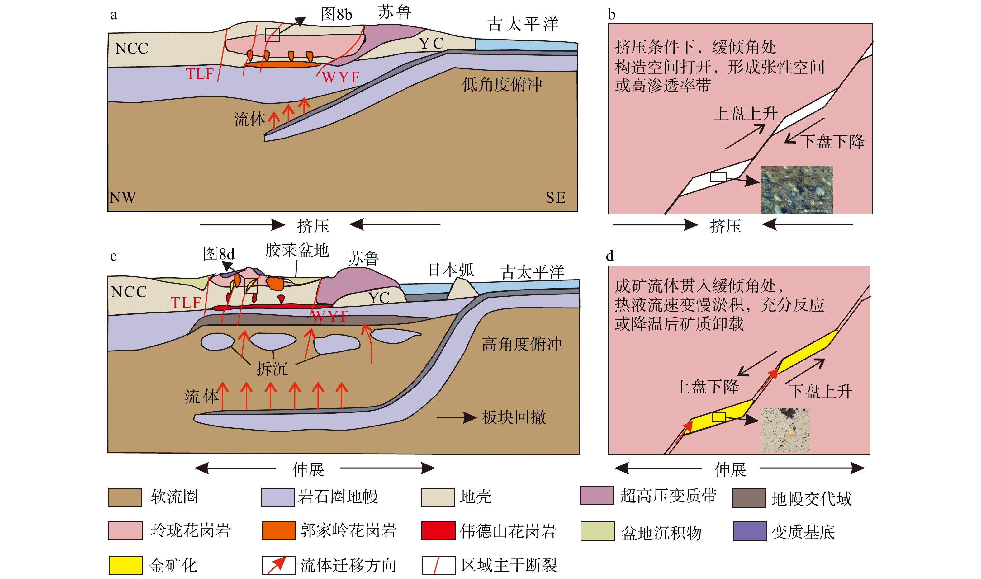
  Objective  Traditionally, the Jiaodong gold deposits are mainly classified into altered-rock type and quartz-vein type. Both types are controlled by a unified geodynamic mechanism, and extensive multi-isotope studies have revealed a broadly homogeneous nature of the ore-forming fluids, with both the ore-forming materials and hydrothermal fluids showing predominantly deep-seated characteristics. However, how a common deep-sourced hydrothermal system evolved to produce two deposits with markedly different geological characteristics remains inadequately understood.   Methods  We employ thermodynamic modeling to investigate the evolution of ore-forming fluids and the mechanisms of gold precipitation in the two types of gold deposits. Based on the systematic differences in the spatial configuration of ore-forming materials between quartz vein-type and altered-rock-type gold deposits, we propose a “low-entropy–high-entropy” end-member framework: the former is characterized by unloading along preferential fluid pathways and localized concentration of ore-forming materials, whereas the latter is characterized by fluid infiltration through complex fracture networks, extensive fluid–rock interaction, and dispersed distribution of ore-forming materials. This end-member framework provides a geological basis for the thermodynamic modeling, on which two representative metallogenic scenarios—unloading along preferential pathways and widespread fluid infiltration coupled with fluid–rock interaction—are established to compare their effects on mineral assemblages and gold precipitation.   Results  The simulations show that most pyrite crystallized prior to native gold, consistent with the common occurrence of native gold along intergranular or intragranular fractures in pyrite and its close association with fine-grained pyrite. Extensive pyrite crystallization continuously consumes HS− in the fluid and modifies the stability of Au complexes, while inducing reducing conditions that promote the conversion and precipitation of Au from complexed forms to native gold.   Conclusions  Pyrite formation and its sustained regulation of fluid chemistry may represent an important mechanism controlling gold unloading and enrichment in the Jiaodong gold deposits. The final localization of ore bodies is controlled by the regulation of fluid flow by fault geometry. Gently dipping segments and composite sites of fault branching become favorable sites for gold precipitation because reduced fluid flow velocity promotes fluid accumulation, while prolonged fluid residence enhances fluid–rock interaction. In contrast, steeply dipping fault segments mainly serve as fluid conduits. Together, these features constitute a spatial differentiation mechanism of “fluid transport–ore-forming material precipitation.”   Significance  Guided by the end-member metallogenic framework, diagnostic information of the metallogenic end members, including geological, geophysical, and geochemical characteristics, can be extracted to establish an integrated prospecting model for the metallogenic system, thereby potentially advancing metallogenic prediction from qualitative to quantitative approaches.
An intracontinental extensional full-temperature metallogenic model: its application to prospecting breakthroughs in the Shuikoushan ore field
WANG Jionghui
2026, 32(5): 1242-1264. doi: 10.12090/j.issn.1006-6616.2026126
Abstract (122) HTML (12) PDF (5015KB)(14)
Abstract:
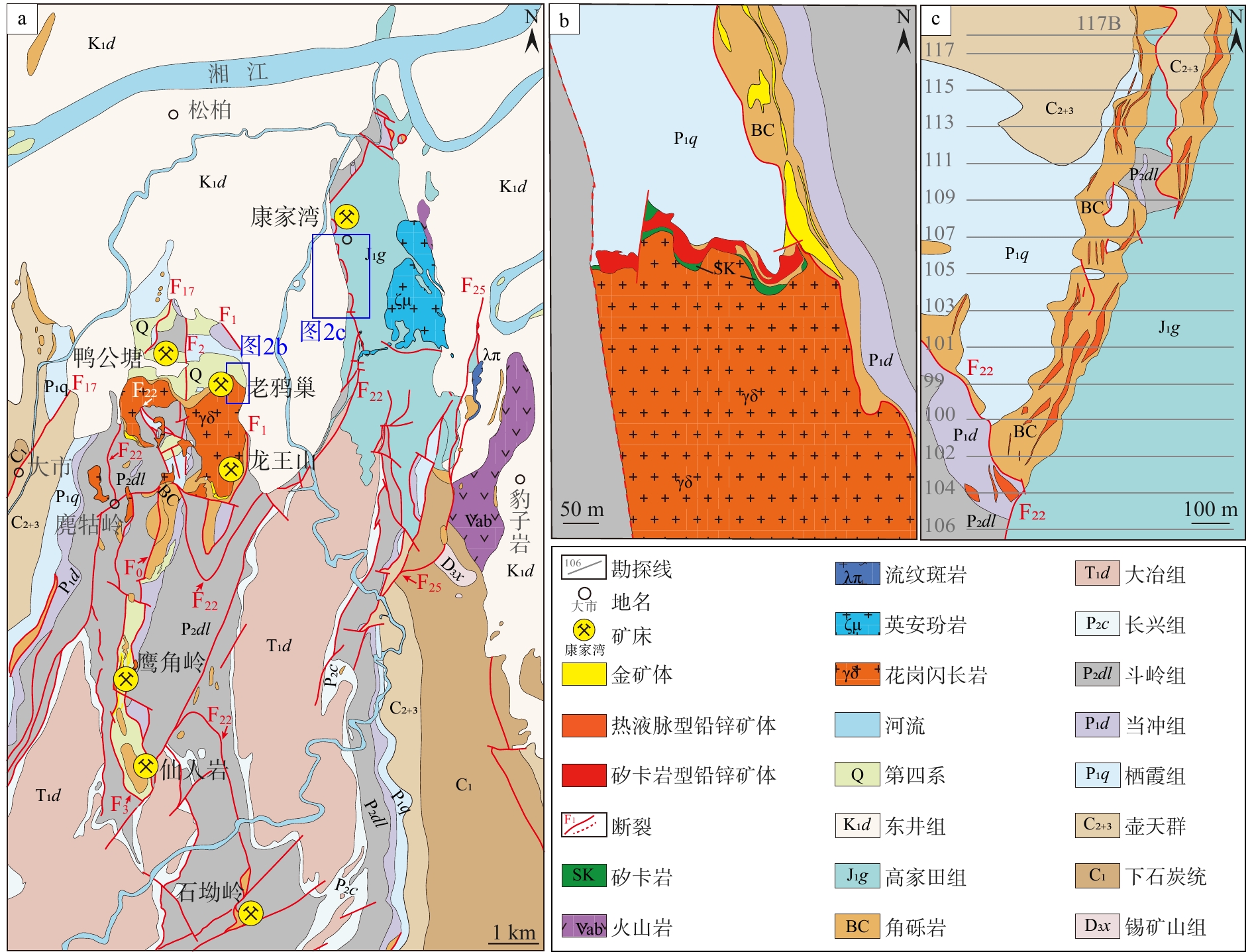
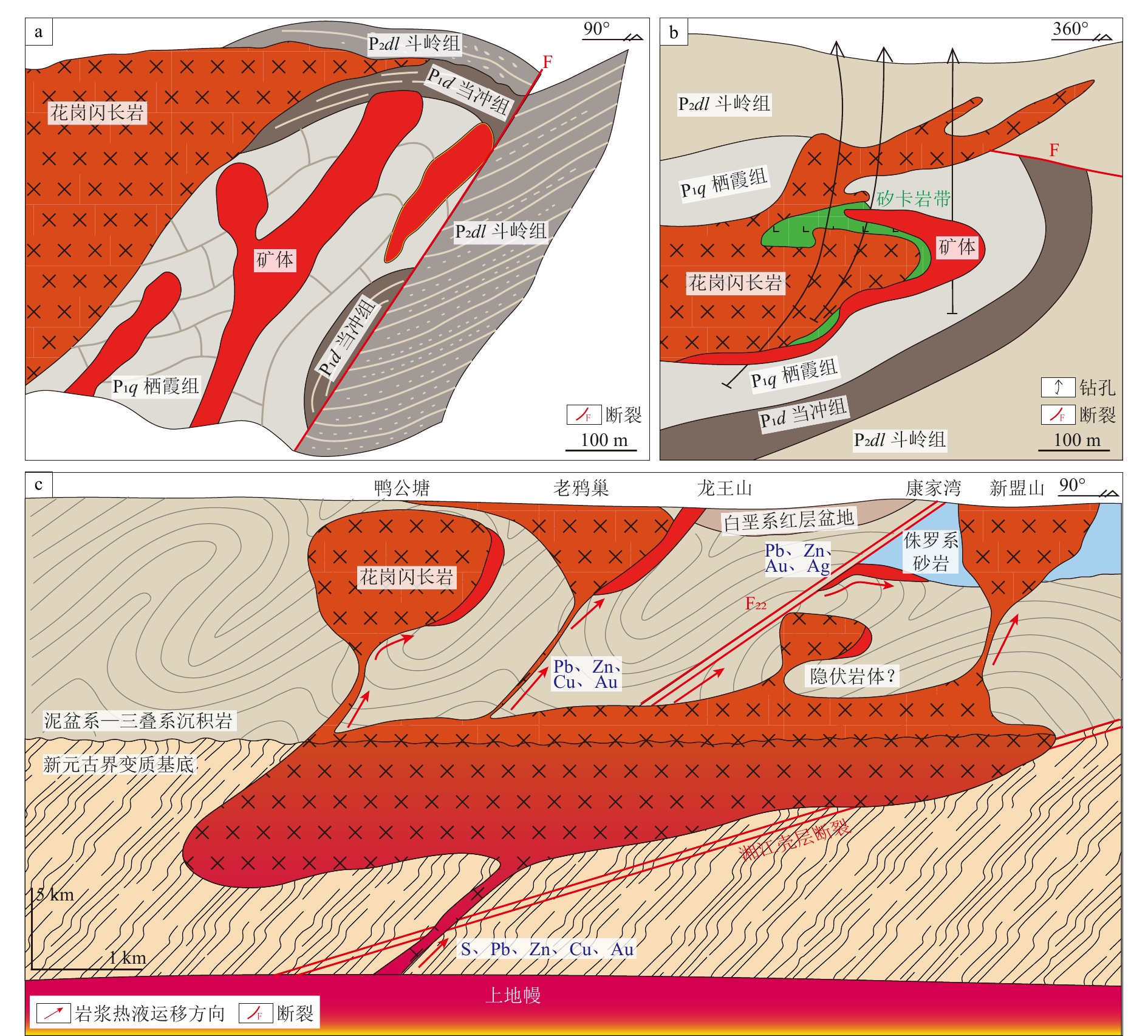
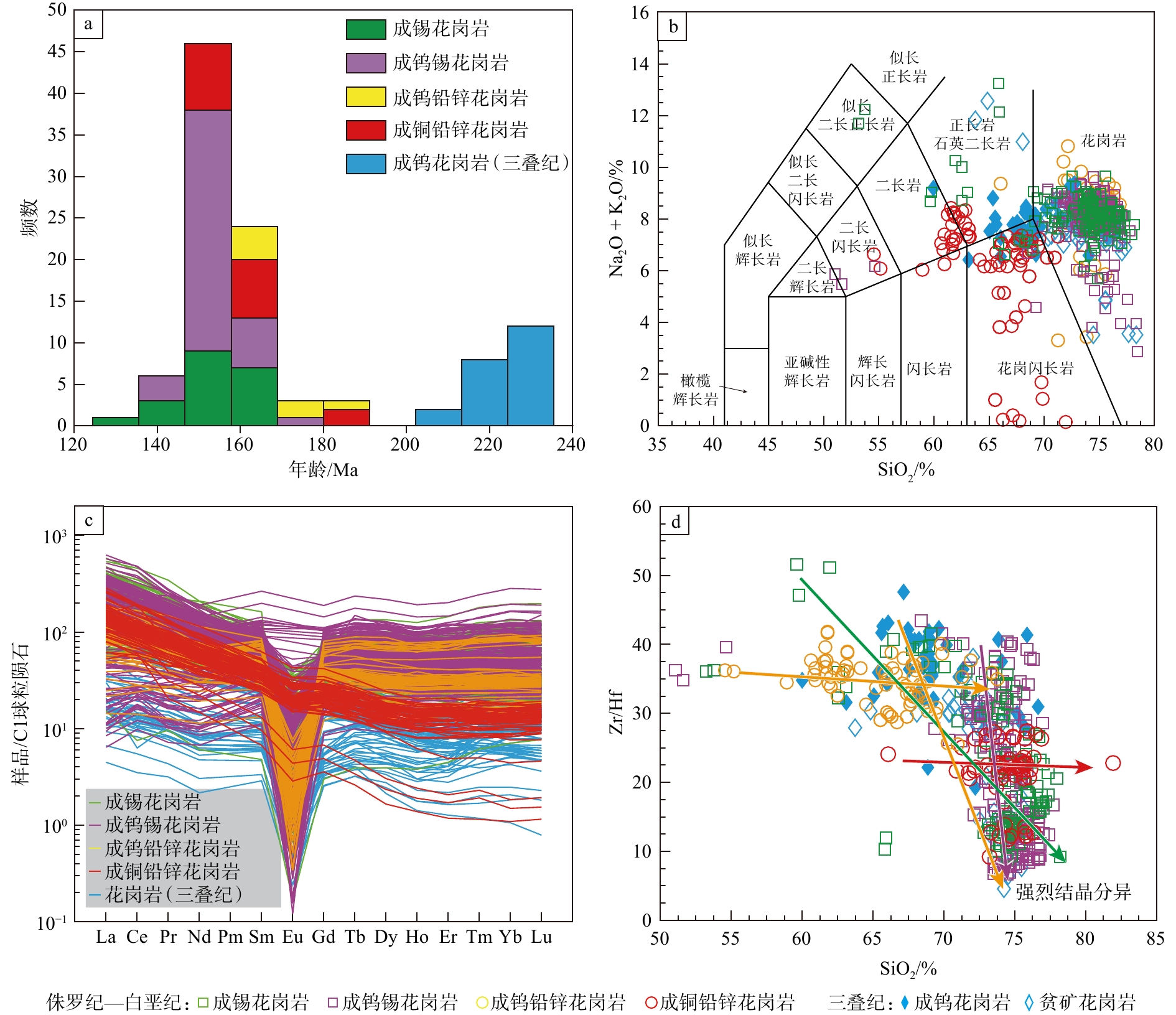
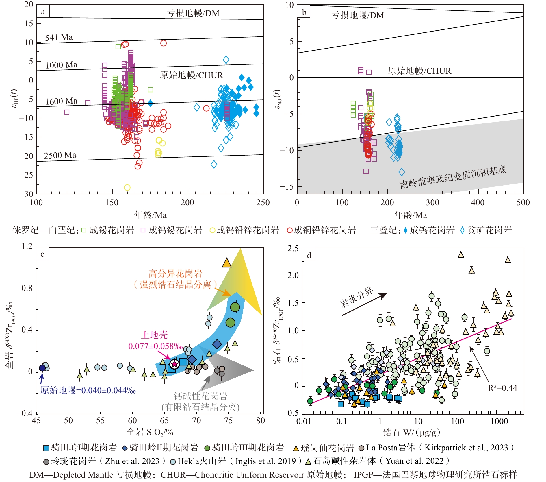
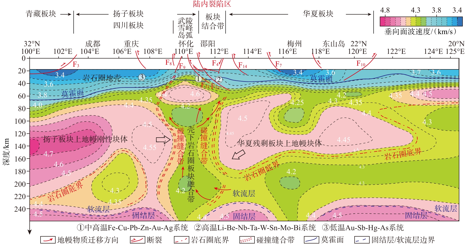
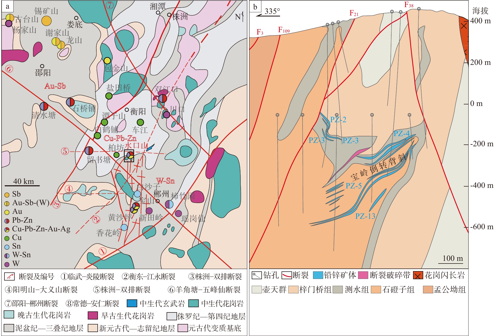
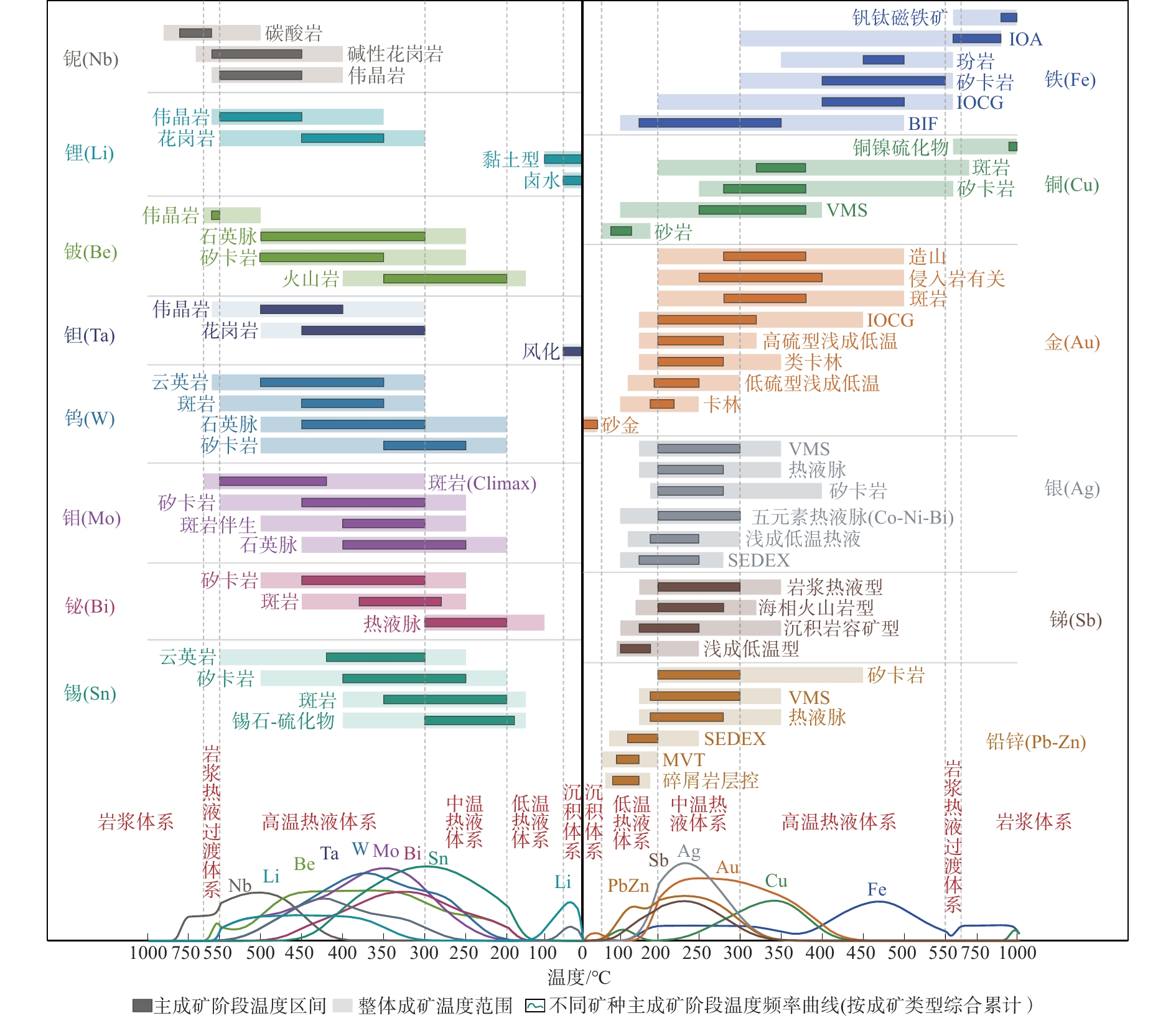
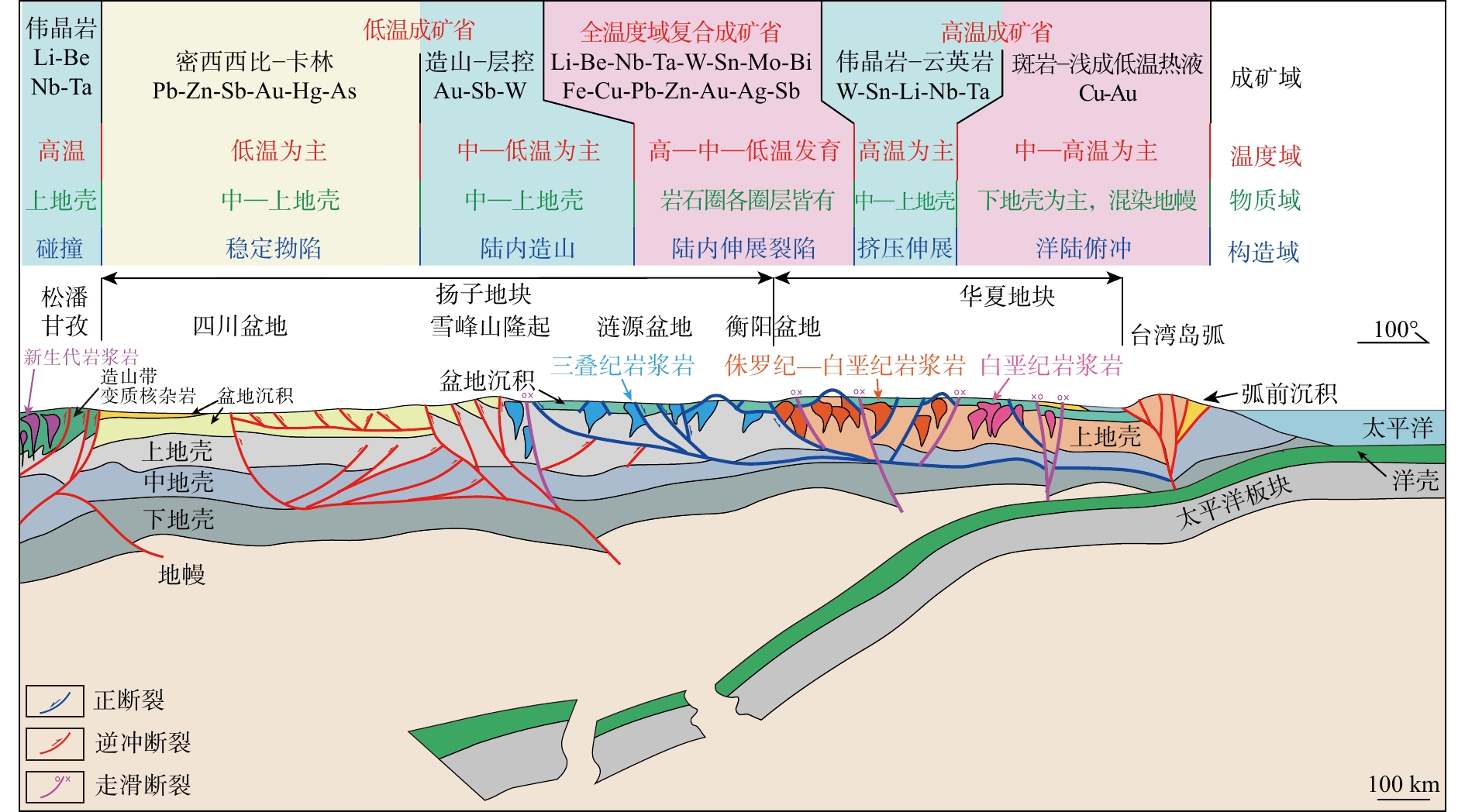
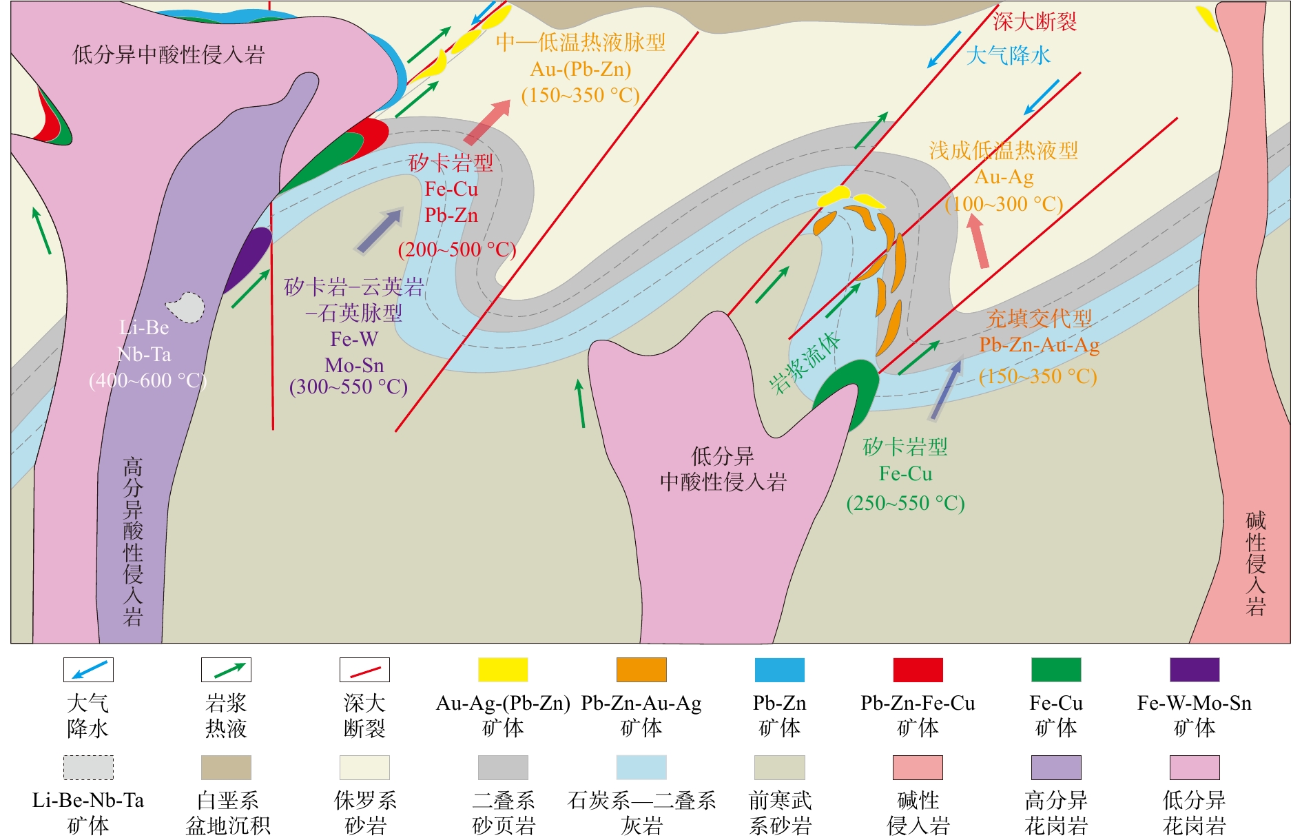
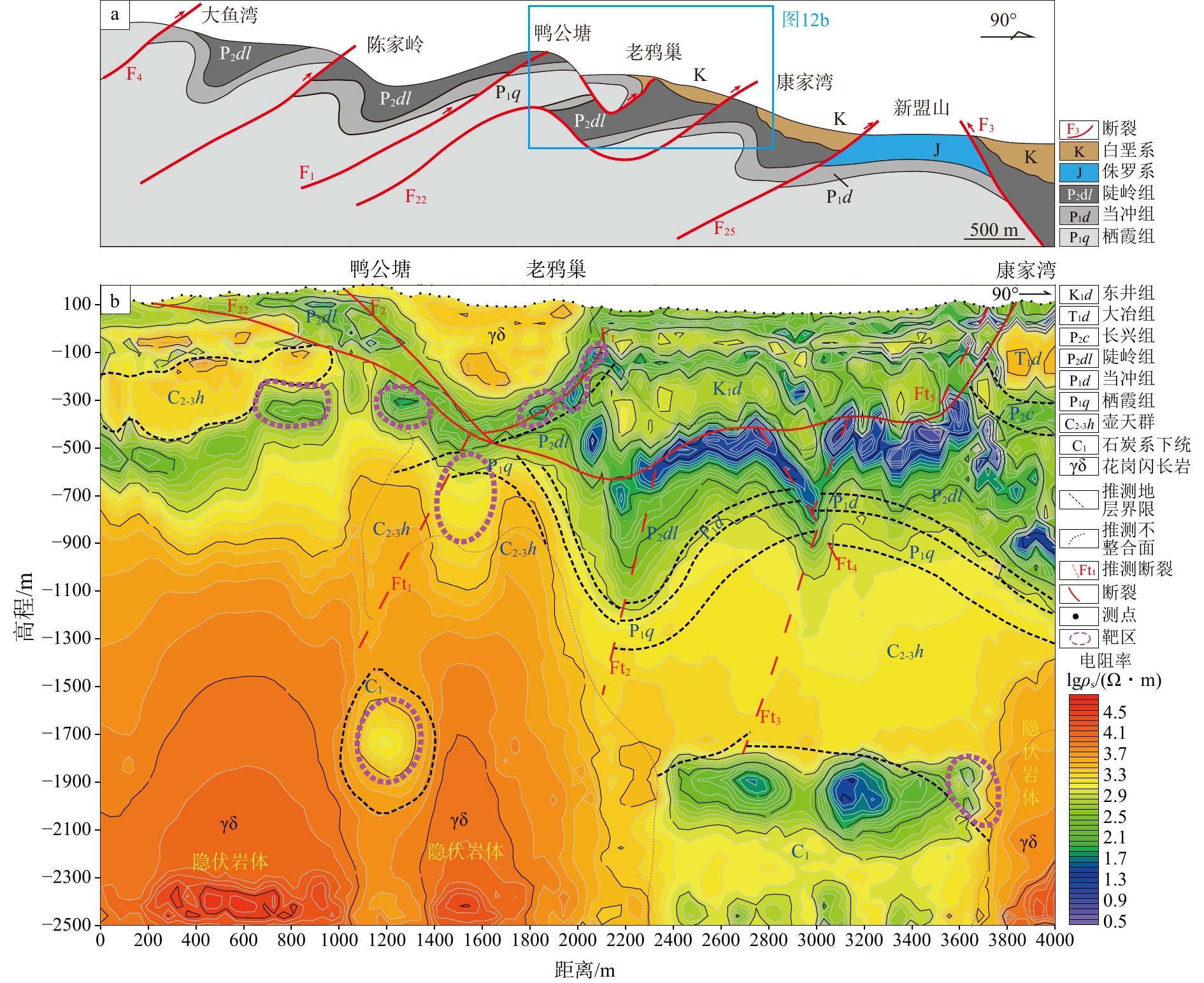
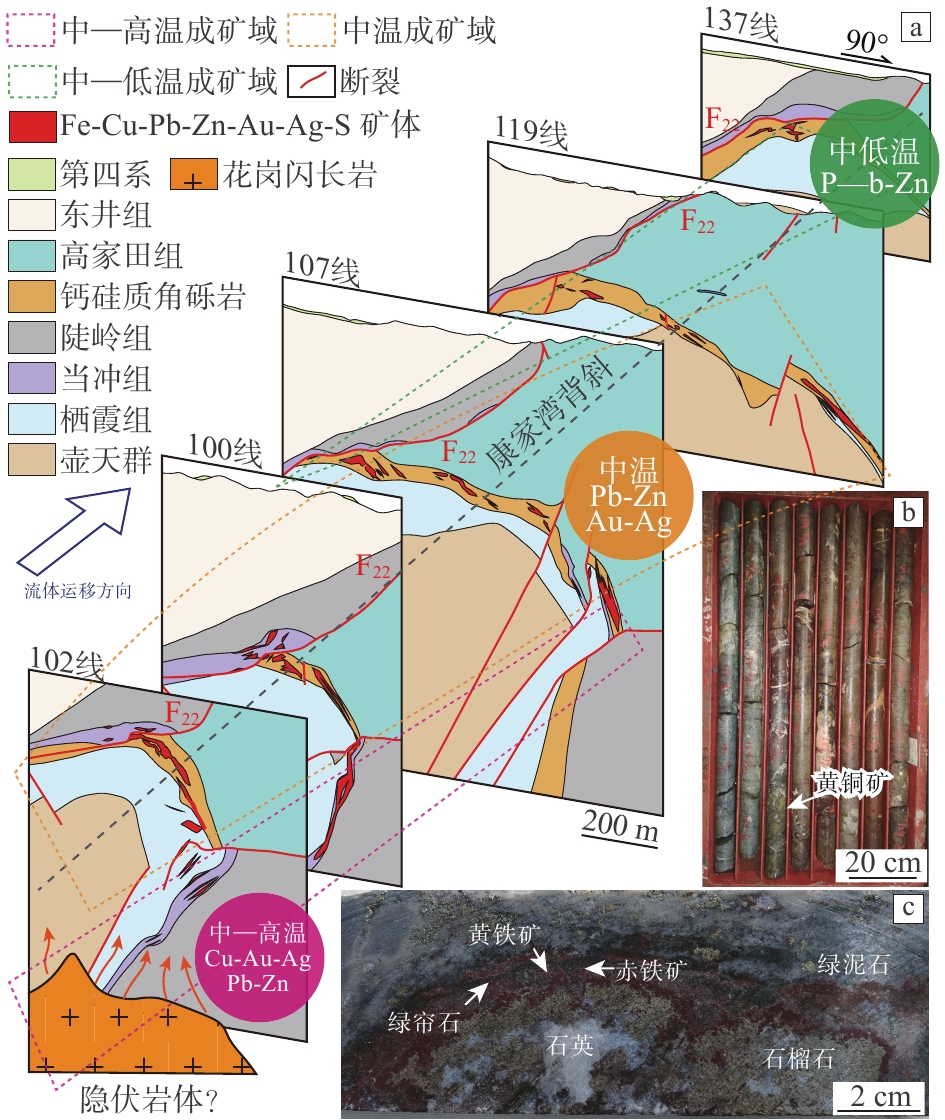
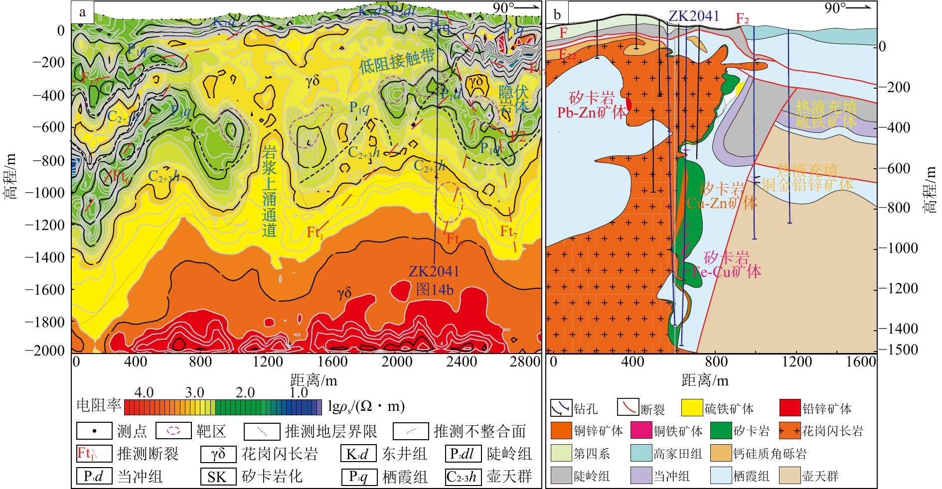
  Objective  The central Nanling metallogenic belt is a representative region of intracontinental magmatic-hydrothermal mineralization in South China. Large Pb–Zn–Fe–Cu–Au–Ag deposits are concentrated in this belt, with the Shuikoushan ore field as a prominent example. However, after more than a century of mining, shallow resources are becoming increasingly depleted, and the identification of replacement resources at depth has become increasingly challenging.   Methods  This study systematically analyzes metal sources, ore-controlling factors, temperature-dependent hydrothermal zonation, mineralization styles, and metal associations as well as their spatiotemporal relationships across the material, structural, thermal, and metallogenic domains.  Results  The material domain reveals that magmas derived from different crustal levels and having undergone different degrees of differentiation carry distinct metal inventories. Highly differentiated S- and A-type granites are enriched in W, Sn, Li, Be, Nb, and Ta, whereas weakly differentiated and oxidized I-type granodiorites are enriched in Fe, Cu, Au, Pb, and Zn. The structural domain shows that the intersections of deep faults and reversed folds, together with the calcareous–siliceous interfaces, serve as the principal conduits and traps for ore-forming fluids. The thermal domain indicates that ore-forming metals are unloaded sequentially with decreasing temperature away from the intrusion. W, Sn, Mo, and Bi precipitate in the high-temperature proximal zone, together with Fe and Cu in the medium-to-high-temperature zone, Pb, Zn, and Au in the medium-temperature zone, and Au and Ag in the low-temperature distal zone. The metallogenic domain integrates these three domains into a coherent framework, which can be summarized as one center, two structures, three systems, and multiple metals. This framework explains why distinct mineralization styles are superimposed within a single ore field.   Conclusions  On this basis,an intracontinental extensional full-temperature metallogenic model is established. This model emphasizes that magmas from different crustal levels and with variable differentiation were collectively emplaced at the intersections of deep faults and reversed folds. They successively formed high-temperature Li-Be-Nb-Ta pegmatite-greisen (400~600 °C), medium-to-high temperature W–Sn–Fe–Cu skarn-porphyry (250~550 °C), medium-temperature Pb–Zn skarn (200~450 °C), medium-to-low-temperature hydrothermal Pb–Zn–Au–Ag veins (150~350 °C), and epithermal Au–Ag (100~300 °C) mineralization. Distinct metallogenic systems can overlap at the same period. The application of this model to the Shuikoushan ore field achieved three prospecting breakthroughs. First, an IV-3 orebody cluster was newly identified east of the F22 fault in the Kangjiawan mining area, guided by the "anticline + N faults" model. Second, high-temperature Cu–Au mineralization was identified at depth in the overturned limb of the Kangjiawan structure, based on the understanding that concealed intrusions can independently develop mineralization across the full temperature range. Third, skarn-type Cu–Fe orebodies and indications of porphyry-type Cu–Au mineralization were identified at depth in the Laoyachao–Yagongtang area, guided by the concept that mineralization in different temperature domains can serve as mutual prospecting indicators.   Significance  These results suggest that South China still holds extensive exploration potential for nonferrous and rare metals. The intracontinental extensional full-temperature metallogenic model can provide new exploration strategies and target directions within mature mining districts.
Research and application of a prospecting model for sedimentary manganese deposits in the Xialei–Longbang area, southwestern Guangxi
ZHOU Shangguo, LONG Tao, JIANG Sha, HUANG Qin, WANG Huaqing, LI Rongzhi, HE Pingxian, XI Zhenzhu
2026, 32(5): 1265-1283. doi: 10.12090/j.issn.1006-6616.2026087
Abstract (103) HTML (7) PDF (10621KB)(12)
Abstract:
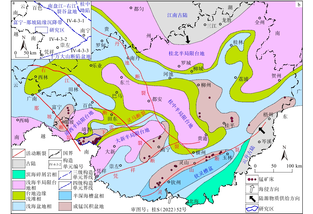
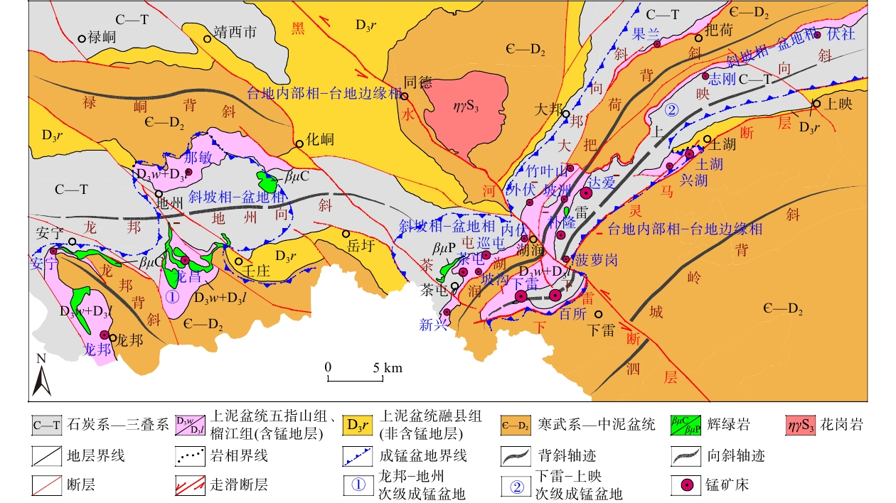
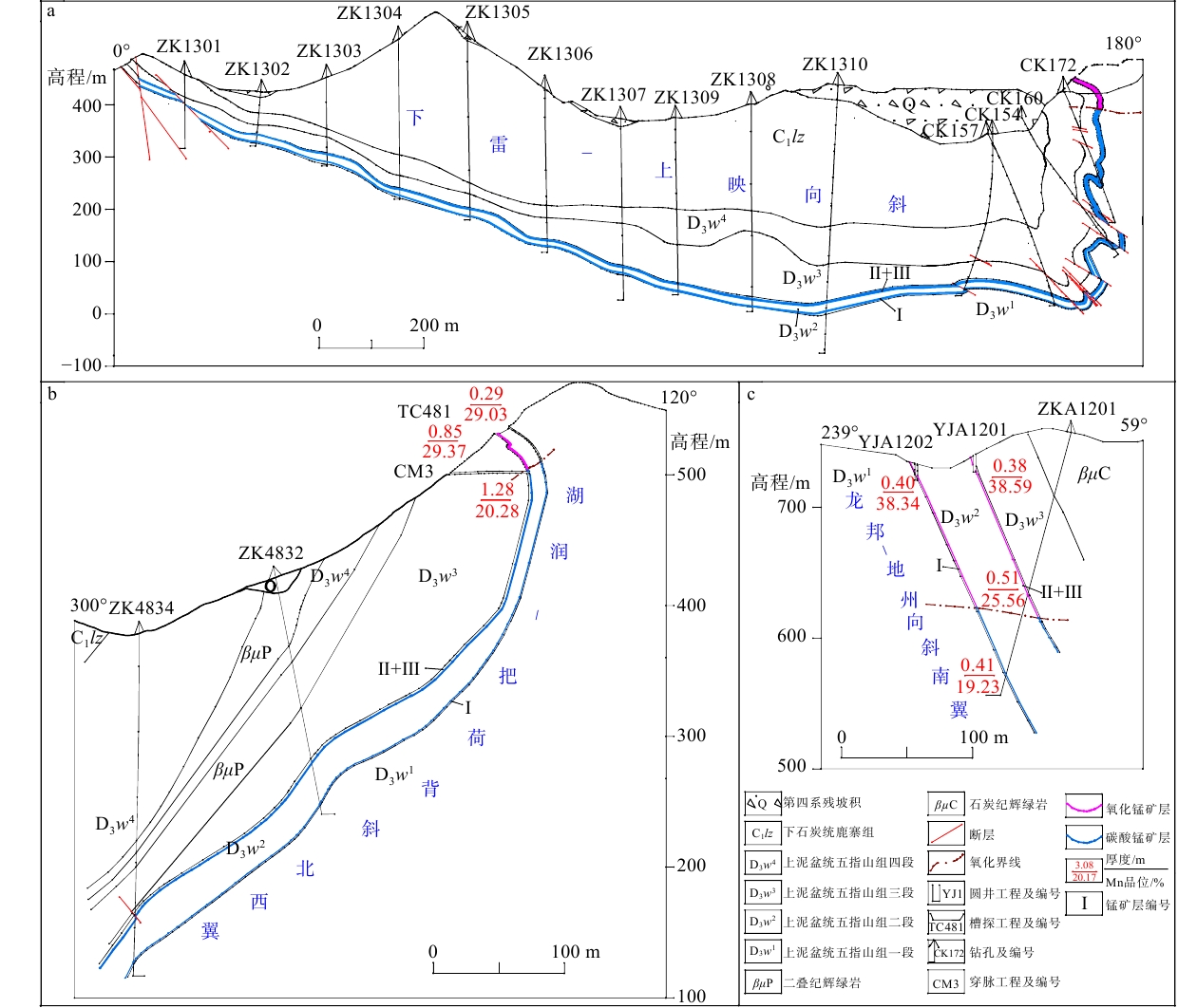
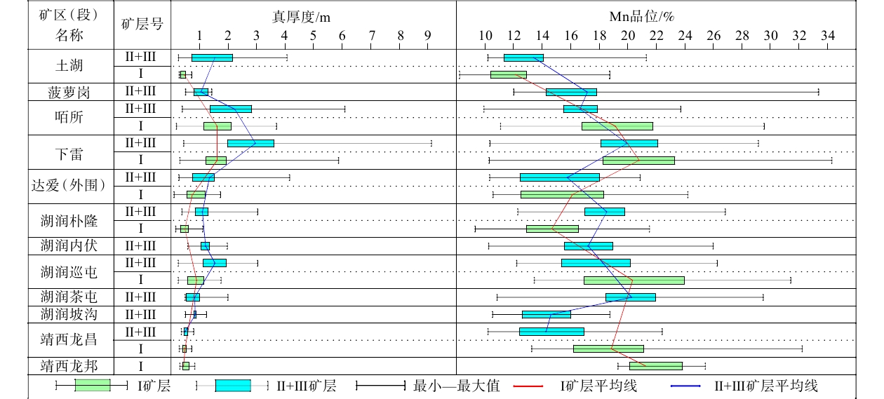
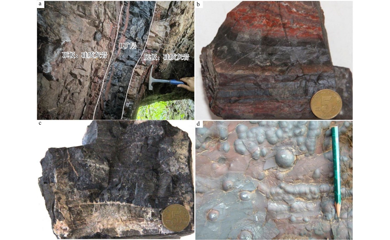
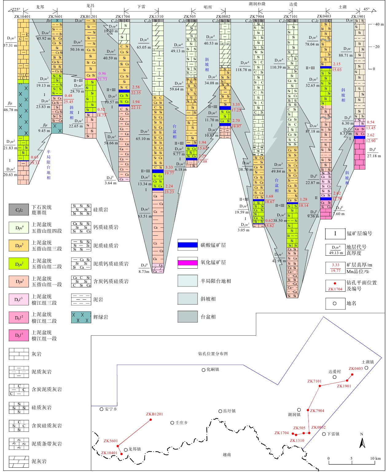
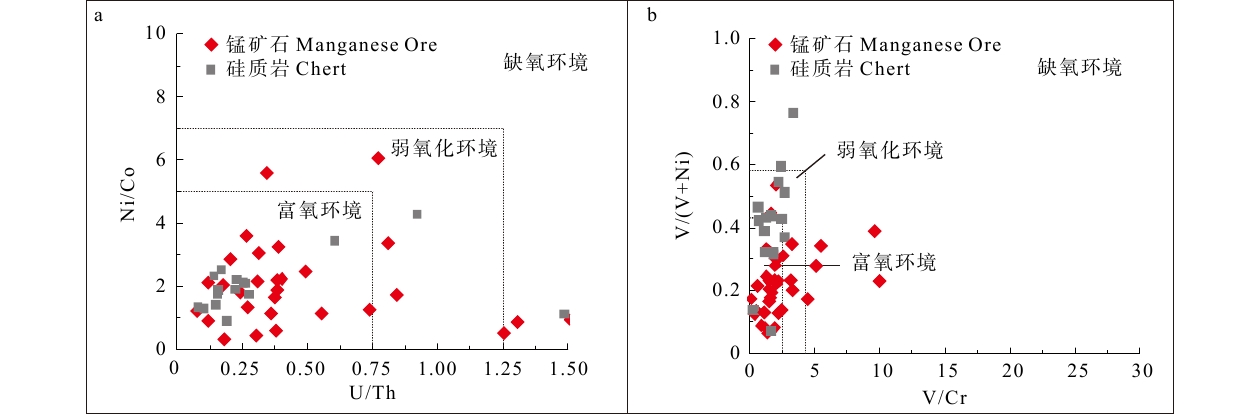
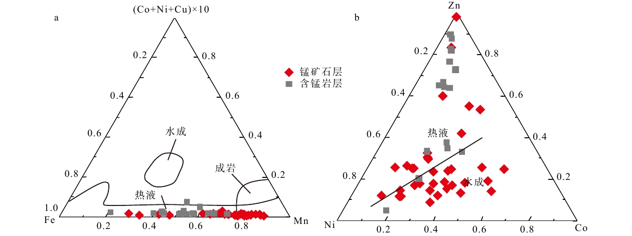
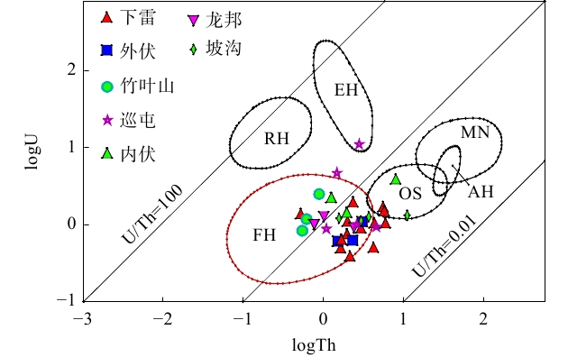
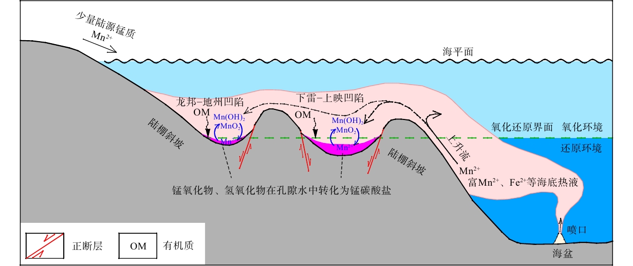
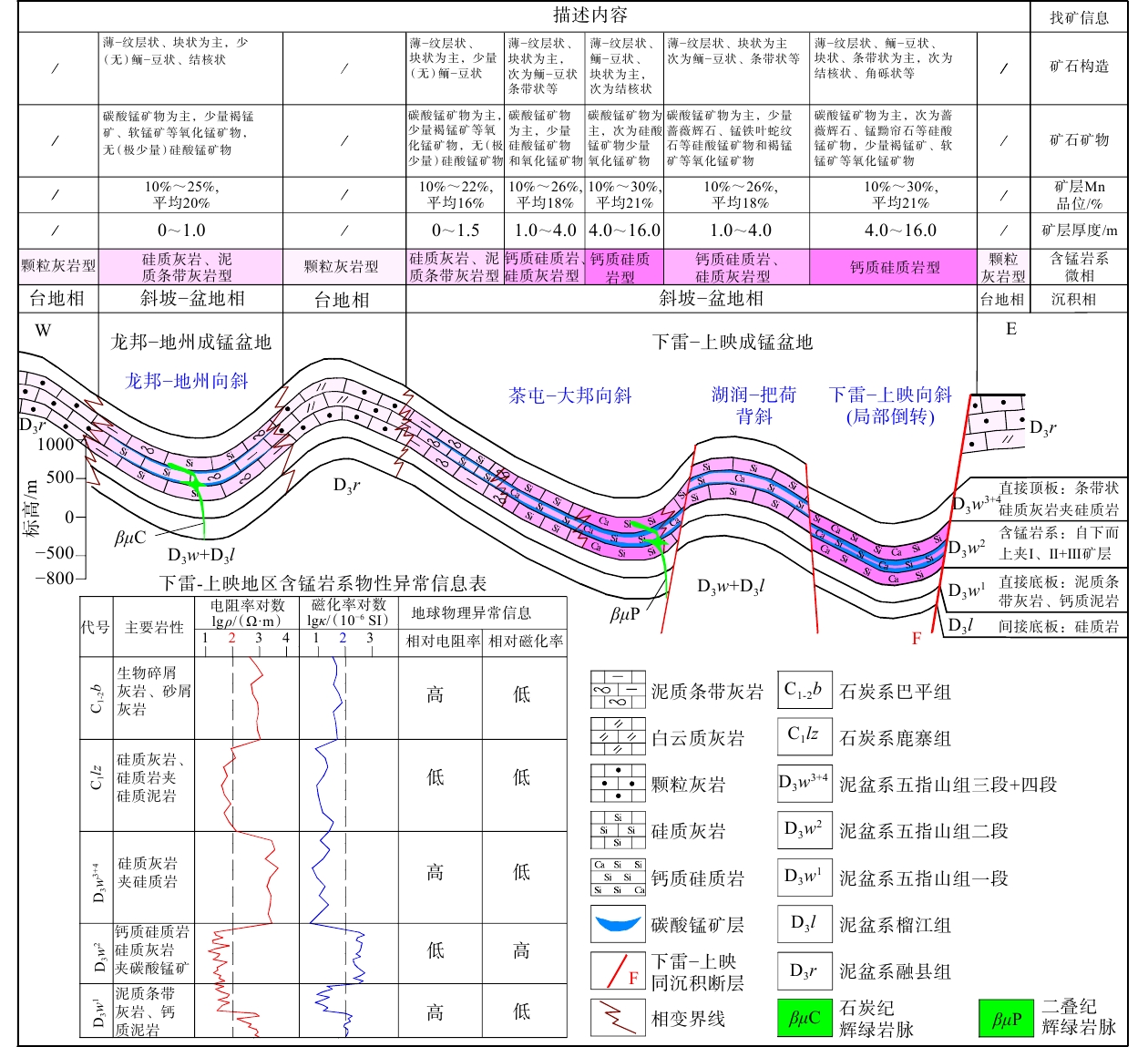
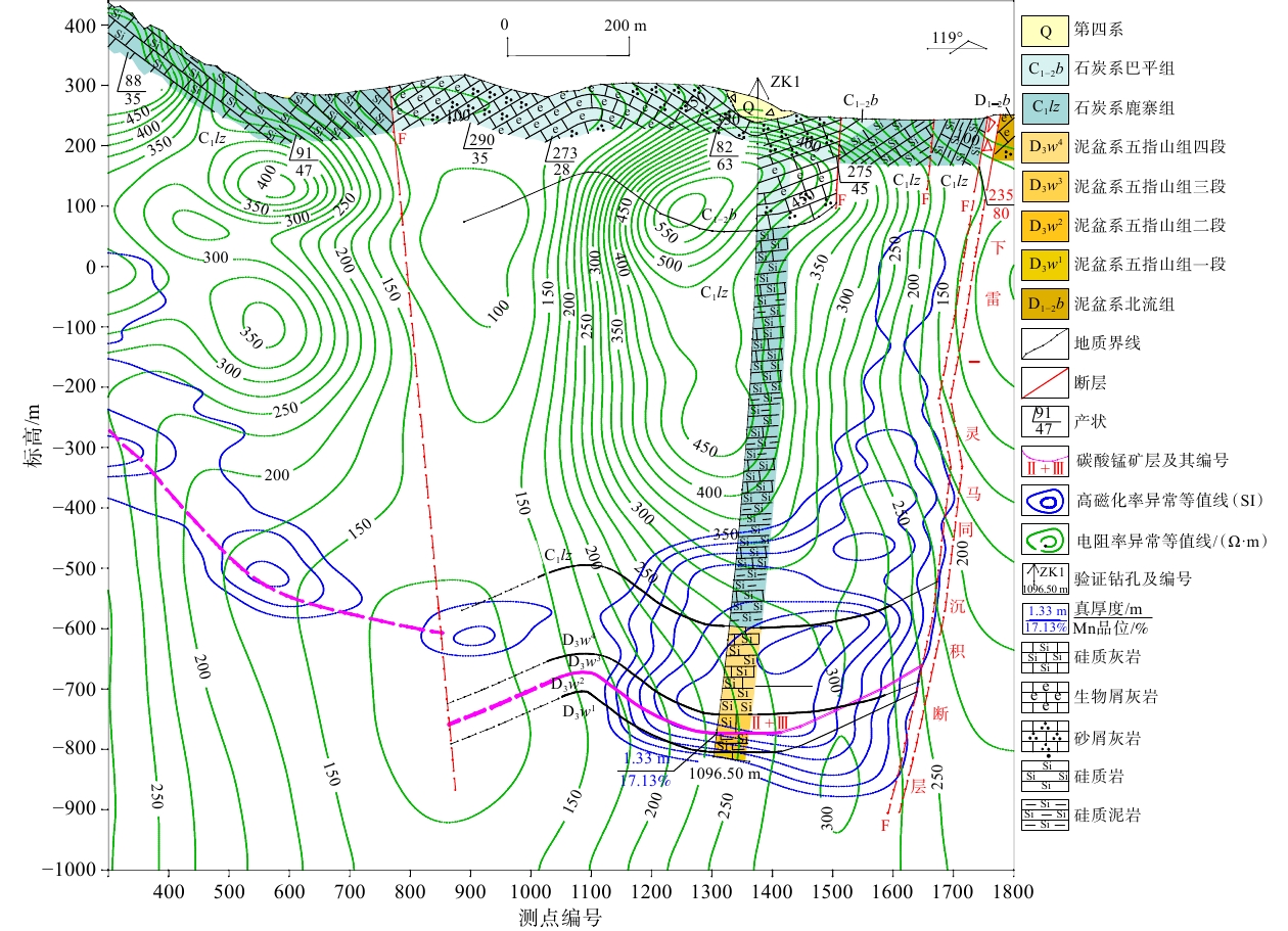
  Objective  The Xialei–Longbang area in southwestern Guangxi hosts a critical manganese ore concentration district in China. Current exploration is hindered by an incomplete understanding of the occurrence patterns of sedimentary manganese deposits and a lack of a sound basis for selecting effective exploration methods.  Methods  Based on an analysis of the metallogenic geological settings, this study compares the geological characteristics of typical deposits and the geochemical characteristics of manganese-bearing rock series, and evaluates the results of exploration tests using the multi-polarization magnetotelluric (MPMT) method in the ore concentration district.   Results  The study area can be divided into two secondary manganese-forming basins, namely the Xialei–Shangying Basin and the Longbang–Dizhou Basin. Three sedimentary microfacies types are identified in the Xialei–Shangying manganese-forming basin: calcareous siliceous rock, calcareous siliceous rock–siliceous limestone, and siliceous limestone–argillaceous banded limestone. Only the siliceous limestone–argillaceous banded limestone microfacies occurs in the Longbang–Dizhou manganese-forming basin. Among these microfacies, the calcareous siliceous rock microfacies is the most favorable for mineralization, followed by the calcareous siliceous rock–siliceous limestone microfacies, whereas the siliceous limestone–argillaceous banded limestone microfacies is the least favorable. Centers of manganese enrichment are distributed within a zone approximately 500–1000 m northwest of the Xialei–Lingma synsedimentary fault. The thickness and Mn grades of rhodochrosite ore beds vary considerably among different mining areas (segments). Outward from the Xialei Mining Area, the manganese ore beds gradually thin and their Mn grades decrease. Moreover, the thickness and Mn grade of ore beds II+III generally show positive correlations with those of ore bed I. The ore-forming fluids were dominated by submarine hydrothermal fluids, and the sedimentary metallogenic environment was weakly oxidizing to oxidizing. Compared with the overlying and underlying wall rocks, the manganese-bearing rock series are characterized by a combination of low resistivity and high magnetic susceptibility.   Conclusions  Based on these results, a comprehensive prospecting model for Devonian rhodochrosite deposits was established and validated through exploration tests in the Xialei–Longbang area. The model captures the key ore-controlling factors and prospecting criteria of sedimentary manganese deposits in the region.   Significance  The combination of MPMT and drilling is applicable to sedimentary manganese exploration in southwestern Guangxi and provides important guidance for deep and concealed ore prospecting.
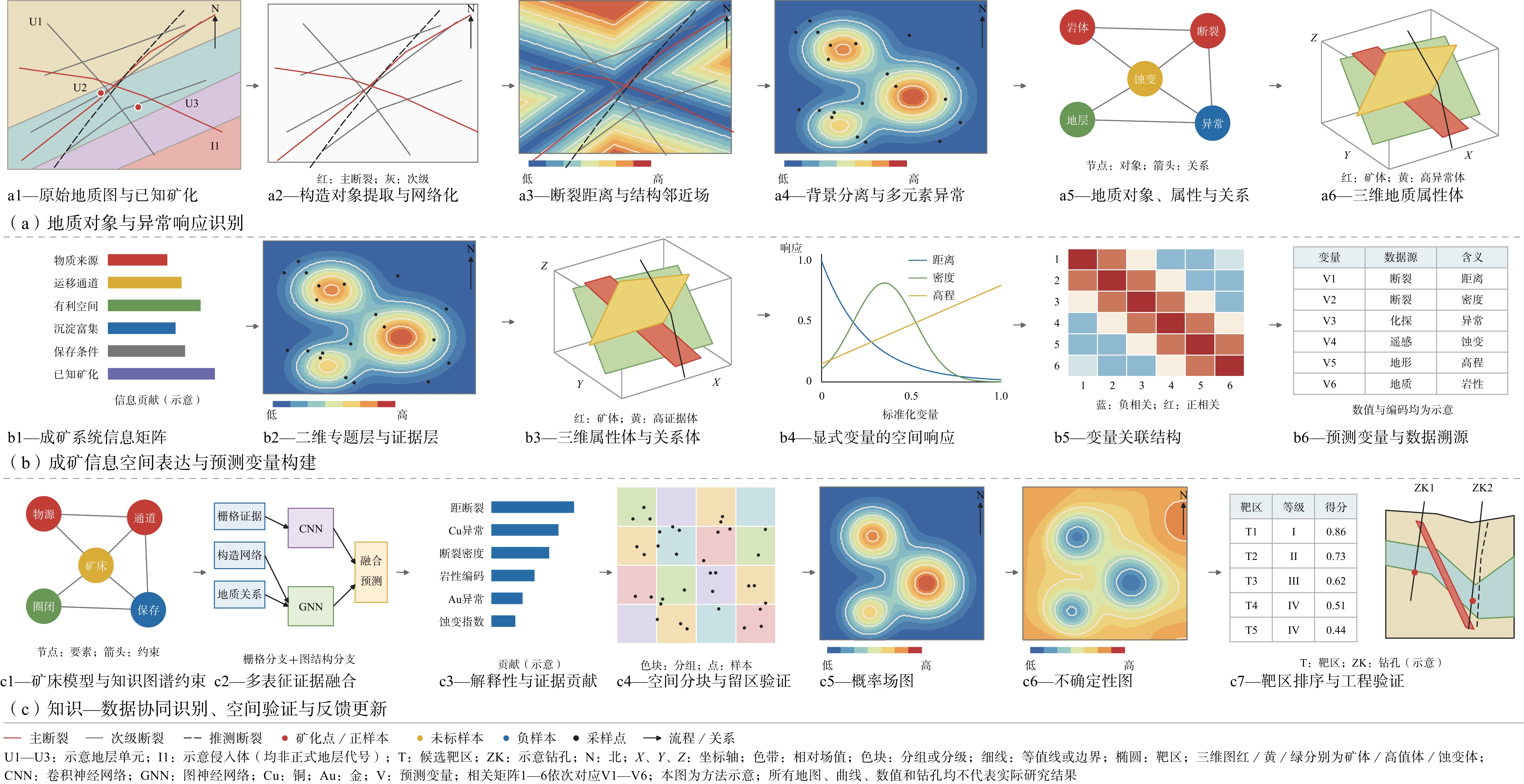
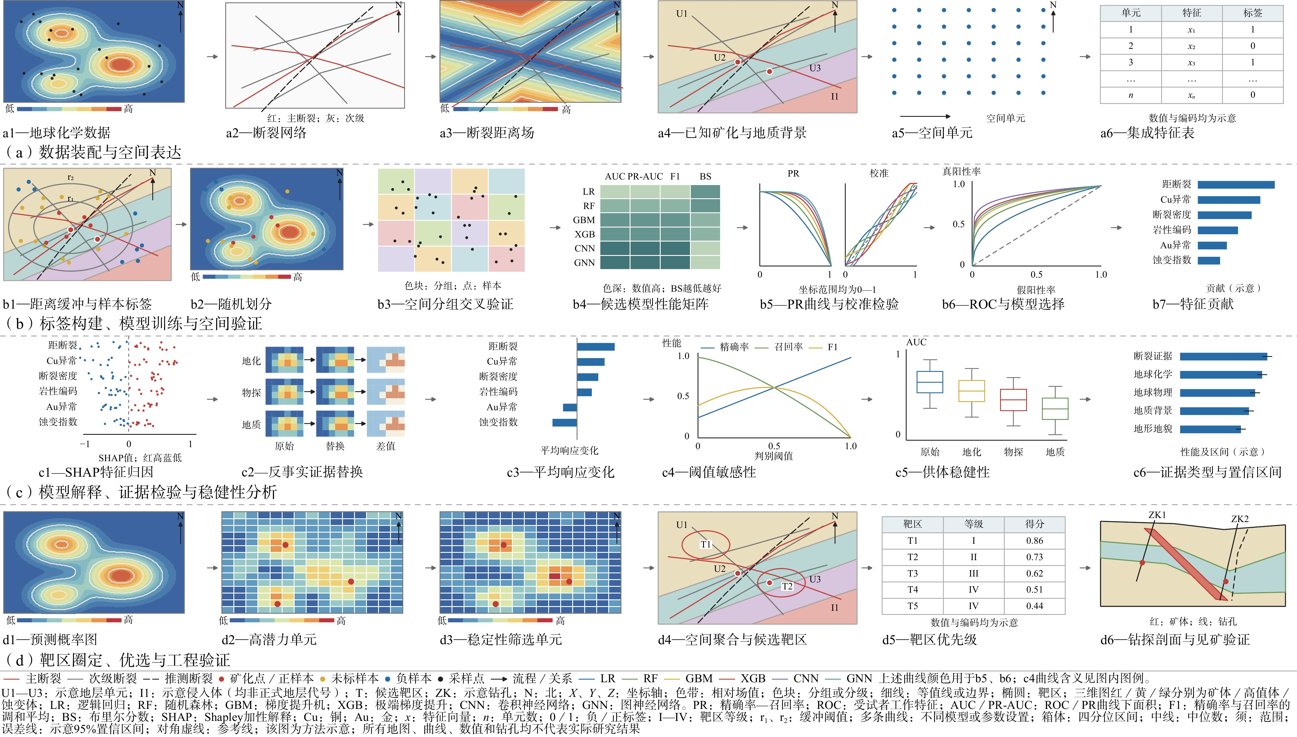
Advances in intelligent extraction and identification of metallogenic information for mineral prospectivity mapping
XIAO Keyan, WANG Zhengyao, LIU Bingli, LI Cheng, CAO Changjie, KONG Yunhui, WANG Yao
2026, 32(5): 1284-1297. doi: 10.12090/j.issn.1006-6616.2026098
Abstract (96) HTML (12) PDF (1626KB)(11)
Abstract:
  Objective  The exploration of deep, concealed, and covered mineral resources is increasingly affected by scale mismatches, background interference, and ambiguous geoscientific responses. This study aims to clarify the hierarchical relationships and methodological pathways through which metallogenic knowledge can be transformed into computable and verifiable predictive information.   Methods  Structural geological, geochemical, geophysical remote-sensing, and three-dimensional spatial information were systematically reviewed. The review covered spatial quantification, statistical analysis, conventional machine learning, deep learning, geological-knowledge constraints, and spatial validation. A hierarchical framework of "raw data–geological objects and anomalous responses–metallogenic information–spatial representation–predictive variables–quantitative prediction–validation" was established, and different methods were compared in terms of data organization, applicable scale, sample design, interpretability, and validation strategy.   Results  Six classes of mineral system information were synthesized, including material sources, migration pathways, favorable sites for mineralization, precipitation and enrichment, preservation conditions, and known mineralization. Two principal spatial representations were summarized, namely two-dimensional thematic maps/evidence layers and three-dimensional attribute volumes. Six technical components were identified: information spatialization, anomaly and multivariate-association extraction, conventional machine-learning recognition, deep spatial representation, geological knowledge constraints, and spatial or engineering validation. Both convolutional neural networks (CNNs) and graph neural networks/graph convolutional networks (GNNs/GCNs) belong to the field of deep learning, but are suited to different data structures: CNNs are generally better suited to regular grids, including two-dimensional rasters and three-dimensional voxels, whereas GNNs/GCNs are more suitable for irregular graph-structured data. Random sample splitting may cause spatial leakage, while spatial-block, leave-area-out, cross-district, and engineering validation are more appropriate for evaluating model transferability.  Conclusions  Metallogenic information is computable evidence produced by quantifying metallogenic knowledge. Its reliability depends primarily on geological semantics, scale compatibility, data quality, sample representativeness, and independent validation rather than algorithmic complexity. Intelligent extraction and identification of metallogenic information should therefore remain constrained by mineral-system concepts, deposit models, and prospecting models, with future emphasis on multisource integration, coordinated two- and three-dimensional representation, uncertainty characterization, and interpretable learning.
Geo-hazards & Engineering Geology
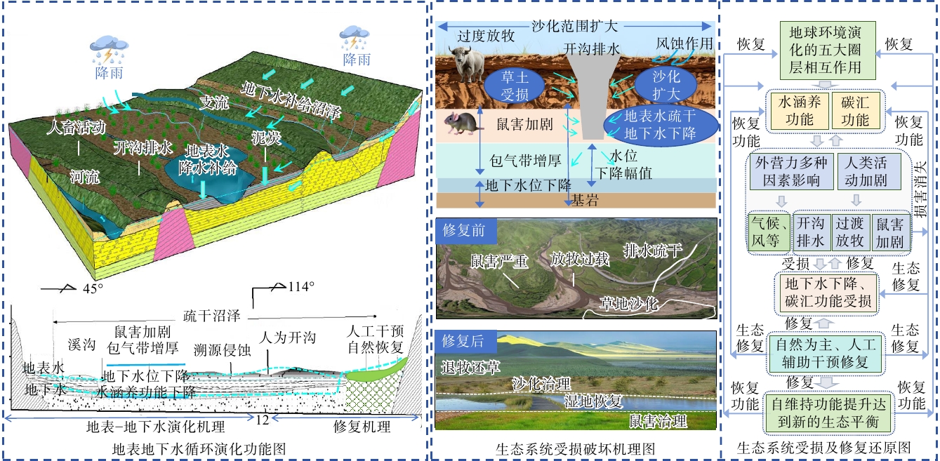
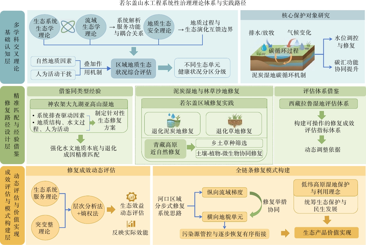
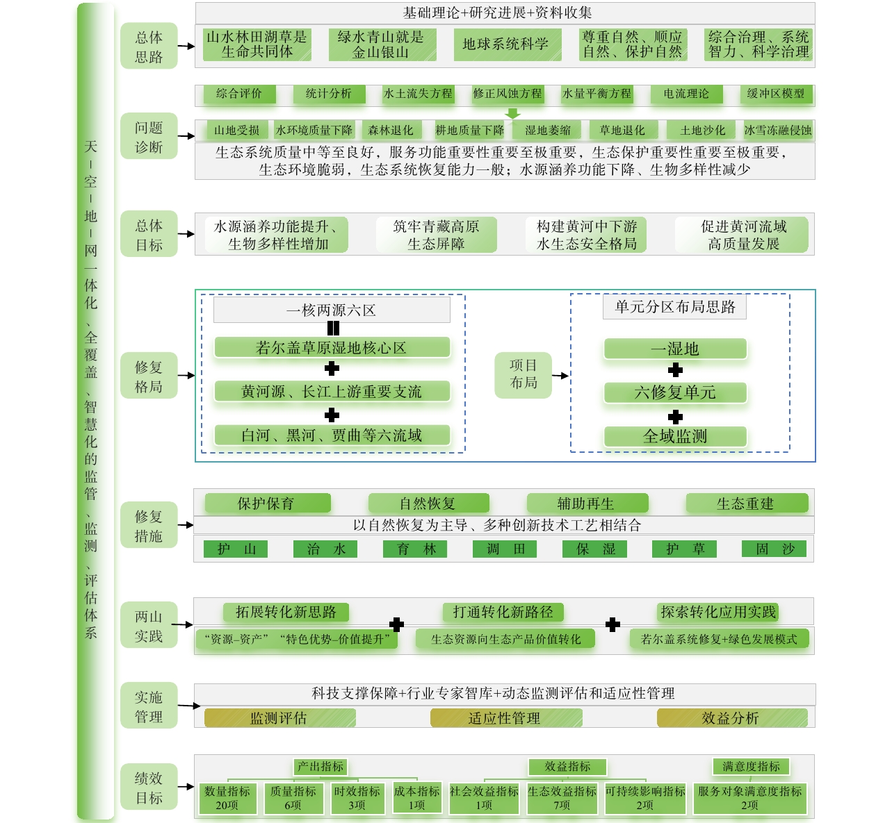
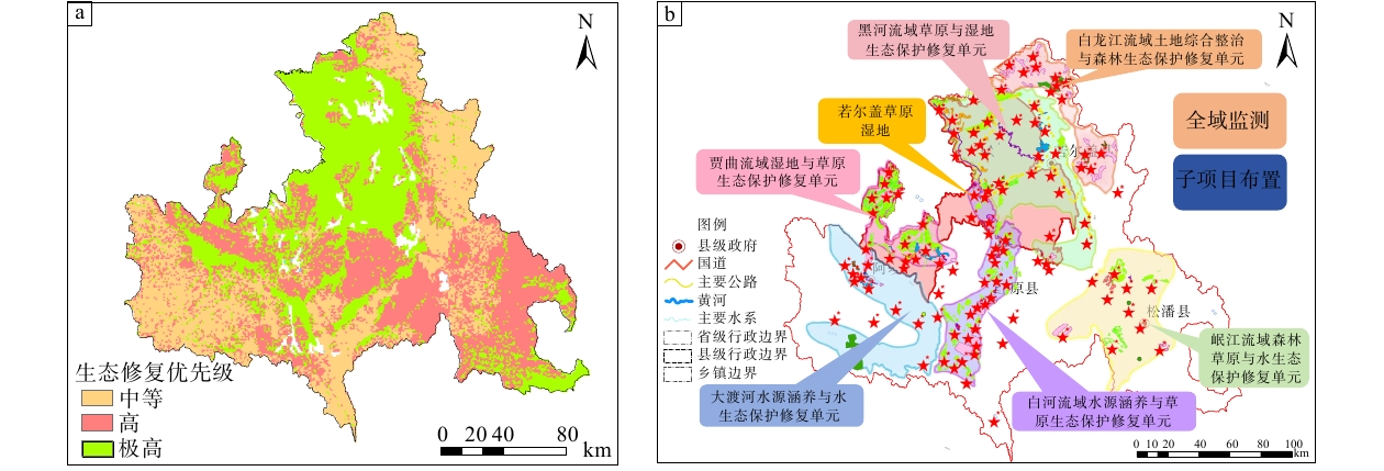
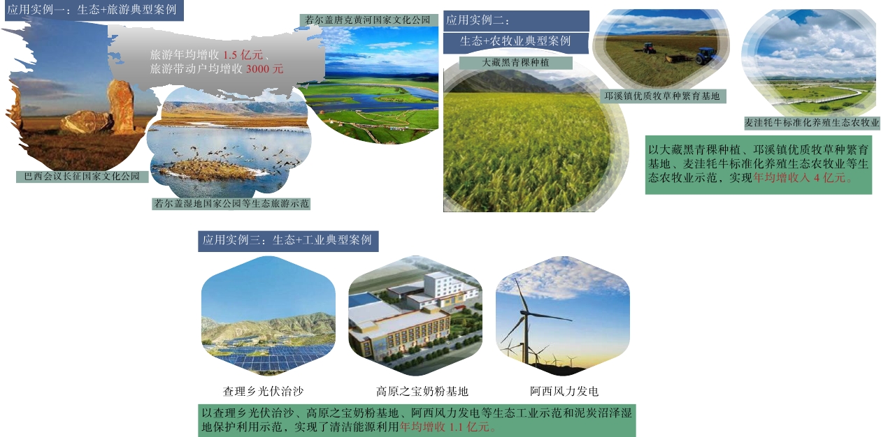
Ecological restoration in Zoige: technical framework and application under the Shan–Shui Initiative in China
XU Xiangning, XIANG Guoping
2026, 32(5): 1298-1316. doi: 10.12090/j.issn.1006-6616.2026111
Abstract (52) HTML (8) PDF (15620KB)(3)
Abstract:
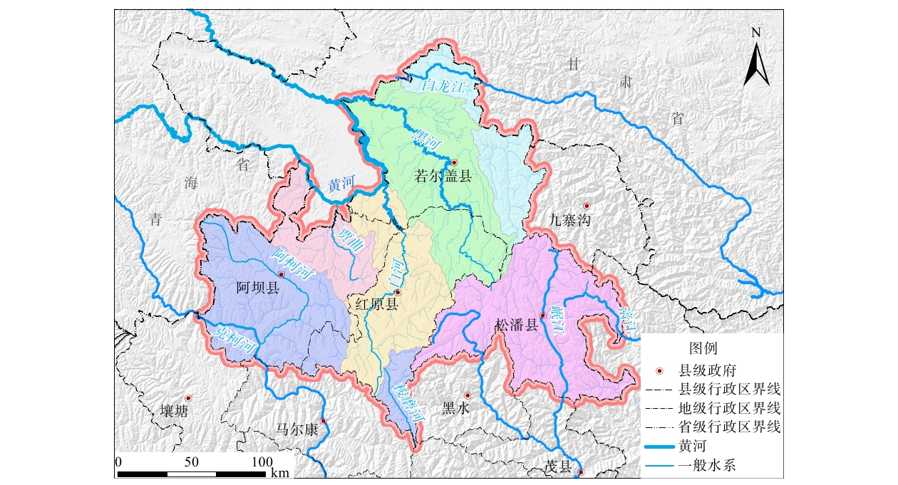
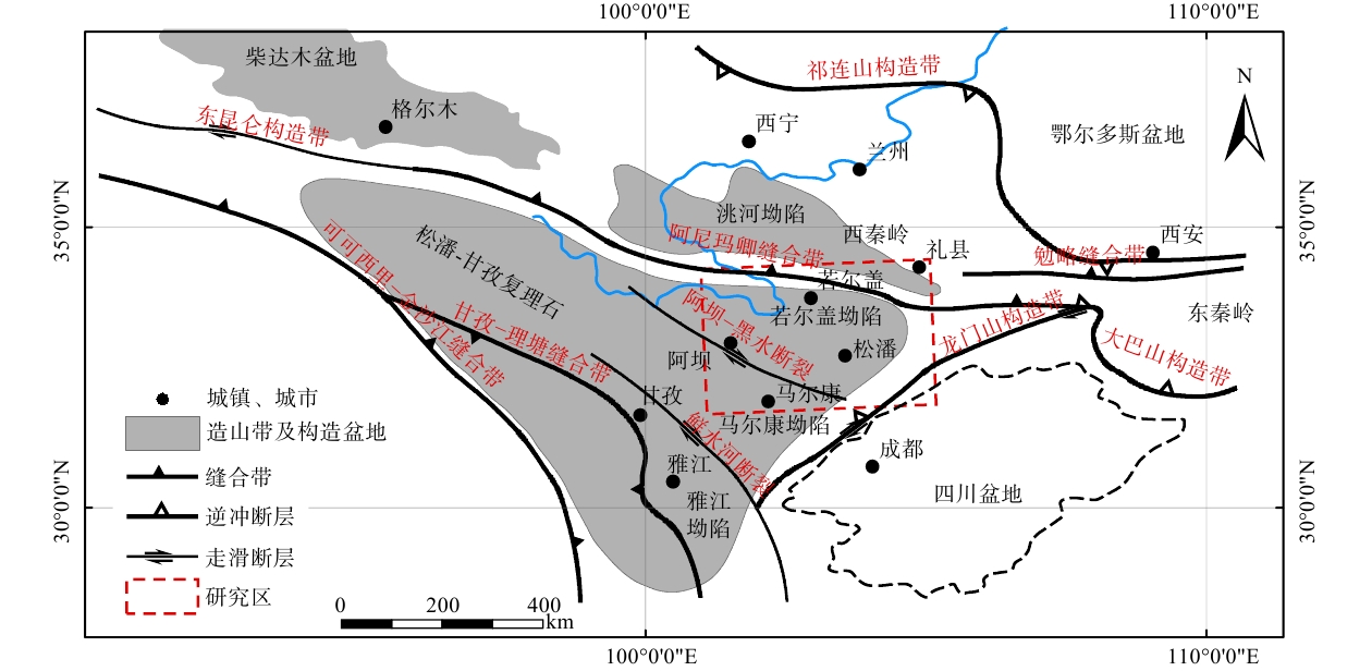
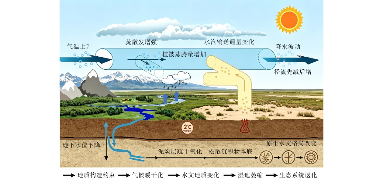
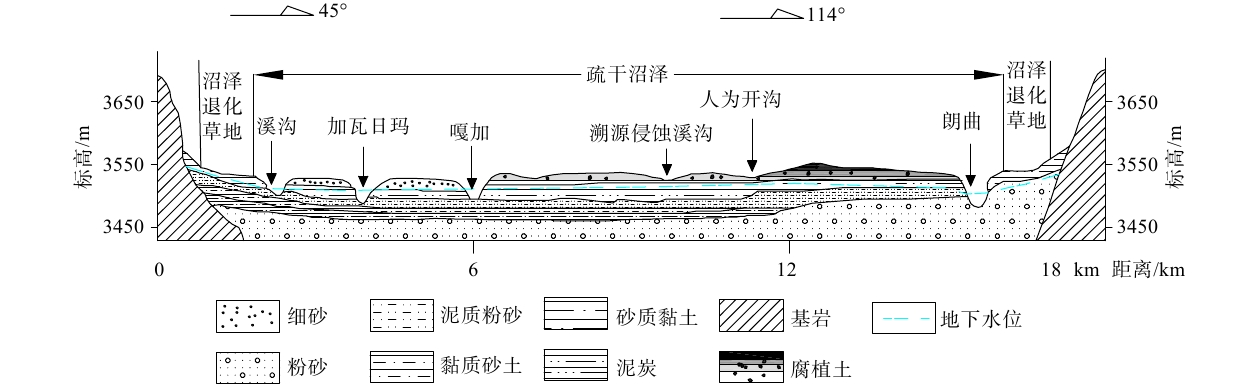
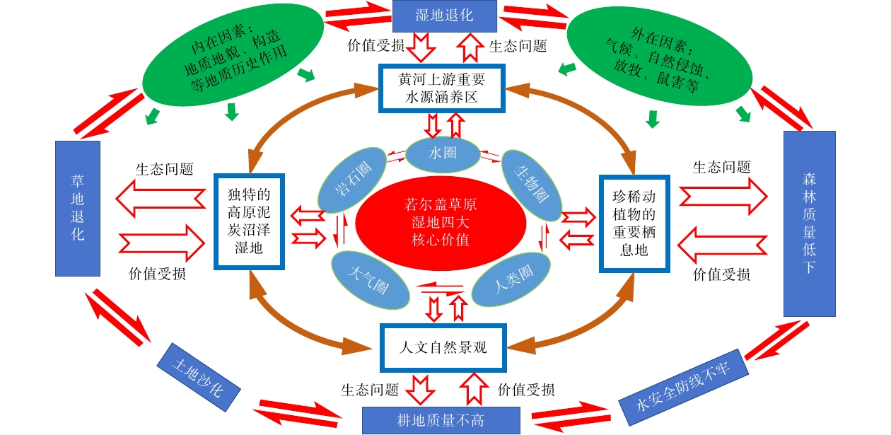
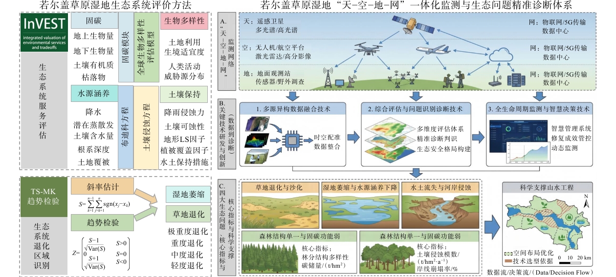
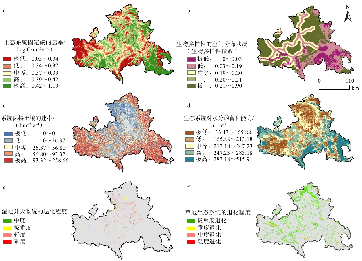
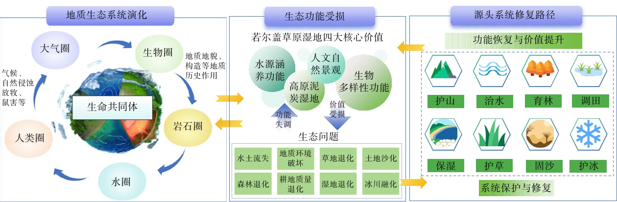
  Objective  The alpine grassland wetlands of Zoige face serious ecological problems, including wetland shrinkage and grassland desertification, which threaten their functions in water conservation, carbon storage, and biodiversity conservation. Focusing on the integrated protection and restoration of mountains, rivers, forests, farmlands, lakes, grasslands, and deserts in Zoige, this study reveals the evolutionary characteristics and laws of surface water–groundwater cycles in alpine ecological functional zones.   Methods  Through systematic field investigations, comprehensive evaluation, and scientific analysis, this study accurately identifies and diagnoses key geological–environmental and ecological problems in Zoige and elucidates their underlying causes.   Results  A theoretical and technical support system for integrated ecological restoration based on geo-ecosystem evolution is established. Technologies for identifying and diagnosing ecological problems and conducting life-cycle monitoring in high-altitude grassland wetlands are developed. In addition, a practical model for translating the Two Mountains Theory into practice is established, with an emphasis on leveraging the unique geo-ecological resources of Zoige and enhancing their value.  Conclusions  The research results fully support the ecological restoration of high-altitude grassland wetland ecosystems, and provide replicable technical paradigms for the systematic governance of alpine wetlands.  Significance  This study provides a basis for developing the theoretical and technical framework for ecological restoration in high-altitude, cold grassland wetlands.
Scientists' Spirit
The spirit of independent innovation: an exploratory study of Mr. J.S. Lee's scientific research traits
GAO Ping
2026, 32(5): 1317-1322. doi: 10.12090/j.issn.1006-6616.2026097
Abstract (3) HTML (1) PDF (543KB)(0)
Abstract:
Inside Front Cover
Inside Front Cover
2026, 32(5)
Abstract (2) PDF (9791KB)(1)
Abstract:
Inside Back Cover
Inside Back Cover
2026, 32(5)
Abstract (3) PDF (20485KB)(0)
Abstract: