Current Issue

2026 Vol. 32, No. 4

Cover
Cover
2026, 32(4)
Abstract (59) PDF (2211KB)(18)
Abstract:
Contents
Contents
2026, 32(4): 1-2.
Abstract (86) HTML (39) PDF (434KB)(88)
Abstract:
Tectonic System & Structural Geology
Deformation characteristics and 40Ar/39Ar geochronology of the Shili ductile shear zone at the northwestern margin of the Yunkai Block
GUO Shangyu, WU Xiangke, ZHAO Bing, LI Dan
2026, 32(4): 771-785. doi: 10.12090/j.issn.1006-6616.2025052
Abstract (158) HTML (29) PDF (6154KB)(62)
Abstract:
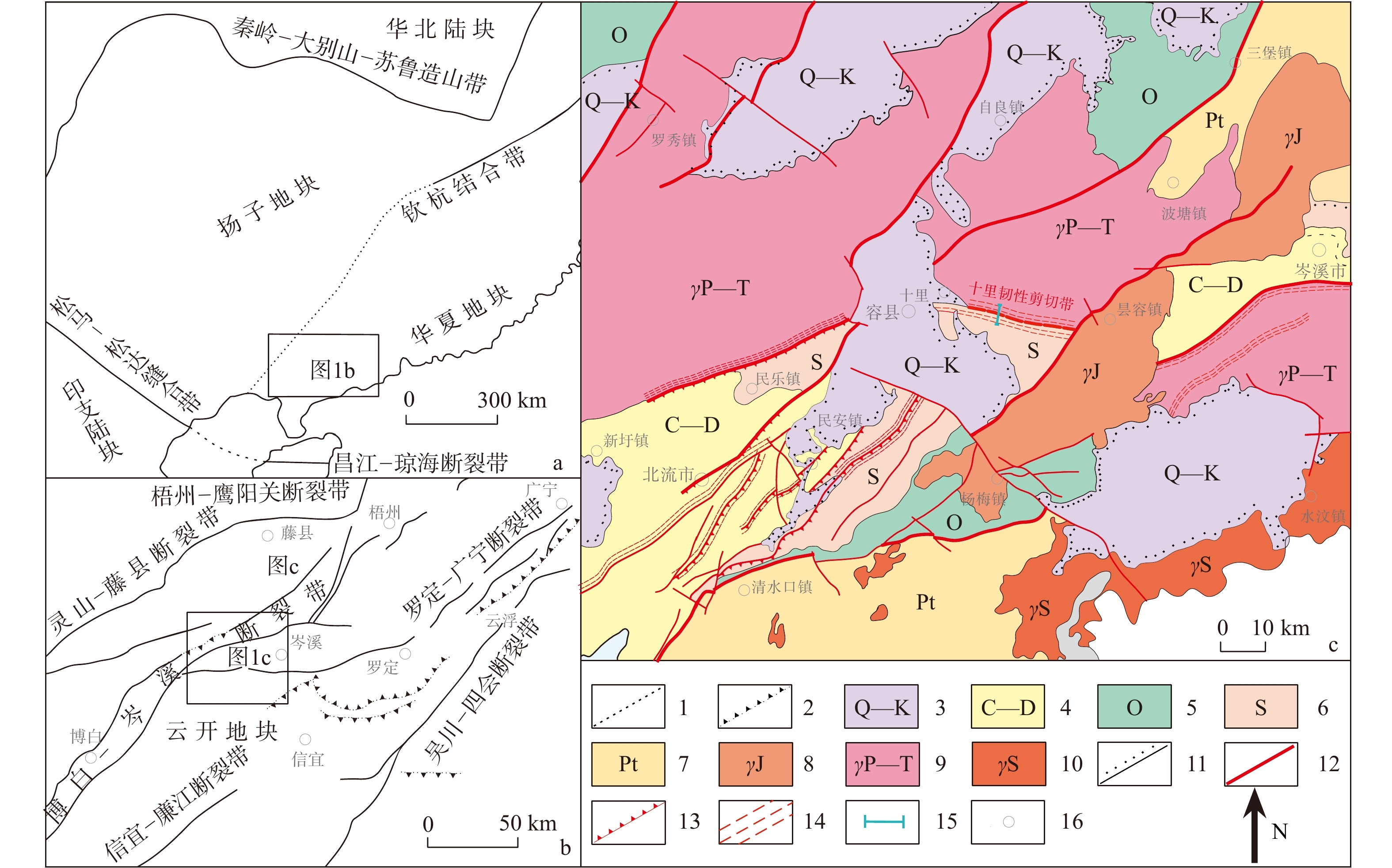
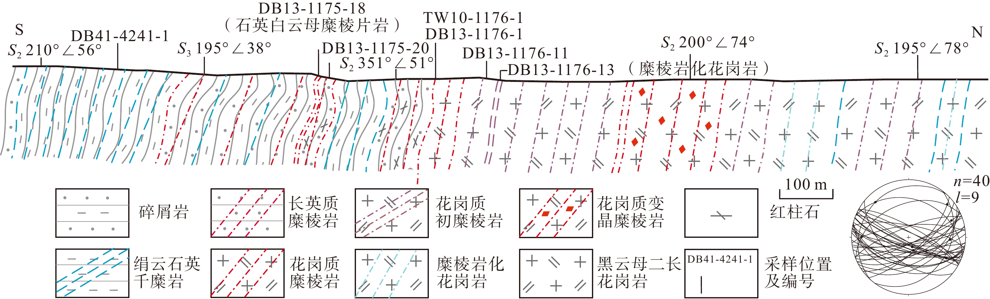
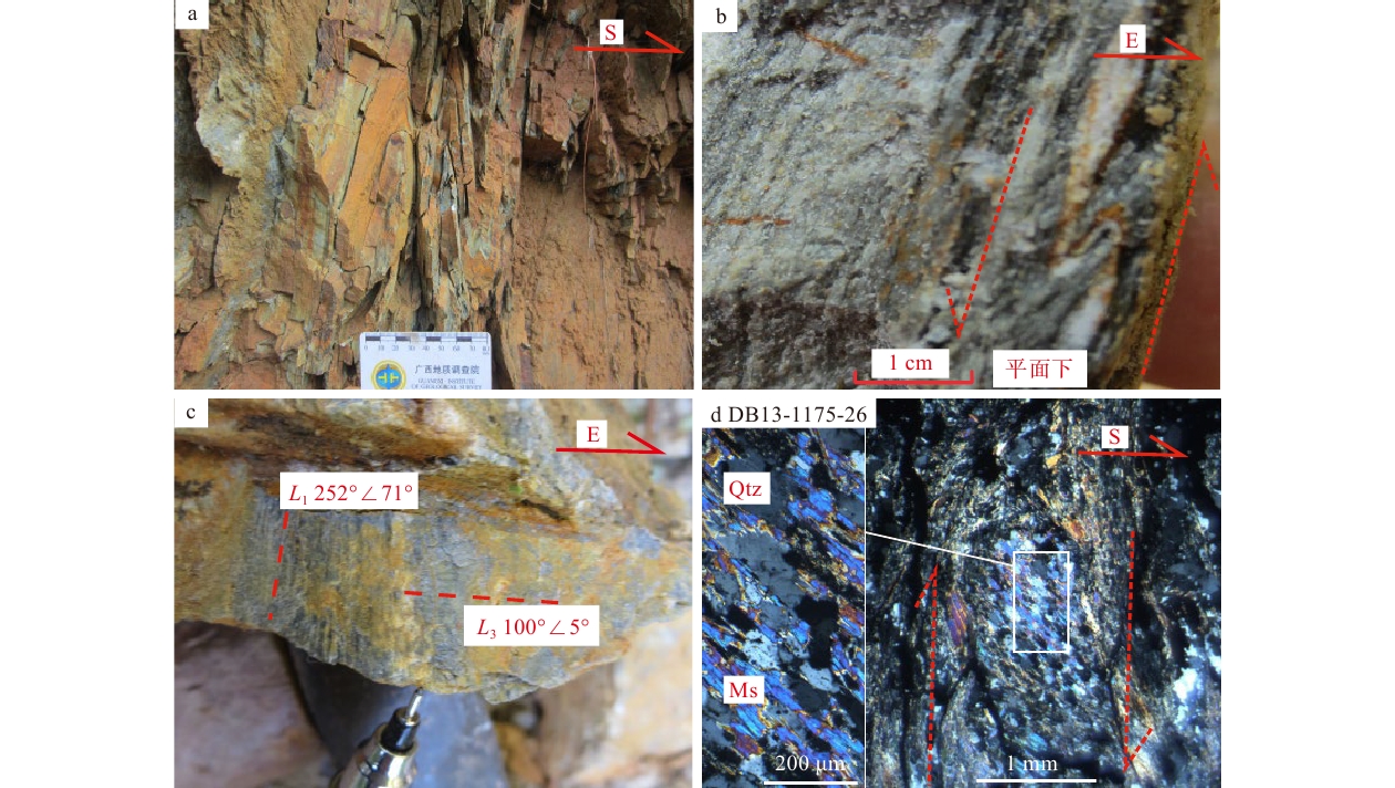
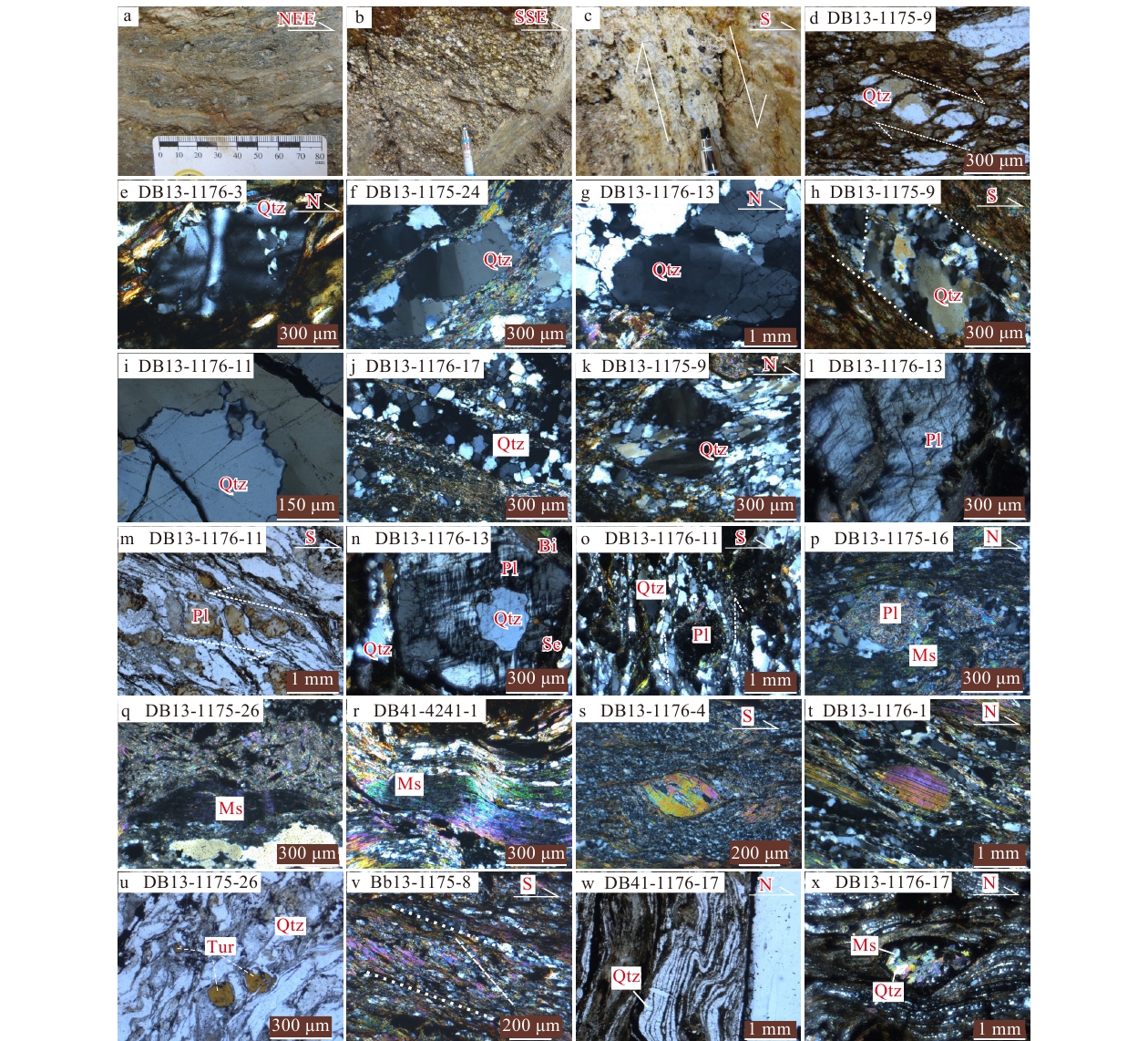
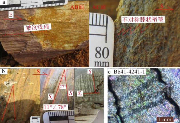
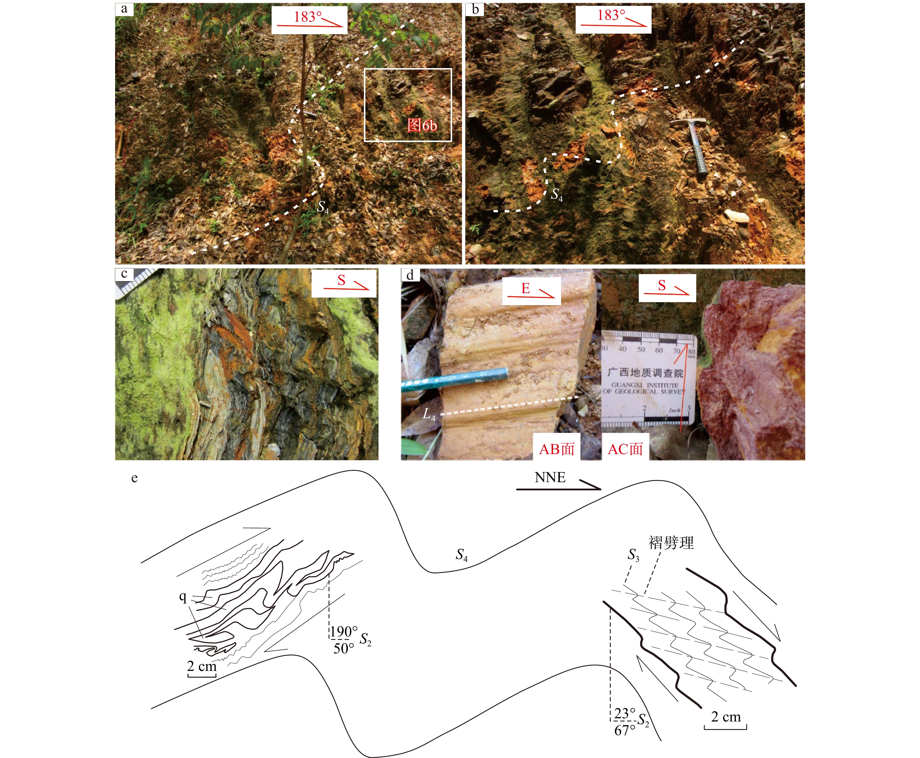
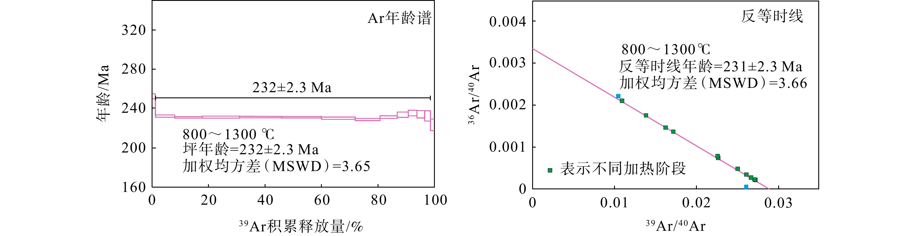
  Objective  The Yunkai Massif is one of the Precambrian metamorphic crystalline basements within the South China Block. To better understand the Indosinian deformation characteristics in the Yunkai area, the Shili ductile shear zone at the northwestern margin of the Yunkai Massif was selected for this study.  Methods  Through detailed field investigations, finite strain measurements, kinematic vorticity analyses, and 40Ar/39Ar geochronology, the structural characteristics and evolutionary process of the shear zone were constrained.   Results  The Shili ductile shear zone generally strikes WNW–ESE with NNE-directed thrusting. It has undergone four phases of deformation. Among which, the D2 to D4 deformations all indicate movement from SSW to NNE. D2 to D4 formed under a unified tectonic stress field, reflecting an evolution from ductile shear through brittle-ductile deformation to folding during the Late Triassic. Mylonites formed synchronously with the ductile shear deformation yield a muscovite 40Ar/39Ar plateau age of 232 ± 2.3 Ma (MSWD = 3.65). The Flinn index (K) is 0.06–0.77, the Lode parameter (ν) is 0.13–0.89, the Effective strain (Es) is 0.41–0.51, and the kinematic vorticity value (Wk) is 0.70–0.78. These parameters indicate a flattening-type strain regime dominated by general shear, with comparable contributions of pure shear and simple shear. The dynamic recrystallization of minerals suggests that the deformation environment reached the upper greenschist facies.  Conclusions  This study indicates that the mylonitization, crenulation cleavage development, and folding within the Shili ductile shear zone were dynamically driven by the propagation of far-field stress resulting from the NE–SW collision between the Indochina and South China blocks during the Indosinian period.   Significance  These findings provide critical constraints on the Indosinian tectono-thermal event and its geodynamic framework in South China.
Formation and modification of the Minle Basin in the Hexi Corridor: Insights into Cretaceous tectonic characteristics of the northeastern Tibetan Plateau
ADINA Alimu, ZHANG Beihang, YANG Yan, ZHAO Heng, JIANG Hai, LIU Yugang, DING Zhe
2026, 32(4): 786-805. doi: 10.12090/j.issn.1006-6616.2025154
Abstract (230) HTML (44) PDF (9189KB)(120)
Abstract:
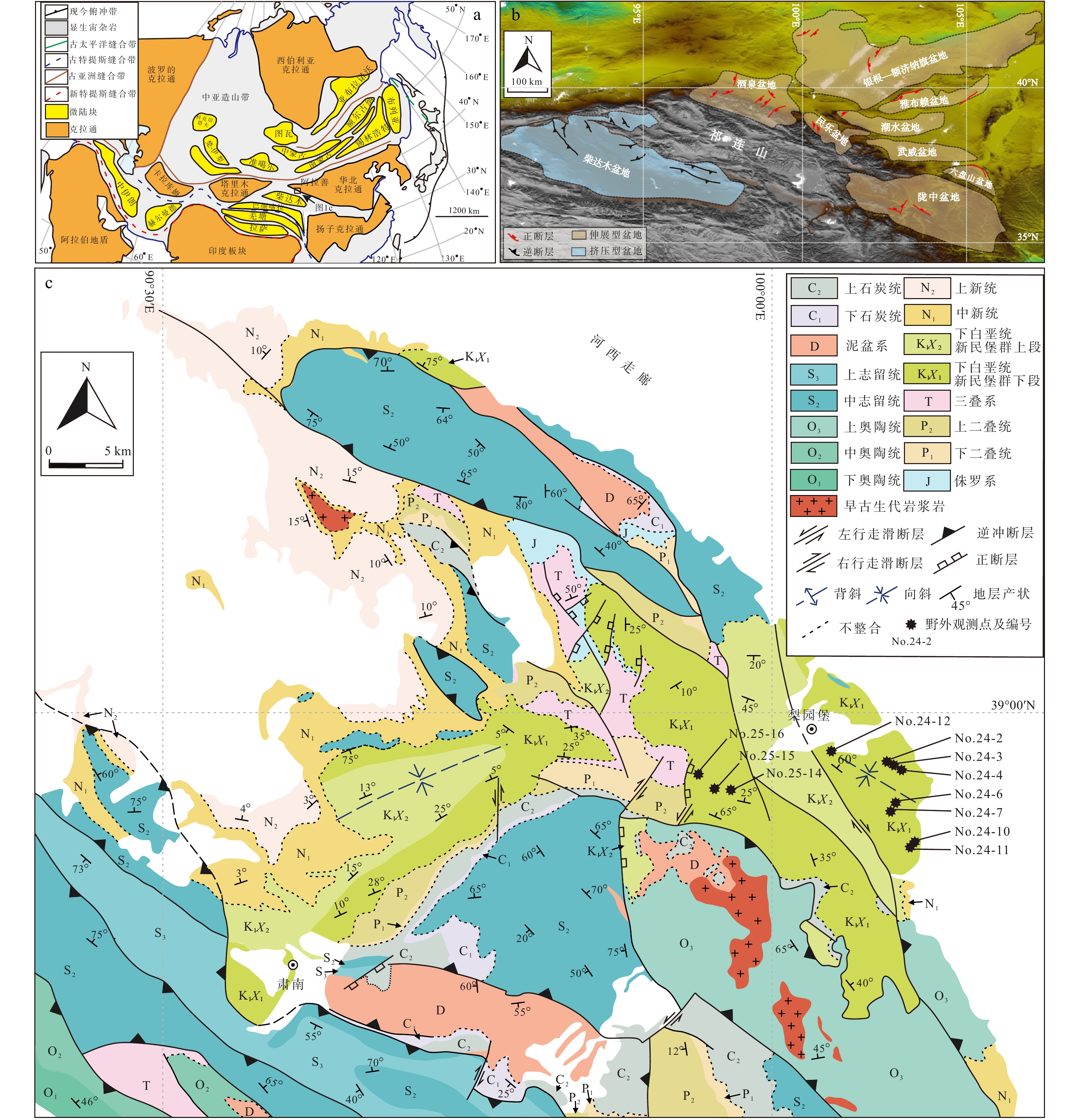
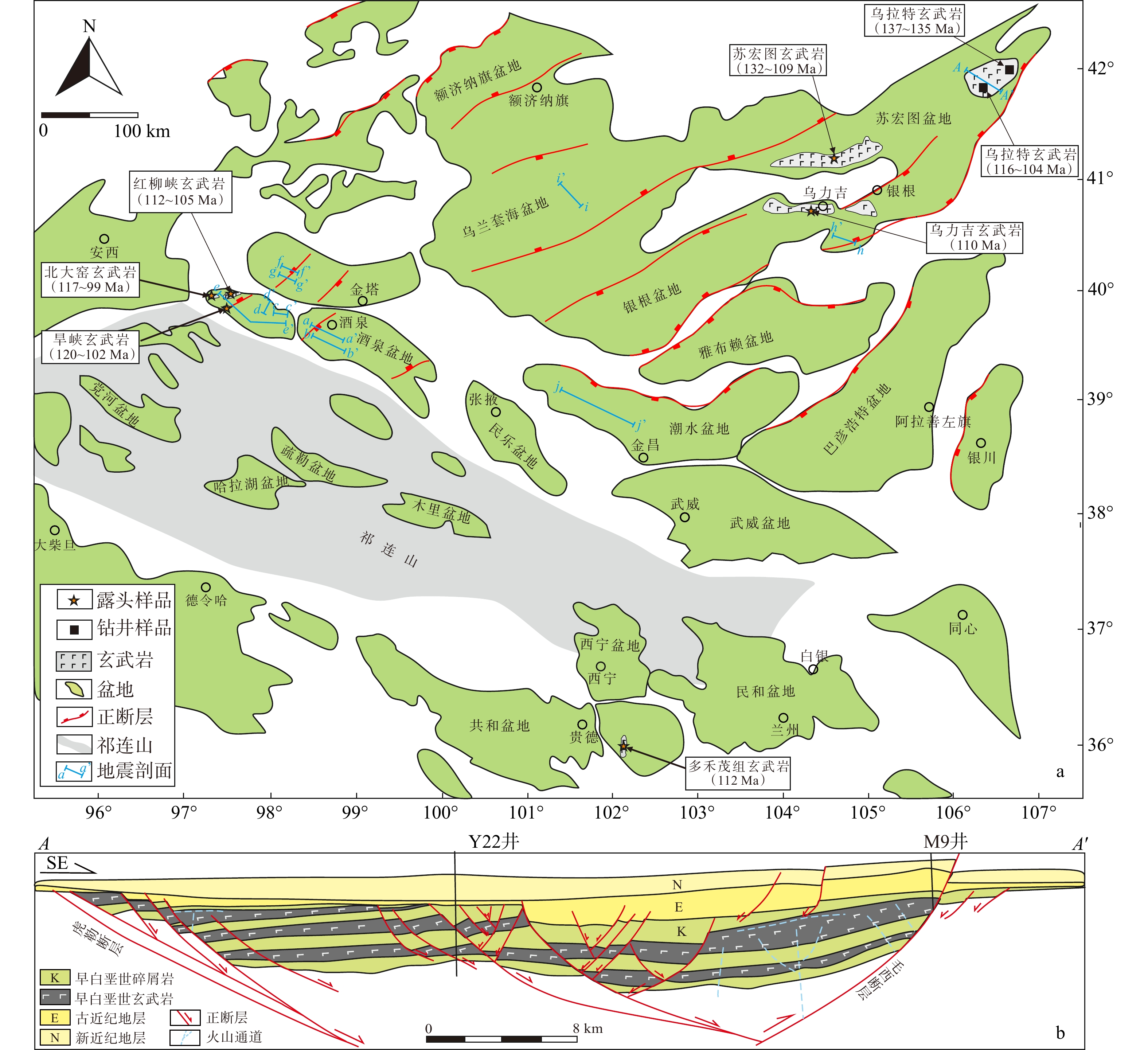
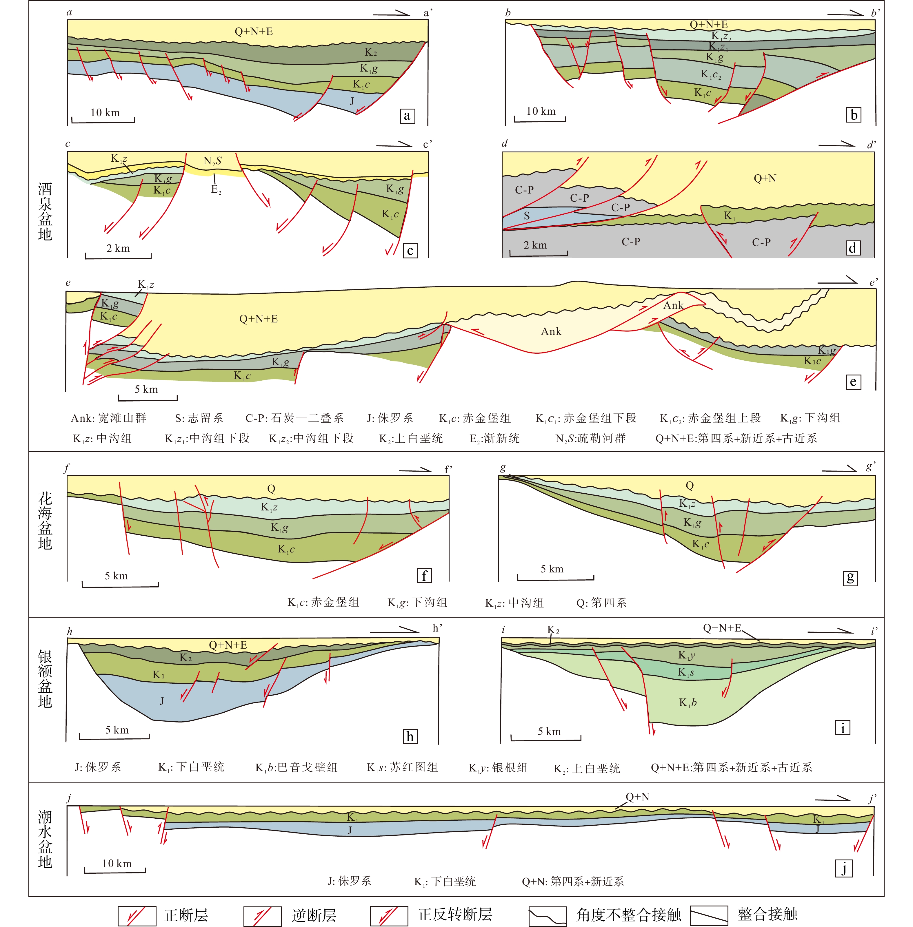
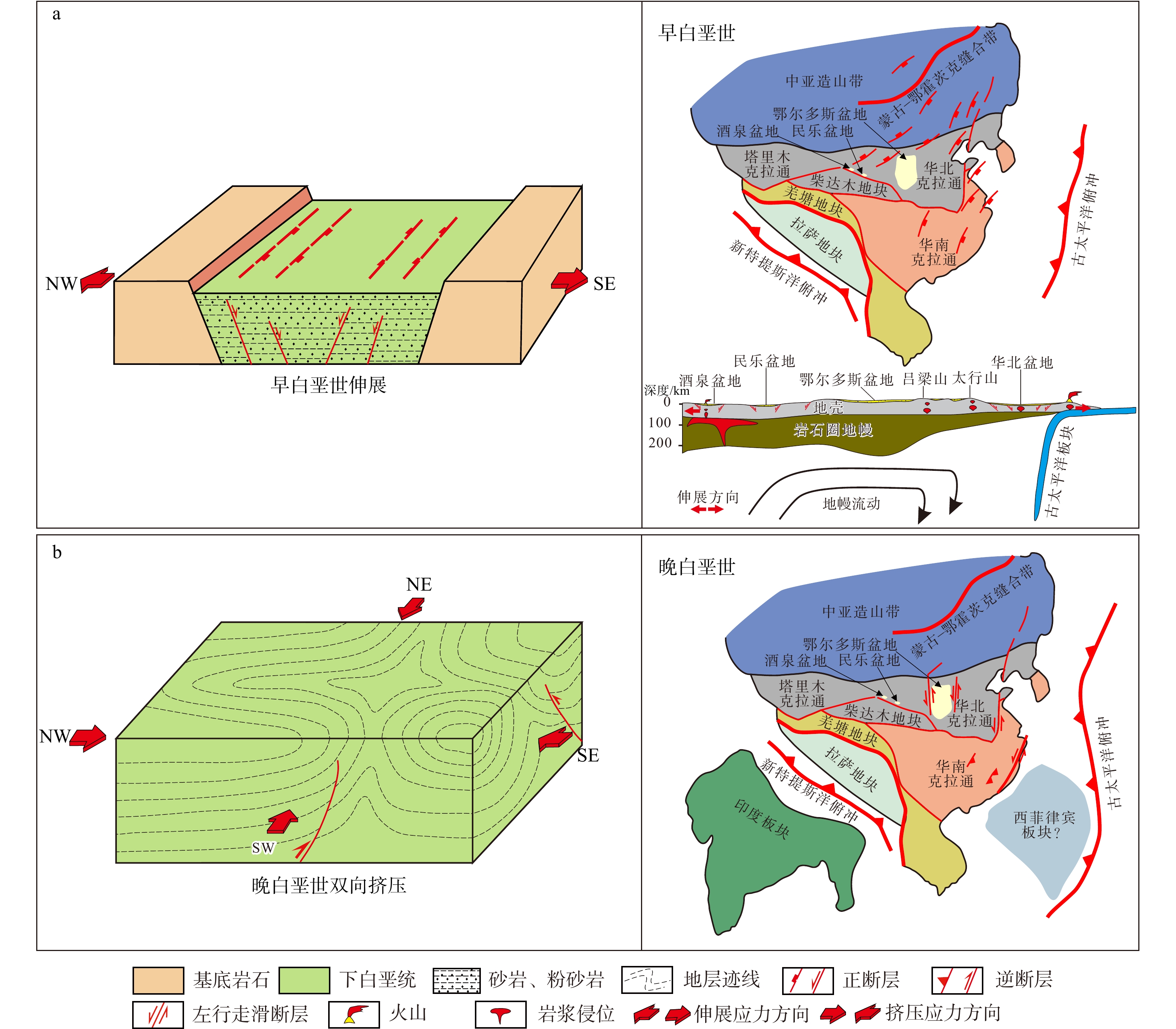
  Objective  A series of Early Cretaceous sedimentary basins developed in the Hexi Corridor along the northeastern margin of the Tibetan Plateau. These basins preserve critical records of the regional pre-Cenozoic tectonic evolution, forming the basis for understanding the Cenozoic growth mechanism of the Tibetan Plateau. However, the nature of these Early Cretaceous basins remains controversial, impeding a clear understanding of the late Mesozoic tectonics in this critical area.   Methods  Focusing on the Minle Basin in the central Hexi Corridor, this study carried out systematic field structural investigations and paleo-stress reconstructions. Through detailed structural analysis, the formation and post-depositional modification processes of the Minle Basin were re-evaluated.   Results  Our investigation reveals that the Lower Cretaceous strata in the Minle Basin are characterized by abundant syn-sedimentary normal faults with initial nearly N-S strikes, indicating that the basin was an extensional fault basin controlled by E-W-directed extension during the Early Cretaceous. Subsequent deformation is represented by two sets of folds with NE-SW and NW-SE axial trends, together with shortening structures in Lower Cretaceous rocks, revealing that the basin underwent bidirectional (NE-SW and NW-SE) horizontal shortening during the Late Cretaceous.   Conclusions  The Early Cretaceous extension in the Minle Basin was consistent with the widespread extensional deformation and extensional stress direction across East Asia during this period, resulting from the slab rollback of the Paleo-Pacific Plate and associated mantle flow. The bidirectional Late Cretaceous shortening resulted from the superimposition of the remote effects of simultaneous compression events in the Tethys and Pacific tectonic domains, respectively, along the southern and eastern margins of the Eurasian Plate. [ Significance ] The deformation characteristics demonstrate that the influence of the subduction of the Paleo-Pacific Plate extended westward to at least the Hexi Corridor and the northern margin of the Tibetan Plateau.
Fractal characteristics of karst geology in large-scale thrust-nappe tectonic settings
SHI Xiaodi, YAO Jianxin, ZHAO Biyi, YAO Dan, KUANG Li
2026, 32(4): 806-816. doi: 10.12090/j.issn.1006-6616.2025039
Abstract (118) HTML (29) PDF (1130KB)(70)
Abstract:
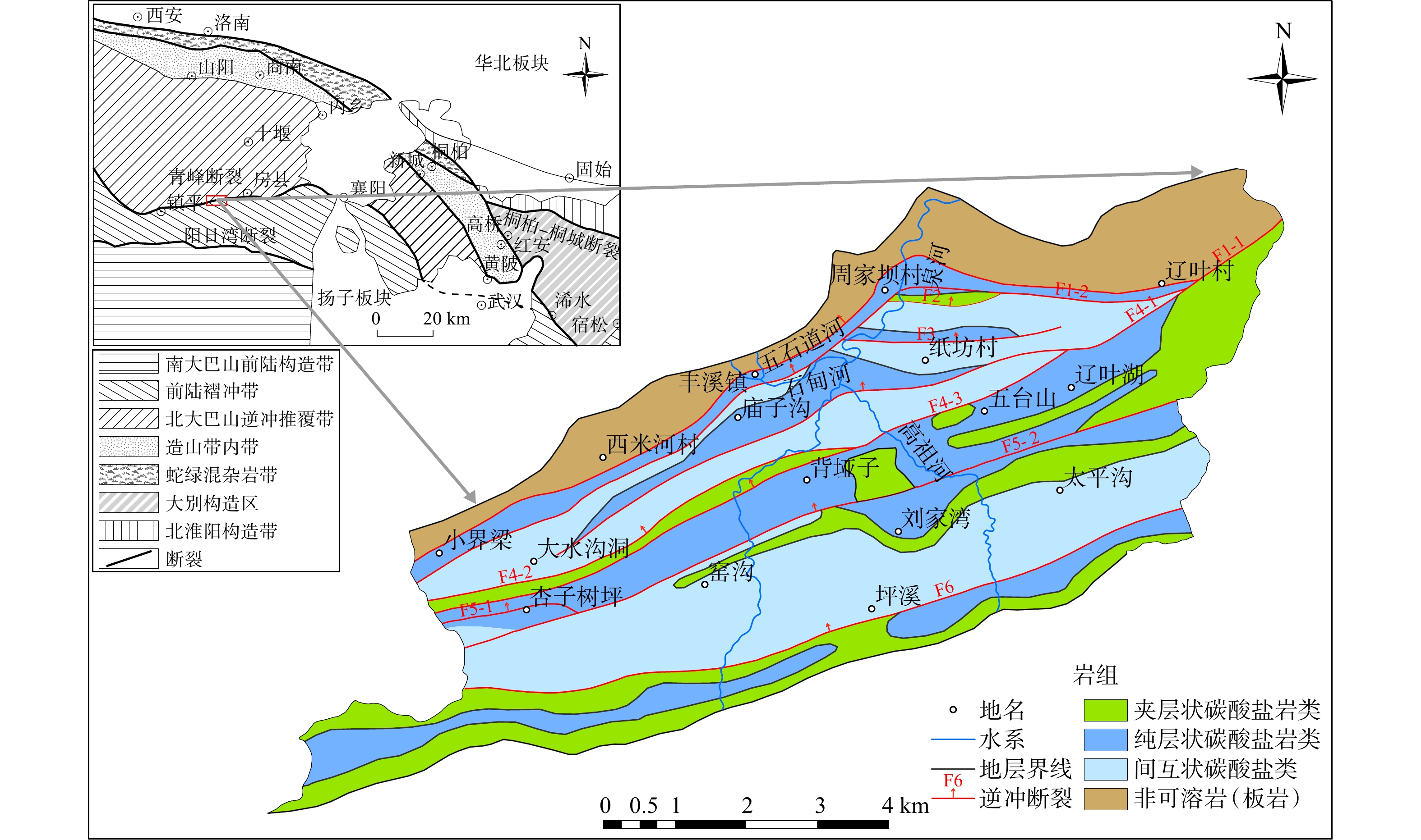
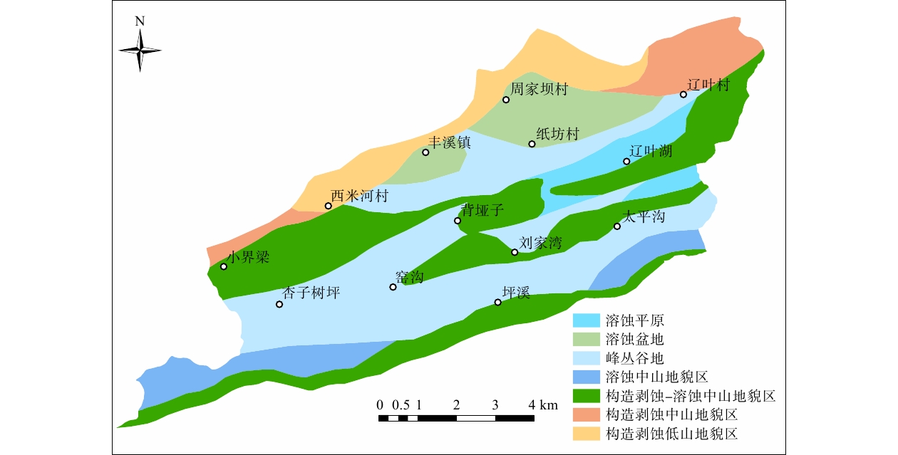
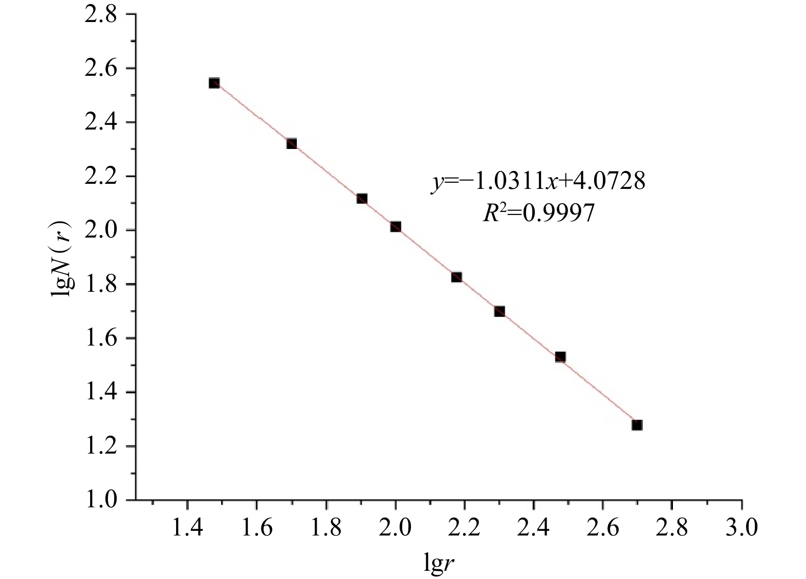
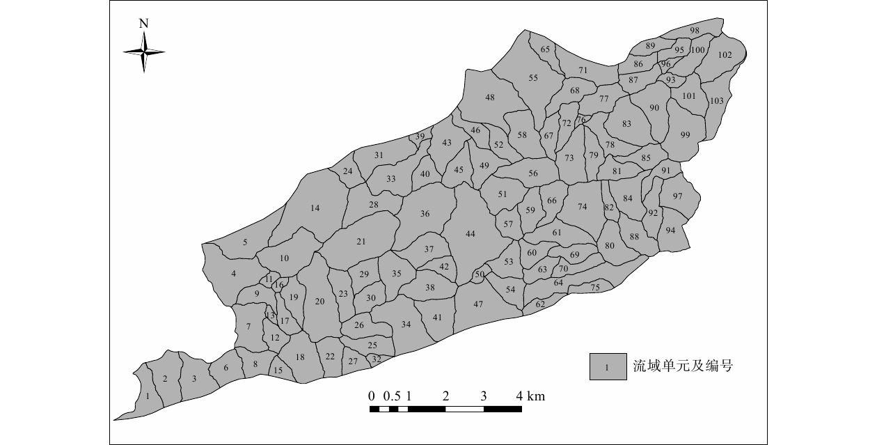
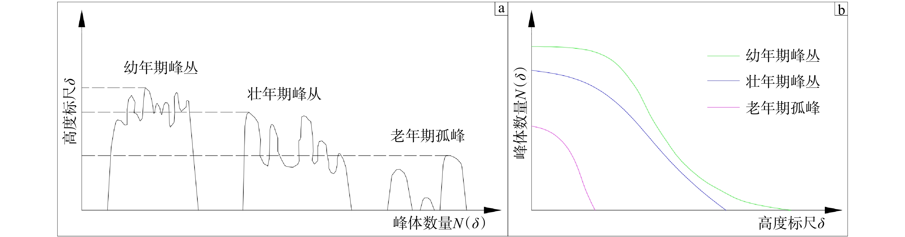
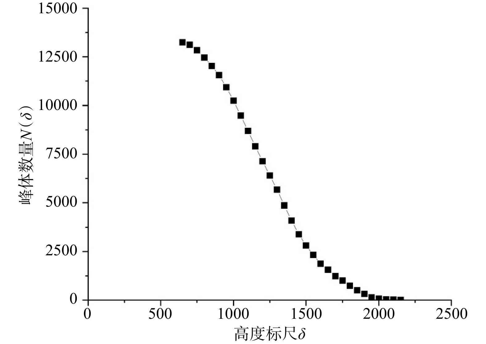
  Objective  Large-scale thrust-nappe structures have a significant impact on the regional geological environment and are important factors controlling the development of karst systems. Quantitative analysis of karst geological fractal characteristics in such settings provides essential scientific insights into the nonlinear behavior of complex karst systems.  Methods  Focusing on the karst region along the Qingfeng fault zone, the box-counting dimension method of geological fractal theory was used to quantify key geological elements. We evaluated the fractal characteristics across both regional scales and watershed units to determine their fractal dimensions and scaling properties.  Results  The stratigraphic boundaries at both regional and watershed scales exhibit pronounced fractal characteristics. Karstification significantly enhances boundary complexity, leading to higher fractal dimensions in areas with more advanced karst development. Furthermore, thrust-nappe structures and tectonic movements strongly influence drainage network fractals, modifying the conventional spatial mapping between surface and groundwater systems. The fractal dimensions of surface drainage systems show a positive correlation with those of subsurface karst drainage systems. Peak landforms in the study area exhibit youth-stage peak-cluster characteristics, indicating an early stage in the regional karst geomorphic cycle.  Conclusions  Karst in the region exhibits fractal characteristics, and the peak evolution follows the three-stage patterns common in karst areas. Surface and groundwater systems have positively correlated fractal patterns, and stratigraphic boundary dimensions serve as a robust indicator of karst development intensity.   Significance  Clarifying the self-similarity of karst in thrust-nappe tectonic zones provides a quantitative reference and theoretical basis for assessing the relationships between faulting, karst distribution, and evolutionary dynamics, offering a valuable methodological approach for addressing similar karst geological issues.
Crustal Stress & Tectonic Stress Field
Tectonic stress field characteristics in Wushi, Xinjiang, and the stress impact of the M 7.1 Wushi earthquake
SONG Zeyao, WAN Yongge, GU Peiyuan, ZHOU Mingyue
2026, 32(4): 817-828. doi: 10.12090/j.issn.1006-6616.2025085
Abstract (513) HTML (96) PDF (6970KB)(576)
Abstract:
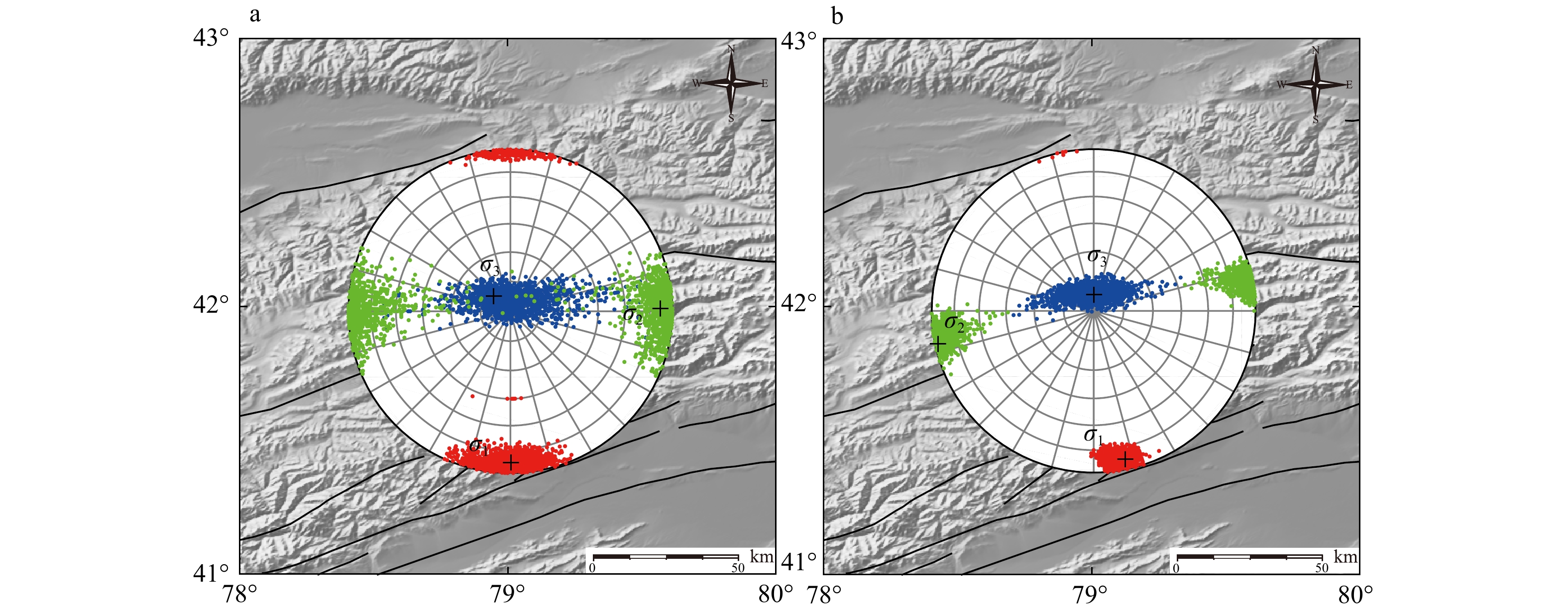
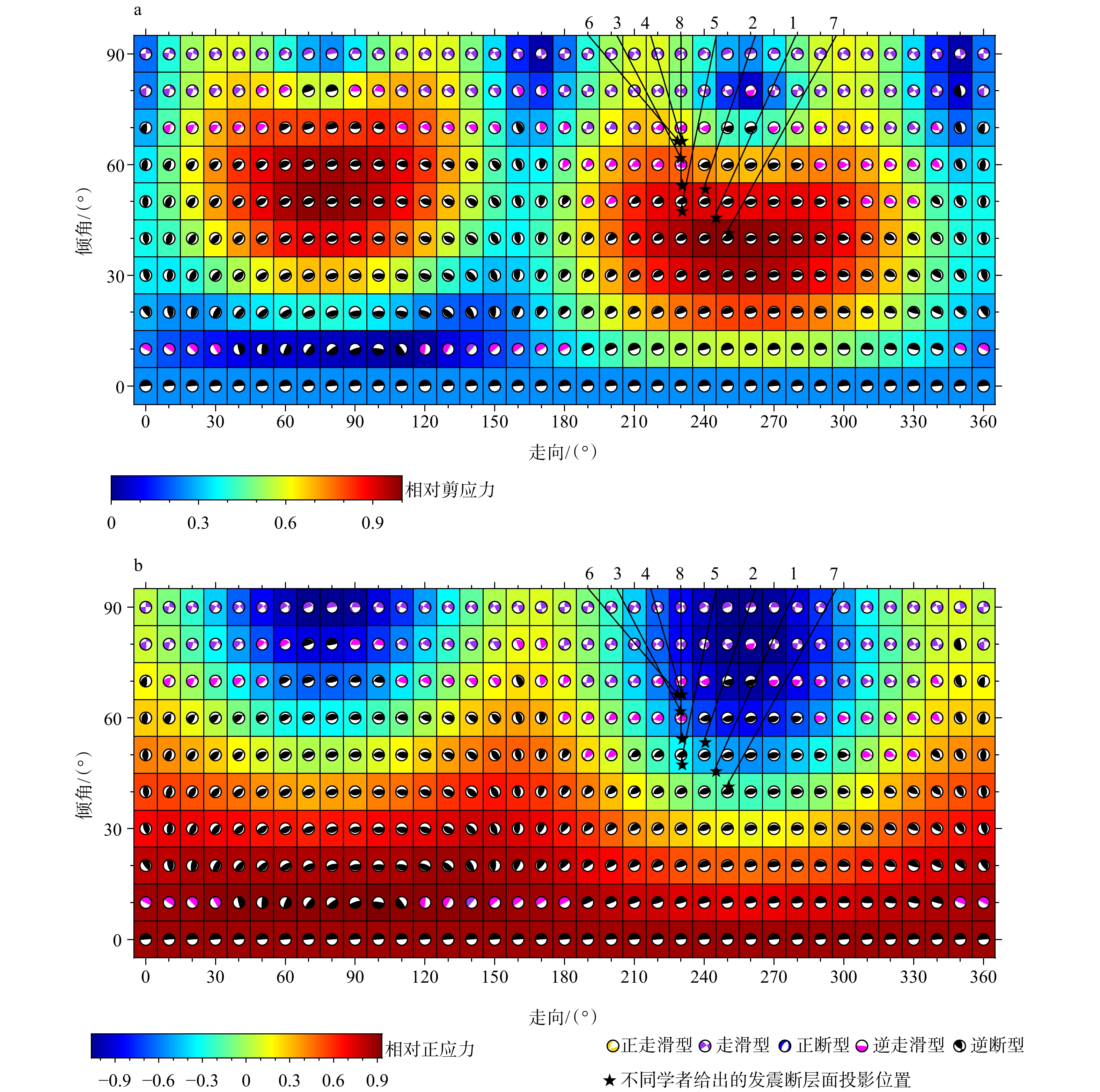
  Objective  The Wushi region in Xinjiang is located at the intersection of multiple tectonic units, characterized by frequent tectonic activity, making it a critical region for stress concentration and release. On January 23, 2024, an M 7.1 earthquake struck Wushi (epicenter: 41.26°N, 78.63°E; depth: 22 km), representing the largest event in this area over the past decade. To better understand the regional seismogenic environment and assess future seismic hazards, this study utilizes comprehensive focal mechanism data to investigate the regional tectonic stress field and quantitatively evaluate the impact of the M 7.1 Wushi earthquake on the stress regime.   Methods  Based on 148 focal mechanism solutions (January 1976 to March 2025) compiled from multiple domestic and international institutions, we applied the damped stress tensor inversion method to determine the stress field characteristics across subregions and systematically evaluate changes in the stress field before and after the earthquake.   Results  Stress tensor inversion reveals that the Wushi region is dominated by a compressional stress regime under N–S compression. Except for the area near the Jiashi earthquake cluster where R > 0.5, the azimuth of the maximum principal compressive stress (σ1) gradually rotates from NNW in the south to approximately N–S in the north (azimuth range: 168.75°–183.45°; plunge range: 6.85°–19.58°). The Jiashi seismic cluster exhibits a strike-slip stress regime characterized by NNE–SSW compression and NWW–SEE extension, with thrust faulting dominating to its north and strike-slip faulting to its south. Comparative analysis shows that the optimal σ1 direction adjusted from an azimuth/plunge of 178.91°/6.24° before the earthquake to 167.61°/7.98° after the earthquake, corresponding to an azimuth deviation of 12.53° and a total spatial rotation of 15.06°. This indicates that the mainshock exerted a relatively minor impact on the regional stress field, which remains under the dominant compressional regime.   Conclusions  The tectonic stress field in the Wushi region is driven by the northward collision of the Indian plate against Eurasia, which transmits near-N–S horizontal compression northeastward into the Tianshan orogenic belt, causing crustal shortening and thrusting between the Tarim Basin and the Tianshan Mountains. The M 7.1 earthquake caused only localized adjustments, leaving the overall regional stress regime controlled by deep-seated tectonic processes. Furthermore, the northern Jiashi earthquake cluster, located at the boundary between the northern Tarim plate and the Tianshan Mountains, exhibits a strike-slip stress mechanism, marking a major tectonic transition zone between the Tarim Basin and the Tianshan orogenic belt.   Significance  This study provides a refined characterization of the tectonic stress field in the Wushi region and clarifies the limited impact of the M 7.1 mainshock on regional stress states. These findings deepen our understanding of the tectonic interactions between the Tianshan orogenic belt and the Tarim Basin, providing critical scientific constraints for regional tectonic segmentation and seismic hazard assessment.
Mechanical property prediction and 3D modeling via statistical regression and prestack inversion: a case study from the Bonan Sag
WANG Bin, XIAO Han, NIU Xuemin, ZHANG Ruixuan, GE Xing
2026, 32(4): 829-841. doi: 10.12090/j.issn.1006-6616.2025084
Abstract (297) HTML (64) PDF (4282KB)(378)
Abstract:
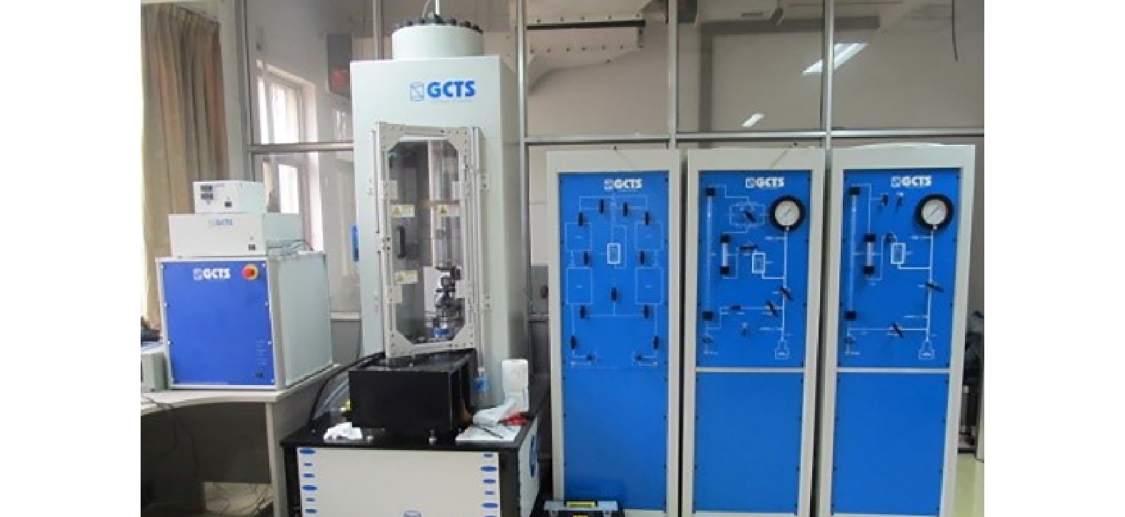
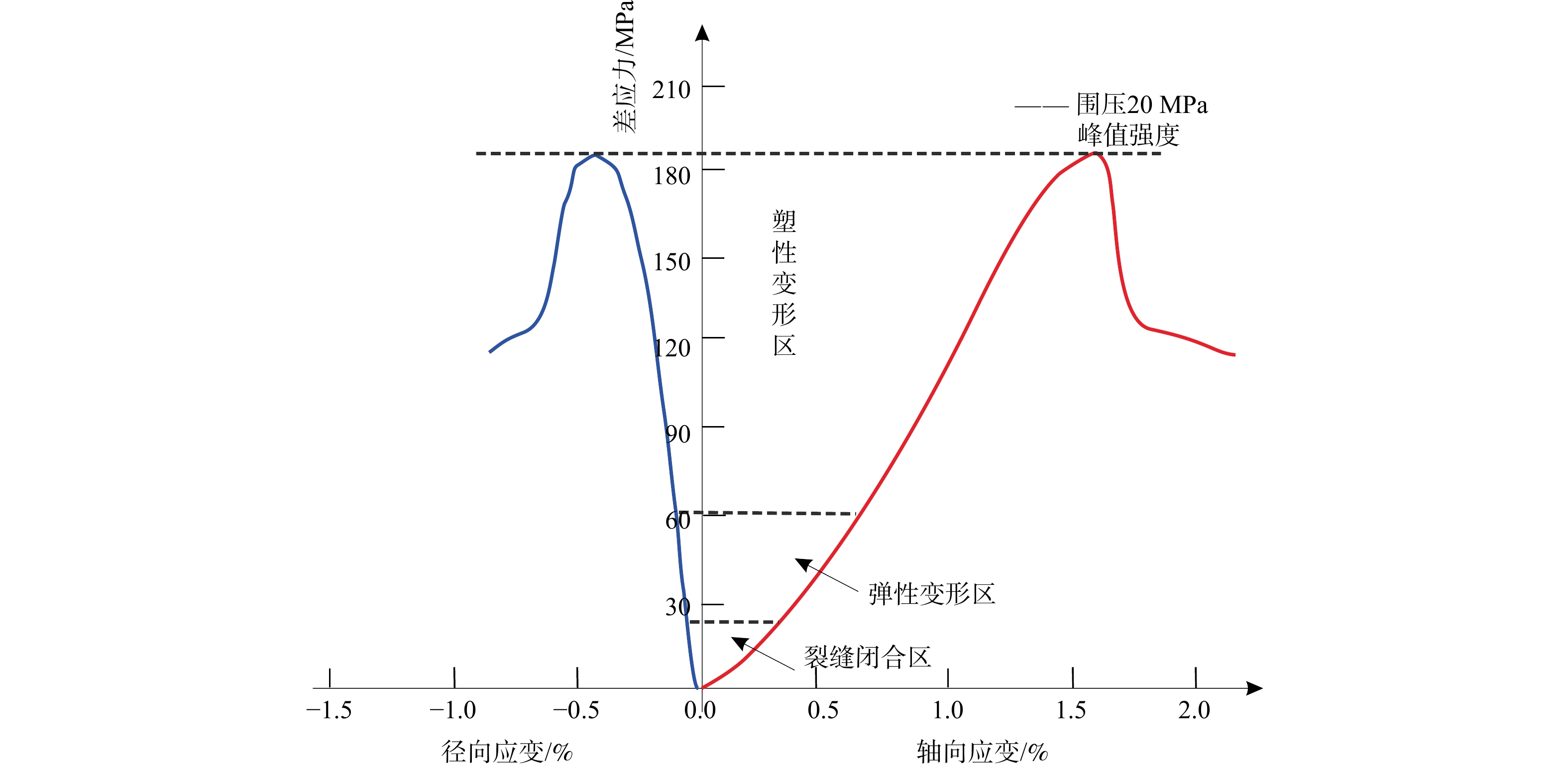
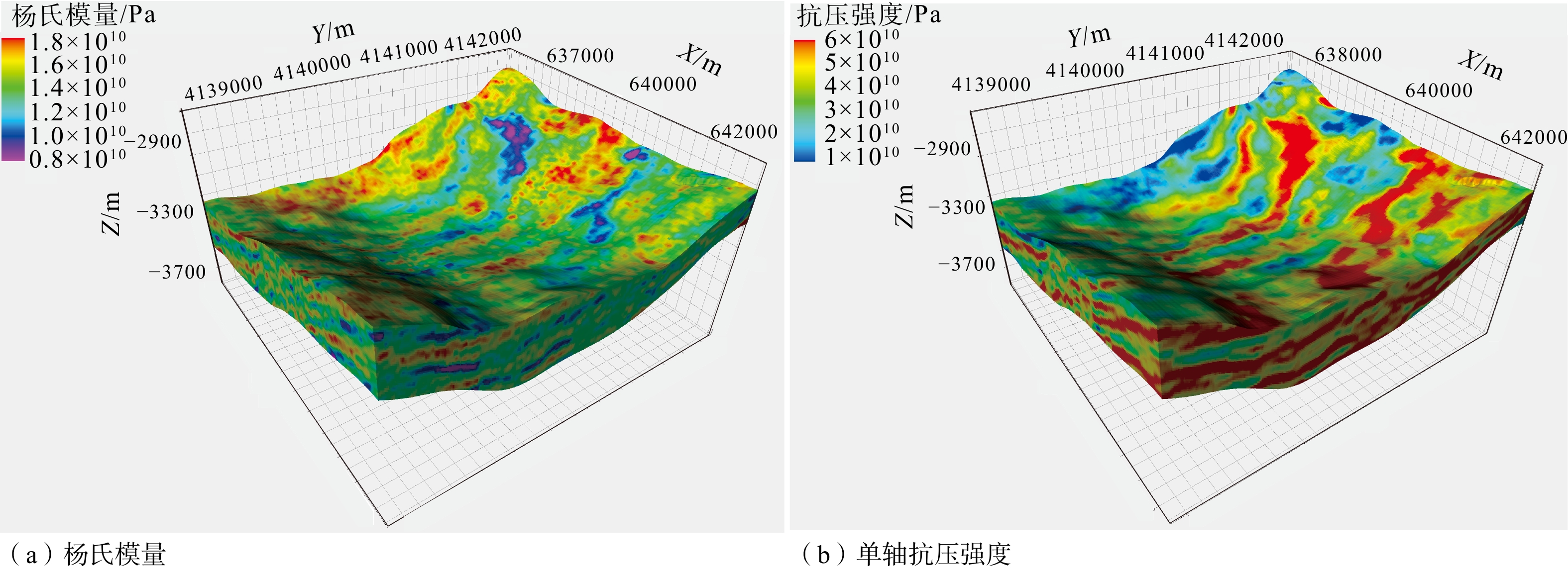
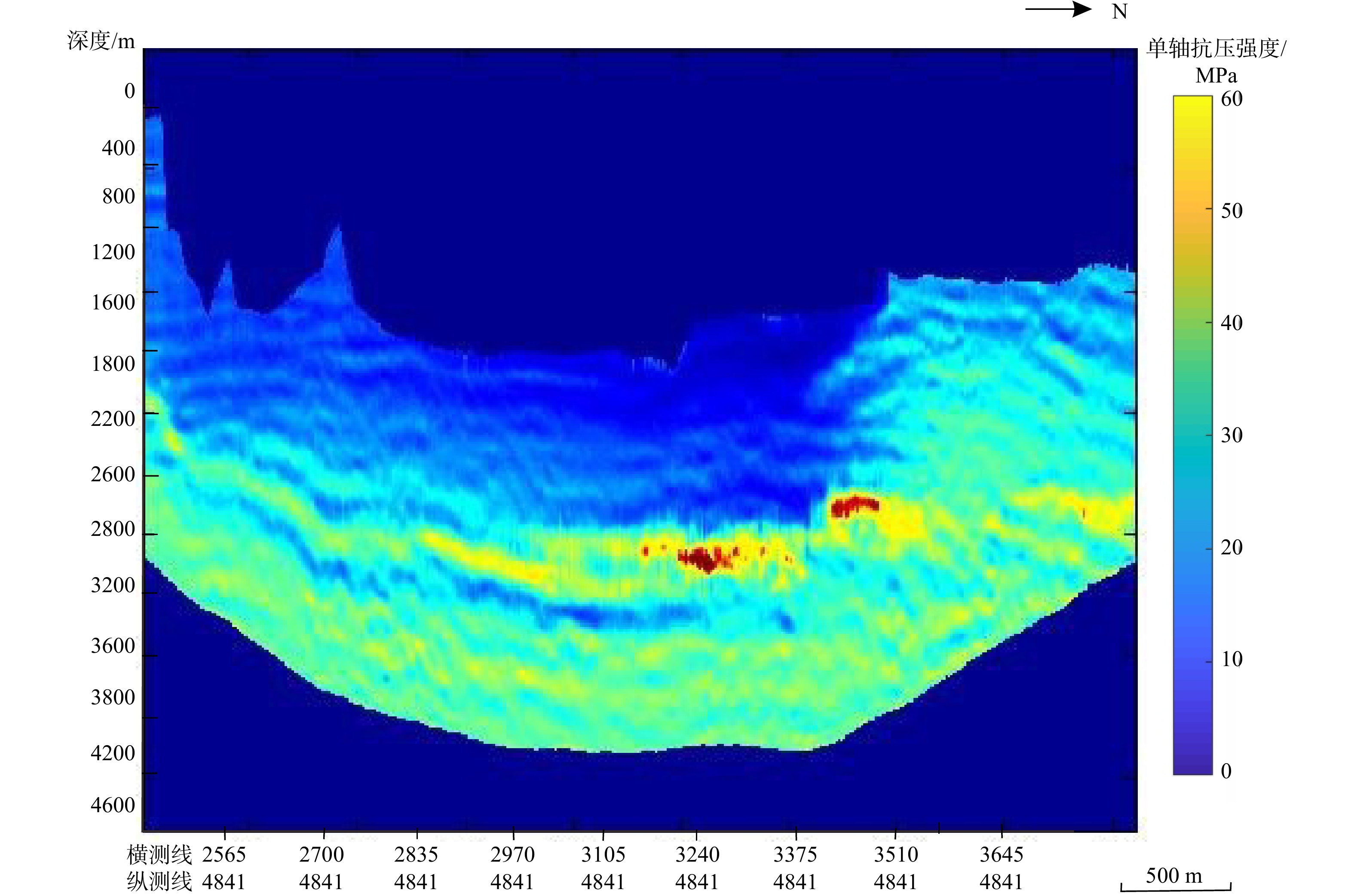
  Objective  Unconventional oil and gas development is frequently hindered by complex reservoir structures and unquantified rock mechanical properties. To optimize horizontal well trajectories and hydraulic fracturing designs—thereby expanding the stimulated reservoir volume, mitigating casing deformation risks, and ensuring efficient production—high-resolution rock mechanical models are essential. This study proposes an integrated workflow combining statistical regression and 3D prestack seismic inversion to accurately characterize the vertical and lateral variations of rock mechanical parameters in target zones.  Methods  Using core test results and well log data, quantitative empirical relationships were established between elastic attributes and rock mechanical properties. A 3D prestack seismic inversion was subsequently performed using integrated drilling and seismic datasets to extract precise elastic parameters, including compressive wave velocity, bulk density, Poisson's ratio, and Young's modulus.  Results  The workflow was applied to tight glutenite reservoirs in the Bonan Sag, yielding three key findings: (1) Young's modulus demonstrated a strong correlation (e.g., R2 > 0.75) with Uniaxial Compressive Strength (UCS) . In these low-porosity glutenites, rock mechanics are primarily governed by lithology and gravel content rather than burial depth, justifying a unified prediction model. (2) By integrating well logging and a time-depth velocity field, a depth-domain structural framework was established. Attribute extraction and property modeling generated a continuous 3D volume of rock mechanical parameters, bridging the spatial gaps inherent in discrete log and core measurements. (3) The resulting 3D mechanical volume provides critical input for hydraulic fracturing optimization. It enables precise profiling along horizontal wellbores, rational stage and cluster spacing, pumping parameter optimization, and improved fracture conductivity, thereby maximizing single-well productivity.  Conclusions  Integrating prestack seismic inversion with statistical regression offers a robust approach for 3D geomechanical characterization in heterogeneous tight glutenites. This methodology successfully bridges the gap between petrophysics and seismic geophysics, resolving key uncertainties in complex unconventional plays.  Significance  This study provides a practical and scalable framework for predicting 3D rock mechanical properties. The findings offer a reliable data foundation for defining mechanical boundaries and optimizing stimulation treatments in heterogeneous unconventional reservoirs.
Energy Resources Geology
Evaluation of hydrocarbon source rocks and oil-source correlation of the Chang 7 and Chang 6 Members of the Yanchang Formation in the Jingbian area, Ordos Basin
TANG Siwei, XUE Hui, TANG Youjun, WANG Shumin, HU Guangming, LI Geng, SHI Fangtingyu
2026, 32(4): 842-860. doi: 10.12090/j.issn.1006-6616.2025050
Abstract (292) HTML (62) PDF (2679KB)(297)
Abstract:
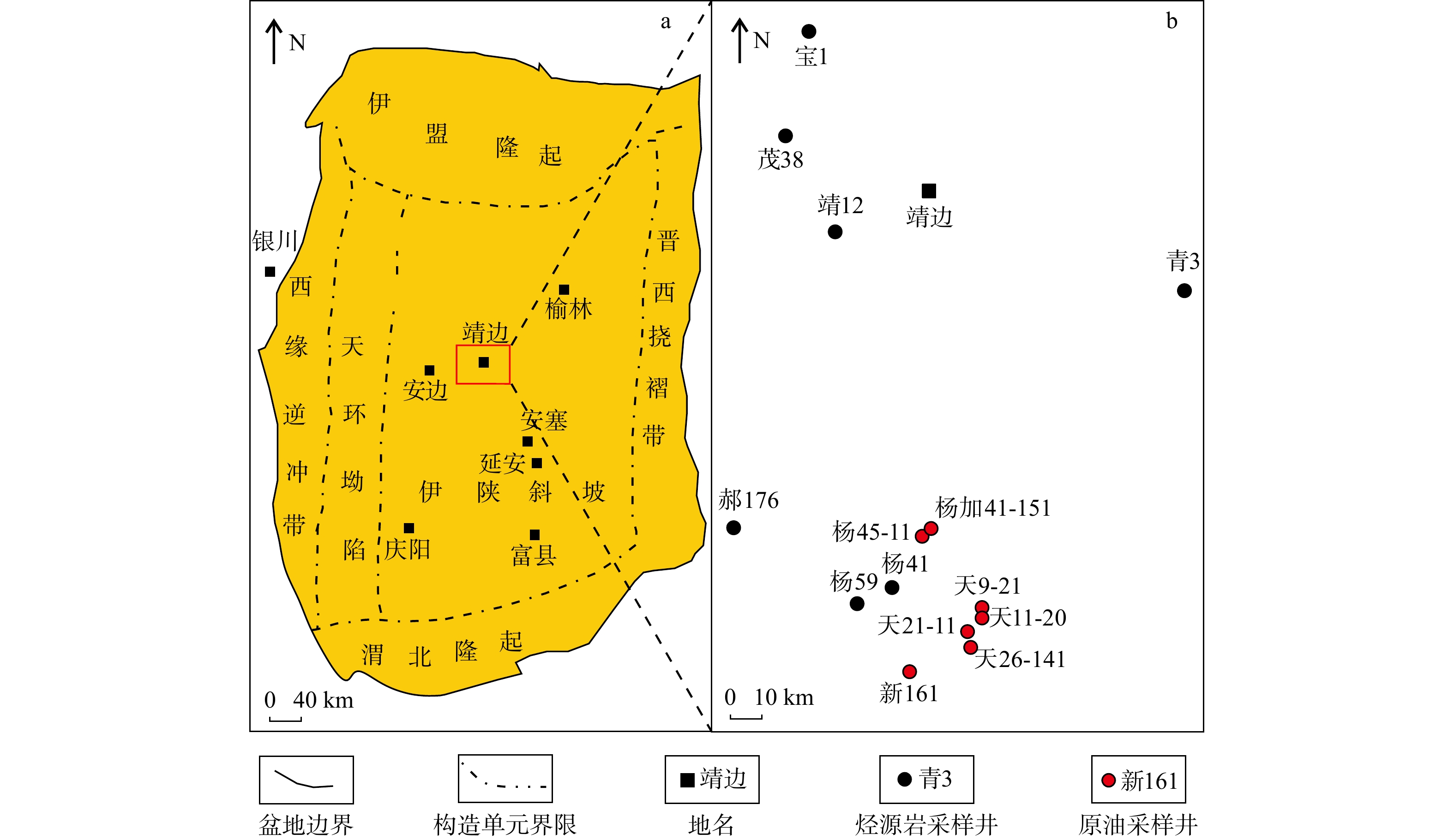
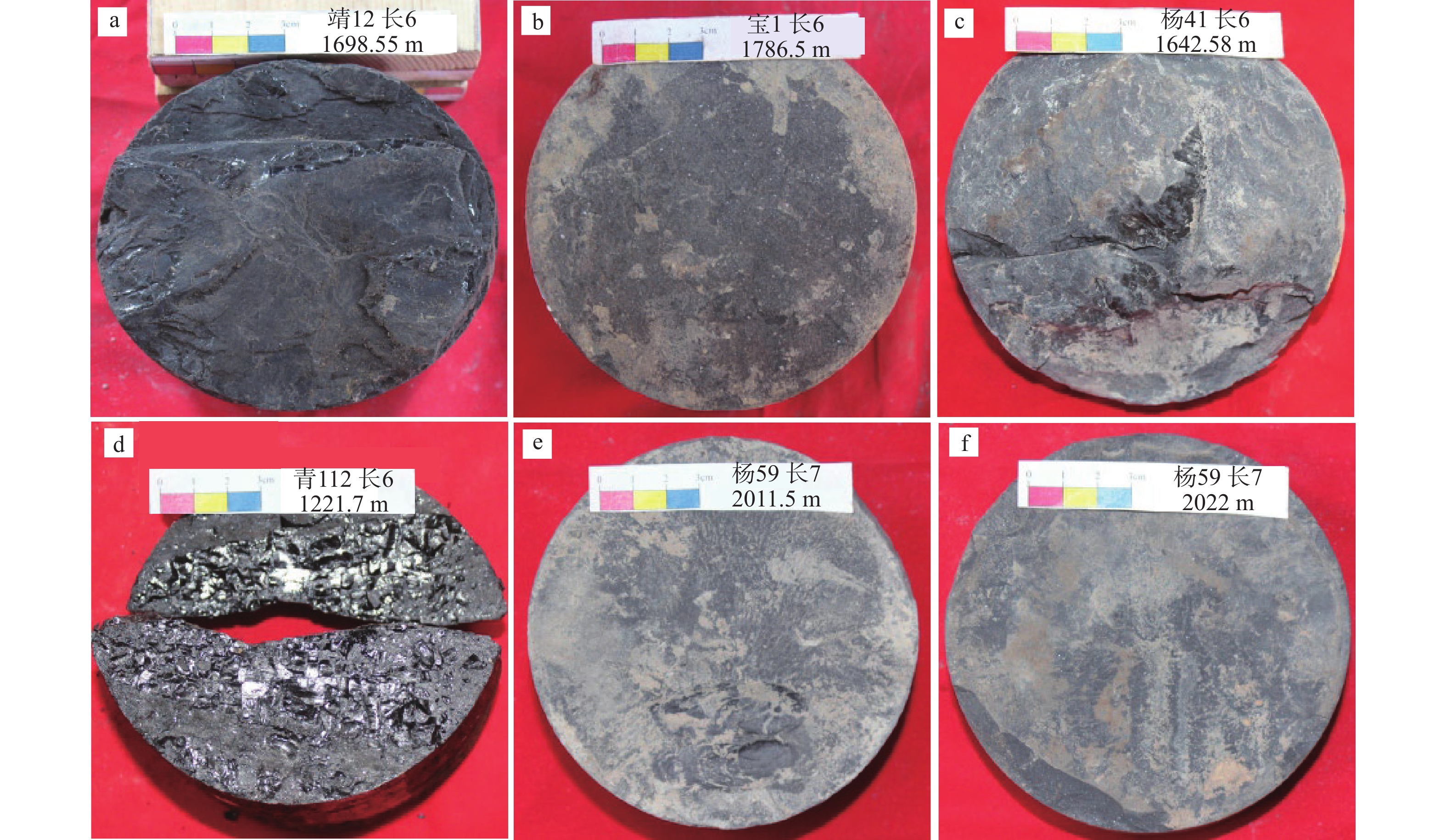
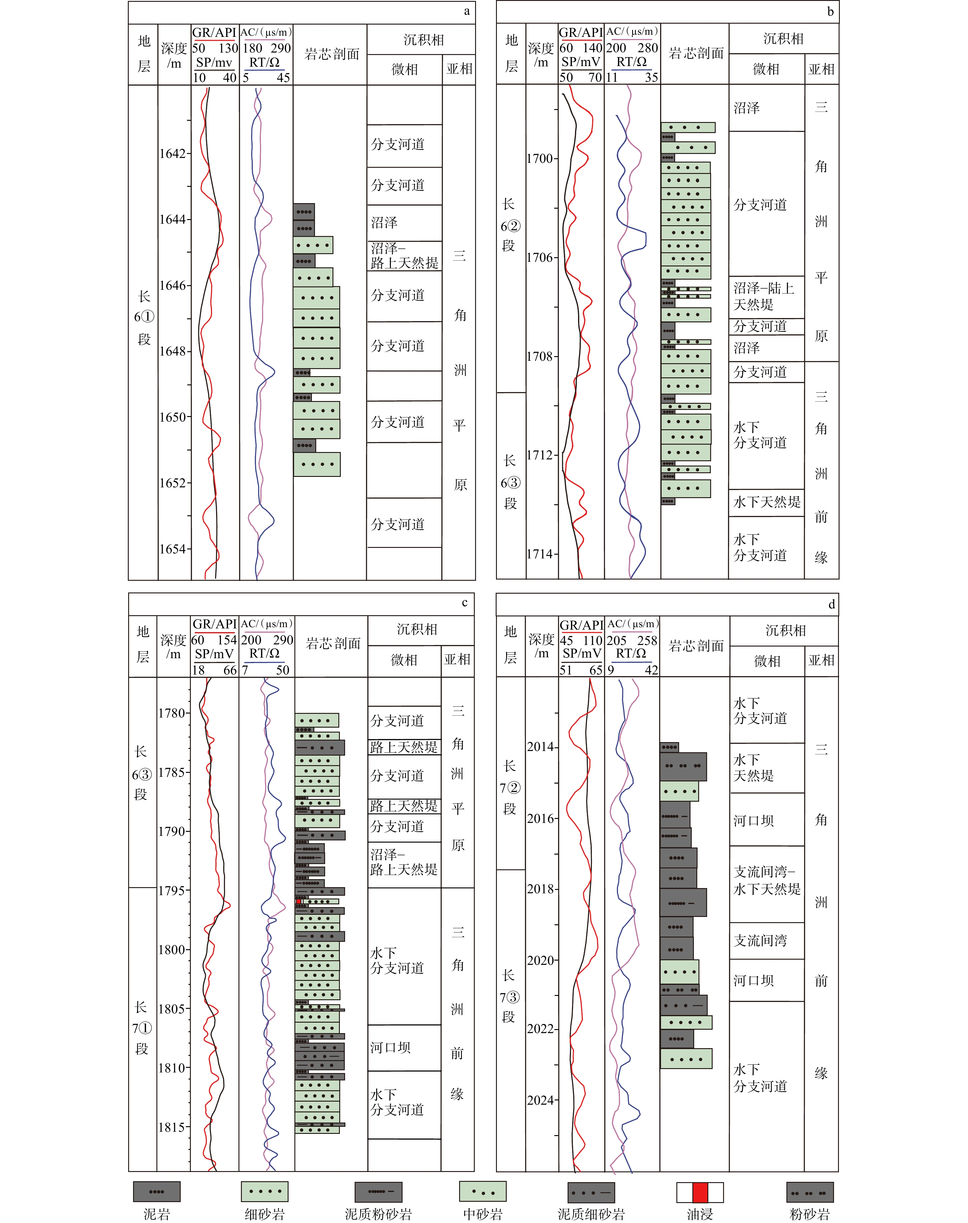
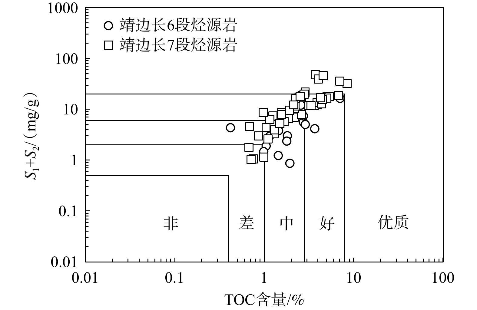
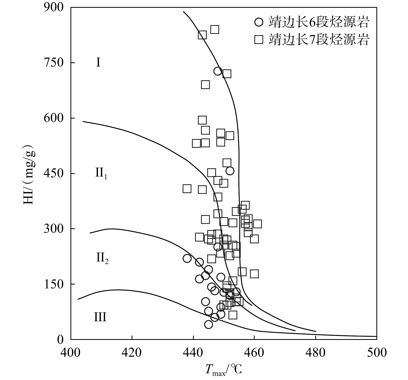
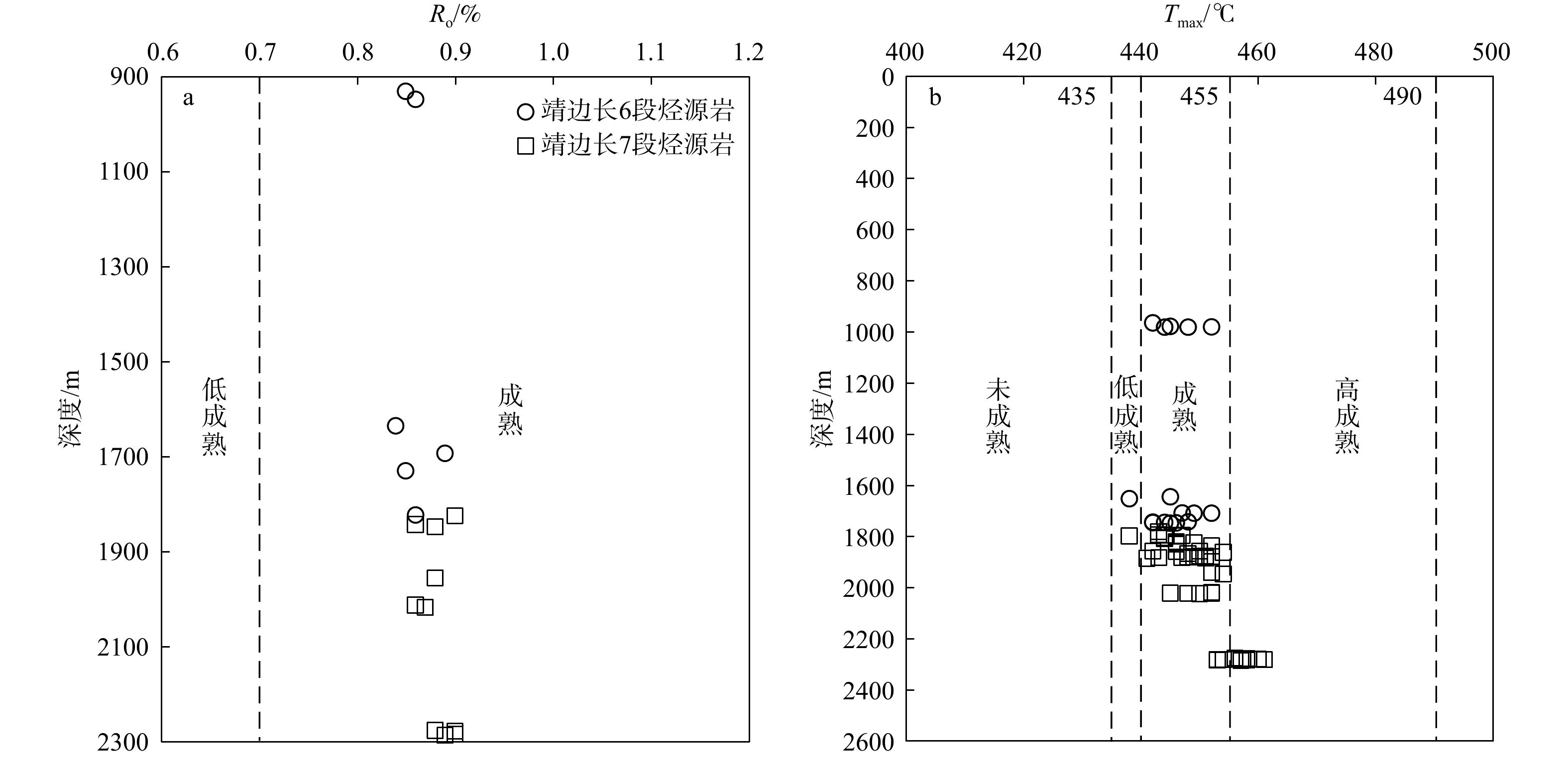
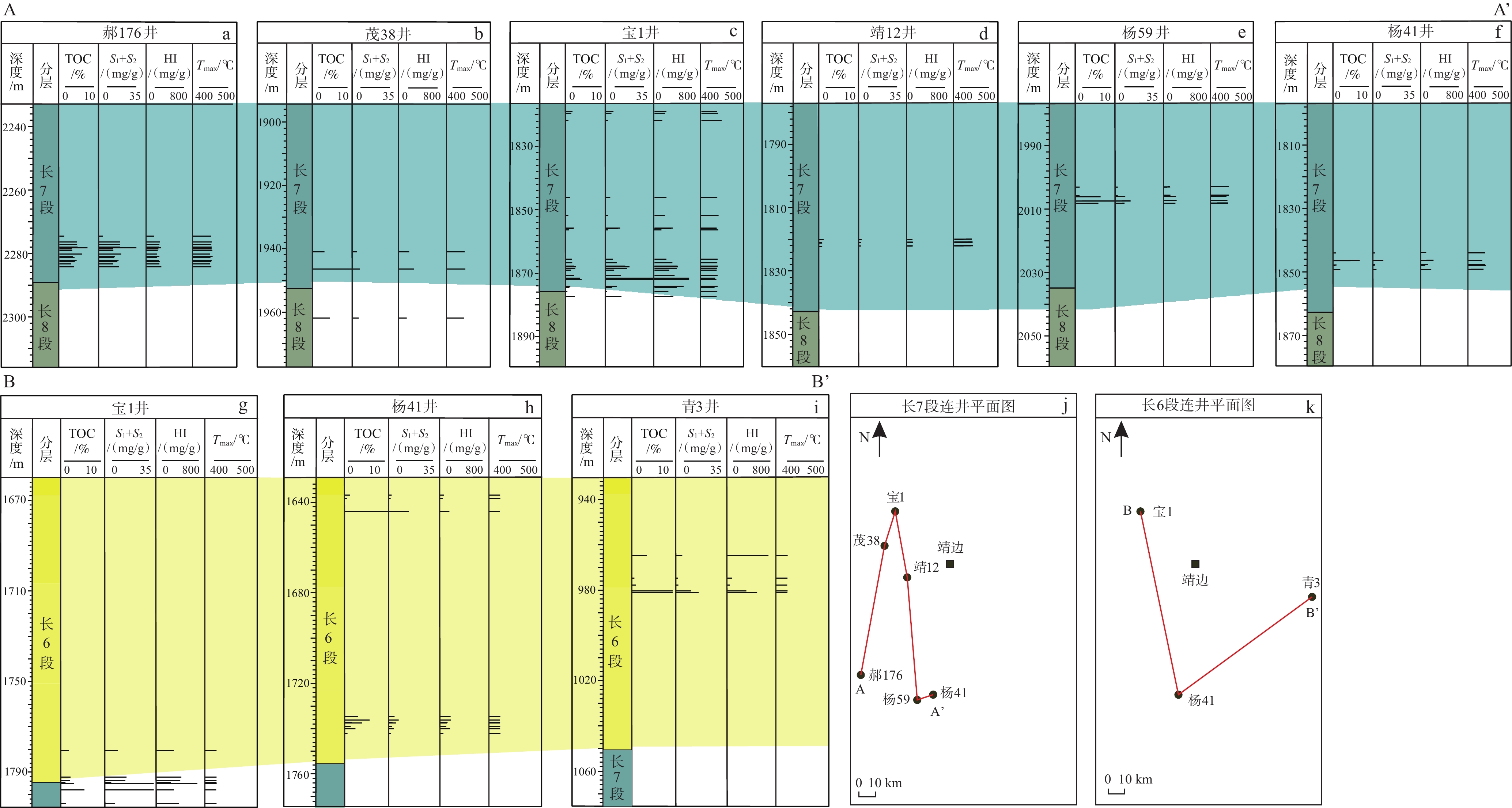
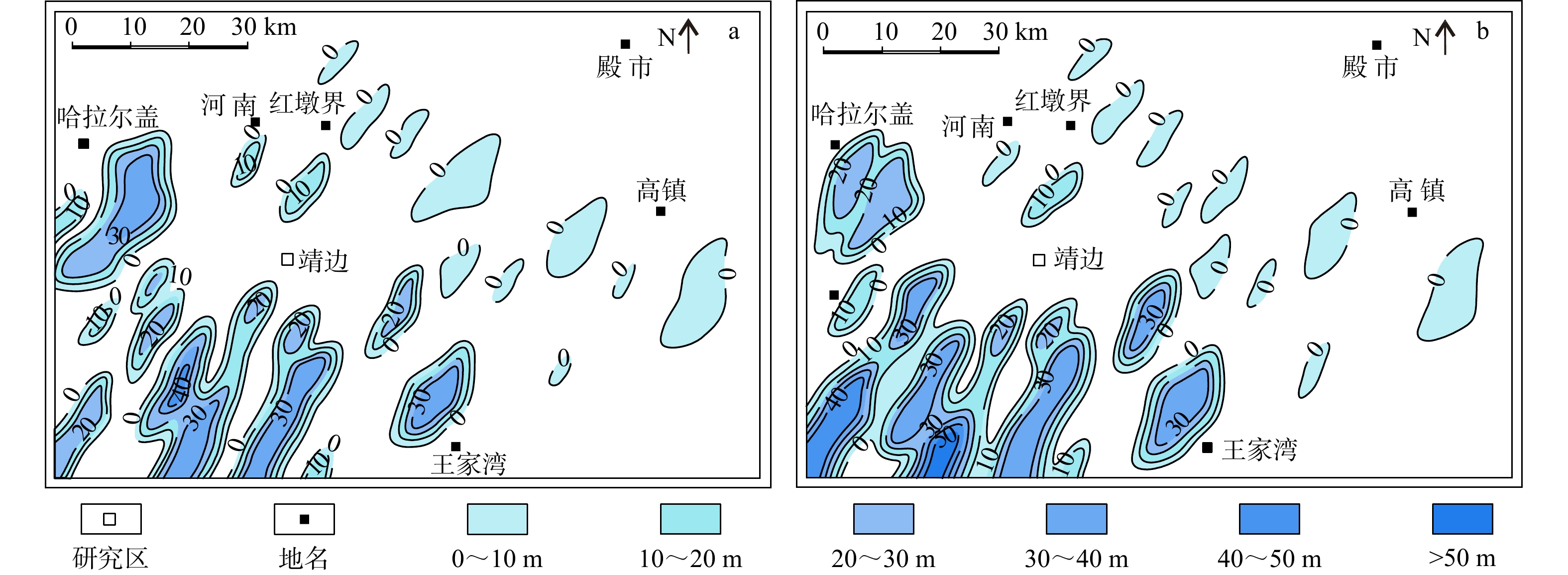
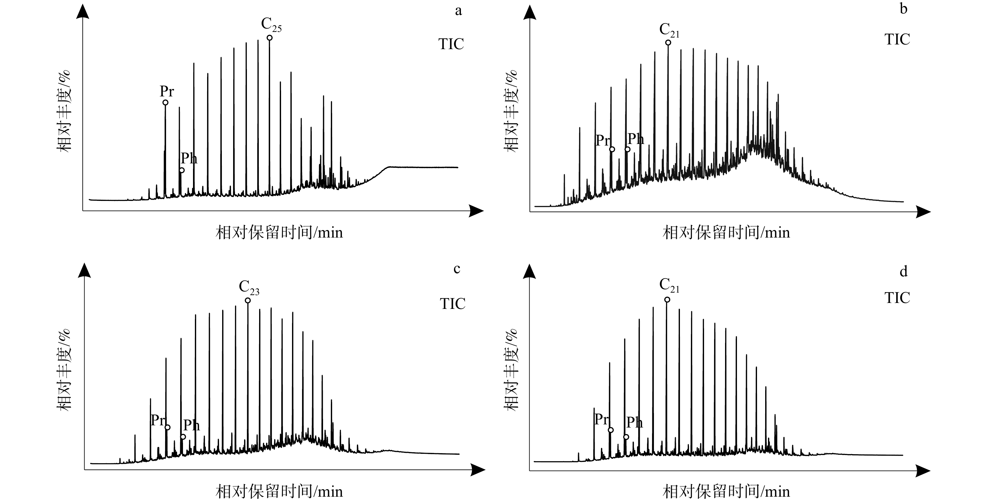
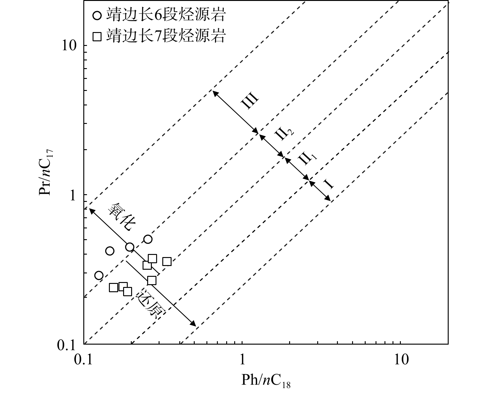
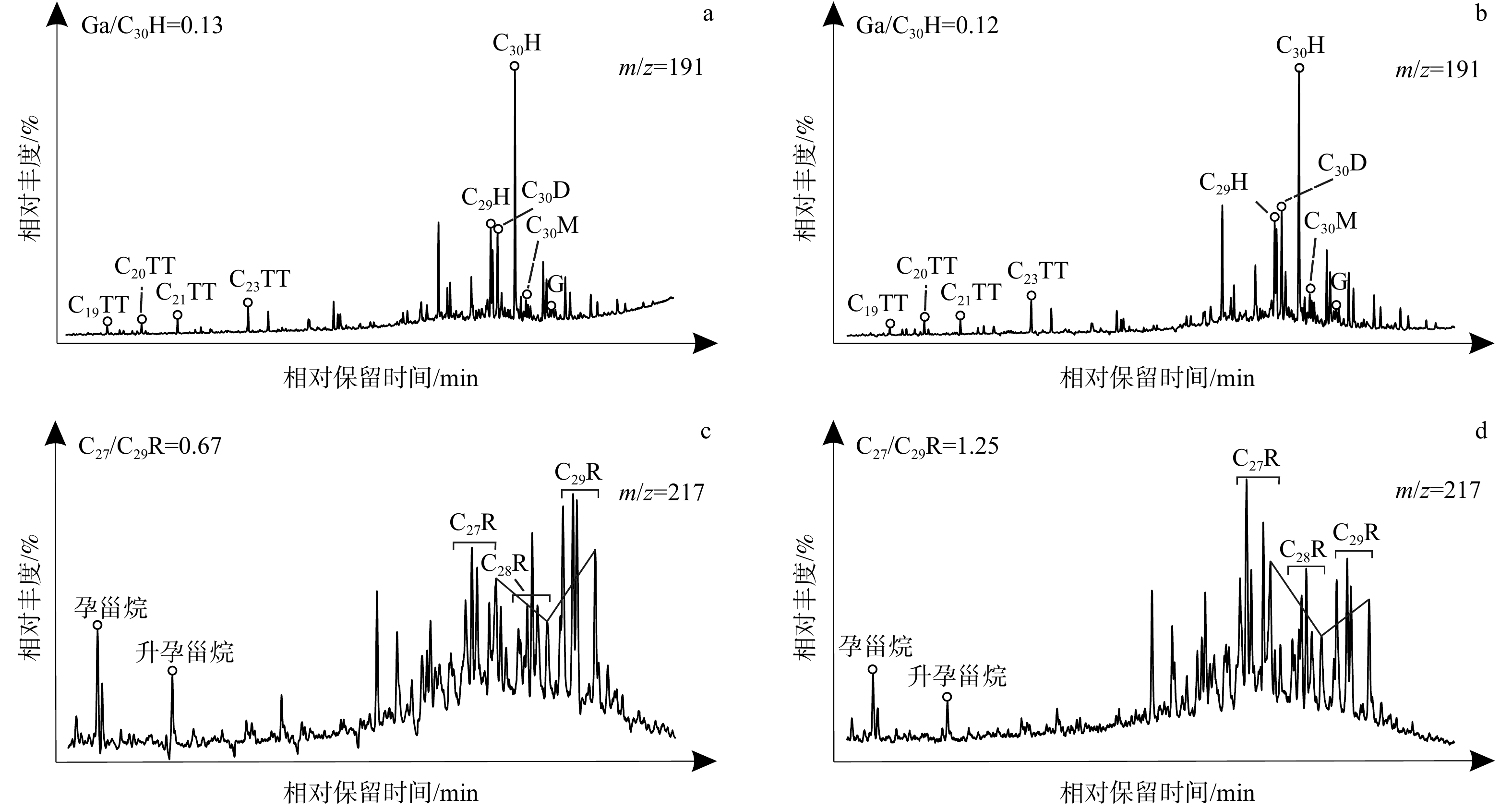
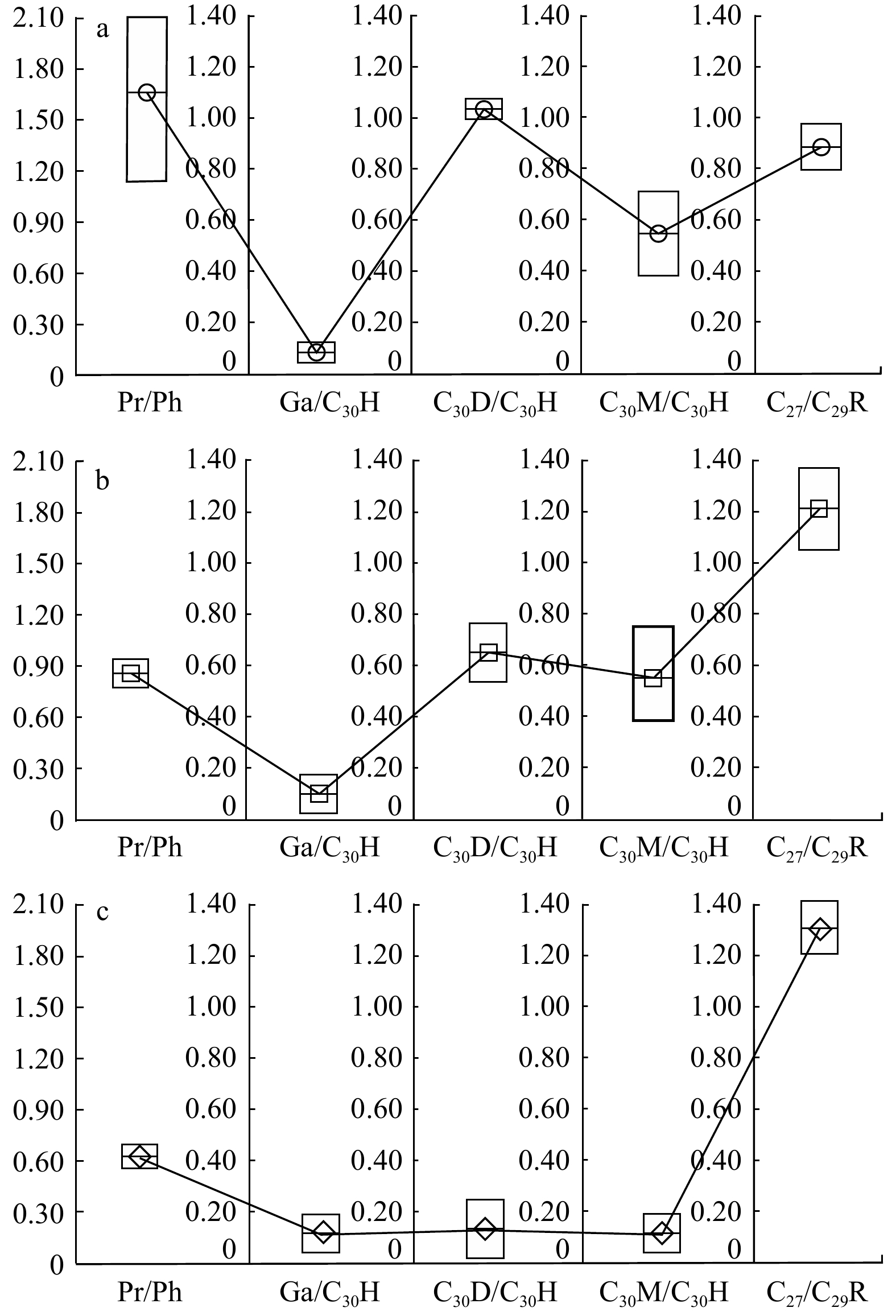
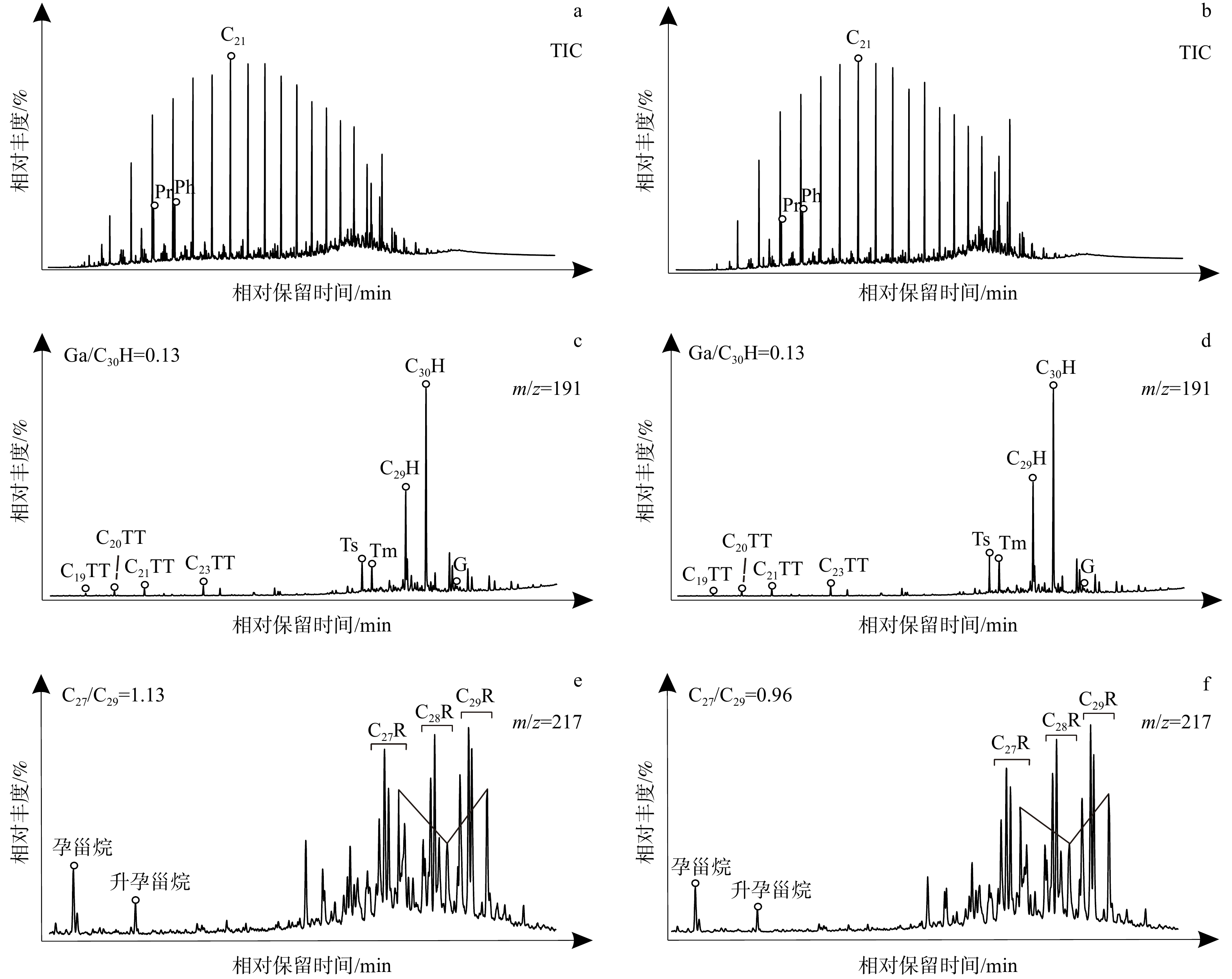
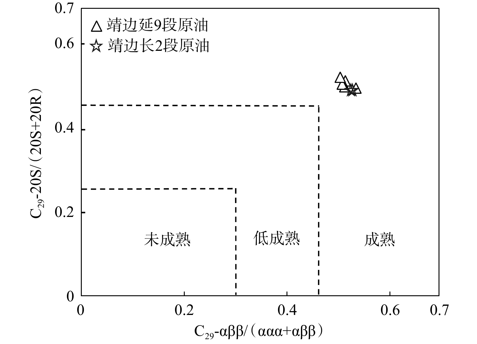
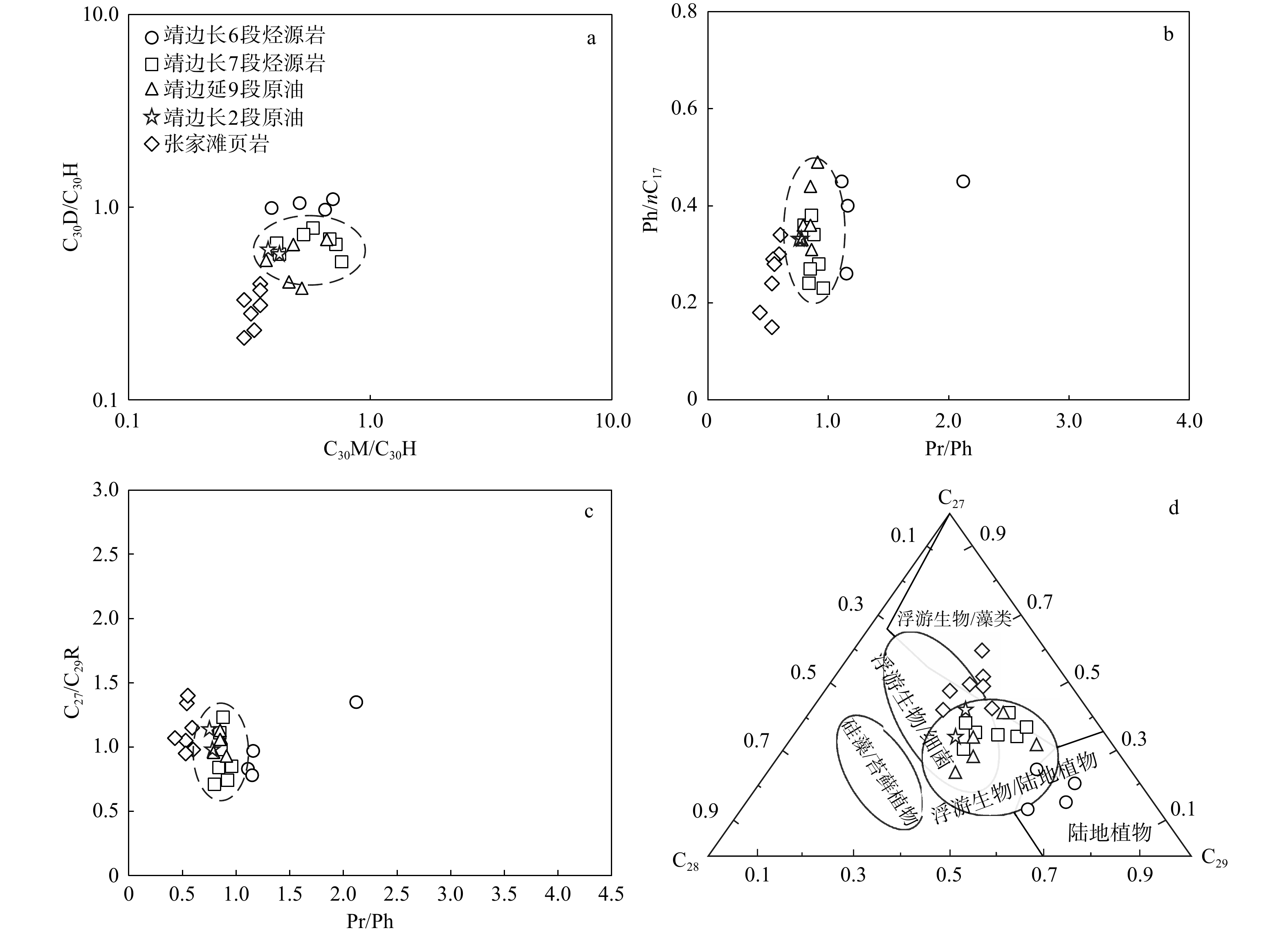
  Objective  The Chang 7 and Chang 6 Members of the Yanchang Formation in the Jingbian area of the Ordos Basin are important source rock intervals. However, systematic studies on their hydrocarbon generation potential and contributions to hydrocarbon accumulation remain limited, which has hindered further exploration efforts in this region. Therefore, this study applies geochemical analytical methods to systematically characterize the distribution and the geochemical properties of the Chang 7 and Chang 6 source rocks in the Jingbian area. In addition, the geochemical signatures of the crude oils from the Yan 9 and Chang 2 reservoirs in the Jingbian Oilfield were investigated.   Methods  By comparing the geochemical parameters of the Chang 7 and Chang 6 source rocks in the study area with those of the Zhangjiatan Shale in the basin center, the potential sources of the Yan 9 and Chang 2 reservoir oils were identified through oil–source correlation.  Results  The Chang 7 source rocks are moderate to excellent-quality source rocks, characterized by wide distribution, large thickness, Type Ⅰ–Ⅱ2 kerogen, and a mature thermal evolution stage. Biomarker characteristics indicate mixed organic matter inputs and deposition under reducing conditions with relatively low salinity. Low Pr/Ph ratios and high C27/C29 regular sterane ratios suggest that the organic matter was predominantly derived from aquatic algae and other lower organisms and accumulated in a reducing freshwater to brackish-water depositional environment. In contrast, the Chang 6 source rocks are moderate to good-quality source rocks, dominated by Type Ⅱ2–Ⅲ kerogen, and generally at the low-maturity to mature stage. Moderate Pr/Ph ratios and relatively low C27/C29 regular sterane ratios indicate a predomint innput of terrigenous higher plantsand deposition under weakly reducing conditions. Oil-source correlation results reveals that the Yan 9 and Chang 2 crude oils have the same originand were primarily sourced from the Chang 7 source rocks, with a minor contribution from the Chang 6 source rocks. The distinct geochemical characteristics of the Zhangjiatan Shale compared with the Yan 9 and Chang 2 crude oils further suggest that the Zhangjiatan Shale was not the major hydrocarbon source for these oils.  Conclusions  (1) The Chang 7 Member is the primary and high-quality source rock in the Jingbian area, exhibiting advantages over the Chang 6 Member in terms of thickness, lateral distribution, organic matter abundance, and hydrocarbon generation potential. (2) Distinct biomarker signatures differentiate the Chang 7 (aquatic/algal-derived organic matter under reducing conditions), Chang 6 (terrigenous organic matter under weakly reducing conditions), and Zhangjiatan Shale (highly aquatic organic matter under strongly reducing conditions) source rocks. (3) The Yan 9 and Chang 2 crude oils share a common origin and were primarily sourced from local Chang 7 source rocks, with possible minor contributions from the Chang 6 source rocks. These oils show no direct genetic relationship with the Zhangjiatan Shale in the basin center, supporting a predominantly local hydrocarbon charging model in the Jingbian area. [ Significance ] This study provides critical geochemical evidence for understanding the local hydrocarbon system, resolving uncertainties regarding oil sources, and evaluating exploration potential in the Jingbian area of the Ordos Basin.
Permian–Triassic reservoir characteristics and controls on their differences in the Pen-1 West Sag, Junggar Basin
ZHANG Fushun
2026, 32(4): 861-876. doi: 10.12090/j.issn.1006-6616.2026027
Abstract (191) HTML (42) PDF (11903KB)(113)
Abstract:
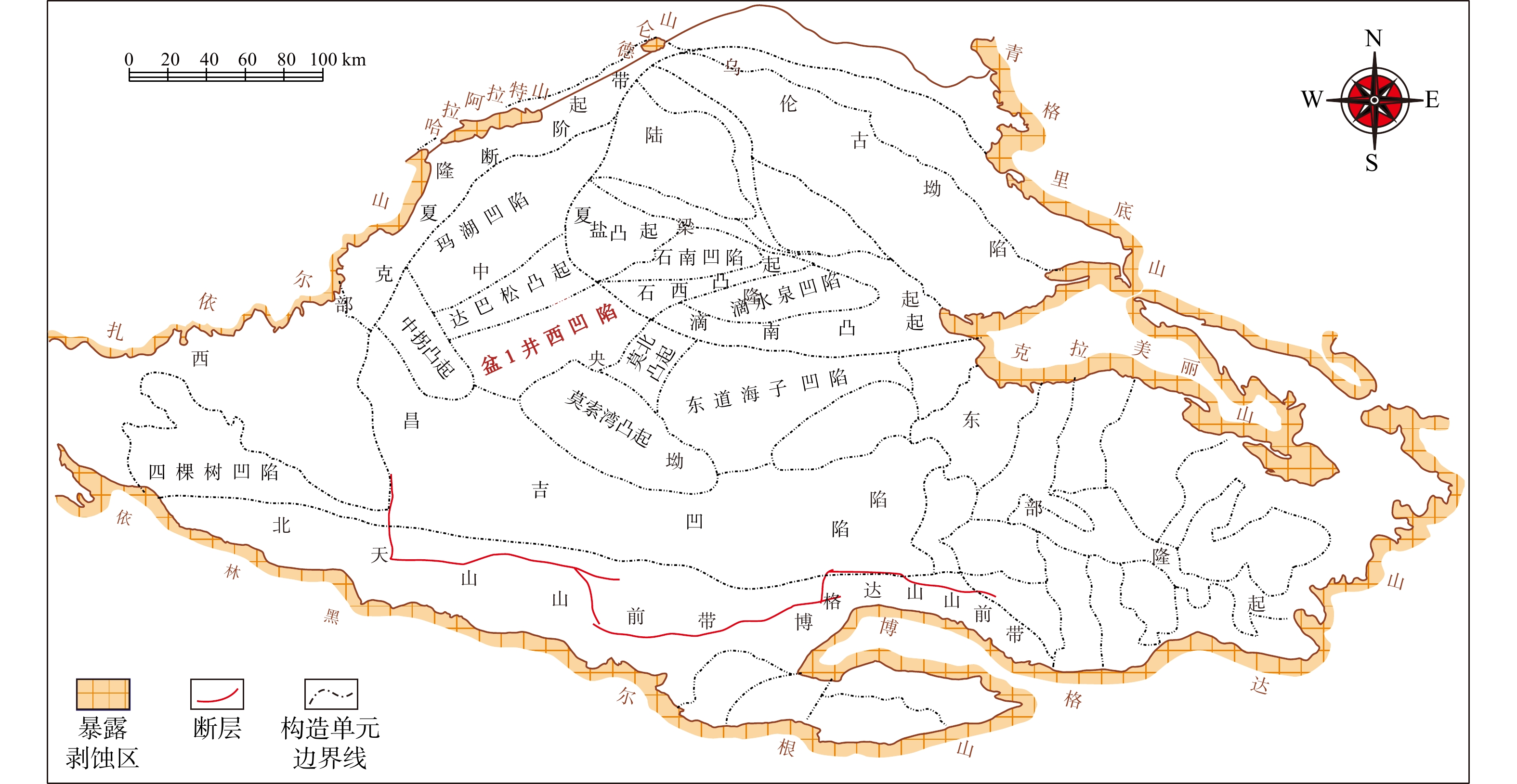
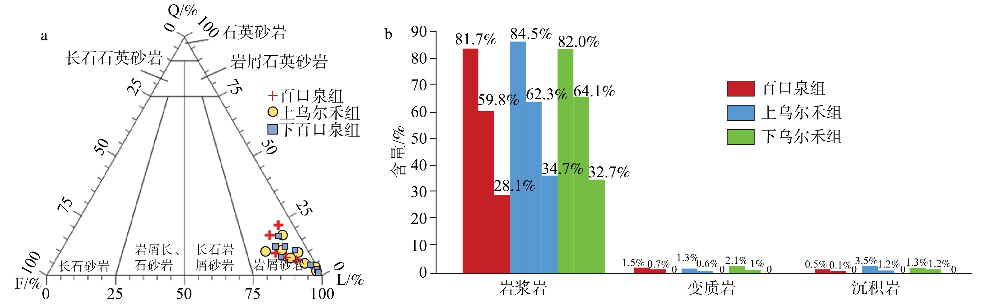
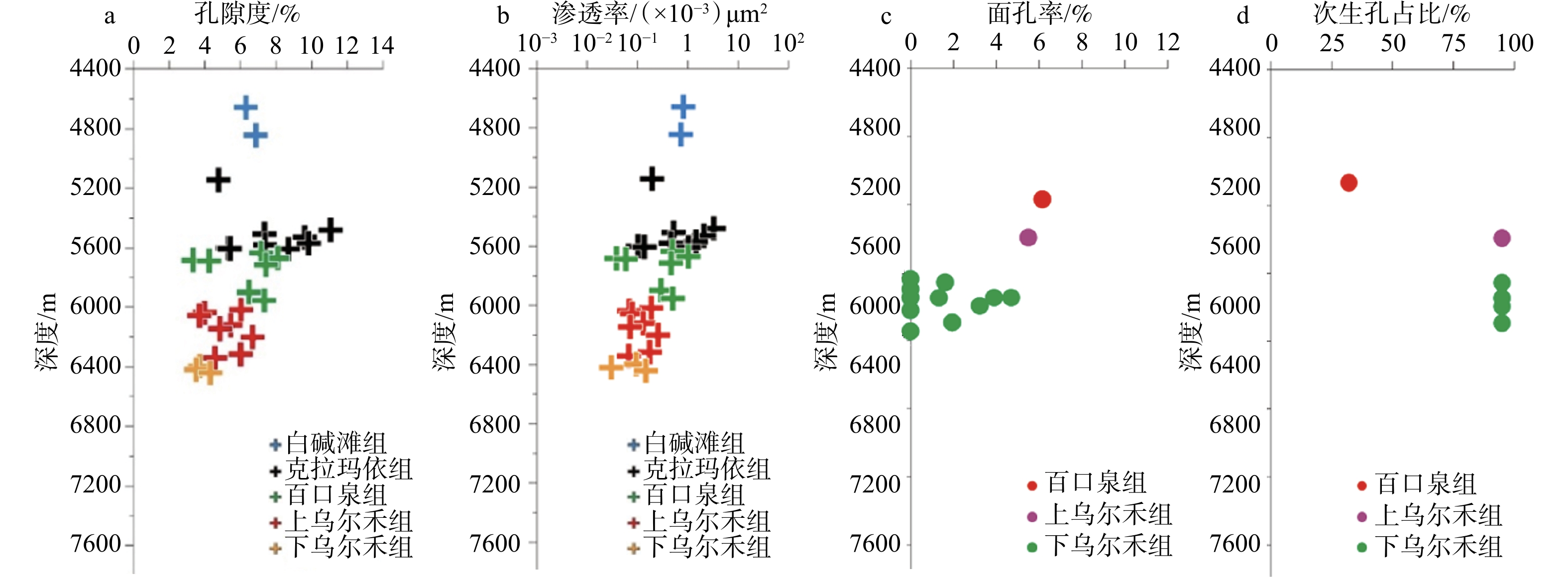
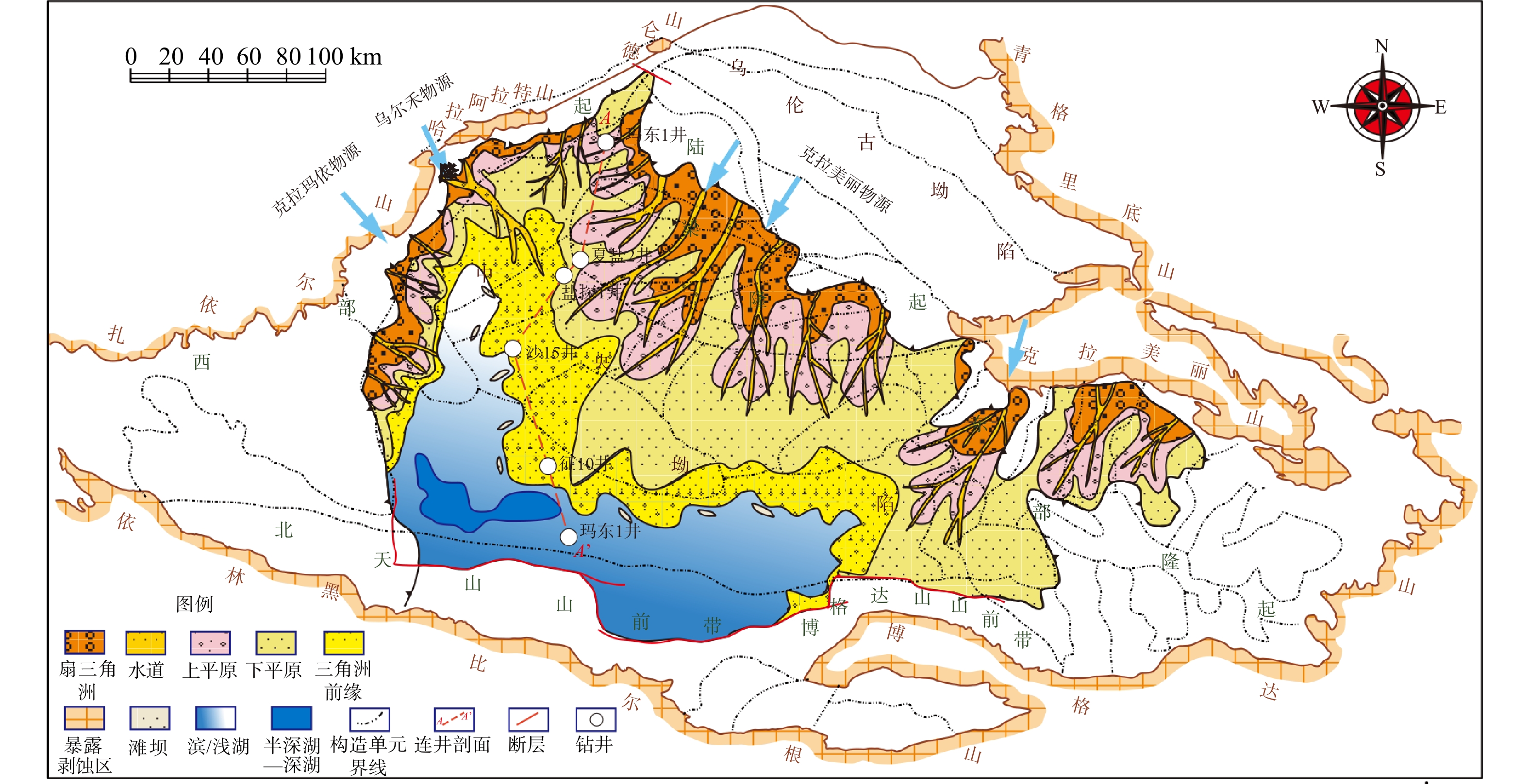
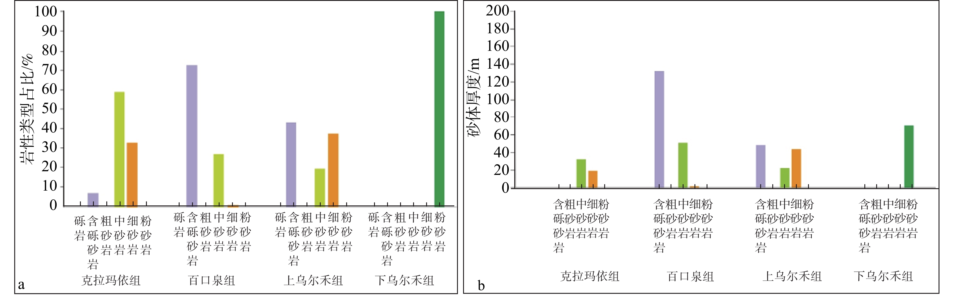
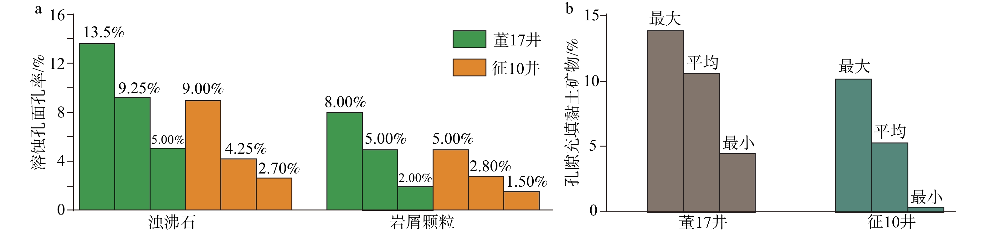
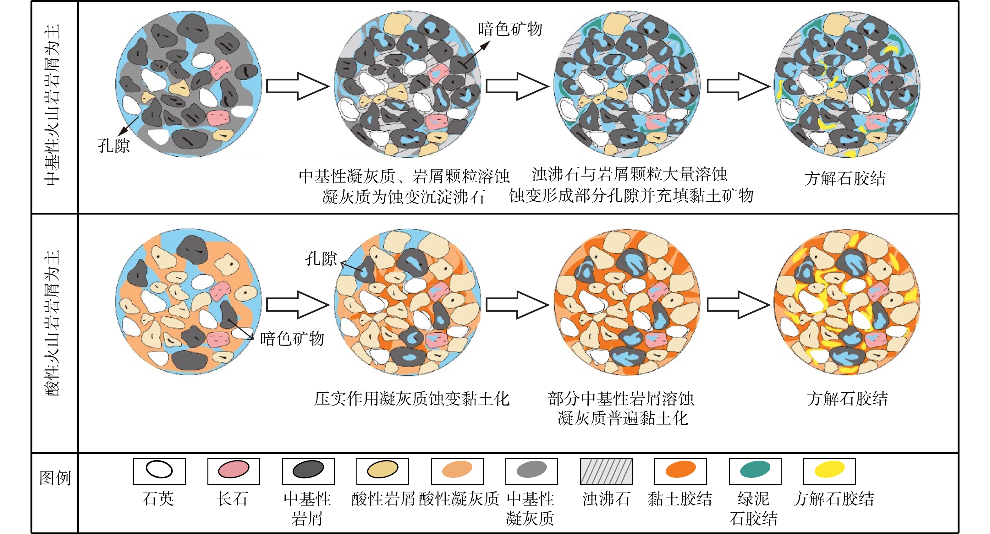
  Objective  The Pen-1 West Sag is an important area for future hydrocarbon exploration in the hinterland of the Junggar Basin. However, systematic studies on the characteristics and development mechanisms of its deep to ultra-deep Permian–Triassic reservoirs remain limited.   Methods   Core, well-log, analytical, and seismic data were integrated to systematically investigate the petrological characteristics, reservoir properties, pore structures, and diagenetic evolution of the Permian–Triassic reservoirs in the Pen-1 West Sag and to identify the main factors controlling differences in reservoir quality.  Results  The reservoirs are predominantly lithic sandstones, with volcanic lithic fragments accounting for more than 80% on average; intermediate to mafic volcanic rock fragments dominate. Reservoir properties show significant vertical variations. The Karamay and Baikouquan Formations exhibit the best reservoir properties, with porosities mainly ranging from 5% to 13% and permeabilities mostly in the range of 0.1×10⁻³–10.0×10⁻³ mD, indicating relatively high-quality reservoirs. In contrast, the Upper and Lower Urho Formations have poorer reservoir properties. Secondary pores dominate the reservoir pore system, with dissolution pores within zeolite cements and intragranular dissolution pores within volcanic lithic fragments being the most abundant secondary pore types. Secondary pores account for more than 70% of the total pore space in the Baikouquan and Upper Urho Formations, whereas they account for 40%–60% in the Karamay Formation, where residual primary intergranular pores remain important.   Conclusions  Reservoir property differences are jointly controlled by multiple factors, including provenance characteristics, lithology and grain size, diagenetic alteration (grain-coating development, zeolite cementation and dissolution, and clay-mineral filling), the composition of volcanic lithic fragments, and temperature and pressure conditions. Based on the diagenetic evolution sequence and variations in the proportions of pore types, two reservoir property evolution models are proposed: a primary-pore-preservation type, represented by the Karamay Formation, and a secondary-pore-dominated type, represented by the Baikouquan and Upper Urho Formations.   Significance  These findings provide an important basis for predicting and evaluating deep clastic reservoirs in the Pen-1 West Sag and in other areas with similar geological conditions.
Diffusion coefficients and multi-scale diffusion models of shale oil and gas
ZHANG Mingdi, ZHANG Guangdong, ZHU Langtao, MENG Sijin
2026, 32(4): 877-888. doi: 10.12090/j.issn.1006-6616.2025140
Abstract (247) HTML (50) PDF (1174KB)(146)
Abstract:
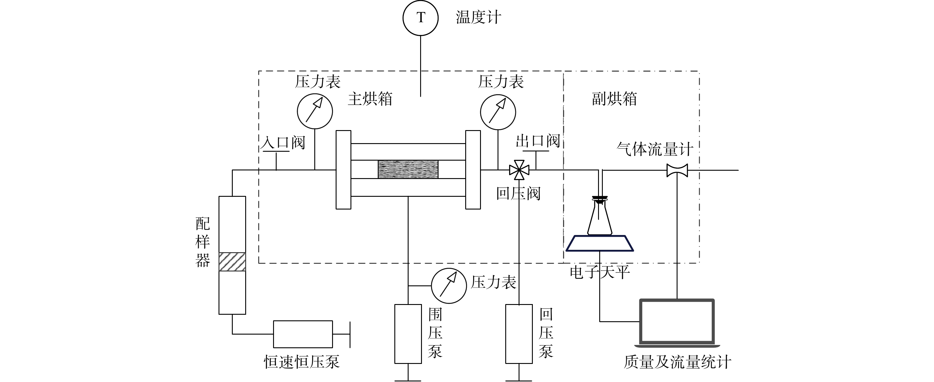
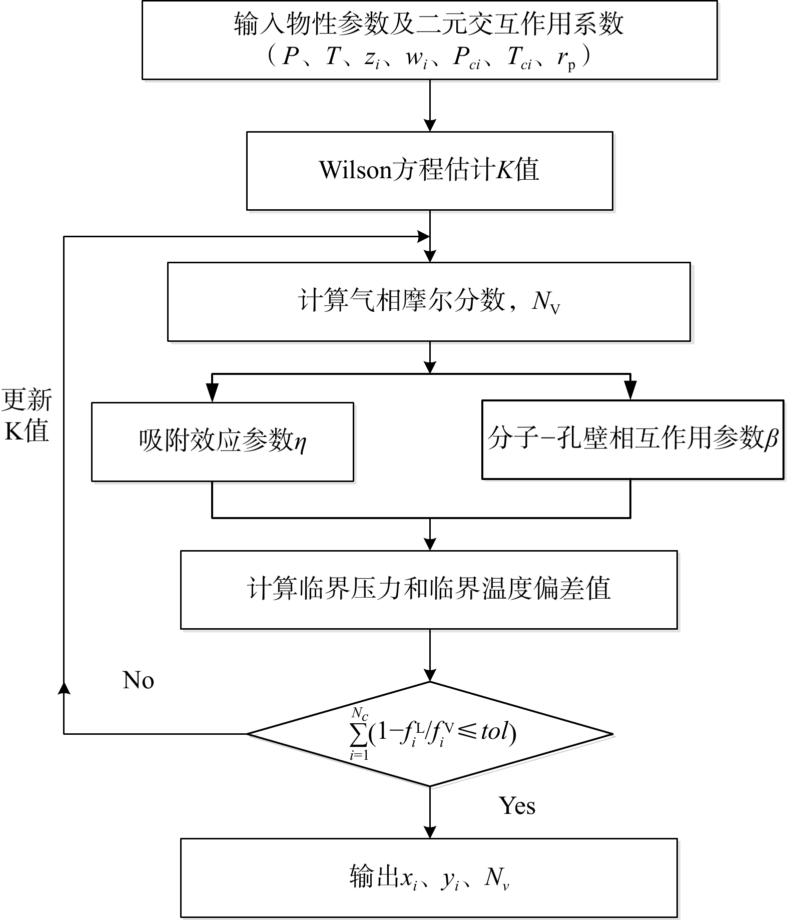
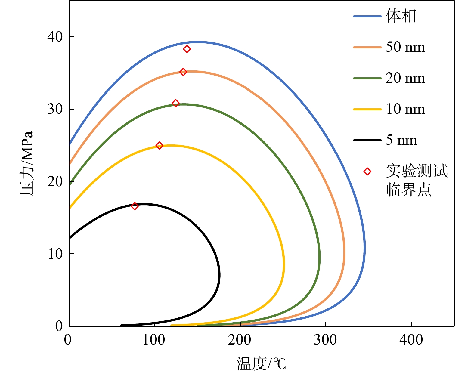
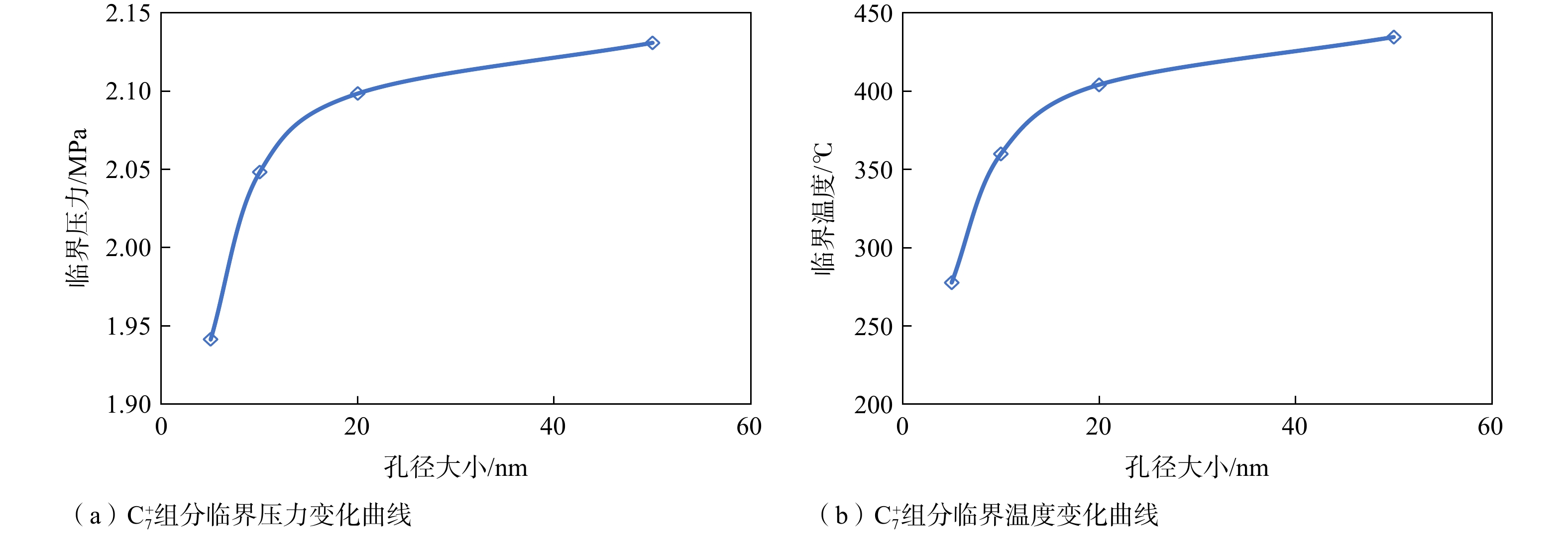
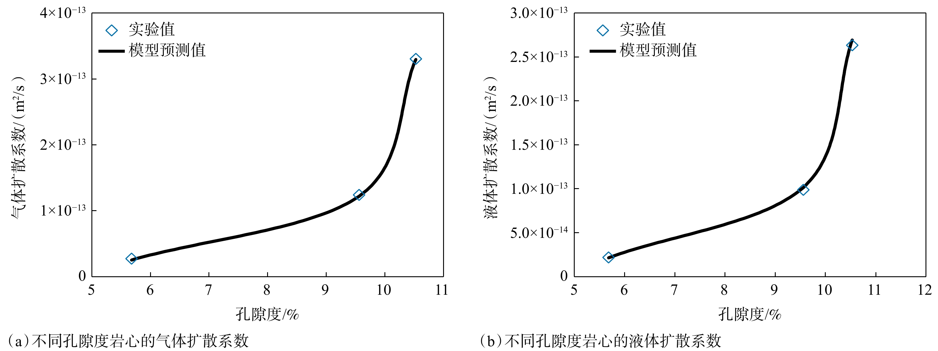
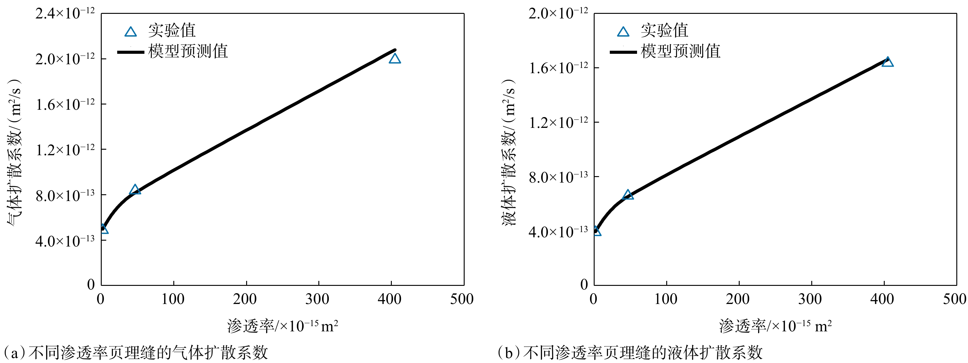
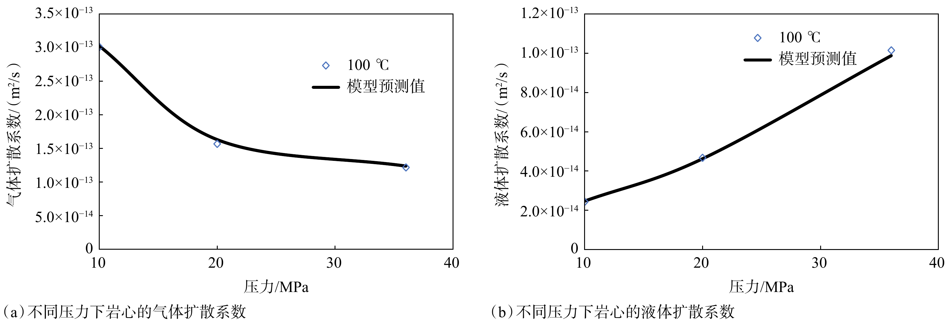
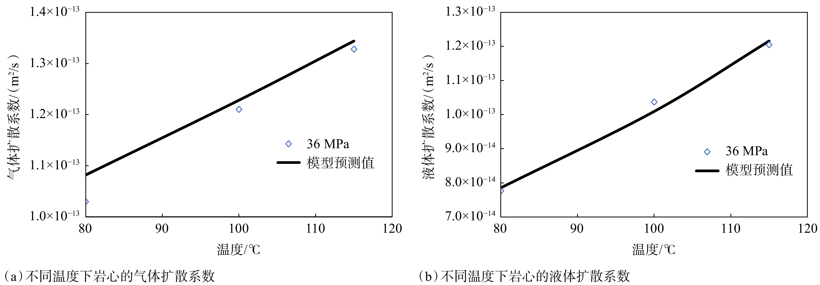
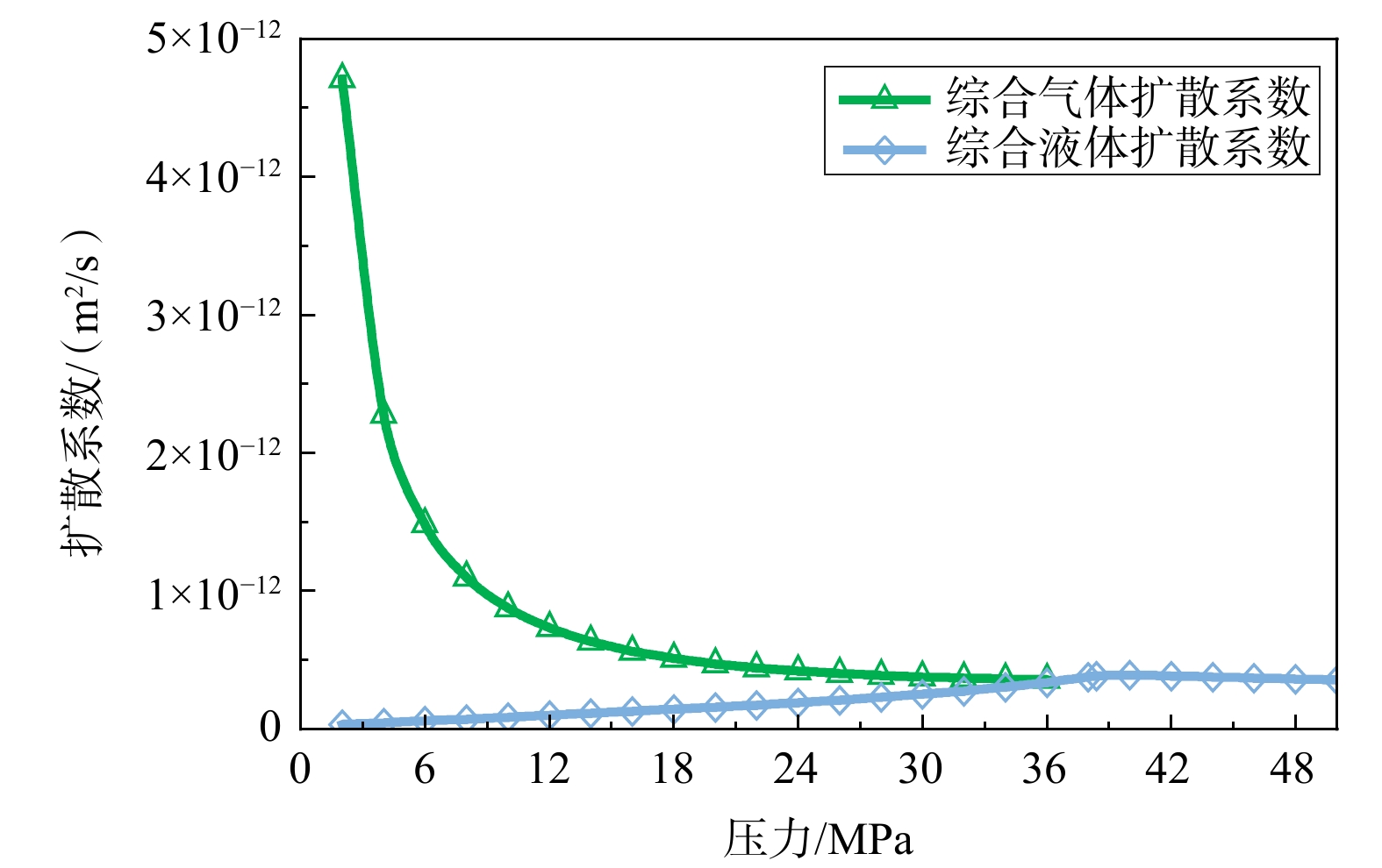
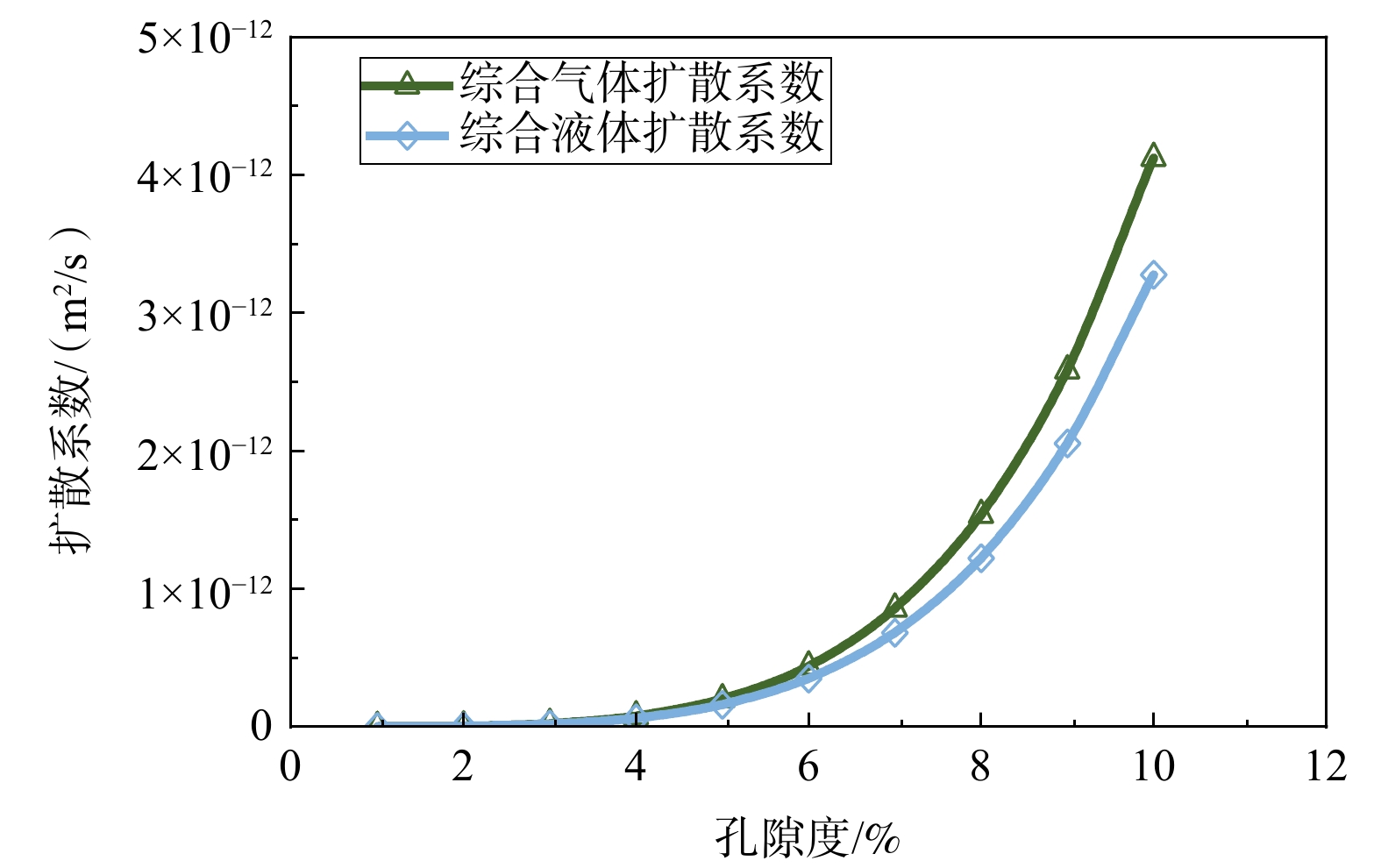
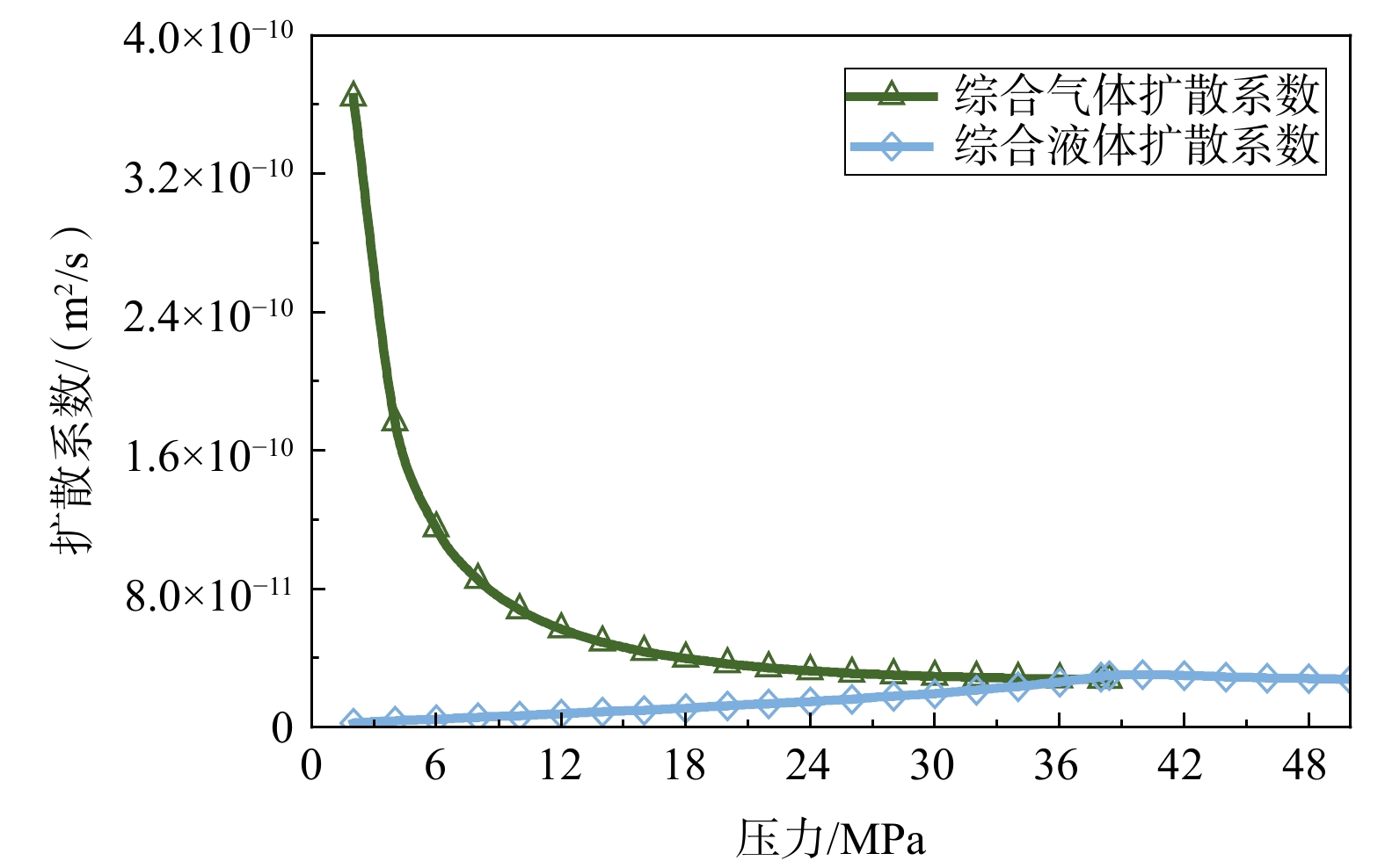
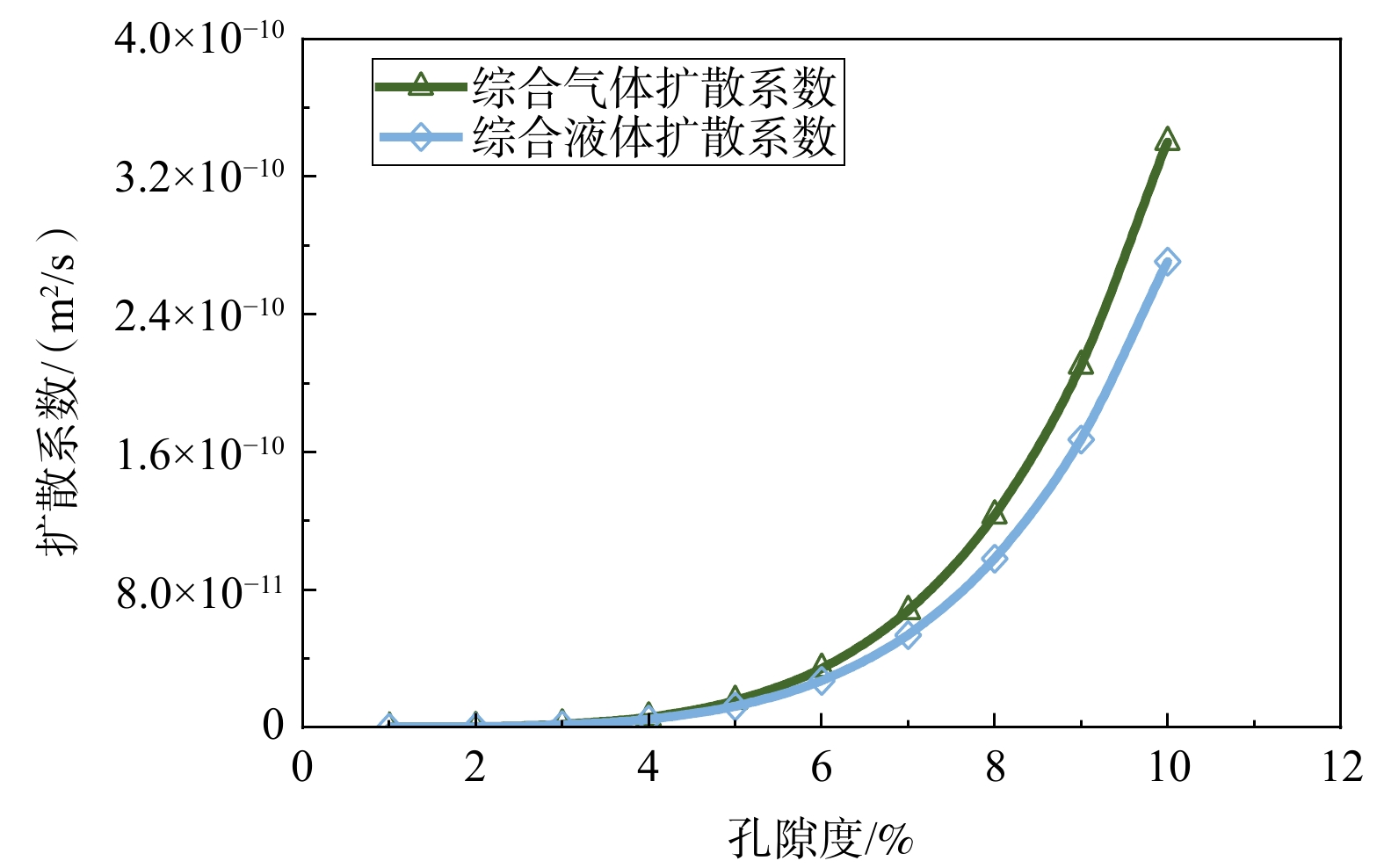
  Objective  To elucidate the diffusion mechanisms of shale oil and gas in nano- to microscale pore-fracture systems and overcome the limitations of conventional models in cross-scale prediction, this study investigates the diffusion characteristics and controlling factors of shale fluids across multiscale porous media.   Methods  High-temperature and high-pressure diffusion experiments were conducted on matrix and bedding-fractured core samples with varying petrophysical properties. A multiscale diffusion model was developed by coupling fractal theory, a tortuous capillary-bundle representation, and a confinement-corrected Peng–Robinson equation of state to account for pore-size distribution, tortuosity, phase saturation, and nanoscale fluid–wall interactions.   Results  Nanoscale confinement leads to phase-diagram contraction and a leftward shift of the critical point, substantially weakening diffusion capacity in confined spaces. Porosity and permeability are the primary structural controls: when porosity increases from 5.68% to 10.53%, gas and liquid diffusion coefficients increase by approximately one order of magnitude; when bedding-fracture permeability increases from 1.69 ×10⁻¹⁵ m2 to 404.88 ×10⁻¹⁵ m2, diffusion coefficients rise by about three to four times. Increasing pressure (10~36 MPa) suppresses gas-phase diffusion but enhances liquid-phase diffusion, whereas higher temperatures (80~115 °C) promote diffusion overall.   Conclusions  The proposed fractal–confinement diffusion model accurately matches the experimental results and reveals key nanoscale mechanisms, including a ~10−5 reduction in effective diffusivity relative to bulk fluids and diffusion capacities in fractures that exceed those of the matrix by one to two orders of magnitude.  Significance  This model enables structural-sensitivity analysis and cross-scale prediction of diffusion processes, providing theoretical support for the quantitative characterization of shale-fluid migration and the optimization of reservoir development.
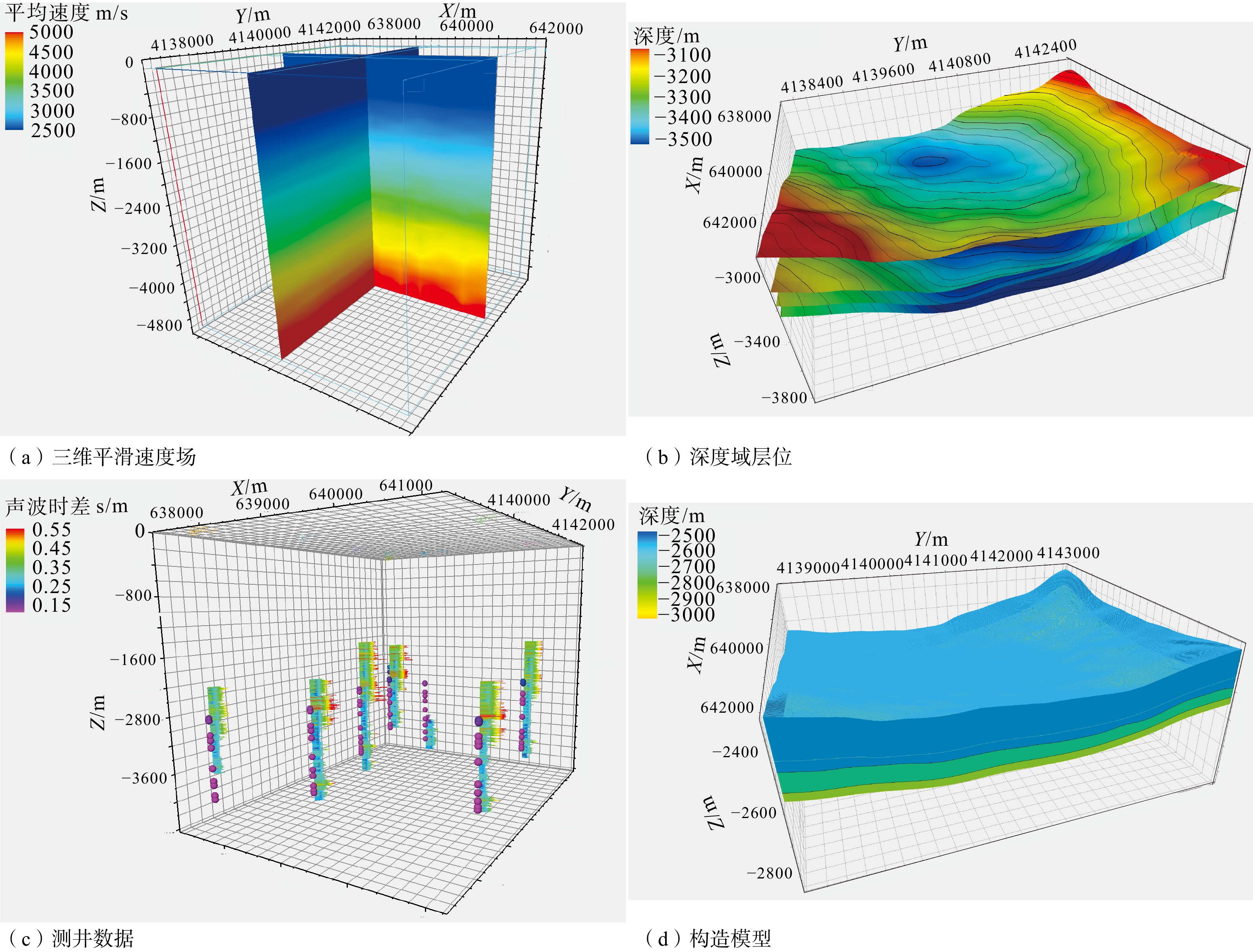
Geo-hazards & Engineering Geology
Slope engineering in the deeply incised valleys of the Tibetan Plateau: key challenges and strategic considerations
WANG Jiming, QI Bangshen
2026, 32(4): 889-898. doi: 10.12090/j.issn.1006-6616.2025061
Abstract (133) HTML (29) PDF (5098KB)(67)
Abstract:
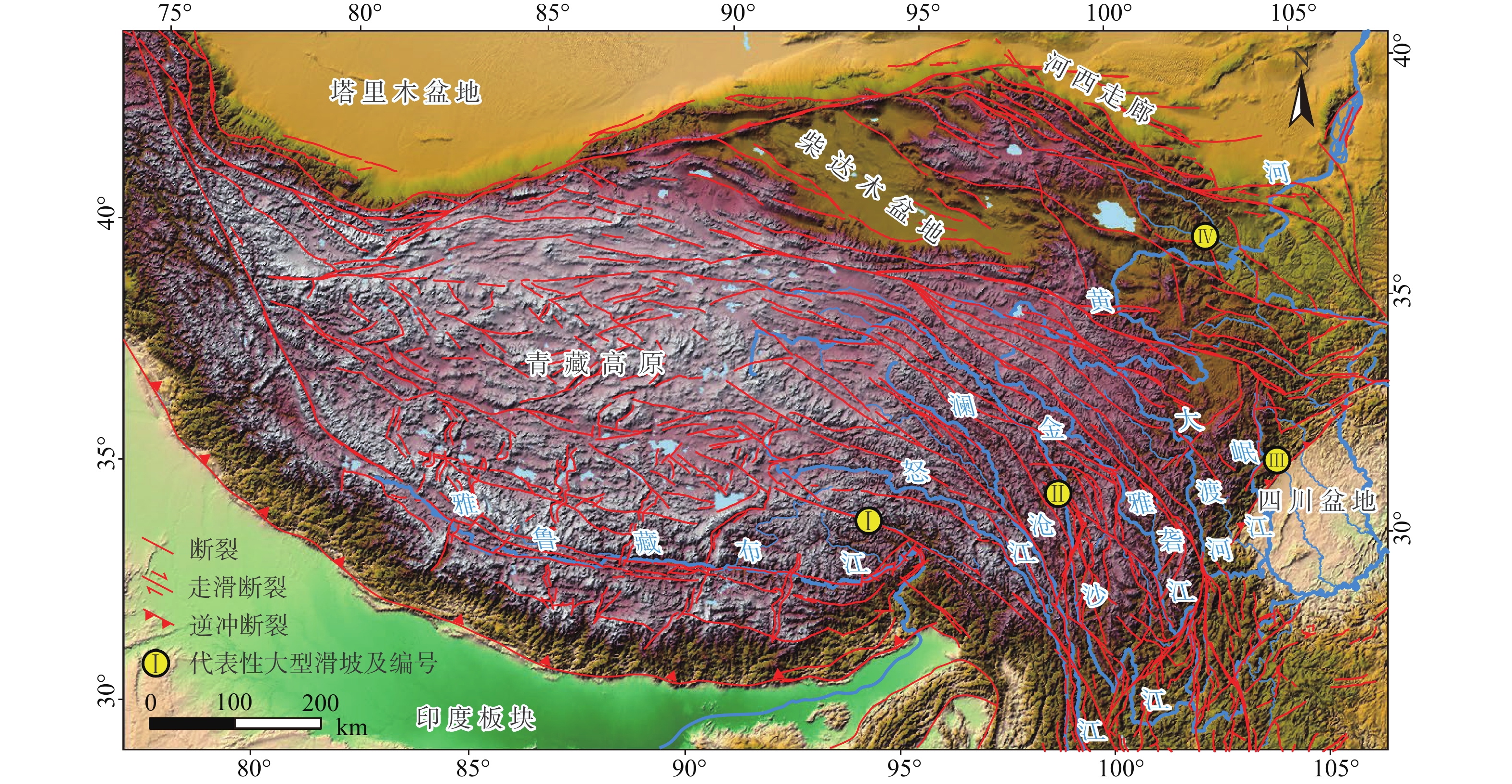
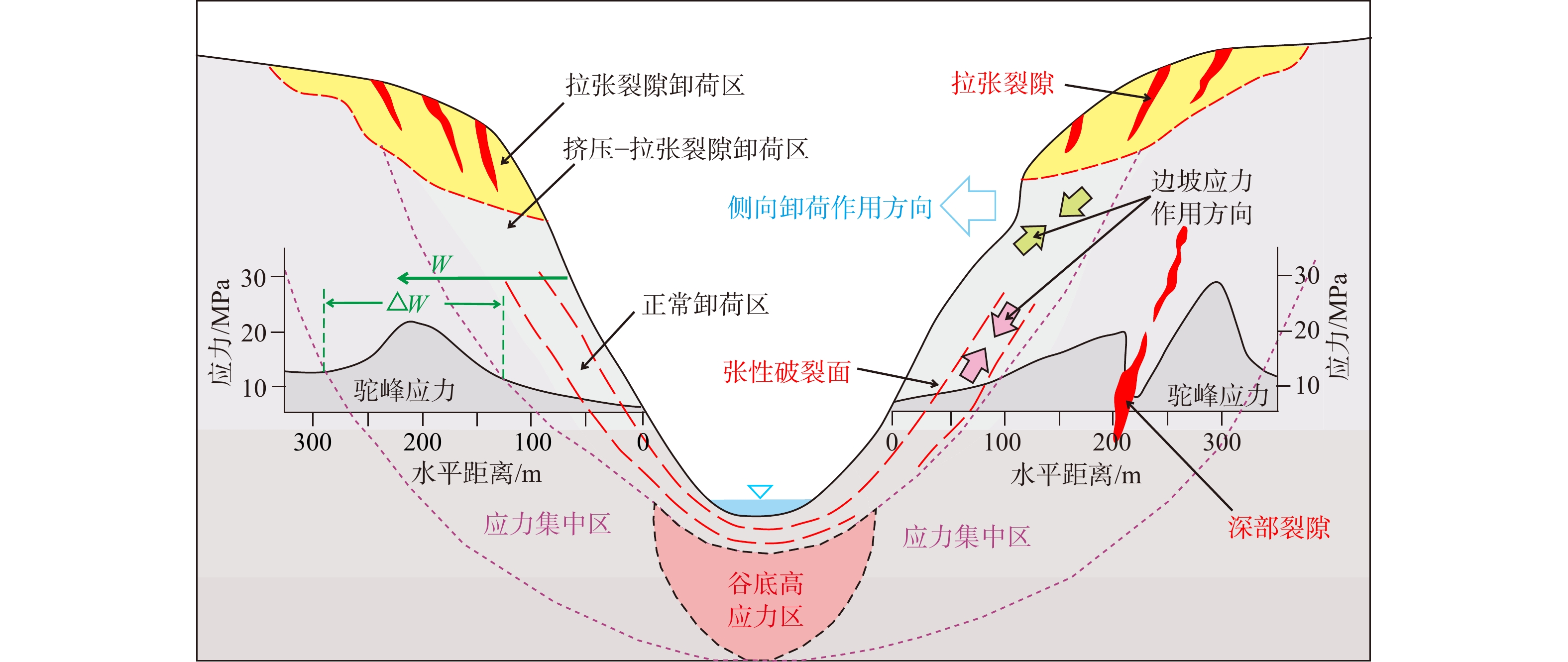
  Objective  As human engineering activities expanded into the Tibetan Plateau and its surrounding areas, slope instabilities—particularly large-scale landslides—in deeply incised valleys have occurred with increasing frequency, posing severe threats to major infrastructure projects and public safety. This study evaluates how regional tectonic activity controls slope stability and outlines key challenges, insights, and strategic recommendations for slope engineering planning and construction in these deeply incised valleys.   Methods  Based on an overview of the tectonic activity characteristics across the Tibetan Plateau, the controlling influence of tectonic activity on slope stability was systematically analyzed. Problems encountered in slope engineering planning were identified, leading to practical engineering recommendations and strategic directions for future research.   Results  Tectonic activity exhibits strong spatial consistency and temporal synchronicity with slope instability across the plateau. Tectonic processes provide the essential structural and geomorphic boundaries, material sources, dynamic conditions, and triggering factors for slope failures. Key challenges include the dominant control of regional tectonic stress on valley slope stability, the need to re-evaluate reverse slope stability in deeply incised valleys, and the required paradigm shift regarding the horizontal cover depth for mountain-adjacent underground works. Analysis suggests that slope engineering should prioritize south-, west-, and southwest-facing slopes while avoiding north-, northeast-, and east-facing slopes. Furthermore, the deep-seated stability of consequent slopes is superior to that of reverse slopes, and underground structures along mountain slopes should be situated within the unperturbed in-situ stress zone.  Conclusions  Future research must focus on quantitative investigations into: (1) the morphological characteristics and failure mechanisms of deeply incised valleys; (2) the evolution of in-situ stress fields under rapid tectonic uplift; and (3) the spatial distribution of in-situ stress fields across the plateau.  Significance  The findings provide critical theoretical guidelines and engineering references for slope design, infrastructure planning, and geohazard mitigation on the Tibetan Plateau.
Reactivation mechanism and stability trend prediction of the Huangci No.2 landslide, Heifangtai, Gansu Province, China
DOU Xiaodong, LI Yushan, MENG Yateng, CONG Kai, ZHANG Yongjun, JIA Qiang
2026, 32(4): 899-918. doi: 10.12090/j.issn.1006-6616.2026014
Abstract (456) HTML (46) PDF (11819KB)(290)
Abstract:
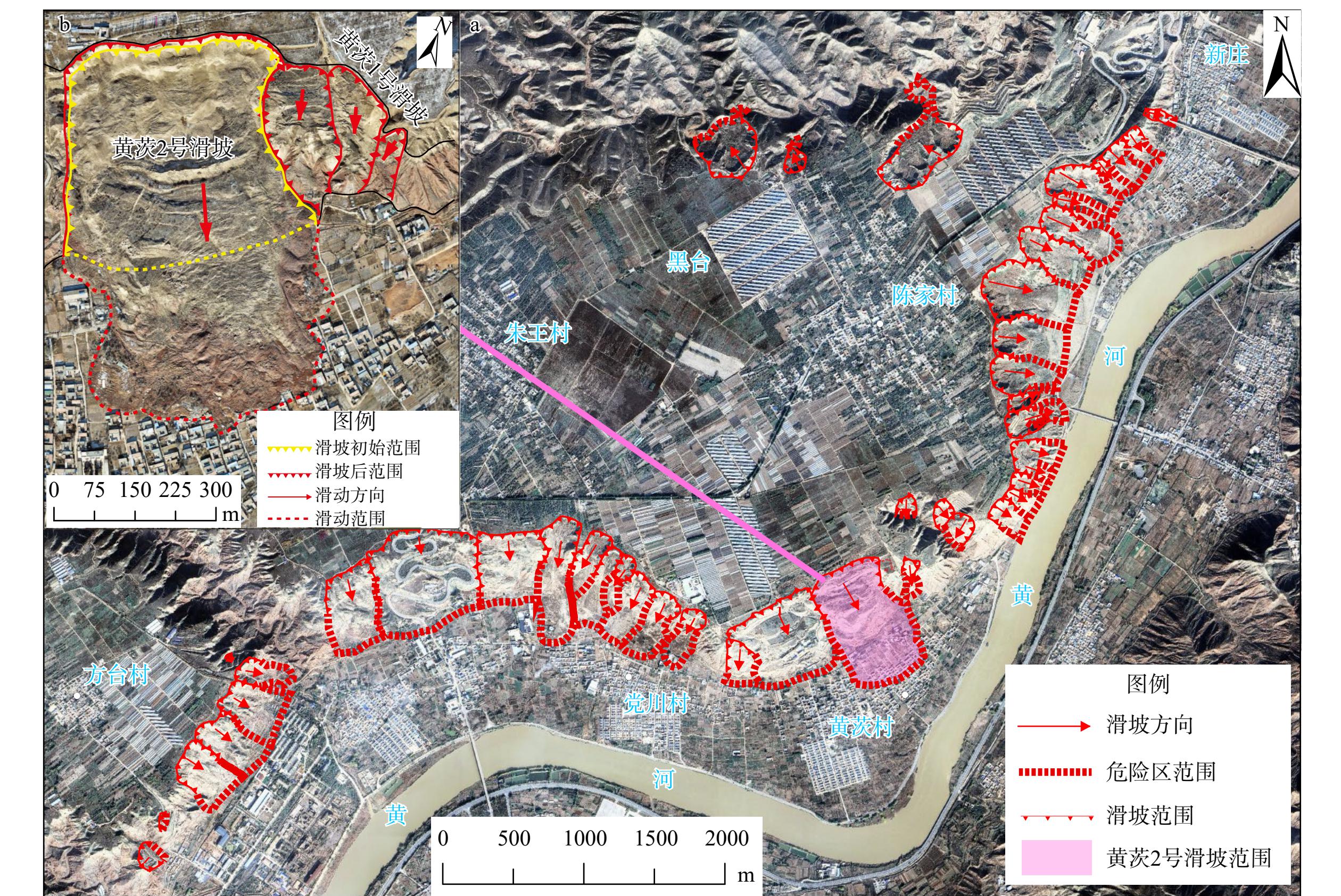
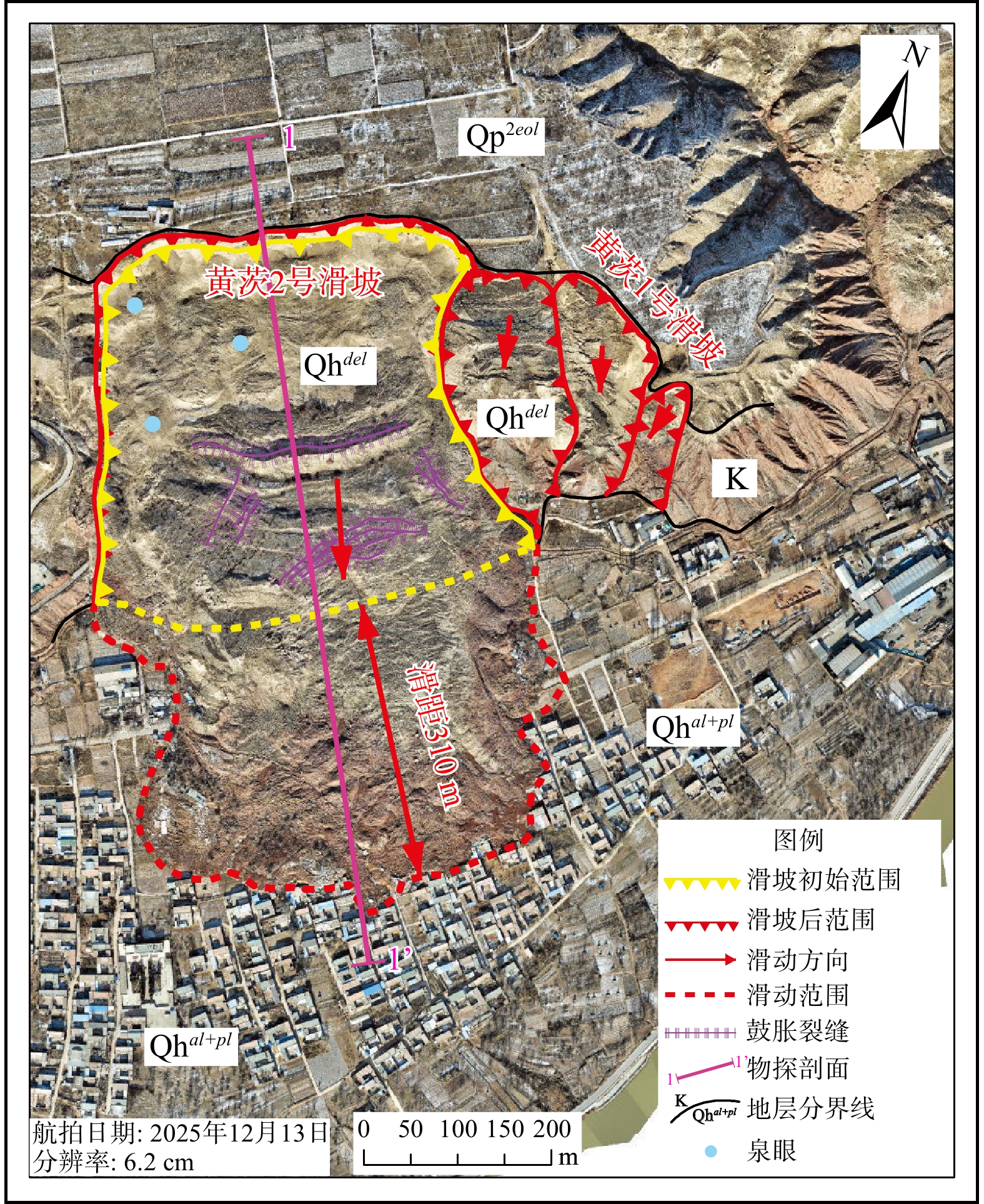
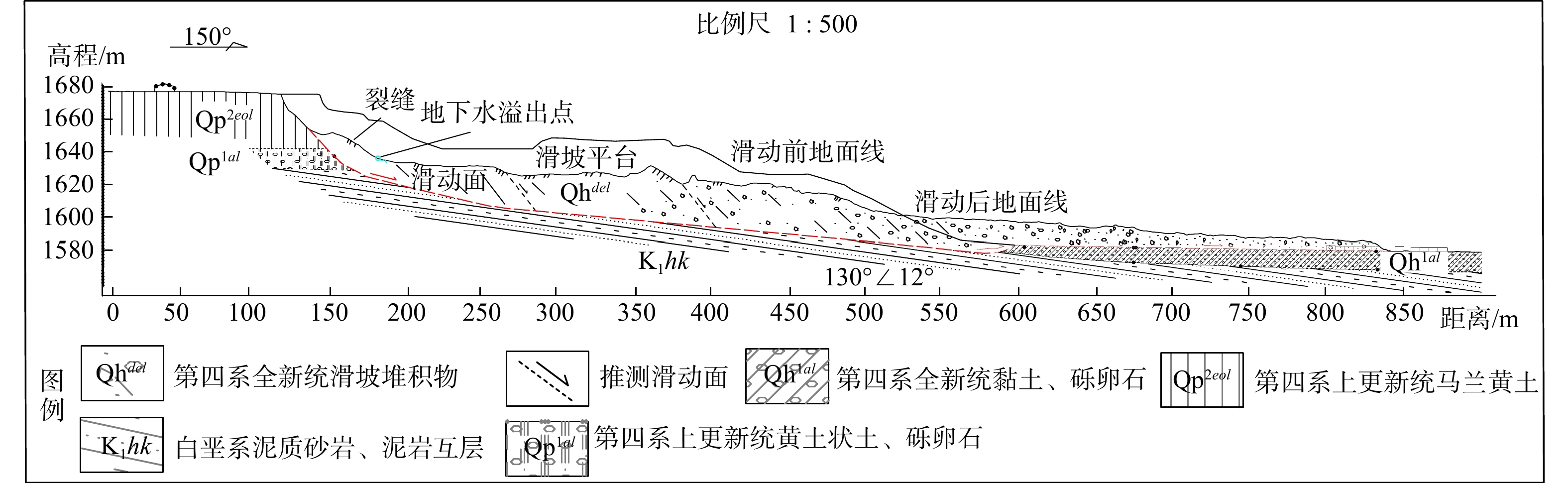
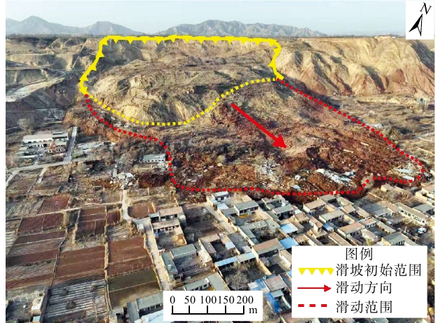
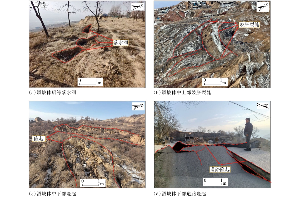
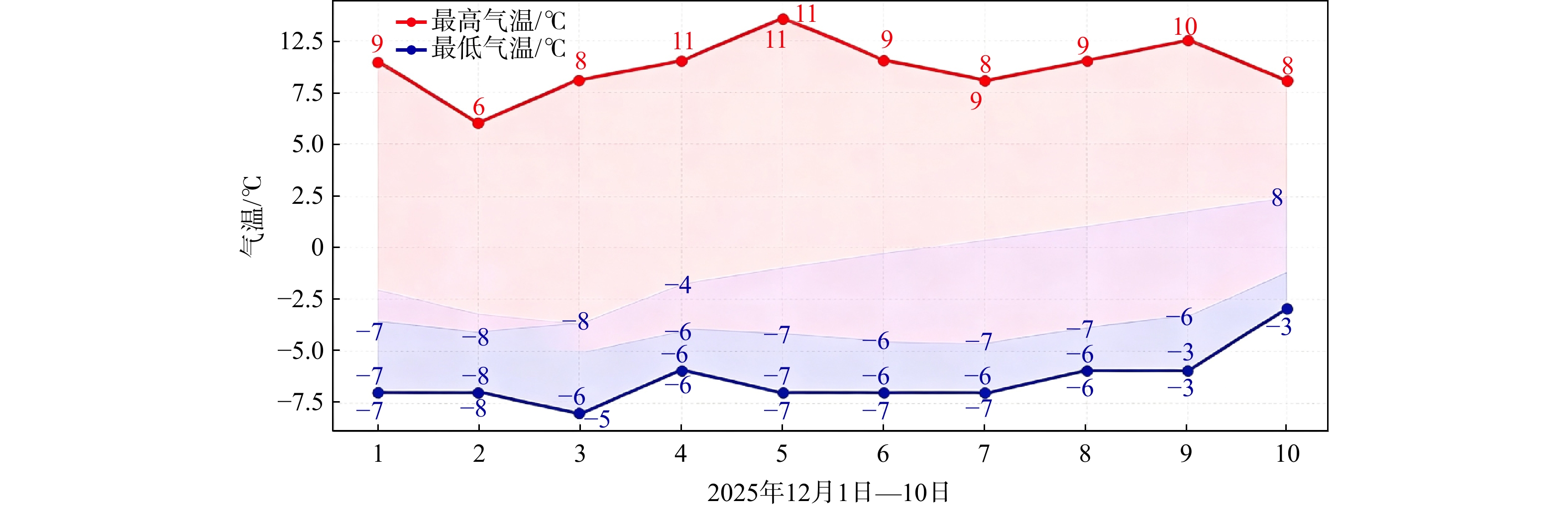
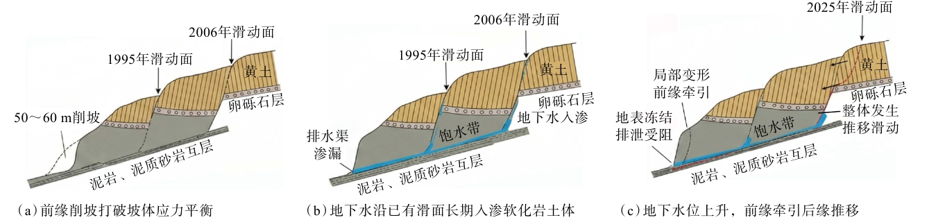
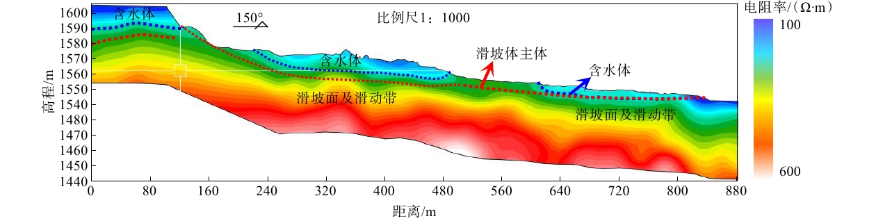
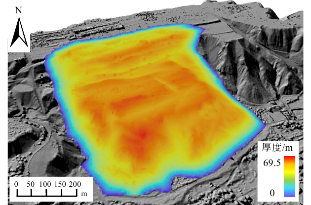
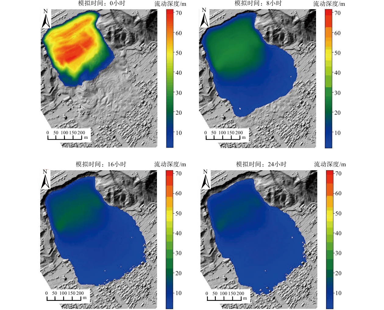
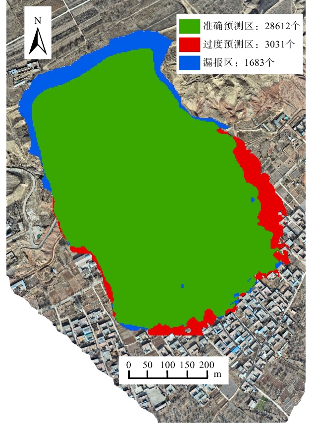
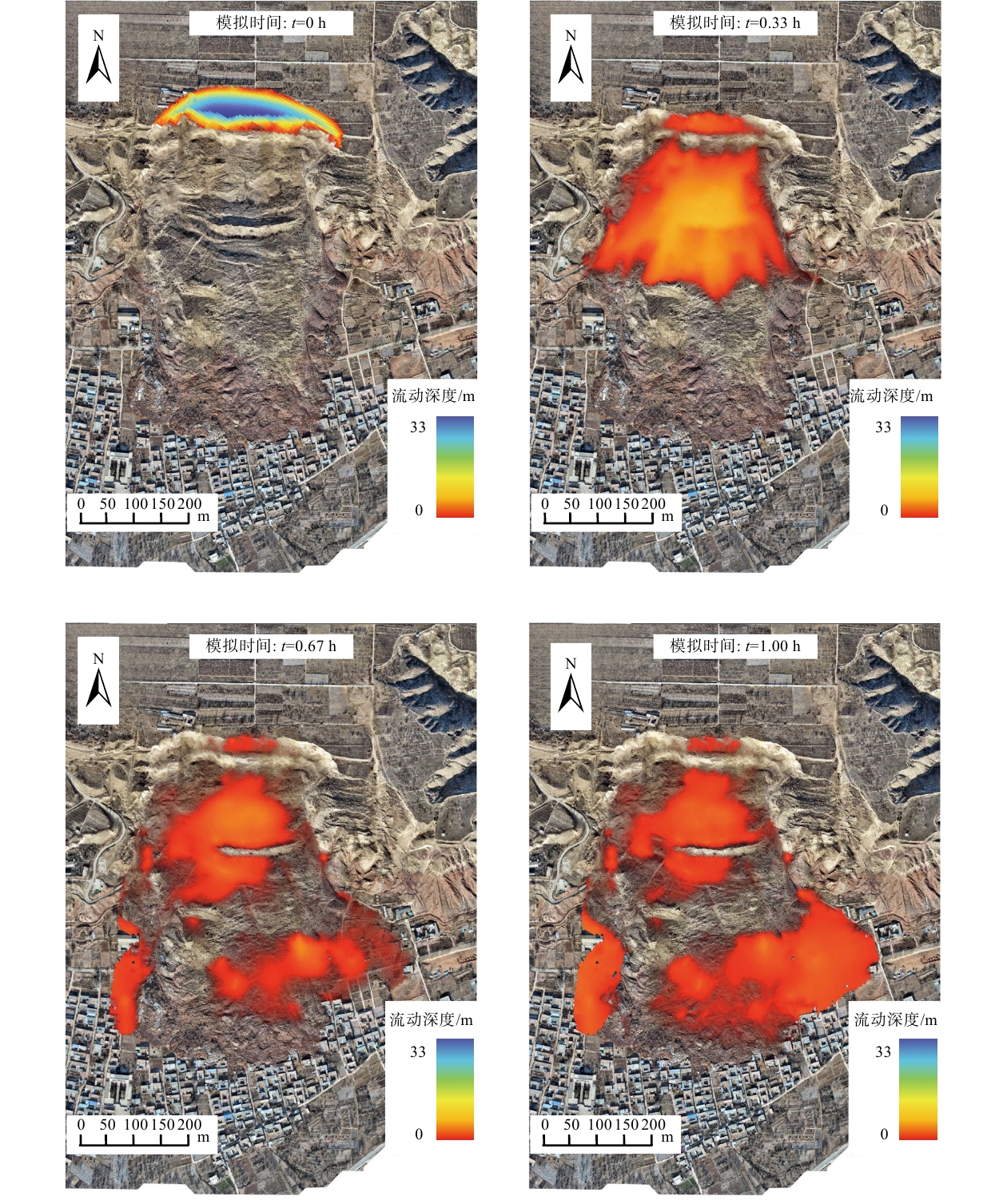
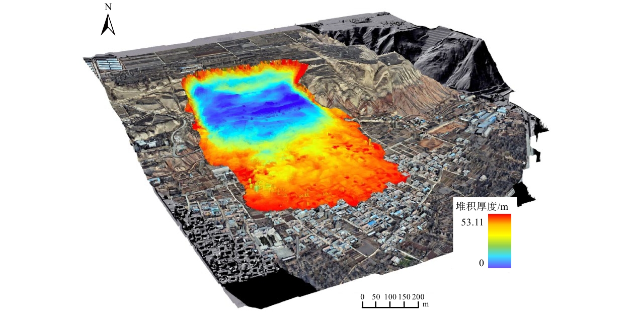
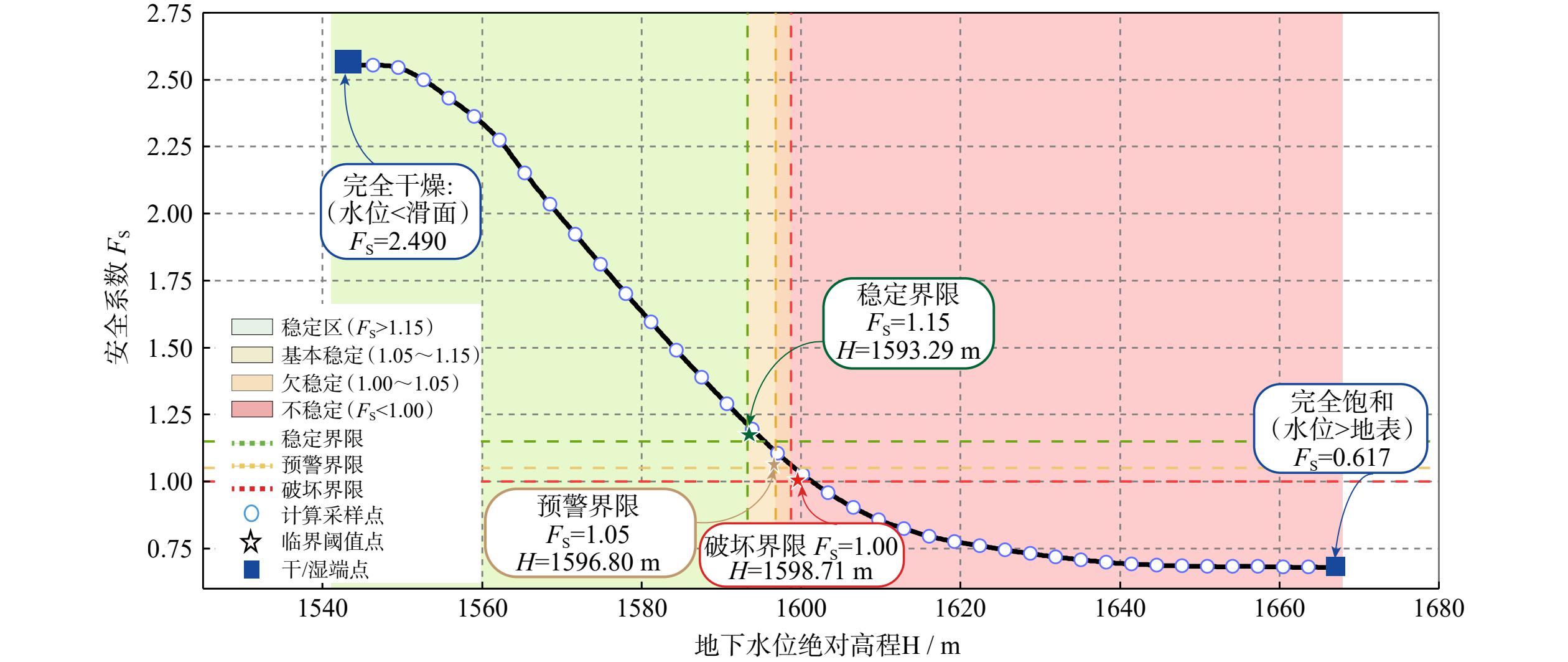
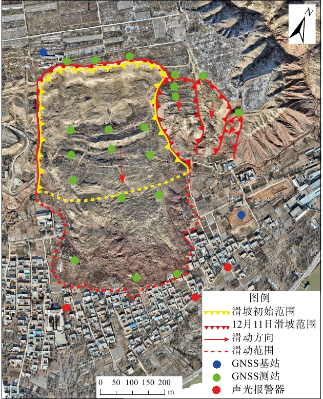
  Objective  To investigate the disaster-causing mechanisms, dynamic evolution, and post-disaster stability trends associated with the reactivation of the Huangci No. 2 landslide in Heifangtai, Gansu Province, on December 10, 2025, field geological investigations and the transient electromagnetic (TEM) surveys were conducted to characterize the deep structure of the landslide.  Methods  The entire three-dimensional dynamic sliding process was back-analyzed using the Massflow numerical model, and the three-dimensional limit equilibrium method was employed to quantitatively evaluate the post-event deposit and the stability of the high and steep rear slope and to predict their potential kinematic responses.   Results  (1) The reactivation of the landslide resulted from the coupled effects of slope-toe excavation, long-term irrigation, and winter freezing conditions. The freezing-induced water-retention and pore-pressure buildup effect acted as the direct trigger: surface freezing blocked seepage pathways, causing pore-water pressure to accumulate at depth and triggering a bedding-parallel slide along the loess–mudstone contact. (2) The entire sliding process lasted 22 h 10 min, with a cumulative displacement of 310 m. The Massflow simulation reproduced four stages of the dynamic evolution: creep, accelerated sliding, deceleration and deposition, and stagnation and compaction. The intersection over union (IoU) of the simulated and observed deposition morphologies reached 85.85%. (3) Quantitative calculations indicate that the current deposit has a factor of safety greater than 1.15, suggesting a relatively stable state characterized by settlement and consolidation. However, under extreme saturation conditions, the potential failure volume of the high and steep rear slope could reach 40.9×10⁴ m3, with a maximum sliding distance of approximately 640 m.  Conclusions  The reactivation of the landslide was controlled by freezing-induced water retention and pore-water pressure buildup, together with multiple external disturbances. Although the main landslide body has generally stabilized, the high and steep rear slope remains highly susceptible to secondary failure. A long-term dynamic monitoring system should therefore be established to mitigate the risk of high-elevation secondary hazards.   Significance  This study quantitatively demonstrates freezing-induced water retention and pore-water pressure buildup as a distinctive triggering mechanism for winter loess landslides, extending the conventional understanding of loess landslide initiation beyond single hydrodynamic factors such as rainfall and irrigation. The findings provide direct technical references and theoretical support for winter landslide prevention and mitigation, emergency monitoring deployment, and early identification of geological hazards in Heifangtai and other irrigated loess tablelands, thereby contributing to the protection of local communities and their property.
Active Tectonics & Earthquake
Remote sensing image characteristics and seismic hazard of the Baiganhu Fault on the south side of the central Altyn Tagh Fault
LIU Hanlin, CHEN Tao, YUAN Zhaode
2026, 32(4): 919-932. doi: 10.12090/j.issn.1006-6616.2025187
Abstract (185) HTML (37) PDF (21838KB)(122)
Abstract:
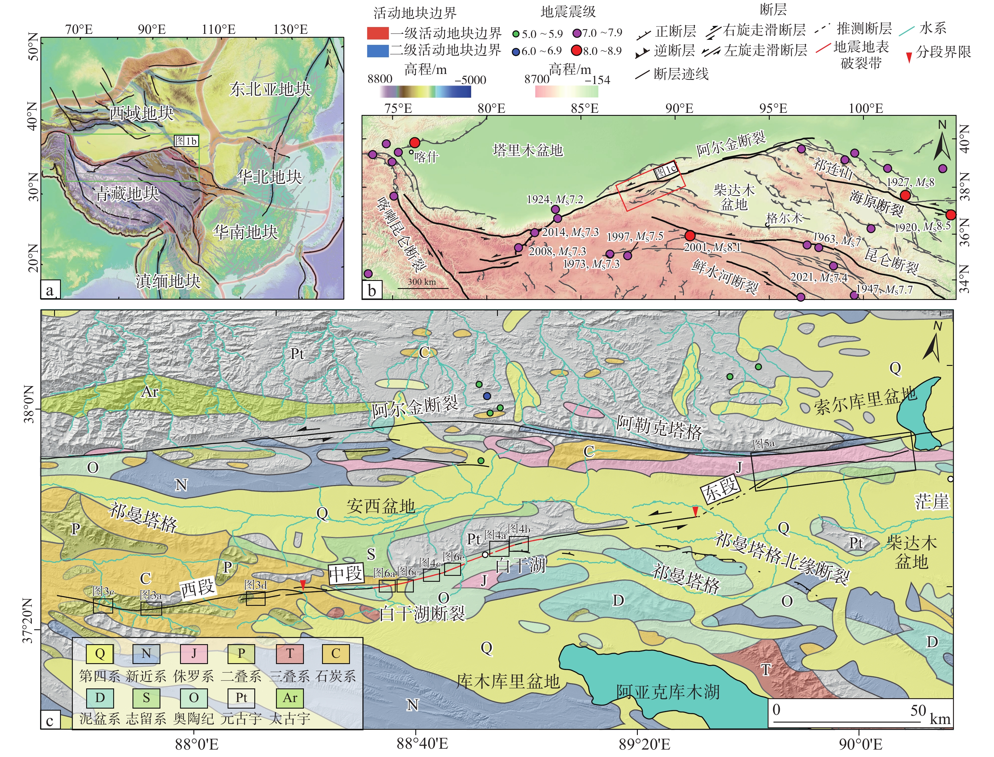
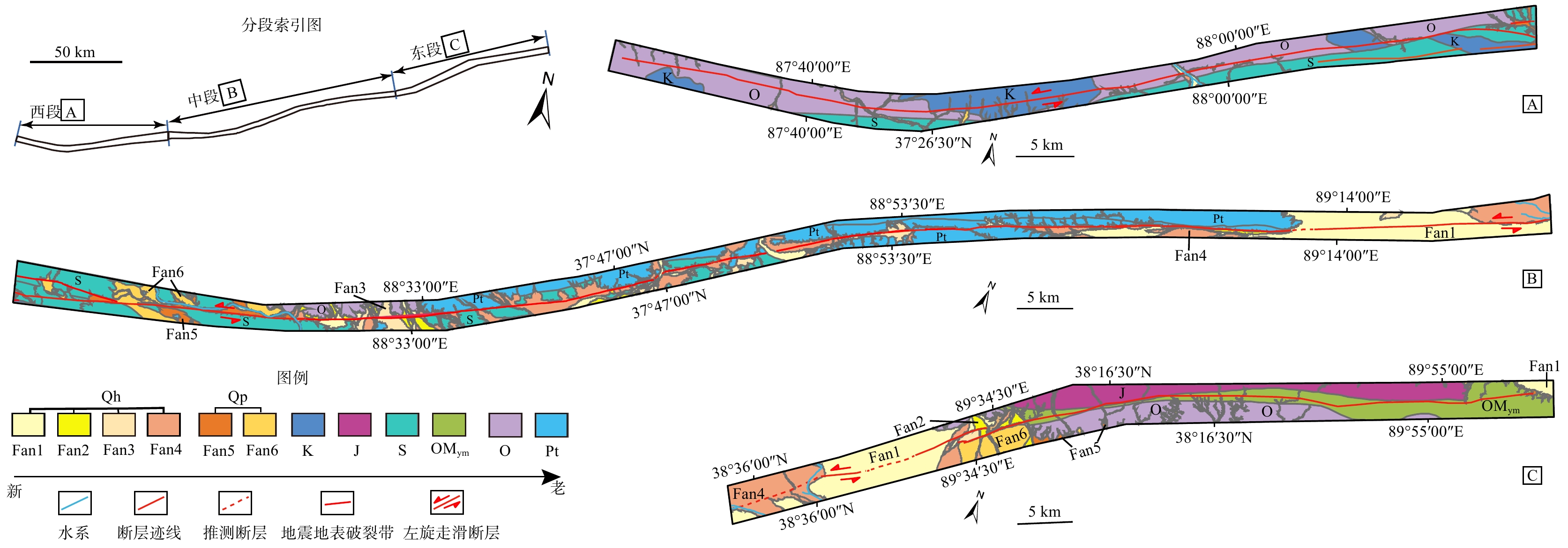
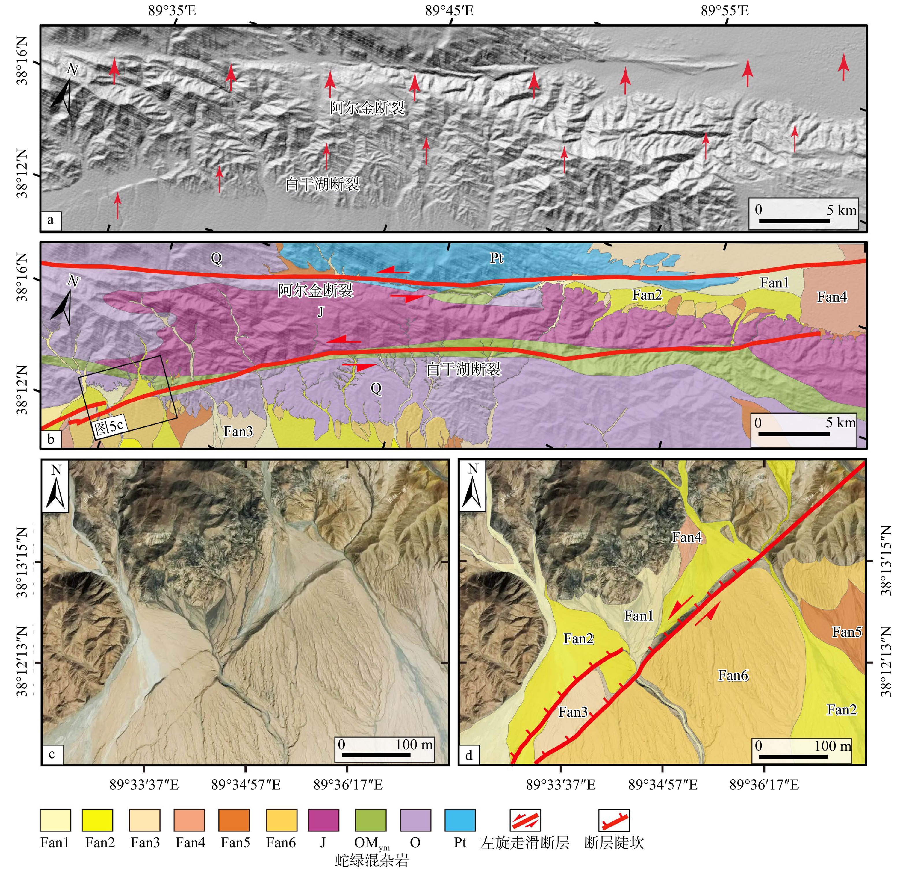
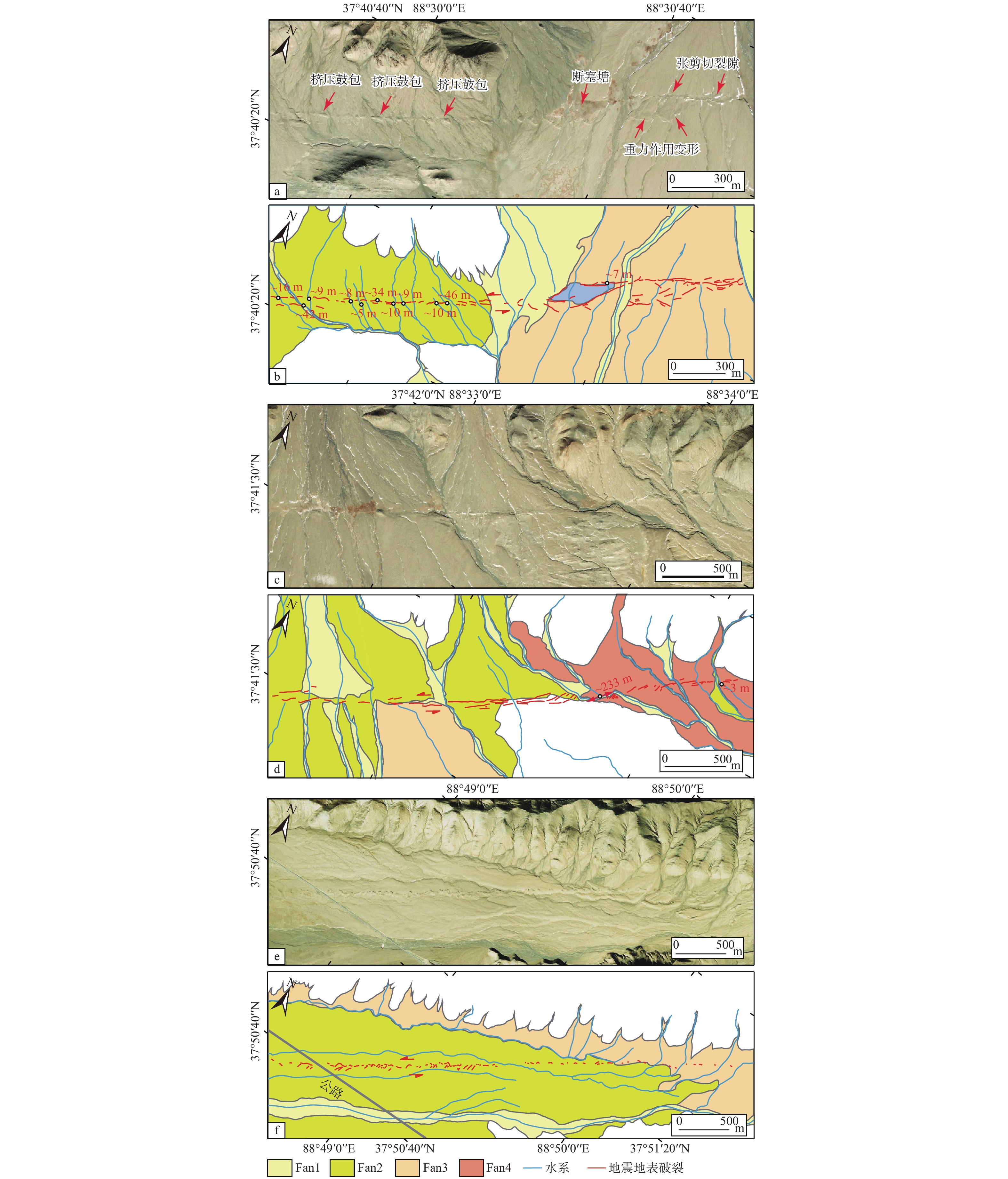
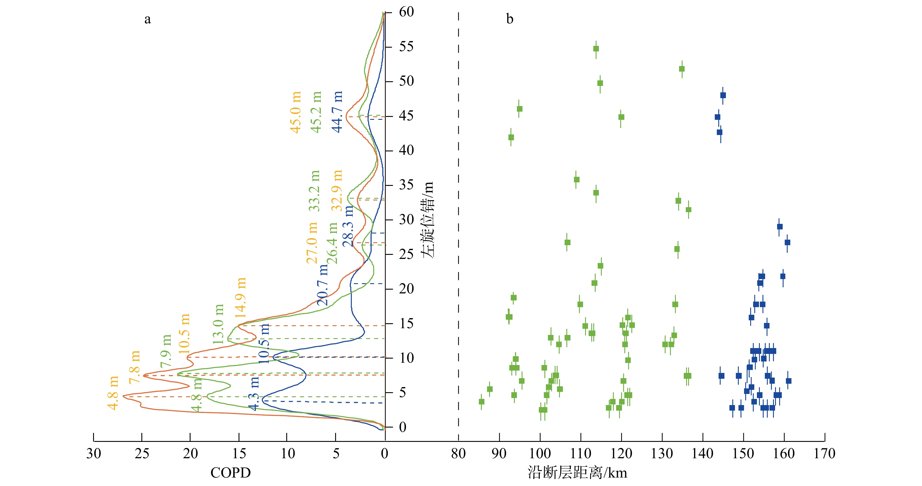
  Objective  Accurately delineating the spatial distribution and geometric scale of active faults is essential for understanding crustal deformation and assessing regional seismic hazards. While the Altyn Tagh Fault (ATF) has been extensively studied, its adjacent secondary structures—such as the Baiganhu Fault—remain poorly constrained regarding their geometry, slip history, and seismic potential. This study aims to systematically characterize the offset geomorphology of the Baiganhu Fault, establish its segmentation, and evaluate its potential for generating large earthquakes, including multi-fault cascading ruptures with the ATF.  Methods  Using multi-source high-resolution satellite imagery and digital topographic data, we conducted detailed geomorphic mapping of the Baiganhu Fault. Displaced landforms (e.g., offset gullies, alluvial fans, pressure ridges, and sag ponds) were measured. We constrained displacement variations at individual measurement points using Gaussian cumulative probability density (COPD) distributions to interpret the displacement accumulation pattern and evaluate coseismic slip.  Results  The Baiganhu Fault extends for approximately 247 km along a general northeast–east (NEE) strike, displaying prominent left-lateral strike-slip geomorphic features. Based on fault geometry and deformation patterns, it is divided into western, central, and eastern segments. The central segment hosts a well-preserved ~50-km-long surface rupture zone with an average coseismic displacement of 4.8 m. Statistical analysis of 99 offset gullies yields an average horizontal offset of 4.3–4.8 m for the most recent event, corresponding to a moment magnitude of MW 7.4±0.3. A full-segment rupture could generate an earthquake of MW 7.8±0.3. Furthermore, the ~5-km-wide stepover separating the Baiganhu Fault from the main strand of the ATF is unlikely to act as a permanent barrier, making a cascading rupture mechanically plausible.   Conclusions  The Baiganhu Fault is a highly active left-lateral structure capable of generating MW 7.4 events. Regional seismic hazard models must incorporate the scenario of cascading ruptures between the Baiganhu Fault and the Altyn Tagh Fault to avoid underestimating seismic risk to surrounding infrastructure.  Significance  This study provides critical quantitative constraints on the geometry, slip behavior, and seismic potential of a previously under-studied secondary structure within the ATF system. By highlighting the potential for multi-fault cascading ruptures, our findings underscore the need to update regional seismic hazard models, which is vital for risk mitigation and infrastructure safety in the region.
Numerical simulation analysis of seismically triggered load and ball-and-pillow structures in the lacustrine sediment
YAN Zelong, FAN Ruixiang, LIANG Lianji, ZHONG Ning, ZHANG Junjie
2026, 32(4): 933-941. doi: 10.12090/j.issn.1006-6616.2026005
Abstract (178) HTML (35) PDF (1775KB)(112)
Abstract:
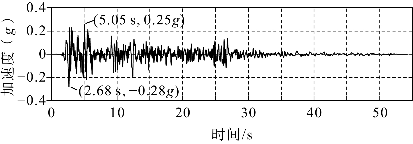
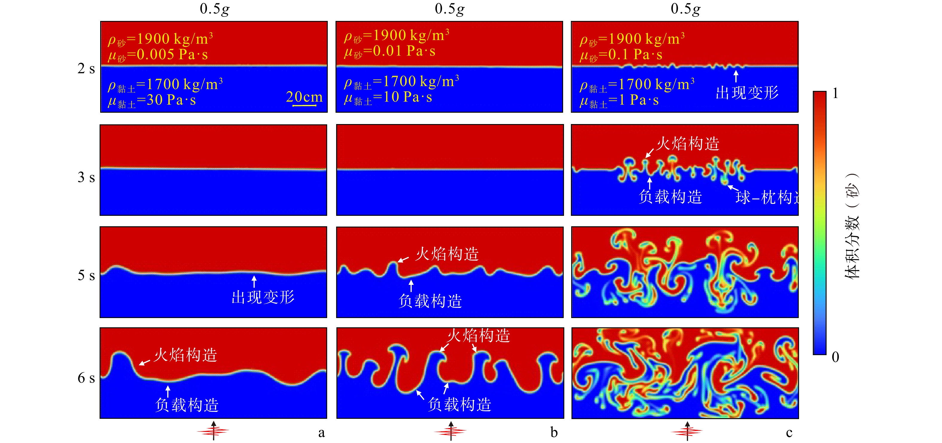
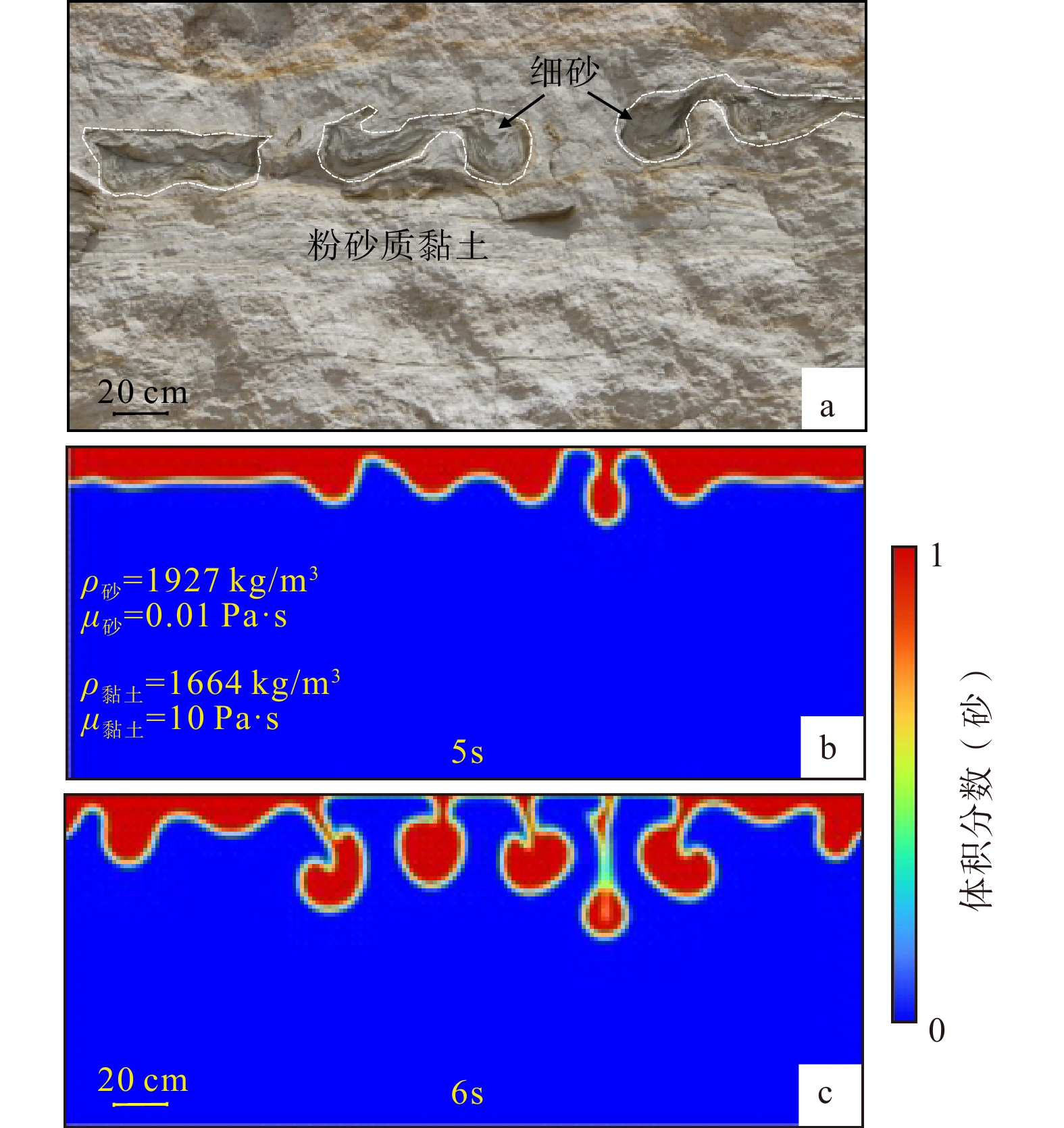
  Objective  Seismically triggered soft-sediment deformation structures (SSDSs) in the lacustrine sediments serve as reliable stratigraphic records for studying paleoearthquake events in tectonically active regions. Load and ball-and-pillow structures, as common types of SSDSs, are generally attributed to gravitational instability caused by an inverse density gradient between adjacent sedimentary layers. However, their formation mechanisms and the quantitative relationship between their development and seismic intensity remain poorly constrained.  Methods  This study employs the multiphase-flow numerical simulation approach implemented in ANSYS Fluent to simulate the formation of load and ball-and-pillow structures in saturated sand–clay layers under different peak ground accelerations (PGAs; 0.125g, 0.25g, 0.5g, and 0.8g) and varying physical properties, including density, dynamic viscosity and layer thicknesses). The effects of sediment physical properties on the development of these deformation structures and their relationship with seismic intensity were investigated.  Results  The results show that as the PGA increases, load and flame structures develop earlier at the sand–clay interface and progressively evolve from small load structures into larger-scale load and ball-and-pillow structures. Under the same PGA, a larger density contrast, a smaller dynamic viscosity contrast, and a thicker overlying sand layer result in greater deformation and larger-scale development of load and ball-and-pillow structures.  Conclusions  The morphologies of the load and ball-and-pillow structures produced by the numerical simulations are highly consistent with those observed in lacustrine sediments in the Tashkorgan area. This agreement supports the proposed mechanical mechanism of their formation and provides a quantitative basis for understanding the development of SSDSs under different seismic and sedimentary conditions.  Significance  This finding verifies the seismic trigger of SSDSs in this region and provides a new technological insight into the study of SSDSs and paleoearthquakes.
Fundamental Geology & Regional Geology
Tectonic evolution of the western Yangtze Block during the Ediacaran–Cambrian: evidence from detrital zircon U-Pb geochronology
SHI Zhiqiang, SUN Le, ZHANG Hong, PEI Jinyun, LI Wei
2026, 32(4): 942-957. doi: 10.12090/j.issn.1006-6616.2025065
Abstract (366) HTML (74) PDF (2674KB)(273)
Abstract:
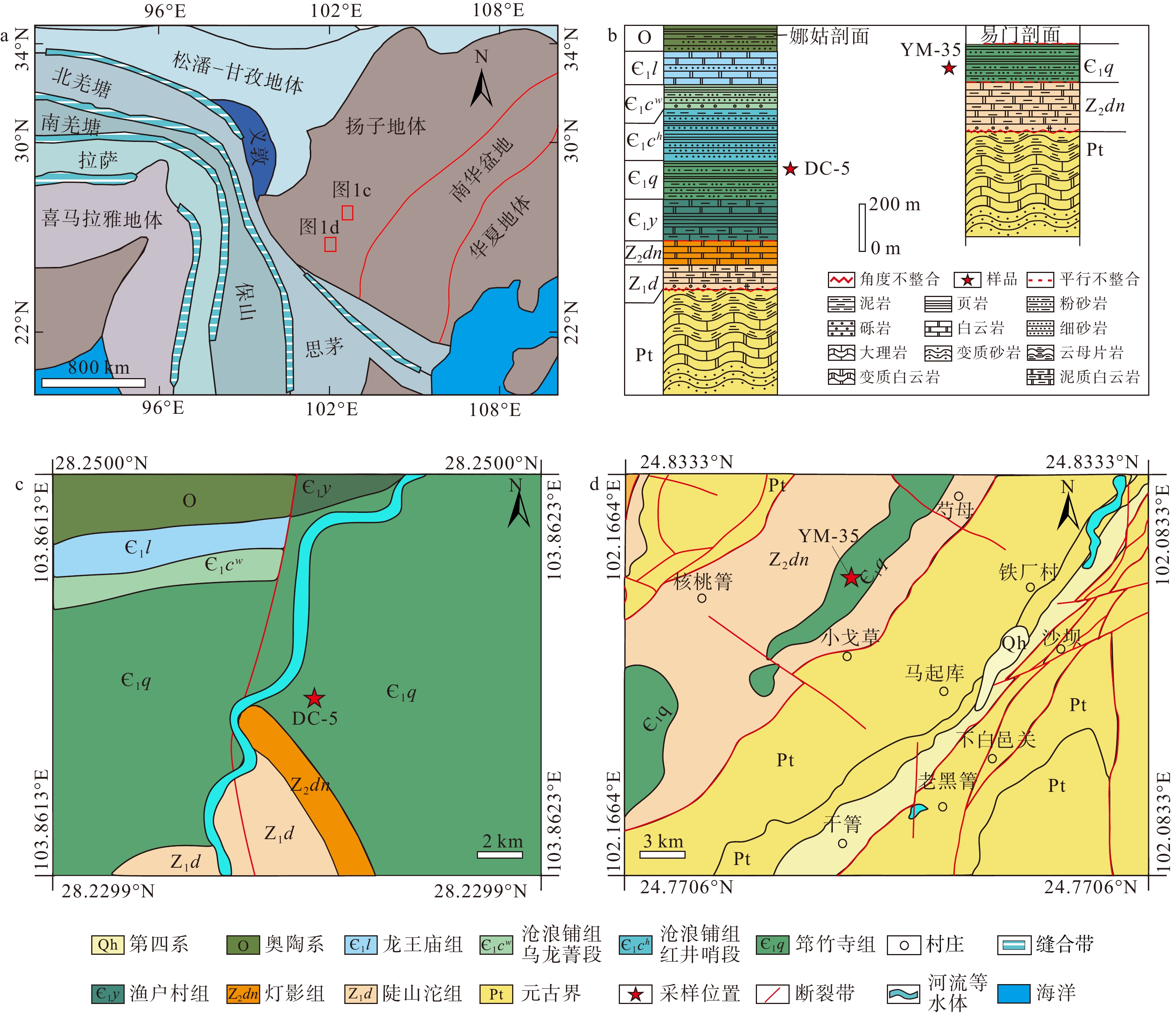
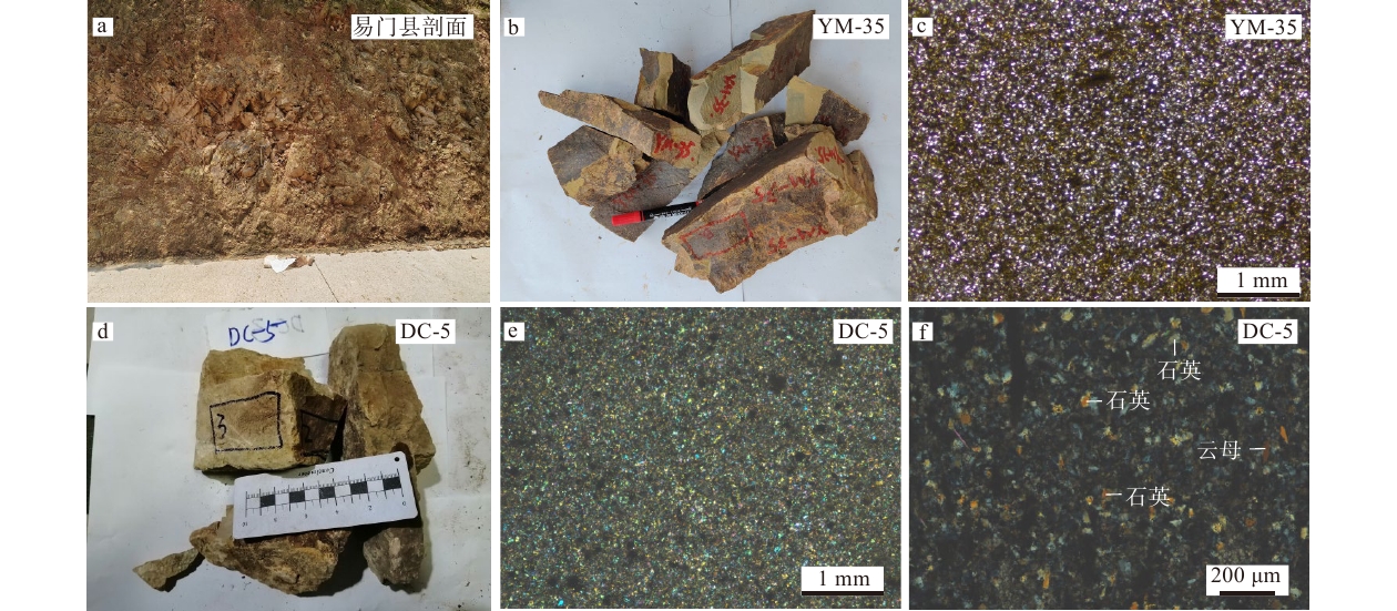
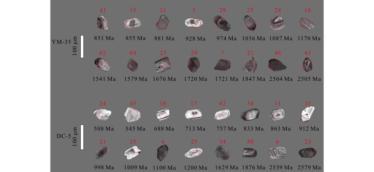
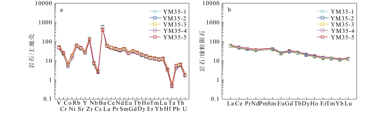
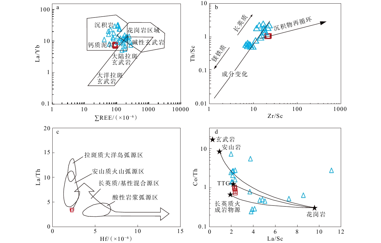
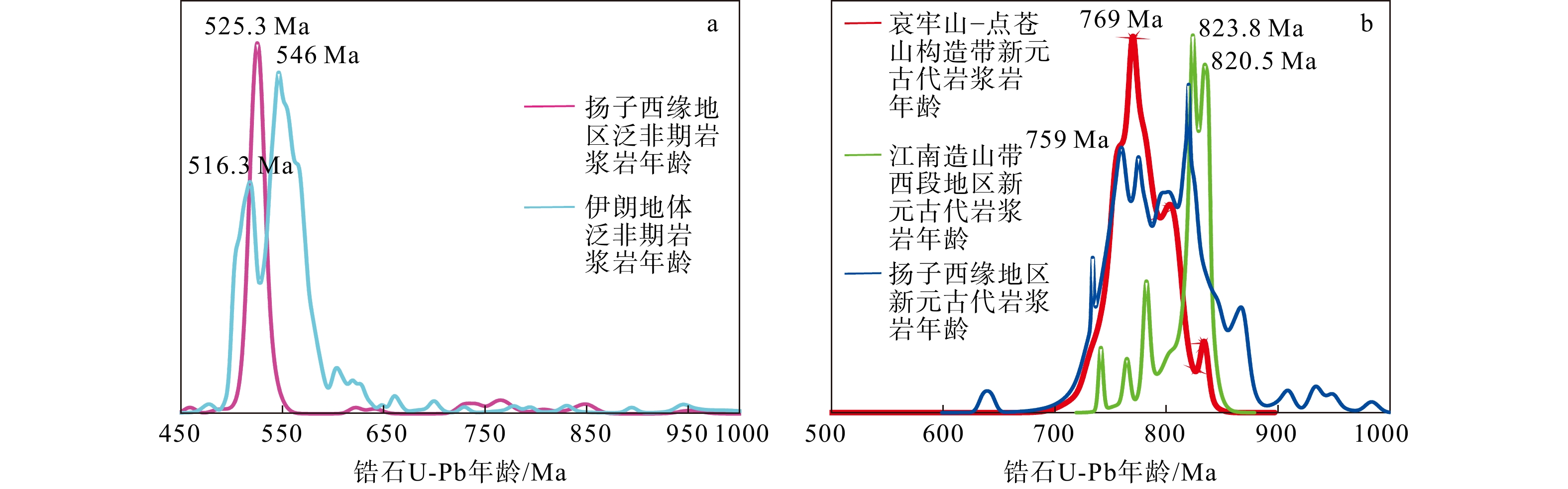
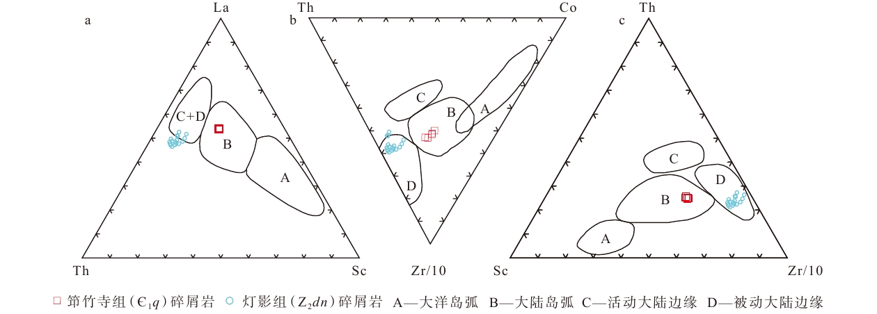
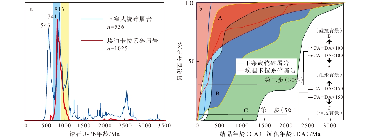
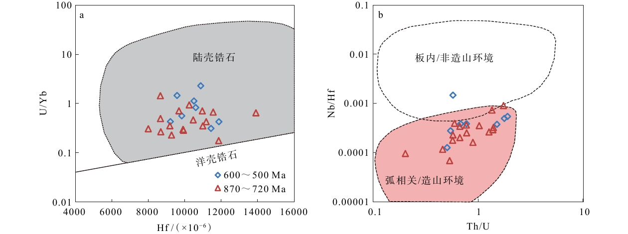
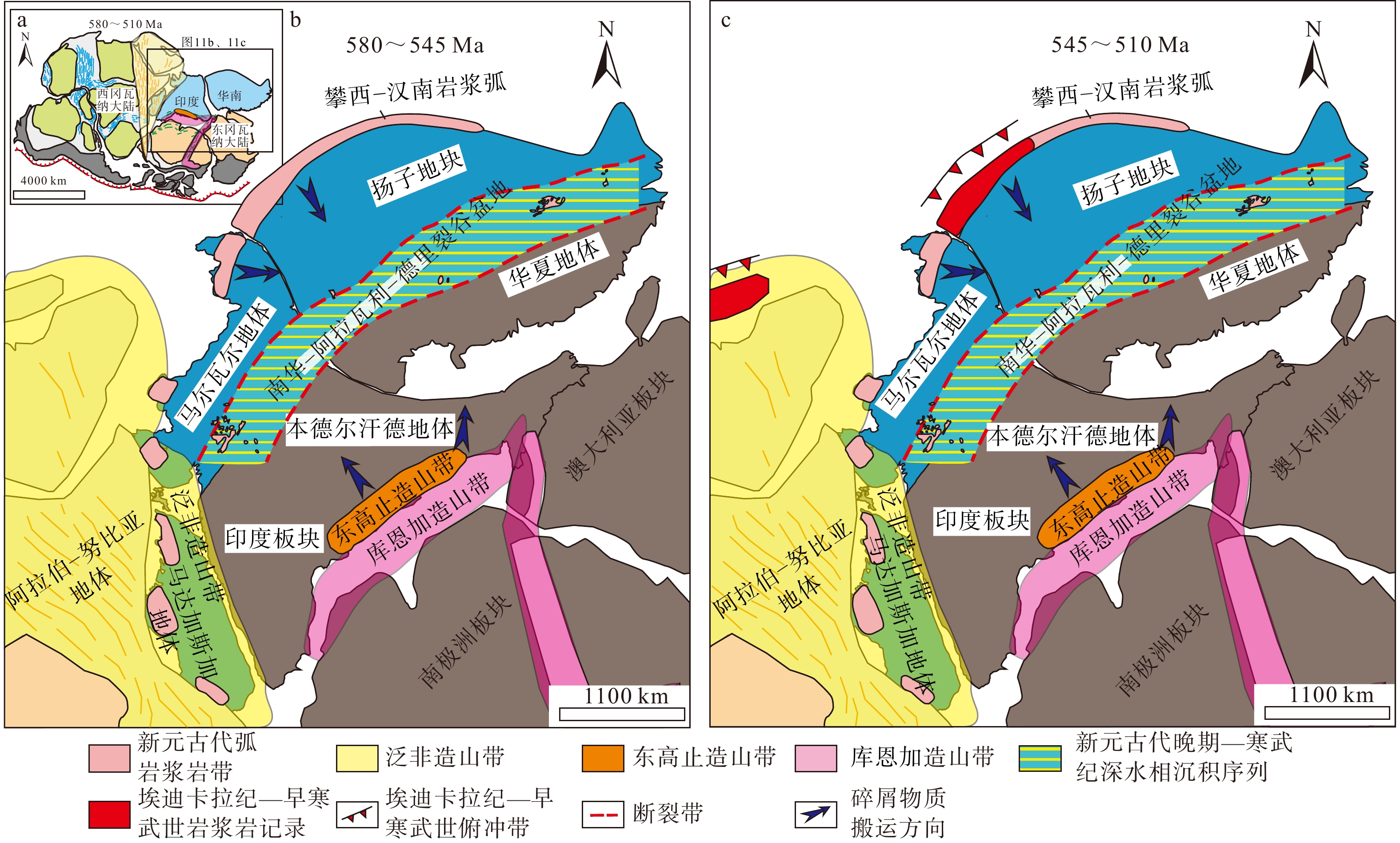
  Objective  The Yangtze Block was a crucial component of the Gondwana supercontinent. During the Ediacaran–Early Cambrian, its western margin underwent a marked transition from carbonate- to siliciclastic-dominated depositional environments. However, the tectonic dynamics and geotectonic setting governing this pronounced sedimentary facies shift remain poorly constrained. Thick Lower Cambrian terrigenous clastic rocks widely exposed along the western margin of the Yangtze Block (Western Yangtze) serve as a key archive for tracing sediment provenance and deciphering Early Cambrian geotectonic evolution.  Methods  This study presents systematic detrital zircon U–Pb geochronological and whole-rock major- and trace-element geochemical analyses of the Lower Cambrian Qiongzhusi Formation in the Western Yangtze to constrain its provenance and tectonic background.  Results  Whole-rock geochemical data indicate that high-field-strength elements (HFSEs) and large-ion lithophile elements (LILEs; e.g., Th, Zr, Hf, Ba, Pb) in the Qiongzhusi Formation clastic rocks align closely with upper continental crust (UCC) values. Conversely, elements such as Co, Ni, Y, Nb, Cs, Hf, and Ta are depleted relative to UCC, with Co, Cs, and Ta showing the most significant depletion. Characteristics of immobile elements (Th, Sc, Hf, Zr, Ho) and rare earth elements (REEs; e.g., La, Ce, Yb) consistently indicate a predominantly felsic igneous source. Detrital zircon U–Pb age spectra exhibit two primary population peaks at ca. 590–500 Ma and ca. 880–720 Ma, alongside two subordinate clusters at ca. 1900–1500 Ma and ca. 2500–2400 Ma.  Conclusions  Integrated with regional geological evidence, we propose that the Early Cambrian detritus was primarily derived from Ediacaran–Early Cambrian magmatic rocks within the Longmenshan tectonic belt, as well as weathering products of late Neoproterozoic felsic magmatic rocks from the Panxi–Hannan and Ailaoshan magmatic arcs. Subduction of the Proto-Tethys Ocean beneath the Western Yangtze during the latest Ediacaran–Early Cambrian established a Late Ediacaran–Early Cambrian magmatic arc. This tectonic event converted the Western Yangtze from a passive margin into an active continental margin, supplying voluminous Early Cambrian detritus that drove the major depositional transition from carbonates to siliciclastics. [ Significance ]These findings establish key provenance links between the Western Yangtze and surrounding orogenic belts, providing critical constraints for reconstructing the tectonic and paleogeographic evolution of the South China Block during the Ediacaran–Early Cambrian transition.
Genesis of Ordovician Kelimoli Formation dolomites in the complex tectonic zone along the western margin of the Ordos Basin
MA Zhanrong, LI Zhenhong, LIU Jianping, HU Aiping, KOU Linlin
2026, 32(4): 958-979. doi: 10.12090/j.issn.1006-6616.2025031
Abstract (246) HTML (73) PDF (17456KB)(381)
Abstract:
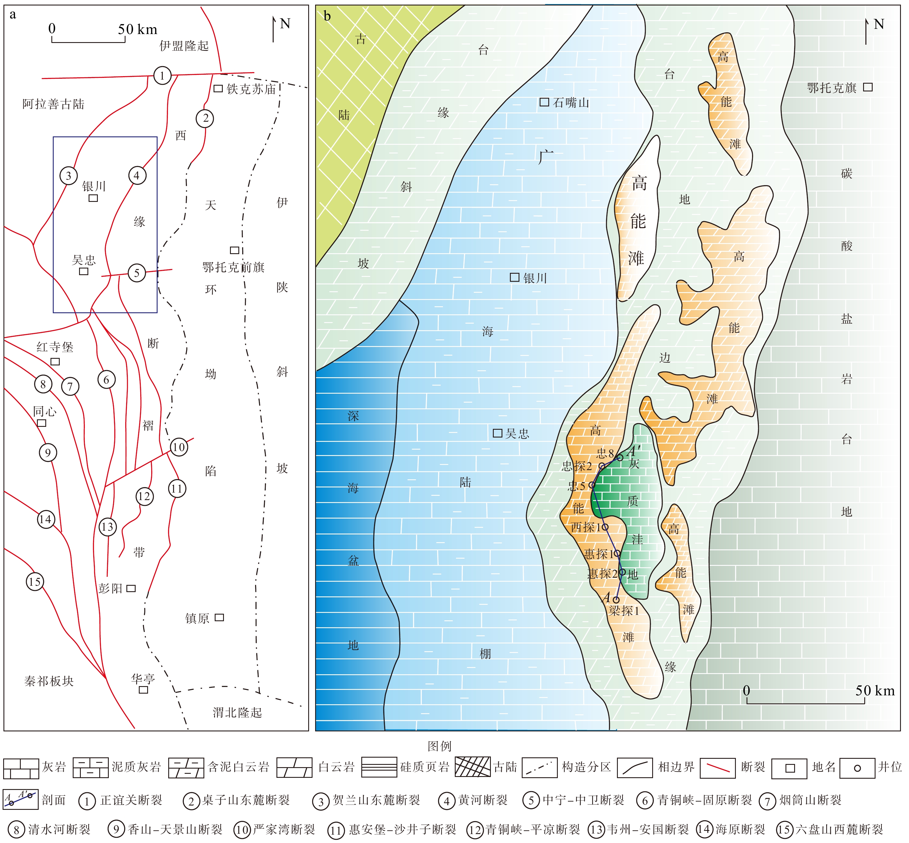
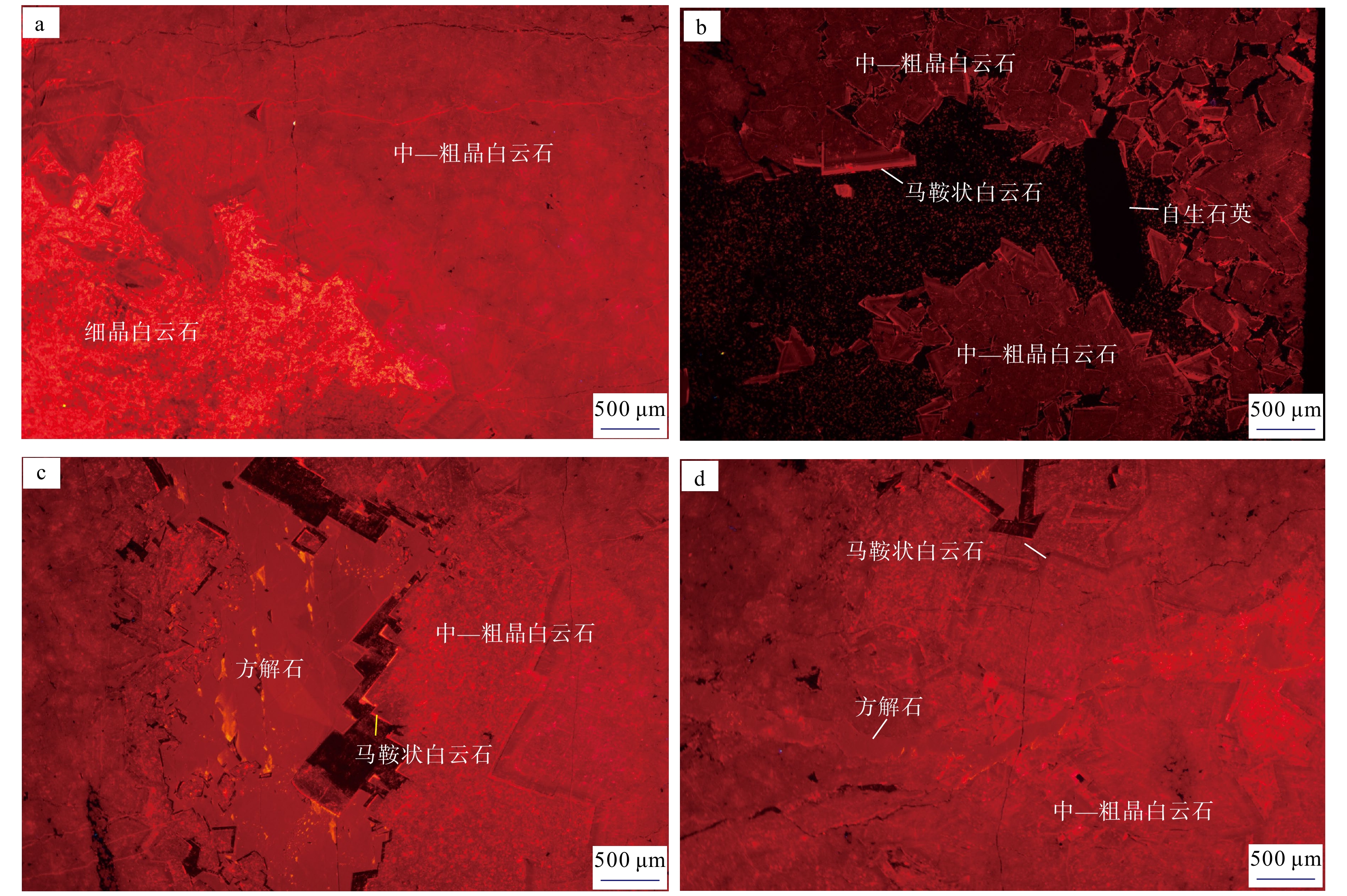
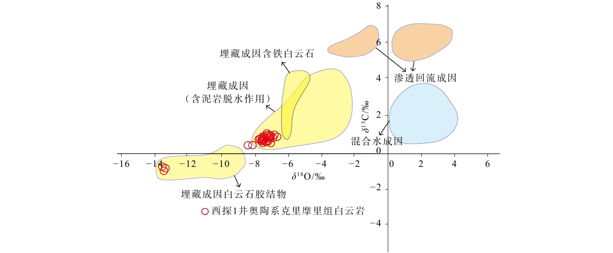
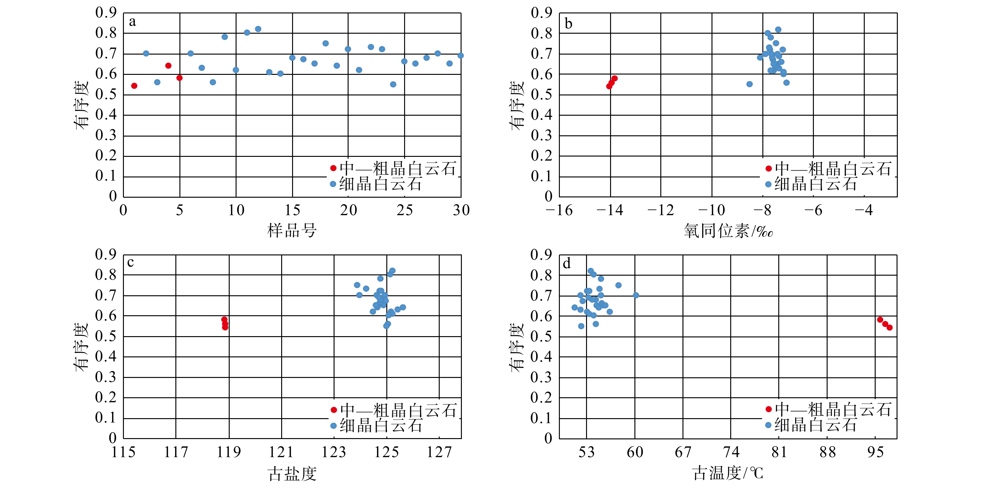
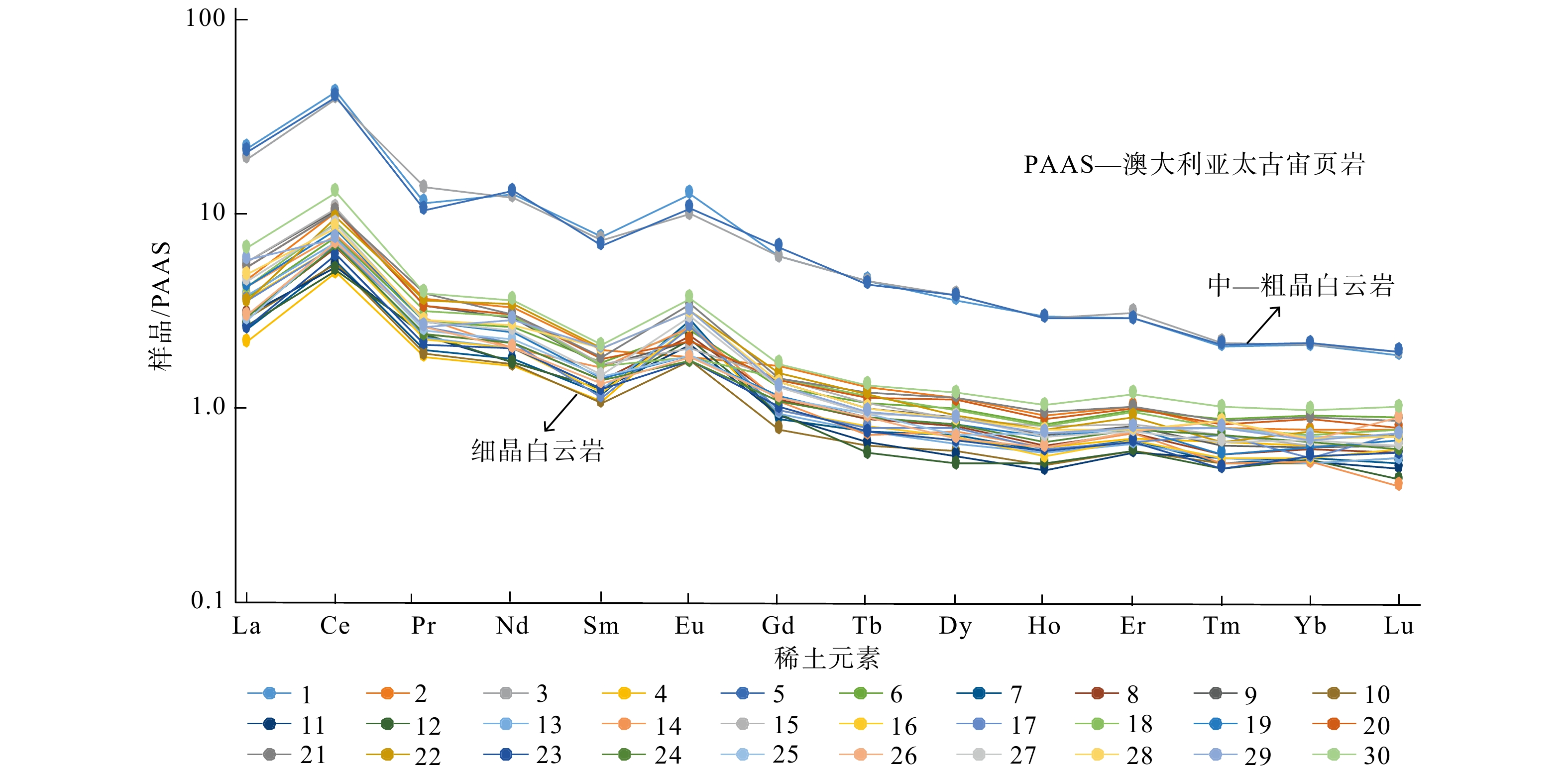
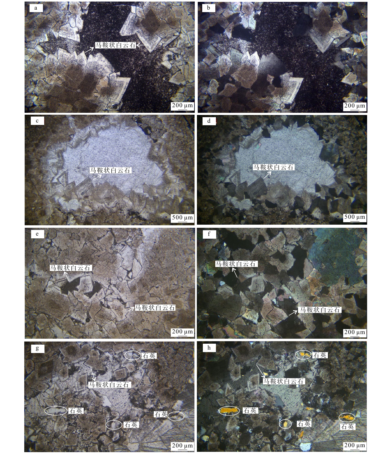
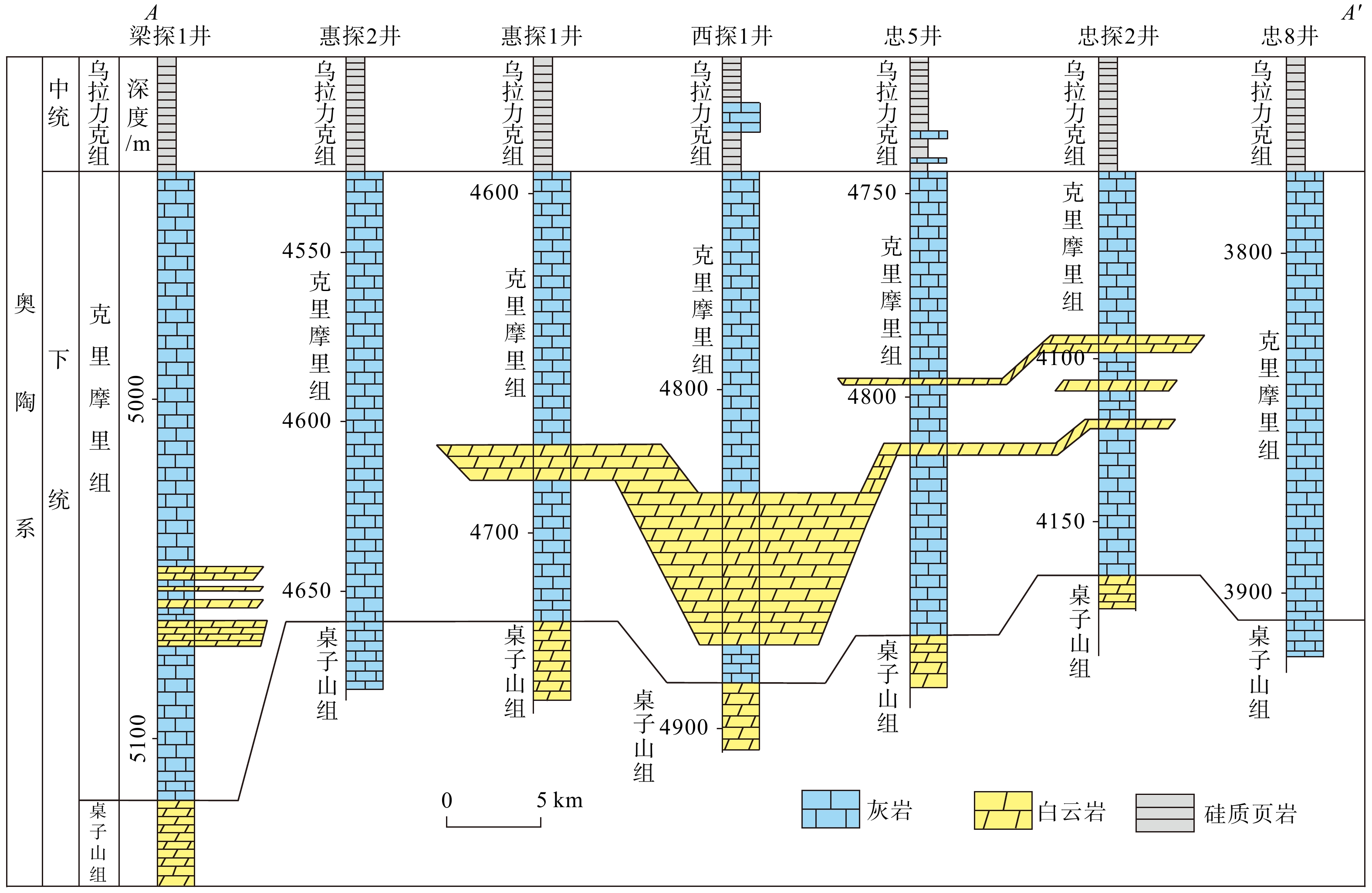
  Objective  The dolomite in the Ordovician Kelimoli Formation of the complex tectonic zone along the western Ordos Basin margin is a high-quality reservoir for natural gas exploration. However, its genetic mechanism and the relationships among the sedimentary environment, multi-stage tectonic superimposition, and diagenetic alteration remain controversial, limiting effective guidance for oil and gas exploration.  Methods  To elucidate the genesis of this dolomite, a comprehensive analytical approach was applied, incorporating thin-section petrography, cathodoluminescence (CL), C–O isotopes, X-ray diffraction (XRD) ordering degrees, trace and rare earth element (REE) geochemistry, and Sr isotopes, integrated with regional tectonic evolution.  Results  Under CL, the dolomites generally exhibit weak dark-brown luminescence with distinct zonation, alongside authigenic quartz and saddle dolomite, indicating hydrothermal involvement and multi-stage recrystallization during deep burial. Carbon and oxygen isotopic signatures further support a burial origin. XRD data reveal a relatively low ordering degree in dolomites, which decreases with increasing temperature, suggesting rapid crystallization under elevated temperatures. REE patterns display positive Ce and Eu anomalies, indicating that dolomitization occurred in a relatively closed, high-temperature, and high-pressure diagenetic system via internal fluid readjustment and material redistribution. Overall, the dolomite shows a relatively low degree of order, and the order decreases with higher temperatures, suggesting that the dolomite formed in an environment with relatively high temperature and rapid crystallization rate. Geochemically, lower Sr contents correlate with higher Fe and Mn concentrations, reflecting multi-stage superimposed alteration under deep burial conditions. Furthermore, strontium isotope values of medium-to coarse-grained dolomite closely approach average crustal values, likely influenced by crustal Sr transported along coeval tectonic conduits.   Conclusions  This research attributes the dolomite formation primarily to deep burial and the coeval superimposition of tectonic fluid modification. The origin and evolution of the Ordovician Kelimoli Formation dolomite were strongly controlled by deep fault systems. During the co-deposition period, this fault system controlled the development of high-energy terraces. In the subsequent tectonic activity phase, the deep fault system became a fluid migration channel, facilitating the superimposed modification of dolomite bodies.   Significance  The research results provide fundamental support for the efficient exploration of oil and gas resources.
Study on the cooling history of Pliocene basalt columns in Kanchanaburi, Thailand
ZHOU Enxiong, YAN Yonggang, LAI Zhenyang, LI Danxin, FU Yalan, DENG Xiaotai, ANCHANA Thanakan, VEERAVINANTANAKUL Apivut, CHARUSIRI Punya, WANG Weitao, HUANG Baochun, ZHANG Peizhen
2026, 32(4): 980-998. doi: 10.12090/j.issn.1006-6616.2025169
Abstract (224) HTML (46) PDF (6100KB)(171)
Abstract:
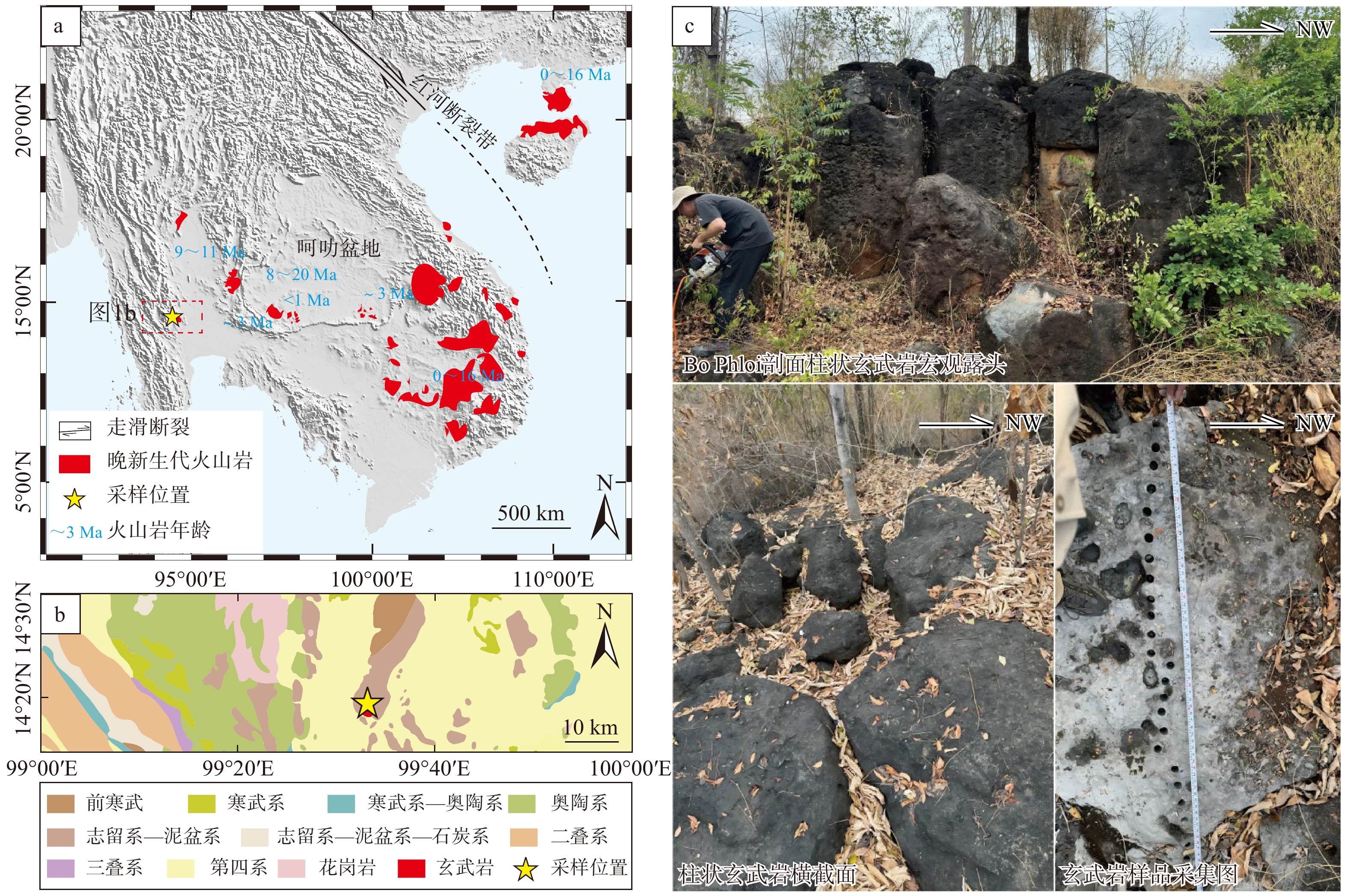
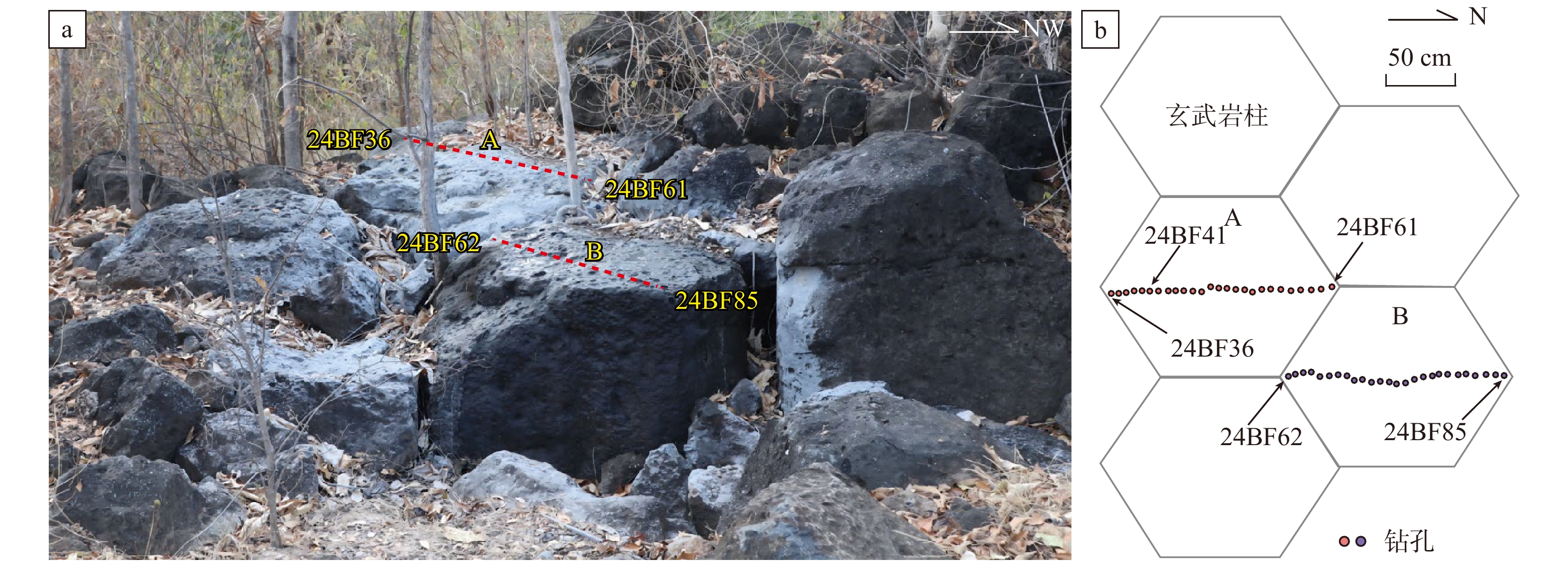
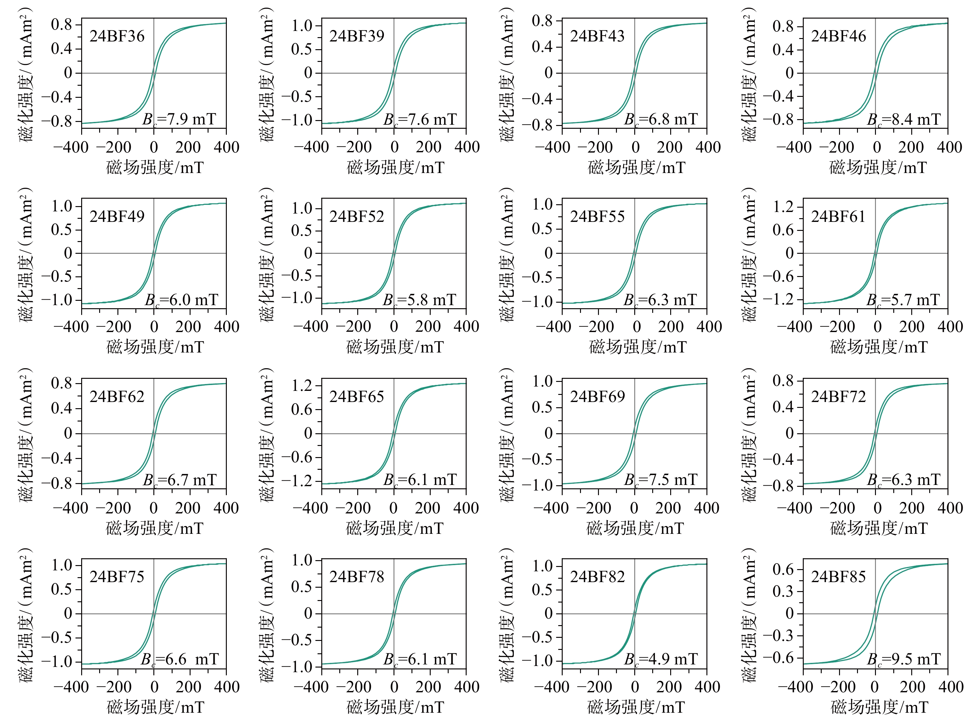
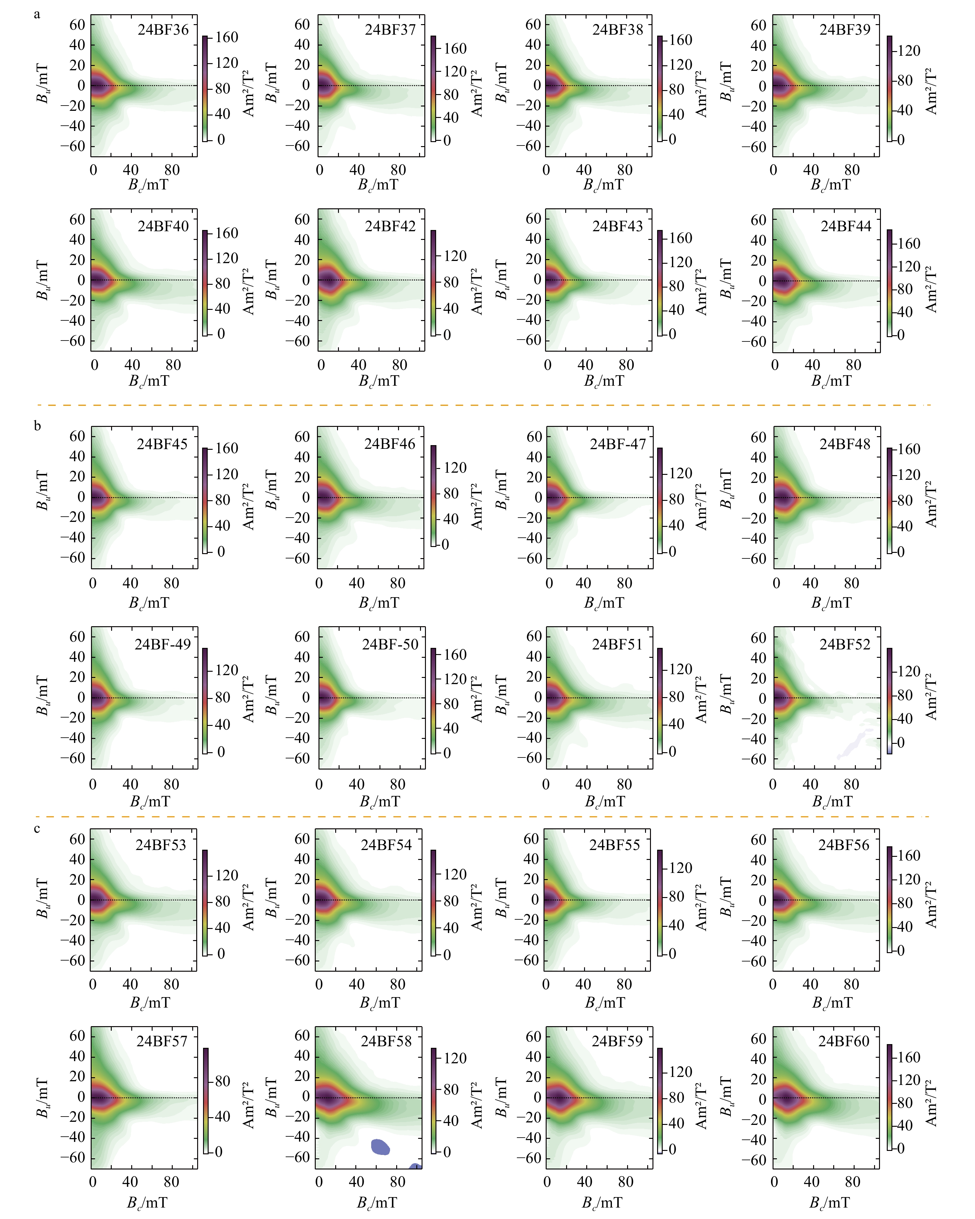
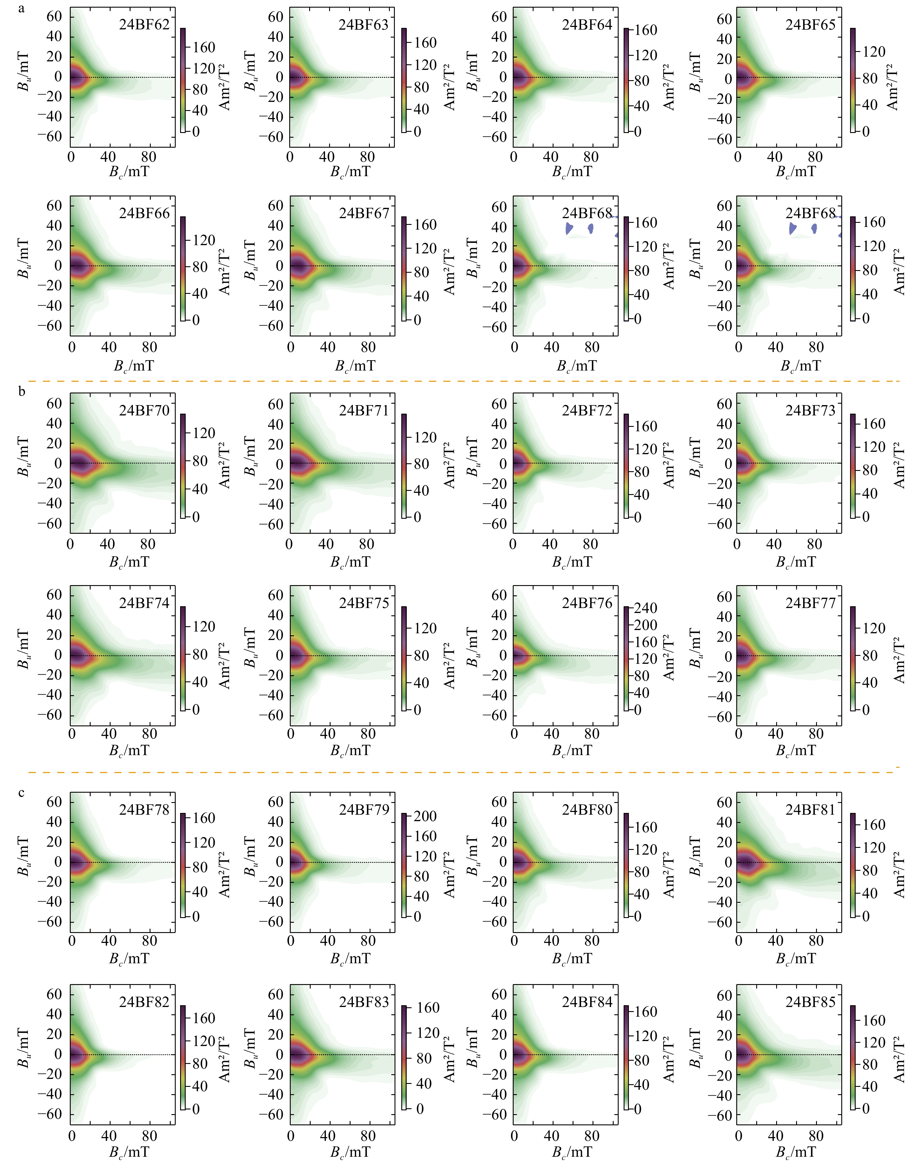
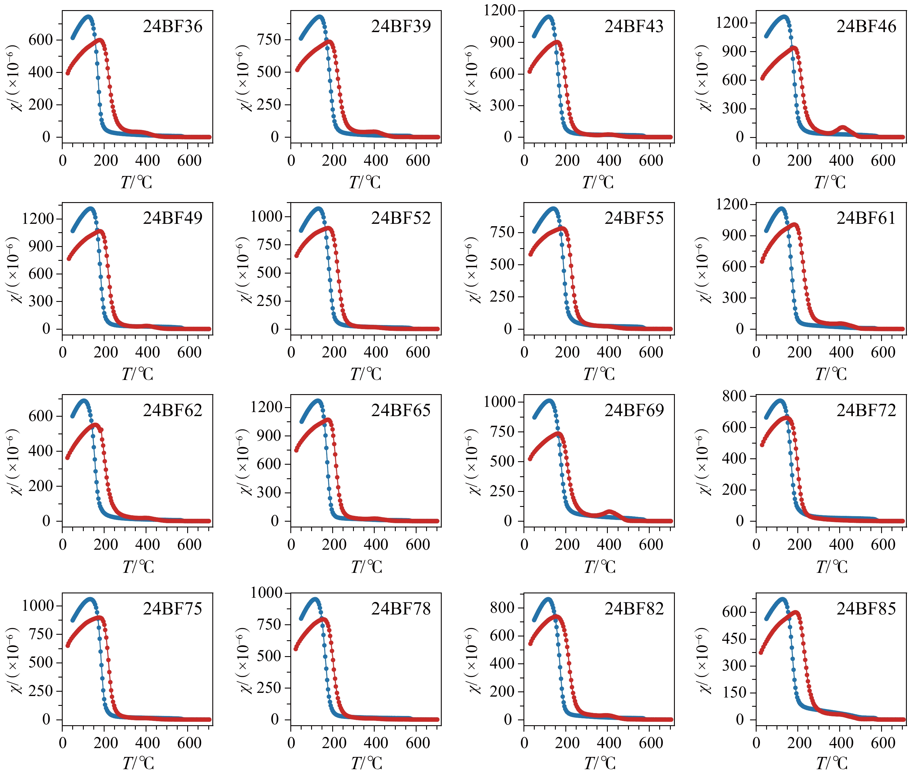
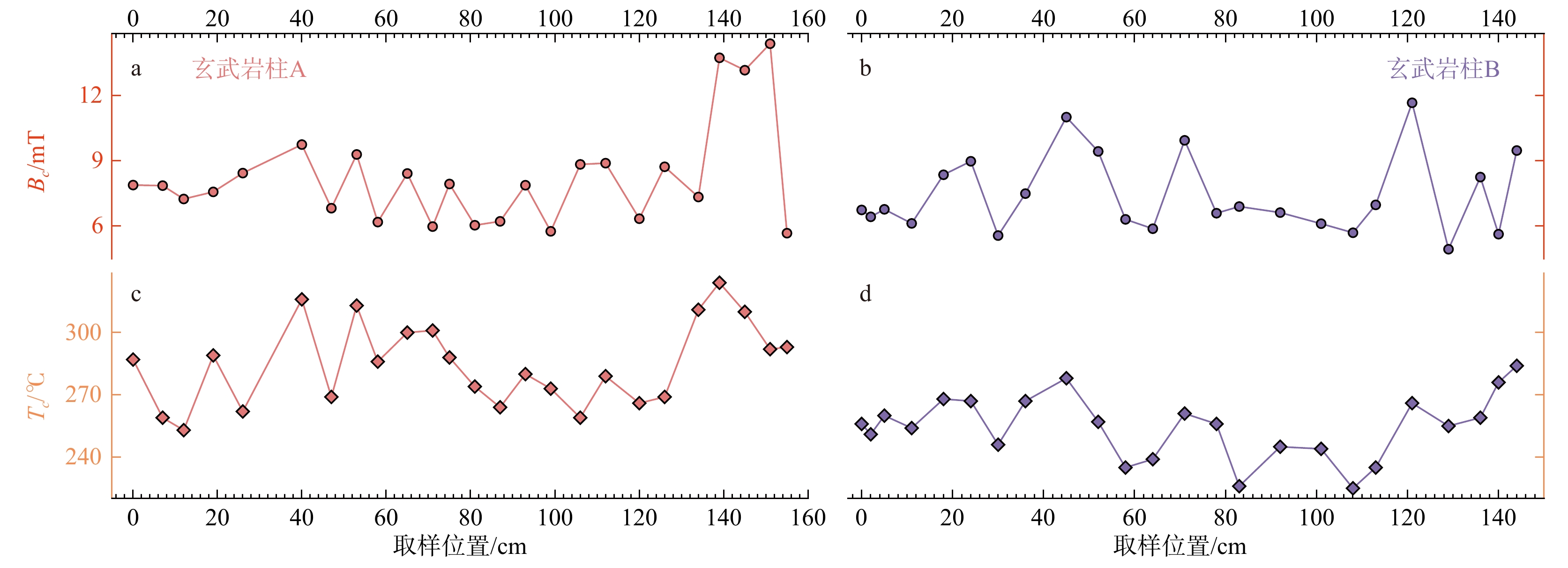
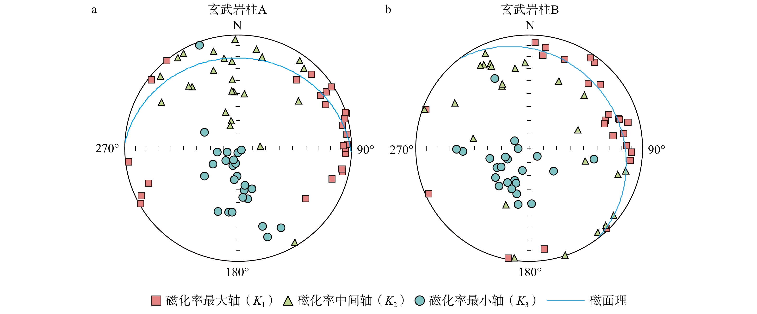
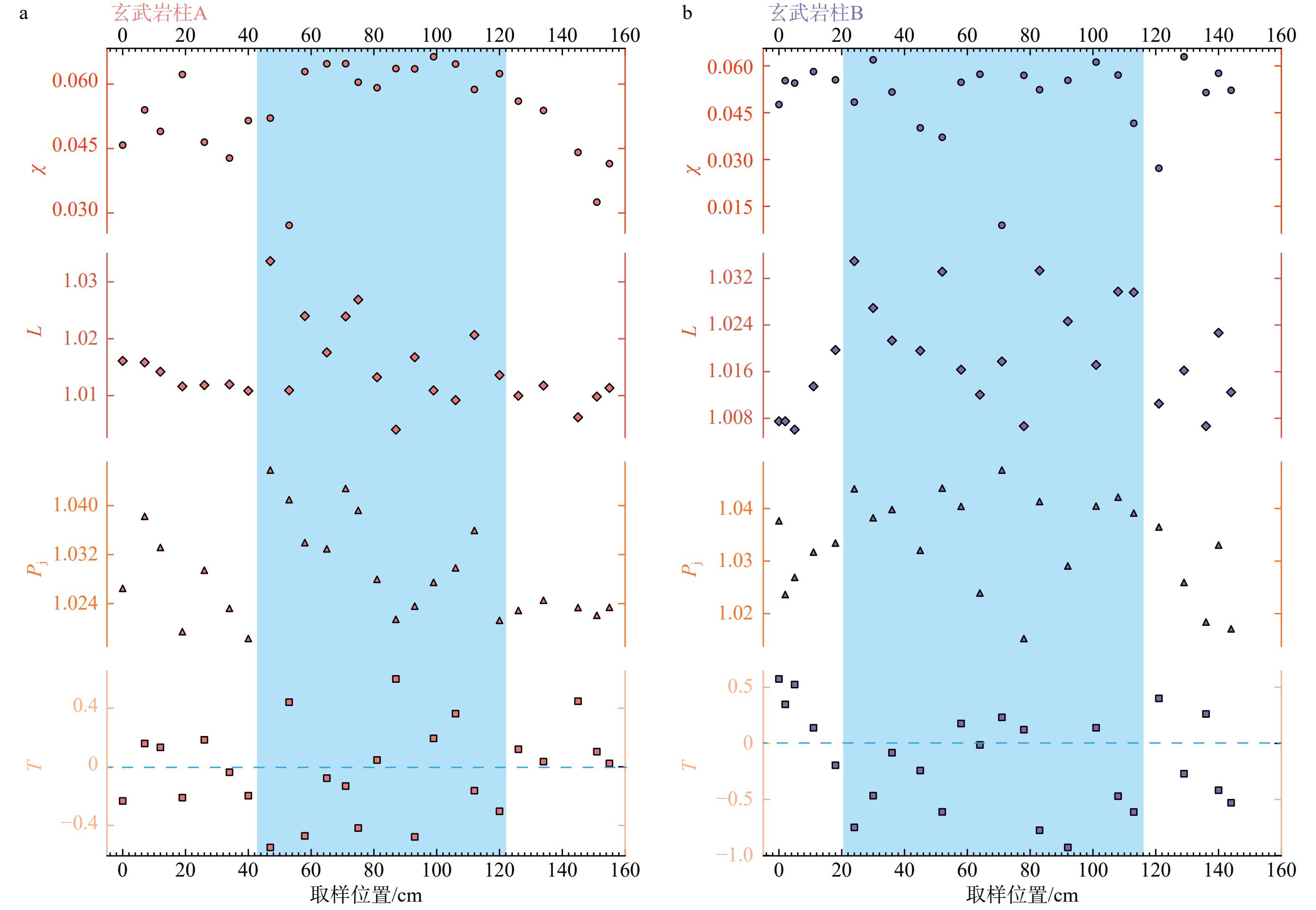
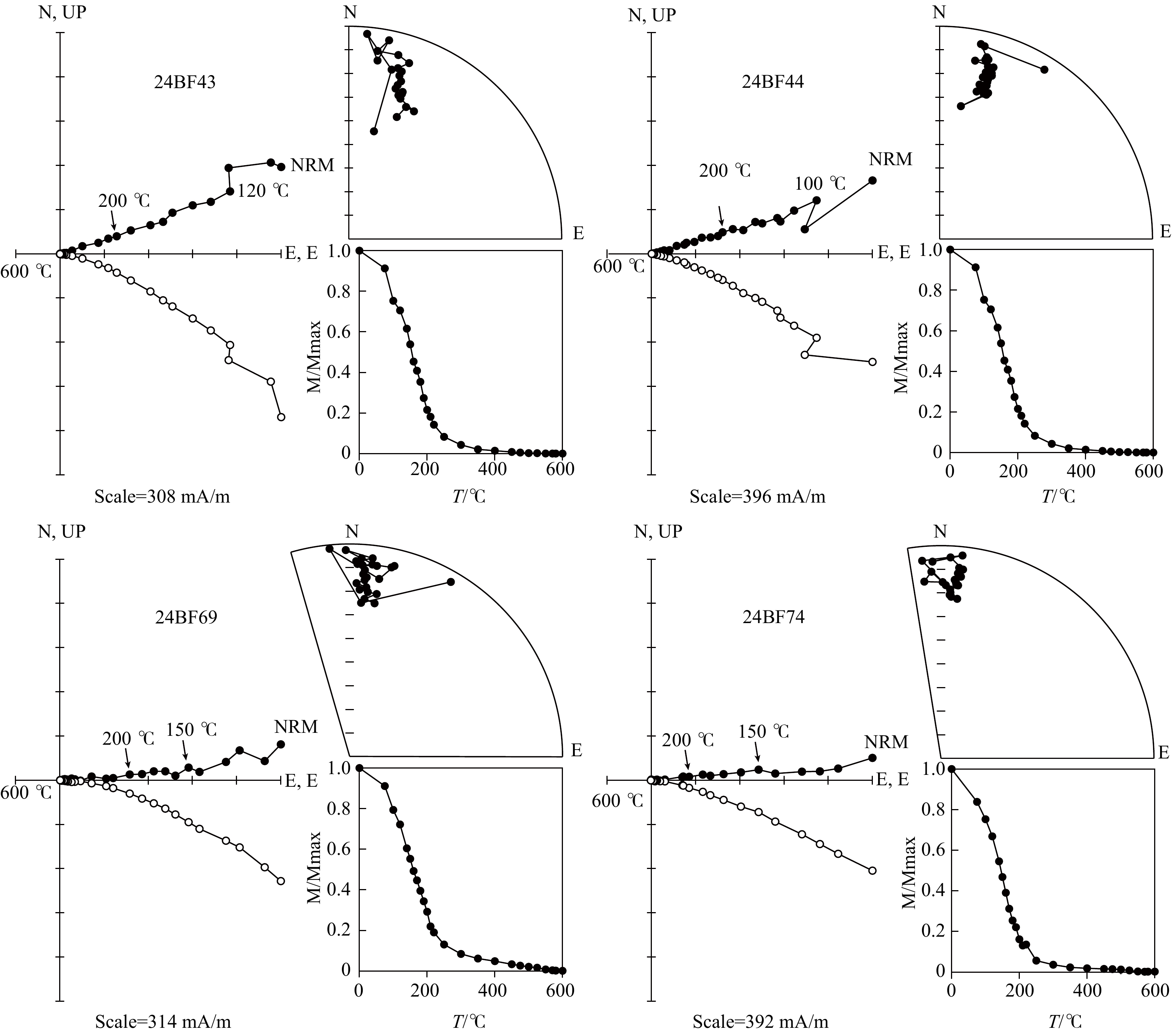
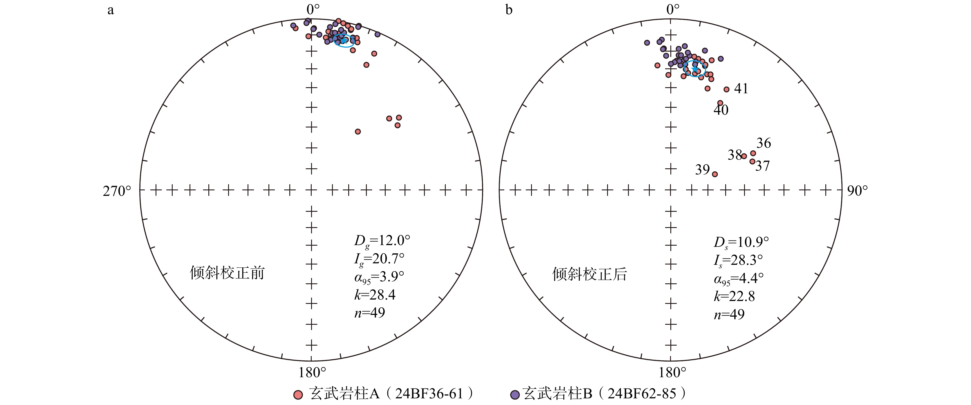
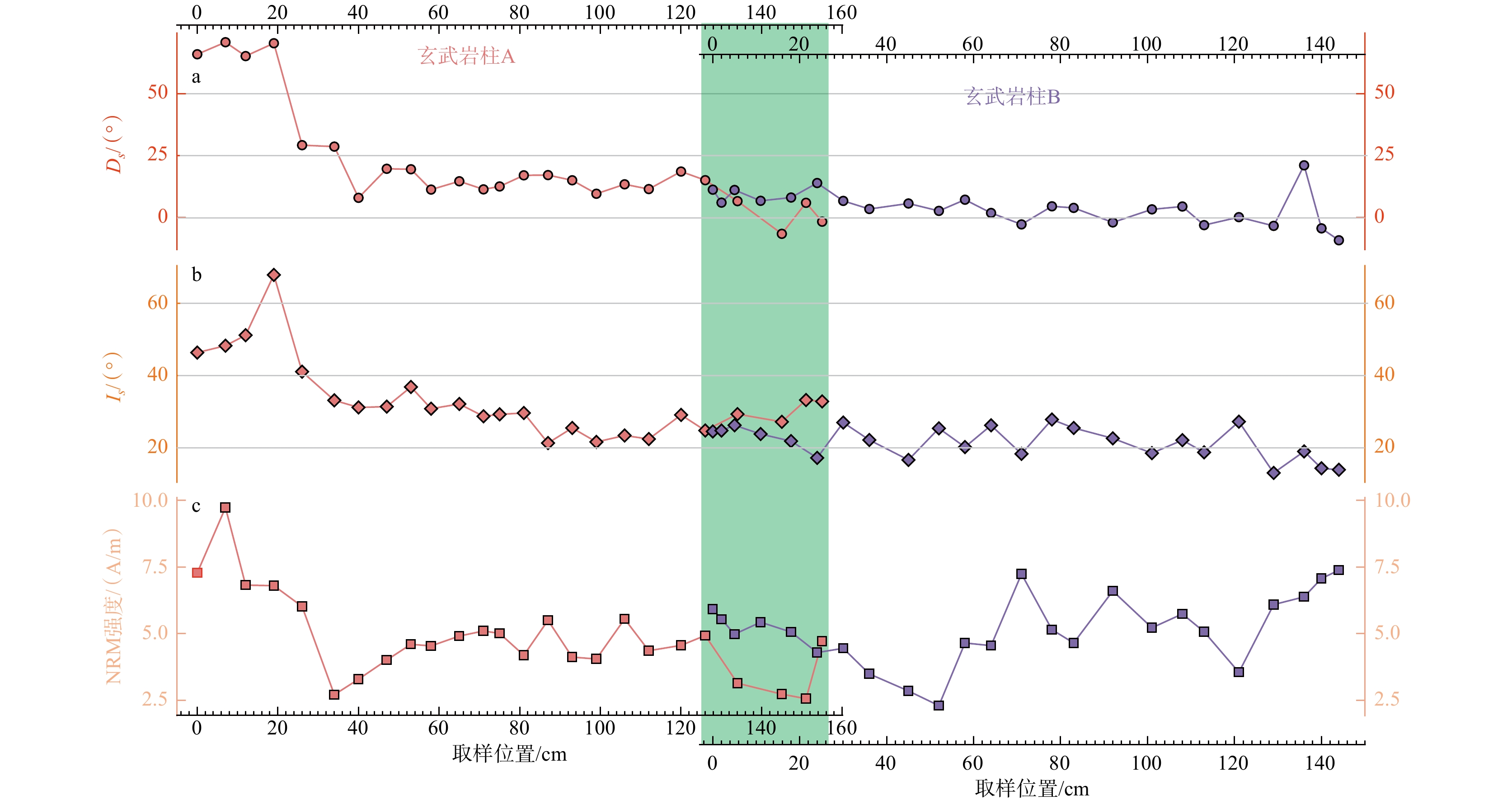
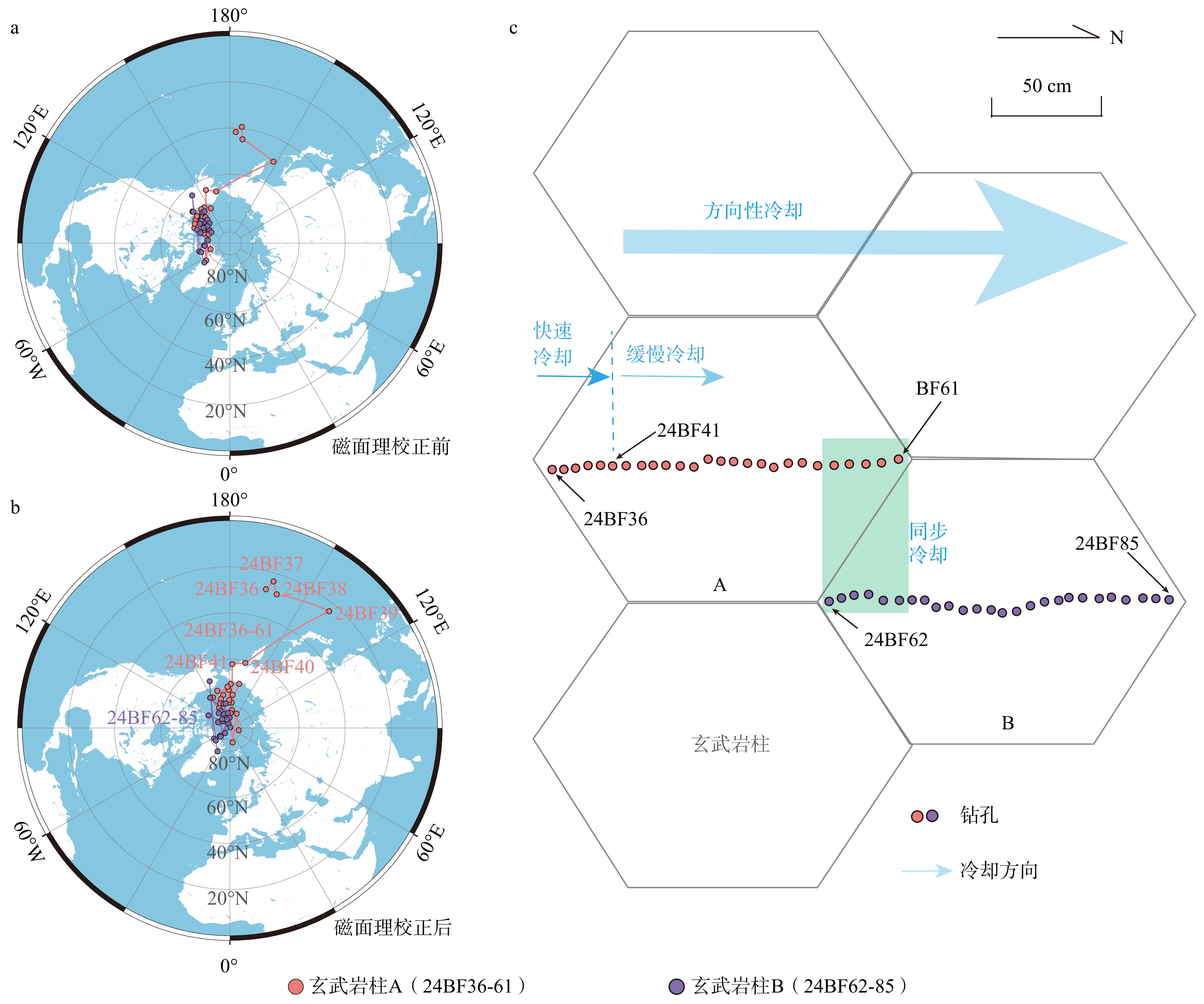
  Objective  Columnar joints in basalt are typical structures formed during magmatic cooling and contraction. However, their formation mechanisms, internal structural characteristics, and cooling histories remain debated. This study aims to constrain the internal structures and cooling histories of large-diameter basalt columns through integrated rock magnetic and paleomagnetic analyses.   Methods  Detailed rock magnetic and paleomagnetic analyses were conducted on 49 oriented samples collected from two Pliocene basalt columns, each reaching up to 1.5 m in diameter, in the Bo Phloi section, Kanchanaburi, Thailand. Rock magnetic experiments included hysteresis-loop measurements, isothermal remanent magnetization (IRM) acquisition, first-order reversal curve (FORC) analysis, anisotropy of magnetic susceptibility (AMS) measurements, and temperature-dependent magnetic susceptibility measurements. Stepwise thermal demagnetization was performed to isolate stable components of remanent magnetization.  Results  Hysteresis loops and IRM acquisition curves indicate that the magnetic assemblage is dominated by pseudo-single-domain (PSD) titanomagnetite grains, with magnetic saturation reached at fields below approximately 300 mT. The two-stage increase in IRM acquisition with increasing field suggests contributions from magnetic components with different coercivities. FORC diagrams further support the predominance of PSD magnetic grains and reveal systematic differences between the margins and interiors of the basalt columns. For both basalt columns, AMS results show sub-vertical minimum susceptibility axes (K3) and sub-horizontal maximum (K1) and intermediate (K2) axes, with generally low degrees of magnetic anisotropy (Pj < 1.05). These AMS fabrics indicate a primary near-horizontal magma-flow fabric during emplacement, but provide no evidence for vertical melt migration or internal convection. AMS parameters also reveal systematic spatial variations. Samples from the column margins exhibit lower magnetic susceptibilities (χ), lineation (L), and anisotropy degree (Pj) values and are predominantly characterized by oblate fabrics (T > 0), whereas interior samples show higher χ, L, and Pj values and predominantly prolate fabrics (T < 0). These differences reflect contrasting cooling conditions between the margins and interiors of the basalt columns. The margins cooled more rapidly, leaving less time for magnetic minerals to crystallize, grow, and develop preferred orientations. In contrast, the interiors cooled more slowly and likely remained at elevated temperatures in a plastic or partially molten state for longer periods, allowing magnetic minerals to crystallize, become concentrated, and develop preferred orientations under thermal contraction stresses. Paleomagnetic results indicate that stepwise thermal demagnetization isolates a stable, single-component remanent magnetization carried by PSD titanomagnetite. Six marginal samples from basalt column A exhibit relatively scattered virtual geomagnetic pole (VGP) distributions and anomalous directions, whereas the remaining 43 samples show relatively clustered VGPs after tilt correction. Systematic variations in remanent magnetization directions and VGPs indicate that cooling did not proceed symmetrically or uniformly from the column margins toward the cores. Instead, the columns appear to have undergone an asymmetric, unidirectional regional cooling process, possibly influenced by a localized heat source.  Conclusions  Integrated rock magnetic and paleomagnetic analyses lead to the following conclusions: (1) The basalt columns in Kanchanaburi are dominated by PSD titanomagnetite. Their AMS fabrics, characterized by subvertical K3 axes and subhorizontal K1 and K2 axes, record a primary near-horizontal magma flow during emplacement. (2) The column margins cooled more rapidly, resulting in finer magnetic grains, lower magnetic anisotropy, and predominantly oblate fabrics, whereas the interiors cooled more slowly, allowing magnetic minerals to crystallize, grow, and develop stronger preferred orientations, resulting in higher anisotropy and predominantly prolate fabrics. (3) Systematic variations in paleomagnetic directions and VGPs among the 49 samples indicate that post-jointing cooling was neither uniform nor symmetric but instead proceeded asymmetrically and unidirectionally across the basalt columns.  Significance  These findings contribute to a better understanding of the cooling processes of basaltic lava and provide new insights into long-term variations in the geomagnetic field.