Current Issue

2026 Vol. 32, No. 3

Display Method:
Cover Page
Cover Page
2026, 32(3)
Abstract (60) PDF (2228KB)(36)
Abstract:
Contents
Contents
2026, 32(3): 1-2.
Abstract (47) HTML (32) PDF (386KB)(61)
Abstract:
2026, 32(3): 507-508. doi: 10.12090/j.issn.1006-6616.20263202
Abstract (53) HTML (20) PDF (327KB)(32)
Abstract:
Characteristics of surface ruptures produced by recent major earthquakes on the Tibetan Plateau and its surrounding areas, and their tectonic implications
PAN Jiawei, LI Haibing, LIU Fucai, CHEVALIER Marie-Luce, LIU Dongliang, LU Haijian, CHEN Peng, YANG Shaohua
2026, 32(3): 509-527. doi: 10.12090/j.issn.1006-6616.2026053
Abstract (187) HTML (44) PDF (22744KB)(138)
Abstract:
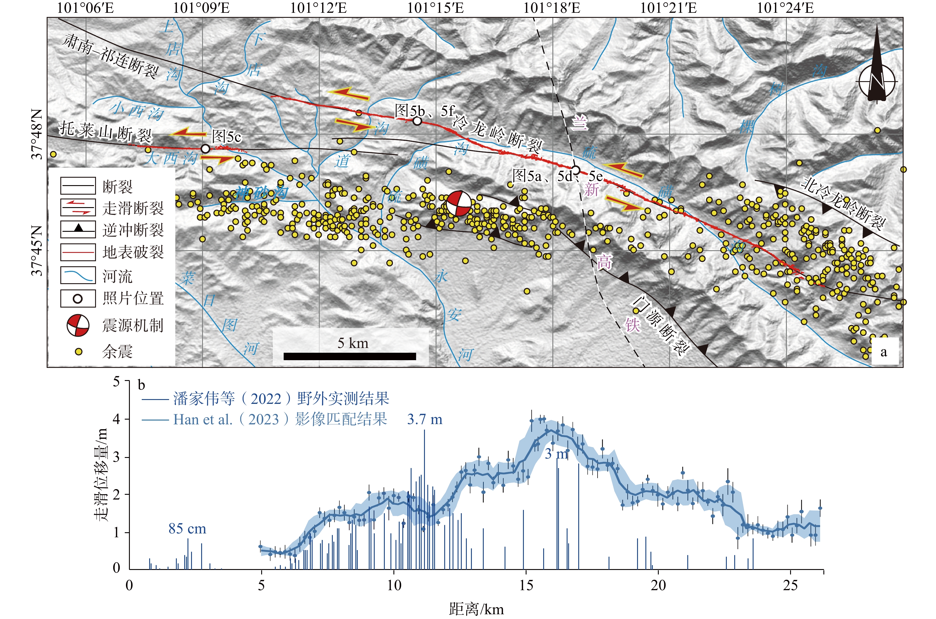
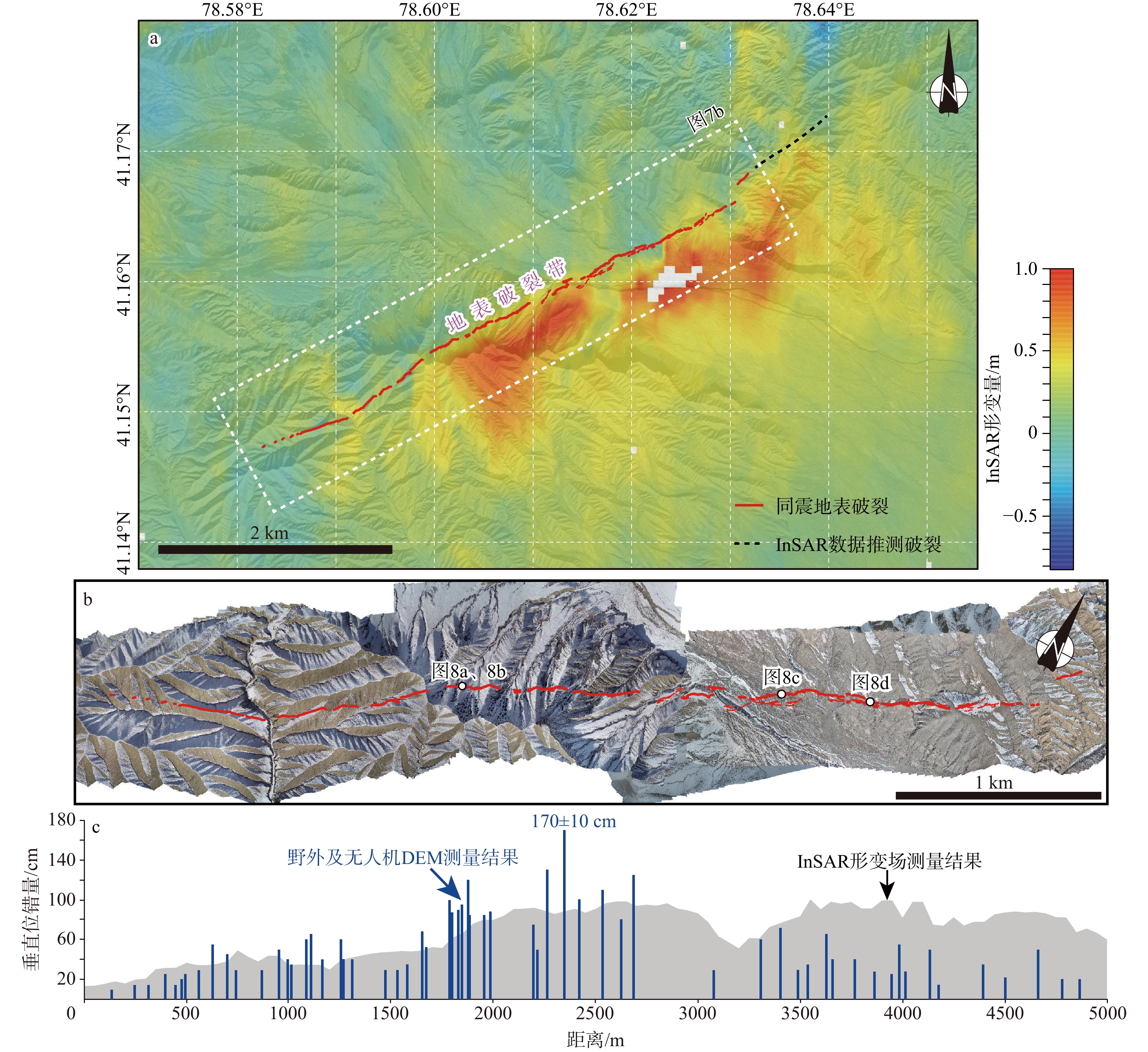
  Objective  Coseismic surface ruptures provide key evidence for identifying the seismogenic structures of earthquakes, elucidating crustal deformation mechanisms, and assessing seismic hazards. To understand the surface deformation and disaster development characteristics associated with different types of fault activity on the Tibetan Plateau, and to reveal the current crustal deformation patterns reflected by a series of strong earthquakes in recent years, we systematically compiled and analyzed the surface rupture characteristics of five M>6.5 earthquakes that have occurred on the Tibetan Plateau and surrounding areas since 2021, based on field surveys.   Methods  We used the 2021 MW 7.4 Maduo, 2022 MW 6.6 Menyuan, 2022 MW 6.6 Luding, 2024 MW 7.0 Wushi, and 2025 MW 7.1 Dingri earthquakes as representative cases. We integrated results from remote sensing interpretation, field surveys, and UAV photogrammetry, as well as seismological and geodetic data, to conduct a detailed analysis of the surface rupture and coseismic displacement distribution characteristics of these events.   Results  The strike-slip Maduo and Menyuan earthquakes formed coseismic surface rupture zones approximately 150~160 km and 22~31 km long, respectively, with maximum coseismic surface displacements of ~3.6 m and ~3.7 m. Contrastingly, the Luding earthquake, also a strike-slip event, exhibited a surface rupture only ~450 m long at Ertaizi. The strong, MW 5.7 aftershock of the thrust-type Wushi earthquake generated a coseismic surface rupture zone ~5 km long with a maximum vertical displacement of ~1.7 m, while the normal-fault-type Dingri earthquake formed a coseismic surface rupture zone 25~36.5 km long with a maximum vertical displacement of ~2.7 m.  Conclusions  A comprehensive analysis of the spatiotemporal distribution characteristics of major regional earthquakes indicates that, prior to the 2022 Luding earthquake, major earthquakes on the Tibetan Plateau were primarily clustered around the periphery of the active Bayan Har block. The subsequent Wushi and Dingri earthquakes both occurred far from the Bayan Har block, suggesting that the clustering period of major earthquakes in this active block may have ended. Further analysis of focal mechanism solutions indicates that strike-slip earthquakes have dominated recent moderate-to-strong seismic events on the Tibetan Plateau and its periphery. This may be related to the fact that current crustal deformation on the Tibetan Plateau is primarily regulated and absorbed through the lateral extrusion of active blocks along large strike-slip fault zones.  Significance  The above research findings provide fundamental data and references for earthquake early warning, disaster prevention and mitigation, as well as the planning, construction, and seismic design of major regional engineering projects in the Tibetan Plateau region.
Coseismic surface rupture and seismogenic background of the 1951 M 8.0 Beng Co earthquake in the central Tibetan Plateau
LIU Fucai, PAN Jiawei, LI Haibing, CHEVALIER Marie-Luce, SUN Zhiming, JIANG Chenyi, ZHANG Siqi
2026, 32(3): 528-544. doi: 10.12090/j.issn.1006-6616.2026016
Abstract (203) HTML (52) PDF (41413KB)(127)
Abstract:
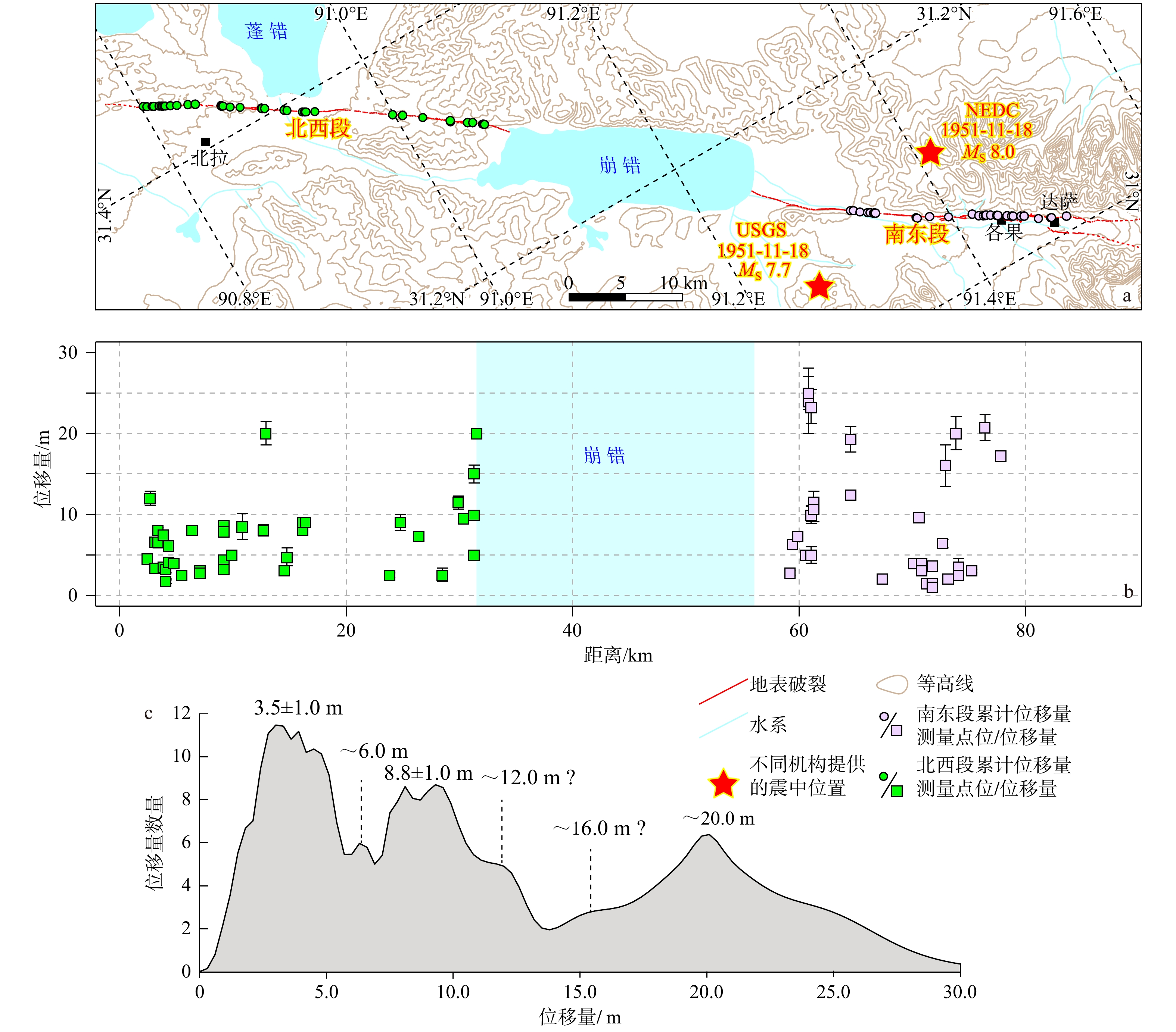
  Objective  The coseismic surface rupture formed by an earthquake is the most obvious geomorphological evidence of fault activity. Its spatial distribution and deformation characteristics record essential information about seismic ruptures and fault motion. This information not only aids in understanding the earthquake rupture process and seismogenic mechanism but also contributes significantly to a deeper comprehension of fault evolution and crustal deformation. Therefore, it is of great importance to promptly investigate coseismic surface rupture zones and acquire high-precision geomorphological data.  Methods  The November 18, 1951 M 8.0 Beng Co earthquake in central Tibet ruptured the Beng Co fault and produced a well-preserved surface rupture zone. We obtained high-precision images by integrating field investigations with high-resolution orthomosaic images and digital elevation models (DEMs) derived from unmanned aerial vehicle (UAV) imagery based on the Structure from Motion (SfM) method. We measured both coseismic and cumulative displacements along the rupture zone to examine the kinematic characteristics of the Beng Co fault and the seismogenic background of the Beng Co earthquake. [Results and Conclusions] The earthquake ruptured the eastern segment of the Beng Co fault, forming an approximately 90-km-long coseismic surface rupture zone with an overall strike of 120°. A series of right-lateral offset gullies/terraces, push-ups, and pull-aparts along the rupture zone reveals that the Beng Co fault is an active right-lateral strike-slip fault. Cumulative offset probability distribution (COPD) analysis suggests that large earthquakes have occurred repeatedly along this fault and have been fairly regular in terms of slip accumulation, with a typical lateral slip of ~4.0 m. The Beng Co earthquake occurred as a direct response to the fault's accommodation of regional extrusion deformation caused by the rapid eastward movement of the eastern Qiangtang block. [Significance] This work not only facilitates the timely preservation of high-resolution 3D data of the coseismic surface rupture associated with the Beng Co earthquake but also provides a basis for studying tectonic deformation and assessing seismic hazards in central Tibet.
Study on the source characteristics and seismogenic structure of the 2021 Yangbi MS 6.4 earthquake sequence
ZHOU Minting, HE Xiaohui, LIU Zhiliang, WANG Weitao
2026, 32(3): 545-562. doi: 10.12090/j.issn.1006-6616.2025183
Abstract (172) HTML (35) PDF (11149KB)(30)
Abstract:
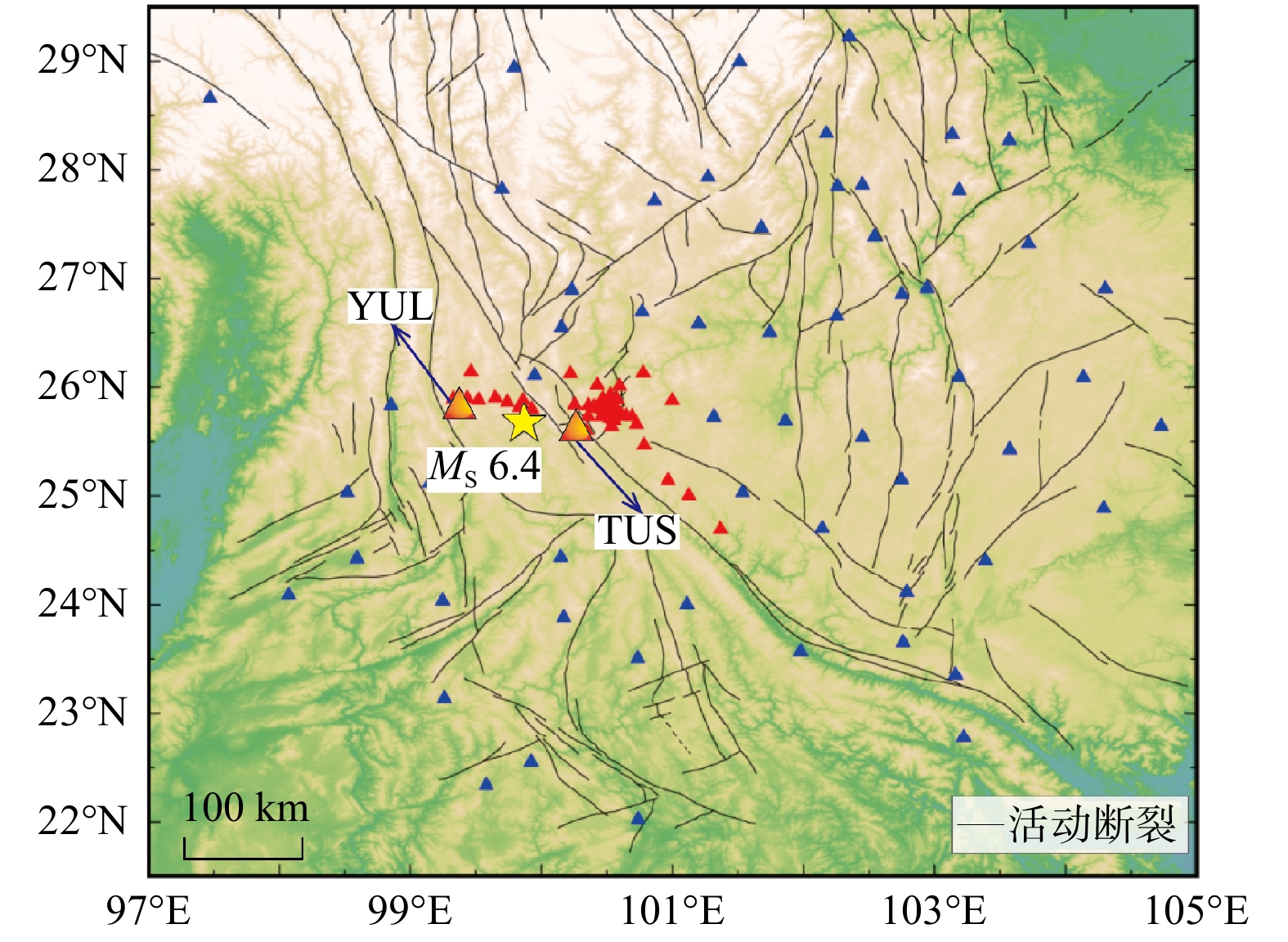
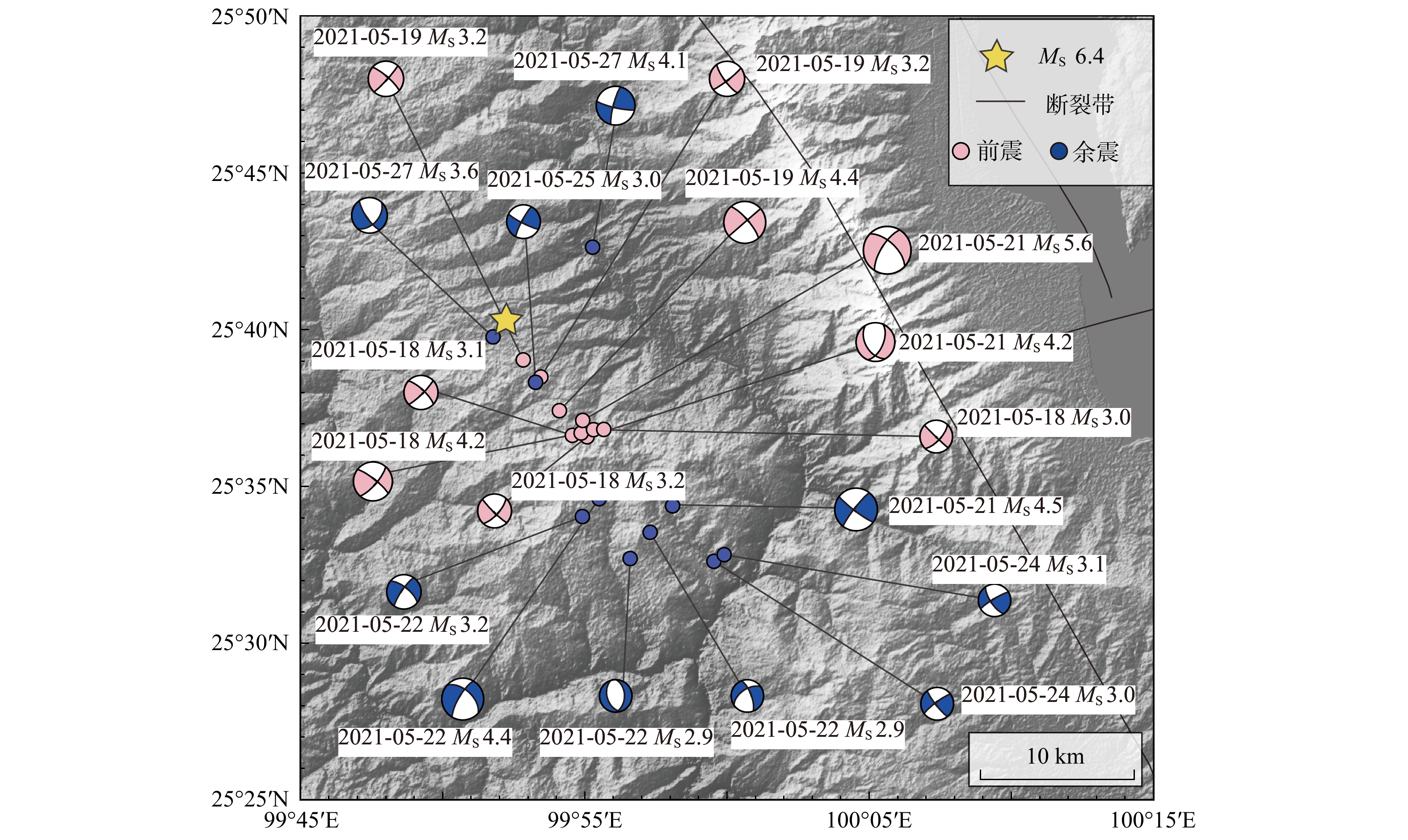
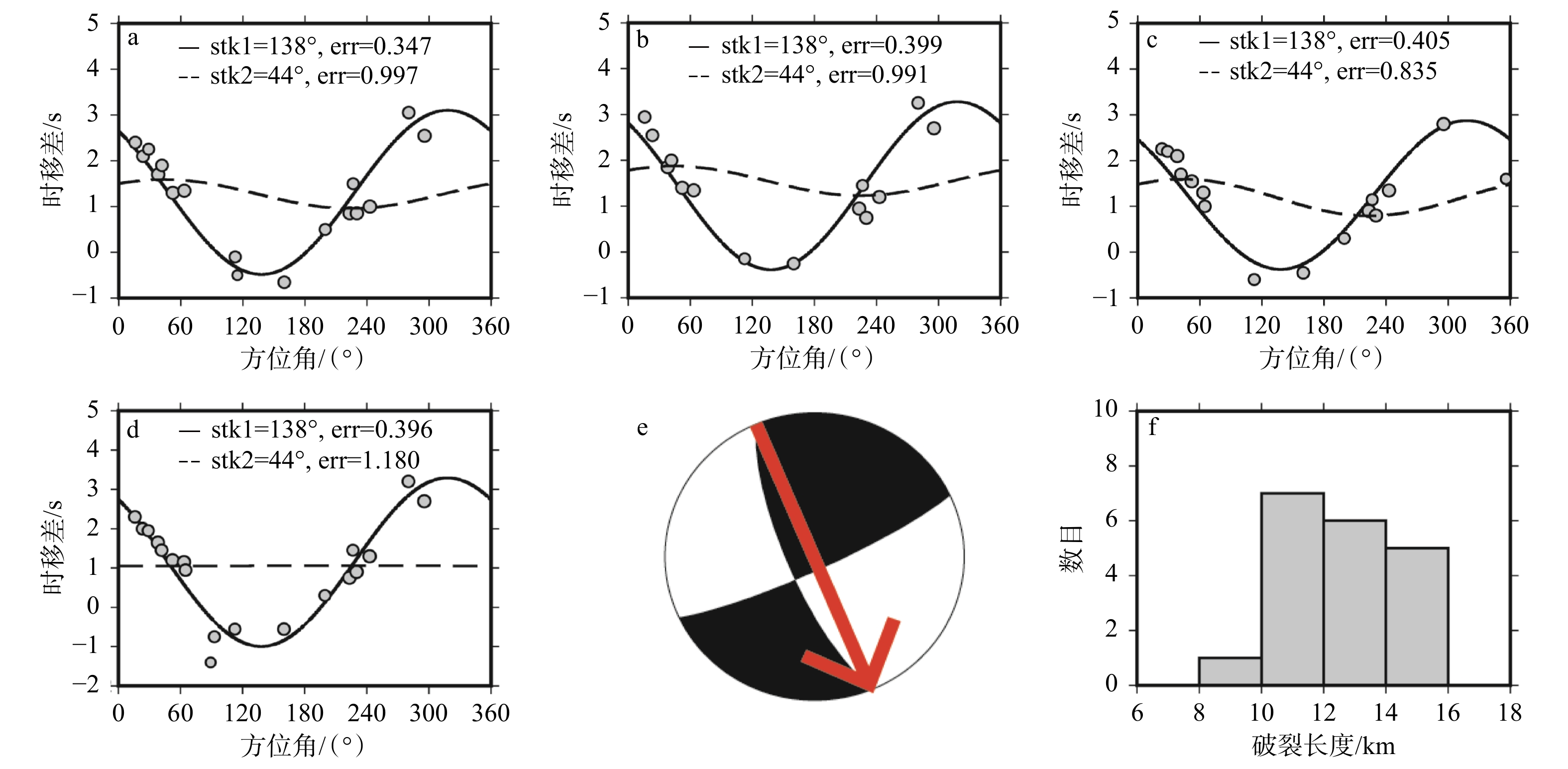
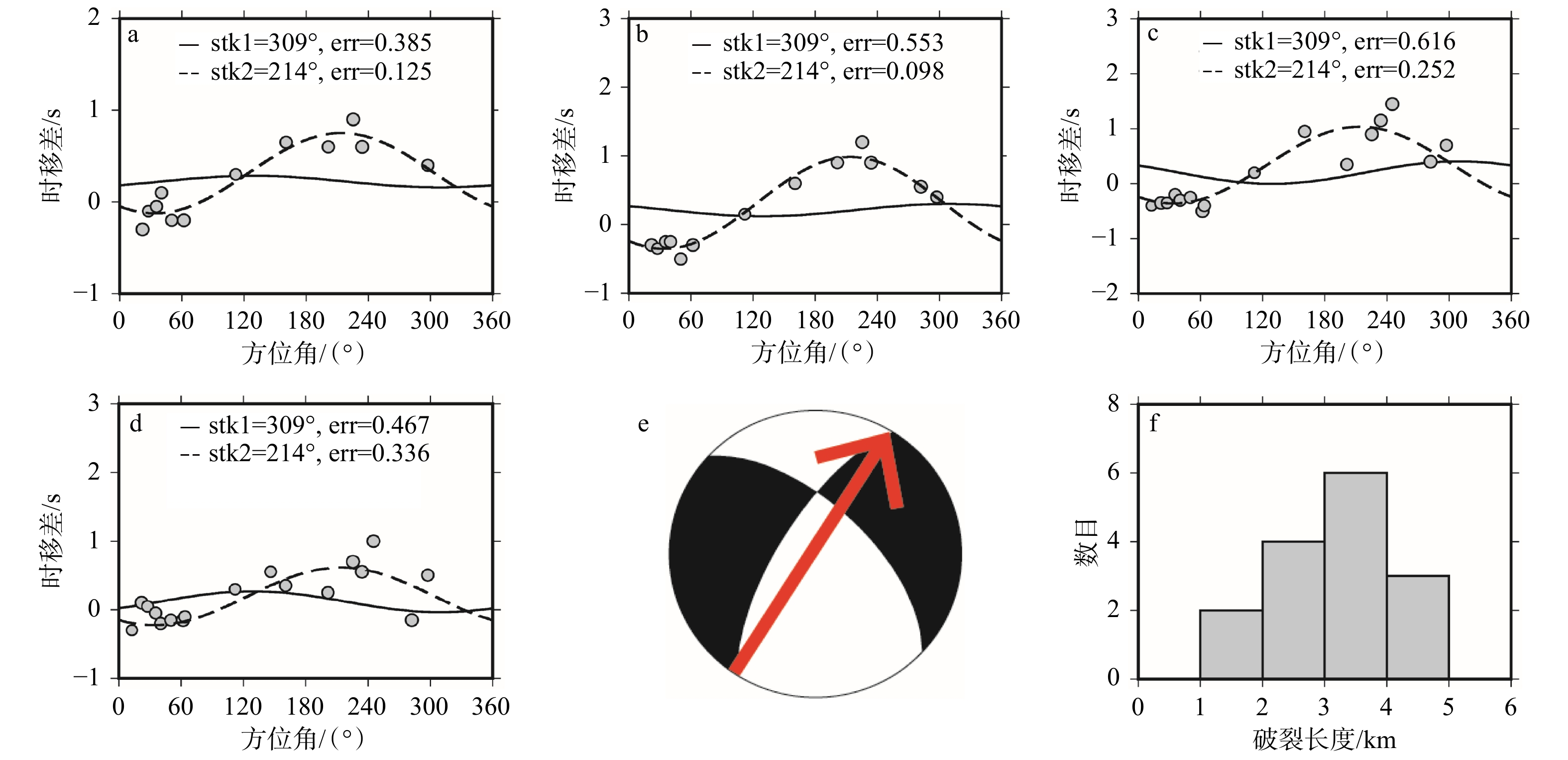
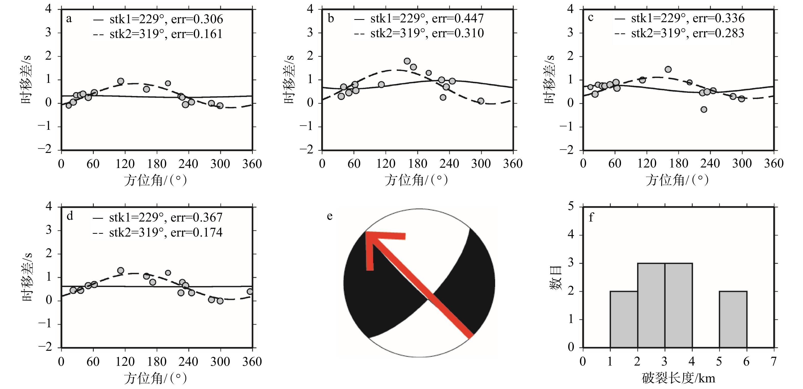
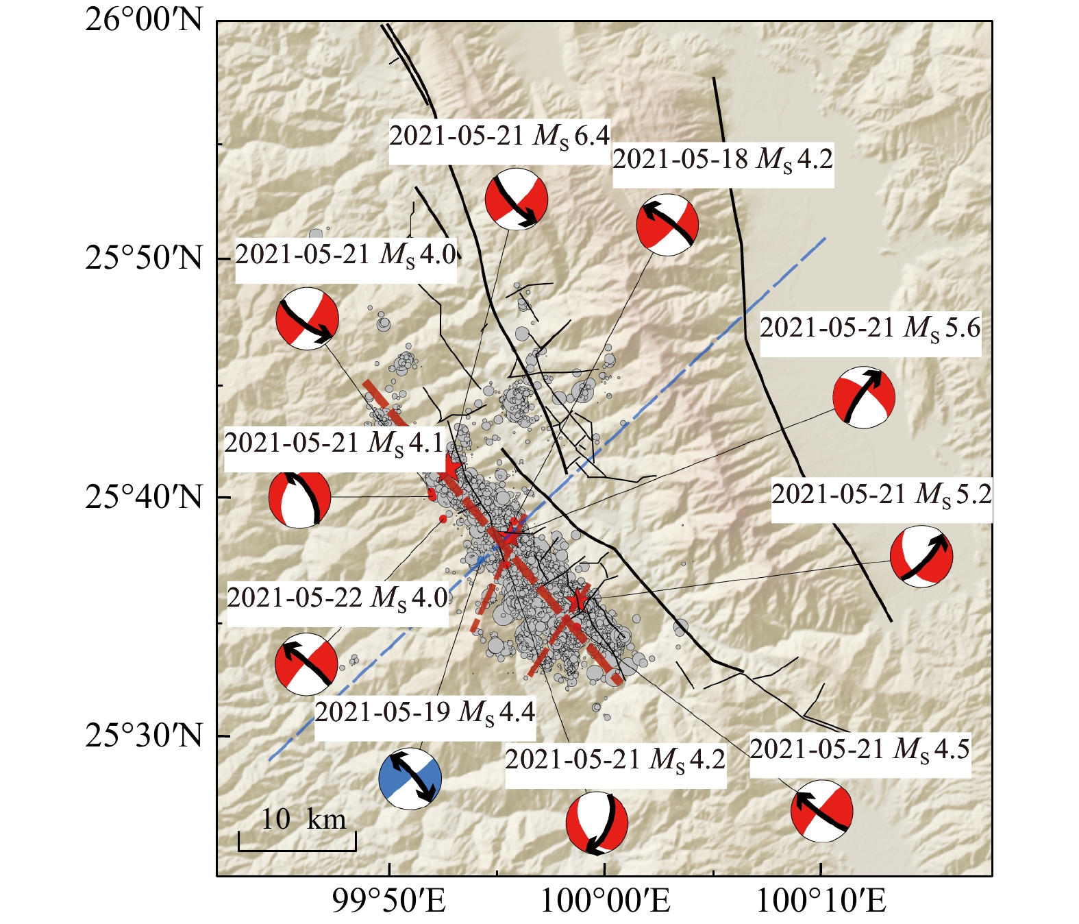
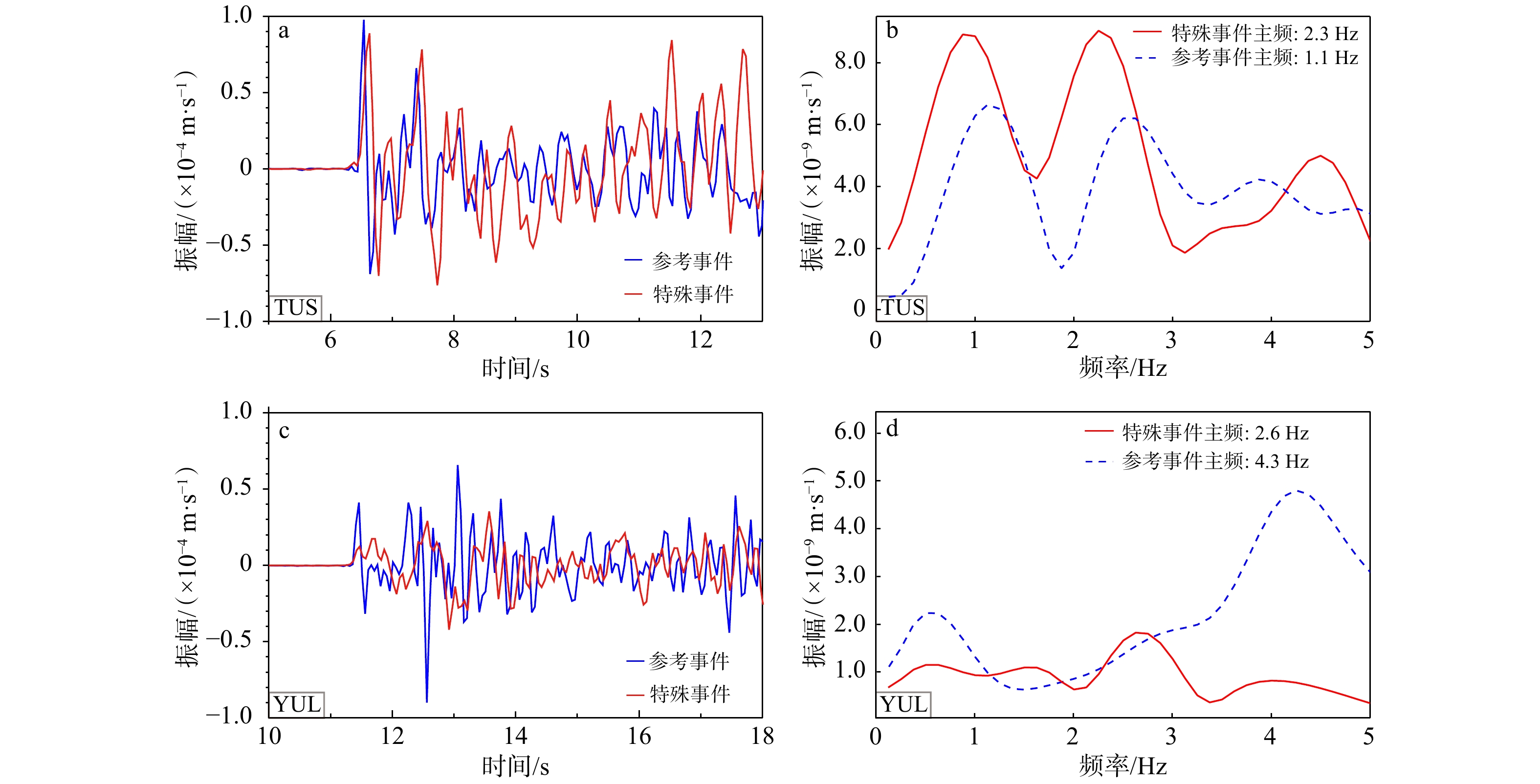
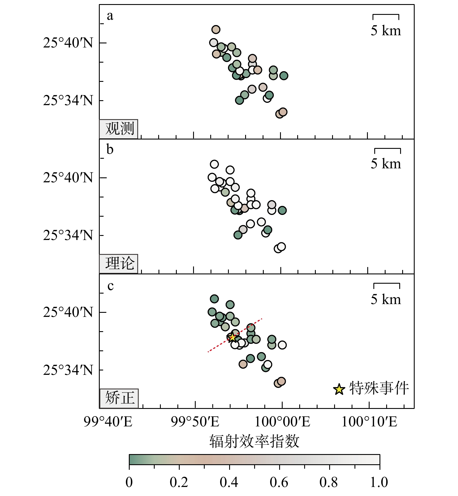
  Objective  On 21 May 2021, an MS  6.4 earthquake struck Yangbi County, Dali Prefecture, Yunnan Province — the largest event near the Weishan Basin segment of the Weixi–Qiaohou fault since 1976. The mainshock produced no surface rupture and did not occur on any known active fault. Despite numerous previous studies, the precise seismogenic structure and causative faults of this typical foreshock–mainshock–aftershock sequence (including seven MS  ≥ 4.0 foreshocks and 22 MS ≥ 4.0 aftershocks) remain controversial; some results are poorly constrained or even mutually contradictory. Furthermore, the occurrence of moderate-to-strong earthquakes surrounding the source area has increased significantly in recent years. This study thus aims to elucidate the rupture behaviour and seismogenic environment of the entire earthquake sequence.   Methods  Using pre-existing focal mechanism solutions of minor earthquakes as reference events, we adopted the relative centroid relocation method and time–frequency source characterisation method to calculate rupture directivity parameters for ten MS ≥ 4.0 events. In addition, we calculated the radiation efficiency for all MS ≥ 3.0 earthquakes based on waveform recording from local seismic station.   Results  Our results demonstrate distinct along-strike segmentation of rupture directivity across the Yangbi sequence. On the northwestern segment of the sequence, five earthquakes feature NW-striking fault planes. On the southeastern segment, four earthquakes exhibit faults either NW or NE. The largest foreshock (MS 5.6) and the largest aftershock (MS 5.2) both rupture toward the NE, indicating that they did not occur on the same fault as the MS 6.4 mainshock. Combined with previous relocation and geodetic results, we interpret that these two events occurred on conjugate faults. The MS 6.4 mainshock ruptured toward the NW, consistent with the dominant rupture azimuth of the NW segment, suggesting that the mainshock primarily ruptured the NW-trending master fault, whereas conjugate faulting in the SE segment constitutes an important component of the entire sequence. For the MS 4.4 foreshock, the relative centroid method yields a rupture direction toward the NW, while the time–frequency source method gives a direction toward the SE. This event is therefore interpreted as a frequency-dependent bilateral rupture. We further calculated and corrected the radiation efficiency values for all MS≥ 3.0 events. The efficiency results show a similar along-strike segmentation: the radiation efficiency differs systematically between the NW and SE segments. Integrating rupture directivity patterns, radiation efficiency measurements and regional geological constraints, we infer that the segmentation in rupture directivity is primarily caused by differences in fault frictional properties between the NW and SE segments.  Conclusions  The Yangbi earthquake sequence exhibits distinct segmentation in rupture directivity, with the NW segment dominated by NW-striking master fault rupture and the SE segment characterized by conjugate faulting. The MS 4.4 foreshock corresponds to a frequency-dependent bilateral rupture event. The segmentation in radiation efficiency further supports the interpretation of different fault frictional regimes along the fault strike. [Significance] These findings deliver new constraints on the source characteristics and seismogenic structure of the Yangbi earthquake sequence. They improve our knowledge of the regional tectonic setting and earthquake nucleation cycle, and offer valuable seismological evidence for future seismic hazard assessment across the study area.
Constraining coseismic off-fault deformation of the 2022 MW 6.6 Menyuan earthquake using man-made linear markers
LIU Yulong, HAN Longfei, YAO Wenqian, LIU Jing, LI Zhenhong, SHAO Yanxiu, LIU Xiaoli, CHEN Xuan, SUN Jie, HE Liang, YIN Zilin
2026, 32(3): 563-580. doi: 10.12090/j.issn.1006-6616.2026017
Abstract (171) HTML (29) PDF (10347KB)(96)
Abstract:
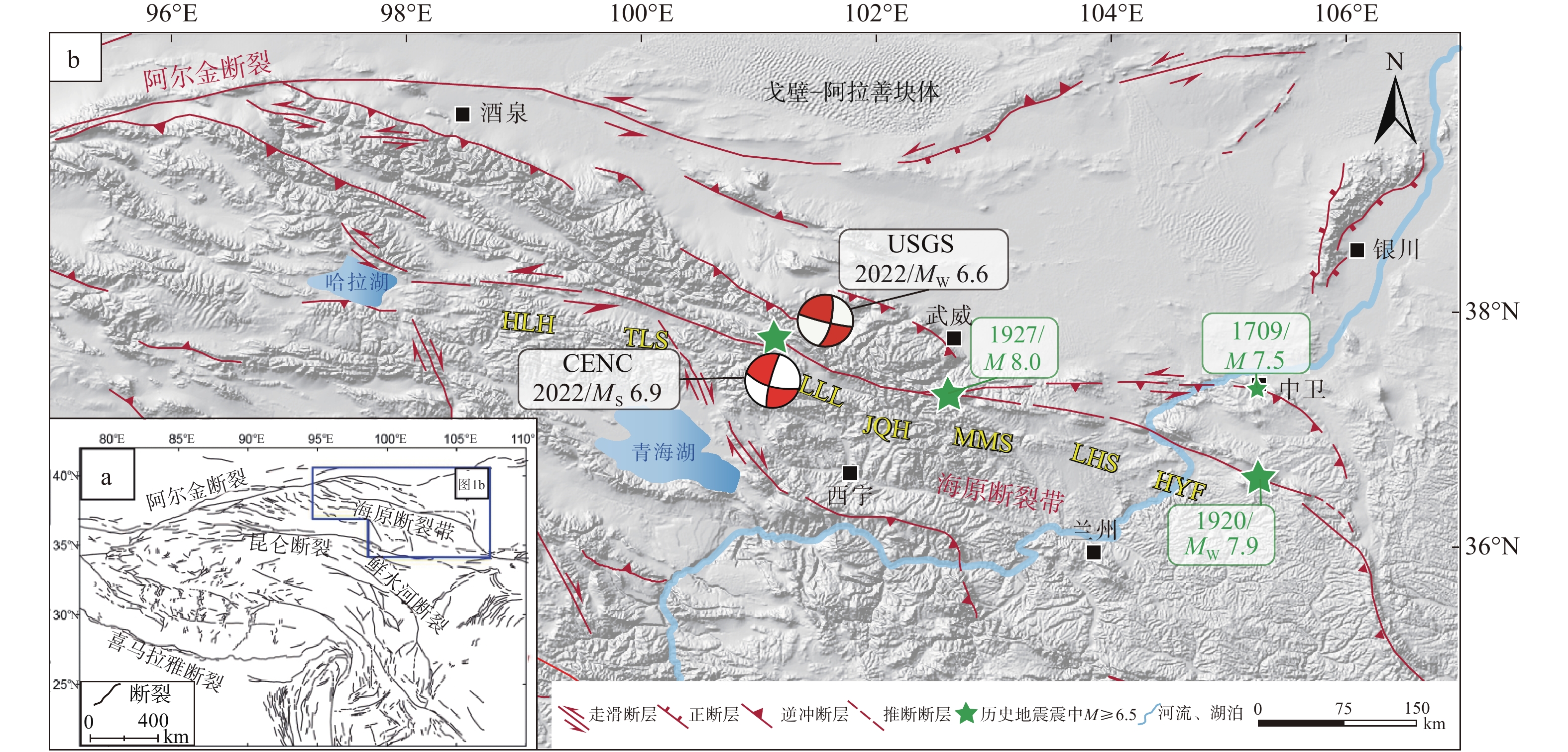
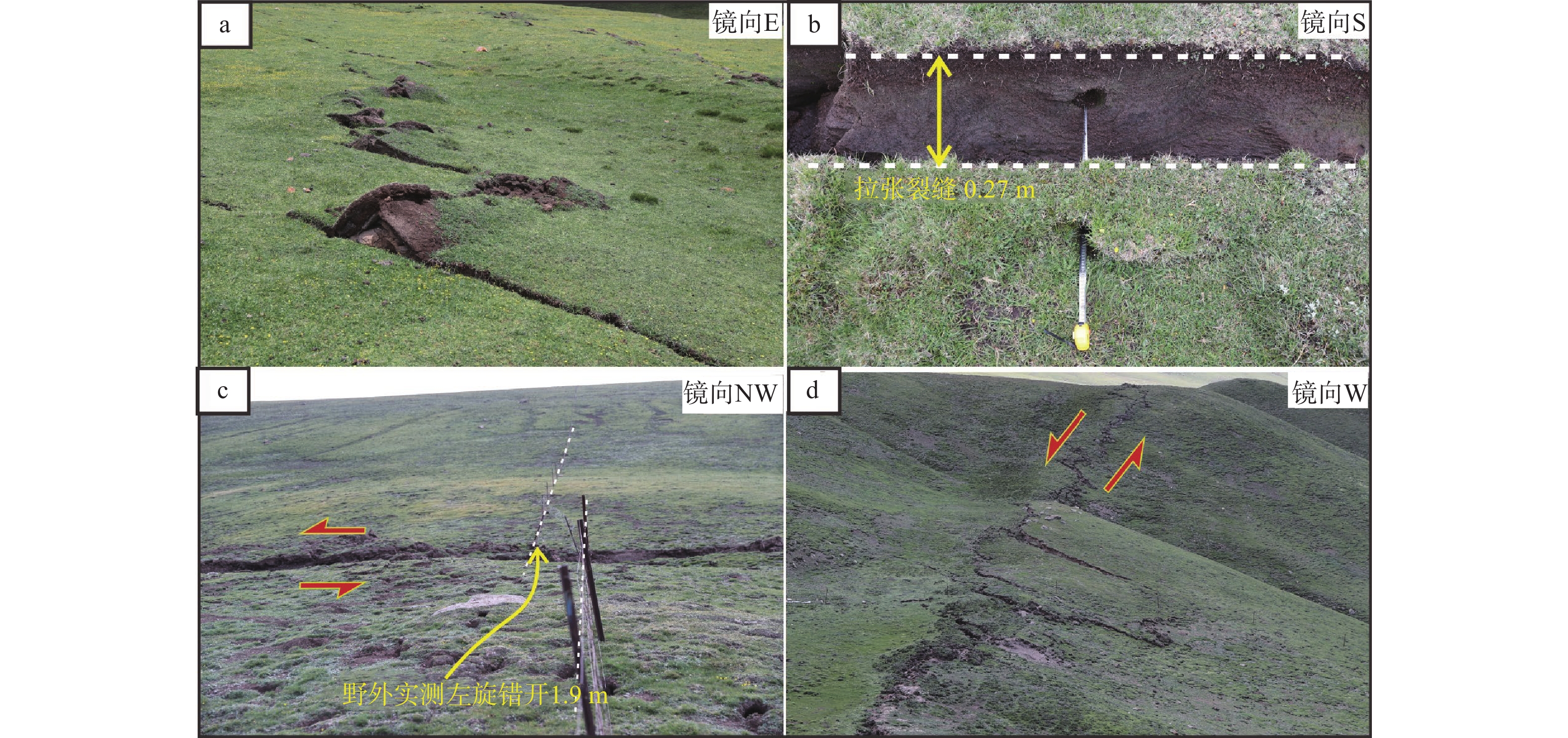
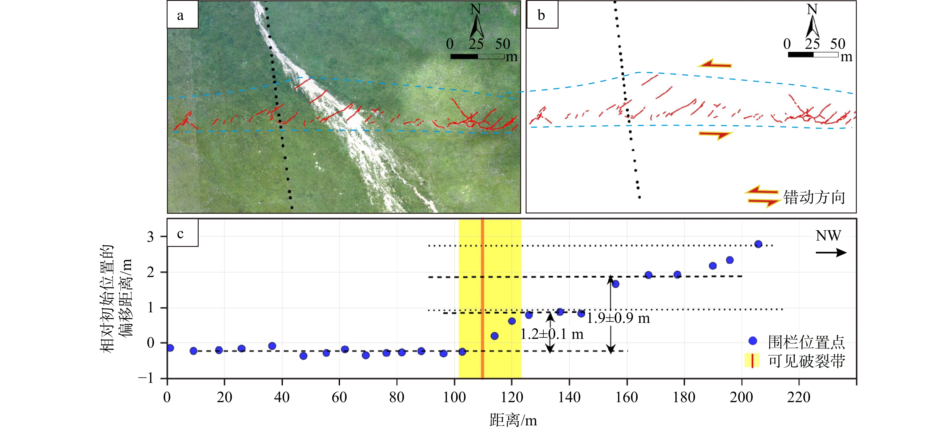
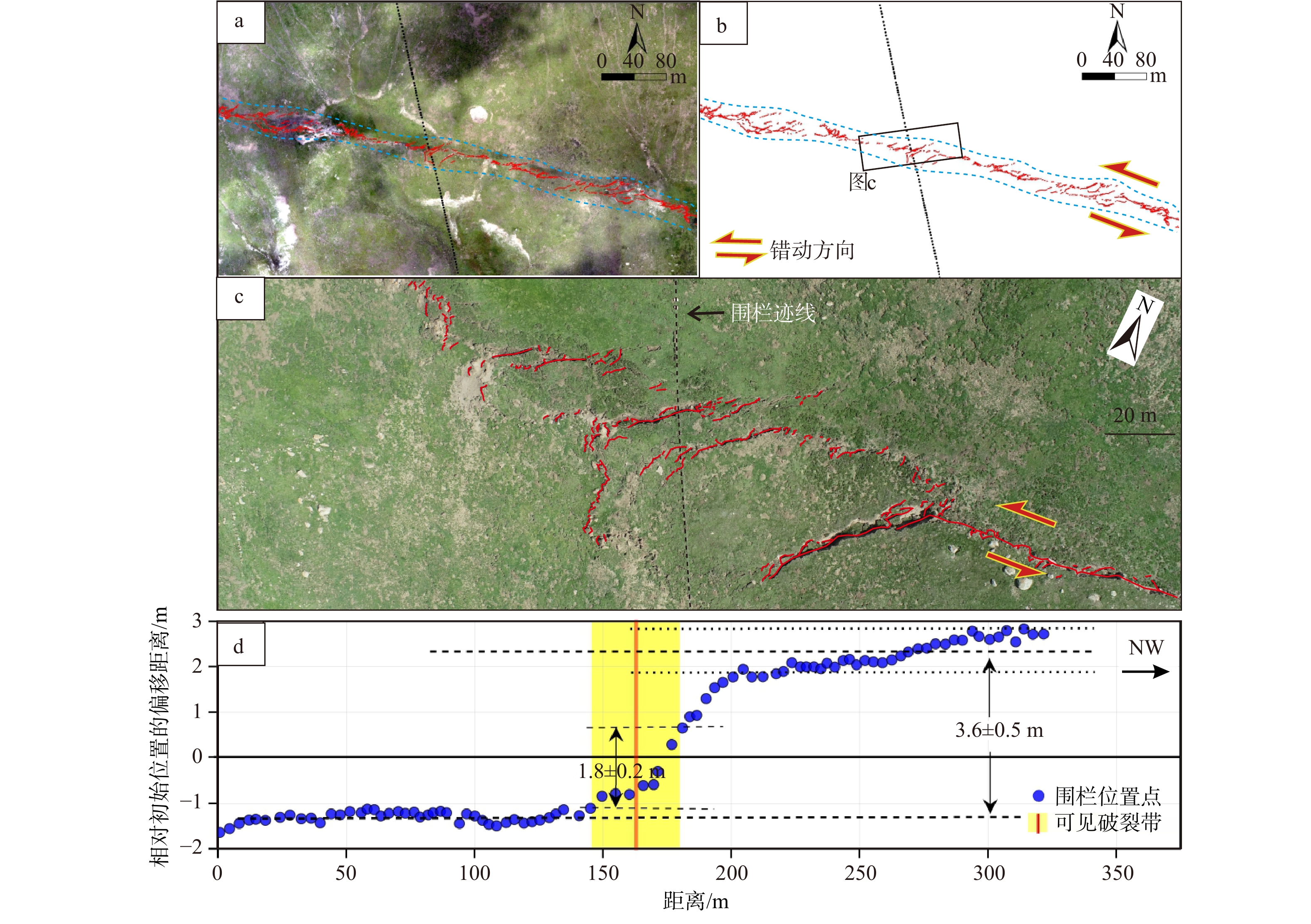
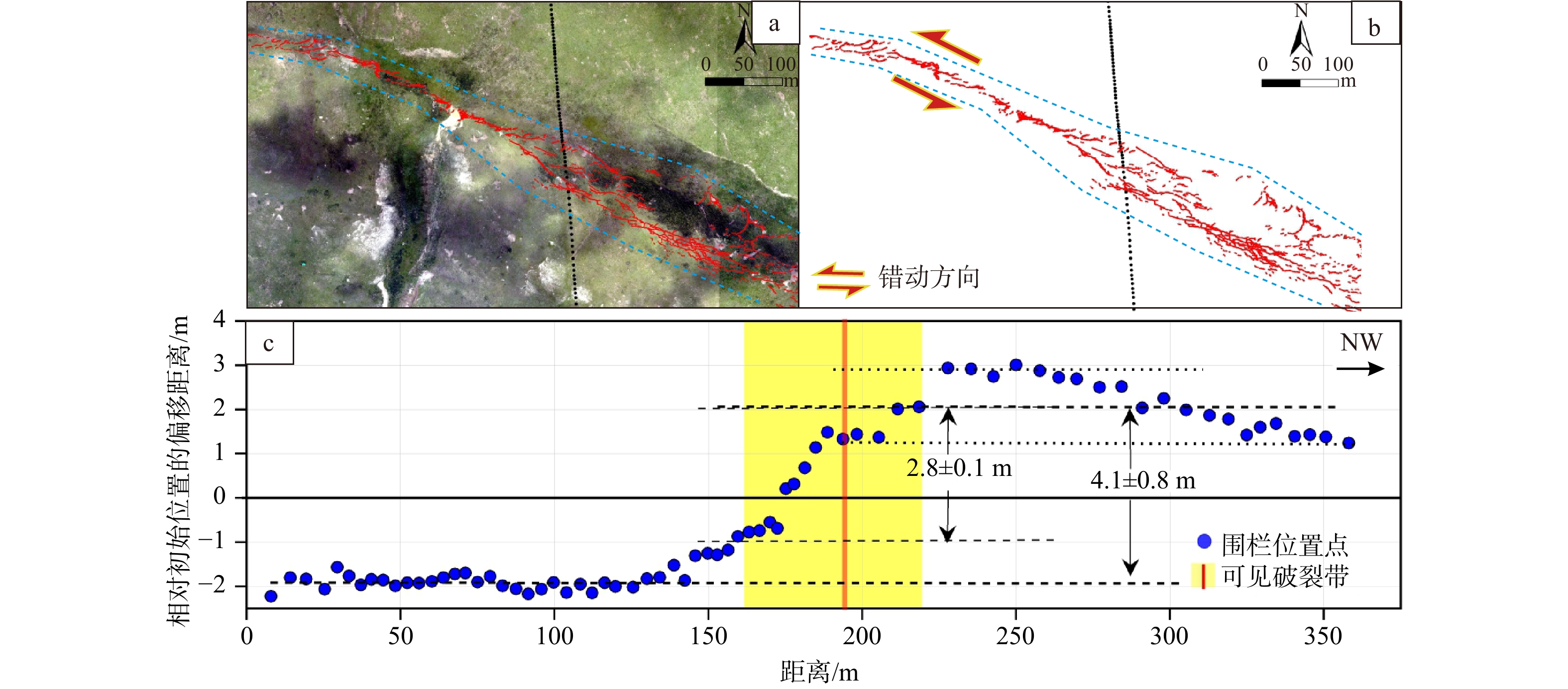
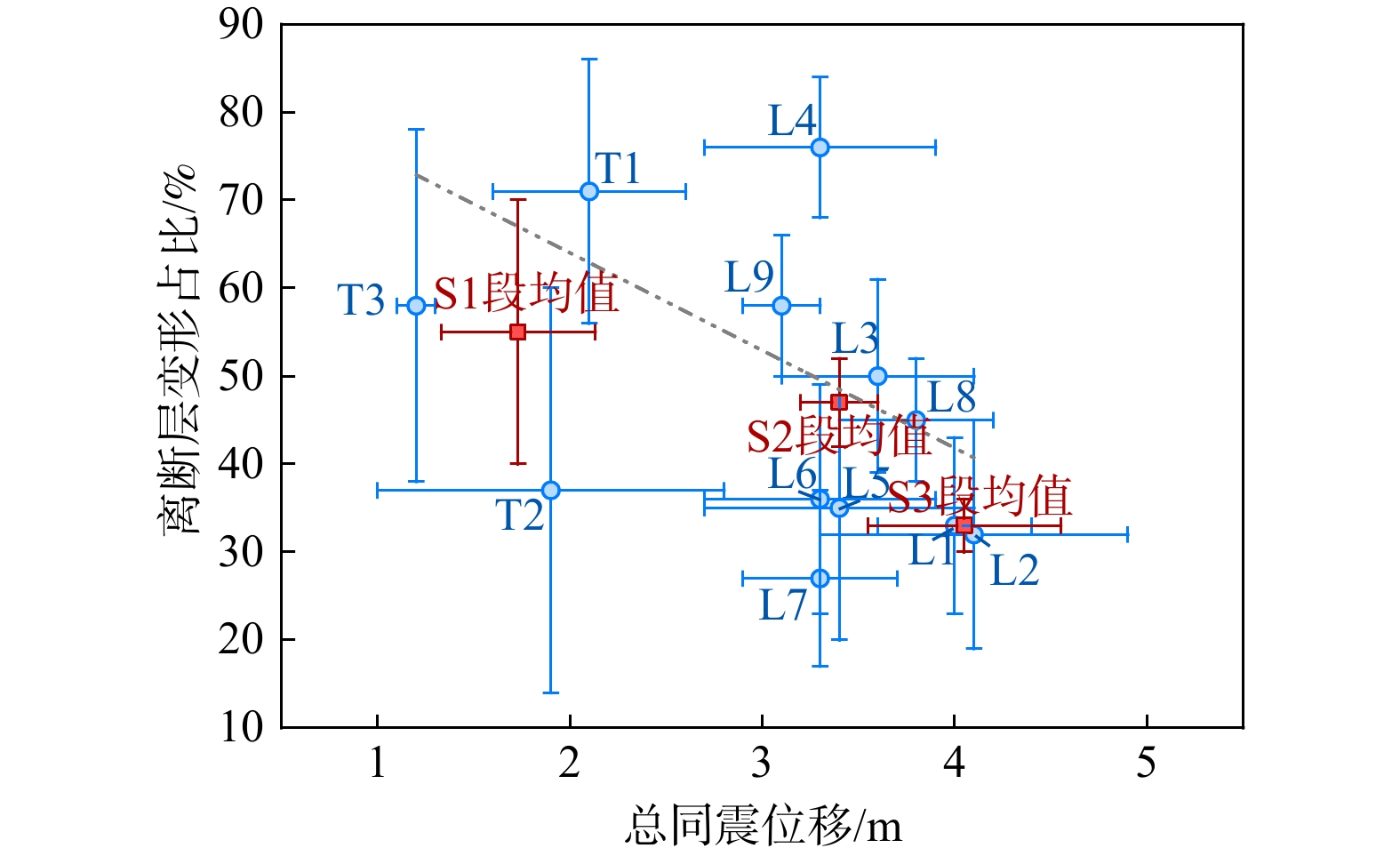
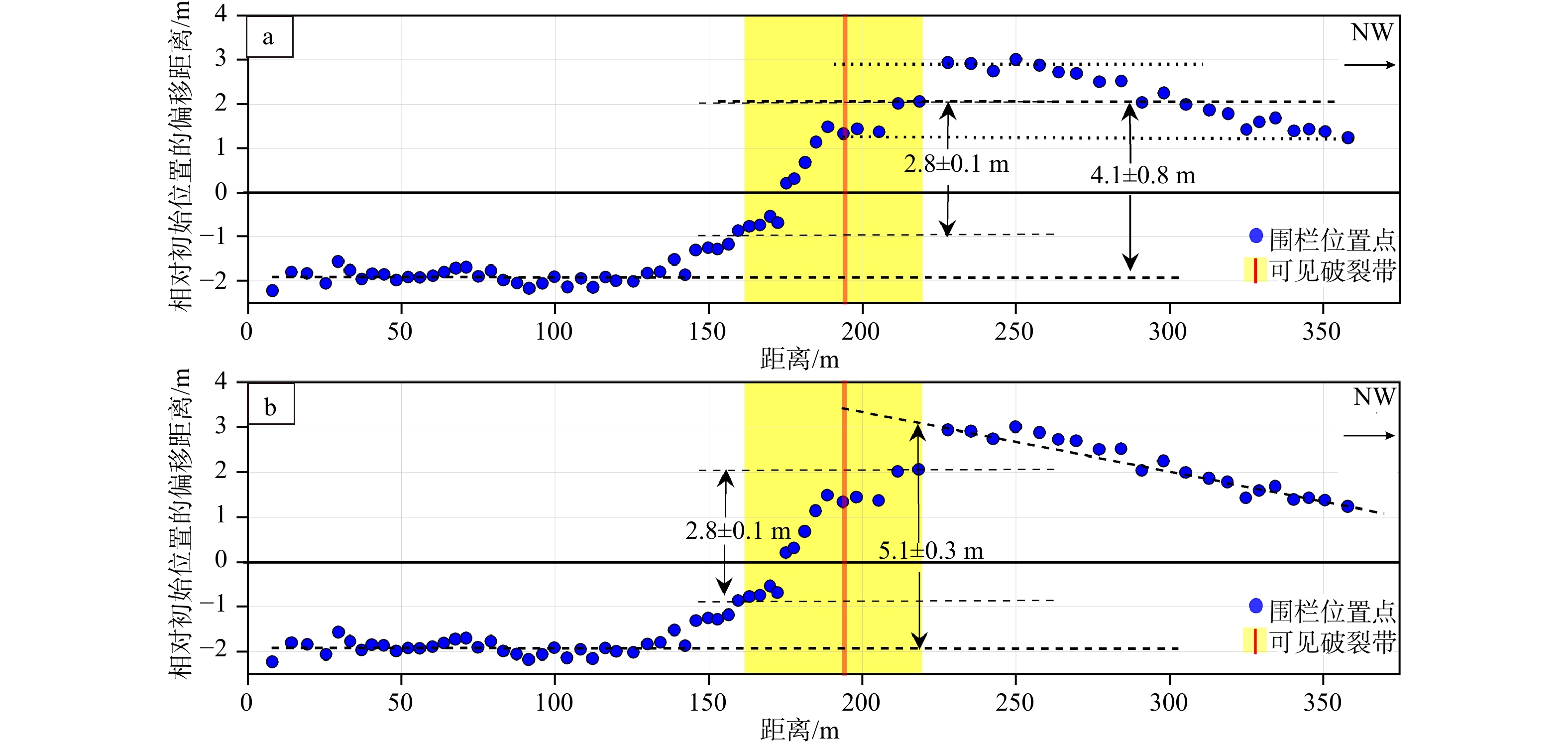
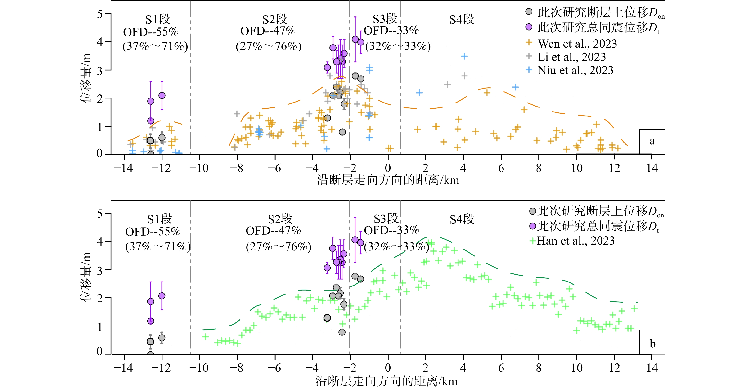
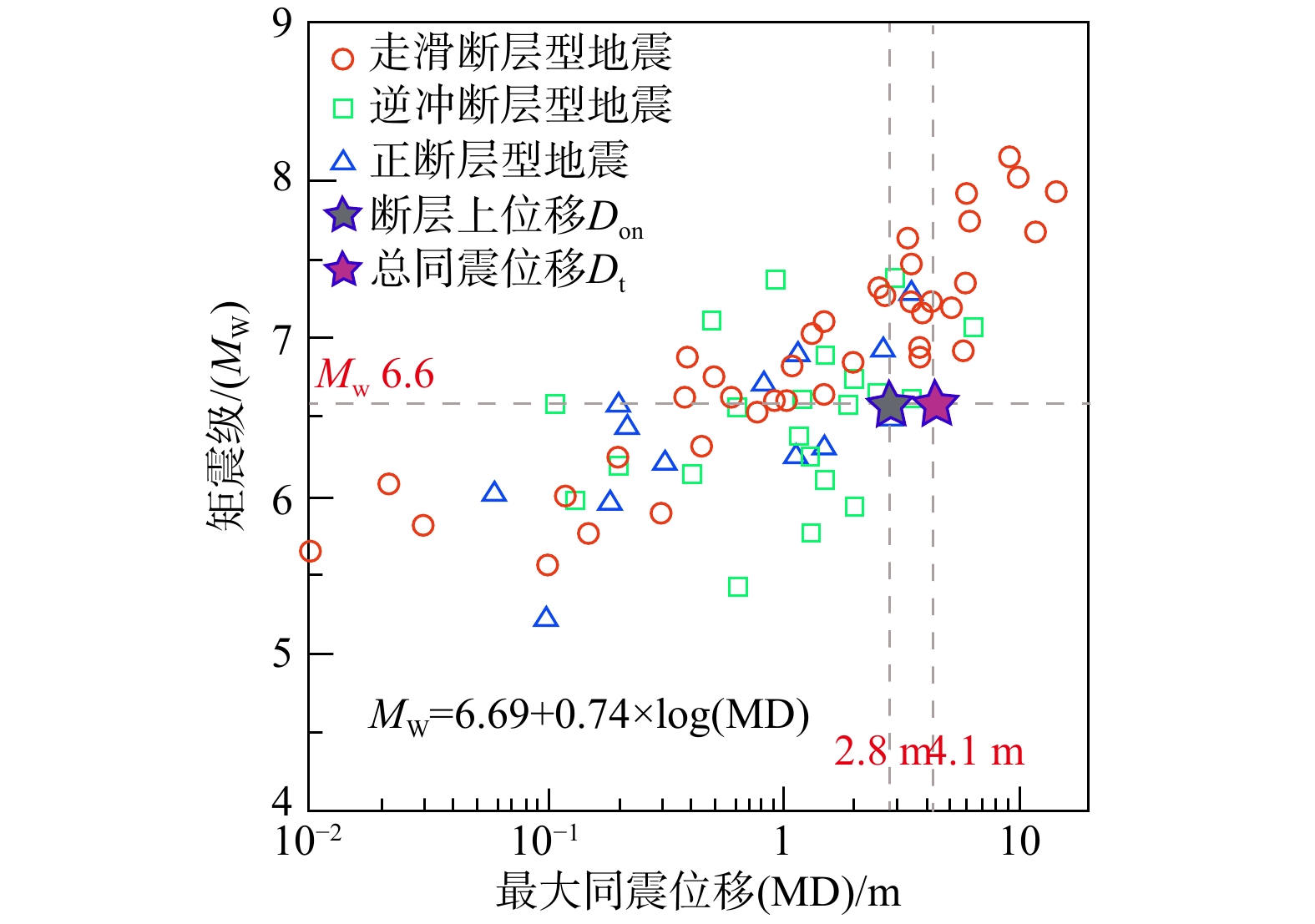
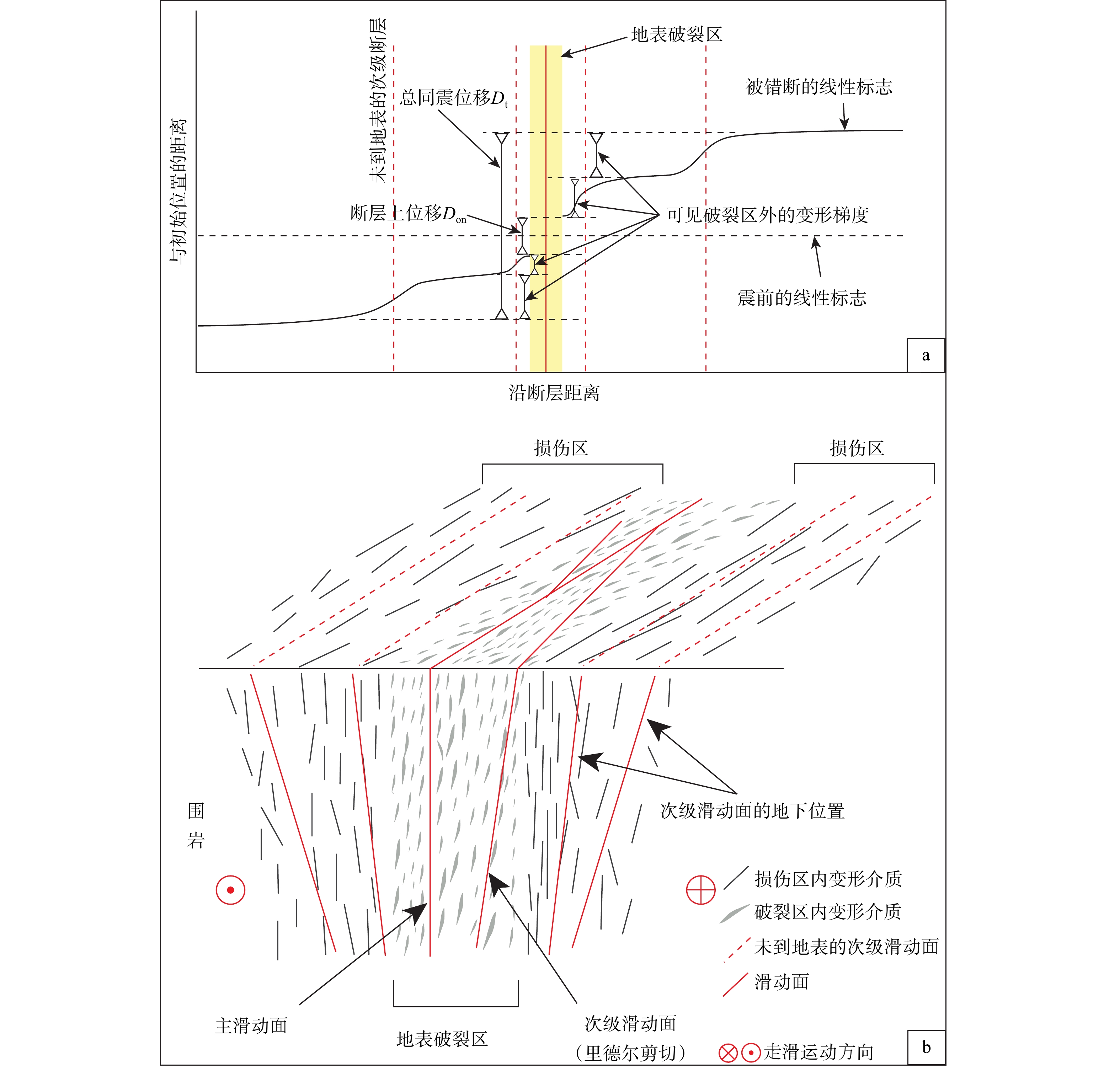
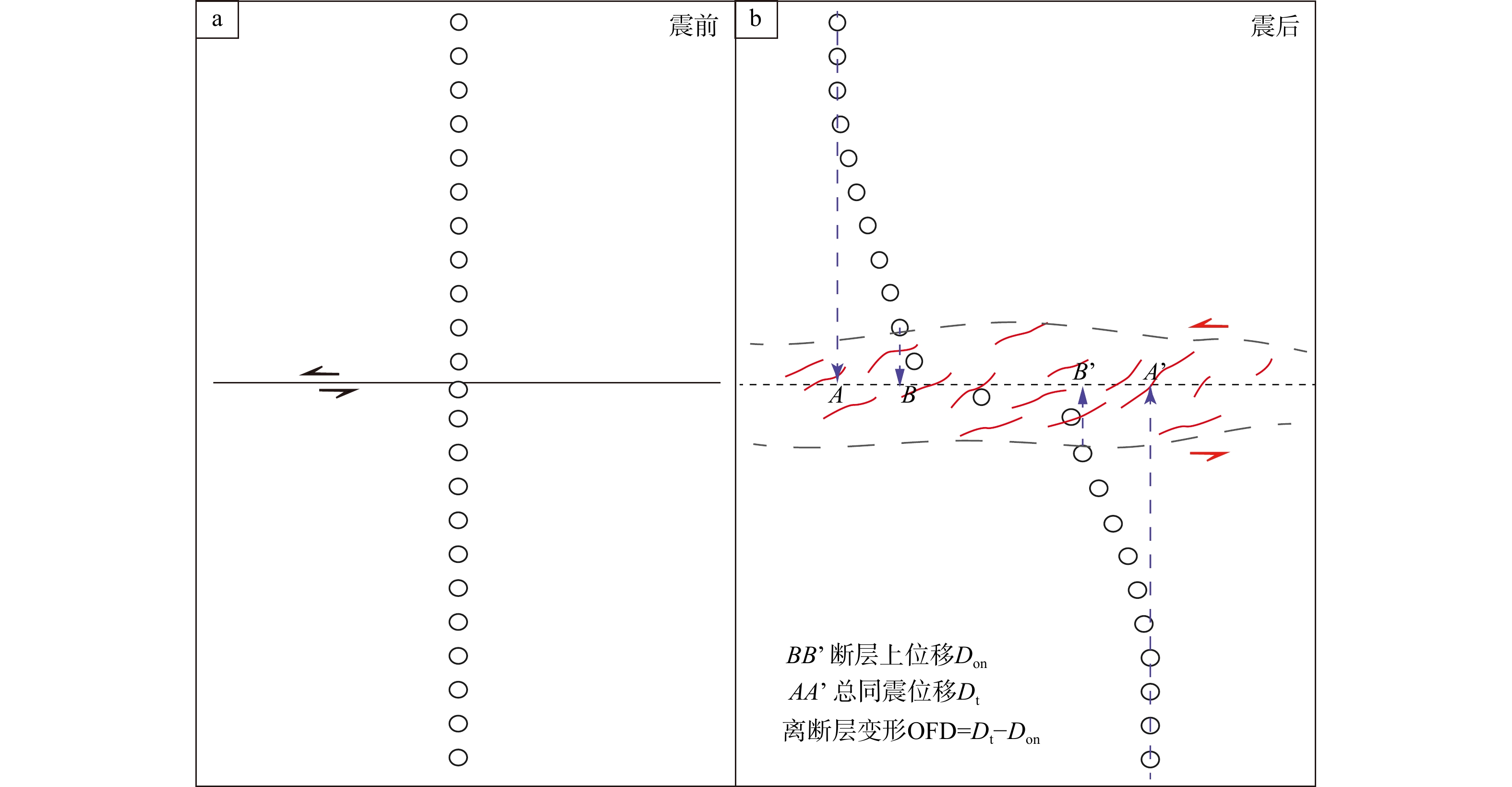
  Objective  Accurate constraints on coseismic surface displacement are essential for revealing earthquake rupture processes, assessing regional seismic hazards, and understanding the partitioning of near-surface deformation. Conventional near-field displacement measurements generally capture only localized deformation along visible rupture zones, potentially underestimating total coseismic displacement by not considering off-fault deformation. Long linear anthropogenic markers crossing rupture zones, such as pasture fences, provide a larger measurement aperture and enable us to quantify total coseismic displacement and evaluate the contribution of off-fault deformation. The 8 January 2022 MW 6.6 Menyuan earthquake along the Haiyuan fault zone displaced multiple pasture fences across the well-preserved surface ruptures, providing an ideal opportunity to investigate total displacement and off-fault deformation.   Methods  In this study, we utilized unmanned aerial vehicle (UAV) photogrammetry to acquire high-resolution aerial images along the entire surface rupture zone of the 2022 Menyuan earthquake and to generate digital orthophoto maps (DOMs) and digital elevation models (DEMs) with spatial resolutions of 2–6 cm. Combined with detailed field investigations, we mapped the coseismic surface rupture at a fine scale and selected 12 groups of long, linear pasture fences crossing the rupture zone to conduct multi-aperture displacement measurements.   Results   The coseismic surface rupture extends for approximately 28 km and consists of two main branches: the southern branch along the Tuolaishan fault and the northern branch along the Lenglongling fault. The rupture zone was divided into four segments from west to east, namely S1 to S4, based on the geometric distribution and structural characteristics of the rupture traces, mainly NE-trending, right-stepping en echelon tensional-shear cracks, oblique compressional bulges, and mole-track-like deformation. The width of the surface rupture zone varies significantly along strike, reaching a maximum of approximately 160 m in the S3 segment. Except for the relatively wide S3, most rupture sections are mainly concentrated within a narrow width range of 10–30 m, indicating strong control by local fault geometry and rupture branching. Multi-aperture measurements using 12 groups of cross-fault pasture fences reveal that visible displacement within the mapped rupture zone ranges from 0 to 2.8 m, whereas the total coseismic displacement measured across the larger aperture of the fences ranges from 1.2 to 4.1 m. The corresponding proportion of off-fault deformation reaches 27%–76%, indicating that a substantial part of the coseismic deformation was accommodated outside the visible principal rupture traces. The maximum total coseismic displacement, approximately 4.1 ± 0.8 m, occurs in the S3 segment of the Lenglongling Fault near the epicenter, where the mean proportion of off-fault deformation is relatively low at approximately 33%. From S3 to S1 along the Tuolaishan branch westward, the total coseismic displacement gradually decreases to a mean of 1.7 ± 0.5 m, while the mean proportion of off-fault deformation increases significantly to about 55%, showing that deformation became progressively less localized and more widely distributed across the surrounding near-surface materials.   Conclusions  Compared with previous near-field measurements, the total coseismic displacements obtained in this study are generally larger. This discrepancy is mainly attributed to the larger measurement aperture provided by the long cross-fault fences, which enabled the capture of a more complete deformation field, including both localized displacement on the visible rupture and distributed off-fault deformation. The 2022 Menyuan earthquake produced a complex surface rupture system composed of the Tuolaishan and Lenglongling fault branches, with clear along-strike variations in rupture geometry, rupture-zone width, and displacement distribution. Multi-aperture measurements using long pasture fences indicate that off-fault deformation accounted for a considerable proportion of the total coseismic displacement, especially in the western branch rupture where deformation was more distributed. The comparison with previous near-field measurements demonstrates that relying only on localized rupture offsets may underestimate the total coseismic displacement. [Significance] This study highlights the critical importance of incorporating off-fault deformation into coseismic displacement measurements to prevent underestimating seismic slip in hazard assessments. Furthermore, it demonstrates that using long, linear, anthropogenic markers via high-resolution UAV photogrammetry is an effective, innovative approach for capturing complete near-surface deformation fields along complex strike-slip fault systems.
Liquefaction-induced large-scale ground deformation triggered by the 7 January 2025 MS 6.8 Dingri earthquake: characteristics and formation mechanisms
HUANG Ting, WU Zhonghai, HAN Shuai, LI Zhichao, FAN Fuxin, GAO Yang, TIAN Tingting, LU Shiming
2026, 32(3): 581-602. doi: 10.12090/j.issn.1006-6616.2026047
Abstract (172) HTML (50) PDF (14465KB)(98)
Abstract:
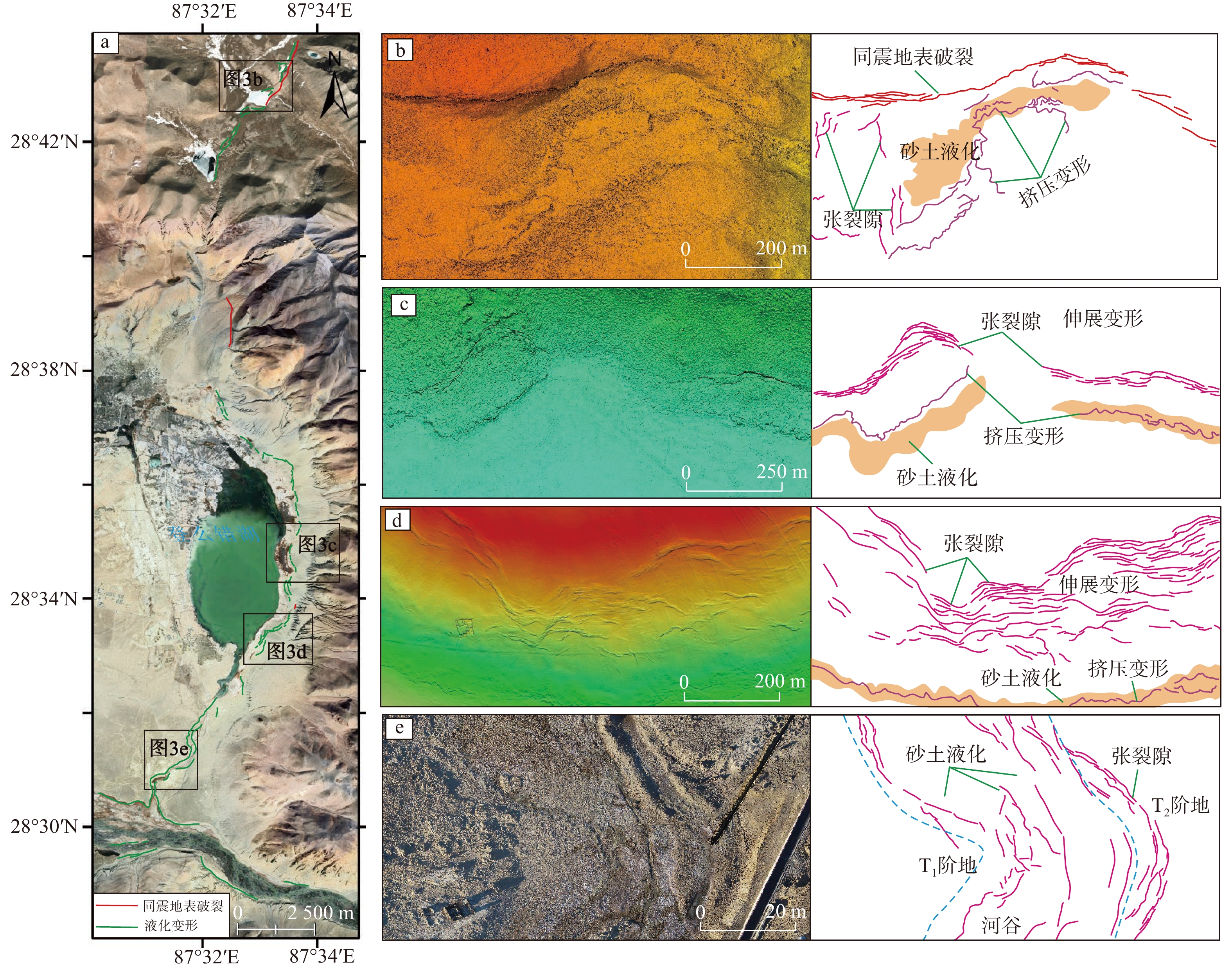
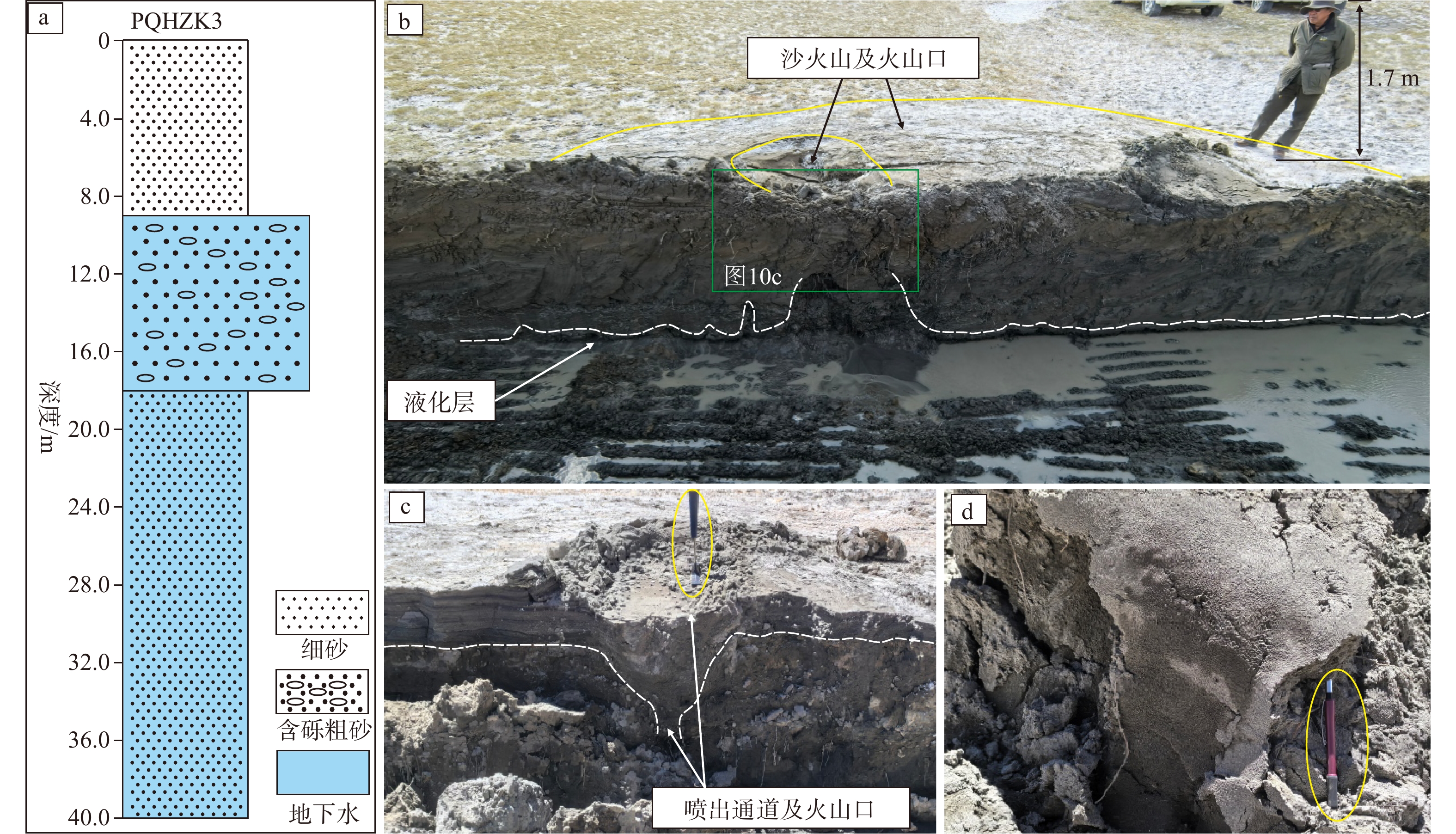
  Objective  In liquefaction-susceptible geological settings, the spatial superimposition of earthquake-induced liquefaction and coseismic fault rupture renders the genetic attribution of surface deformation highly ambiguous, yet systematic field diagnostic criteria and a unified geomechanical framework remain elusive.   Methods  Integrating field emergency surveys, high-resolution remote sensing image interpretation, unmanned aerial vehicle (UAV) photogrammetry, and borehole–trench investigations with regional geological and hydrogeological context, this study systematically characterizes the spatial distribution and controlling mechanisms of large-scale surface deformation triggered by the 7 January 2025 MS 6.8 Dingri, Tibet earthquake.   Results  Our results show that the extensive surface deformation along the eastern shore of Dengmecuo Lake to the Pengqu River is dominated by liquefaction-induced lateral spreading rather than coseismic tectonic surface rupture; small-scale coseismic surface ruptures occur locally along the eastern lake shore; and north of Nixiacuo, coseismic surface rupture predominates, with superimposed liquefaction deformation. The spatial extent of liquefaction-induced lateral spreading is governed by two topographic configurations: free-face conditions in river valleys, and gently sloping ground on low-gradient alluvial–lacustrine plains. Earthquake-induced liquefaction substantially reduces the shear strength of water-saturated sandy sediments and, driven by the combined effects of seismic inertia and gravity, triggers lateral spreading that generates lateral compressive forces and horizontal displacement. At the trailing edge of the deformation zone, tensional ground cracks and graben-like subsidence develop, whereas the leading edge is characterized by pressure ridges and shallow thrust structures formed by lateral compression. Tensile fissures generated by lateral spreading further provide conduits for the upward injection of liquefied sand from depth, giving rise to abundant sand volcanoes. The systematic coexistence of trailing-edge extension, leading-edge compression, and sand volcanoes constitutes a diagnostic deformation assemblage of liquefaction-induced lateral spreading, which is fundamentally distinct in geometry and kinematics from tectonic coseismic surface ruptures. The development of liquefaction deformation is jointly controlled by seismic intensity, micro-topography, the spatial distribution of liquefiable sand layers, and the depth of the shallow groundwater table. Importantly, lateral spreading can impose additional displacement onto active fault zones, and compressional liquefaction deformation may overprint fault traces, systematically biasing the identification of the geometry and kinematics of coseismic surface ruptures. Accordingly, we propose three field criteria for identifying liquefaction-induced deformation: (1) macroscopic plastic flow or fluid-like deformation features; (2) highly consistent deformation patterns along watercourses across both fault and non-fault zones under comparable depositional conditions; and (3) systematic spatial association with liquefaction indicators such as sand volcanoes.   Conclusions  We conclude that the large-scale deformation triggered by the 2025 Dingri earthquake should not be classified as coseismic surface rupture; rather, trailing-edge extension, leading-edge compression, and sand boils together constitute a unified lateral spreading system. Liquefaction-induced deformation exerts a pronounced overprinting effect on coseismic surface ruptures, and rigorously distinguishing the two in liquefaction-prone seismotectonic settings is essential for accurately assessing fault activity. [Significance] This study provides the first systematic mechanistic framework for liquefaction-induced large-scale deformation associated with the Dingri earthquake, and the field criteria and conceptual model established herein offer a scientific basis for seismic hazard assessment, post-earthquake reconstruction, and major engineering siting in the southern Tibetan rift system.
The spatial distribution, deformation characteristics, and engineering effects of the southeastern segment of the Jiali Fault Zone
ZHU Shu, ZHANG Quan, WANG Yanbing, LI Jin, LI Renjie, HUANG Yong, LI Benliang, LIU Fucai, YAN Yuping
2026, 32(3): 603-619. doi: 10.12090/j.issn.1006-6616.2025170
Abstract (333) HTML (80) PDF (11209KB)(382)
Abstract:
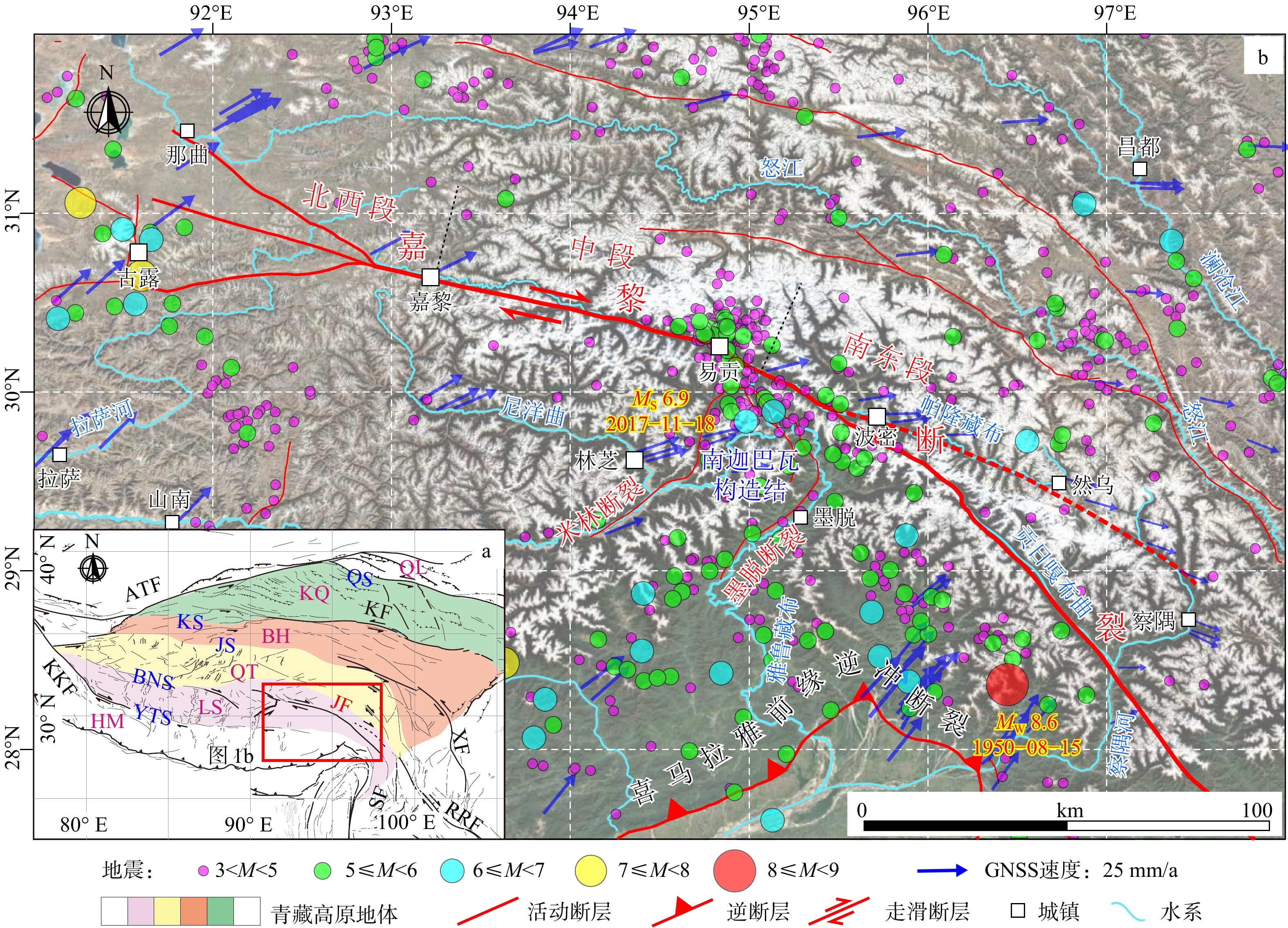
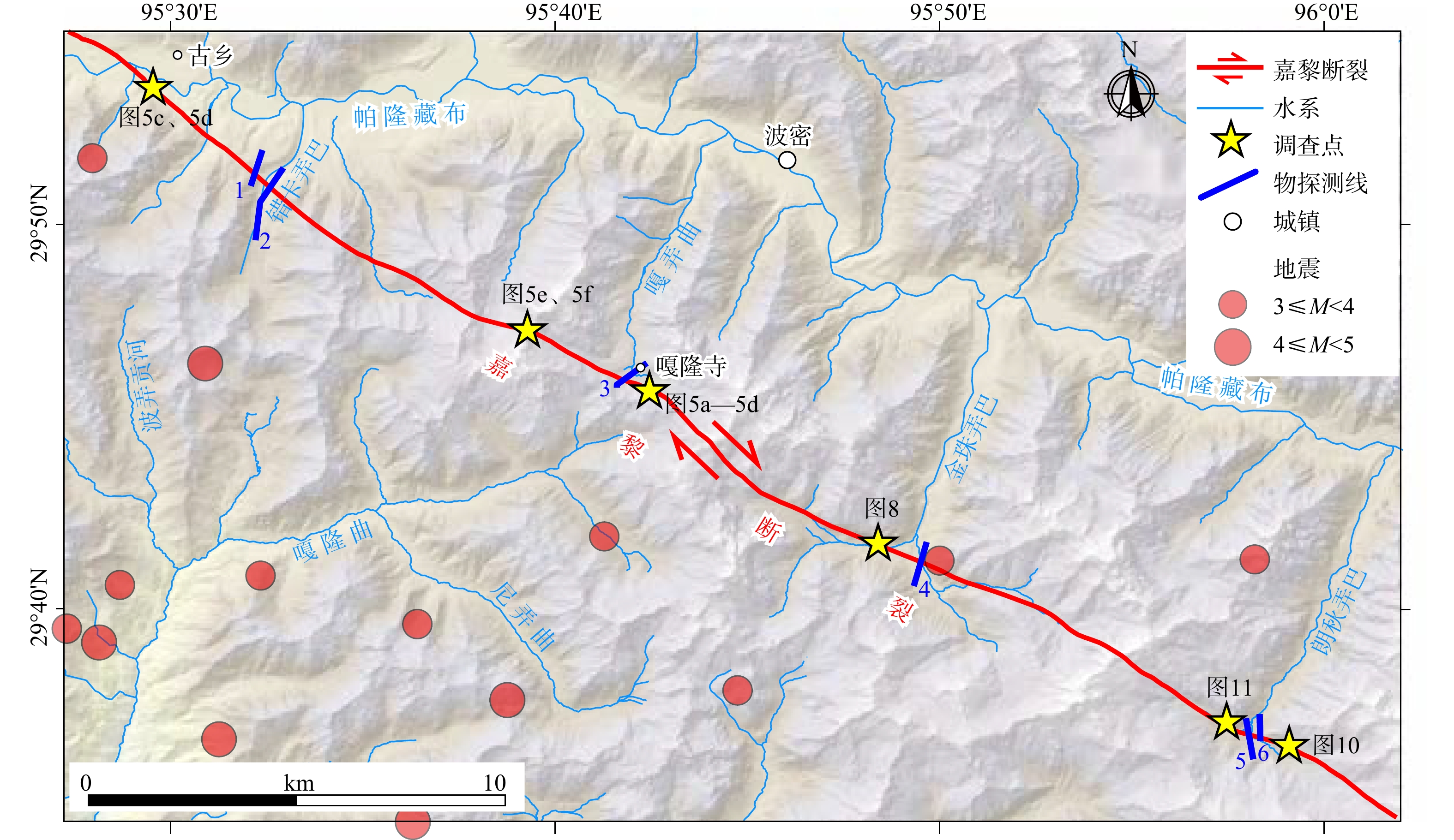
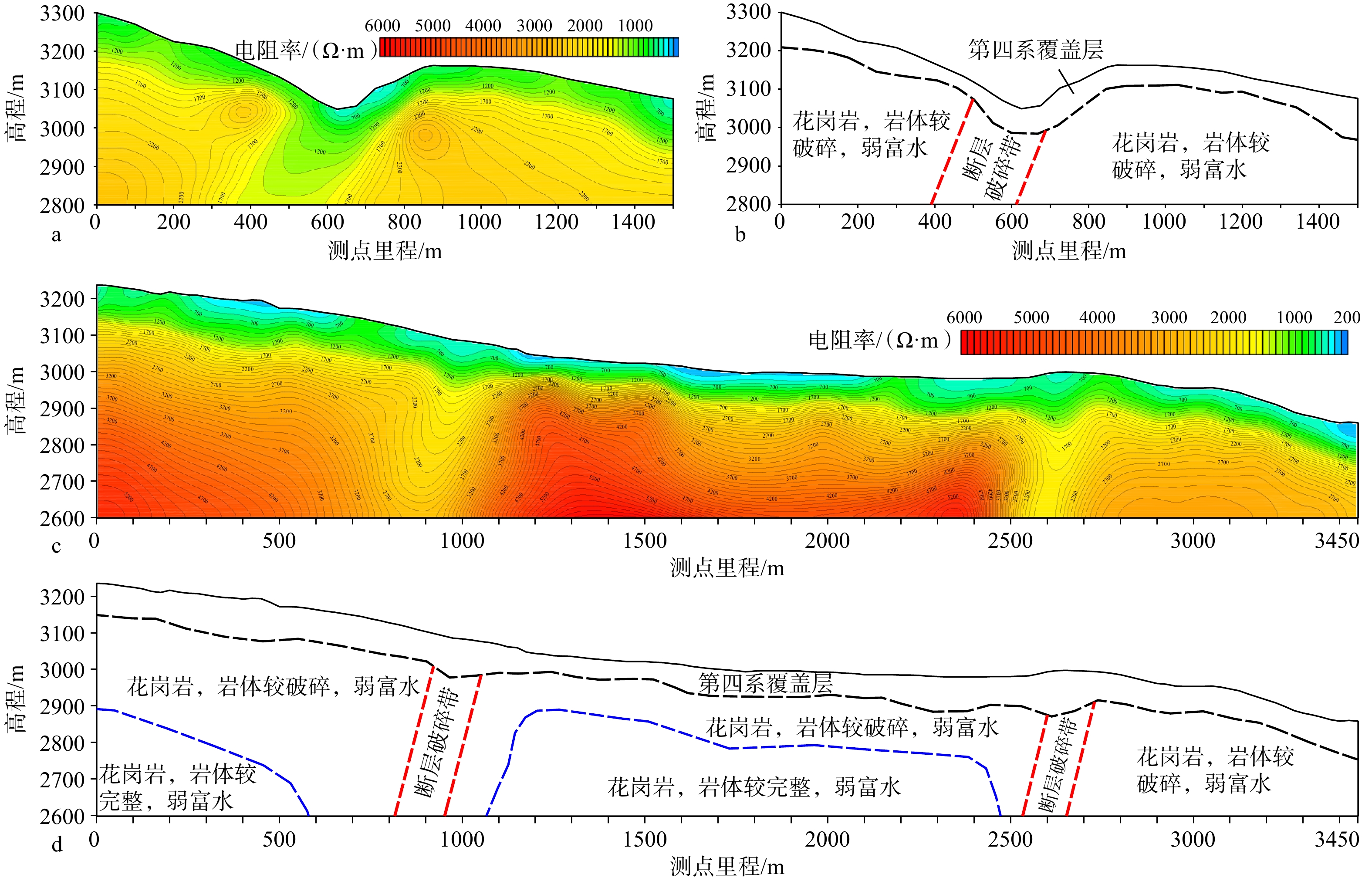
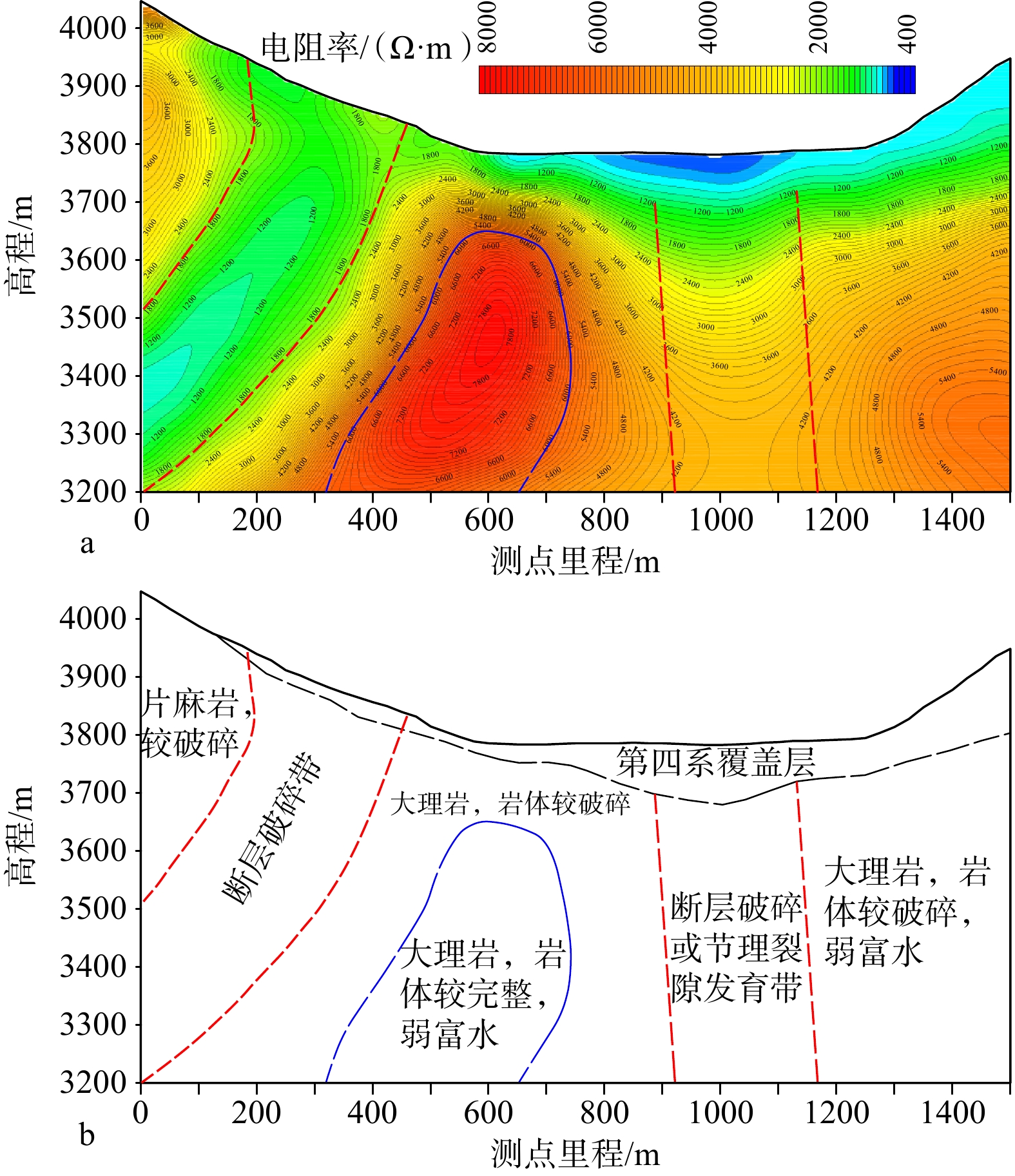
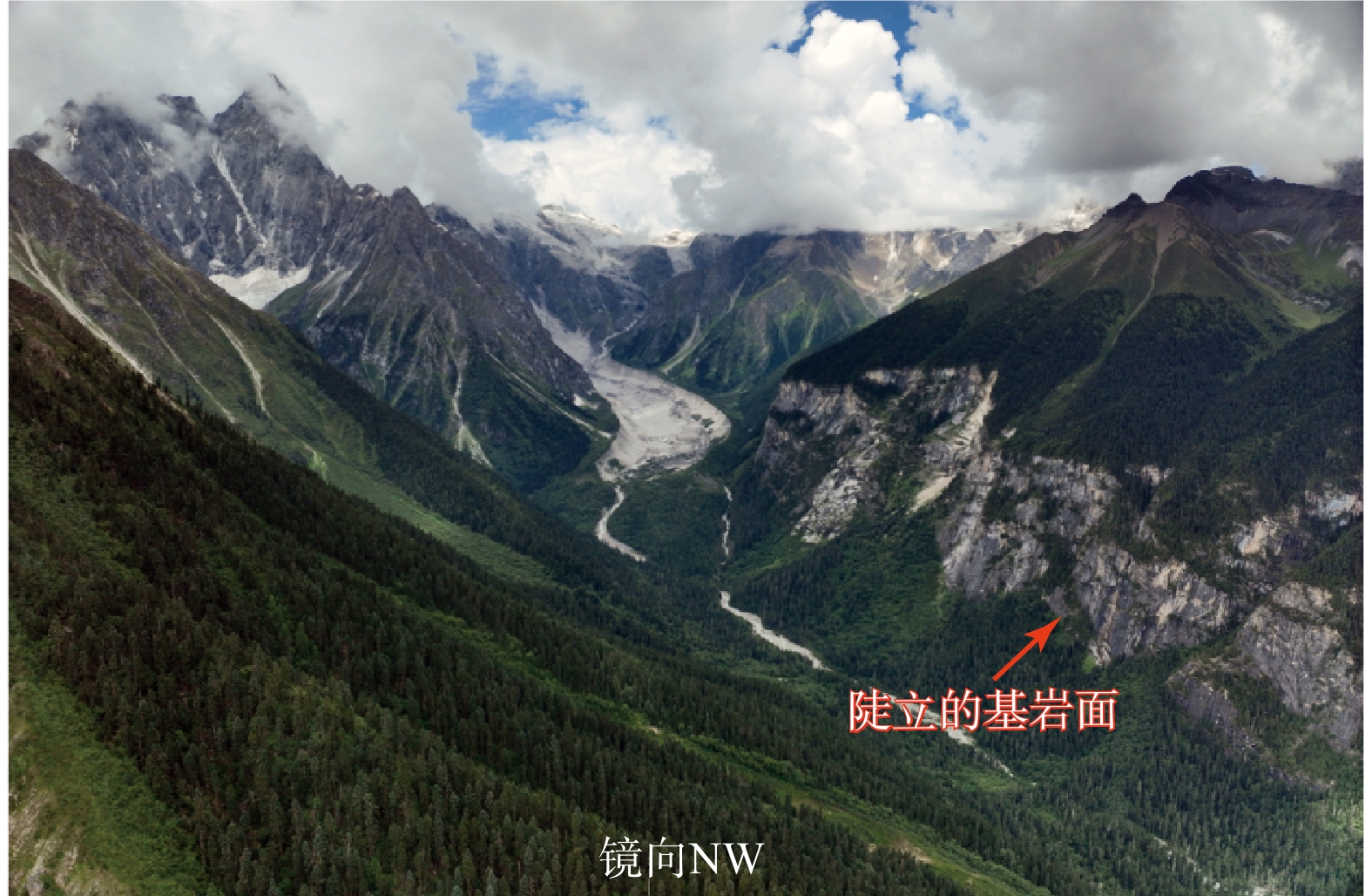
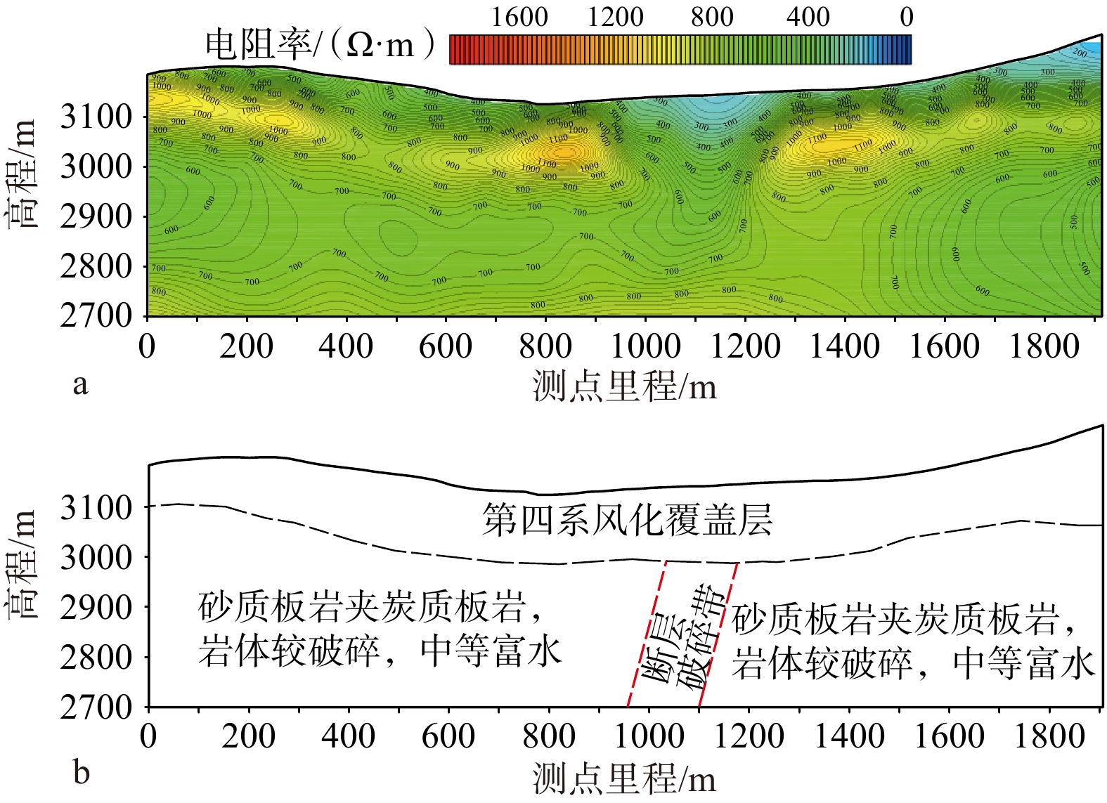
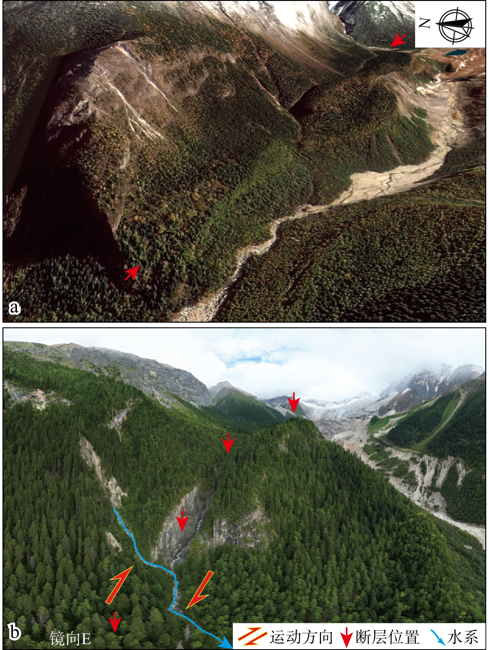
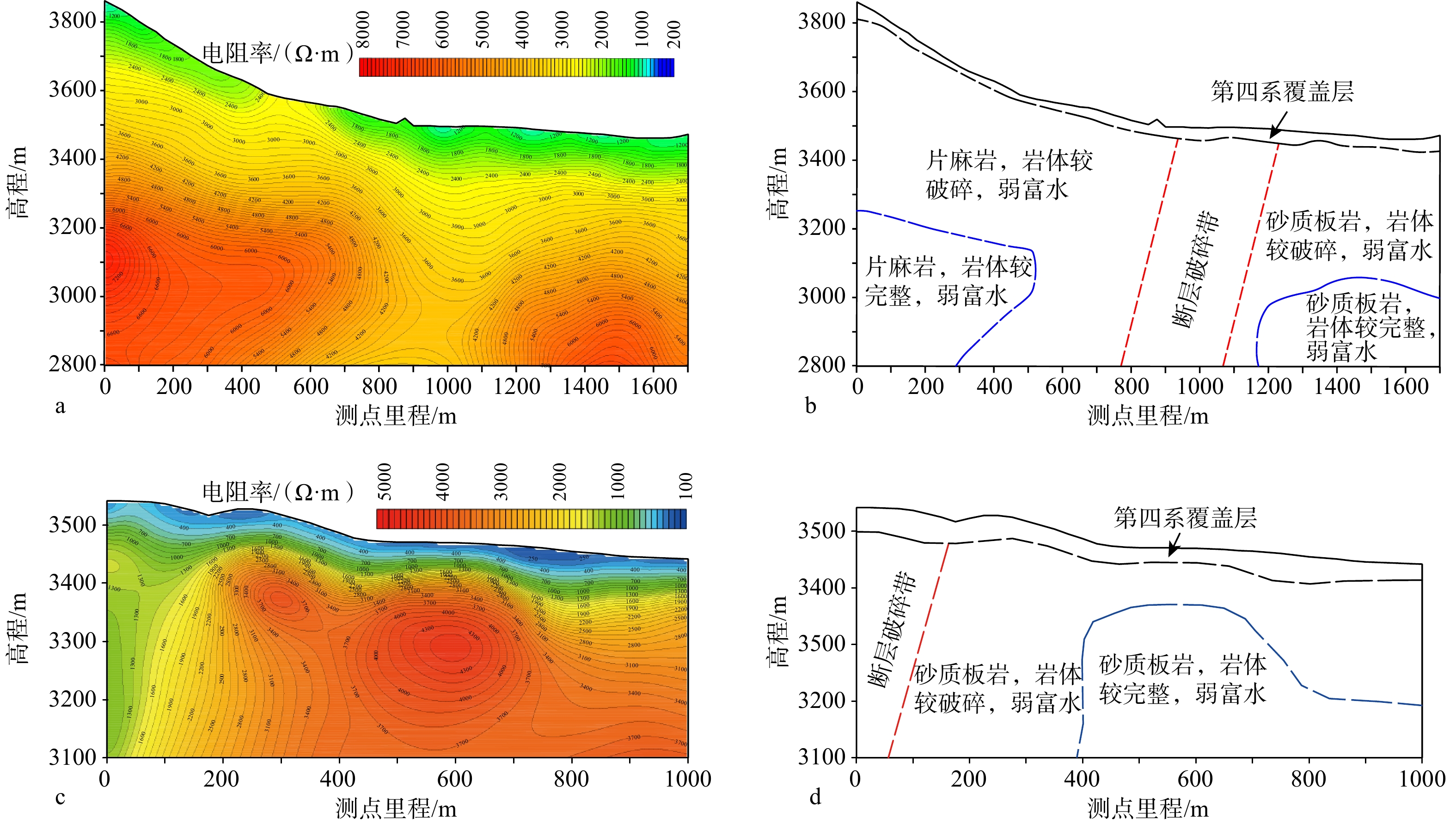
  Objective  The Tibetan Plateau, as the world's largest and most tectonically active continental collision orogenic belt, has long been at the forefront of global geoscience research due to its complex tectonic patterns and ongoing dynamic processes. The Jiali Fault Zone along the southeastern margin of the Tibetan Plateau serves as the key structure for the southeastward extrusion of plateau materials. Its tectonic attributes, geometric distribution, and activity are of great significance for understanding the Cenozoic tectonic evolution of the plateau, the kinematics of southeastward extrusion of plateau materials, the genesis of regional earthquakes and geohazards, and the assessment of regional engineering risks. However, the precise spatial location and Holocene activity of the southeastern segment of this fault zone (from Guxiang to Gongrigabu) have long been subject to controversy due to rugged terrain and dense vegetation cover.  Methods  This study systematically investigated the spatial distribution, structural characteristics, and activity of the Jiali Fault in this critical, disputed segment by integrating multiple techniques, including high-resolution remote sensing image interpretation, field geological and geomorphological surveys, magnetotelluric sounding, and drilling data. Based on these investigations, we further analyzed the potential underground engineering effects triggered by fault activity.   Results and Conclusions  (1) The southeastern segment of the Jiali Fault Zone extends continuously southeastward from south of Guxiang through Galongla and Jinzhunongba to Langqiunongba. Remote sensing interpretation reveales different kinds of structural geomorphologies including fault troughs, sag ponds, and push-up ridges. Field surveys identified bedrock fault planes and horizontal striations, demonstrating predominantly right-lateral strike-slip motion. Geophysical surveys revealed distinct low-resistivity fracture zones (approximately 200–300 m wide) in the Cuokanongba, Galongla, Jinzhunongba, and Langqiunongba areas, indicating that the Jiali Fault dips 60°–80° to the southwest. Drilling cores revealed significant fault fracture zones in the Galongla area. Together, these findings confirm the existence and NW-SE-trending distribution of the Jiali fault. In combination with evidence for Holocene activity in the western segment, offset of late Pleistocene–Holocene sedimentary profiles in the Gongrigabuqu segment, and new survey results, the southeastern segment of the Jiali Fault plausibly exhibits Holocene activity. (2) Activity along the Jiali Fault may trigger the following seven types of underground engineering effects and associated adverse geological issues: co-seismic displacement (with an estimated maximum displacement up to 5–6 meters), rock mass degradation, high stress and rockbursts, ground motion amplification, high-pressure water and mud outbursts, localized geothermal anomalies, and secondary hazards at tunnel entrances. These effects form a complex and intrinsically linked geological risk chain, posing significant challenges for deep, long tunnels crossing fault zones. Therefore, for underground projects crossing potentially active faults where avoidance is impossible or cost-prohibitive, we recommend implementing systematic reinforcement designs and risk control measures corresponding to these effects across the entire project life cycle, starting from the planning and site selection stages.   Significance  This study addressed the challenges of applying traditional active detection methods to complex geological environments, such as high topographic relief, deep vegetation cover, and the absence of fine-grained Quaternary deposits, along the southeastern margin of the Tibetan Plateau. This study focused on remote sensing interpretation, high-precision geophysical surveys, and cross-fault drilling, thereby establishing a successful model for future active fault exploration in similar regions. The outcomes not only provide critical geological constraints for refining the tectonic model of the southeastern Tibetan Plateau, but also offer an indispensable scientific basis for planning, seismic design, and risk prevention of major engineering projects crossing active fault zones. Furthermore, the research methodology establishes a successful model for future active fault investigations in comparable regions.
Response of geomorphic indices to segmental activity of the Kouquan Fault on the western boundary of the Datong Basin
CHU Tianshu, REN Junjie
2026, 32(3): 620-637. doi: 10.12090/j.issn.1006-6616.2024134
Abstract (178) HTML (43) PDF (12551KB)(119)
Abstract:
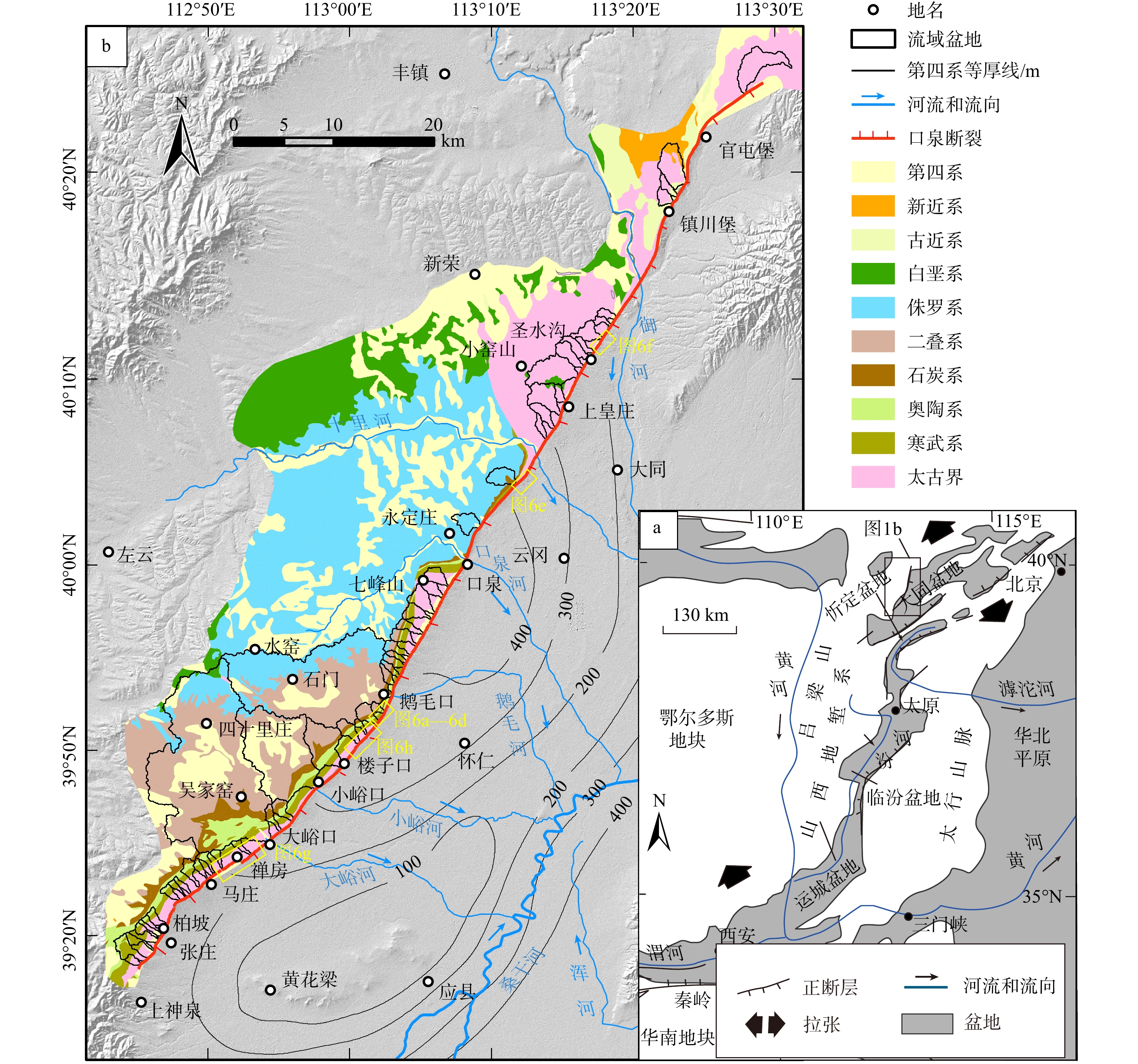
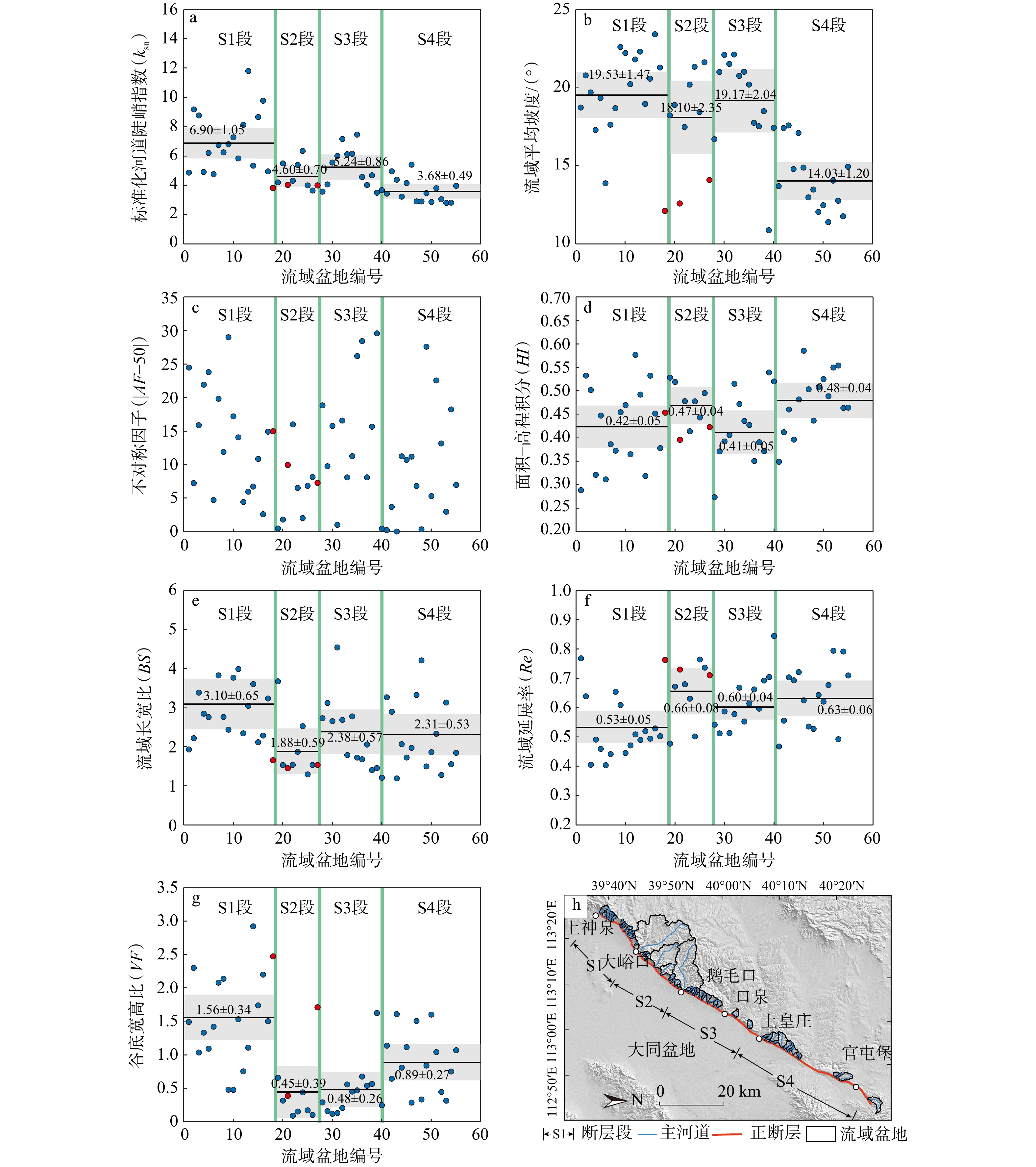
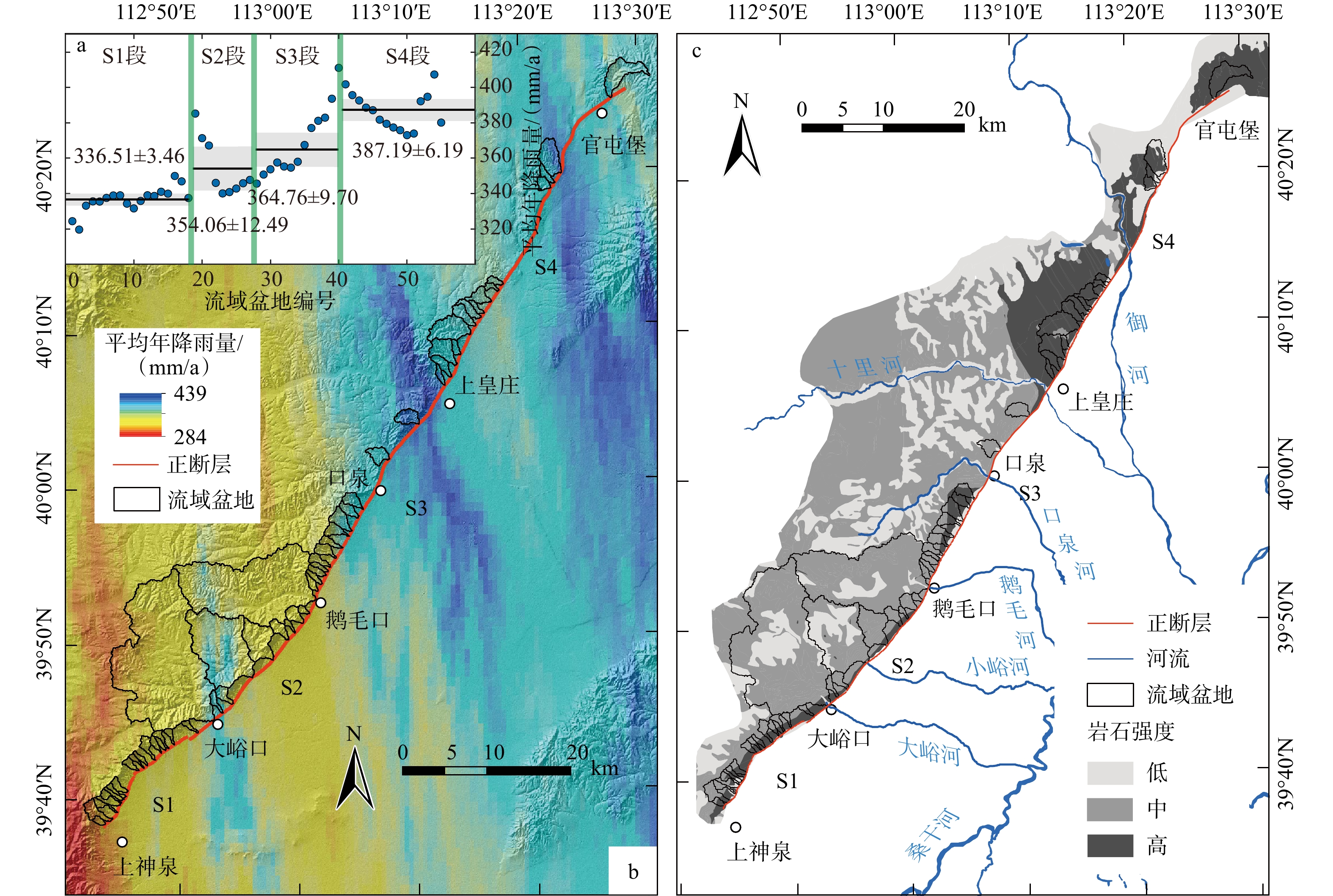
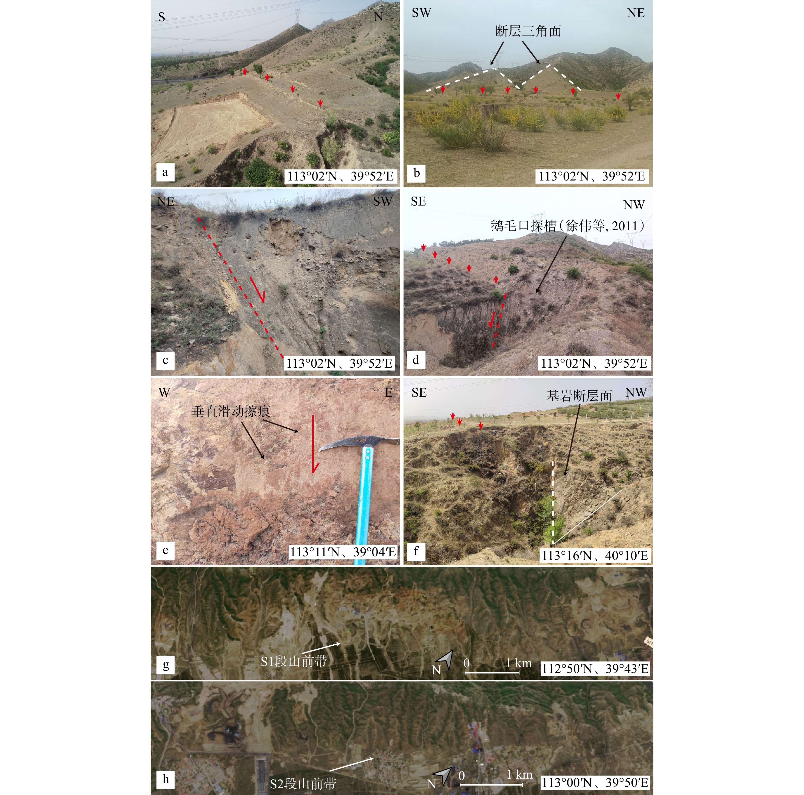
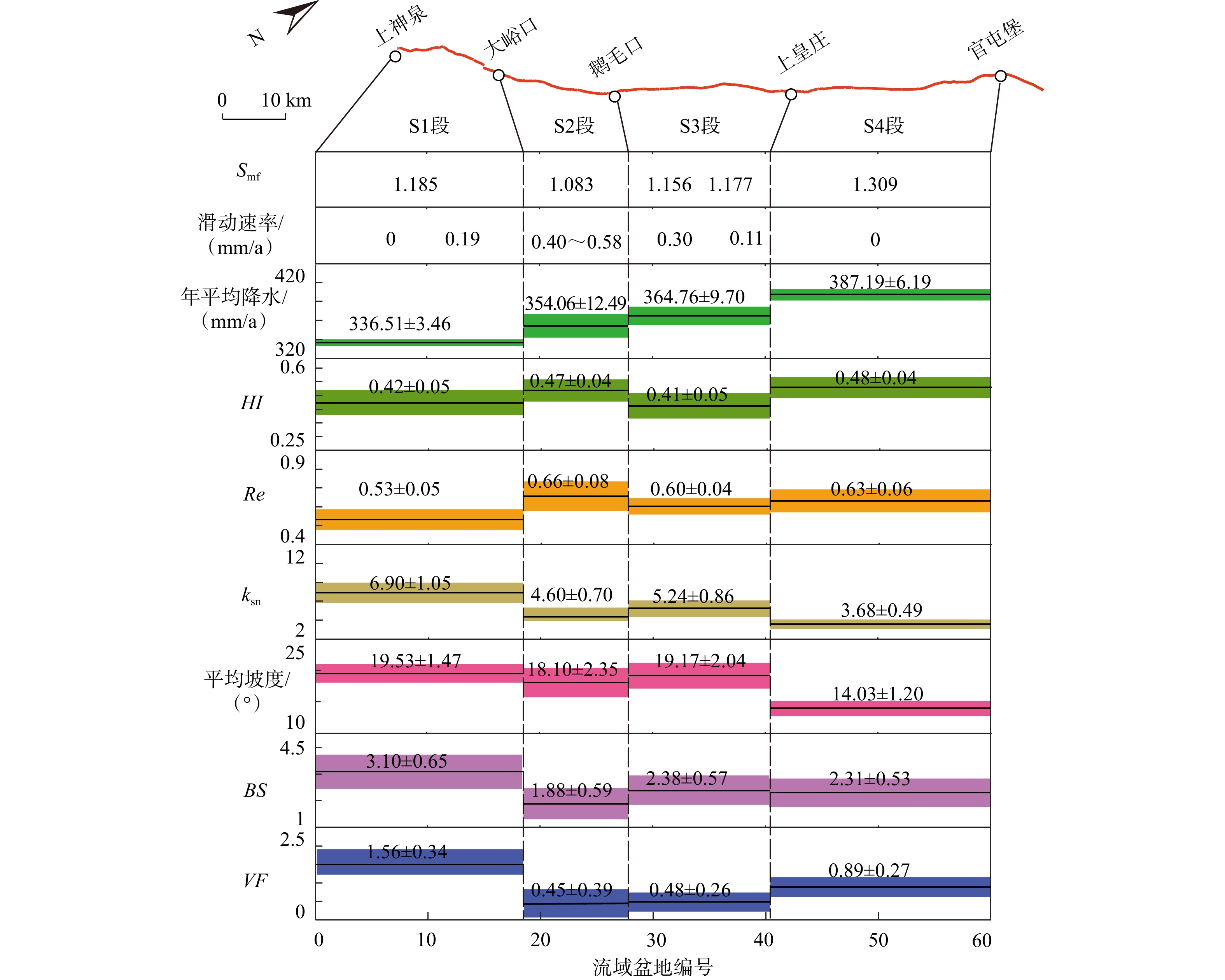
  Objective  Segmentation studies of active tectonics are of great significance for earthquake prediction and hazard assessment. To investigate whether geomorphic indices can reflect differential activity along fault segments, this study focuses on the Kouquan Fault—a typical normal fault located at the mountain–basin transition on the western boundary of the Datong Basin—and conducts a segmentation analysis based on geomorphic indices.   Methods  Using 12.5 m-resolution ALOS-PALSAR DEM data, we extracted 55 drainage basins on the footwall of the fault and calculated various geomorphic indices, including basin slope, mountain-front sinuosity ($ S\mathrm{_{mf}} $), hypsometric integral ($ HI $), valley-floor-width-to-height ratio ($ VF $), basin asymmetric factor ($ AF $), basin elongation ratio ($ Re $), and normalized channel steepness index ($ k\mathrm{_{sn}} $). We analyzed their spatial distribution across different fault segments, examined the influence of non-tectonic factors (such as lithology and climate), and compared the results with existing tectonic activity data (e.g., late Quaternary slip rates).   Results  The geomorphic indices, primarily controlled by tectonic uplift, exhibit clear segmentation. Values in the central segment are significantly higher than those in the northern and southern segments. This spatial variation aligns with the fault's slip rate trend, indicating that geomorphic indices can effectively reflect differential fault activity. Some indices, however, are more influenced by lithology or precipitation and therefore exhibit lower sensitivity to tectonic activity.  Conclusions  The study demonstrates that fluvial geomorphic indices reveal the segmental activity of the Kouquan Fault and can serve as an effective tool for assessing fault segmentation. Furthermore, the geomorphic indices of the Kouquan Fault are mainly controlled by tectonic activity, among which the $ VF $, $ S\mathrm{_{mf}} $, and $ k\mathrm{_{sn}} $indices exhibit the highest sensitivity. [Significance] This research validates the effectiveness and objectivity of geomorphic indices in identifying active fault segmentation. It proposes a new, generalizable approach for fault segmentation studies based on high-precision, quantitative geomorphic analysis.
Geomorphic features and tectonic responses in the Upper Yalong River basin
TAN Ling, LIANG Mingjian, ZHANG Wei, DONG Yunxi, LIU Shao, LI Fupeng, TAN Xin, LONG Jianyu, LI Sheng
2026, 32(3): 638-655. doi: 10.12090/j.issn.1006-6616.2026003
Abstract (183) HTML (28) PDF (29034KB)(107)
Abstract:
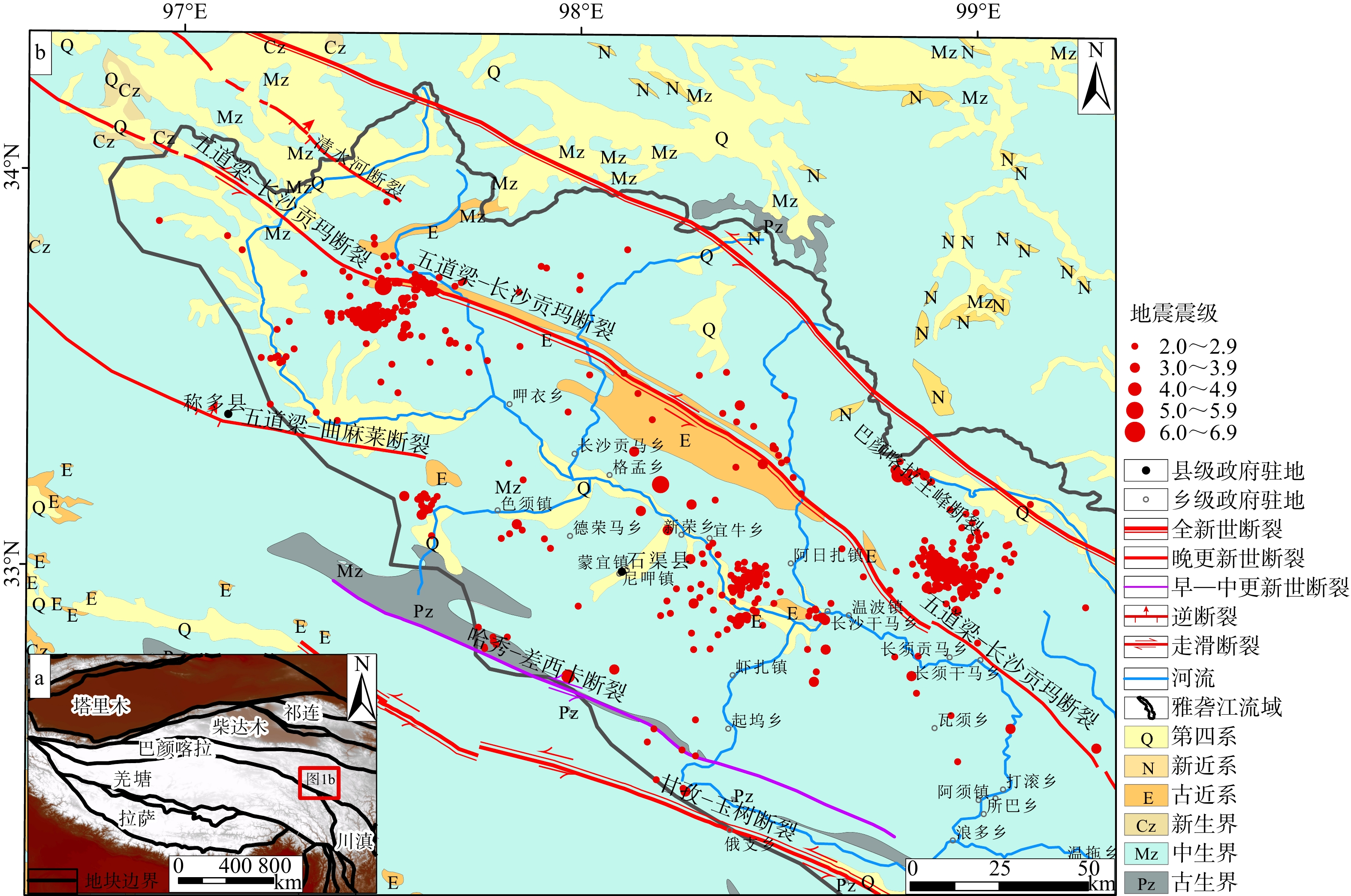
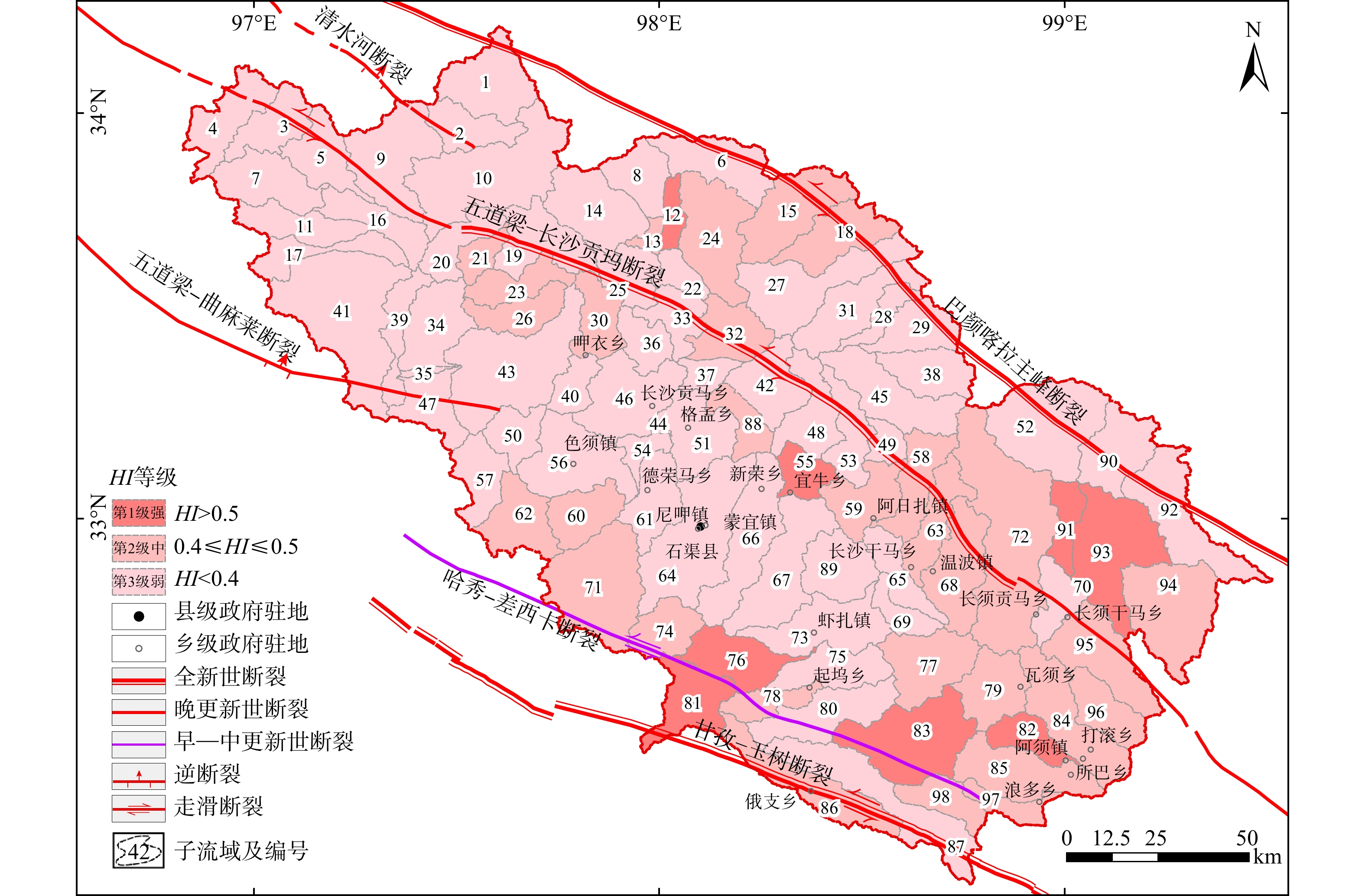
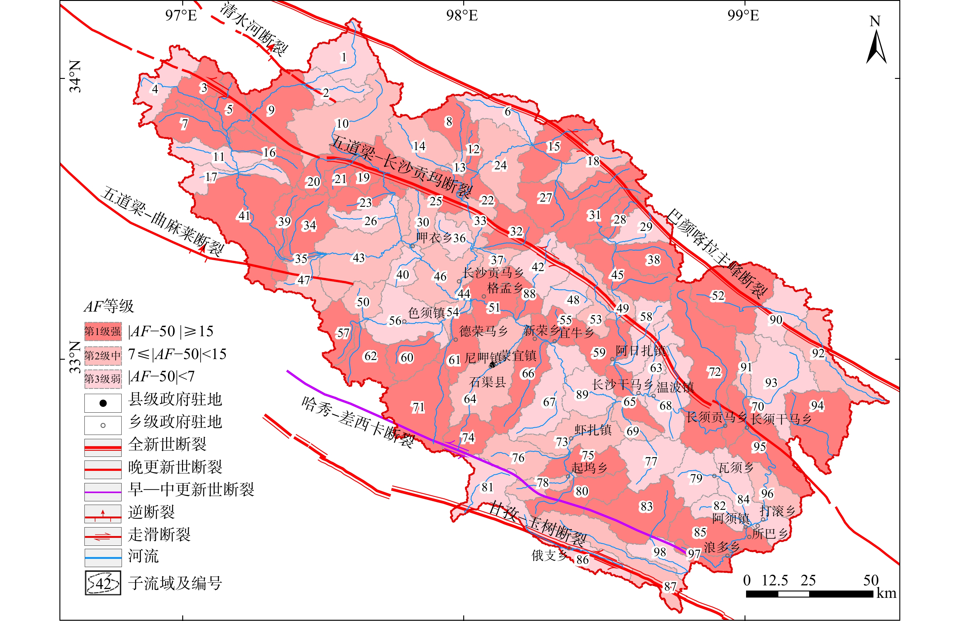
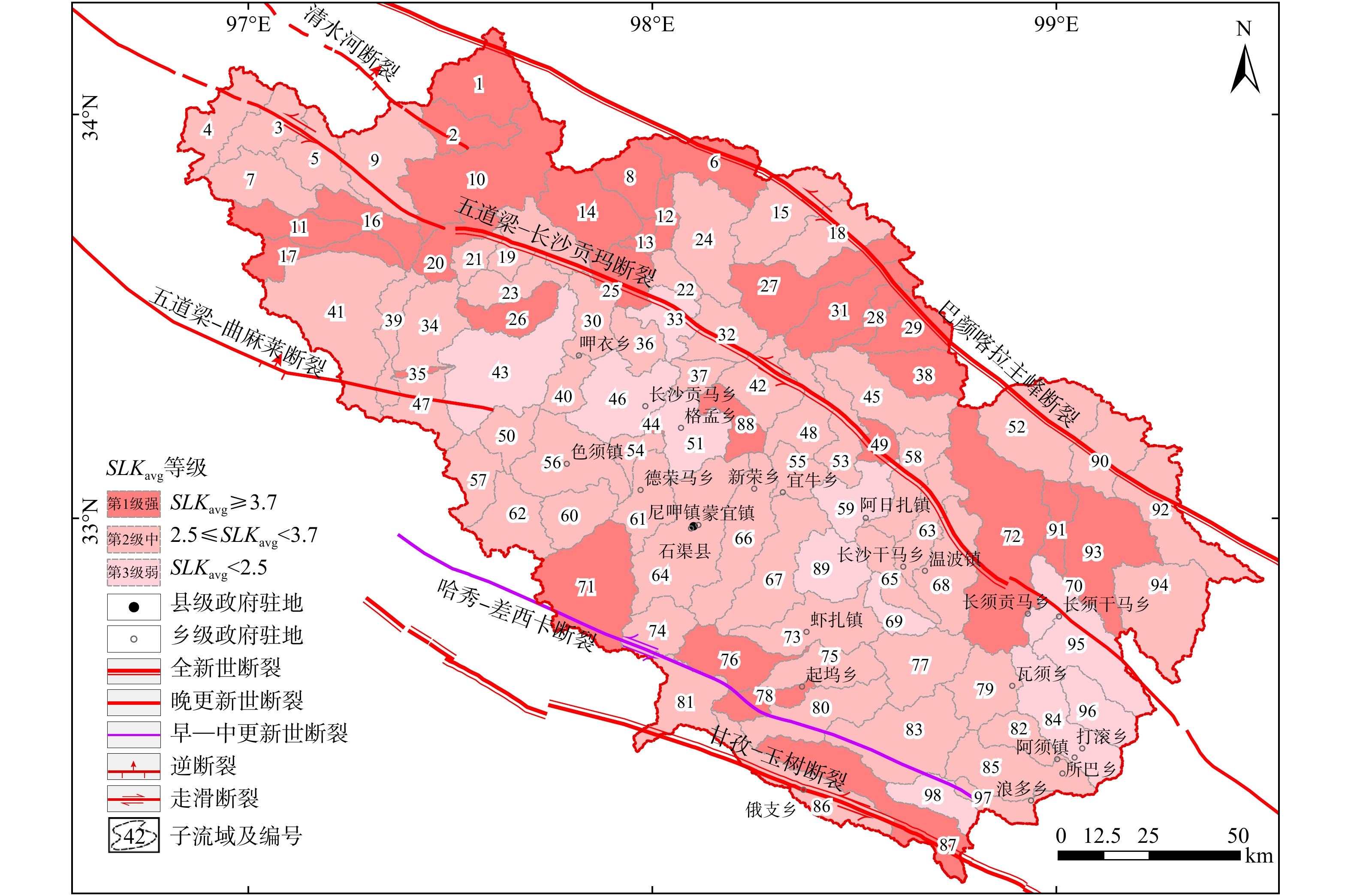
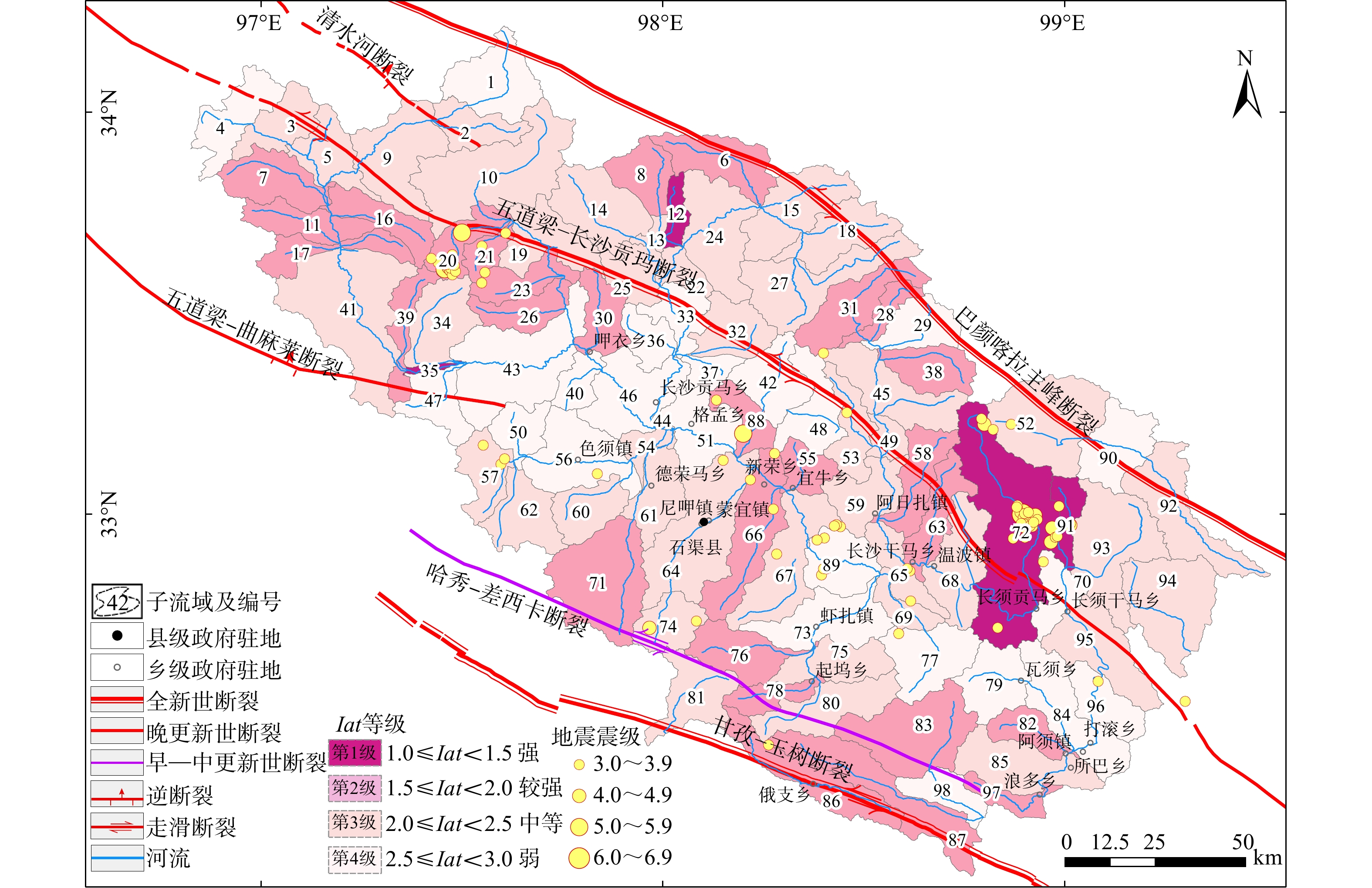
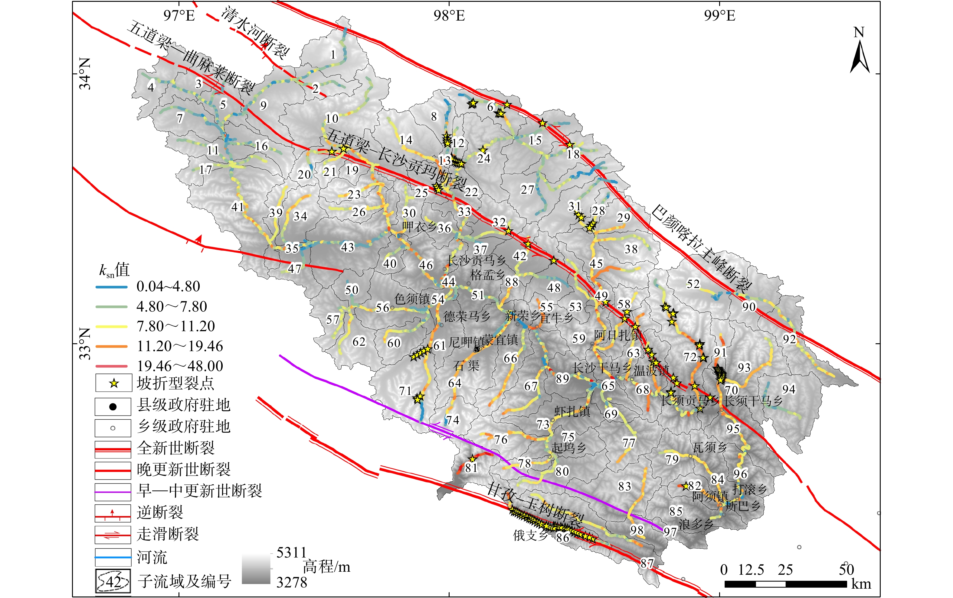
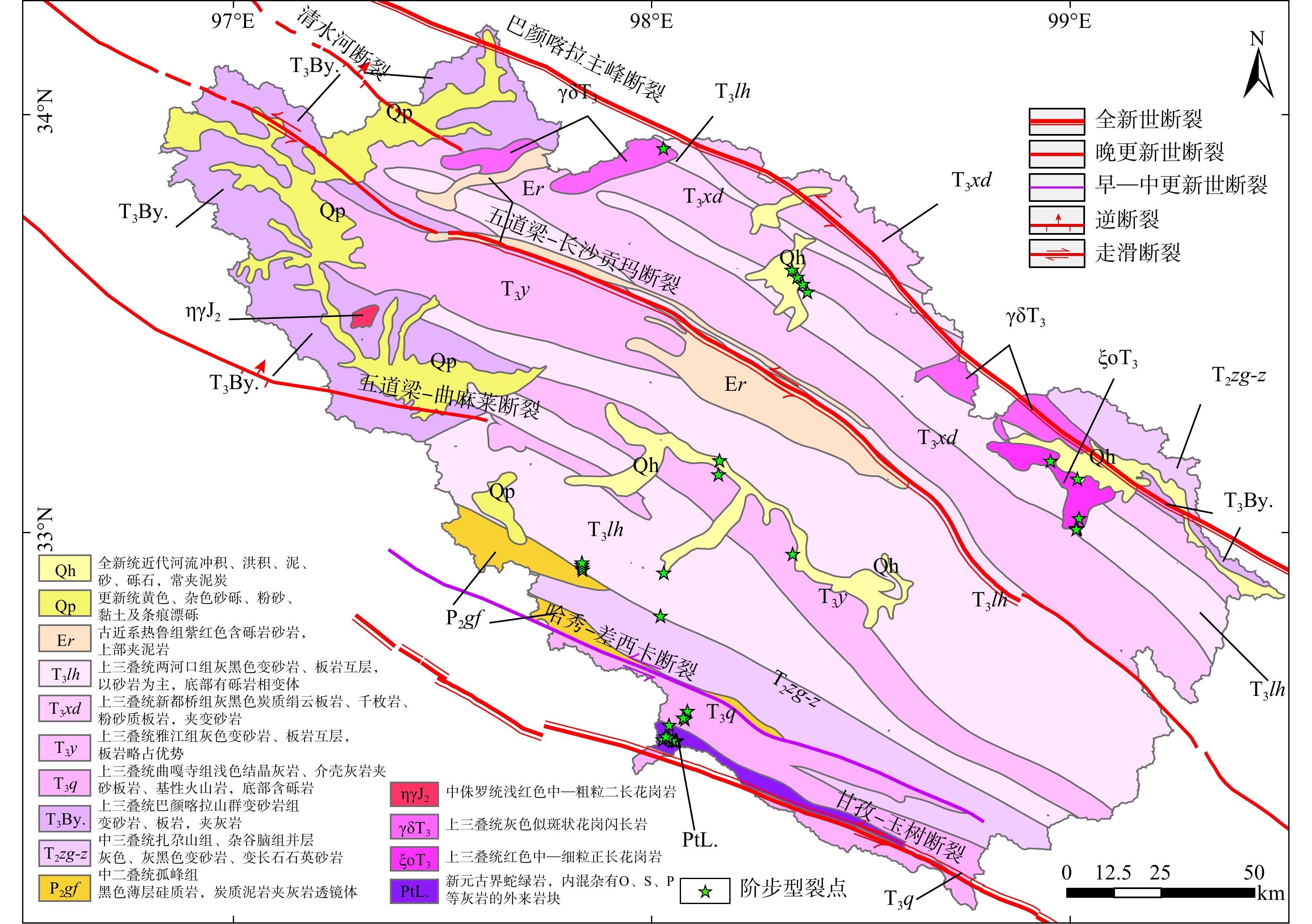
  Objective  The Upper Yalong River basin, situated on the southeastern margin of the Bayan Har block, is characterized by a well-developed river system. Large-scale NW-trending active faults traverse this drainage basin, where tectonic activity constrains regional fluvial geomorphic development and evolution. Current research has predominantly focused on fault activity, paleoseismic events, and seismic hazard assessment, whereas studies addressing basin-scale geomorphic characteristics and their response to tectonic deformation remain relatively limited.   Methods  Based on a 30-meter-resolution Copernicus Digital Elevation Model (DEM), 98 sub-basins were identified within the Upper Yalong River basin. Five geomorphic indices were calculated for each sub-basin: hypsometric integral (HI), basin shape index (BS), asymmetry factor (AF), elongation ratio (Re), and mean normalized stream gradient index (SLKavg). These indices were quantified, classified, and integrated into a composite indicator—the relative strength of tectonic activity (Iat). Furthermore, the normalized channel steepness index (ksn) and knickpoints were incorporated to reveal the spatial differentiation of fluvial geomorphic characteristics and to explore the coupling relationship between tectonic activity and landscape evolution.   Results  In the Upper Yalong River basin, HI values range from 0.09 to 0.63. Some sub-basins are in an early stage of development and exhibit significant asymmetry. Left-lateral offsets of waterways, gullies, and alluvial fans are observed. SLKavg and ksn indicate strong tectonic uplift in most basins, accompanied by significant longitudinal variations in channel slope. Spatially, the Iat displays a pattern of alternating high and low values, with interconnected low-activity zones. Basins with low Iat values are distributed in linear belts along fault zones. Along the Wudaoliang–Changshagongma fault, which crosses the upper basin, Iat values are lower in the northern and southern Holocene-active segments. In contrast, the middle segment intersecting the Changshagongma Basin shows higher Iat values, possibly related to localized variations in tectonic deformation along fault segments. Basins traversed by the Ganzi–Yushu fault also exhibit relatively low Iat values, corresponding to strong activity at the block boundary. The geomorphic indices affect Iat in the order: Re > HI > AF > SLKavg > BS.   Conclusions  The strong consistency among tectonic activity, geomorphic features, and seismic activity in the study area directly reflects the role of tectonic processes in shaping the regional landscape pattern. The spatial differentiation of Iat and geomorphic indices effectively captures differential tectonic uplift and deformation along fault zones, providing clear geomorphic evidence of ongoing tectonic dynamics on the southeastern margin of the Bayan Har block.
A 4400-year-old extreme paleo-storm surge recorded in the Dongzhai Port Chenier, Hainan Island, China
WANG Chaoqun, SUN Dongxia, ZHANG Yaoling, YANG Xiaoxiao, ZHANG Lei, HU Daogong
2026, 32(3): 656-669. doi: 10.12090/j.issn.1006-6616.2025073
Abstract (224) HTML (51) PDF (5356KB)(253)
Abstract:
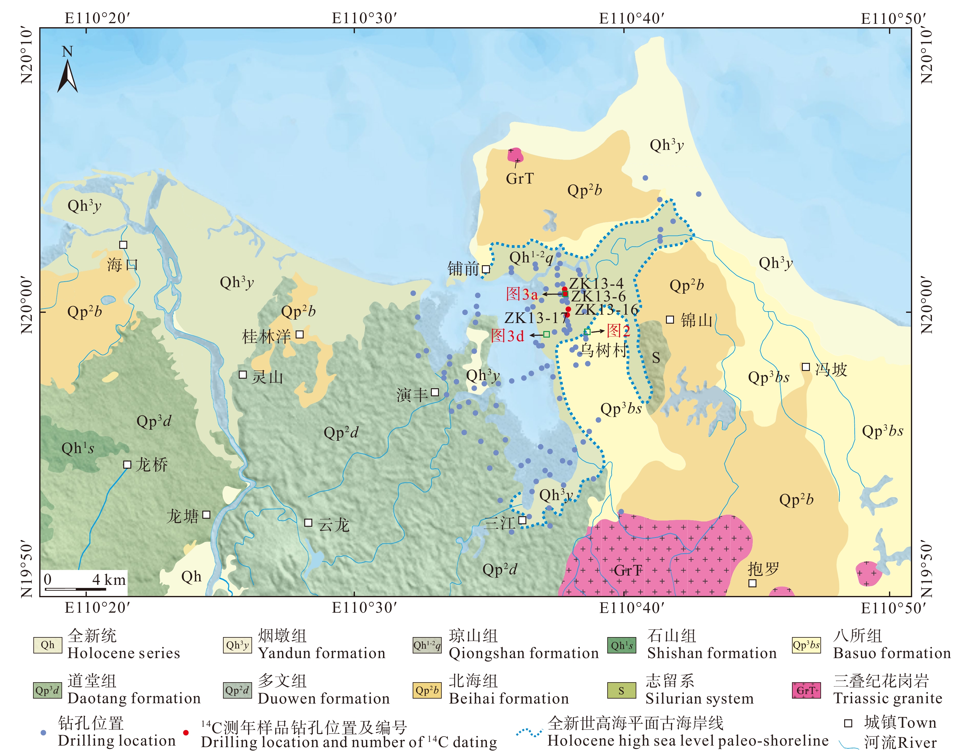
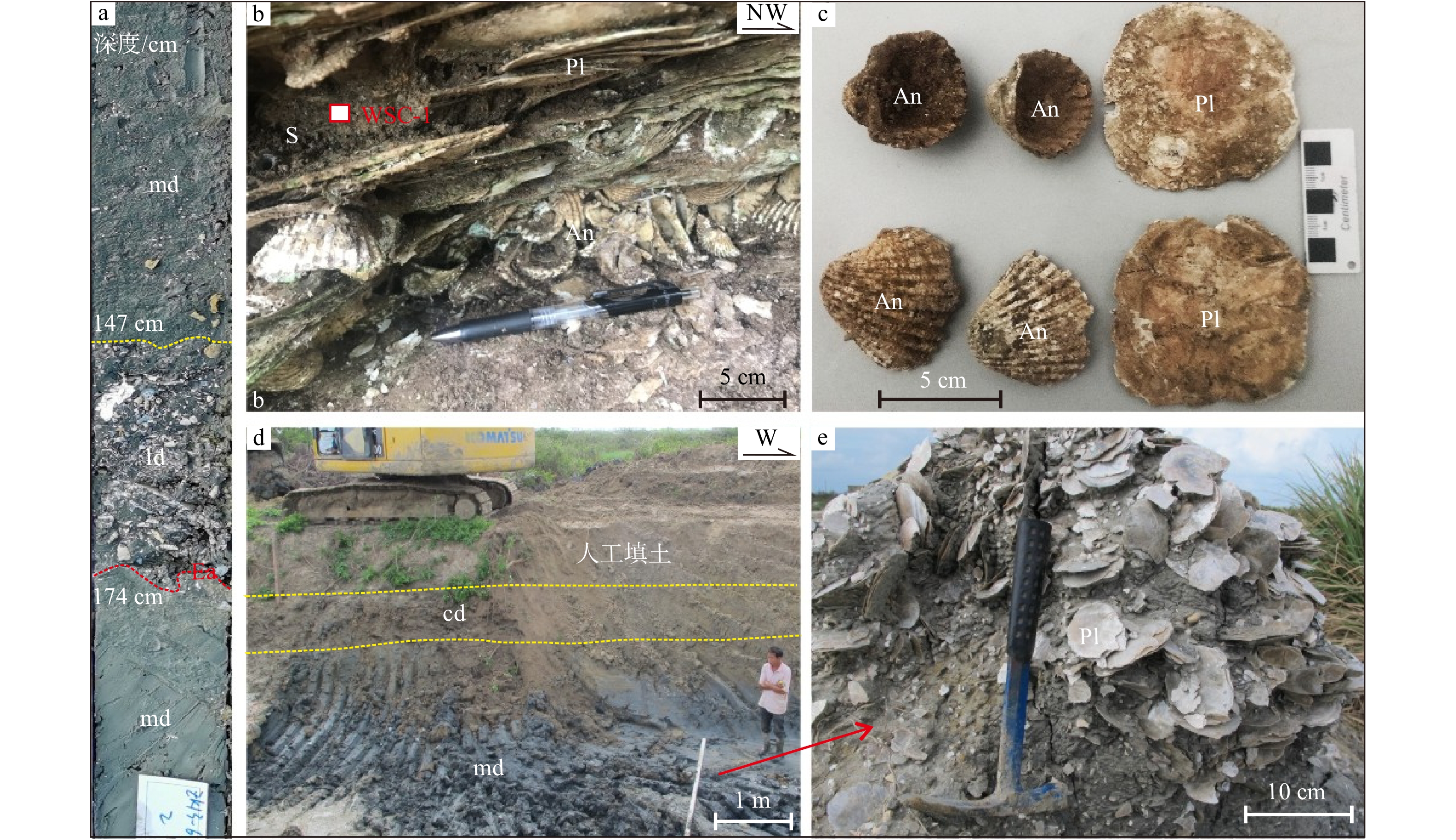
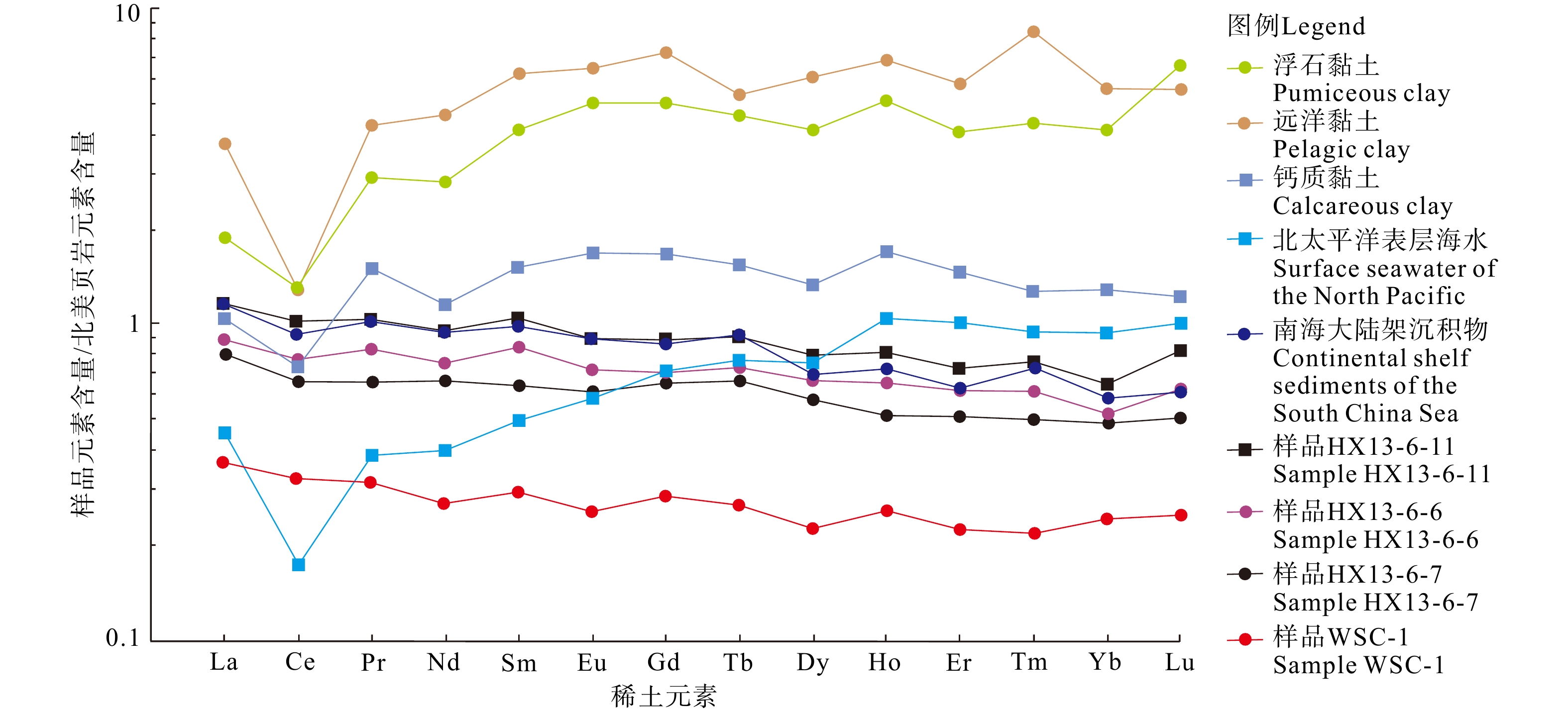
  Objective  Establishing a long-term typhoon sequence by identifying ancient storm surge records and extreme storm surge elevation events holds significant scientific and practical value for predicting future storm disasters. Previous research on storm surge deposits has predominantly focused on the eastern part of Hainan Island, while relatively limited attention has been given to the extreme storm events in the coastal bays and estuaries along the Qiongzhou Strait—the areas most severely affected by storm surges.   Methods  This study investigates a 3.2-m-thick shell ridge in Wushu Village, Dongzhai Port, located in the southern part of Puqian Bay on Hainan Island. Analyses of sedimentary structures, shell origins, AMS 14C dating of shells, geochemical indicators, and microfossile assemblages indicate that the shell ridge records a super-strong storm surge and an extreme surge elevation event that occurred 4,400 years ago. The ridge was deposited on a Late Pleistocene coastal plain landward of the Holocene high-sea-level paleo-coastline.   Results  The 14C ages of nine shells range from 4,402 to 6,647 a B.P., showing age inversions and the coexistence of older and younger shells. The shells are well-sorted and exhibit hummocky bedding, parallel bedding, wavy bedding, scour surfaces, and soft-sediment deformation structures.   Conclusions  Comparison of fossil species and shell 14C ages between the shell ridge and drill cores from the new coastal plain of Dongzhai Port indicates that the fossils in the shell ridge originated from the nearby sedimentary layers of the Puqian Bay estuary. Integrated analysis of the fossil ages, erosional scour surfaces, soft-sediment deformation structures, and Holocene sea-level changes suggests that the shell ridge in Wushu Village was formed through multiple storm-induced aggradation events occurring 4,400 years ago. Given the elevation of the highest storm deposit pinch-out point, the storm surge height reached at least 5.5 m. This surge height is close to the extraordinary storm surge height (5.9 m) recorded in Leizhou Bay during Typhoon 8007, which crossed the Qiongzhou Strait in 1980. [Significance] This study provides crucial scientific evidence for the prevention and mitigation of extreme storm surge disasters in Hainan, offering valuable insights for regional disaster risk reduction and coastal management.
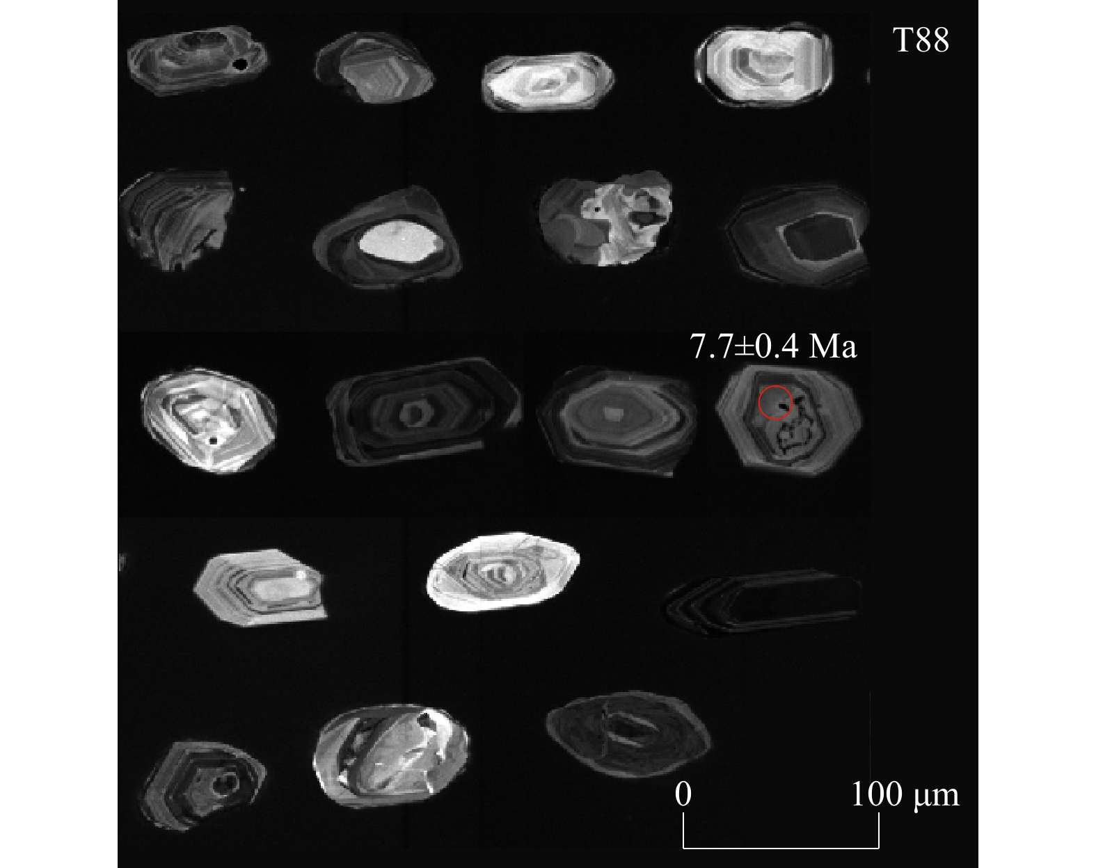
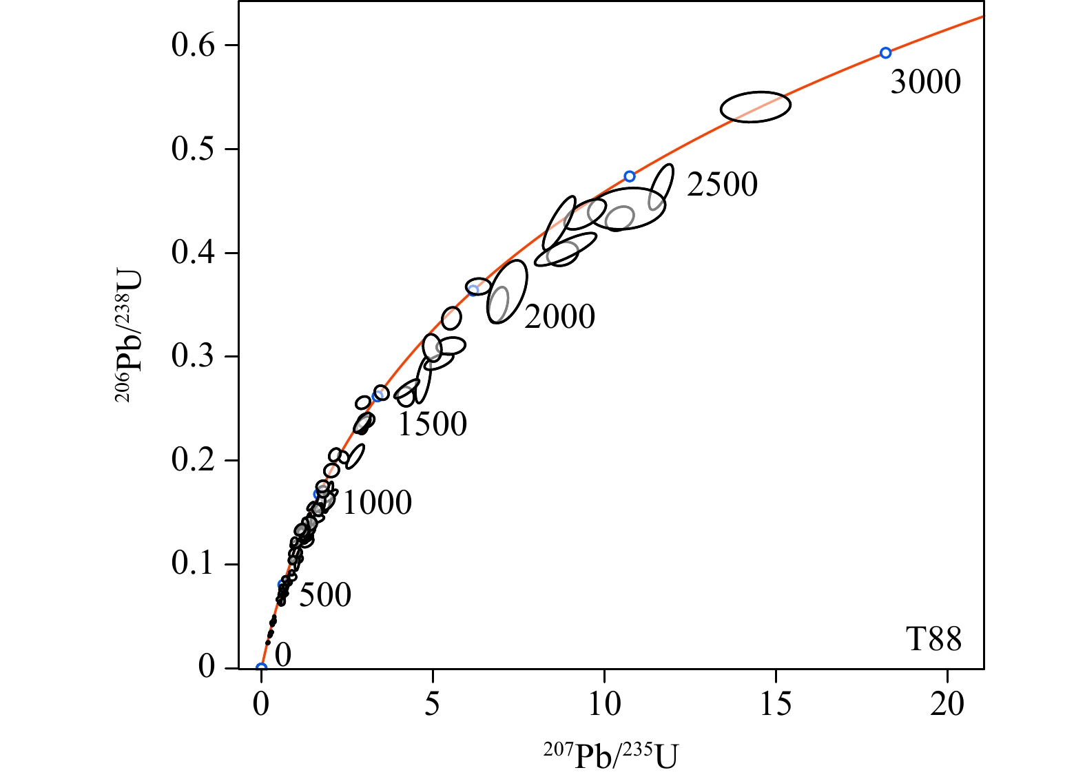
Tectonic uplift and geomorphic evolution of the East Tianshan from the Late Cretaceous to the Cenozoic
JING Hulu, WANG Weitao, LIU Kang, LI Zhigang, ZHANG Yipeng, LU Lejun, ZHANG Peizhen
2026, 32(3): 670-682. doi: 10.12090/j.issn.1006-6616.2025177
Abstract (199) HTML (42) PDF (18968KB)(130)
Abstract:
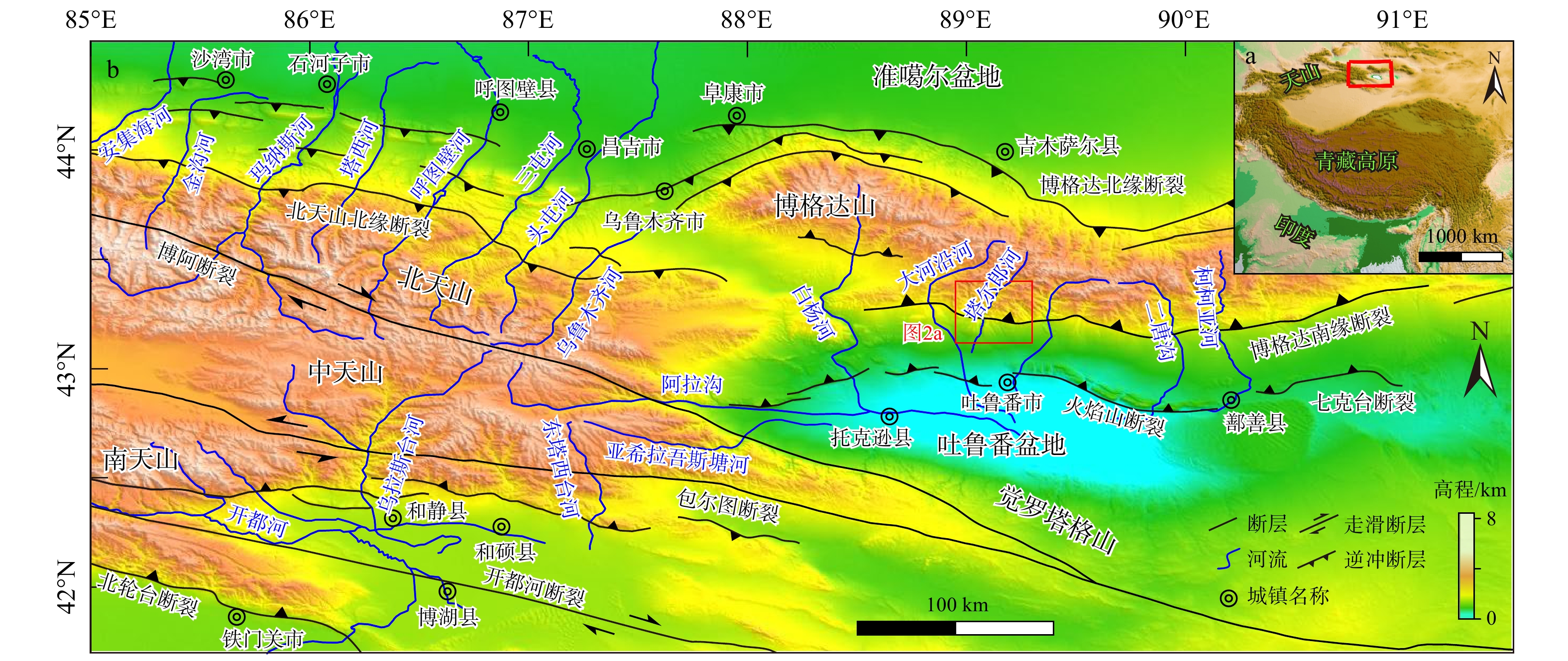
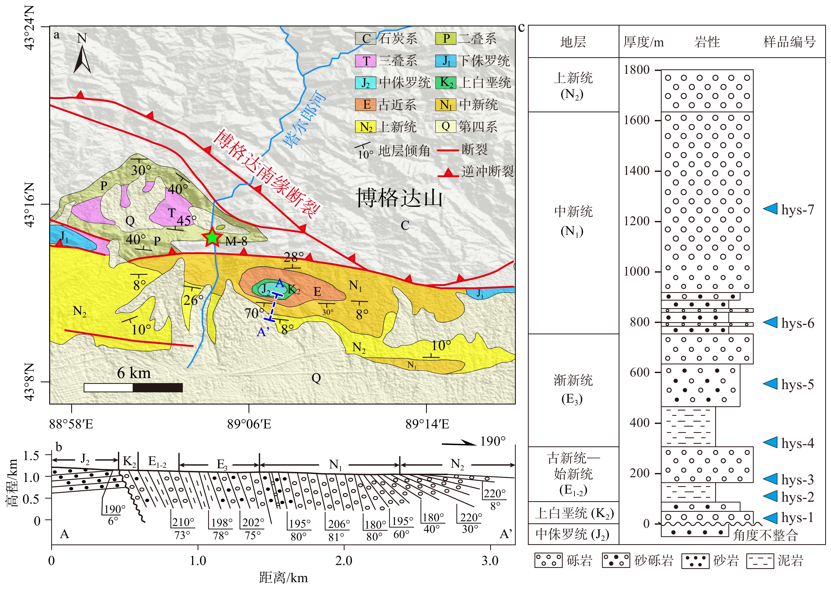
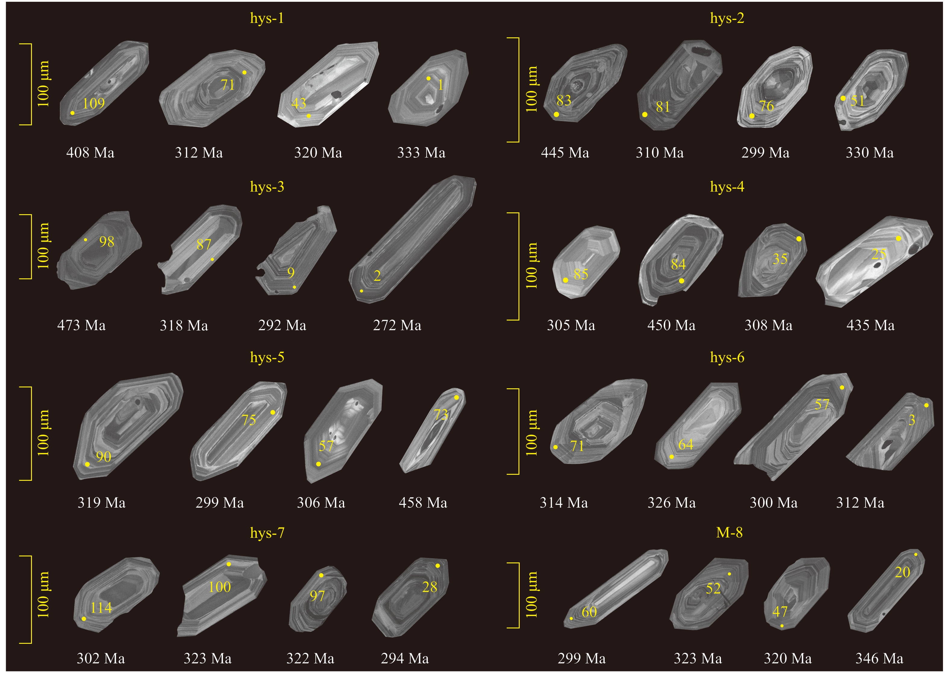
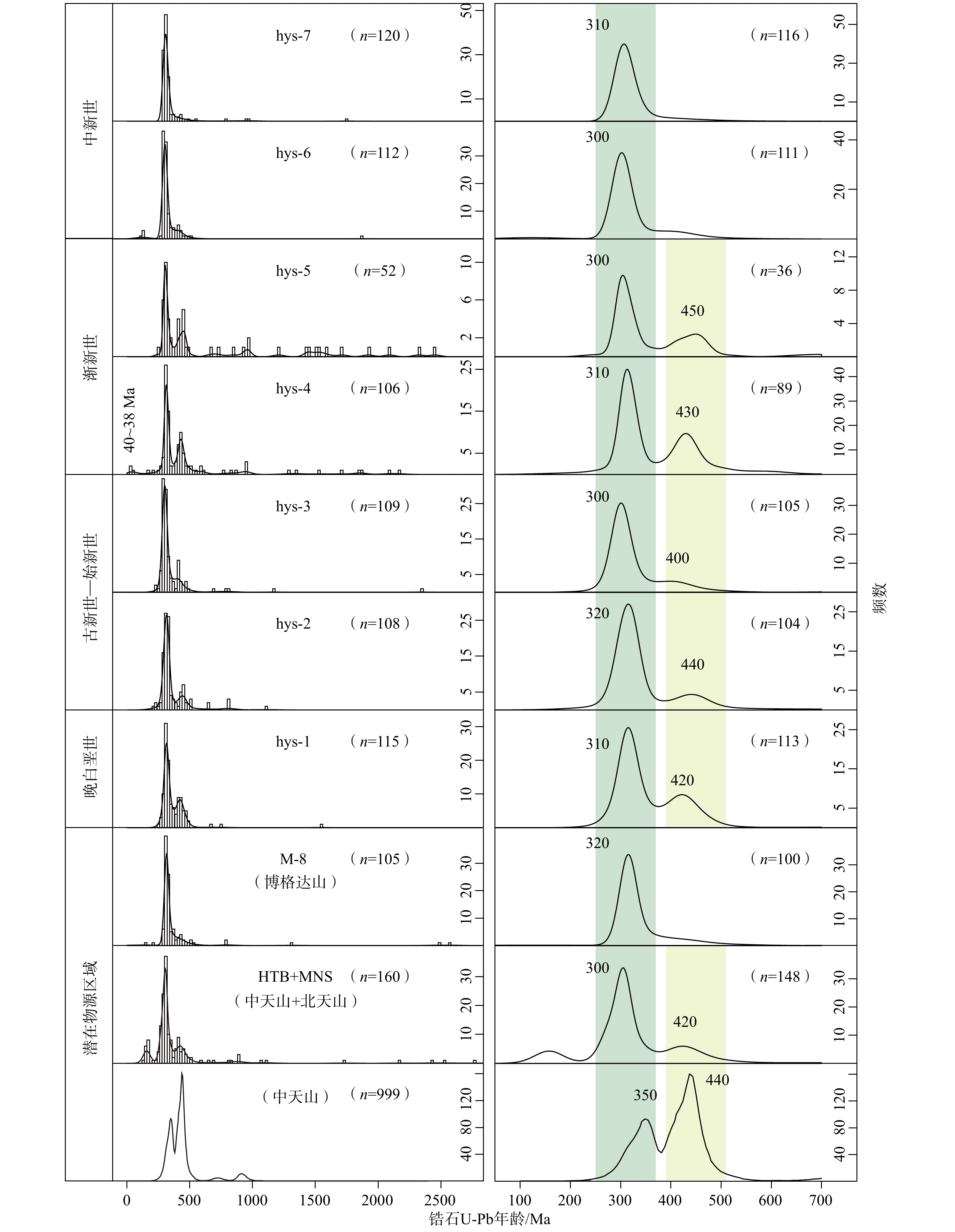
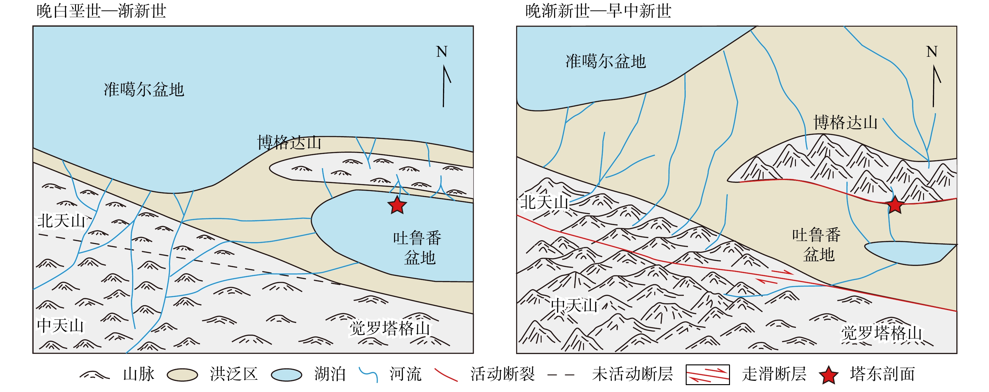
  Objective  The Tianshan is an intracontinental orogenic belt reactivated in the Cenozoic by far-field effects of the India-Asia collision. Its Cenozoic tectonic evolution is thus key to understanding intracontinental deformation mechanisms.   Methods  Based on stratigraphic sedimentary characteristics and provenance tracing of a section on the northern margin of the Turpan Basin (south of the Bogda Shan), the Late Cretaceous to Cenozoic tectonic and geomorphic evolution of the East Tianshan and its adjacent region has been constrained.   Results  Field investigations reveal that the Paleocene and lower Oligocene strata in this area consist predominantly of red mudstones, indicating a lacustrine environment and stable tectonic conditions. The uppermost Cretaceous and Eocene strata contain relatively thin conglomerate deposits with small clast diameters, suggesting slight tectonic uplift of the Bogda Shan. In contrast, the upper Oligocene to Pliocene strata are composed of extremely thick, coarse conglomerates, reflecting long-term and intense tectonic activity. Detrital zircon U-Pb ages show that, from the Late Cretaceous to the Oligocene, the northern Turpan Basin continuously received detrital material from the West Tianshan, implying low topographic relief of the Bogda Shan during this period. Since the Miocene, however, the Bogda Shan has become the primary sediment source, indicating its rapid tectonic uplift.   Conclusions  In summary, the Bogda Shan remained tectonically stable with low relief during the Late Cretaceous to Oligocene. Since the late Oligocene, it has undergone intense deformation and rapid uplift, becoming the sole provenance area for the northern Turpan Basin. [Significance] This study refines the Cenozoic tectono-geomorphic evolution of the East Tianshan, thereby contributing to a better understanding of the intracontinental deformation processes resulting from the India–Asia collision.
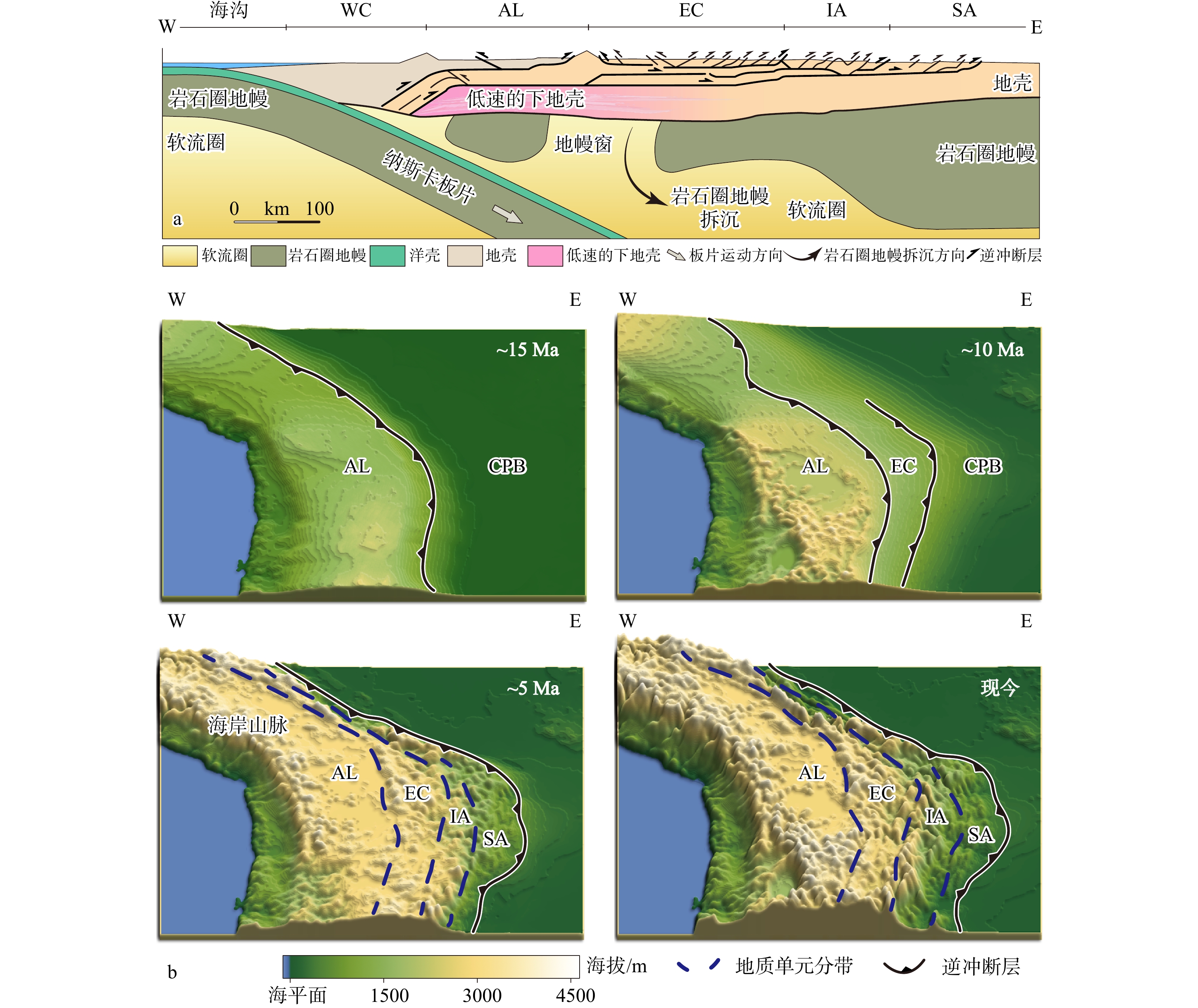
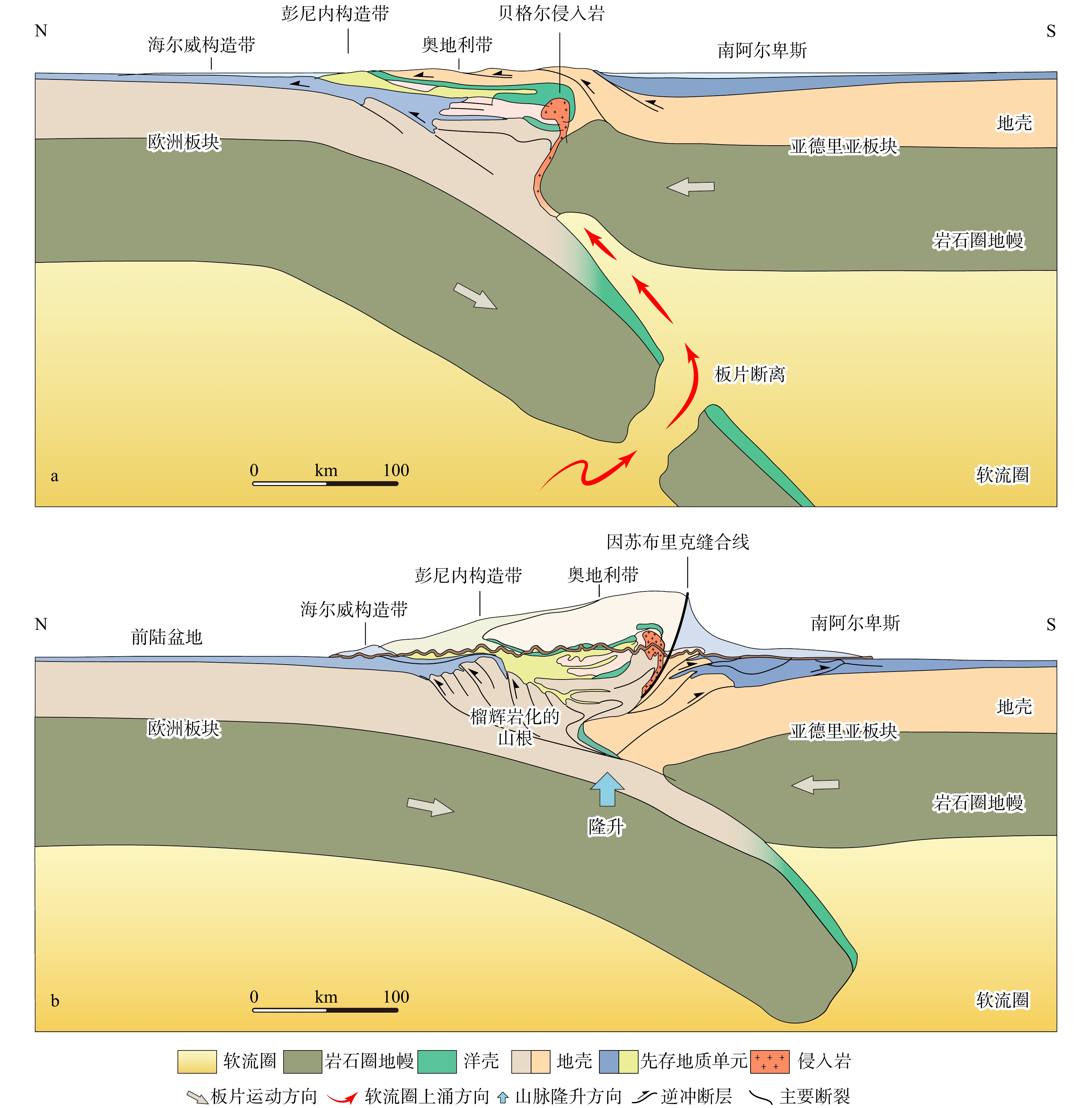
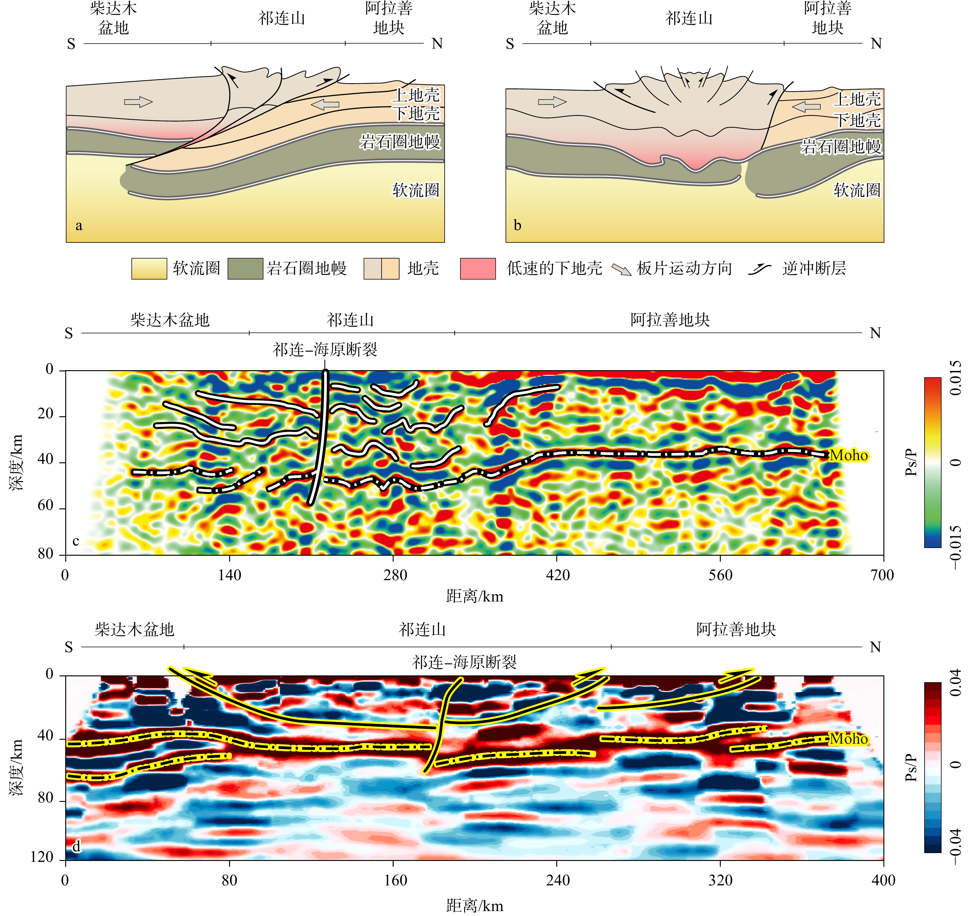
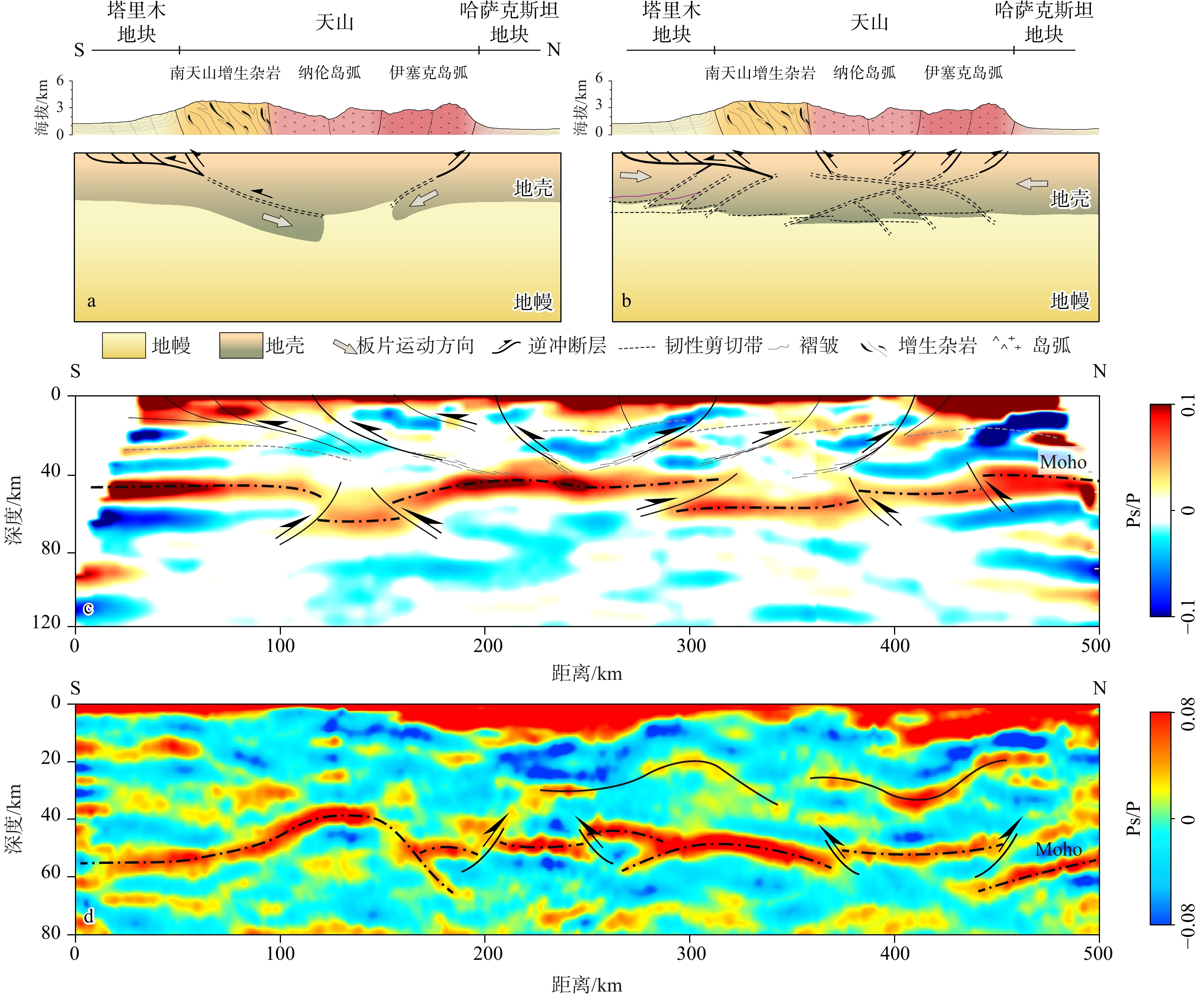
Symmetric and asymmetric deformation from plate-margin orogeny to intracontinental tectonics: formation mechanisms of lithospheric tectonic vergence
ZHANG Yipeng, XIE Liubiao, JIN Ruizhi, SHEN Xuzhang, HE Xiaohui, JING Hulu, LIU Kang, WANG Yang, ZHANG Peizhen
2026, 32(3): 683-703. doi: 10.12090/j.issn.1006-6616.2026026
Abstract (167) HTML (34) PDF (17429KB)(105)
Abstract:
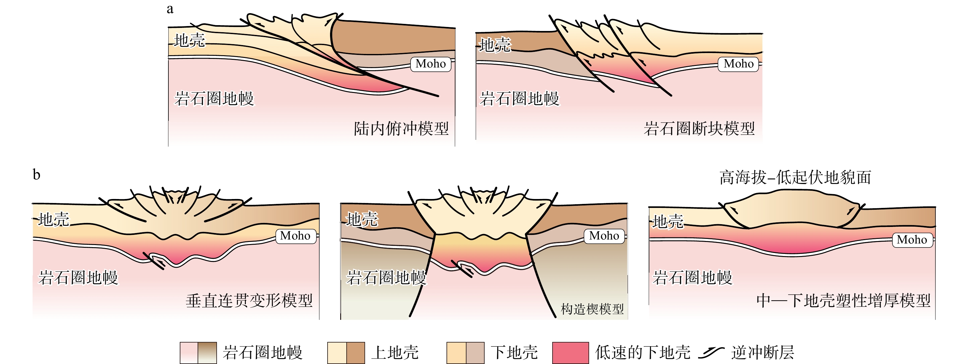
  Objective  Tectonic vergence records the geometric asymmetry and kinematic directionality of shortening during orogenic thickening and provides a key link between surface deformation and lithospheric-scale geodynamics. Although vergence is widely used in structural geology, its expression at the scale of entire orogenic belts remains insufficiently clarified, especially in intracontinental settings where stable plate-boundary subduction is absent. This study aims to compare vergence patterns from plate-margin orogens to intracontinental mountain belts and to identify the mechanisms controlling their formation, maintenance, weakening, and transformation.   Methods  We synthesize five representative orogenic systems: the Central Andes, Taiwan, the Alps, the Qilian Shan, and the Tian Shan. Surface structural styles, fold–thrust belt geometry, orogen–foreland basin coupling, geomorphic evolution, modern crustal deformation, seismicity, and lithospheric architecture — constrained by Moho/LAB geometry and geophysical imaging — are integrated to evaluate vergence at multiple scales.   Results  Plate-margin convergent systems commonly develop stable one-sided tectonic vergence. In the Central Andes, long-lived subduction of the Nazca slab provides persistent asymmetric forcing, causing shortening to be localized above the subduction interface and transmitted eastward toward the retroarc and foreland. The Altiplano Plateau, with crustal thickness locally reaching 60–75 km, records progressive Cenozoic crustal thickening, uplift, and eastward propagation of deformation. Taiwan, as a young arc–continent collision system, locally records early-stage bidirectional deformation around the Central Range and arc-side backthrusting near the Longitudinal Valley–Coastal Range system. However, foreland basin evolution, westward migration of the frontal fold–thrust belt, and modern shortening concentrated along the western Taiwan thrust system indicate that its long-term, orogen-scale, dominant vergence remains west-directed. The Alps demonstrate that tectonic vergence is time-dependent. During early subduction and continental collision, deformation was localized along a single subduction interface, producing a north-vergent simple-shear-dominated architecture. After collision, slab break-off, eclogitization of the orogenic root, and thermomechanical reorganization weakened the earlier interface-controlled deformation and promoted strain redistribution across both flanks of the orogen, leading to paired north- and south-vergent thrust systems and a more symmetric collisional structure. In intracontinental orogens, stable one-sided vergence is not guaranteed. The Qilian Shan and Tian Shan lack compelling evidence for a continuous, long-lived, single-sided lithospheric subduction interface. Their deformation is mainly expressed by distributed crustal thickening, high-angle reverse faulting on opposing flanks, and near-symmetric shortening. Recent studies from the Qilian Shan further show that lithospheric-scale tectonic wedges may develop along basin–mountain transition zones, where relatively rigid basin lithosphere wedges into the weakened lower crust of a thickened orogen. Such wedge structures are best interpreted as local expressions within a pure-shear, vertically coherent deformation framework rather than as large-scale simple-shear intracontinental subduction.   Conclusions  Lithospheric-scale tectonic vergence is controlled by the coupling among boundary conditions, negative-buoyancy forcing, and lithospheric strength–buoyancy structure. Persistent single-sided slabs or effective negative-buoyancy sources favor stable simple-shear vergence, whereas slab break-off, loss of one-sided forcing, and mechanically strong opposing blocks favor distributed pure-shear thickening and weak or near-symmetric vergence. [Significance] This study provides a unified framework for interpreting tectonic vergence from plate margins to continental interiors. It highlights vergence as a geometrically testable indicator for linking surface deformation, basin–orogen coupling, and lithospheric-scale geodynamic processes.
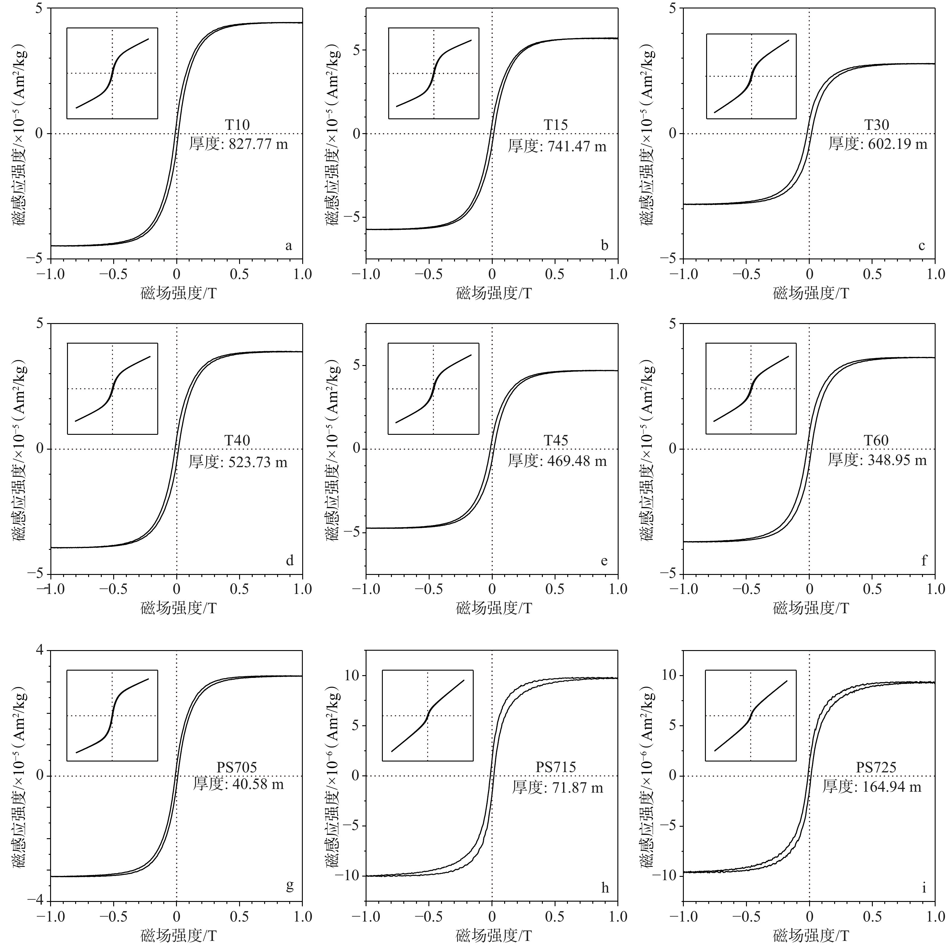
Magnetostratigraphy of the Late Cenozoic sediments of the West Kunlun foreland and its tectonic implications
ZHANG Lijuan, ZHANG Zhiliang, REN Zhikun, BAO Guodong, NING Yutao
2026, 32(3): 704-720. doi: 10.12090/j.issn.1006-6616.2025163
Abstract (170) HTML (42) PDF (8586KB)(144)
Abstract:
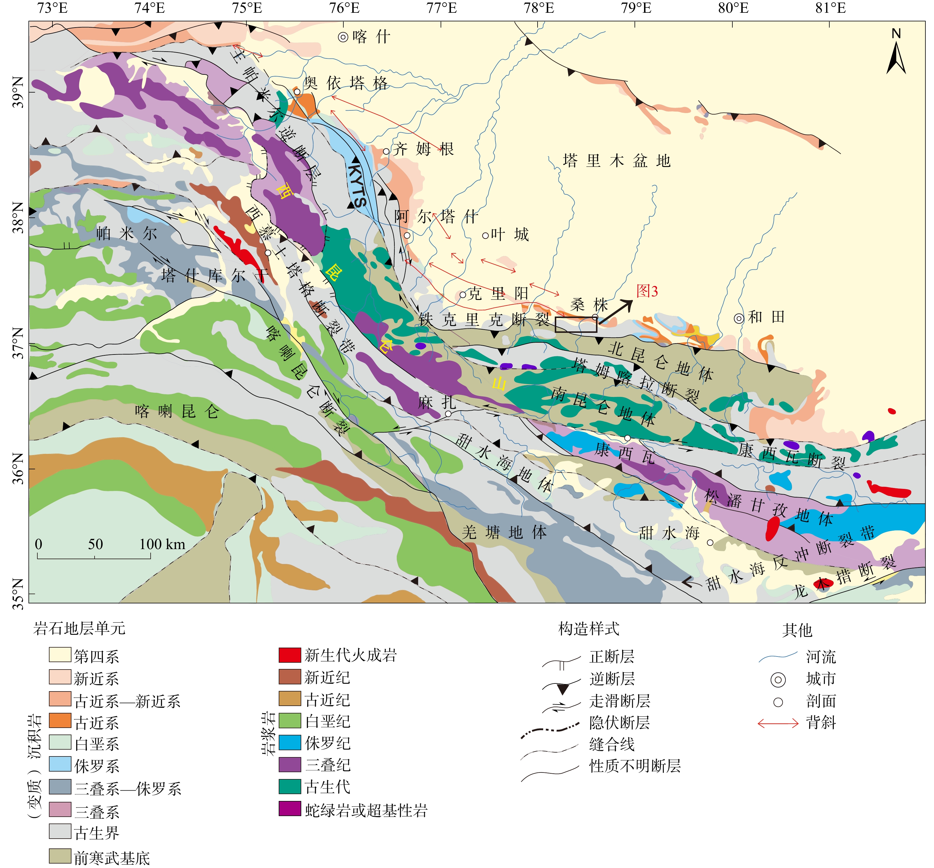
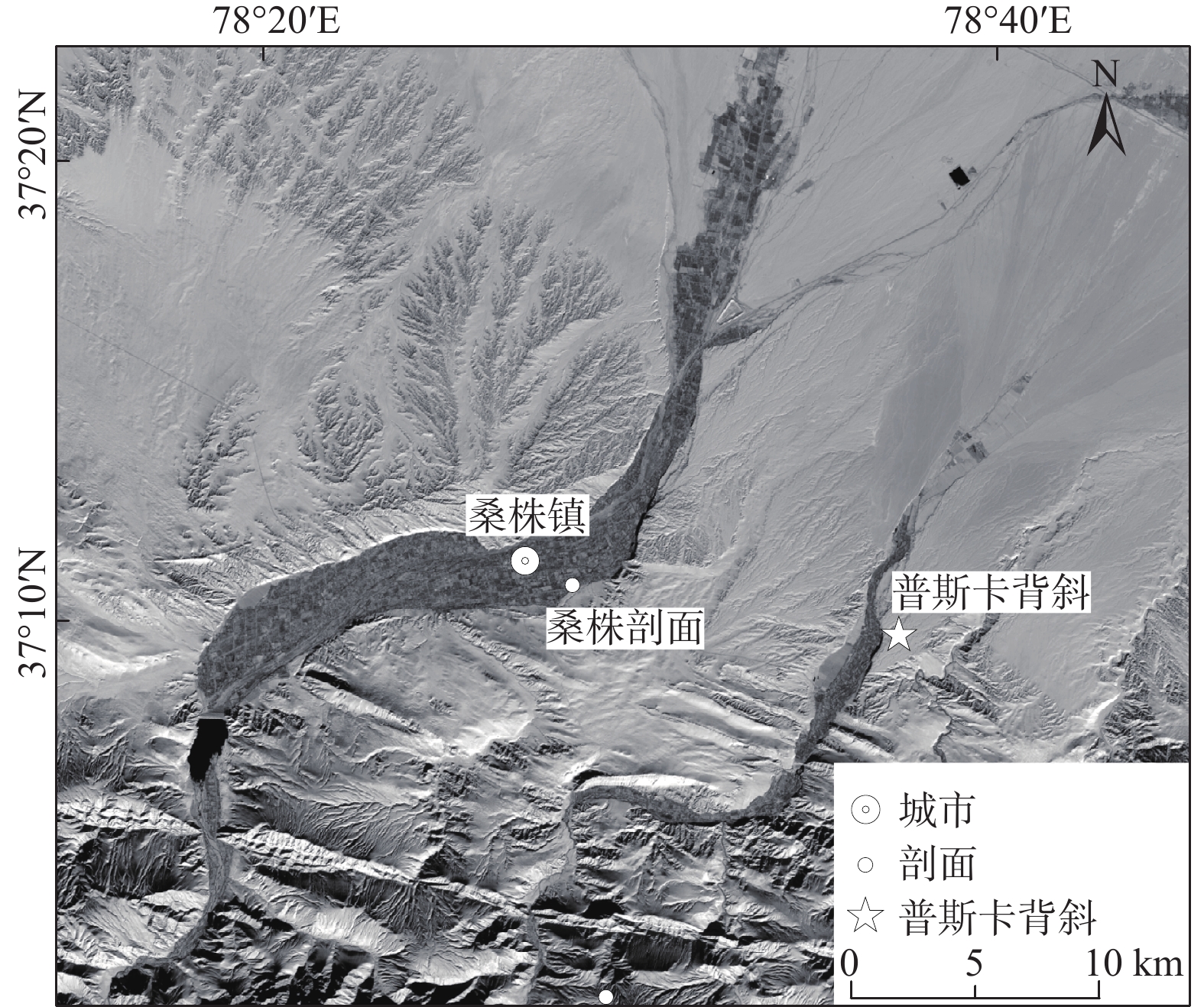
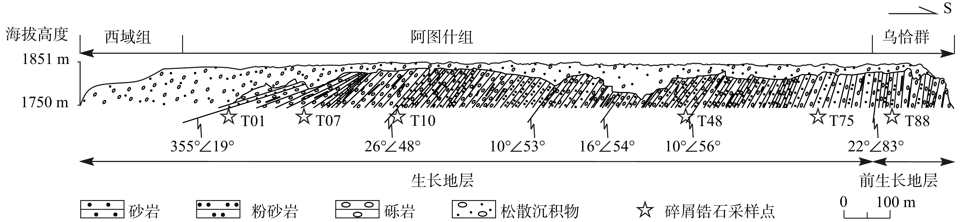
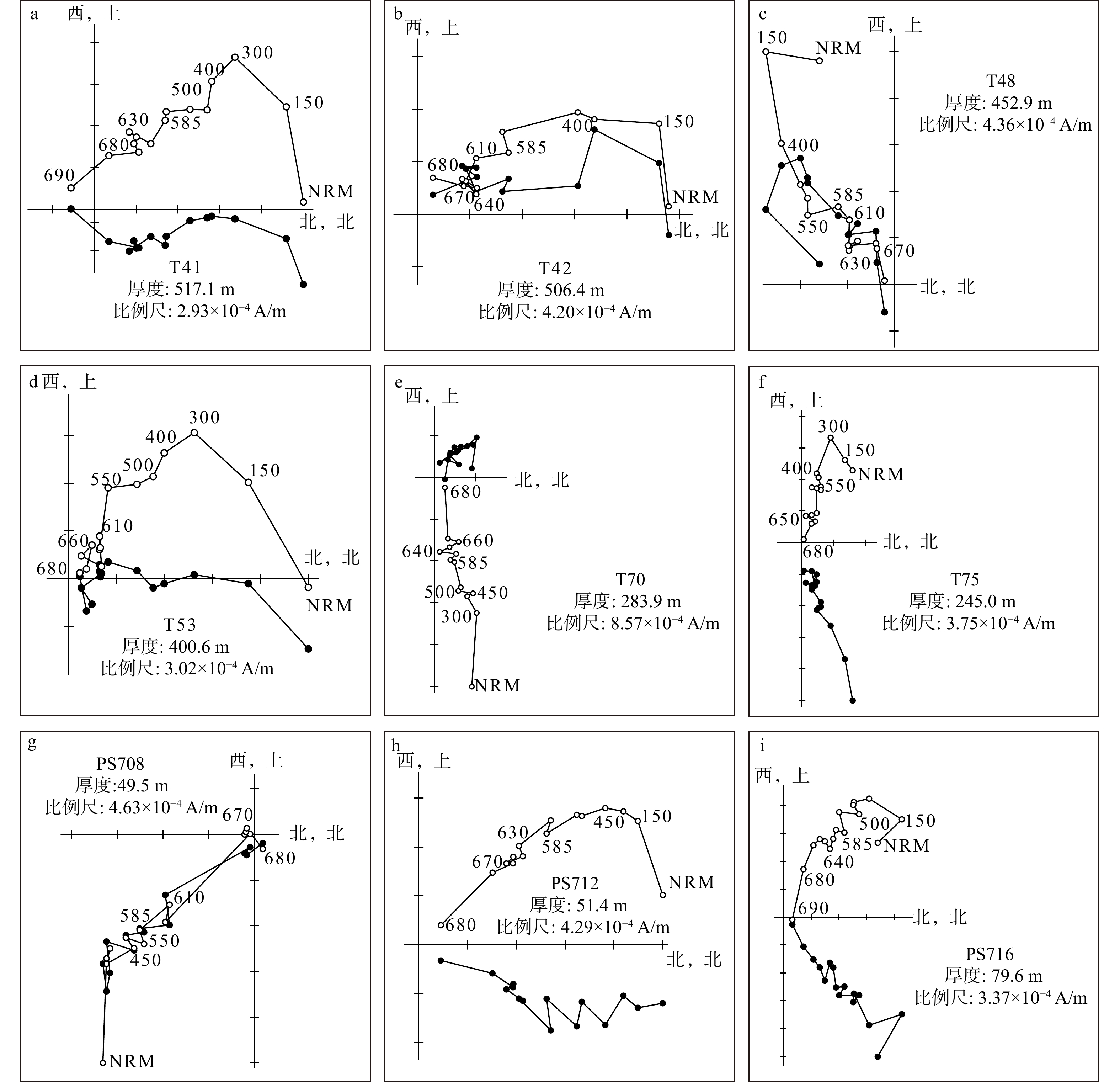
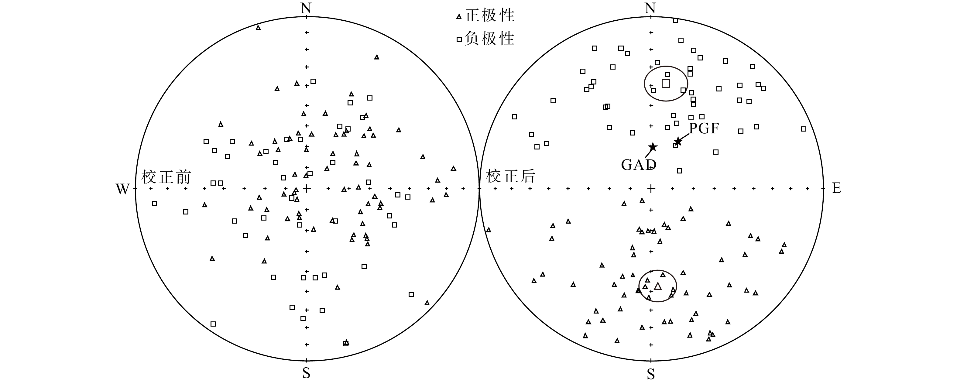
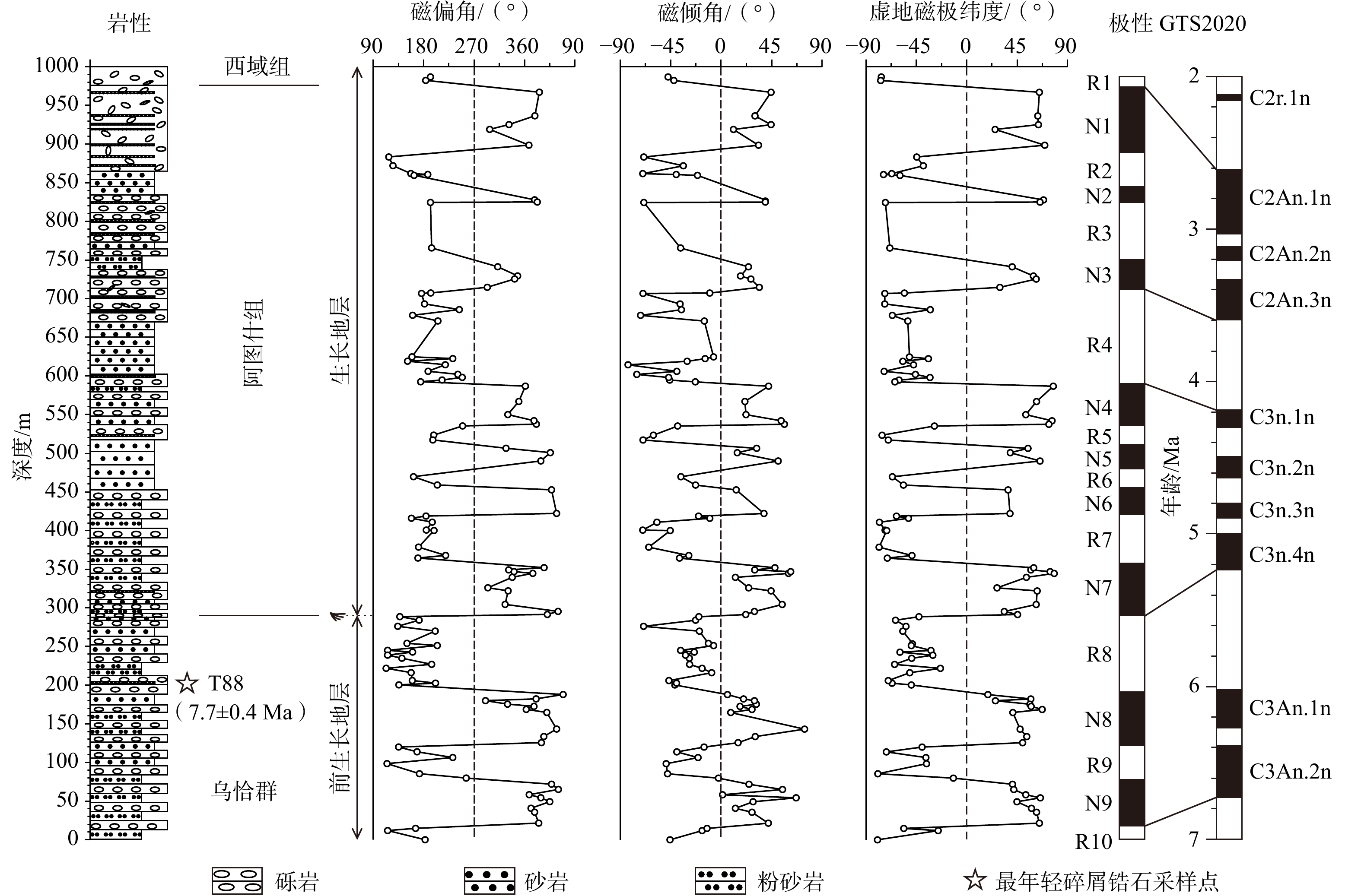
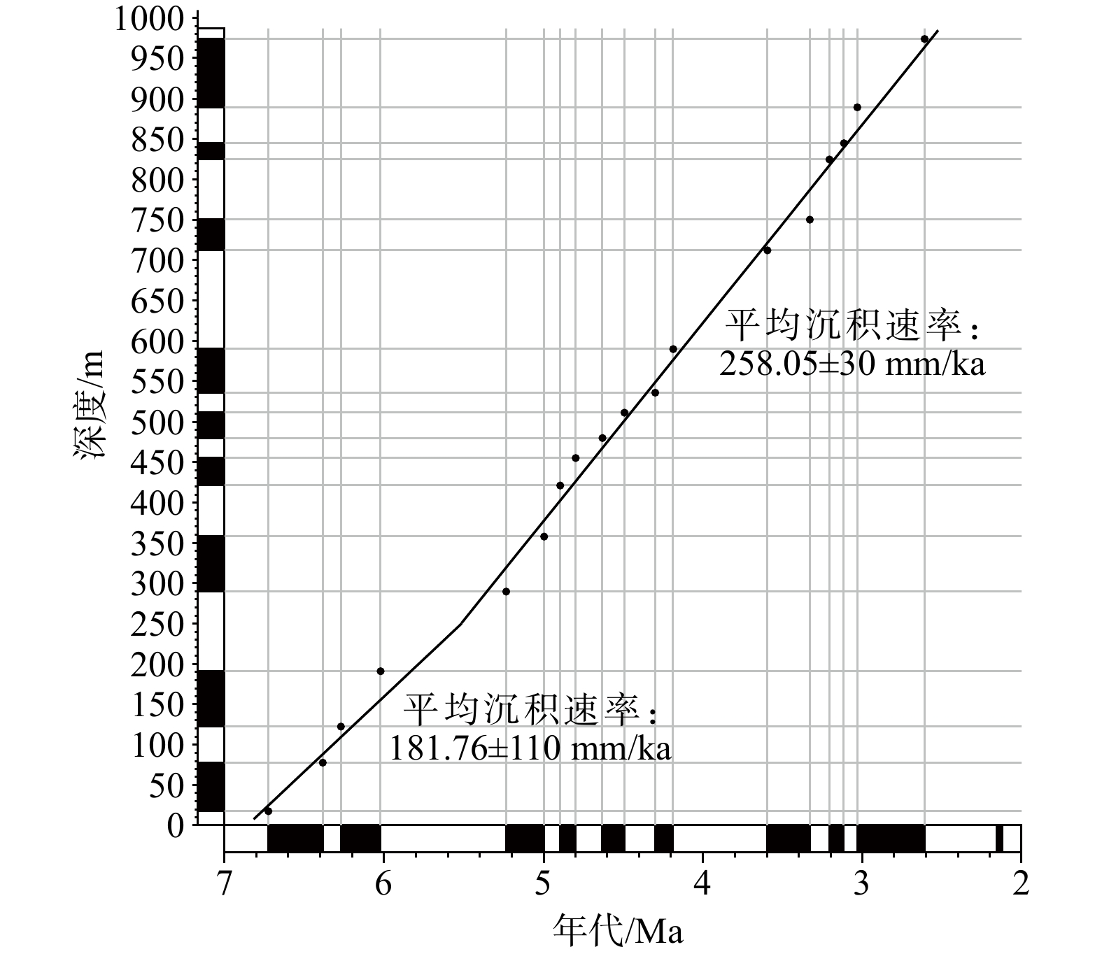
  Objective  The West Kunlun Orogenic Belt, located on the northwestern margin of the Tibetan Plateau, is a key area for studying the tectonic uplift and expansion of the plateau. However, the Cenozoic uplift of the West Kunlun Orogenic Belt is still controversial.   Methods  This study focuses on the well-exposed Late Cenozoic sediments on the Puska Anticline, West Kunlun foreland. High-resolution magnetostratigraphy was applied to constrain the age of the lower boundary of the growth strata, providing insight into the uplift timing of the West Kunlun Orogenic Belt from the perspective of mountain-basin coupling.   Results  Magnetic analysis indicates that hematite and magnetite are the dominant remanence carriers. The high-resolution magnetostratigraphy reveals an age range of ~6.8 to 2.4 Ma for the Puska Section, and the base age of the growth strata is ~5.3 Ma, indicating that the deformation of this anticline was initiated at ~5.3 Ma.   Conclusions  Integrating previously published results of sedimentation, tectonics, and low-temperature thermochronology in the West Kunlun foreland, this study proposes that the West Kunlun Orogenic Belt has undergone an episode of intensive uplift since ~5.3 Ma. This suggests that the Tibetan Plateau has experienced significant uplift since the beginning of the Pliocene, with tectonic strain beginning to propagate toward the Tarim Basin. [Significance] This study provides new perspectives and evidence for understanding the complex relationship between the uplift of the Tibetan Plateau and the sedimentary responses in its periphery, contributing to further unraveling the comprehensive impact of the Tibetan Plateau.
Advances in tectonic physical analog modeling under hypergravity
GUAN Tao, WU Lei, YANG Bo, JIA Dong, WU Xiaojun, YANG Shufeng, CHEN Hanlin
2026, 32(3): 721-740. doi: 10.12090/j.issn.1006-6616.2026019
Abstract (239) HTML (67) PDF (11603KB)(112)
Abstract:
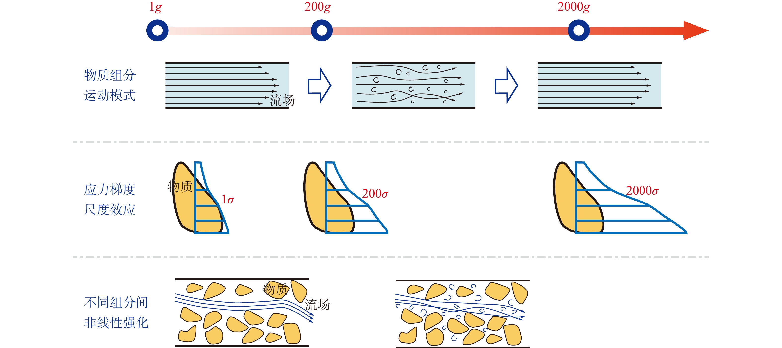
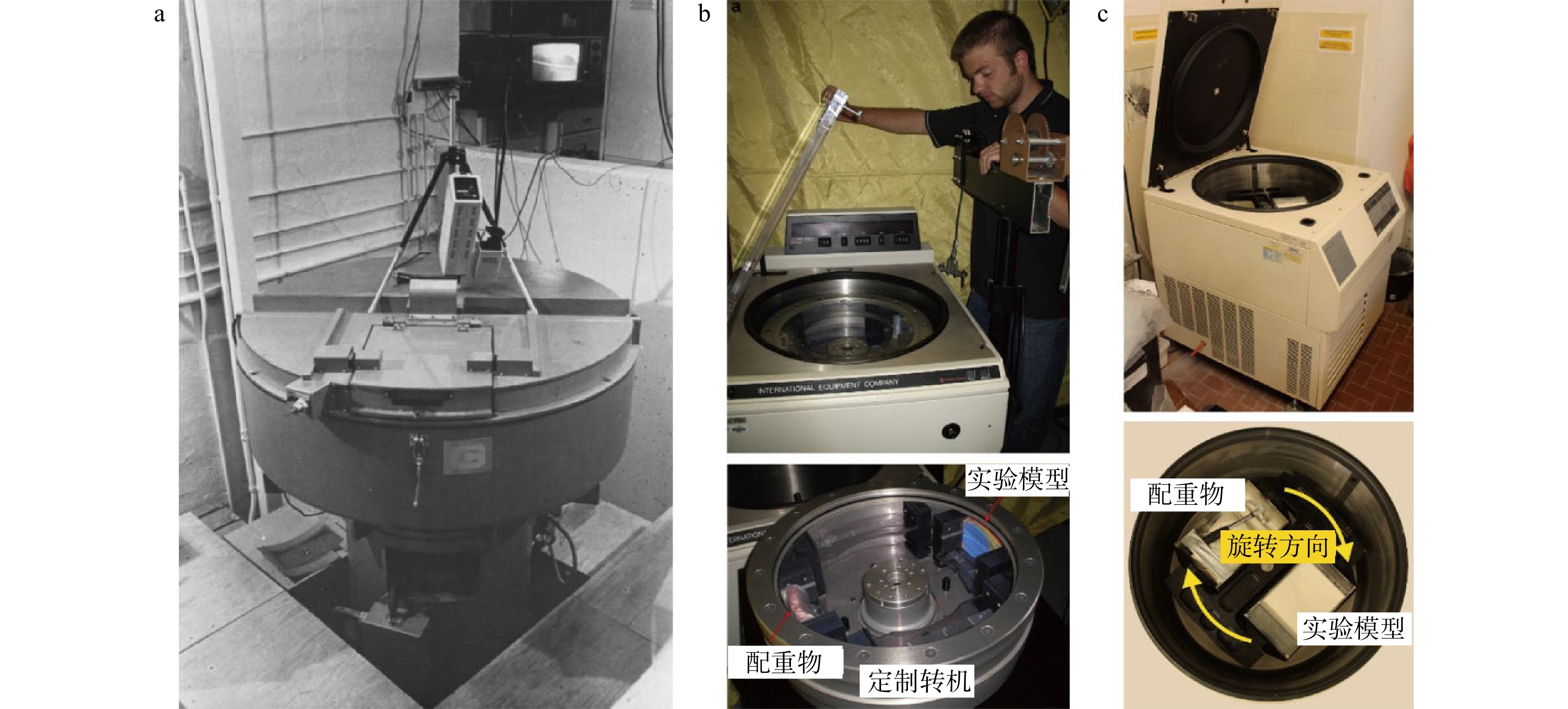
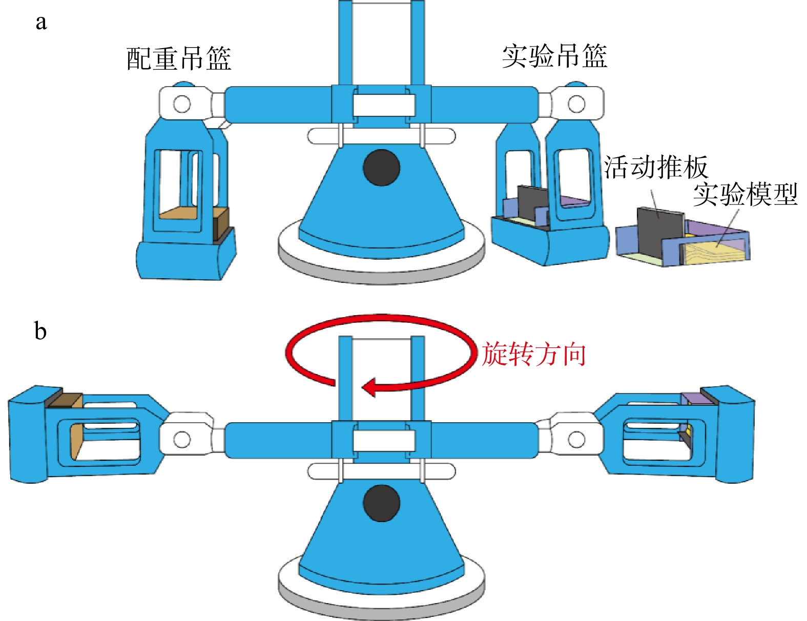
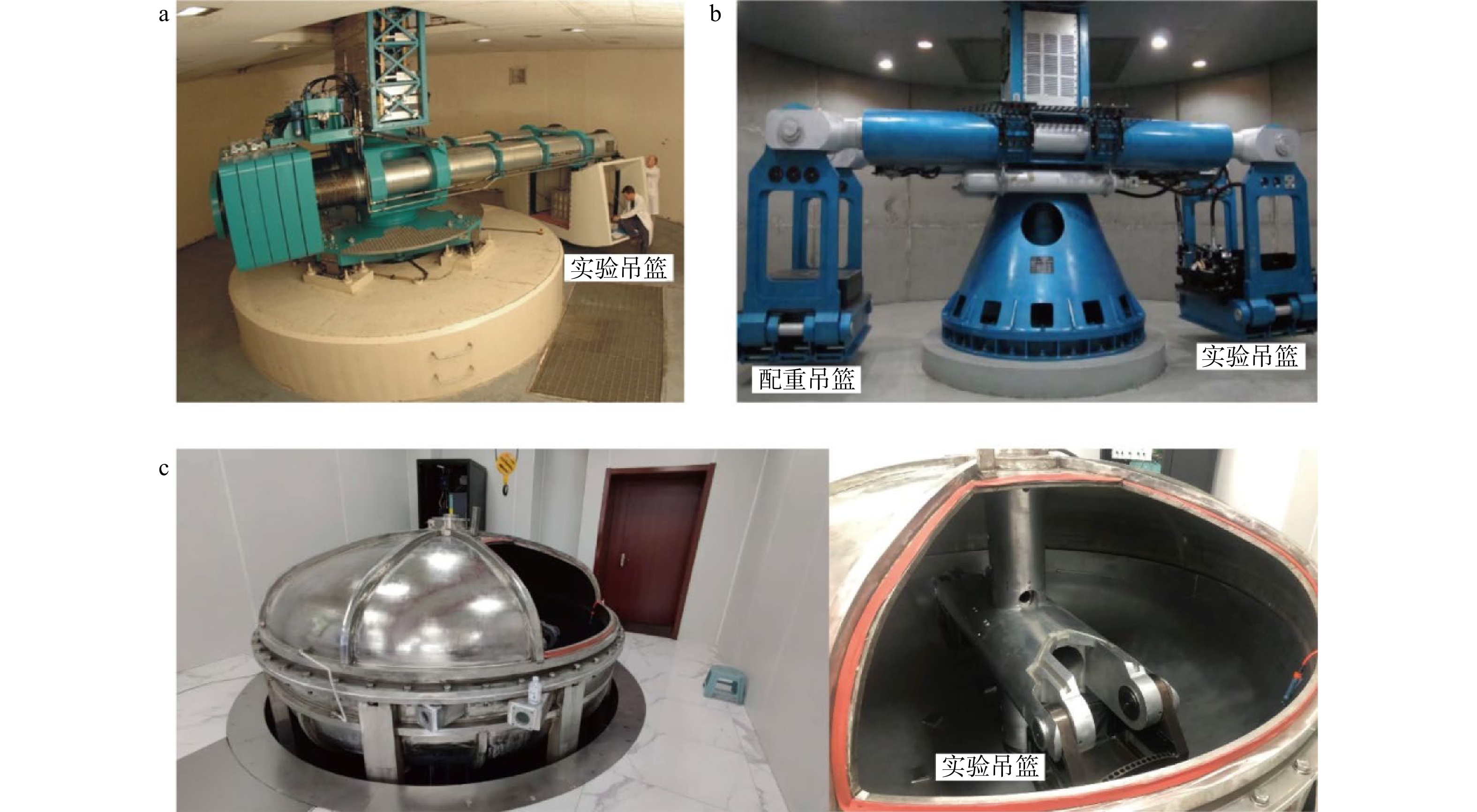
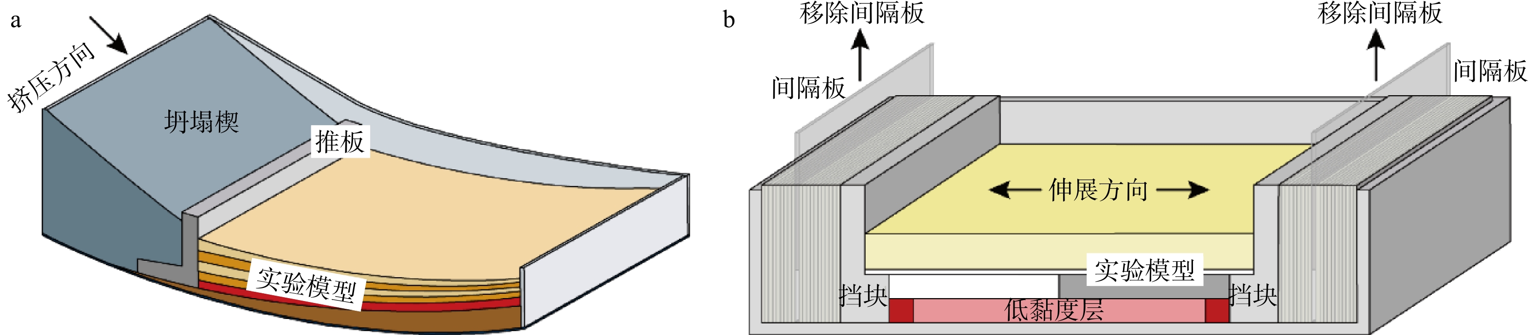
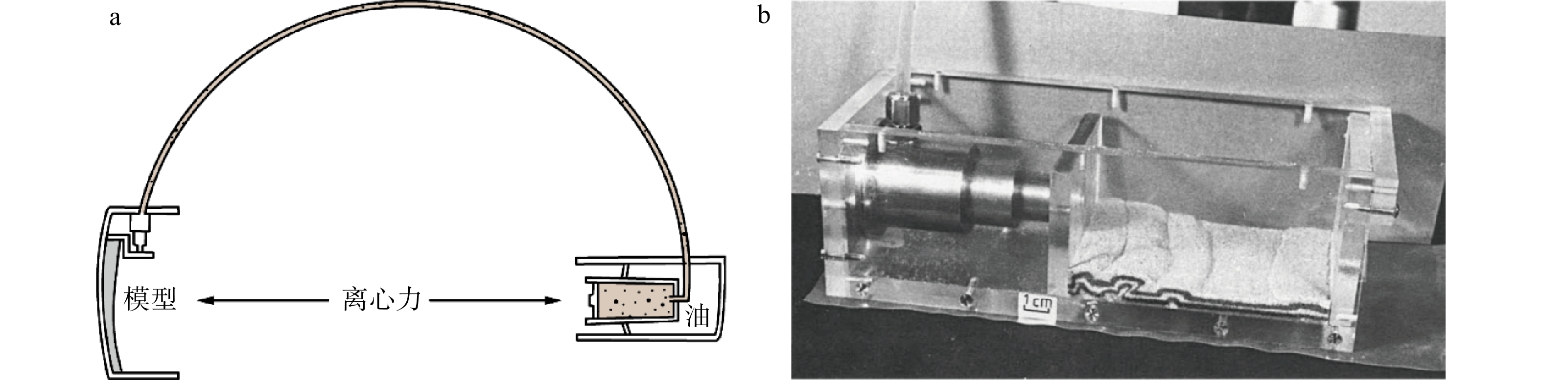
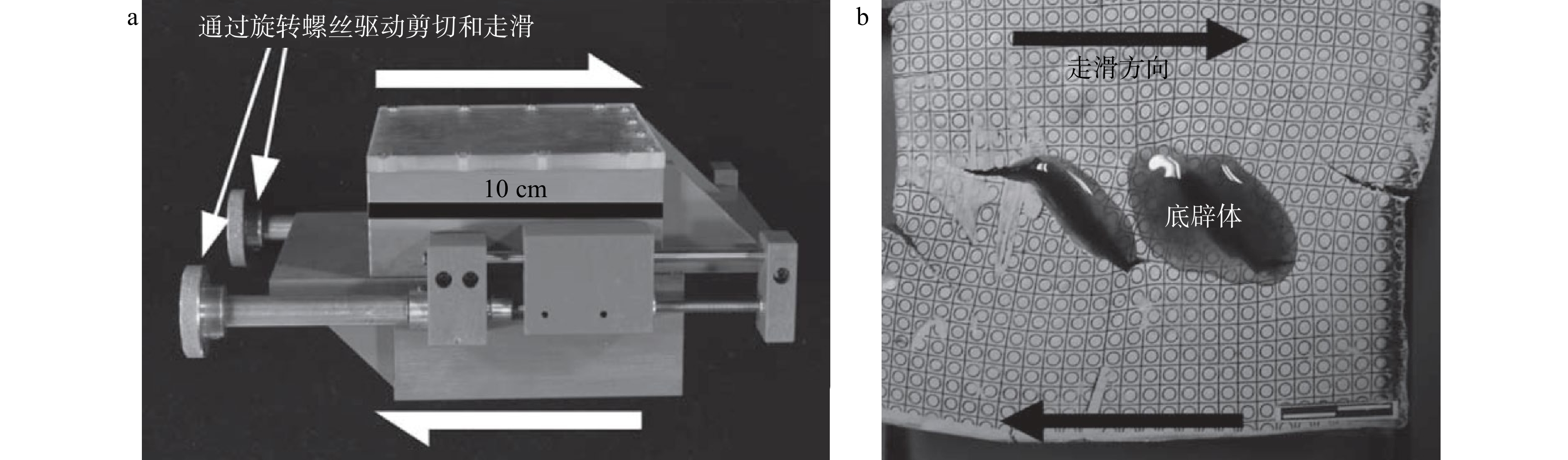
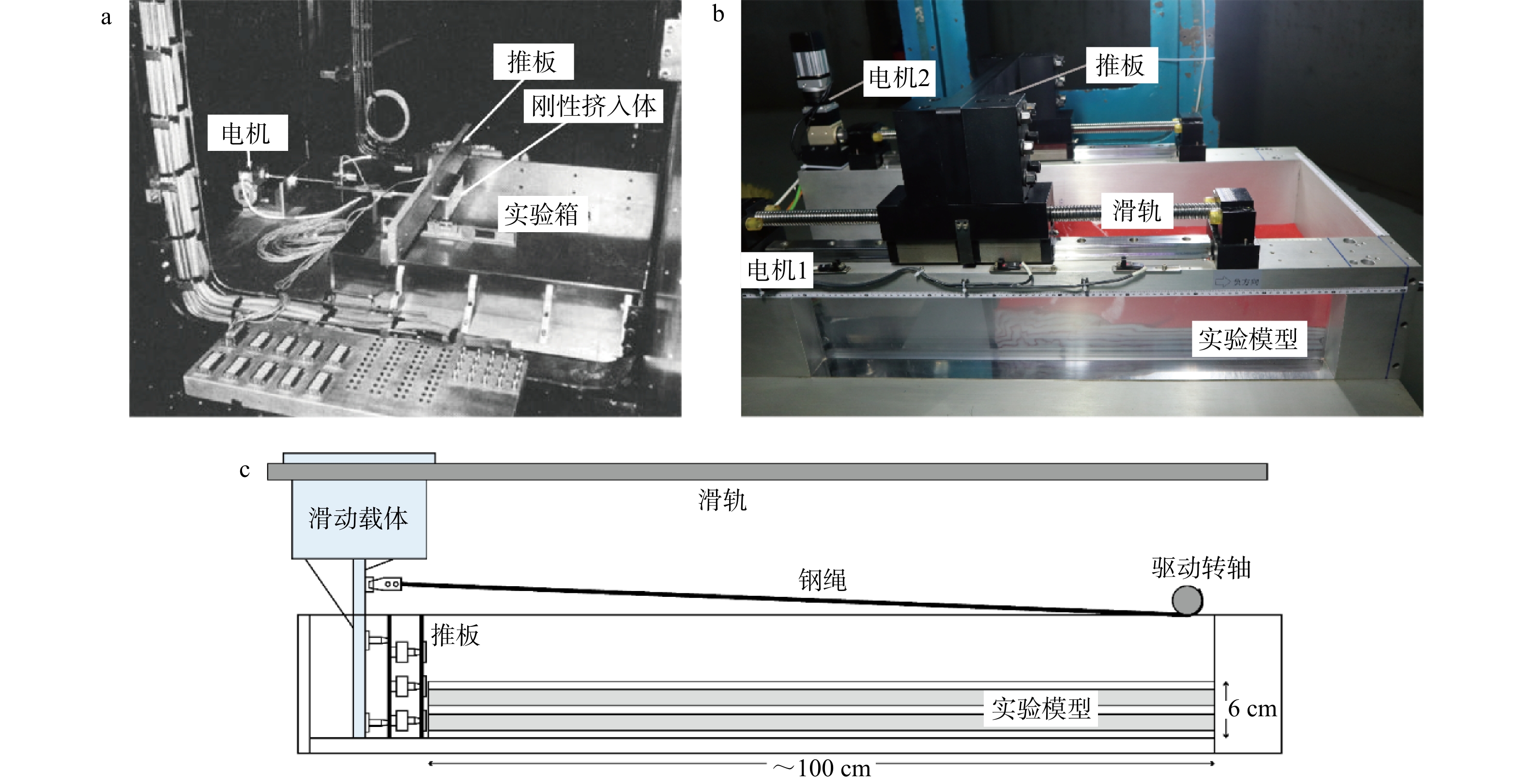
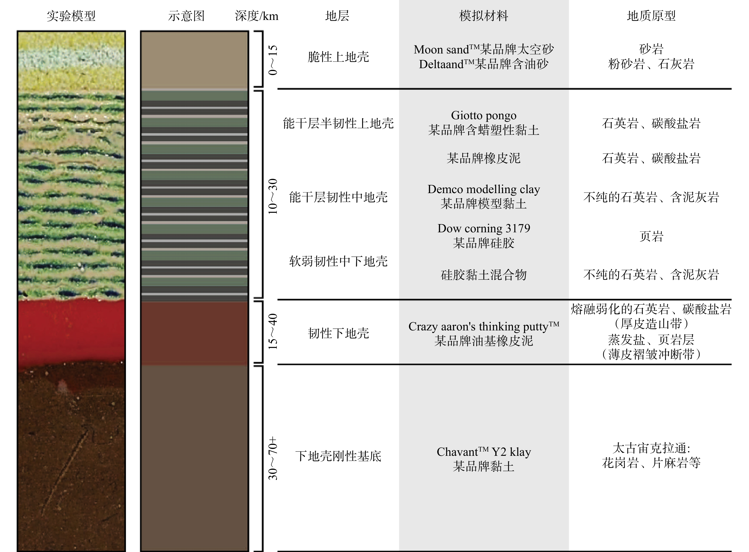
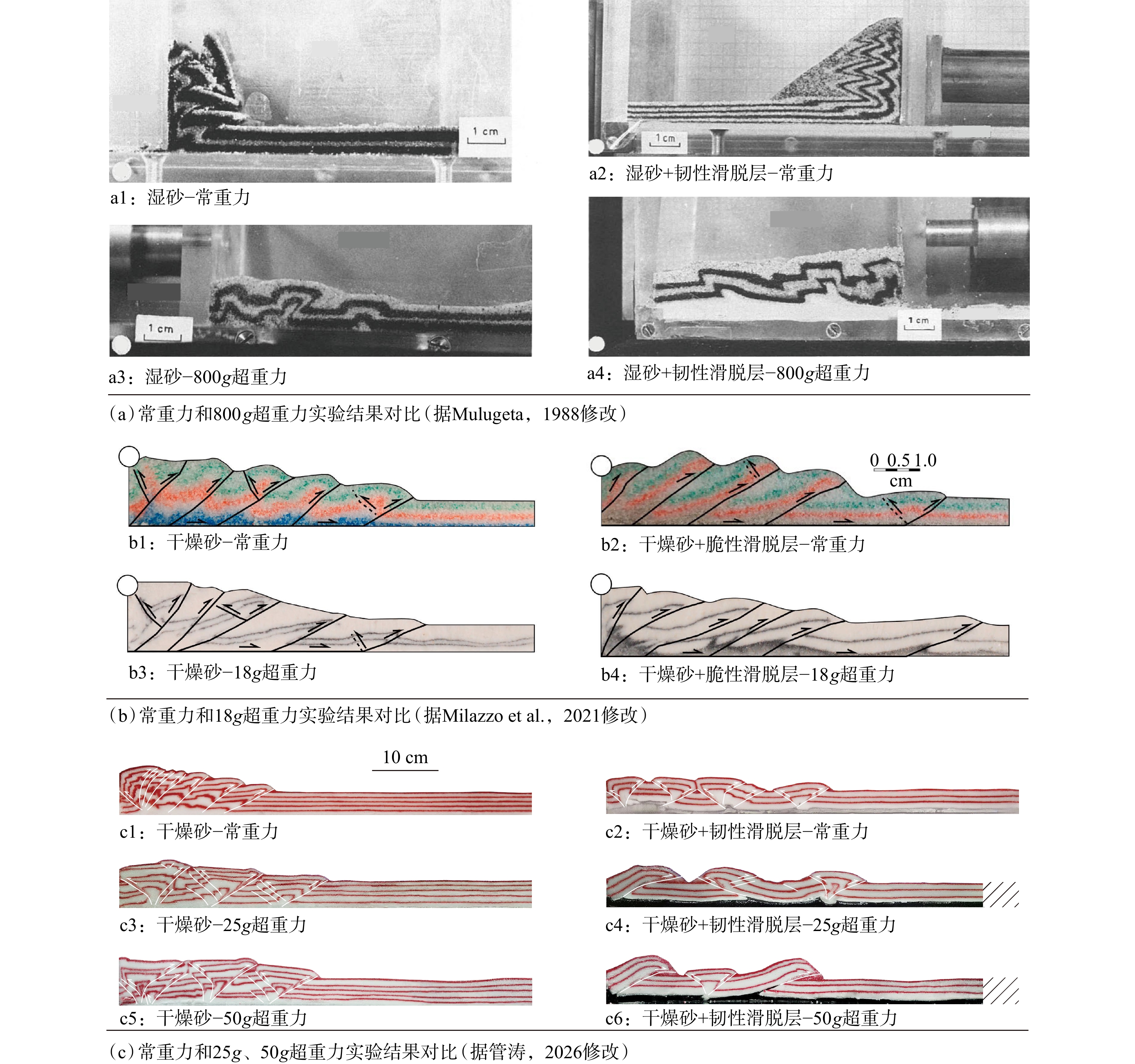
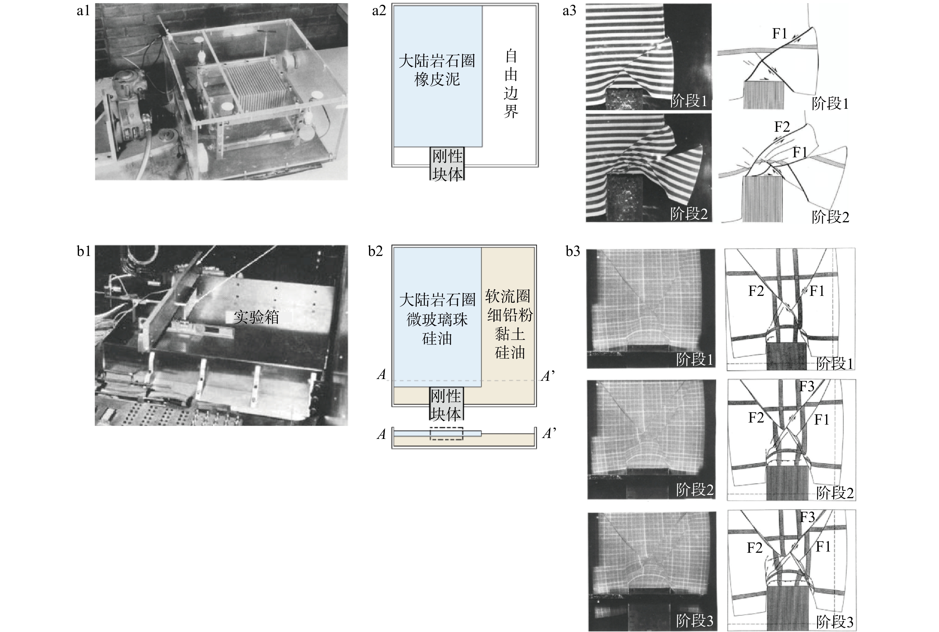
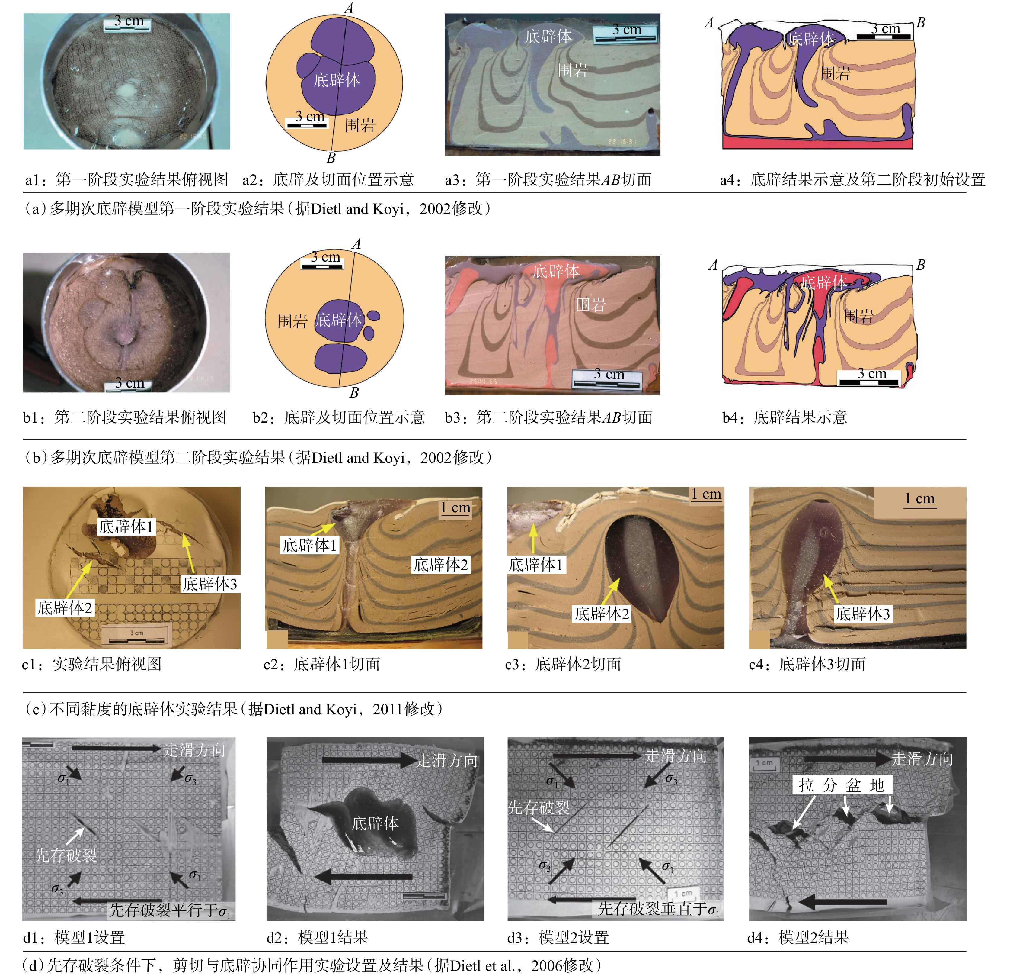
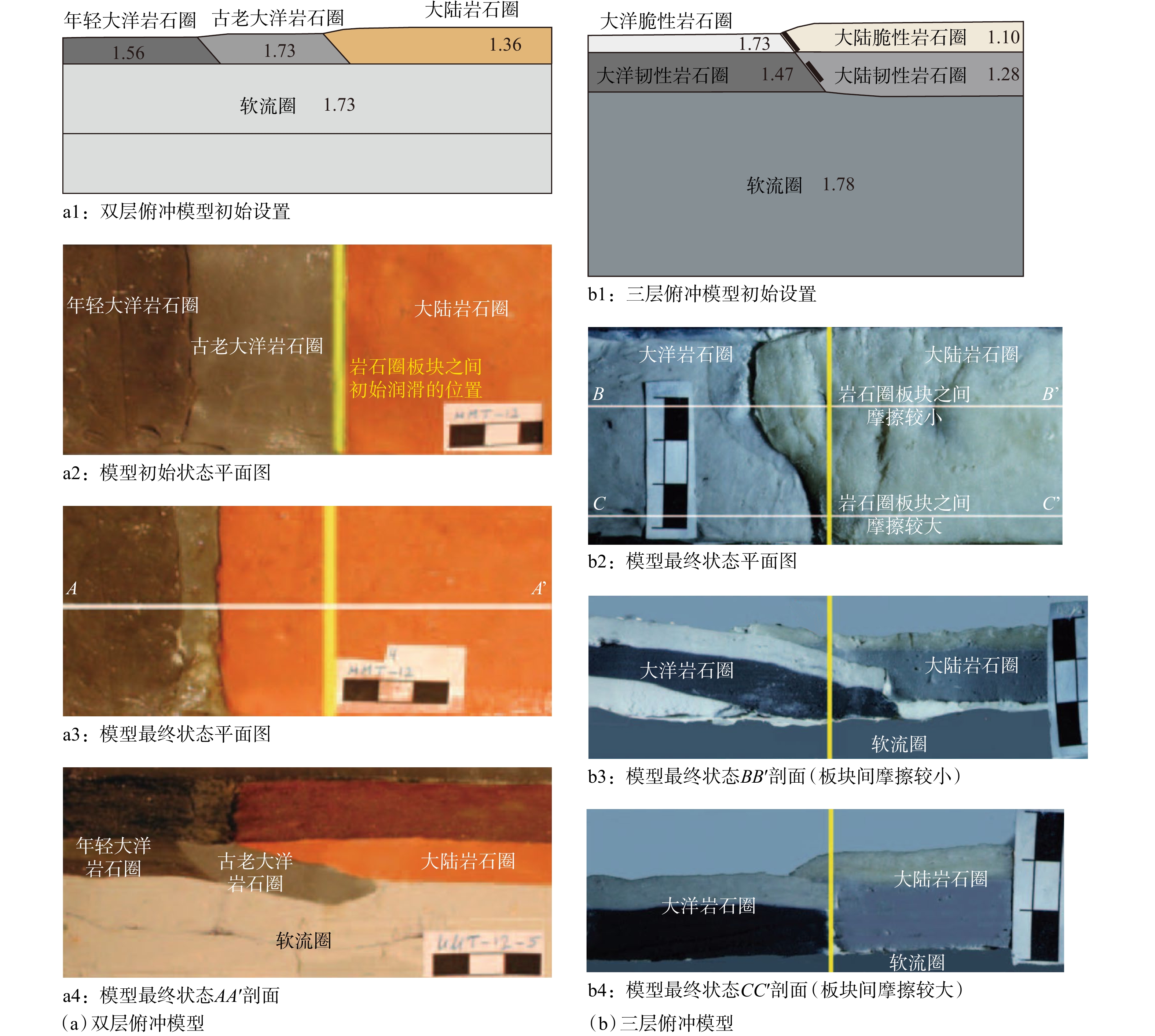
  Objective  Physical analog modeling is an effective laboratory method for reconstructing geological structure evolution, yet conventional normal-gravity experiments face limitations due to significant deviations in stress levels compared to natural prototypes. Hypergravity technology offers a novel pathway to address this issue and has emerged as a frontier approach for investigating deep and large-scale spatio-temporal scale Earth deformation.  Methods  This paper systematically reviews the research progress of hypergravity tectonic physical analog modeling, summarizes the characteristics and applications of experimental devices including small laboratory centrifuges and cantilever centrifuges used worldwide, analyzes the suitability of non-powered and powered driving systems, elaborates on the application principles of analog material systems for ductile, brittle, and complete crustal profiles, and introduces key techniques for surface deformation observation and internal structure detection.  Conclusions  Through the analysis of analog experiments simulating compressional structures, extensional structures, diapirs, and subduction, the unique advantages of hypergravity in amplifying density-driven effects, accelerating tectonic deformation, and improving simulation similarity are revealed, with specific patterns of its influence on structural styles and propagation processes clarified. During the research, the authors also developed a hypergravity physical analog modeling experimental chamber compatible with the Zhejiang University ZJU400 centrifuge and conducted related experimental studies.  Significance  This research provides a systematic reference for methodological innovation and theoretical development in hypergravity physical analog modeling, and holds positive significance for advancing structural geology toward quantification and interdisciplinary integration.
Similarity in geomorphic physical modeling and its application to tectonic geomorphology: A review
YAN Bing
2026, 32(3): 741-758. doi: 10.12090/j.issn.1006-6616.2026015
Abstract (156) HTML (26) PDF (16437KB)(93)
Abstract:
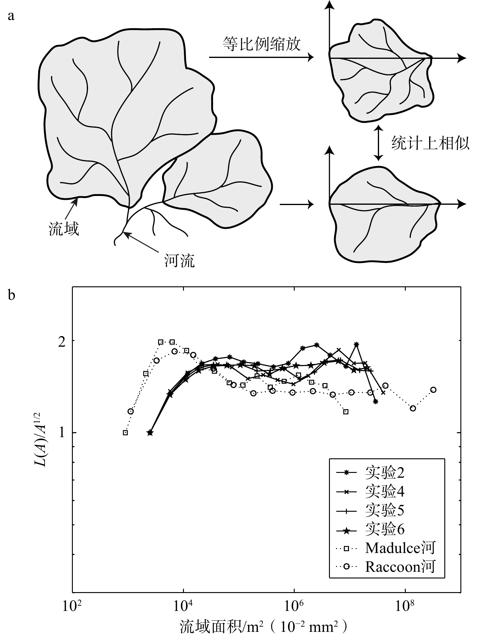
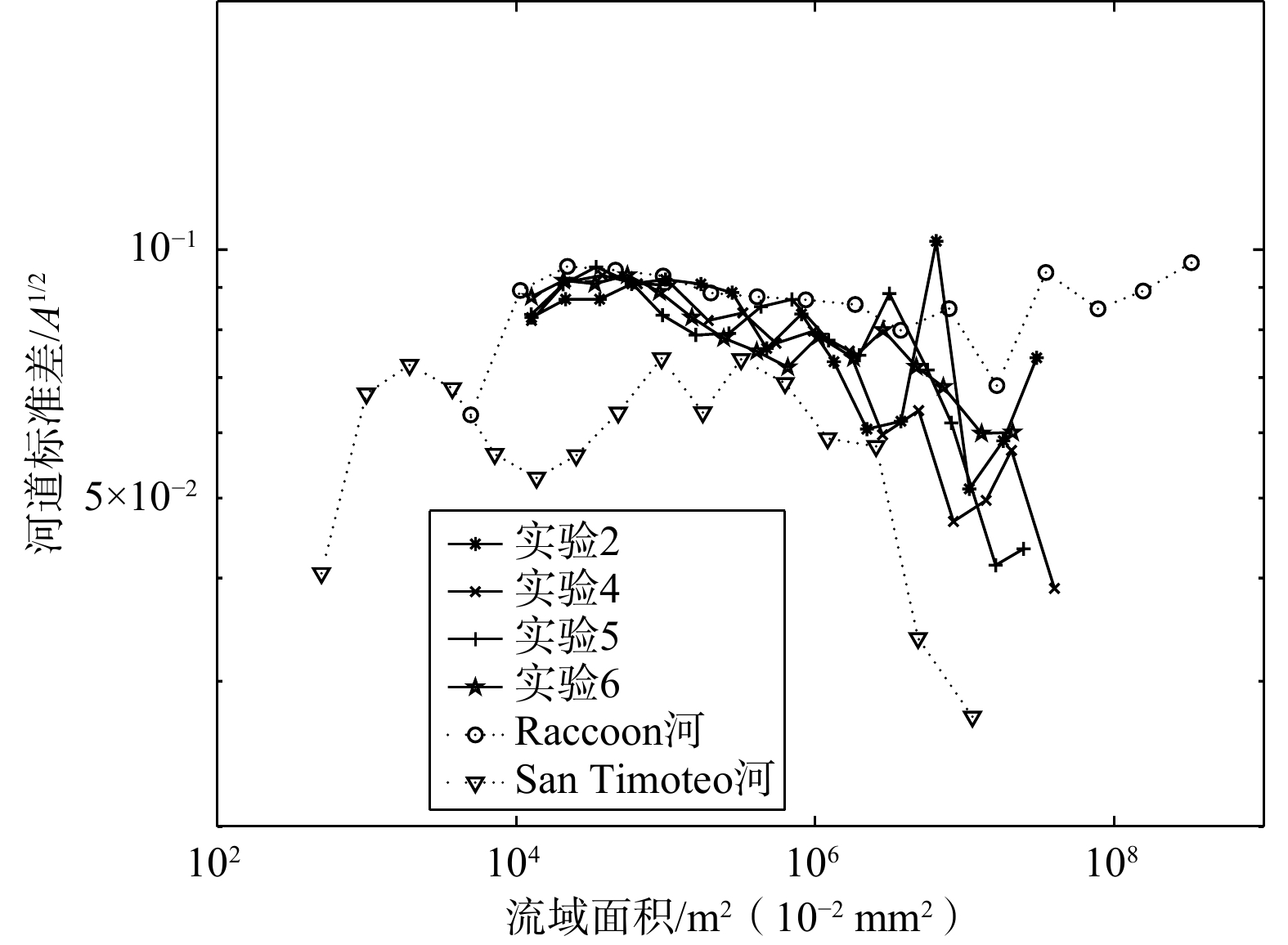
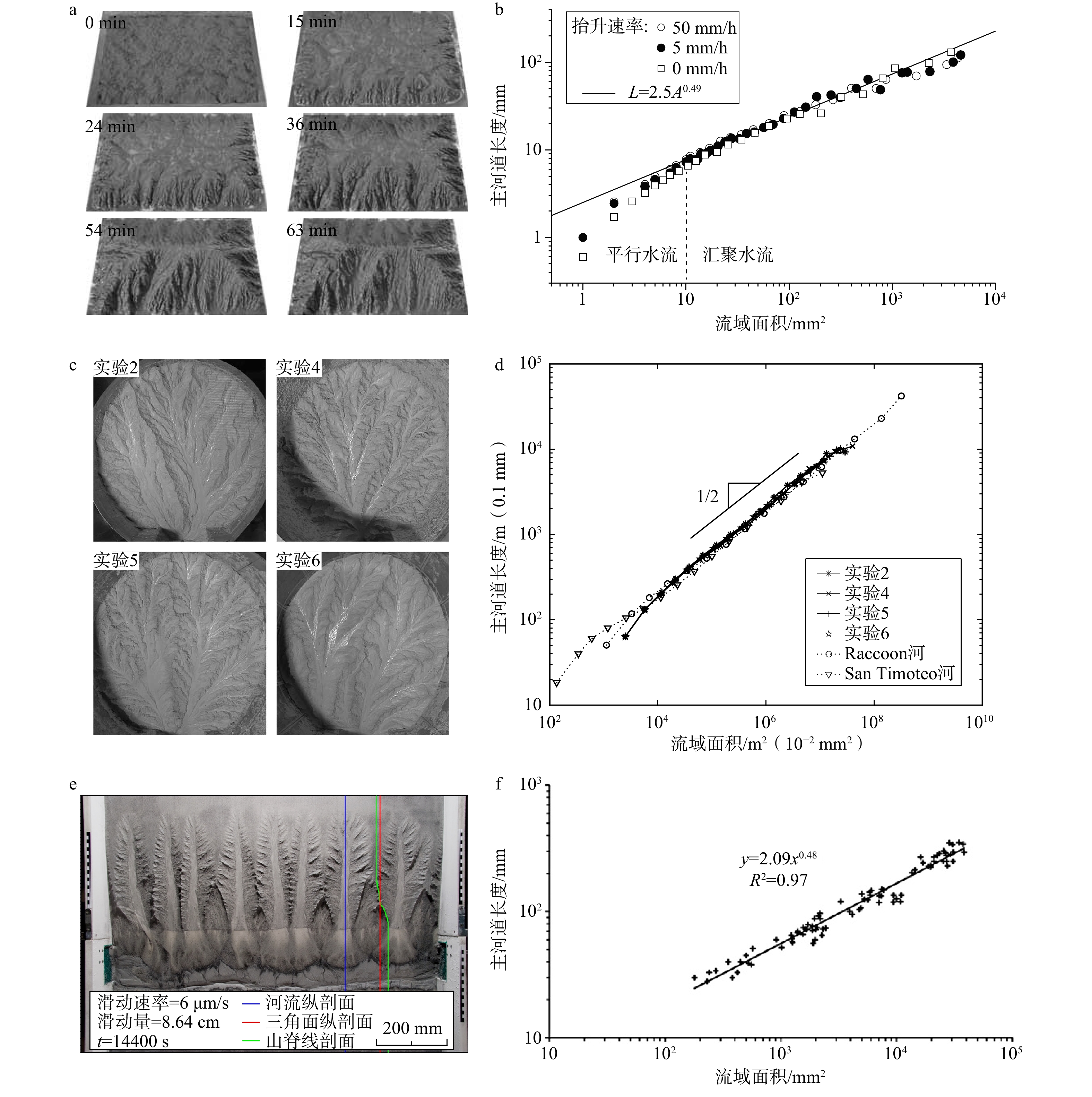
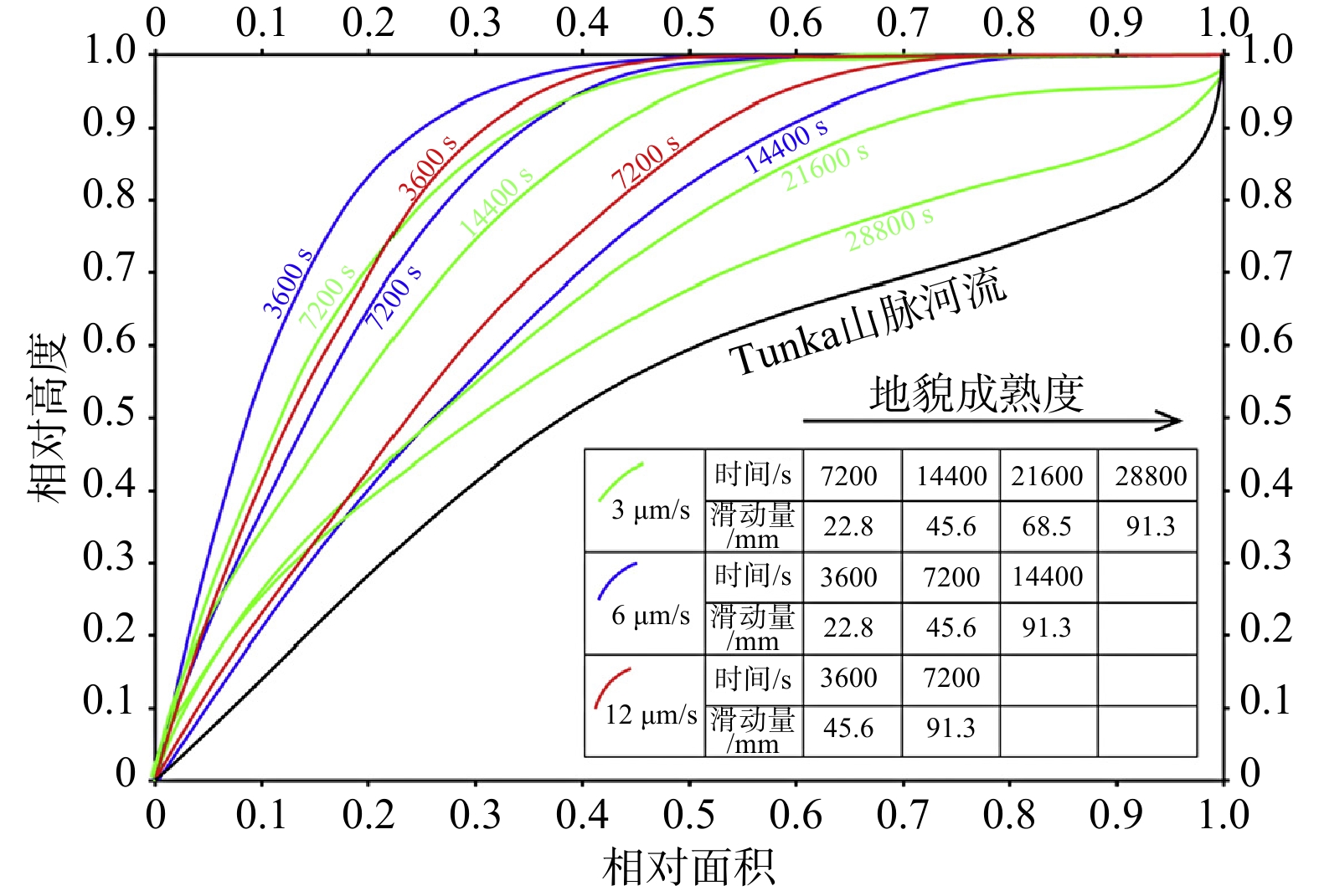
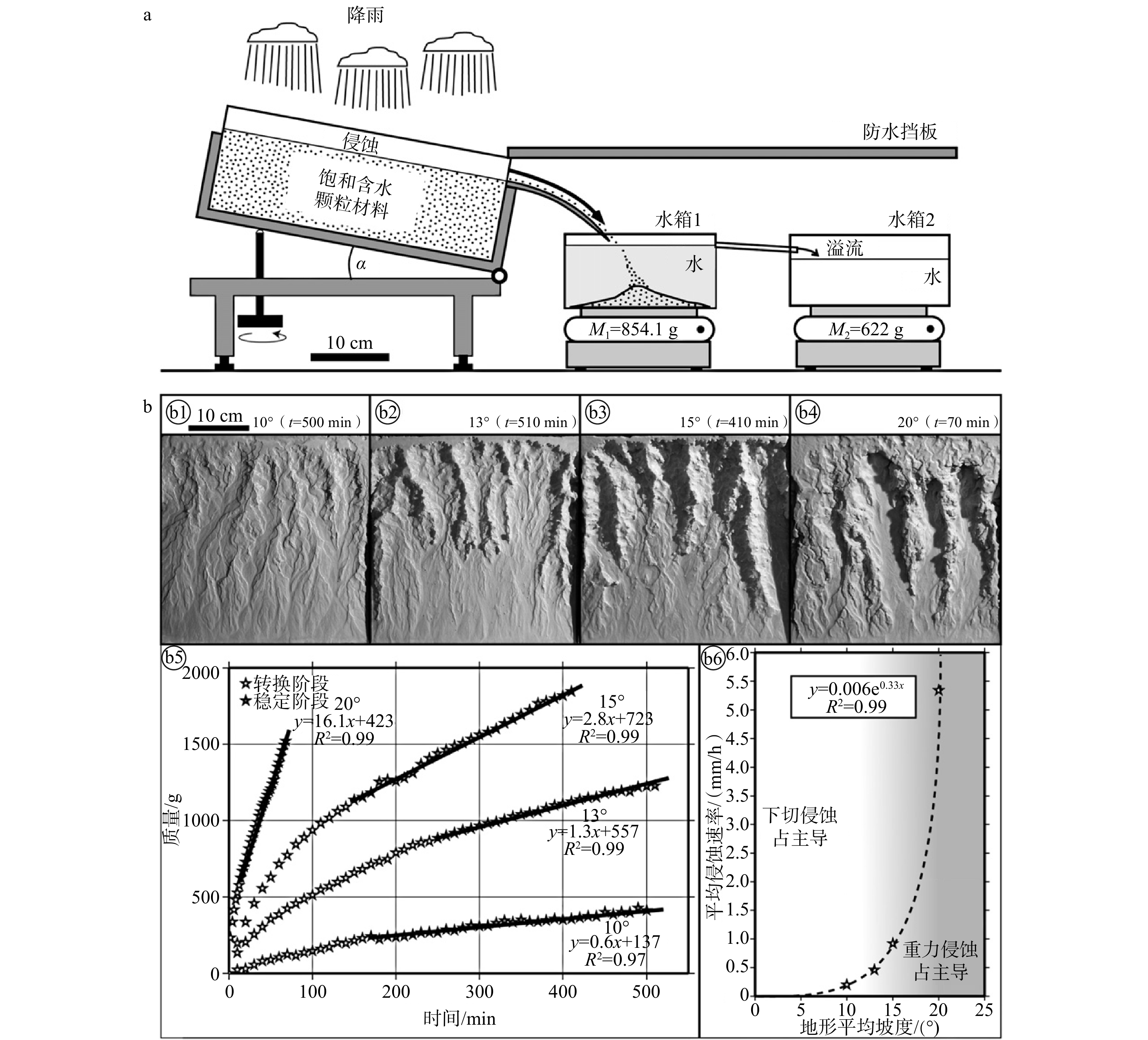
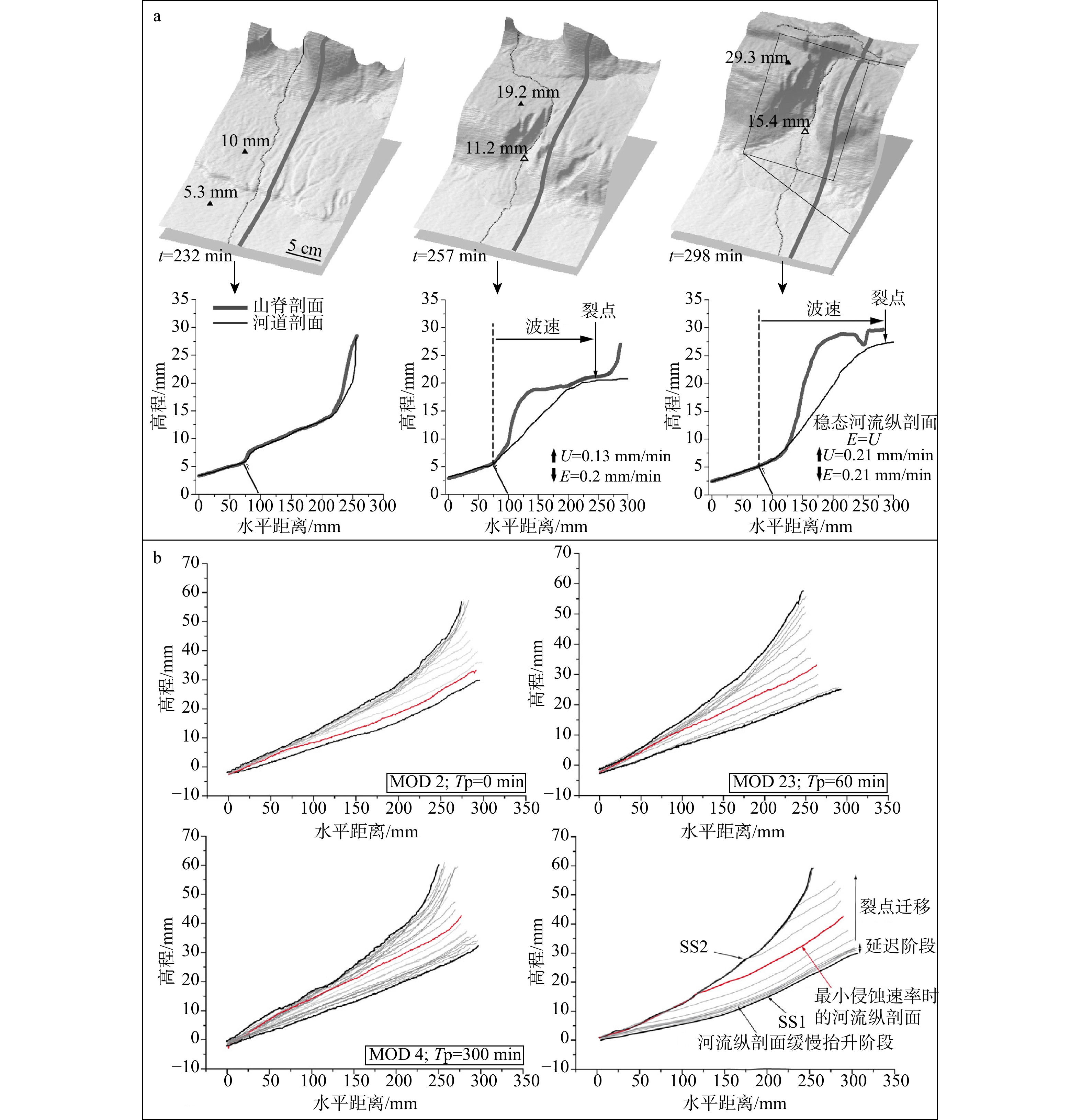
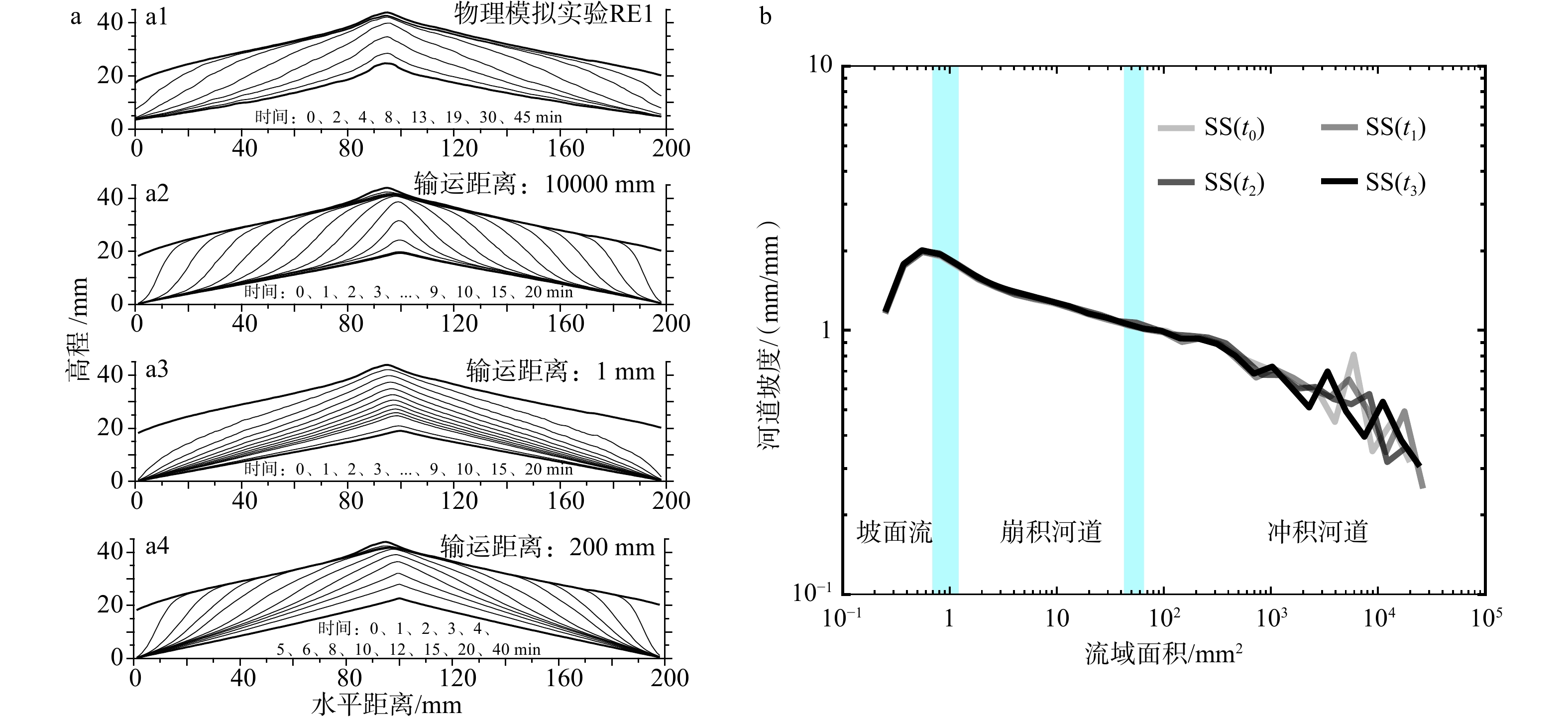
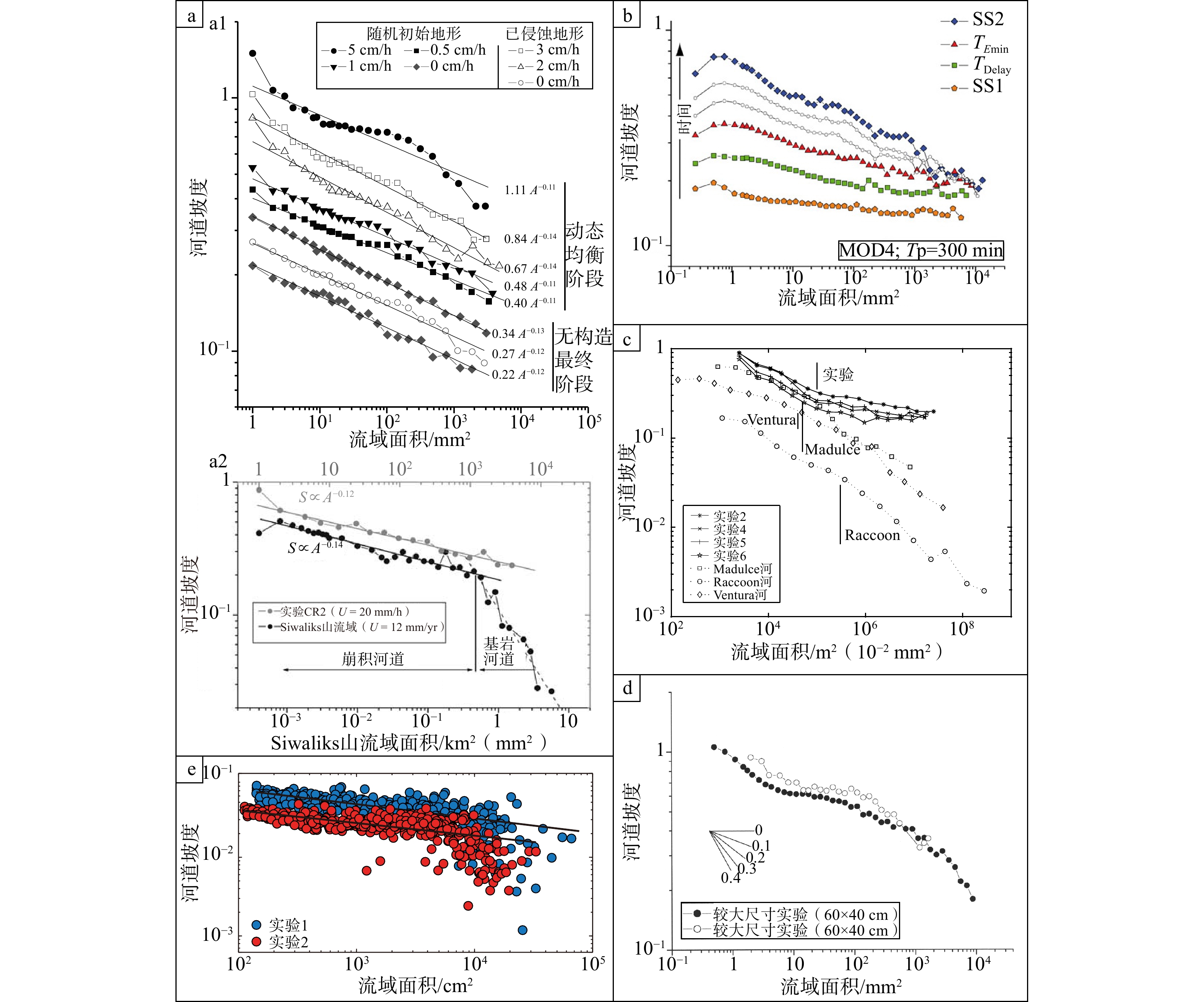
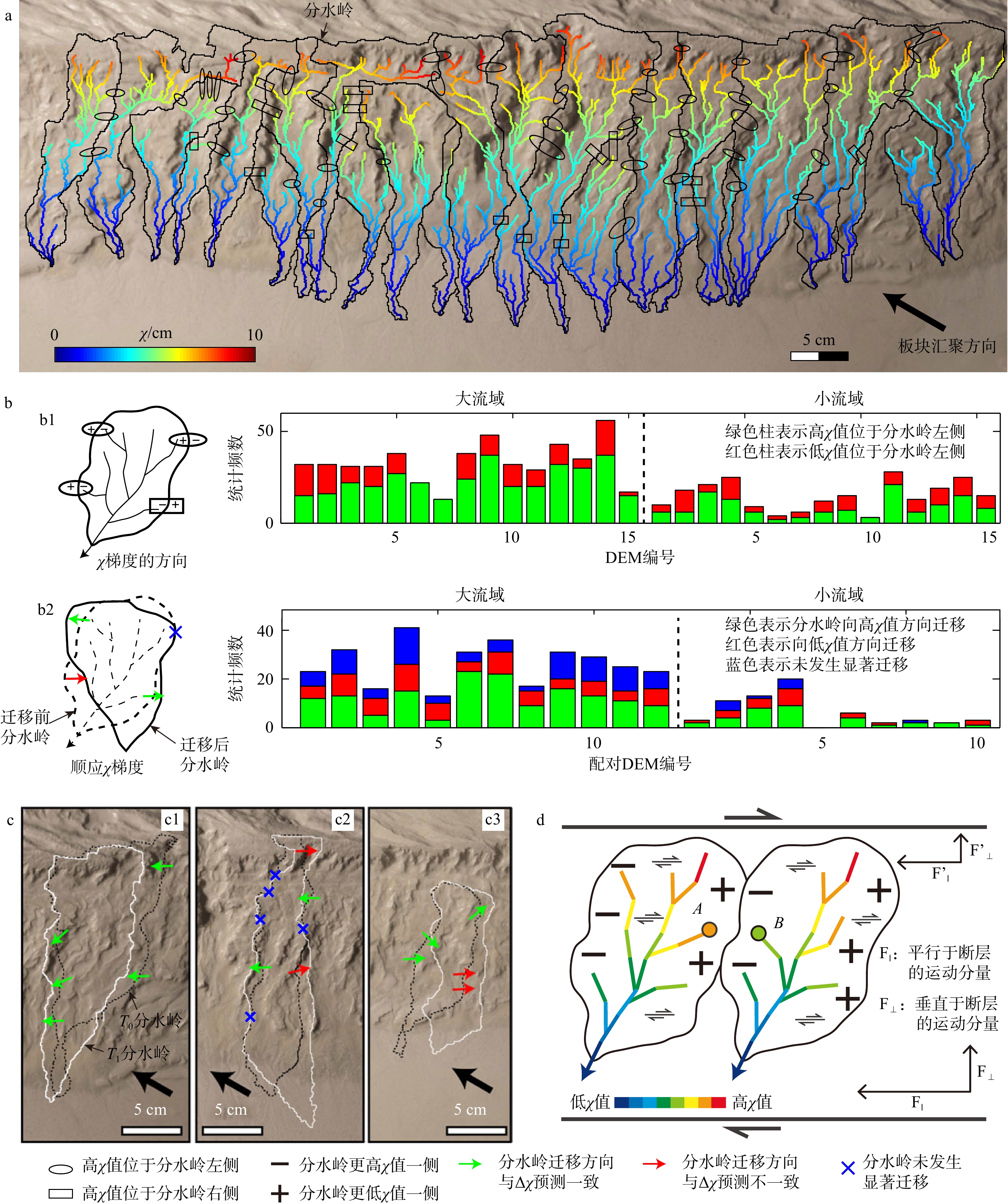
  Objective  In tectonic geomorphology, physical modeling is a key tool for investigating the interactions between tectonics, climate and surface processes. A fundamental challenge lies in establishing similarity between analog laboratory experiments and natural landscapes, which differ greatly in scale, materials, and boundary conditions. This review systematically evaluates progress and remaining challenges in similarity in analog modeling.   Methods  This paper reviews experimental studies using silica powder or the “MatIV” composite material under controlled conditions of rainfall and tectonic uplift. A comparative framework based on geomorphic parameters (basin self-similarity, sinuosity, spacing ratio, Hack’s law, hypsometric integral, slope-area relationships, knickpoint migration, erosion rates, and χ analysis) is adopted to identify consistent findings and discrepancies between experimental and natural landscapes.   Results  In terms of similarity in fluvial morphology, experimental drainage basins exhibit self-similarity over a range of scales, with shape parameters (spacing ratio, Hack exponent) falling within natural ranges. Hypsometric integrals transition from convex to S-shaped as uplift slows, mimicking mature landscapes. The concavity index approaches natural values in sufficiently large basins. Regarding erosion process similarity, experimental erosion rates increase nonlinearly with slope, and a clear shift from fluvial incision to gravity-dominated erosion occurs on steeper slopes, mirroring natural behavior. Derived time scaling has been validated across compressional, extensional, and strike-slip settings. Knickpoint retreat follows a power law with upstream area and can migrate at a constant rate, indicating an intrinsic landscape response. With respect to erosional dynamics similarity, experimental erosion regimes are mixed: detachment-limited in headwaters and transport-limited downstream. The χ value successfully predicts main drainage divide migration toward higher χ values, consistent with theoretical expectations and natural observations.   Conclusions  Despite differences in large-scale and material, analog experiments reproduce key features of natural tectonic landscapes in terms of morphology, erosion processes, and erosional dynamics, including self-similarity, Hack scaling, knickpoint dynamics, and divide migration. This “unreasonable effectiveness” arises from the scale independence of landscape dynamics. Current limitations include lower concavity indices in small basins, insufficient quantification of the steepness index, boundary effects on sinuosity, and oversimplified erosion mechanisms.  Significance  This review provides a systematic synthesis of similarity criteria for physical models of tectonic geomorphology, bridging analog experiments and natural landscapes. It also offers a practical framework for model validation and future quantitative applications in tectonic and climatic research.
The controls on the structural styles in the Wuyitage area, southwestern Tarim Basin: Insights from discrete-element numerical simulations
WANG Jinzhou, RAO Gang, DENG Xiaorui, WANG Biao, FANG Bing, LUO Qiang, XU Zhongbo, XU Chenhao
2026, 32(3): 759-770. doi: 10.12090/j.issn.1006-6616.2026037
Abstract (137) HTML (31) PDF (7600KB)(92)
Abstract:
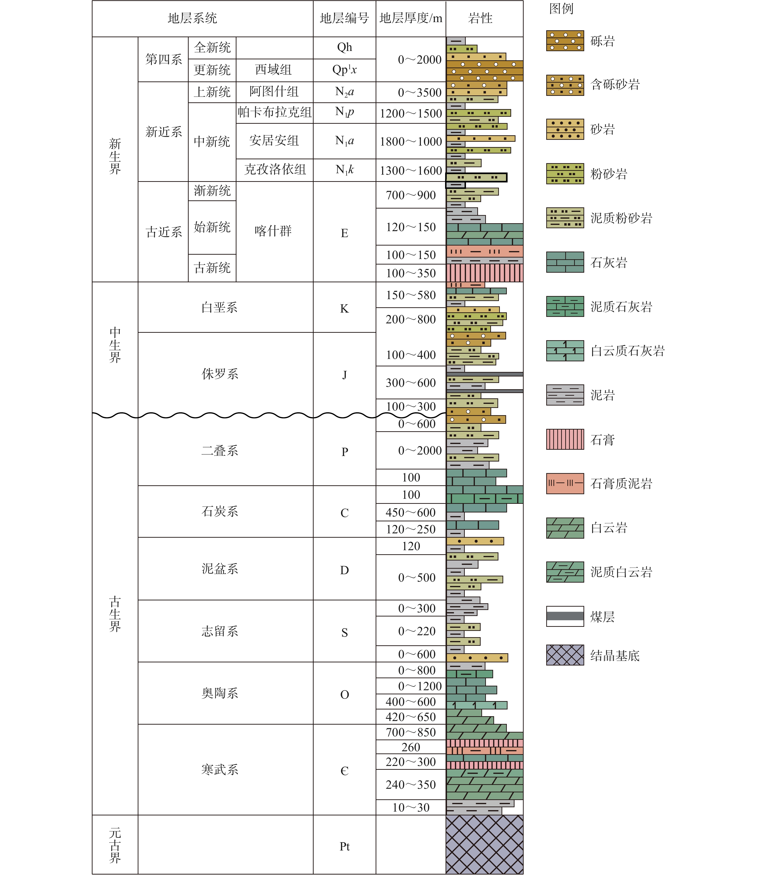
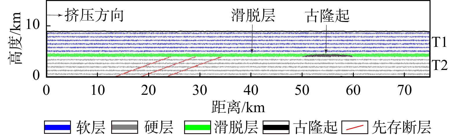
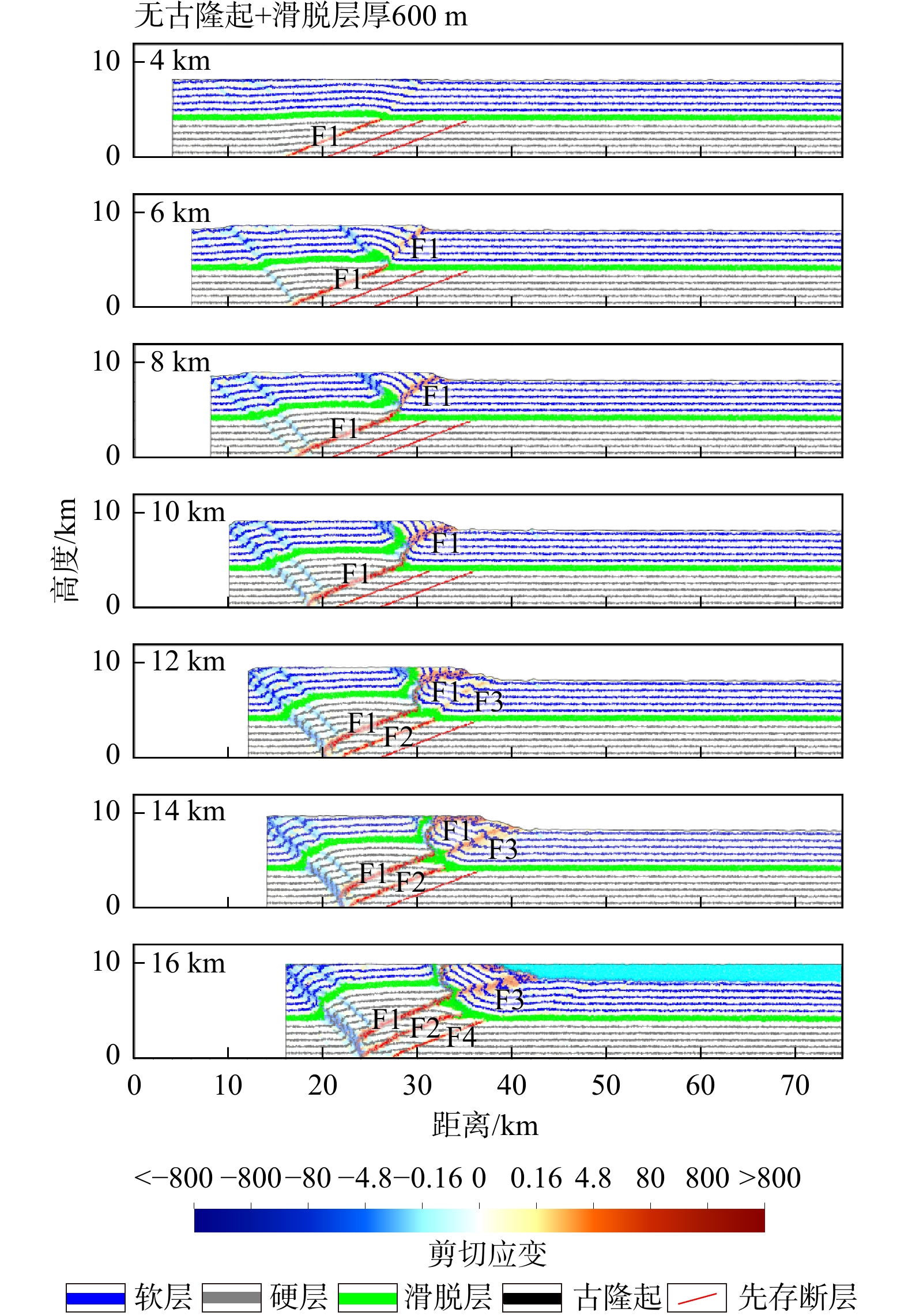
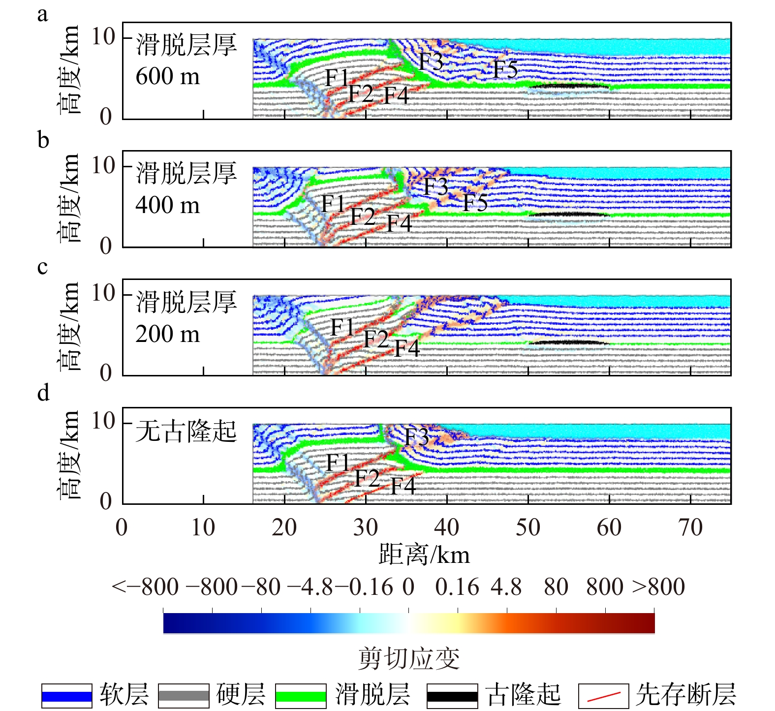
  Objective  The collision and ongoing convergence between the Indian and the Eurasian plates have driven the uplift and expansion of the Tibetan Plateau and the formation of a mountain–basin system rich in oil and gas resources. Fold-and-thrust belts, as important structural units accommodating compressive shortening, have long been a focal and challenging topic in structural geology research due to their complex structural styles and deformation histories. This study focuses on the Wuyitage area in the foothill belt of the southwestern Tarim Basin, and synthesizes previous investigations on the lateral variations in structural styles, detachment layers, and paleo-uplift distribution.   Methods  Through the application of the discrete-element numerical simulation method, the coupled process between the basin and the mountain under the combined influence of multiple factors is explored.   Results  The thrust belt in the study area exhibits significant structural segmentation, with its geometry largely governed by regional detachment layers such as the Paleogene gypsum-salt layer. The thickness of the detachment layer directly influences fault slip efficiency and deformation intensity. A thicker detachment layer strengthens the detachment effect, promotes decoupling between the upper and lower strata, and facilitates the propagation of thrust structures toward the hinterland. In contrast, a thinner detachment layer weakens the detachment effect, making faulting more prone to occur along pre-existing basement faults. The presence of Ulagen and other paleo-uplifts have also played a dominant role in the development of thrust faults by reconstructing the regional stress field and the mechanical properties of the strata.  Significance  This study reveals the main controlling mechanism of the differential structural deformation styles in the Wuyitage area of the southern Tarim Basin, providing an important basis for better understanding the basin–range coupling and its potential resources and environmental effects in the study area.